Powder Forecast –Friday, January 19th, 2024
Ted Schlaepfer CCM —- Mammoth Mountain WeatherGuy
Snowfall forecasts are valid at the Sesame snow course (Main Lodge) for the prior 24 hours, as reported in the 6-7 AM morning snow report.
**Snowfall forecast confidence ranges from very low (1) to very high (5)
Sat 1/20 = 3 – 4” (H20 = 0.25” – 0.40”)**4
Sun 1/21 = 2 – 3” (H20 = 0.20” – 0.30”)**3
Mon 1/22 = 6 – 8” (H20 = 0.60” – 0.75”)**3
Tue 1/23 = 2 – 4” (H20 = 0.25” – 0.40”)**2
Wed 1/24 = 0”
Thu 1/25 = 0”
Fri 1/26 = 0”
Sat – Mon 1/27 – 1/29 = 0”
January Snowfall = 49”
January Forecast = 60 – 70”
Detailed 4-day Snowfall Forecast:
Sat 1/20 – Snow showers are expected to continue at times during the day and overnight. Accumulations 2 – 3” at Main, 4”+ up top
Sun 1/21 – Snow showers are expected to continue at times during the day before moderate to heavy snowfall develops overnight. Accumulations 6 – 8” at Main, 10”+ up top
Mon 1/22 – Snowfall during the morning decreases during the afternoon and tapers off overnight. Accumulations 2 – 4” at Main, up to 6” up top
Tue 1/23 – Other than a chance for a flurry, no snowfall is expected.
Forecast Summary:
Short Term (Days 1 – 4):
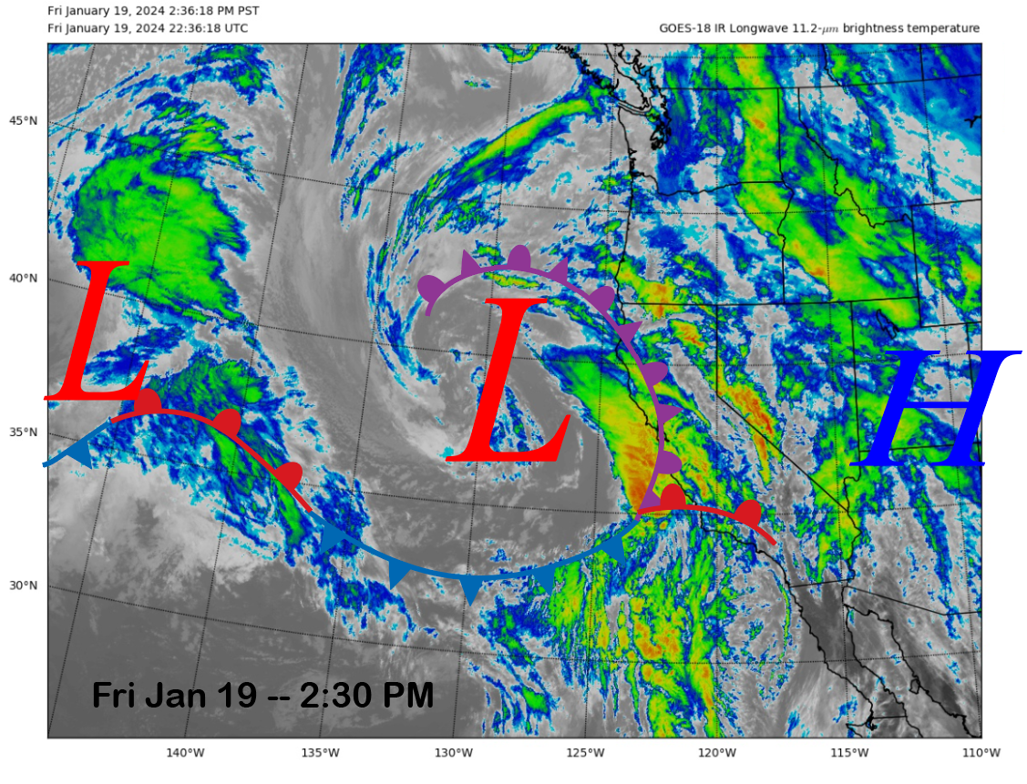
The current infrared satellite image (below) shows a weather system currently moving into California from the west with clouds and rainfall, and it will move eastward into Mammoth tonight. Snowfall should start around midnight and increase into the early morning hours.
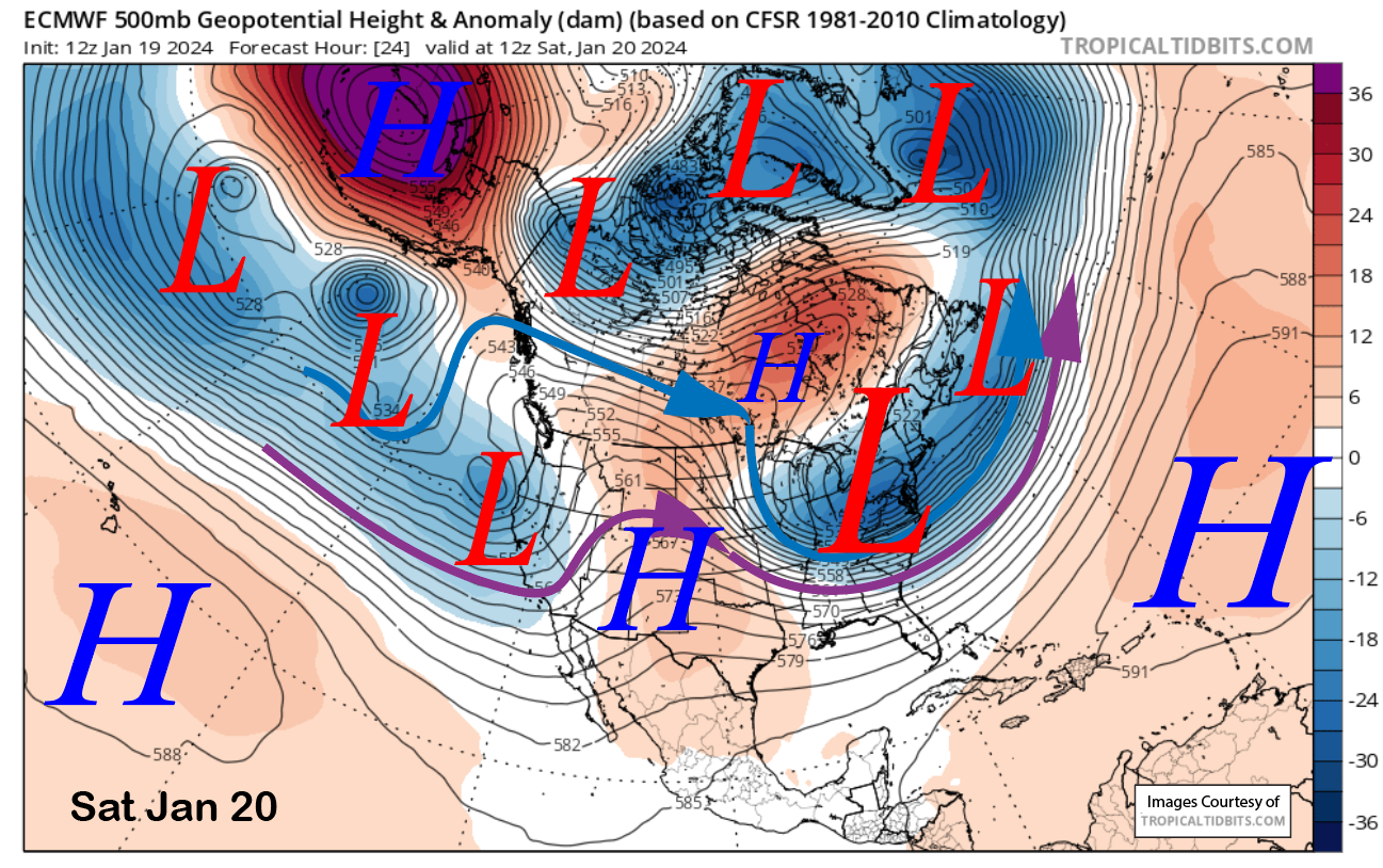
The models have the trough associated with the weather system moving into Nevada tomorrow morning (image below), and the snowfall should mostly end around dawn, with snow showers during the day and overnight into Sunday. Snow showers will likely continue during the day on Sunday, too, but we are not expecting a lot of accumulation again until Sunday overnight.
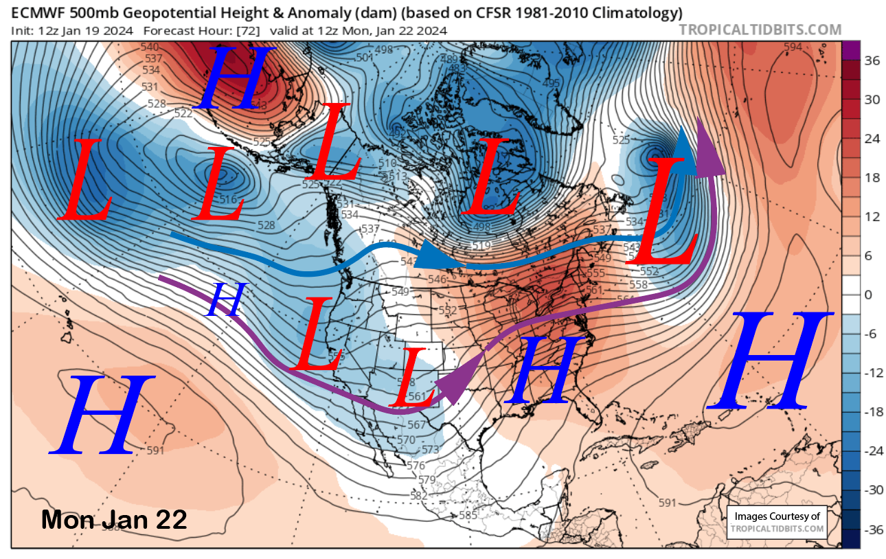
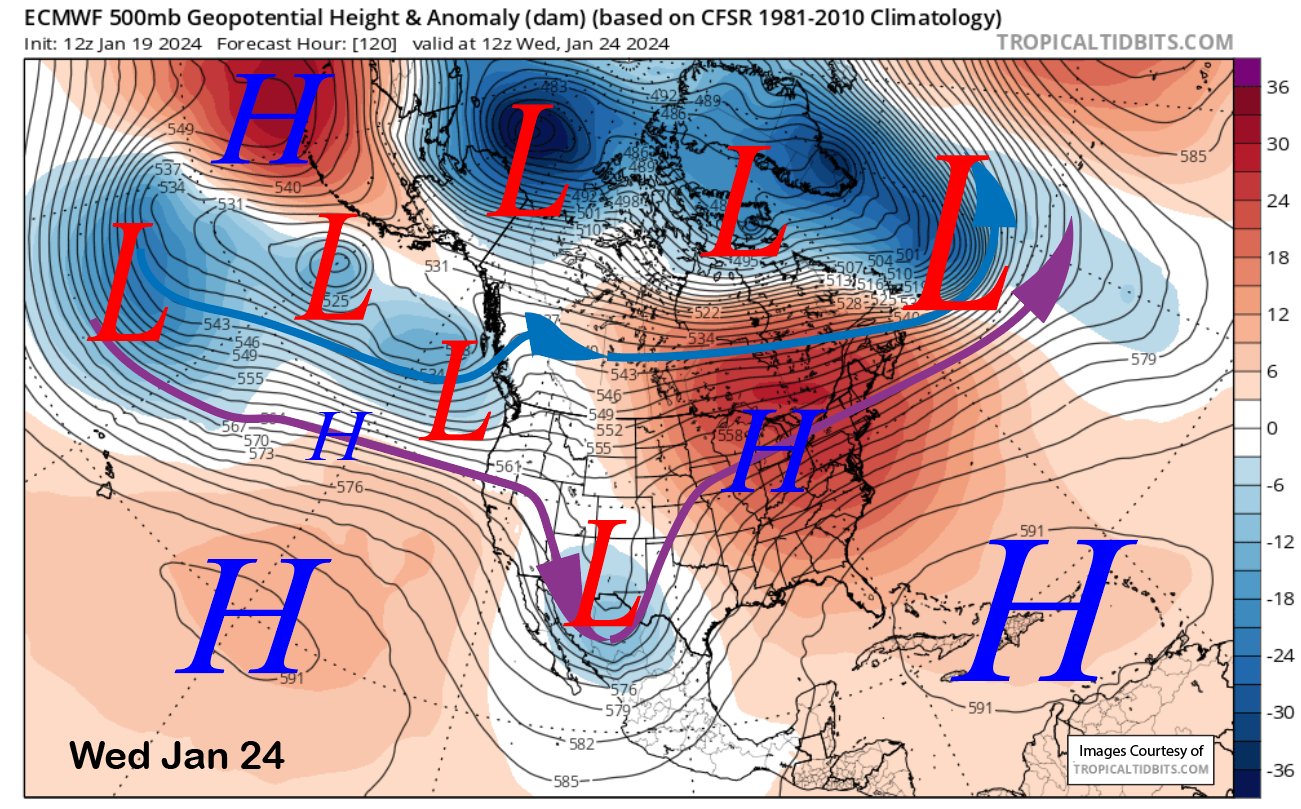
The models move the final short-wave trough within the weak breakthrough of the westerlies on overnight Sunday and early Monday (image below), and that is when the last round of moderate to heavy snowfall is expected. Snow should then change to showers Monday midday before tapering off and mostly ending Monday night. Tuesday should be mostly dry except for a slight chance of a flurry.
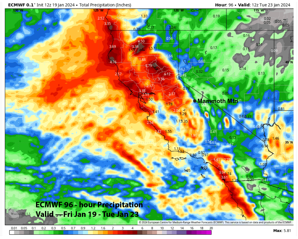
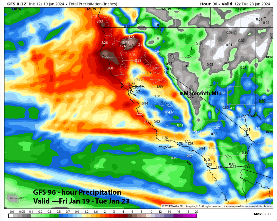
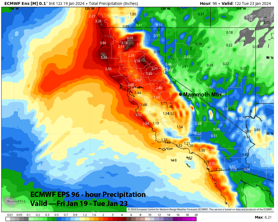
Model QPF does differ slightly from the ECM (image below) and GFS (two images below), showing about one inch of liquid for the two storms, but do have about 2” along the crest of the Sierra. This is closely in line with the ECM EPS forecast (three images below).
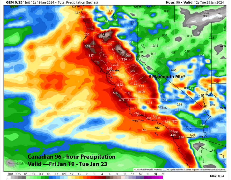
The Canadian is the wettest, with about two inches of liquid (image below), and has nearly 4” on the west side. The NBM (two images below), or National Blend of Models, is in the middle ground with about 1.5” through Monday.
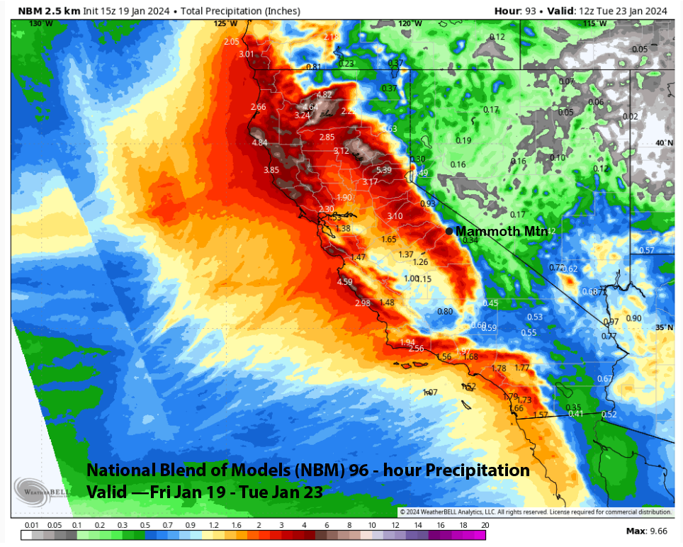
Due to the relatively weak jet stream associated with the storms, it is certainly plausible that most of the precipitation will remain on the west side of the Sierra crest with limited spillover. However, the jet stream is forecast to be aligned parallel to the San Joaquin river basin (southwest flow), and that set-up often results in higher amounts for Mammoth that is directly downstream in that gap in the range.
The forecast favors the NBM model and Canadian with about 1.5” liquid at Main and possibly up to 2” through Monday. Snow levels will be around 6000-6500 feet tonight and tomorrow lowering to around 5K Sunday morning. Snow levels with the Sunday night/Monday snowfall will also be around 6K. Thus, snow ratios will mostly be around 10:1, and about 15-20” is forecast for the Saturday through Monday time period and 2 plus feet up top.
Long Range (Days 5+):
The longer-range guidance has not changed too much since the last post and is not favoring any more storminess for the rest of January. We will have to continue to keep our fingers crossed that snowfall will return in early February.
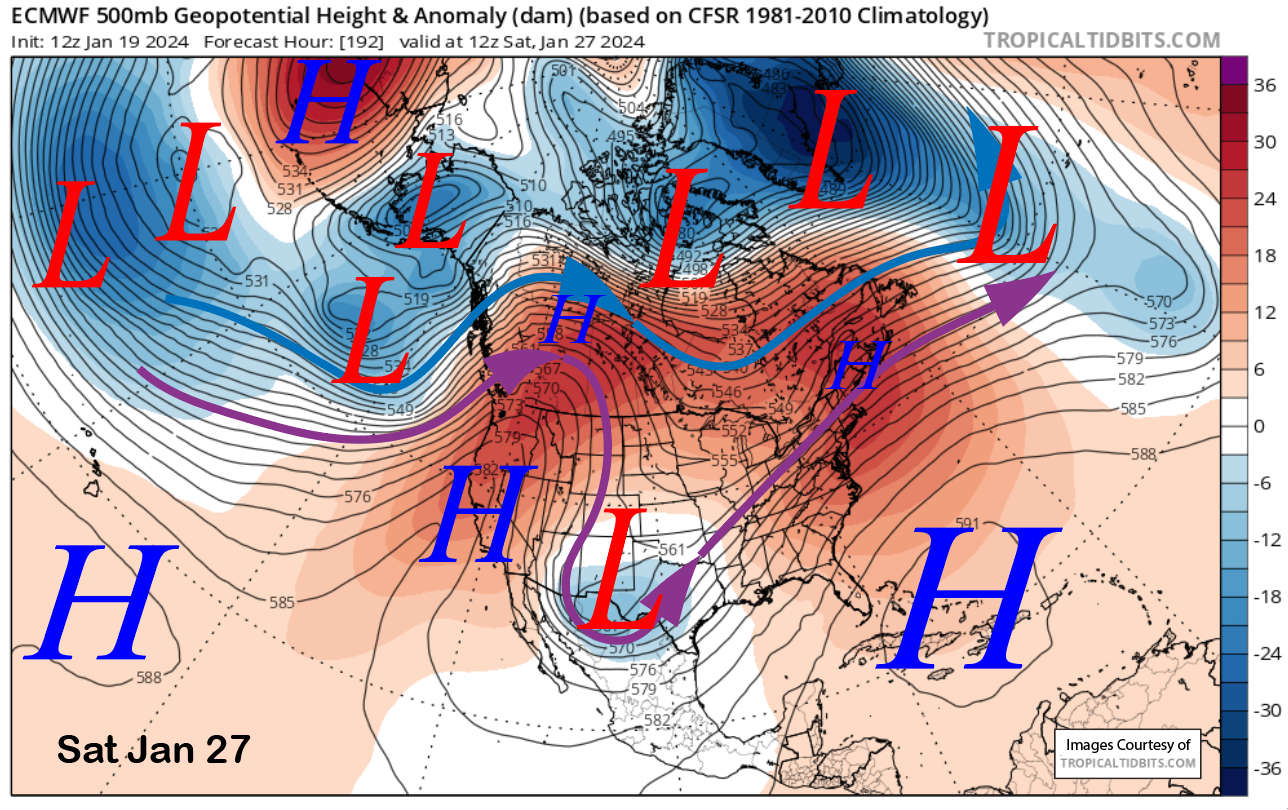
The ECM model (image below) and others move one last wave through NorCal and southern Oregon next Wednesday before a strong ridge of high pressure builds into the West Coast for the rest of the week and into the following weekend (two images below). Thus, a period of fair, dry, and seasonably warm temperatures should be expected.
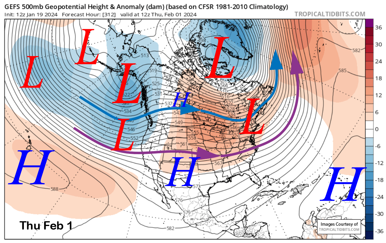
The fantasy range guidance from the GFS ensemble mean suggests the next chance for snowfall will be in early February when a longwave trough develops along the West Coast (images below). The ECM EPS is surprisingly similar, just slightly slower with the extension of the jet stream. But again, it may be a similar scenario as the current upcoming event with the potential storms only backed by a weak jet stream, leaving most of the precipitation on the west side.
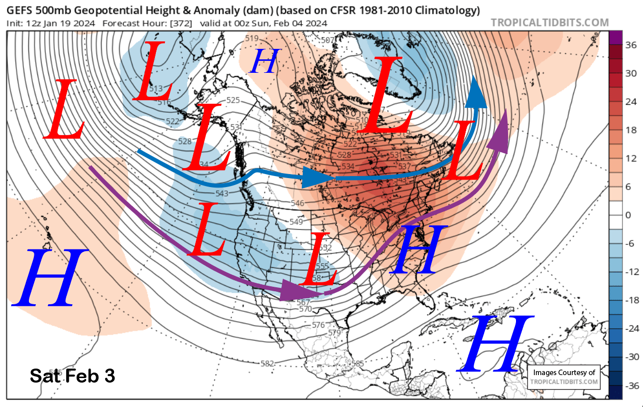
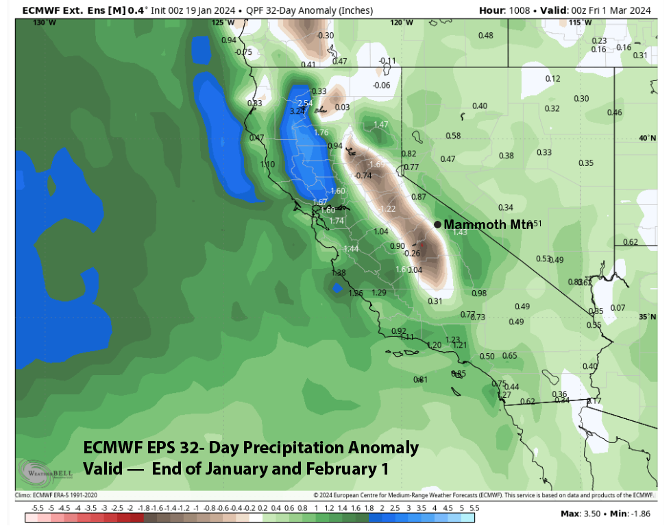
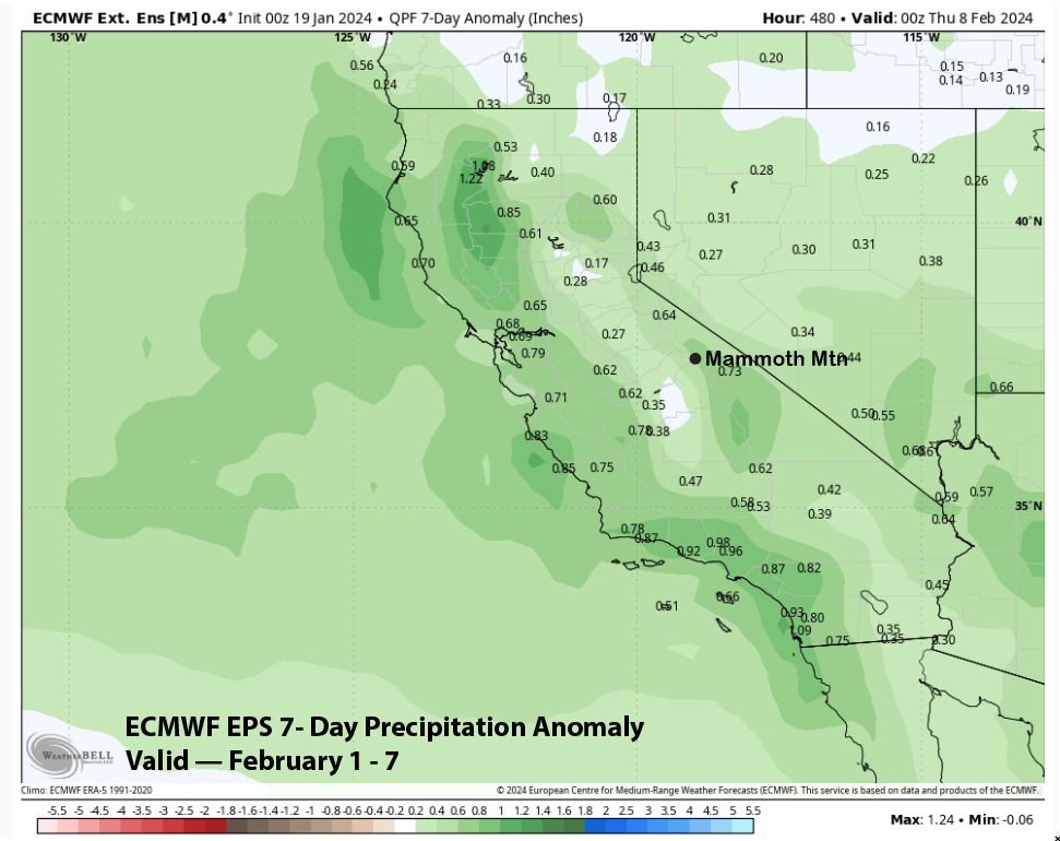
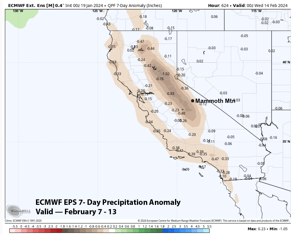
Regardless, this pattern could last the first week of February, with both the CFS and ECM EPS (image below) showing slightly above-normal precipitation and not a major snowmaking pattern. Both models now favor dry weather to return the second week of February (ECM two images below).
The latest overall forecast for February from the ECM EPS 45-day run (image below) has not changed too much since the last post. It has positive anomalies mostly along the coastal strip and a distinct negative anomaly over most of the Sierra. This suggests more of the same with many weak to moderate storms. If you are ok with lots of 3-9” powder days, then there is nothing to complain about. Better than totally dry weather, that is for sure. WG