Powder Forecast –Tuesday March 22nd, 2022
Ted Schlaepfer CCM —- Mammoth Mountain WeatherGuy
Snowfall forecasts are valid at the Sesame snow course (Main Lodge) for the prior 24 hours as reported in the 6-7 AM morning snow report.
**Snowfall forecast confidence ranges from very low (1) to very high (5)
Wed 3/23 = 0”
Thu 3/24 = 0”
Fri 3/25 = 0”
Sat 3/26 = 0”
Sun 3/27 = 0”
Mon 3/28 = 0 – 3”
Tue 3/29 = 3 – 6”
Wed – Fri 3/30 – 4/1 = 2 – 6”
March Snowfall = 7”
March Forecast = 12 – 25”
Detailed 4-day Snowfall Forecast:
Wed 3/23 through Sat 3/26 – No snowfall expected all days.
Forecast Summary:
Short Term (Days 1 – 4):
The infrared satellite image (below) today shows high pressure dominating the weather across the West Coast resulting in fair weather and above normal temperatures for the mountain.
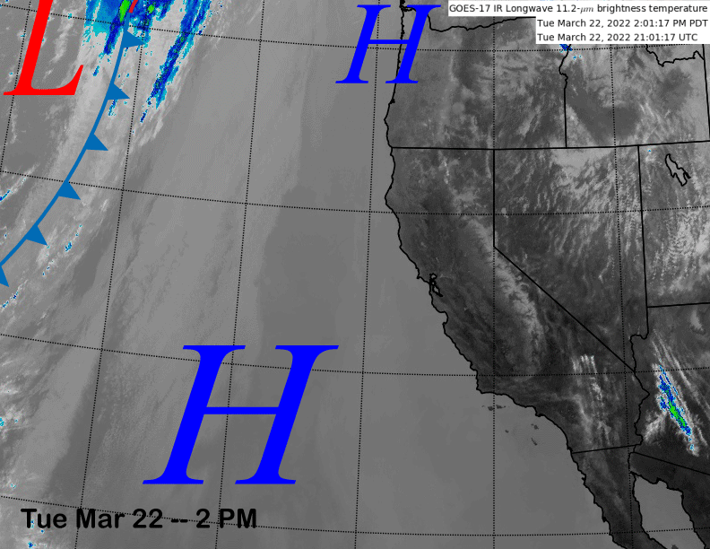
The high-pressure ridge (image below) will edge into the state over the next few days. Continued fair/mild weather can be expected with spring conditions on most, if not all, of the mountain, through Friday and likely Saturday as well.
Long Range (Days 5+):
The longer-range guidance has two more chances for storms before the end of the month. Hopefully at least one of them will pan out and end up a larger storm (>1” liquid) or else this will be the one of the driest, if not driest, January through March periods on record.
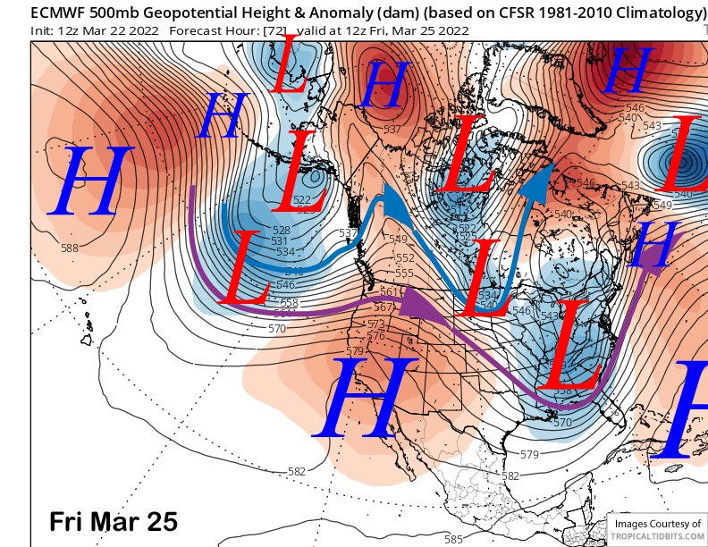
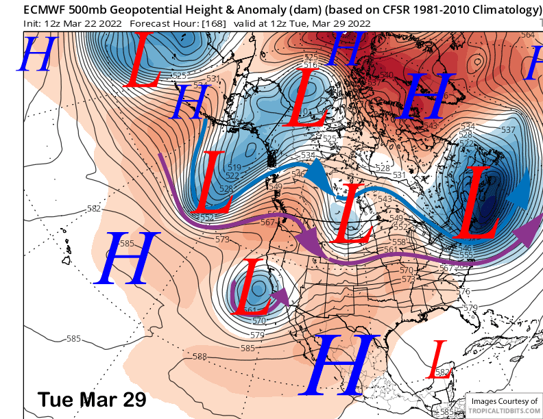
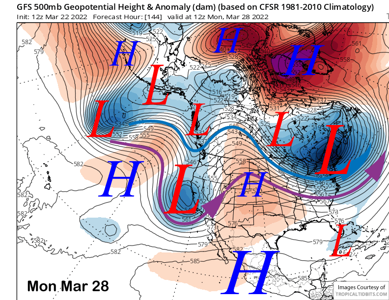
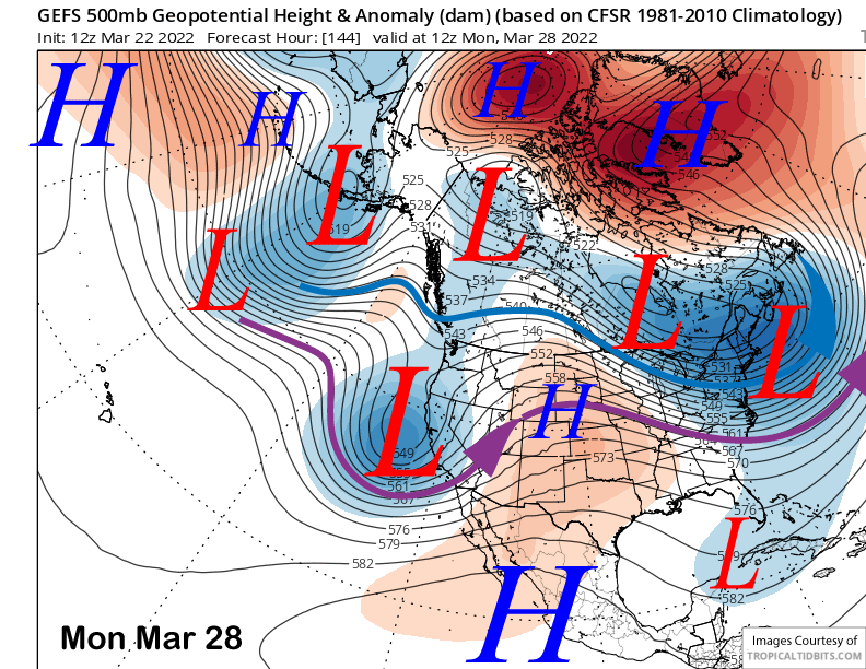
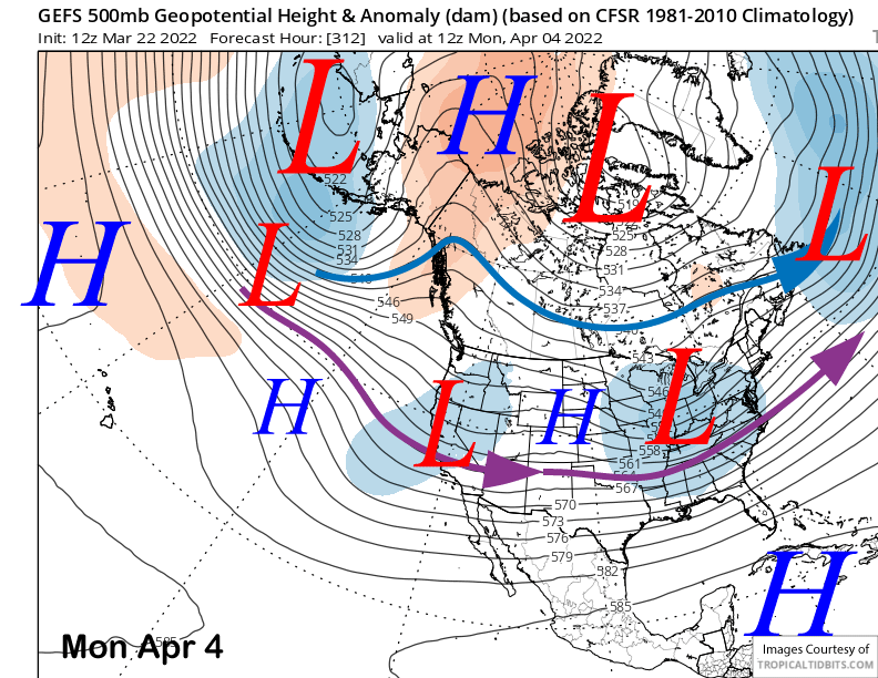
The ECM 12z model run (image below) moves a closed upper-level low into central and southern California around Tuesday next week. The latest Canadian model run is similar. However, the GFS model (two images below) is about a day faster (and a bit stronger) and moves the weather system into the state on Monday.
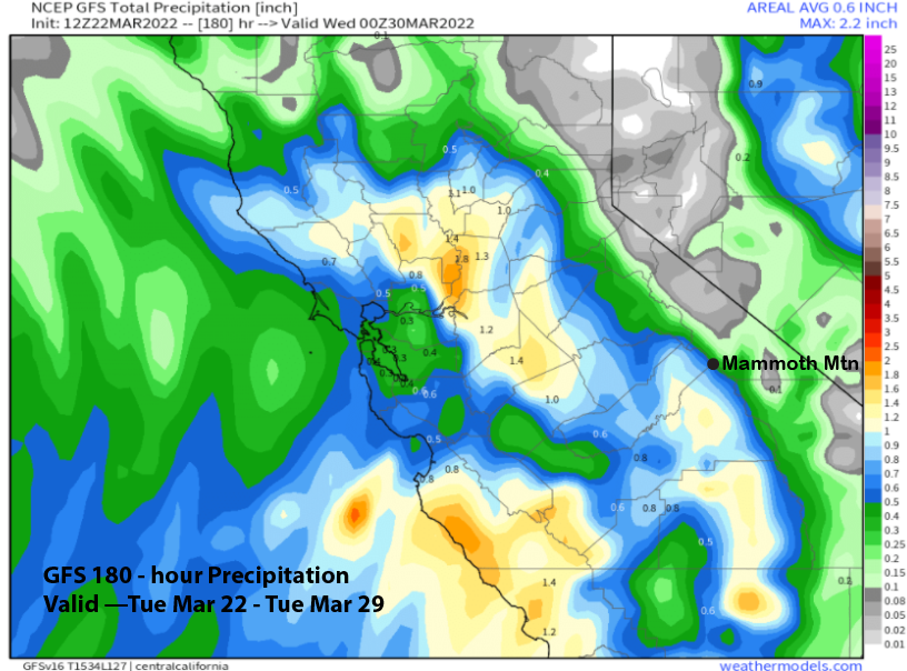
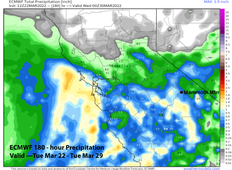
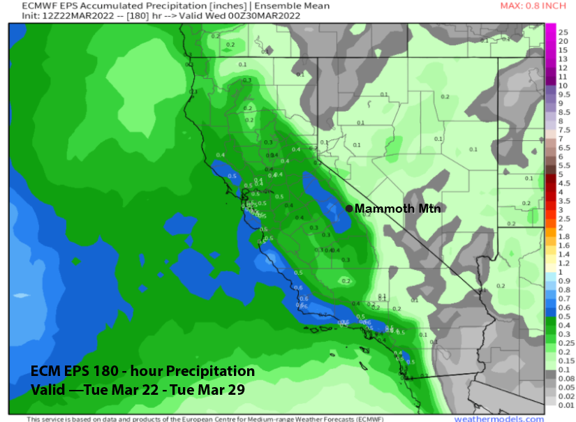
The model QPF however, is not too different, between the models. The GFS model is the wettest (image below) at around a 0.75” liquid with the ECM model just over a half an inch (image below). Both would be good enough for at least low-end powder conditions.
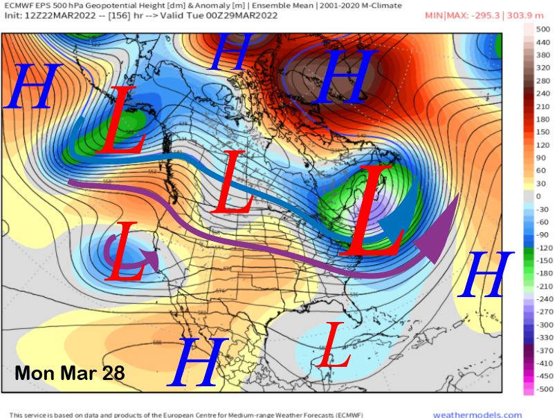
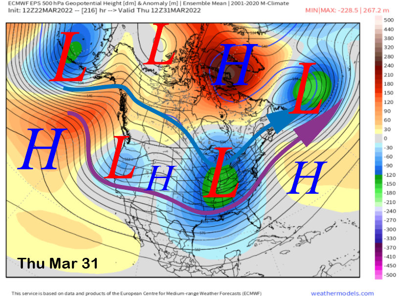
The ensemble means of those respective model suites though, are not in agreement. The GFS ensemble mean has a fairly deep trough (image below) and is for the most part, similar to the operational run of the GFS. The ECM EPS (two images below) on the other hand, is much weaker with the trough and mostly washes it out when it moves ashore.
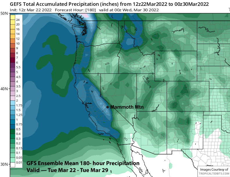
The QPF from the respective model means also reflects these differences with the GFS much wetter (image below) at over an inch and the ECM EPS drier at under half an inch (two images below). That means the GFS ensemble is forecasting close to a foot of new snow while the ECM EPS just a few inches.
It is still potentially a week out, so the model guidance will likely change. Current forecast uses a blend of the two ensemble means and favors around 6” of snowfall around Monday into Tuesday next week. Hopefully the GFS will be right again as that model did better versus the ECM with the last storm over the weekend.
There will be another chance toward the end of the month with both the GFS and ECM (image below) ensemble means showing a fairly deep trough into CA. That would allow a colder-type storm to move into CA and Mammoth with at least light to moderate snowfall. The other question is timing, and whether the potential snowfall will be included in March or April totals.
The long-range guidance keeps chances ongoing through early April with the GFS ensemble showing a weak trough into CA (image below). The ECM EPS is similarly weak. Nonetheless, it represents at least another chance as the models are suggesting ridging could return by the end of the first week of the month.
Climate models do suggest additional chances for at least weak spring storms through mid-April or longer. So there certainly is a chance that April snow totals could be higher than the winter months (Jan = 0”, Feb = 7”) if March (7” so far) ends up a total bust as well. WG