Powder Forecast –Tuesday, January 23rd, 2024
Ted Schlaepfer CCM —- Mammoth Mountain WeatherGuy
Snowfall forecasts are valid at the Sesame snow course (Main Lodge) for the prior 24 hours as reported in the 6-7 AM morning snow report.
**Snowfall forecast confidence ranges from very low (1) to very high (5)
Wed 1/24 = 0”
Thu 1/25 = ~2” (H20 = 0.15” – 0.20”)**3
Fri 1/26 = 0”
Sat 1/27 = 0”
Sun 1/28 = 0”
Mon 1/29 = 0”
Tue 1/30 = 0”
Wed – Fri 1/31 – 2/2 = 15 – 24”
January Snowfall = 70”
January Forecast = 70 – 75”
Detailed 4-day Snowfall Forecast:
Wed 1/24 – Light to briefly moderate snowfall develops during the morning and continues at times during the day before generally ending at night. Accumulations by Thursday AM around 2” at Main, ~3” up top
Thu 1/25 – Chance for an early morning flurry, otherwise, no snowfall expected.
Fri 1/26 and Sat 1/27 – No snowfall expected on both days. Chance for light rain showers Saturday late PM/night.
Forecast Summary:
Short Term (Days 1 – 4):
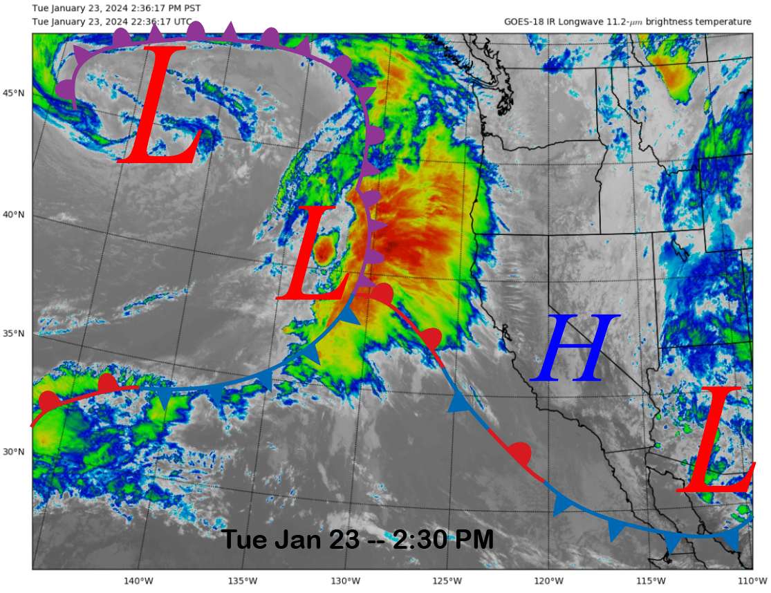
The current infrared satellite image (below) this afternoon shows a transitory ridge of high pressure has built into the state in the wake of the storm that moved through yesterday and Sunday night. The next storm system is positioned in the eastern Pacific and will move into CA tonight and tomorrow.
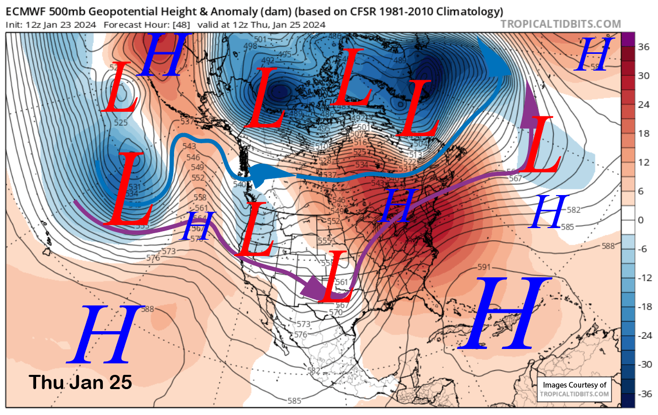
The guidance is now a bit farther southward with the passage of the trough early Thursday (image below) and it will be just far enough southward to produce mostly light snowfall in Mammoth. Snowfall should start tomorrow morning and mostly end by the evening or overnight.
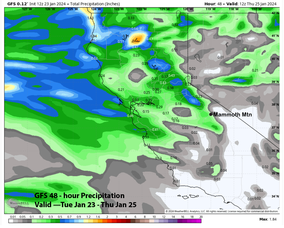
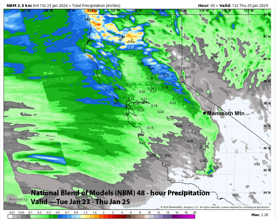
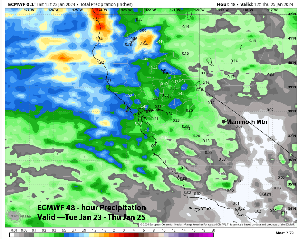
Model guidance is in general agreement that liquid and snow amounts will remain light as the front is only expected to brush Mammoth. The GFS (image below) has about 0.20” and the NBM is similar (two images below) while the ECM is forecasting about 0.15” (three images below). The forecast is calling for only a couple of inches of re-fresher snowfall and maybe up to 3” up top. Should keep the turns fun, but full-on powder conditions are not expected.
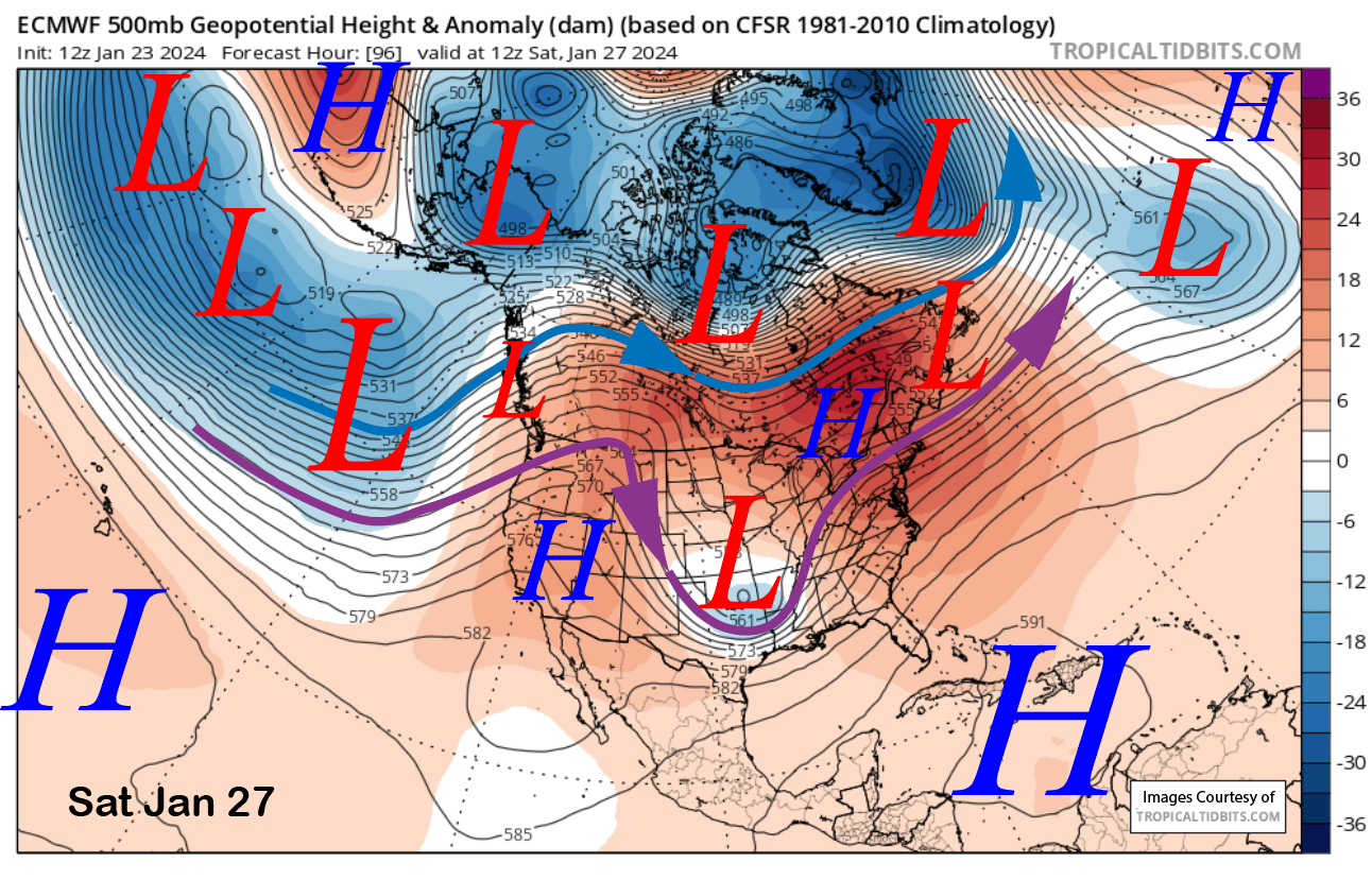
High pressure will then build into the state Friday with a weak low-pressure system moving into the PacNW Saturday (image below) around the ridge and spilling lots of clouds southward into CA. There could be some light rain showers Saturday PM and night and light snow showers up top with snow levels around 10K or slightly higher. Better chance for just passing clouds and low light conditions on Saturday.
Long Range (Days 5+):
The longer-range guidance is certainly showing hope at the start of next month for a stronger and maybe biggest storm system of the winter. However, confidence is still a bit low in the details to proclaim a monster storm yet and it looks to be a relatively short-lived overall wet pattern.
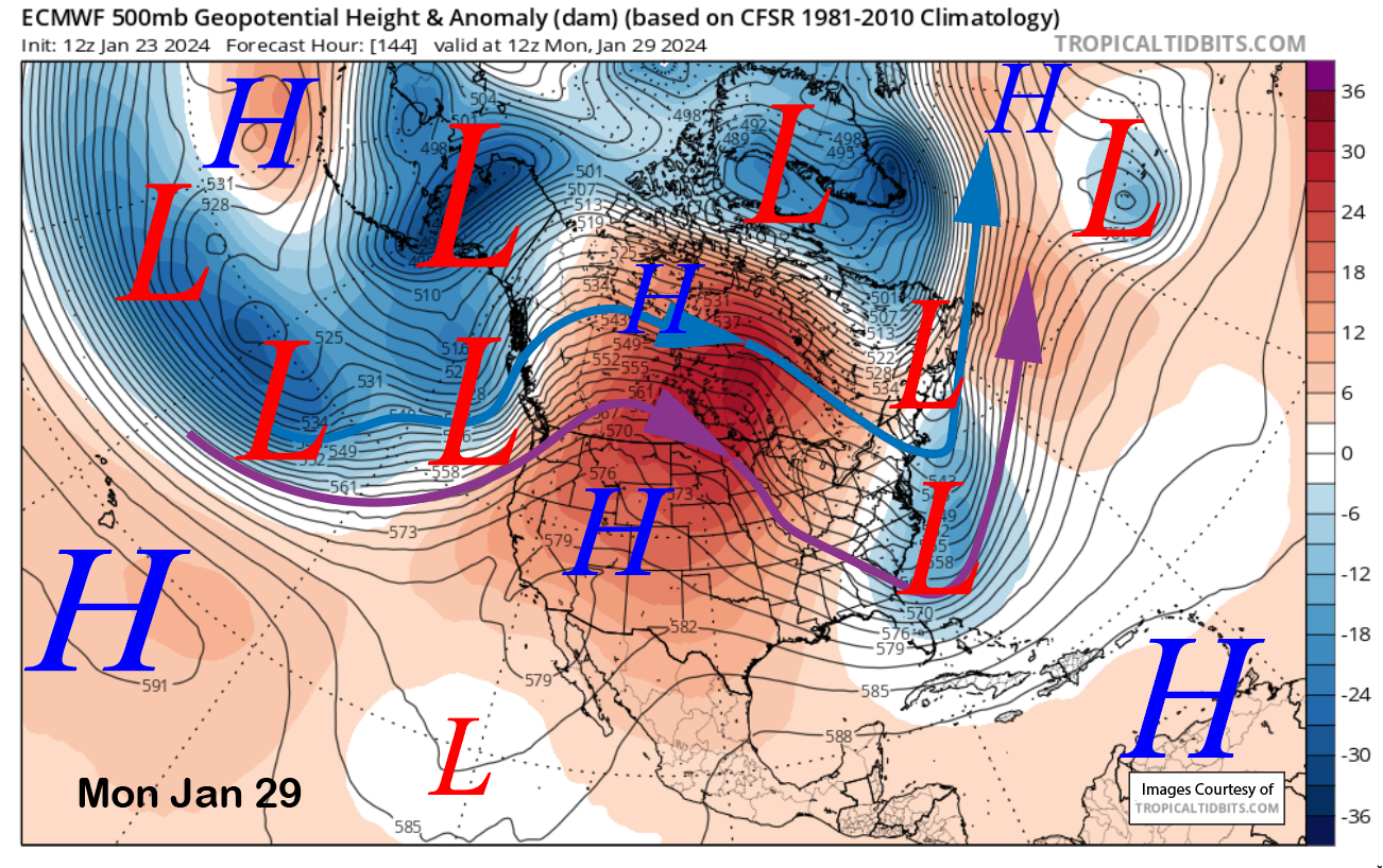
High pressure will build into the state on Sunday and Monday (image below) for dry weather and likely less passing high cloudiness. High pressure and dry weather will probably continue into or through Tuesday next week before changes in the pattern are favored.
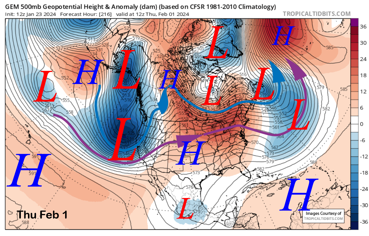
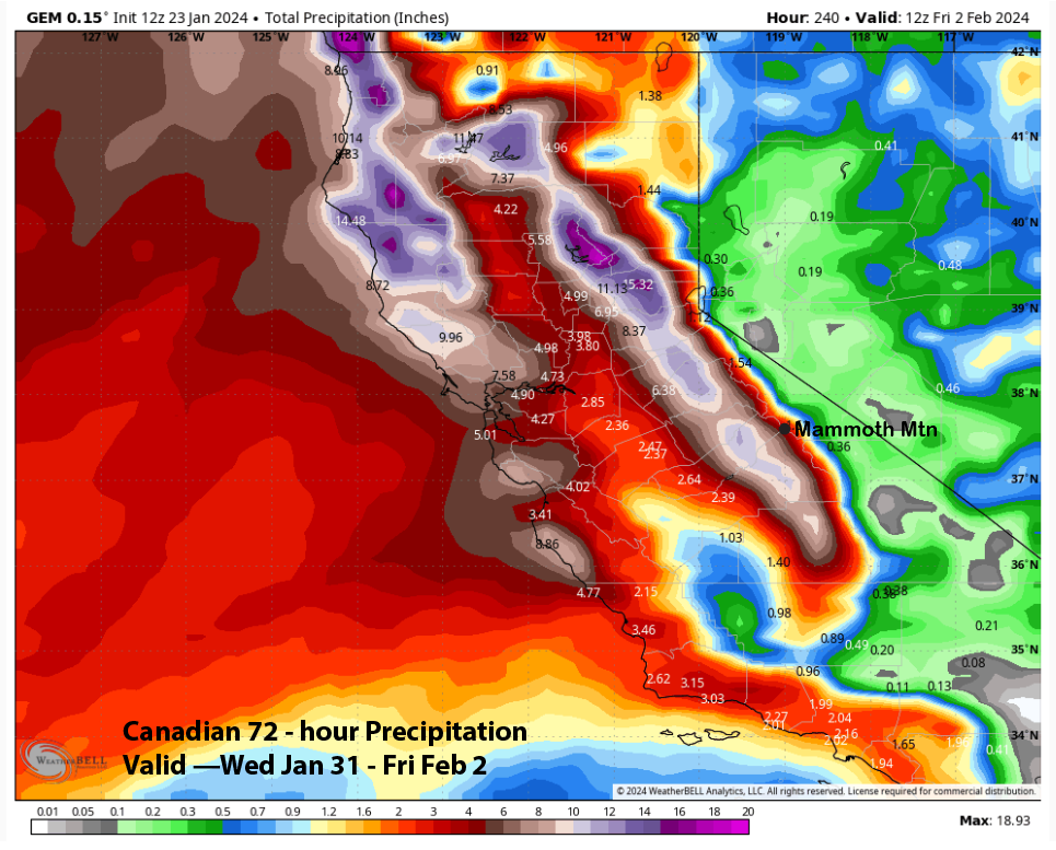
Models are in general agreement that a full latitude longwave trough will develop along the West Coast to start February but disagree about strength and timing, nothing that unusual for a 9-13 day forecast. The 12z Canadian model (image below) is certainly the strongest with the initial short-wave passage and shows a very deep upper low and very strong jet stream moving into the state and Sierra.
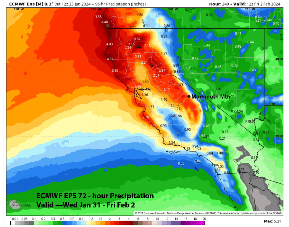
This would be similar to some of the bigger storms from last year and would contain an Atmospheric River. QPF from the model is around 5” liquid for Mammoth and 10” on the western slopes of the Sierra (two images below). Snowfall amounts would be around 4 feet for Main and 6 feet up top in the powder fields.
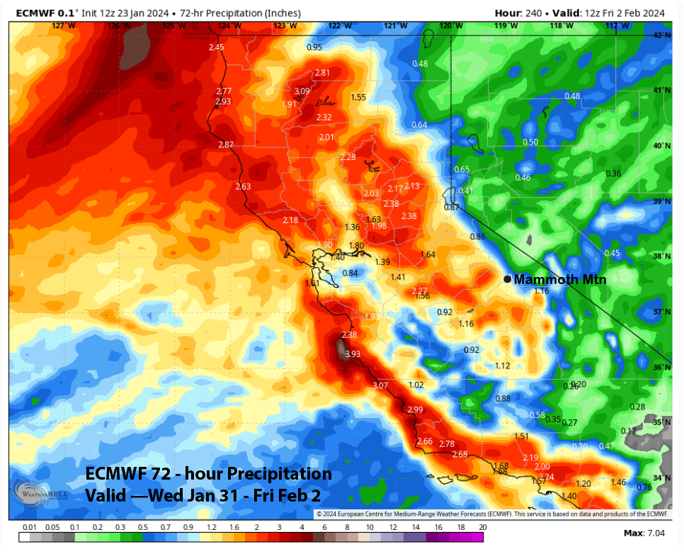
However, the latest deterministic runs of the other models are not showing a strong storm like the Canadian model above. The GFS is rather pedestrian and the ECM model (image below) has backed off a bit from the last run. It still has a nice trough passage that would produce moderate to heavy snowfall for Mammoth, albeit a bit earlier versus the other models.
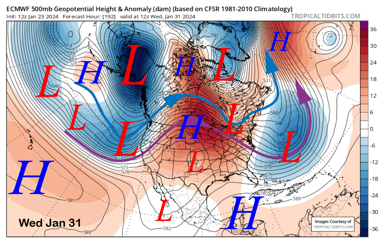
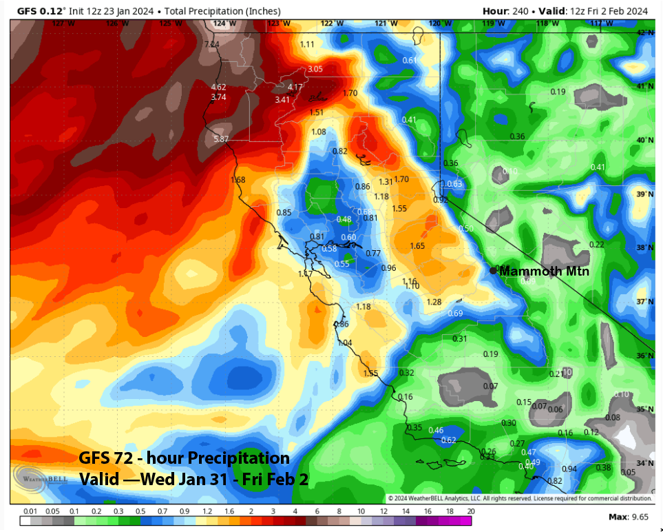
Quantitative Precipitation Forecasts (QPF) from the models are not that impressive with the ECM showing around an inch (image below) and the GFS (two images below) about half that amount.
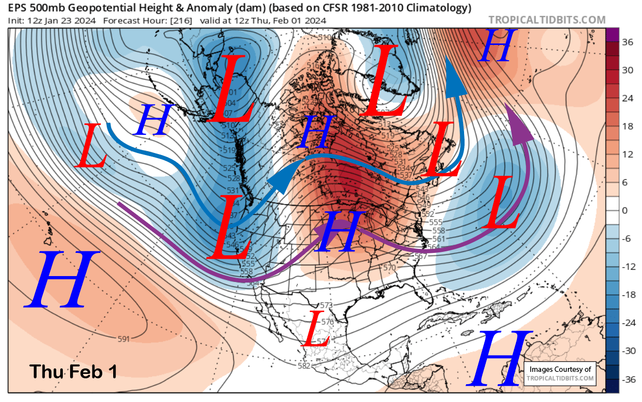
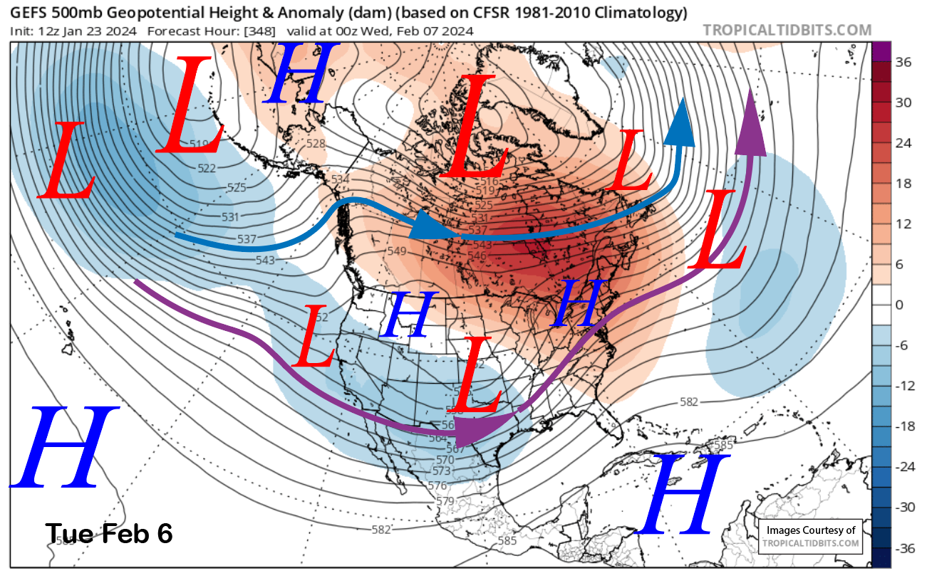
Since it is more than a week out, the forecast leans towards a blend of the ECM EPS (image below) and GFS ensemble (two images below) that both favor a full latitude trough moving into the West Coast backed by both a strong polar (blue arrow) and southern branch (purple arrow) of the jet stream.
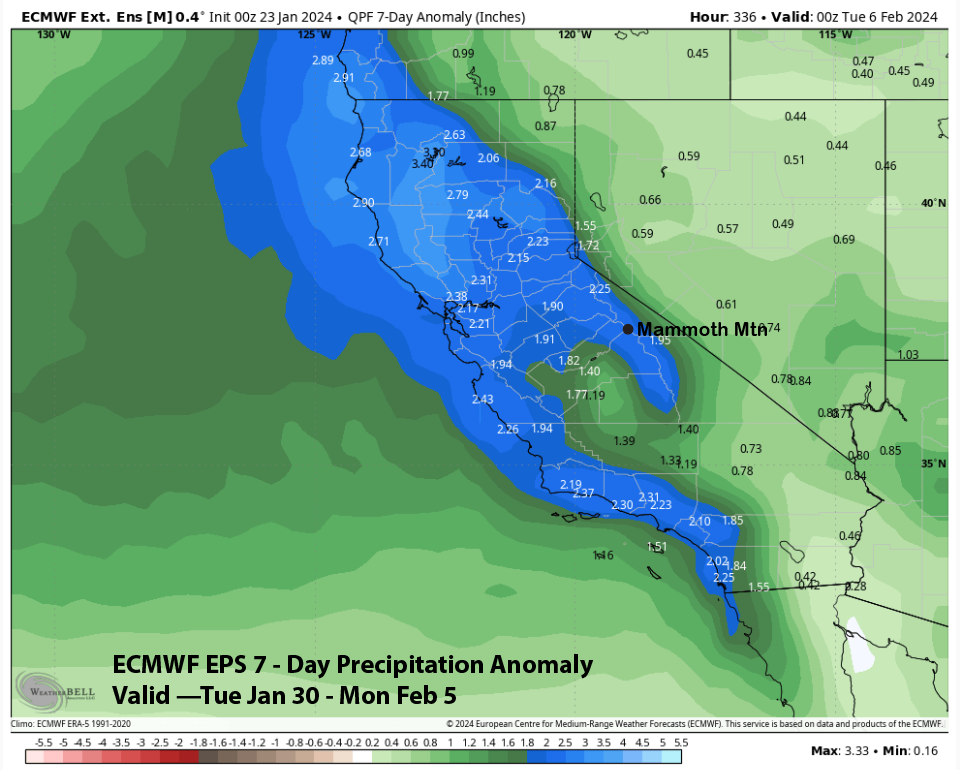
Liquid forecast amounts from the ECM EPS (image below) are around 2” for the first wave of precipitation with still quite a large spread of solutions from the ensembles including many that show the strong Canadian solution. The best guess right now would be at least a foot of snowfall at Main and a decent chance for 2 feet or more, especially through the weekend as snowfall may continue into early the next week.
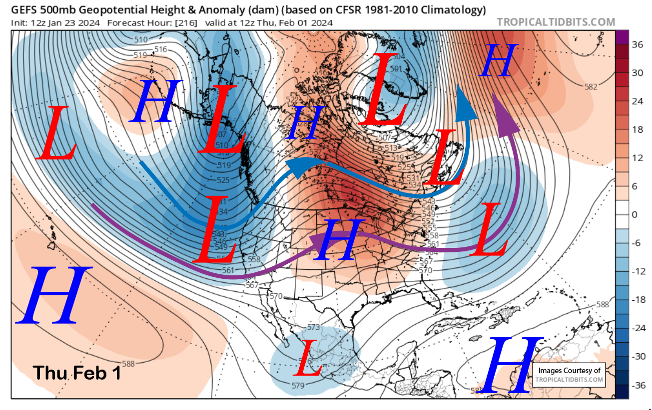
That is what the GFS ensemble is showing (image below) as it keeps a weaker version of the southern branch of the jet stream southward into the state under split jet stream flow. While a big storm is likely under that pattern, additional light to moderate snowfall is possible. Overall, the ECM EPS is favoring a period of above-normal precipitation to end January and start February (two images below).
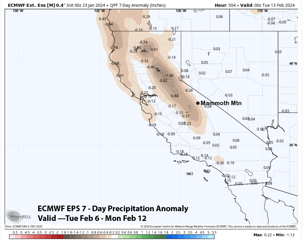
Now that same model is also forecast for below-normal precipitation or drier weather to return over the following week or the second week of February (image below). It then keeps it mostly on the dry side through mid-month. The CFS model is similar. Fingers crossed the wetter models come through this time for early February. WG