Powder Forecast –Tuesday January 9th, 2024
Ted Schlaepfer CCM —- Mammoth Mountain WeatherGuy
Snowfall forecasts are valid at the Sesame snow course (Main Lodge) for the prior 24 hours as reported in the 6-7 AM morning snow report.
**Snowfall forecast confidence ranges from very low (1) to very high (5)
Wed 1/10 = 0”
Thu 1/11 = 9 – 13” (H20 = 0.75” – 0.85”)**4
Fri 1/12 = 0”
Sat 1/13 = 0 –1”
Sun 1/14 = 9 – 12” (H20 = 0.85” – 1.25”)**2
Mon 1/15 = 0”
Tue 1/16 = 0”
Wed – Fri 1/17 – 1/19 = 0 – 2”
January Snowfall = 25”
January Forecast = 55 – 80”
Detailed 4-day Snowfall Forecast:
Wed 1/10 – Snowfall likely develops around mid-day and becomes heavy at times during the evening before ending overnight. Very windy during the afternoon and evening. Accumulations 9 – 13”, ~15” up top
Thu 1/11 and Fri 1/12 – No snowfall expected on both days.
Sat 1/13 – Snowfall likely develops after dawn and may become heavy during the late afternoon or evening before tapering off overnight. Accumulations 9 – 12”, ~15” up top
Forecast Summary:
Short Term (Days 1 – 4):
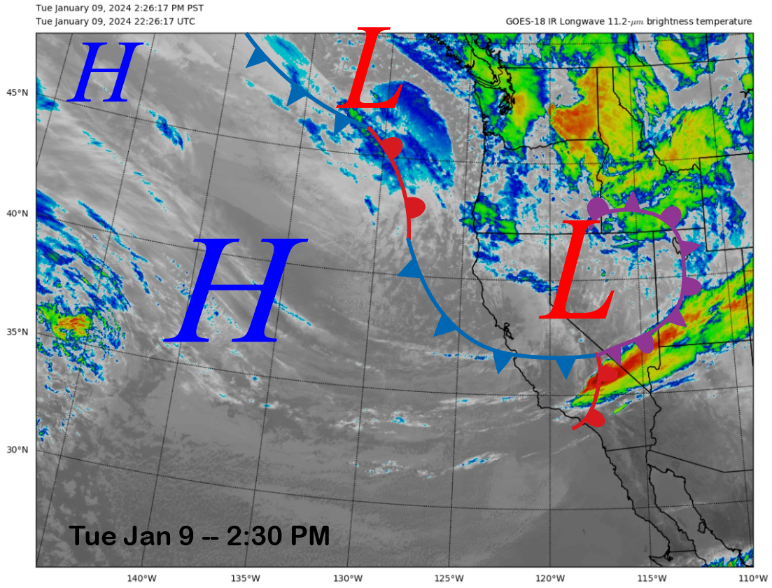
The current infrared satellite image (below) this afternoon shows a weather system and dissipating cold front moving through Central CA that produced gusty winds and wind buff on the mountain today. A trailing weather system is positioned off the PacNW coast and will move into CA and Mammoth tomorrow.
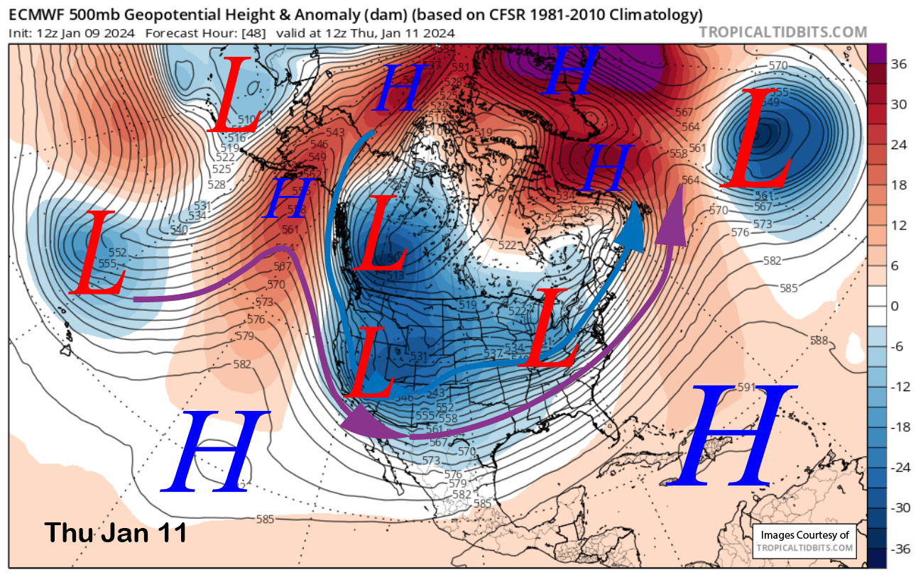
The storm system will move through rather quickly like the previous one and the trough axis will pass through the eastern Sierra by early Thursday (image below) when the snowfall is expected to end. It is backed by a strong northwest oriented jet stream and is rather deep with the polar jet (blue arrow) producing good dynamics during its passage.
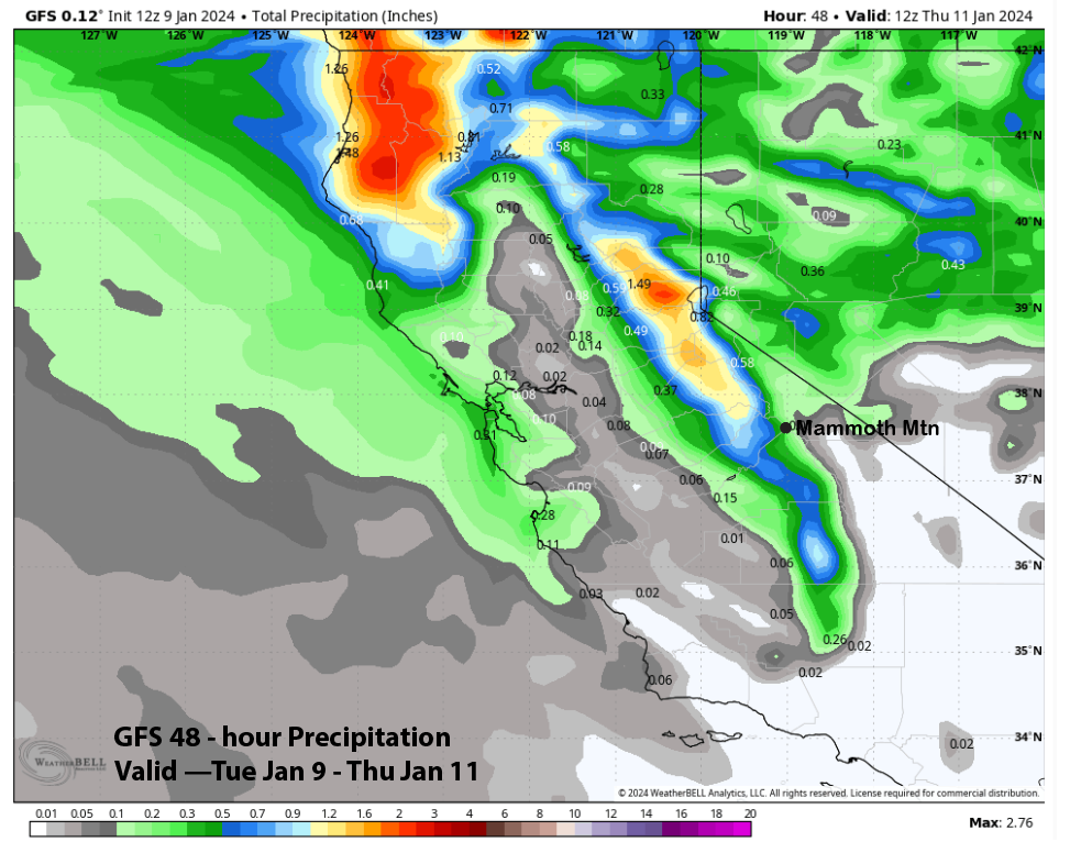
Coming from the Gulf of Alaska like the previous storm, it will be a colder type of storm with snow levels around 4000 feet and snow ratios around 12-14”:1” The models do differ slightly on the forecast amounts with the ECM (image below) and Canadian (two images below) models showing the most at around 0.75” and the GFS (three images below) forecasting half that amount and around a third of an inch liquid.
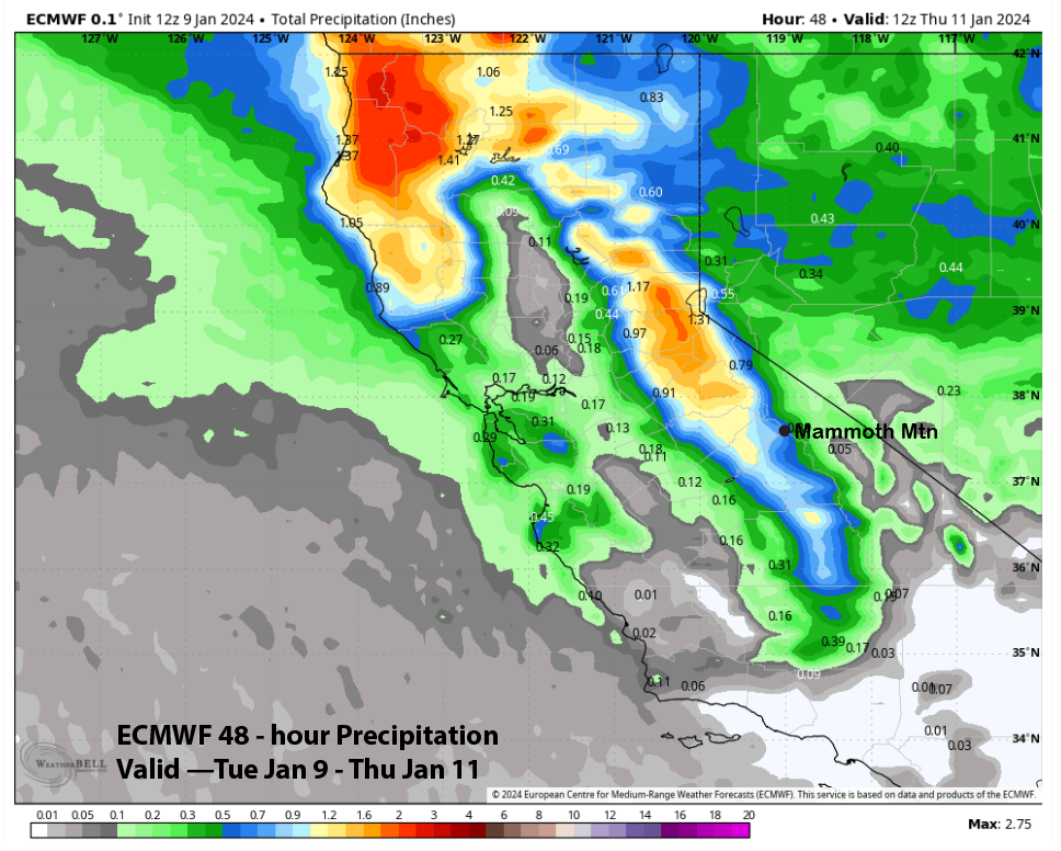
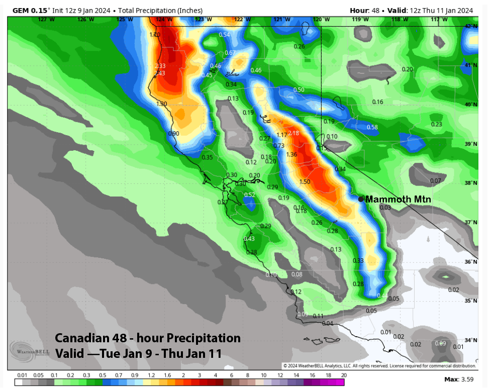
The forecast follows the ECM/Canadian models due to the good jet dynamics associated with the system, even though there is limited moisture and weak orographic enhancement due to the northwest-oriented jet stream. Nonetheless, Main could see 12”+ and well over a foot is likely up top. ECM liquid using the Kuchera ratio method shows about 15” for Main (cover image).
High pressure will then build into the region Thursday during the day and hold through Friday under seasonably cold temperatures. With the fluffy powder, conditions should be excellent, even though it is still low tide out there on the off-piste terrain.
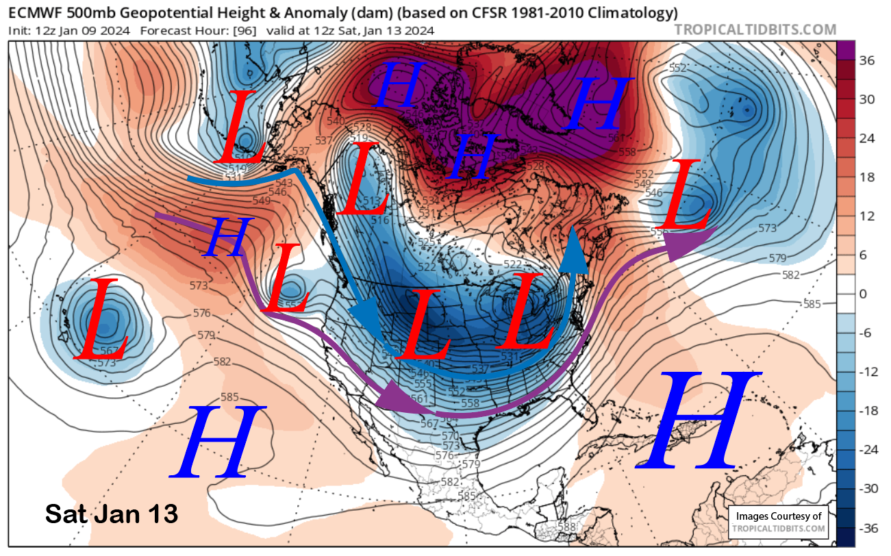
The forecast for the upcoming Holiday weekend is still a bit questionable as there is considerable model disagreement. The ECM (image below) and Canadian models move a short-wave trough from the Central Pacific into the long-wave trough positioned along the West Coast. The models then deepen the upper-level trough and surface low as a baroclinic zone is established just off the CA and Oregon coastlines before moving it into CA on Saturday during the day.
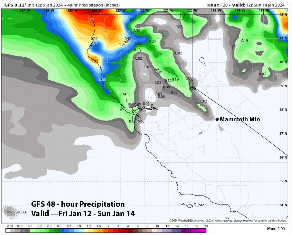
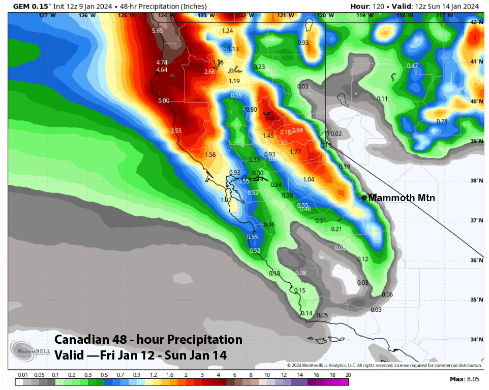
The GFS model has been consistently not on board with that solution as it is much weaker with the development of the surface low and moves it generally westward into Oregon and NorCal with little to no north/south displacement. That is reflected in the Quantitative Precipitation Forecast (QPF) from the model which shows no precipitation accumulation as far south as Mammoth (image below).
The ECM model (image below) is by far showing the largest liquid amounts in its QPF at over an inch while the Canadian model (two images below) has less than half that amount at just under a half an inch. That means the deterministic models are forecasting from zero inches up to 15” of snowfall for Saturday, depending upon your model preference.
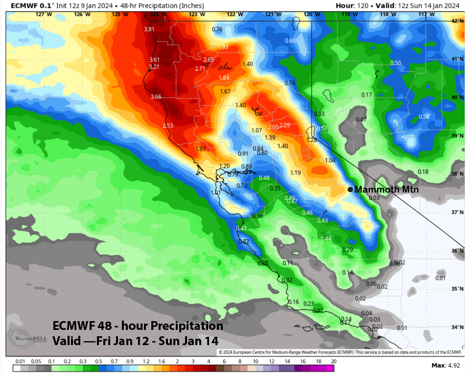
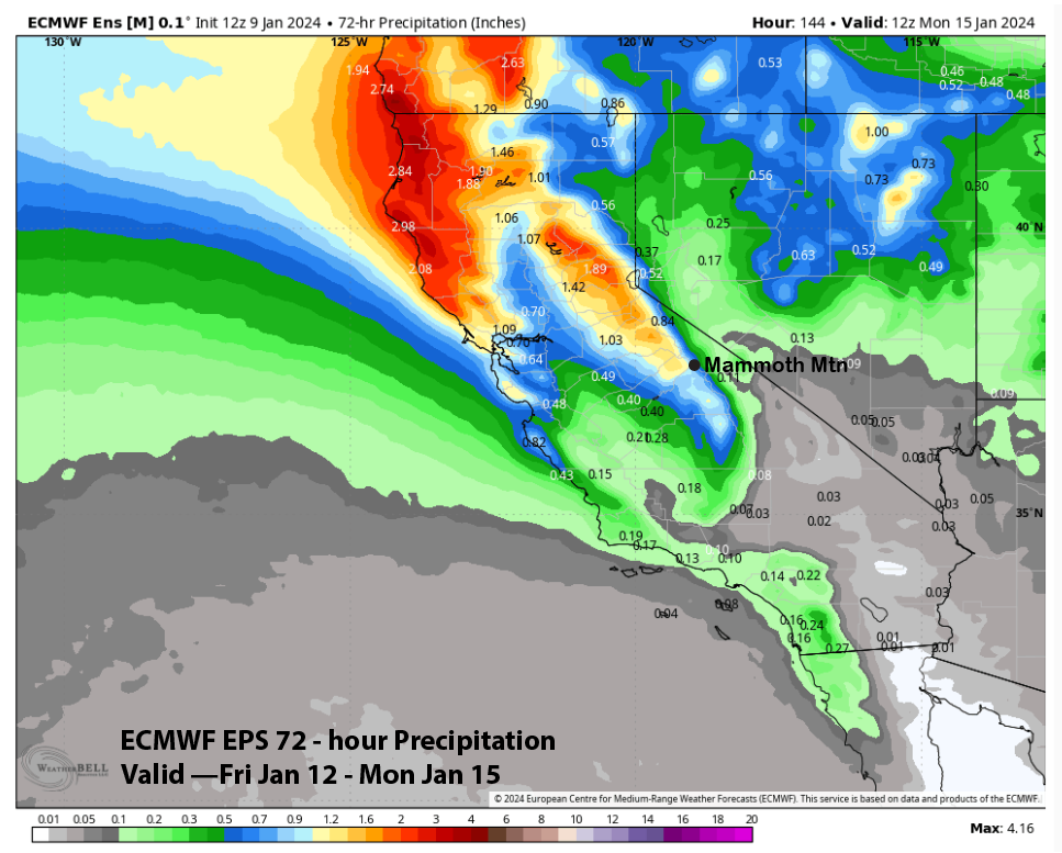
Only a handful of fifty individual ECM ensemble members are showing very little or no precipitation on Saturday like the GFS solution. The current forecast follows the ECM EPS mean (image below) at just under an inch of liquid and 9-12” of snow. This would be a slightly warmer storm than the previous one (but not super warm) with snow levels around 5500 feet and snow ratios around 10”:1”. Overall, low confidence due to the model uncertainty.
Long Range (Days 5+):
The longer-range guidance started looking pretty good a couple of days ago for a potential base snow pattern before now backtracking with the latest runs. Hopefully, the models will flip back as we need that first base-type storm to open up the rest of the off-piste terrain and get the powder skiing season under full swing.
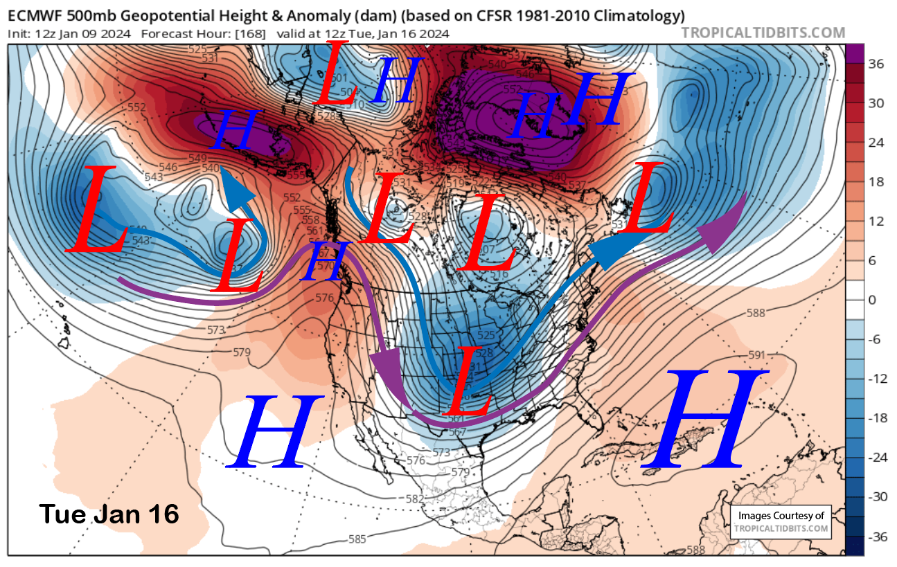
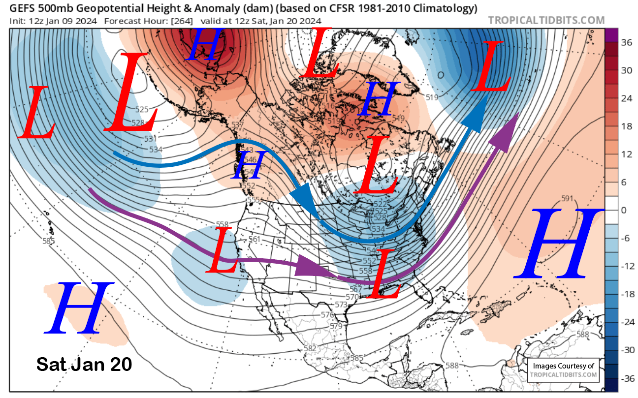
High pressure builds back into the area on Sunday and looks like it will hold through at least next Tuesday (image below). There is a slight chance for a very weak system to move through around late Wednesday or Thursday, otherwise, high pressure and dry weather will probably hold in place through the rest of the 10 days.
The GFS ensemble (image below) favors a very weak undercut or breakthrough of the westerly jet stream over the following weekend. The ECM EPS is now similar after being a bit more bullish on a stronger breakthrough a couple of runs ago. Ridging and dry weather are then shown by the models to return around the 24th.
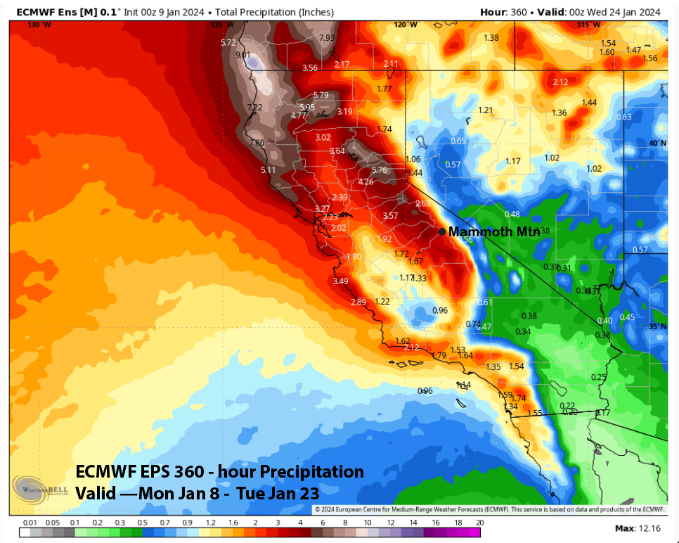
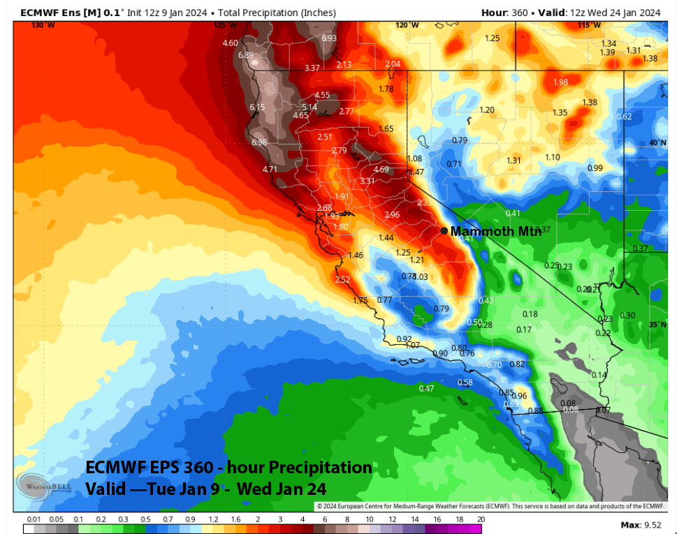
The change in the guidance can be illustrated by the QPF reduction by the ECM EPS from the 0z run last night (image below) when it showed about 4.5” liquid, before going down about an inch (two images below) on the morning run. While that might not be significant if it was just 1 model ensemble, it is the average of the sum of all 50 ensemble members, and that is significant mathematically. I suspect the changes are due to the models having trouble resolving the MJO track and potential influence on the pattern.
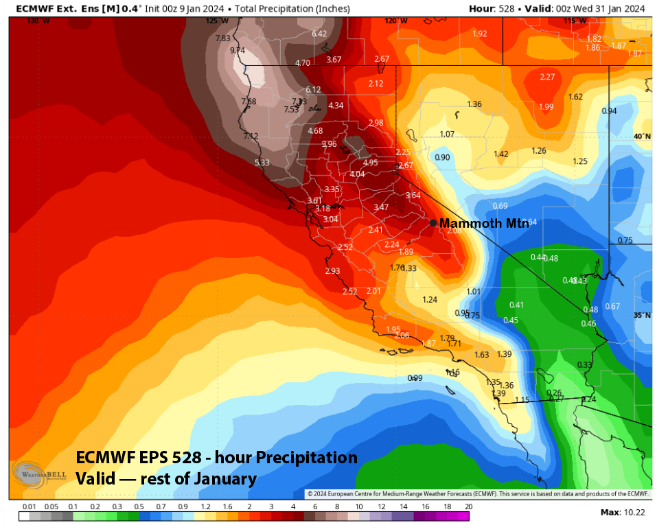
With high pressure possibly returning and also holding over the last week of the month, the monthly forecast is only favoring about 4” more inches of liquid (image below) or 40-50” of snowfall at 10-12”:1” snow ratios. With almost half of that falling with the next two storms, that leaves about 20” of potential snowfall for the second half of the month. The best-case scenario right now would be having it fall all at once and be Sierra Cement with a storm around the 19-21st. WG