Powder Forecast –Tuesday, March 5th, 2024
Ted Schlaepfer CCM —- Mammoth Mountain WeatherGuy
Snowfall forecasts are valid at the Sesame snow course (Main Lodge) for the prior 24 hours as reported in the 6-7 AM morning snow report.
**Snowfall forecast confidence ranges from very low (1) to very high (5)
Wed 3/6 = 0”
Thu 3/7 = 0 – 1”
Fri 3/8 = 0 – 1”
Sat 3/9 = 0”
Sun 3/10 = 0”
Mon 3/11 = 1 – 2”
Tue 3/12 = 0 – 1”
Wed – Fri 3/13 – 3/15 = 2 – 6”
March Snowfall: 39”
Marc Forecast = 60 – 75”
Detailed 4-day Snowfall Forecast:
Wed 3/6 – Dry during the morning, then a chance for light snow showers during the afternoon and evening. Accumulations 0 – 1” by Thursday AM.
Thu 3/7 – Dry during the morning, then a chance for light snow showers during the afternoon and evening. Accumulations 0 – 1” by Friday AM.
Fri 3/8 and Sat 3/9 – No snowfall expected on both days.
Forecast Summary:
Short Term (Days 1 – 4):
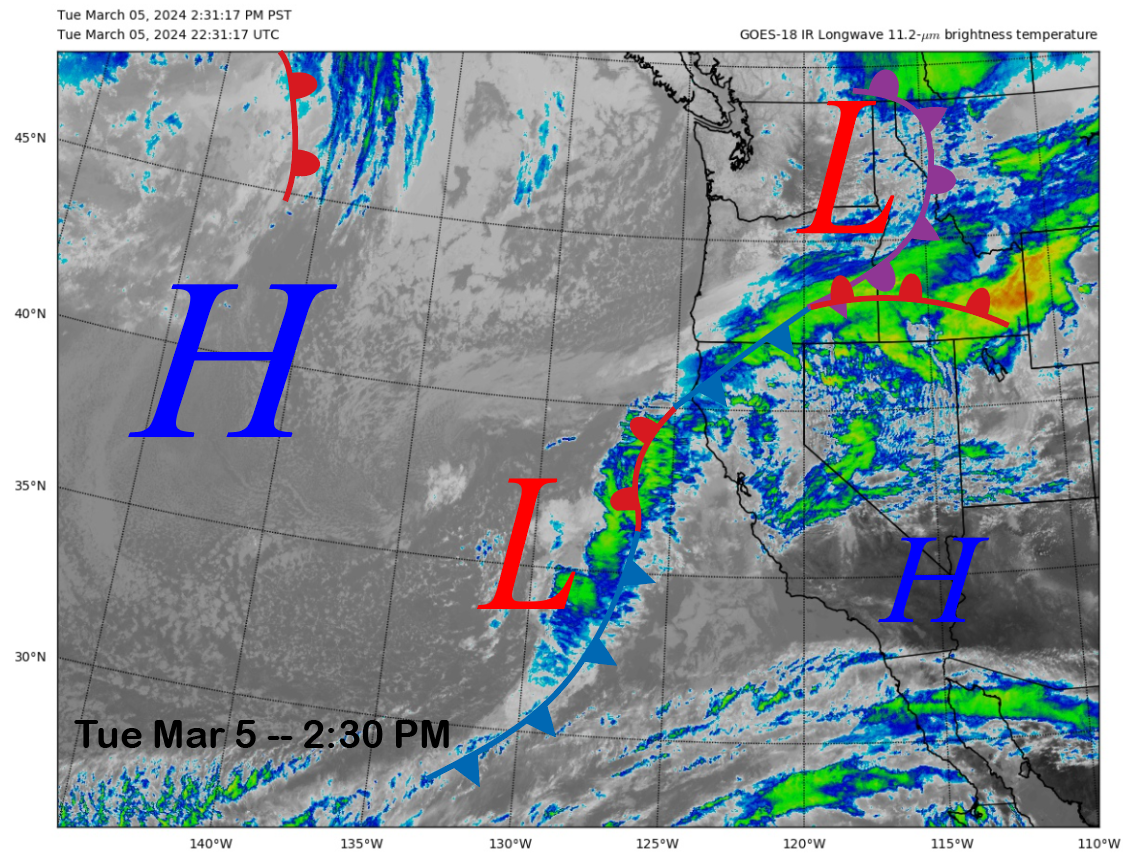
The current infrared satellite image (below) today shows a weather system off the CA coast and a front draped across NorCal associated with a low-pressure system moving eastward through the PacNW. Clouds are being sheared off from the weather system off the coast and into the Sierra, but it has remained dry in Mammoth.
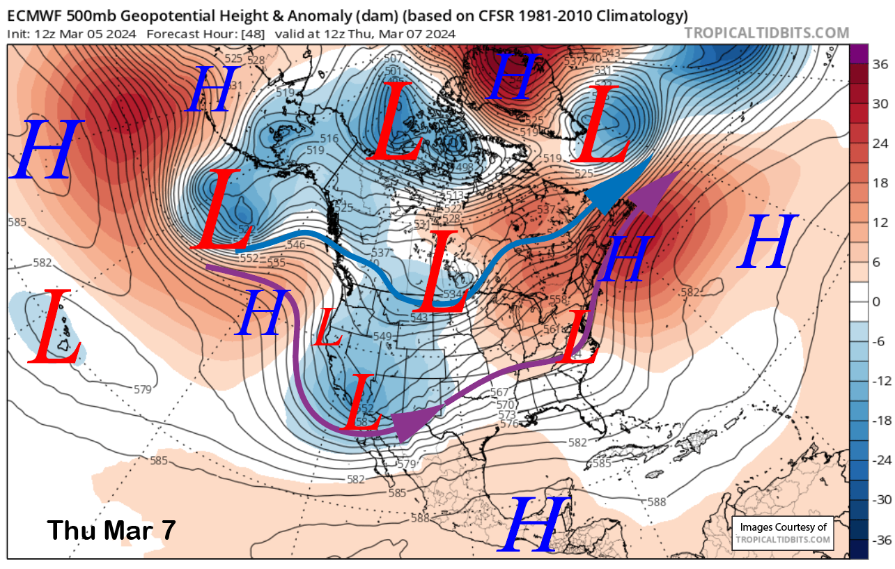
The models move the low currently off the coast into SoCal tomorrow and have another weak short wave moving southward through CA on early Thursday (image below). Moisture could move far enough northward tomorrow for a chance for light snow during the afternoon and evening. Another chance will happen Thursday PM and evening from the other short wave trough.
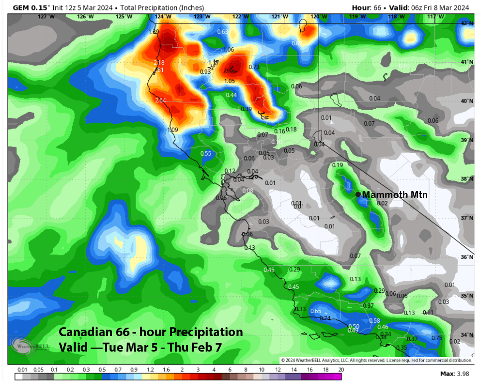
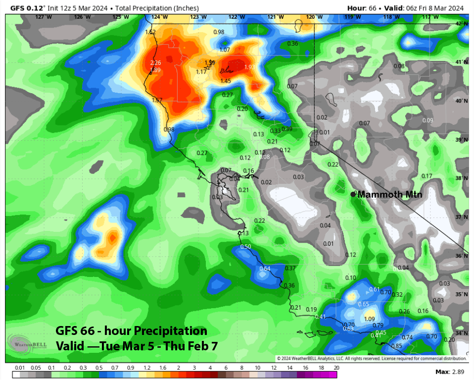
Model QPF is quite underwhelming with the Canadian model the wettest at around a third of an inch liquid (image below). The GFS model (two images below) is a wetter model with about a quarter-inch liquid or two inches of snowfall over both days.
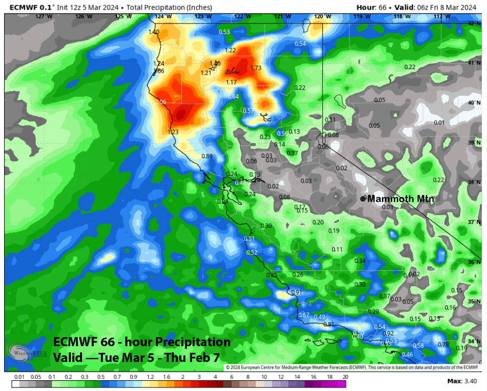
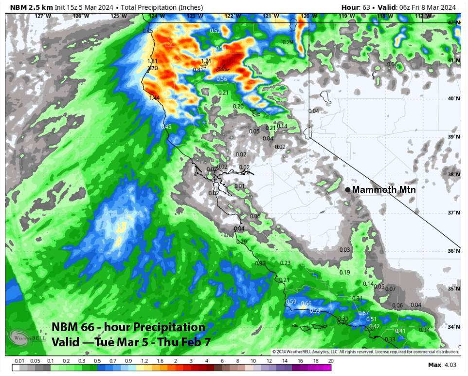
The ECMWF (image below) and NBM models (two images below) are showing only trace amounts and under a tenth of an inch of liquid. That is consistent with the ECM EPS (not shown) which has about a tenth. The forecast is only calling for very light amounts or nothing—dust on crust.
Dry weather is forecast for Friday and should continue on Saturday. A weak system will move north of Mammoth on Saturday night and only passing clouds are expected with the precipitation staying well north of Mammoth. There will be breezy winds on Saturday at just the right strength to produce some wind buff for the upper half of the mountain and not too strong to shut down the lifts.
Long Range (Days 5+):
The longer-range guidance isn’t looking so great for powder chances anymore with the dry pattern now possibly arriving earlier in the month. The weather pattern is starting to look a bit like spring with the models not favoring any more big snowfall patterns for the rest of winter and generally favoring a shift of the jet stream northward.
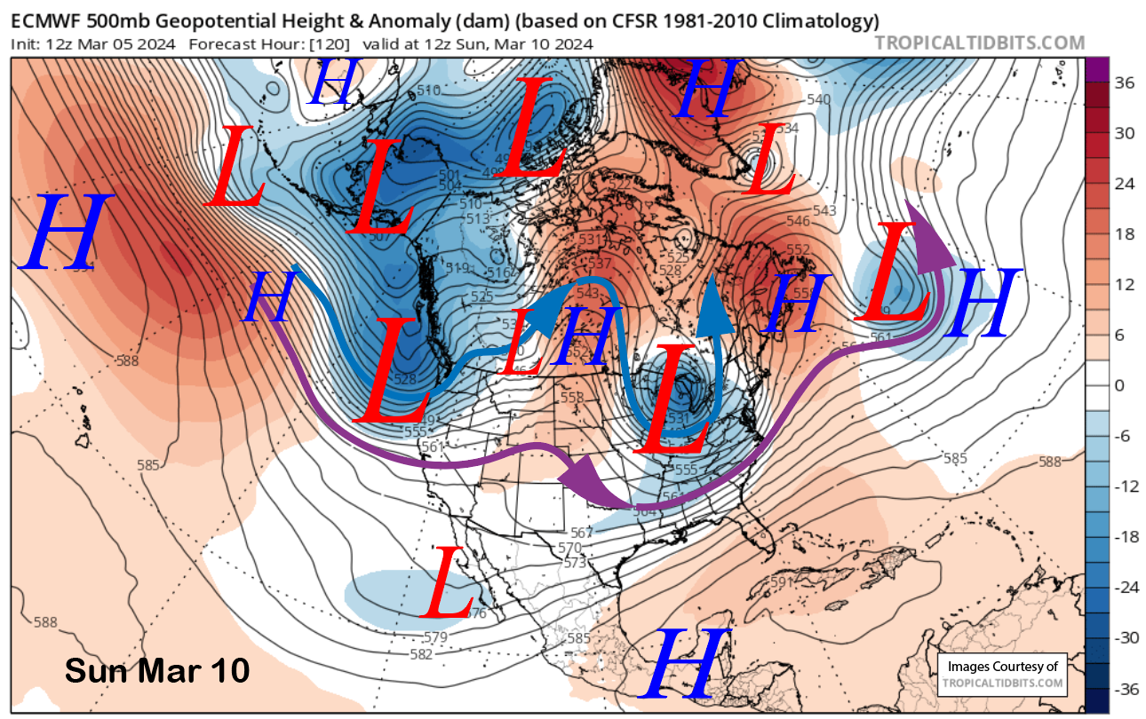
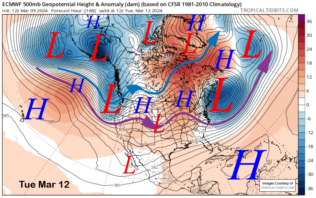
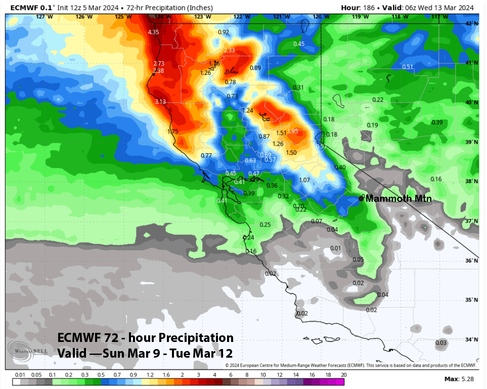
The latest 12z run of the ECM shows one or two more chances for low-end powder conditions before the dry weather sets in. It has two short waves moving into CA on Sunday night (image below) and again on Tuesday (two images) with the jet stream (purple arrow) possibly just far enough southward to produce decent snowfall, but certainly not a slam dunk.
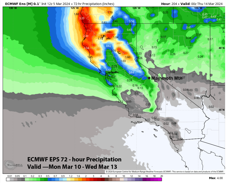
ECM QPF for early next week is not that impressive and has just over half an inch of liquid (image below). That is slightly more than the ECM EPS mean at just under half an inch (two images below). It looks like the better chance for low-end powder would be with the second storm on Tuesday and into early Wednesday next week. The Sunday night into Monday storm is only looking like an inch or two of snowfall and mostly dust on crust.
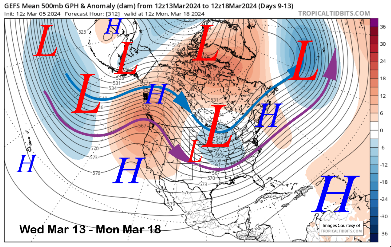
The longer-range guidance is then bullish about high pressure building into the state toward the end of next week and lasting through the following weekend (image below). That would mean fair and dry weather in addition to spring conditions on the lower part of the mountain.
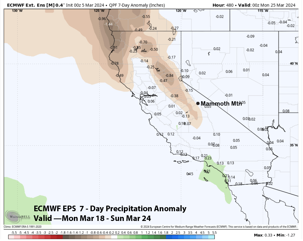
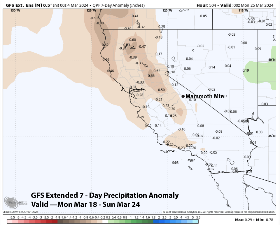
The dry weather will probably last into the next week with the fantasy range guidance suggesting that there is a chance for a weak storm or two later that week or following weekend. Both the ECM EPS (image below) and GFS extended (two images below) shows near average precipitation for that week. The ECM is favoring similar precipitation anomalies for the last week of the month. Any powder is better than no powder. WG