
Mammoth Mountain Powder Forecast – Tuesday, November 21st, 2023
From: Ted Schlaepfer CCM —- Mammoth Mountain WeatherGuy
Snowfall forecasts are valid at the Sesame snow course (Main Lodge) for the prior 24 hours as reported in the 6-7 AM morning snow report.
**Snowfall forecast confidence ranges from very low (1) to very high (5)
Wed 11/22 = 0”
Thu 11/23 = 0”
Fri 11/24 = 0”
Sat 11/25 = 0”
Sun 11/26 = 0”
Mon 11/27 = 0”
Tue 11/28 = 0”
Wed – Fri 11/29 – 12/1 = 0 – 3”
November Snowfall = 14”
November Forecast = 15 – 20”
Detailed 4-day Snowfall Forecast:
Wed 11/22 through Sat 11/26 – No snowfall all days, breezy to gusty northeast winds over the Holiday weekend.
Forecast Summary:
Short Term (Days 1 – 4):
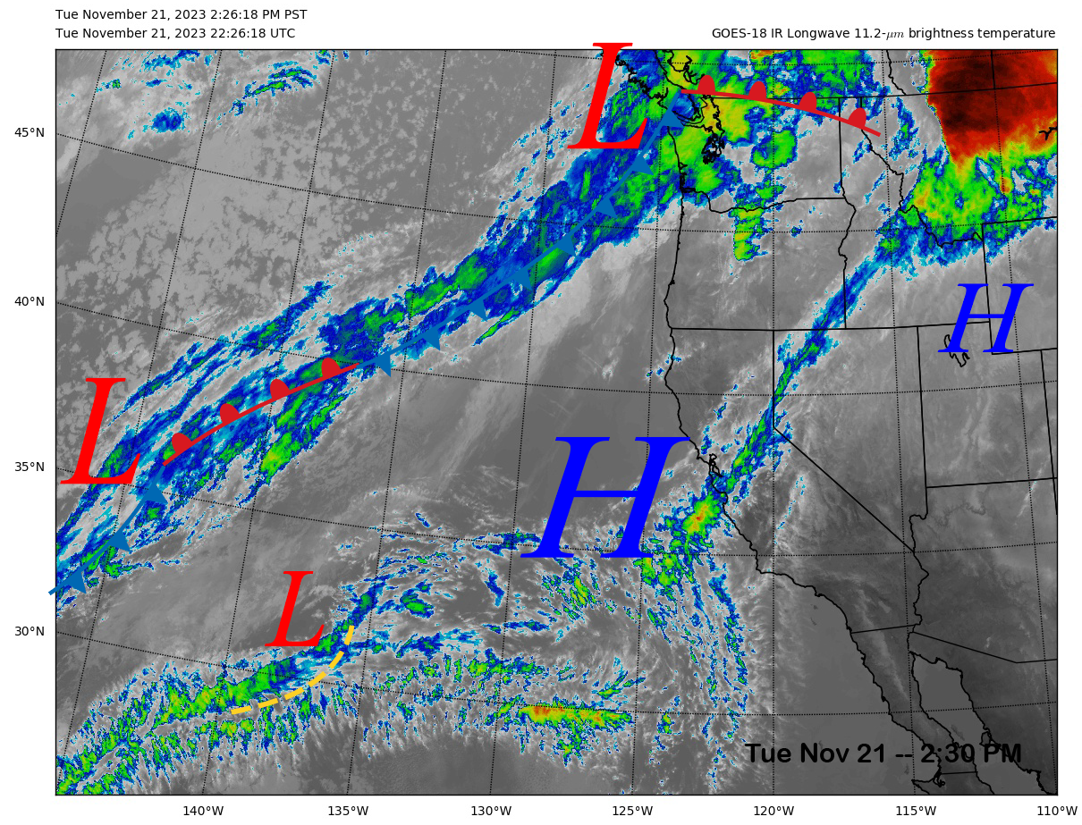
The current infrared satellite image (below) this afternoon shows some high clouds moving through Central California as the high-pressure ridge starts to break down over the next couple of days.
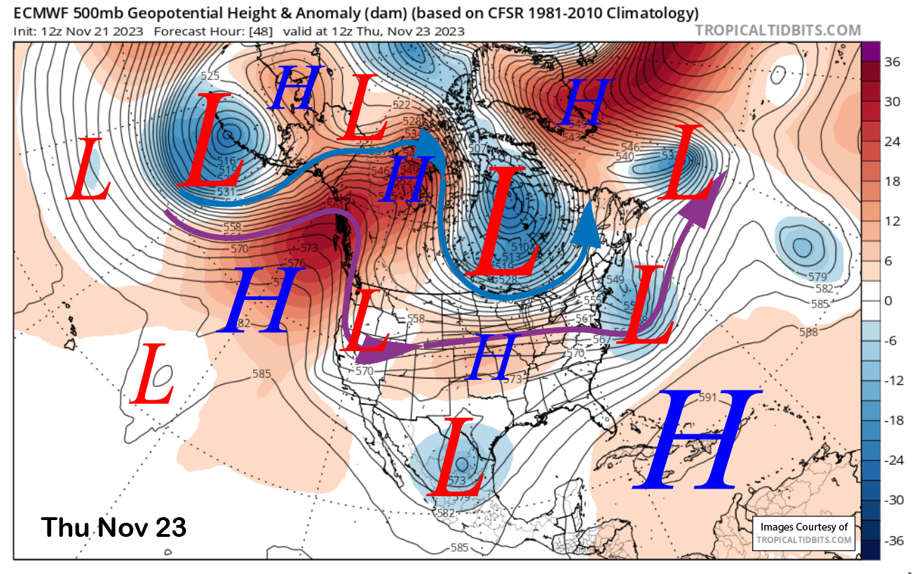
The weather system well off the coast is expected to move through the eastern Sierra on early Thanksgiving (image below) as an inside slider type short-wave trough. That means just colder temperatures for the most part.
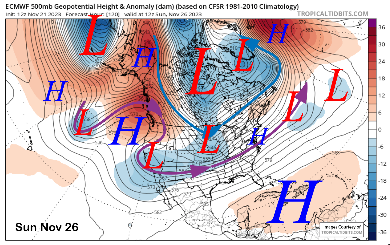
That slider will move into the deserts Southwest Friday followed by additional short-waves out of the northeast that will further deepen the trough through the weekend (image below). No snowfall is expected, but further cooling and breezy to gusty northeast winds should occur at times into Monday. This will also increase snowmaking opportunities with daytime temperatures remaining in the 20s at Main Lodge Friday through Sunday.
Long Range (Days 5+):
The longer-range guidance is still looking dry for almost the rest of the month, and depending upon your preference for long range modeling, possibly into December as well.
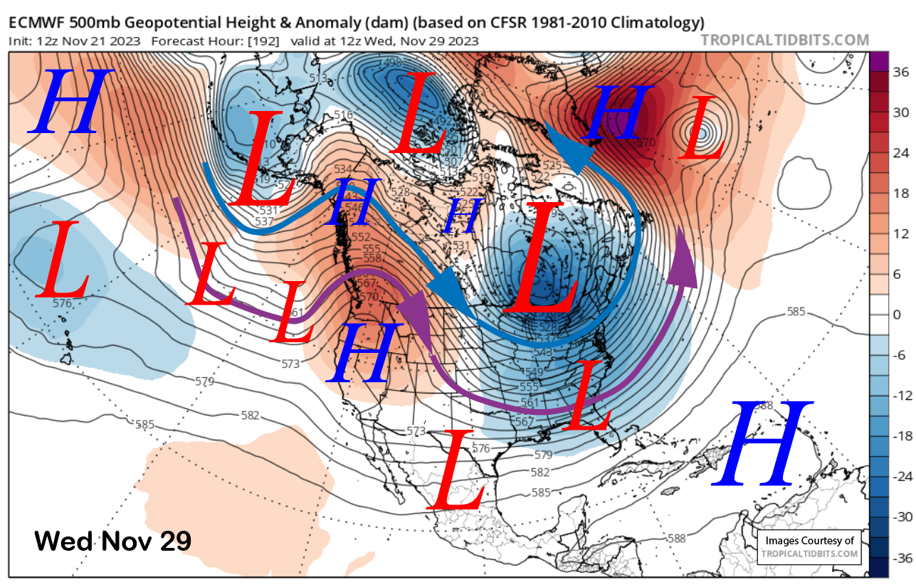
The ridge is forecast to rebuild into the state early next week and last through mid-week (image below) for more fair and dry weather and also seasonable temperatures. It is not forecast to be that strong, and not as strong as the current ridge of high pressure, so snowmaking could continue during the nighttime hours.
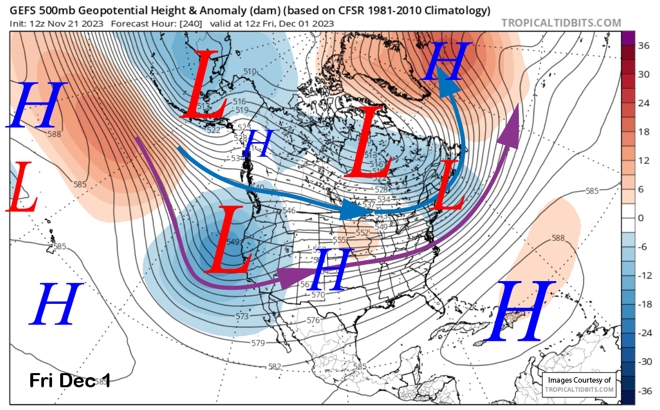
Changes in the weather pattern are then possible toward the end of next week or over the following weekend. The GEFS develops a fairly deep trough for the extended period by next Friday (image below) that would produce a stormy pattern for Mammoth.
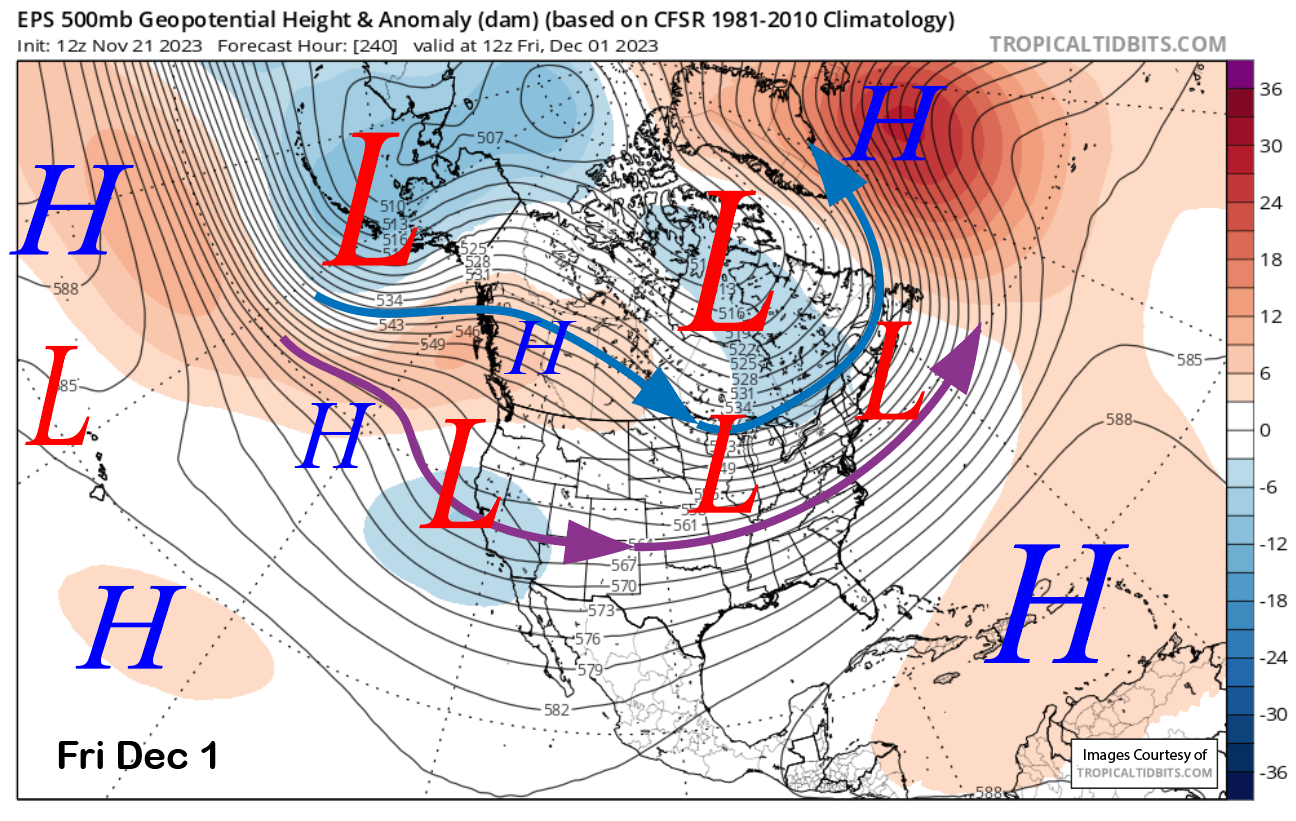
However, the ECM EPS is only showing a weak trough passage (image below) that would probably only mean light snowfall and nothing significant for base building. We will have to wait and see how it plays out, but the models have trended stronger over the past few runs, especially the GEFS.
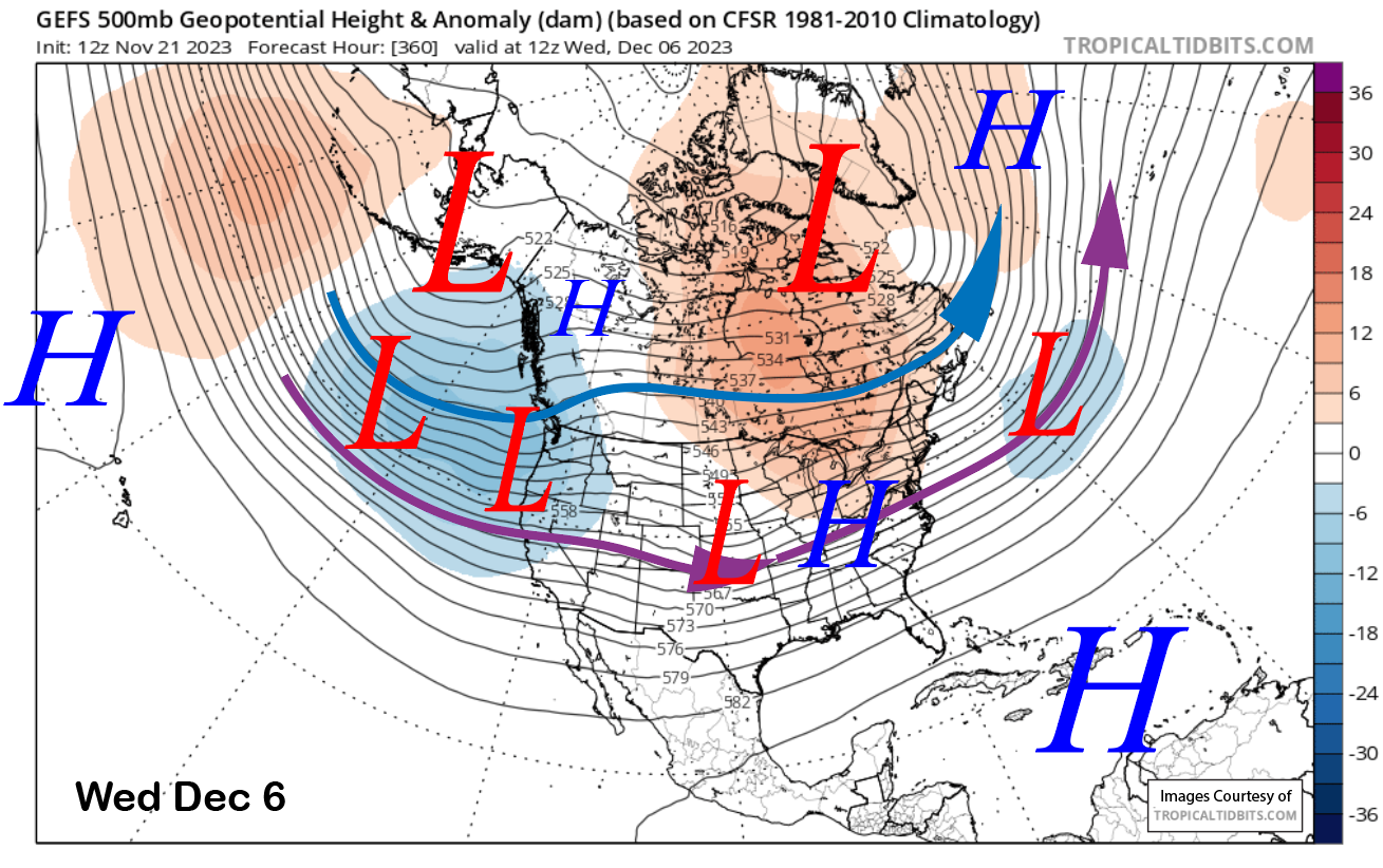
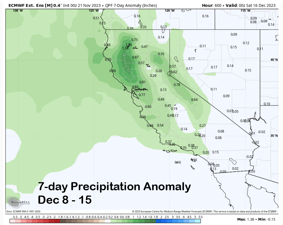
The GEFS keeps a trough in place across the West (image below) through the first week of December that would keep storm chances ongoing. That does match up well with the latest run of the ECM EPS 45-day forecast that is wet during that week too and keeps it anomalously wet through mid-December (two images below). The CFS model is also wet for that time frame.
That is very far out in time to get excited about yet. Hopefully the slow start to the season, that is not that unusual during an El Nino, will come to an end by early December, fingers crossed. WG


