Powder Forecast – Friday, March 8th, 2024
Ted Schlaepfer CCM —- Mammoth Mountain WeatherGuy
**Snowfall forecast confidence ranges from very low (1) to very high (5)
Sat 3/9 = 0”
Sun 3/10 = 0”
Mon 3/11 = 1 – 2”
Tue 3/12 = ~1”
Wed = 2 – 4”
Thu = 0”
Fri = 0”
Sat – Mon 3/16 – 3/18 = 0”
March Snowfall: 39”
Marc Forecast = 60 – 80”
Detailed 4-day Snowfall Forecast:
Sat 3/9 and Sun 3/10 – No snowfall expected both days, with light snowfall developing late Sunday night and into early Monday. Accumulations 1 – 2” by Monday AM at Main, maybe 3” up top
Mon 3/11 – Light snowfall should end during the morning, with only flurries during the afternoon. Snowfall then redevelops overnight. Accumulations ~1” by Tuesday AM.
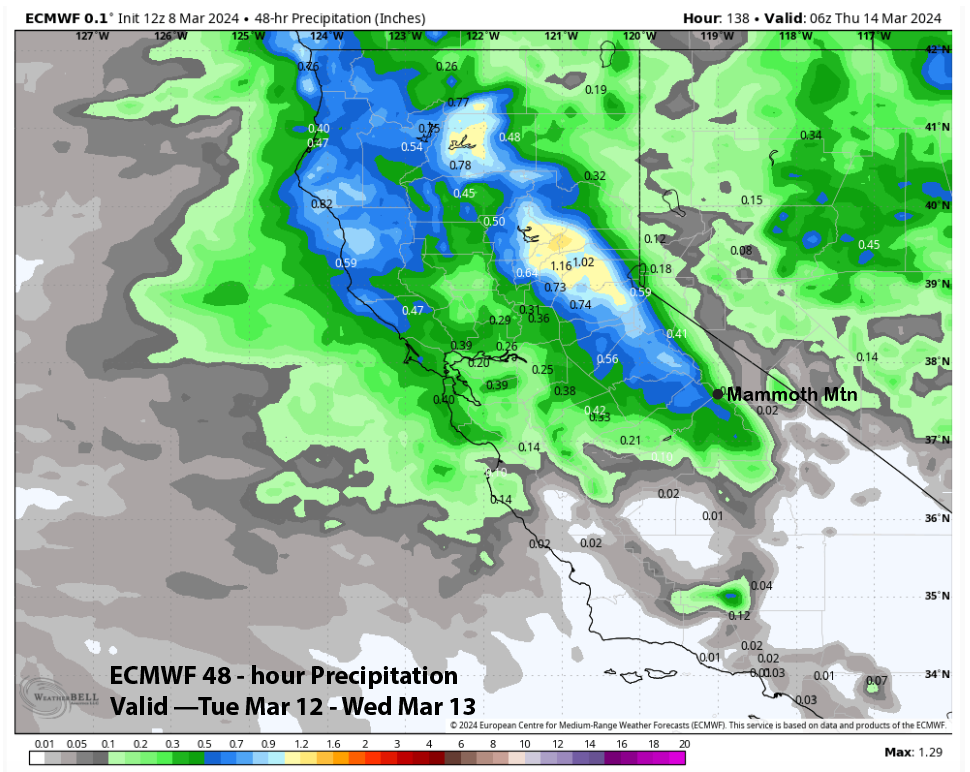
Tue 3/12—Moderate morning and early afternoon snowfall tapers off by evening. Accumulations will be 2 – 4” by Wednesday AM at Main and up to 6” up top.
Forecast Summary:
Short Term (Days 1 – 4):
The current infrared satellite image (below) shows high pressure building over the state and West Coast. A weather system far off the coast will move through NorCal tomorrow, with only passing clouds and an increase in the breeze (and wind buff) for Mammoth.

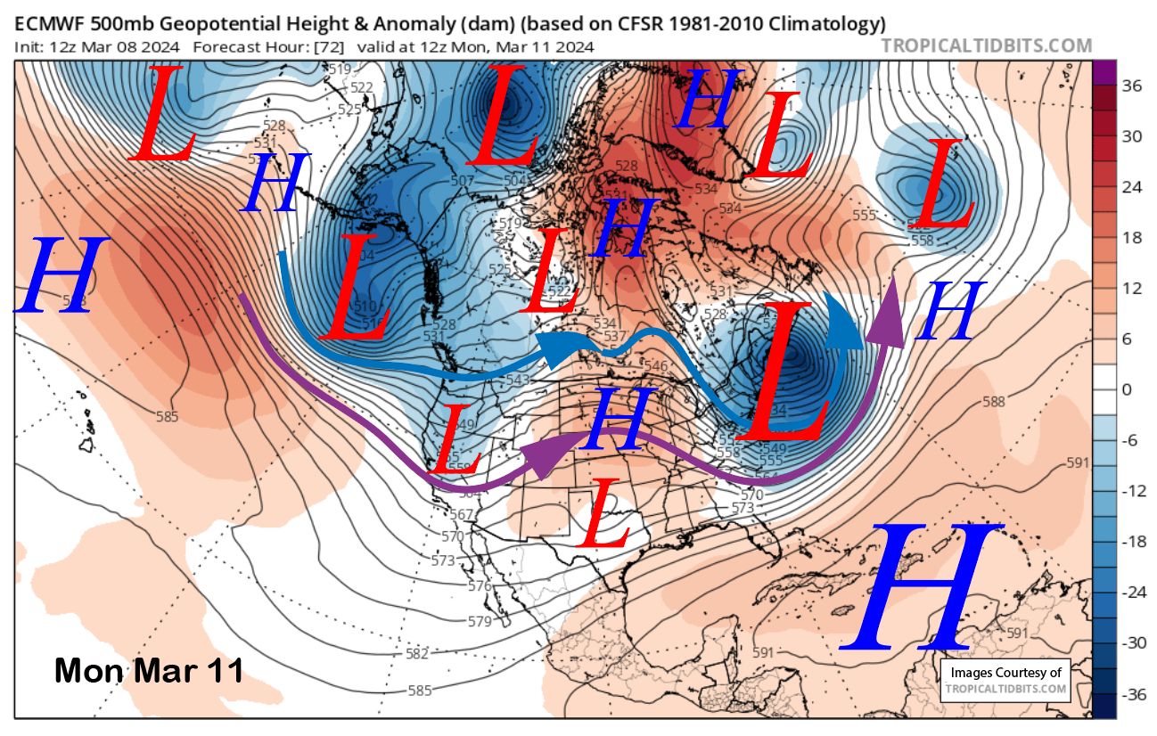
High pressure will then briefly rebuild before another weather system moves a bit farther southward on Sunday night and early Monday (image below) for a decent chance for light snowfall, primarily during the early morning hours.
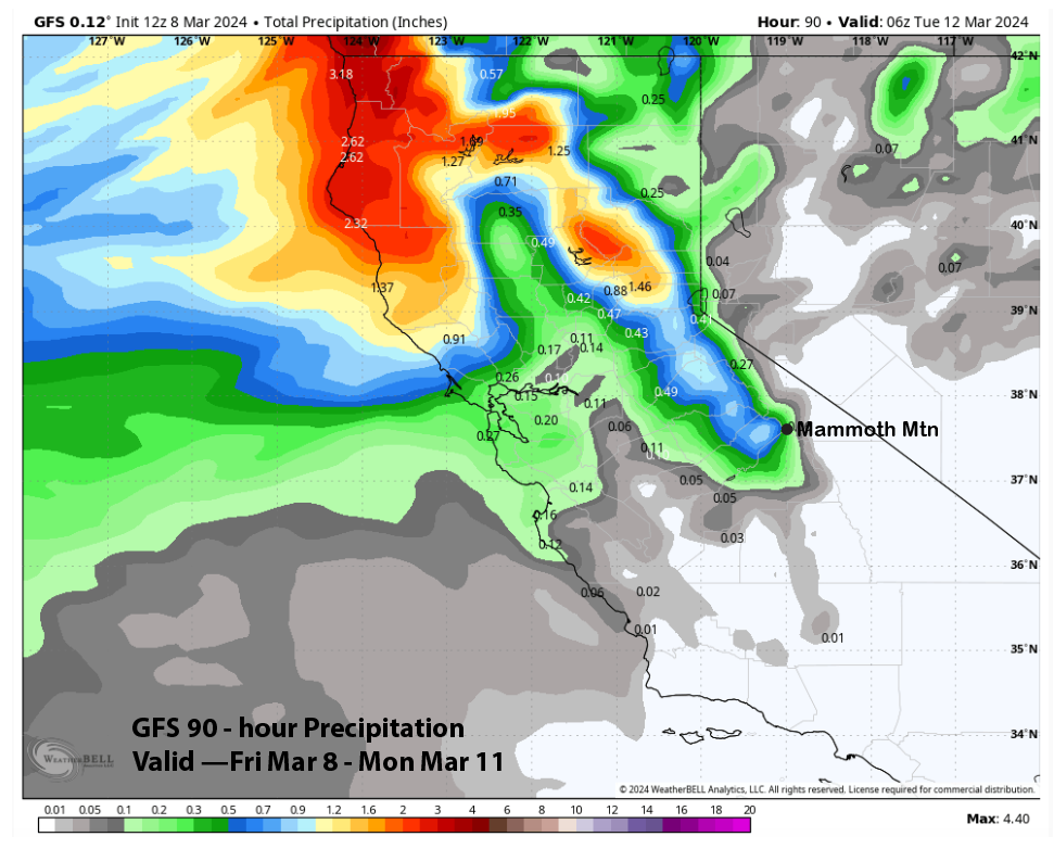
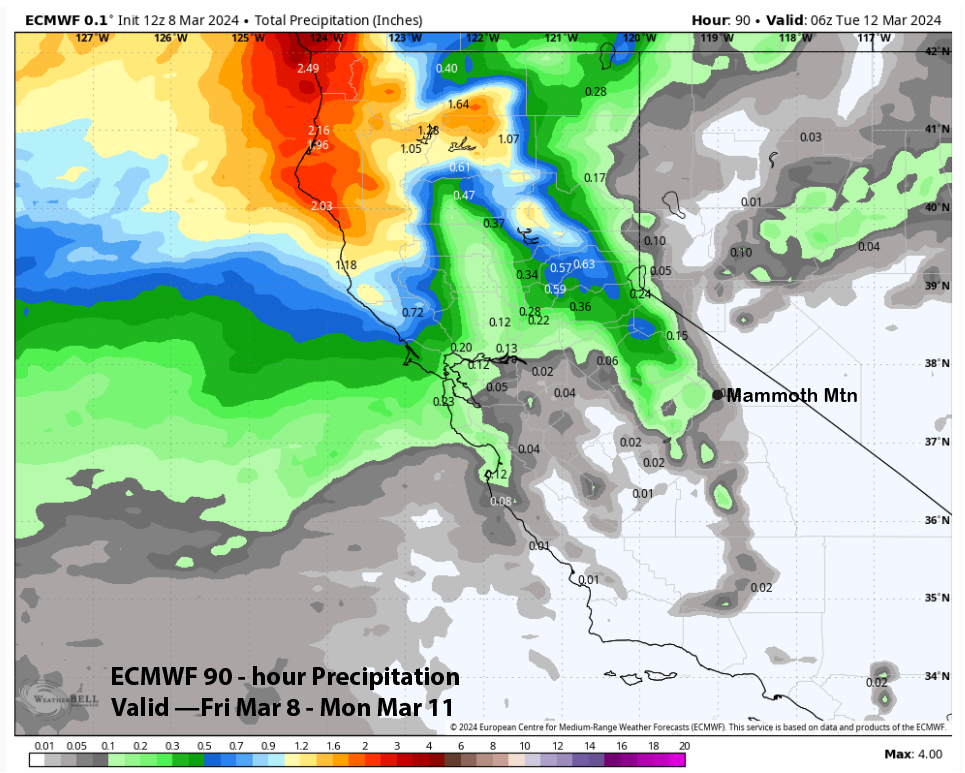
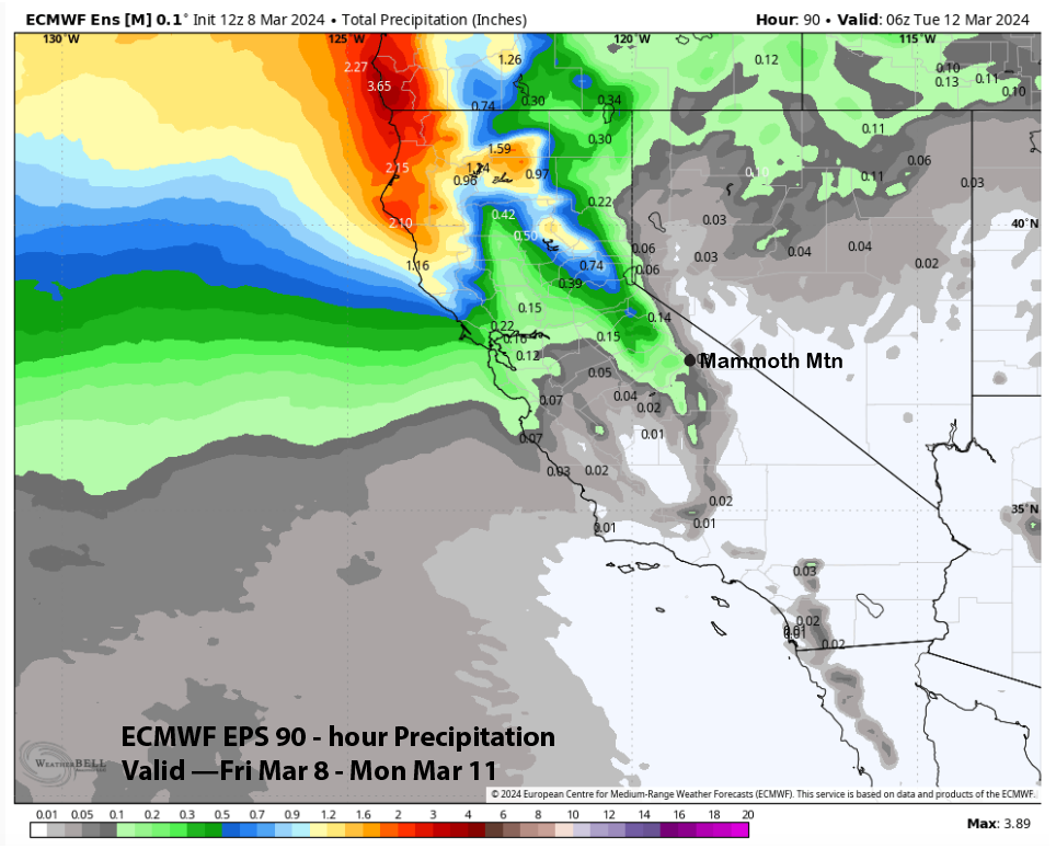
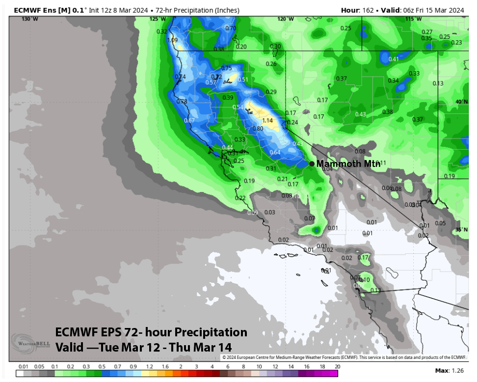
Model QPF is not impressive, with the GFS model the wettest (image below) at around a third of an inch and the ECM model showing only a tenth (two images below). That is fairly consistent with the ECM EPS (three images below). The forecast leans toward the drier solutions, with an inch or two of snowfall at Main and maybe up to 3” up top. There will likely be stashes of low-end powder turns on Monday morning.
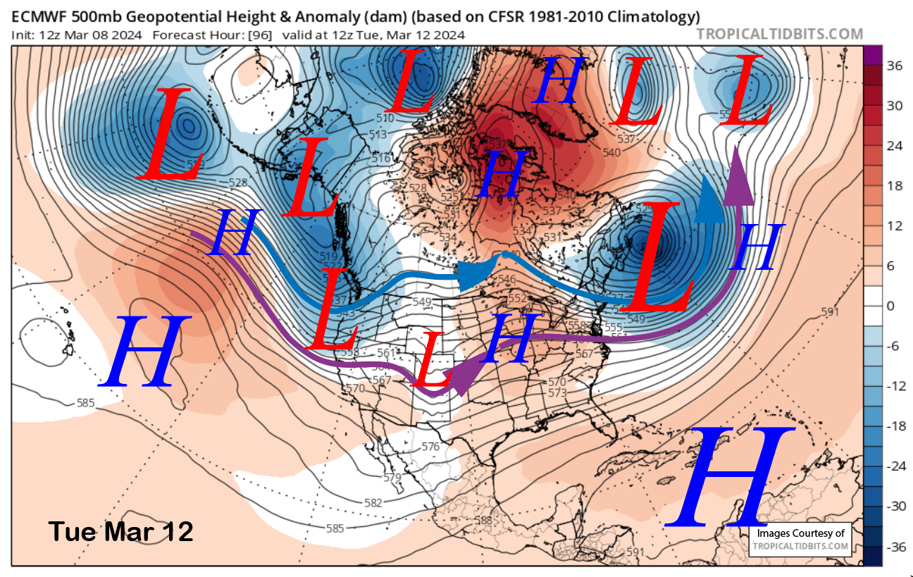
After a brief break, another round of snowfall is expected Tuesday from another passing short-wave trough (image below). That system looks like it will have a bit more moisture, and snowfall amounts should be slightly higher.
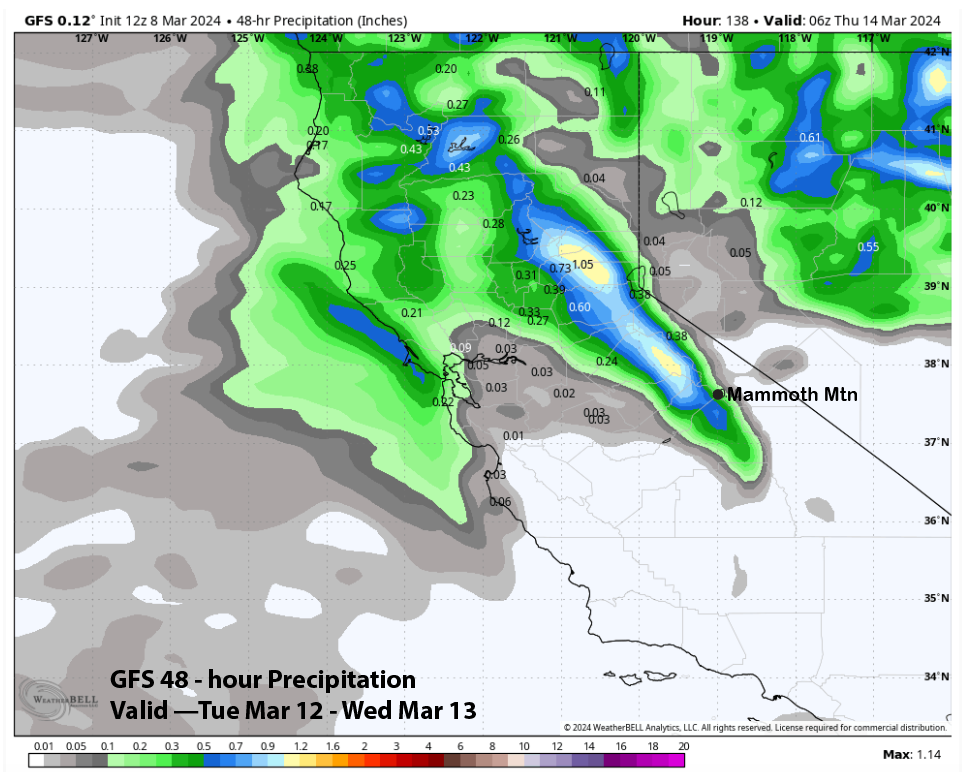
Model QPF for this storm is more consistent from the guidance, and is showing about a third of an inch or so (images below). The forecast is calling for a solid three inches at Main and maybe up to 6” in spots up top. Tuesday will also be a storm-riding day, and accumulations by late morning or midday should be good enough for low-end powder turns.
Long Range (Days 5+):
The longer-range guidance is looking rather dry and spring-like through mid-month and possibly through the third week of the month. There is still some hope that storms could return over the last part of the month. Time is running out on winter.
The storm on Tuesday looks like it will move southward into Arizona by the end of the week, where it will be cut off from the jet stream. High pressure will build into NorCal and the PacNW, and the result will likely be gusty northeast winds for the latter part of next week.
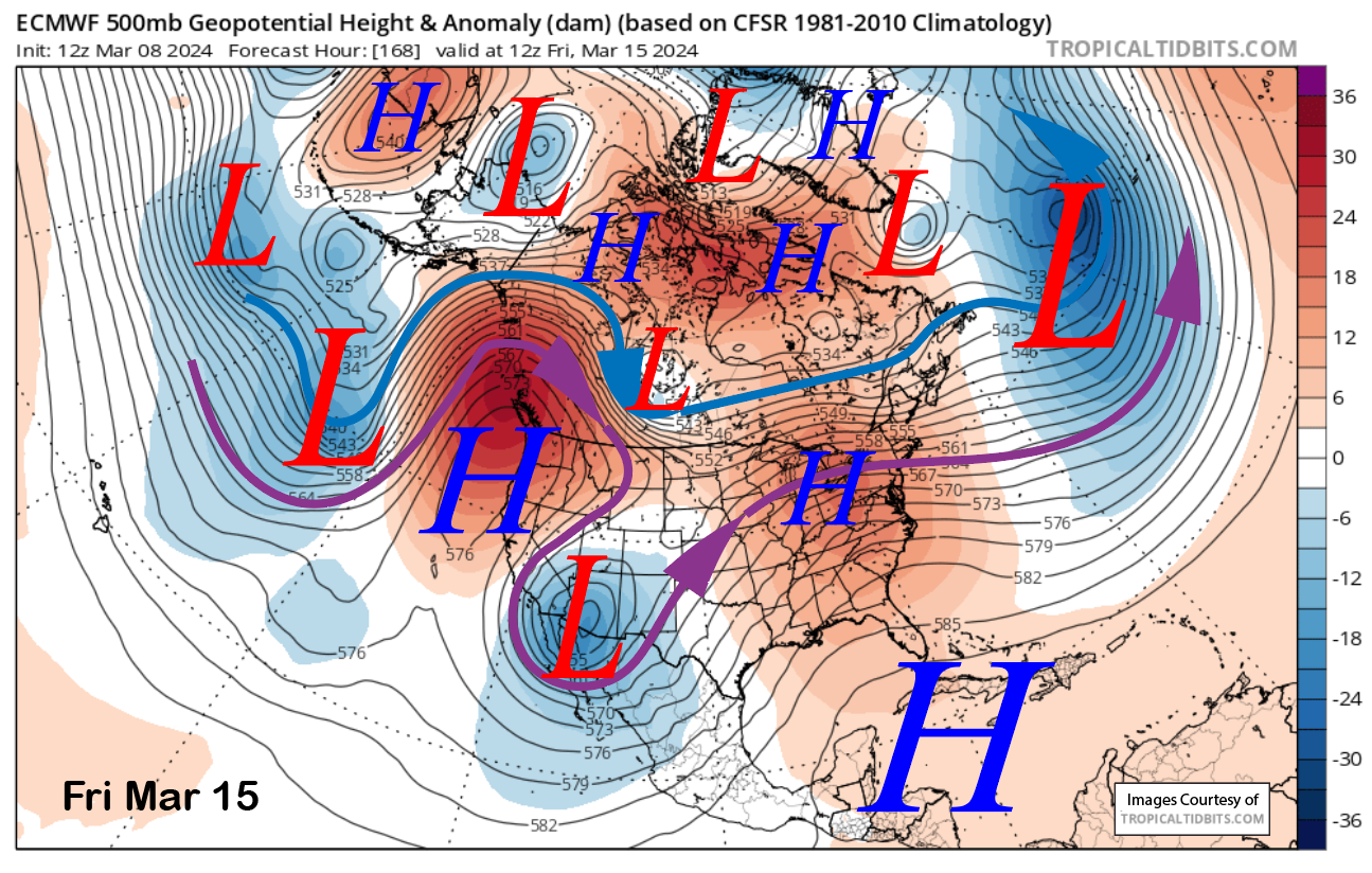
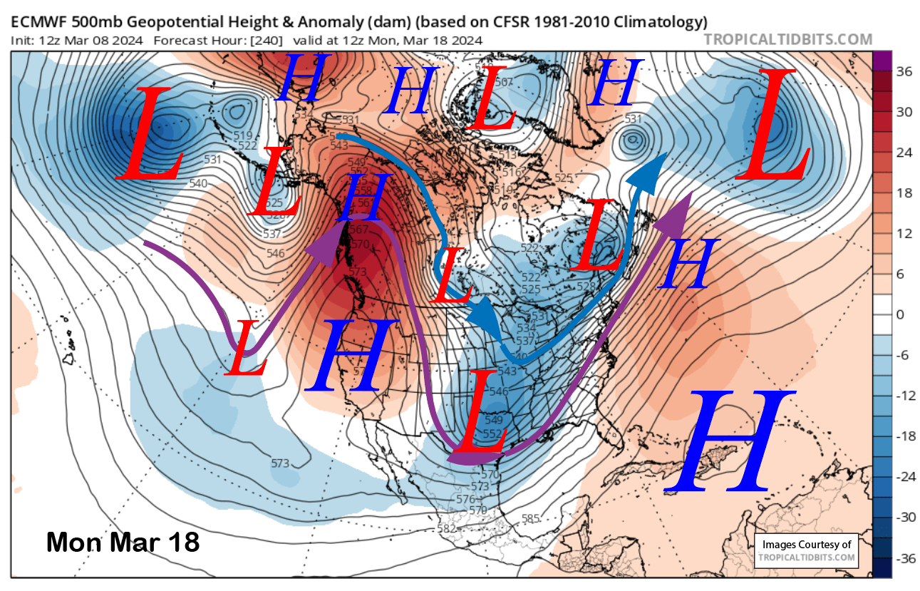
Those winds should die off over the weekend when the system finally moves eastward and high pressure builds more firmly over the state (image below). That will mean warmer temperatures and continued dry weather into the early part of the next week, including spring conditions on the lower part of the mountain.
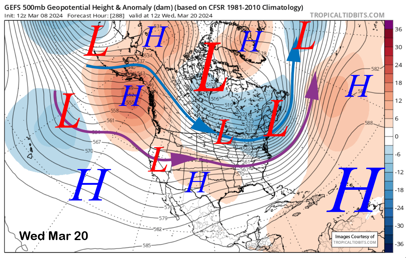
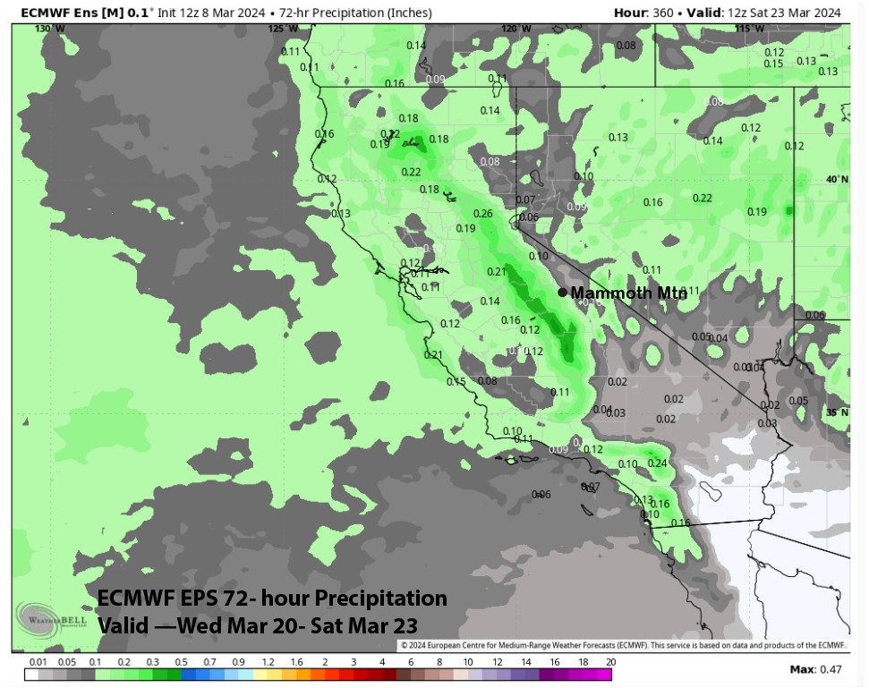
The GFS ensemble is suggesting a weak weather system may move through the ridge around the middle (image below) or the latter part of that week. The ECM EPS is showing it too. But the current QPF from the ECM EPS is only showing very light amounts, around two-tenths of an inch. That would probably just mean dust on crust, but hopefully the forecast will turn wetter as we get closer in time.
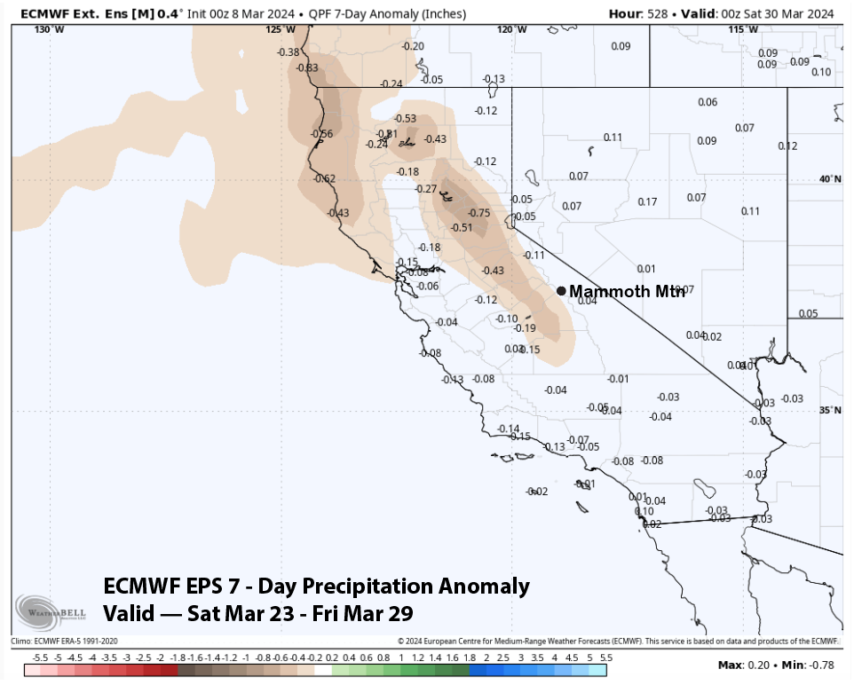
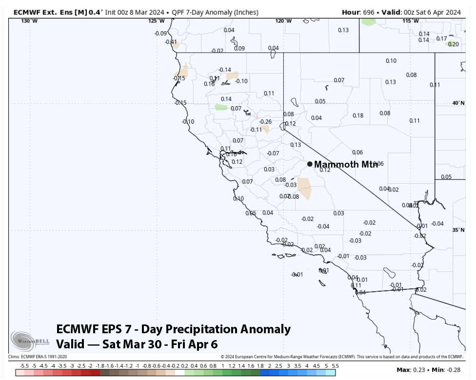
The fantasy range guidance suggests it could get wetter over the last part of the month, although not super wet or snowy, with the model only showing average or slightly below normal precipitation (image below). That anomaly drops to average during the first week of April (two images below), but the average for early April is probably around 6” of snowfall per week. If it falls all at once, though, it could be a powder day. WG