Powder Forecast – Tuesday, April 16th, 2024
Ted Schlaepfer CCM —- Mammoth Mountain WeatherGuy
Snowfall forecasts are valid at the Sesame snow course (Main Lodge) for the prior 24 hours, as reported in the 6-7 AM morning snow report.
Next post on Tuesday, 4/23
**Snowfall forecast confidence ranges from very low (1) to very high (5)
Wed 4/17 = 0”
Thu 4/18 = 0”
Fri 4/19 = 0”
Sat 4/20 = 0”
Sun 4/21 = 0”
Mon 4/22 = 0”
Tue 4/23 = 0”
Wed – Fri 4/24 – 4/26 = 0”
April Snowfall: 29”
April Forecast = 30 – 40”
Detailed 4-day Snowfall Forecast
Wed 4/17 through Sat 4/20 – No snowfall expected all days.
Forecast Summary:
Short Term (Days 1 – 4):
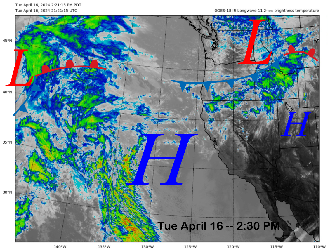
The current infrared satellite image (below) shows a weather system situated across the interior PacNW and a high-pressure ridge centered just off the coast. High clouds are drifting across the state today, but otherwise, it is a fairly typical spring day.
The high-pressure ridge will generally block any storms from moving into CA this week, ensuring continued fair and dry weather. The GFS moved a very weak low in the subtropical branch of the jet stream into SoCal on Friday (image below).
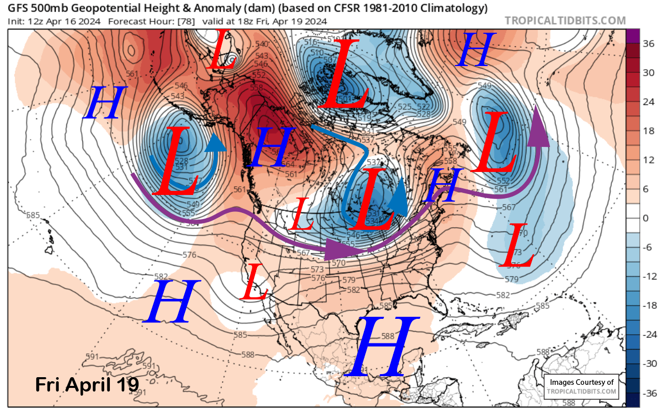
That system will push some clouds through the Mammoth area and also produce a chance for a late afternoon or evening shower or thunderstorm on Friday and Saturday. Otherwise fairly typical spring weather and snow conditions will continue through the week.
Long Range (Days 5+):
The longer-range guidance still suggests a chance for a spring storm during the second half of the month and through most of May. The next chance for that spring storm appears to be over the last few days of the month.
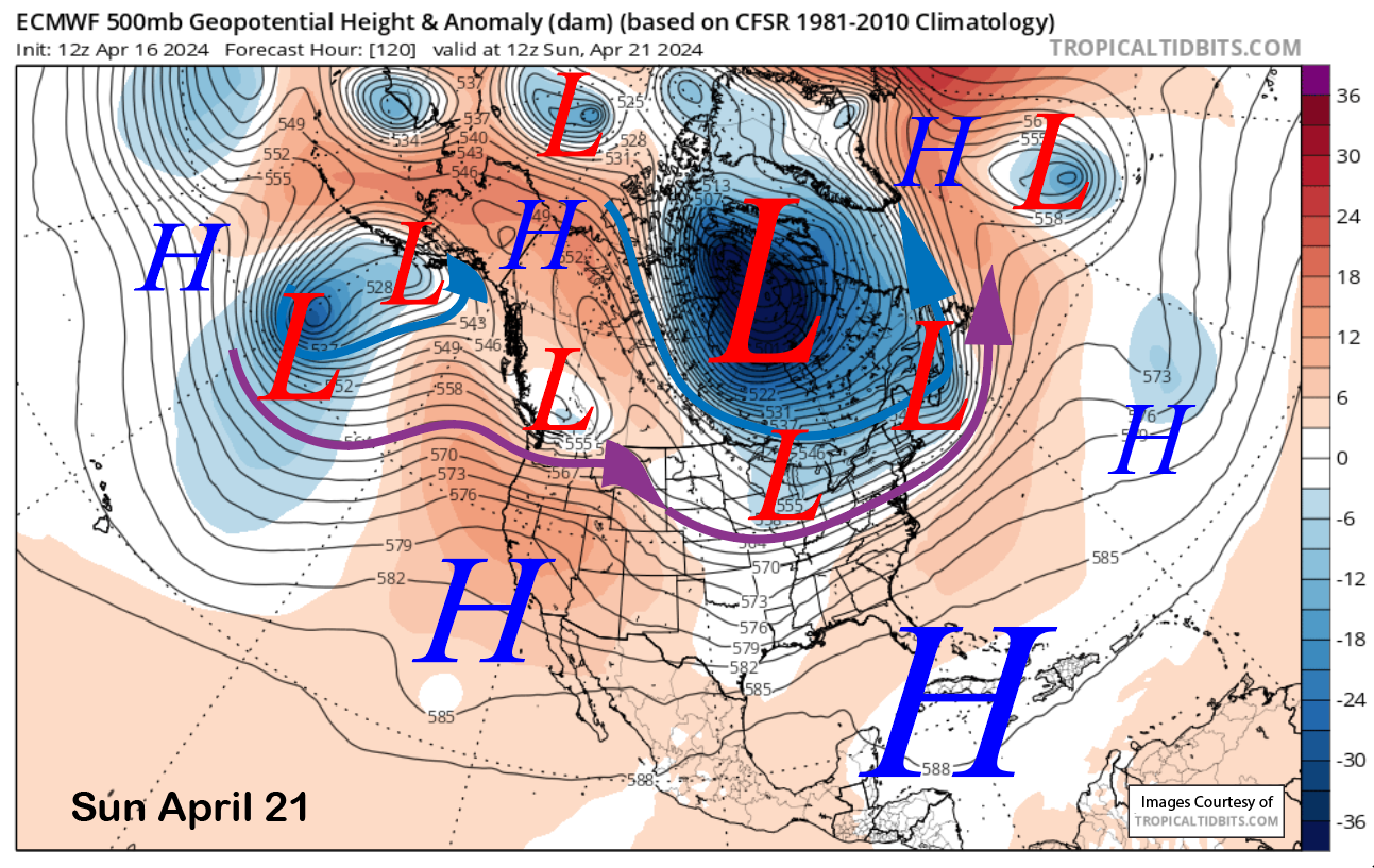
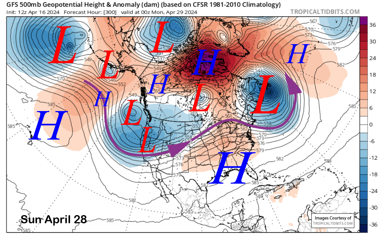
High pressure will rebuild on Sunday (image below) and should hold over the state through mid-week next week for continued dry weather and spring conditions. The ECM model then moves an upper-level trough into the state toward the end of next week (image below) for a chance for snowfall.
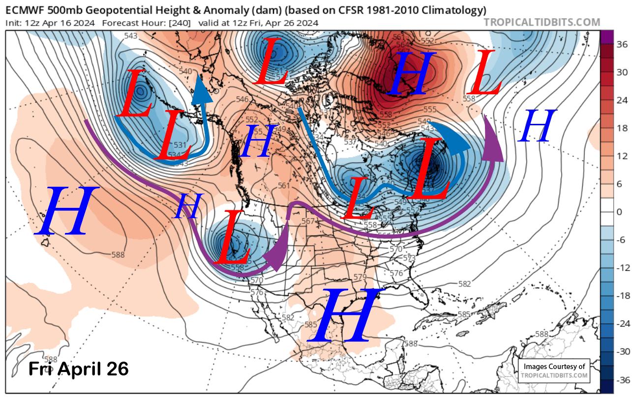
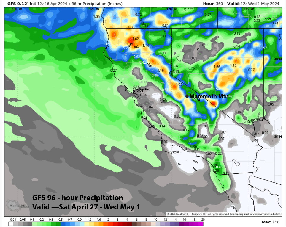
The GFS model does not move that trough into central CA but does move another one into the central and southern part of the state over the following weekend (image below) and into the next week. That model is showing almost an inch of liquid (image below), which would add up to almost a foot of snowfall.
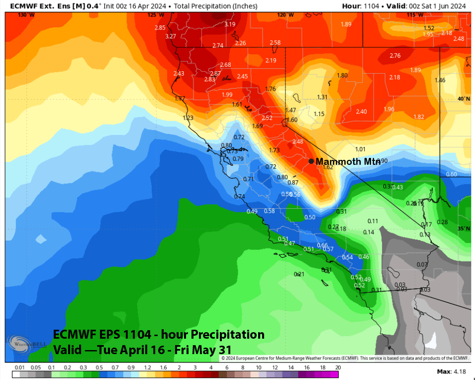
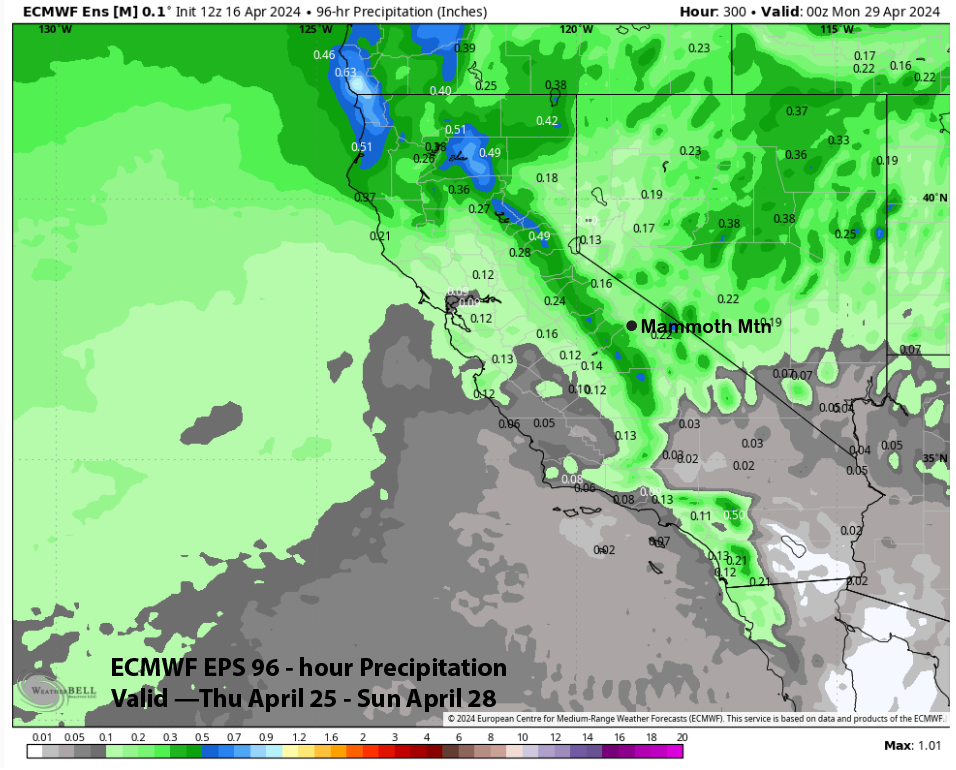
The ECM EPS is not showing those large amounts right now and is only favoring light amounts of around a third of an inch (image below) or a few inches of snowfall. It is a long way out, so there is plenty of time for the forecast to move in either direction (wetter or drier).
As mentioned above, there may be additional chances through May. The latest run of the 45-day ECM EPS model is favoring about 2.5” liquid through May (image below). Spring storm surprises could happen as Mammoth has announced it will be open through Memorial Day. WG