Powder Forecast – Tuesday, April 9th, 2024
Ted Schlaepfer CCM —- Mammoth Mountain WeatherGuy
Snowfall forecasts are valid at the Sesame snow course (Main Lodge) for the prior 24 hours, as reported in the 6-7 AM morning snow report.
**Snowfall forecast confidence ranges from very low (1) to very high (5)
Wed 4/10 = 0”
Thu 4/11 = 0”
Fri 4/12 = 0”
Sat 4/13 = 0 – 1”
Sun 4/14 = 6 – 12” (H20 = 0.65” – 1.25)**2
Mon 4/15 = 0 – 2”
Tue 4/16 = 0”
Wed – Fri 4/17 – 4/19 = 0 – 2”
April Snowfall: 28”
April Forecast = 35 – 45”
Detailed 4-day Snowfall Forecast
Wed 4/10 and Thu 4/11 – No snowfall expected on both days.
Fri 4/12 – Dry during the morning and into the early afternoon, then a slight chance for a light snow shower late PM and evening. Little or no accumulation is expected.
Sat 4/13 – Snowfall likely develops by the late afternoon and may become heavy during the evening hours before tapering off overnight. Accumulations 6 – 12” by Sunday AM
Forecast Summary:
Short Term (Days 1 – 4):
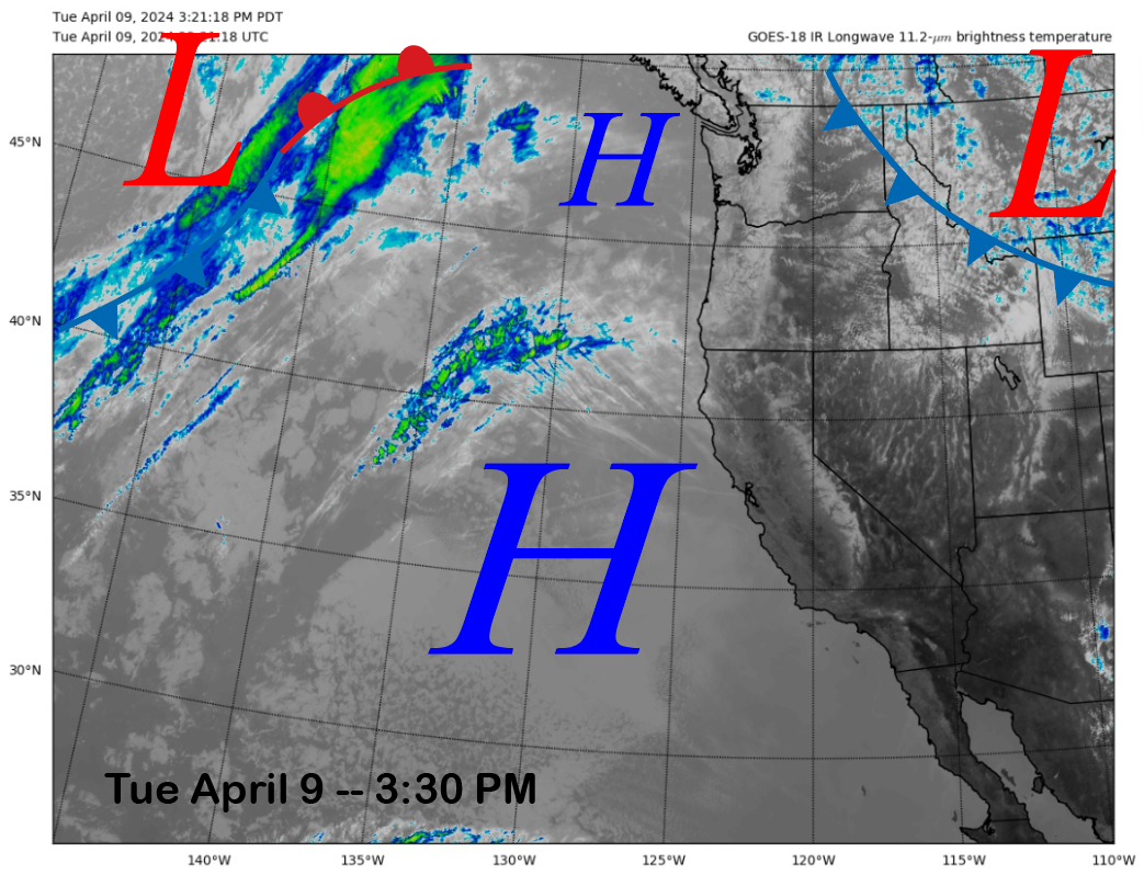
The current infrared satellite image (below) today shows high pressure off the CA coast that will continue to build into the state through Thursday. That means fair and spring weather.
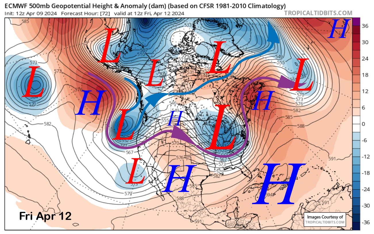
The weather pattern then changes back to winter, and changes are forecast for the weekend. The latest ECM model moves a short-wave trough southward toward CA out of the Gulf of Alaska on Friday (image below) and then just off the coast by early Saturday (two images below). It then moves eastward out of the state on Sunday and Monday.

There could be afternoon/evening snow showers or flurrys on Friday, with the main frontal passage likely occurring late Saturday afternoon and Saturday night, when the snowfall may be briefly heavy. This storm is not as deep or cold as the previous storm, so the amounts should be less, although there is still considerable uncertainty with the details.
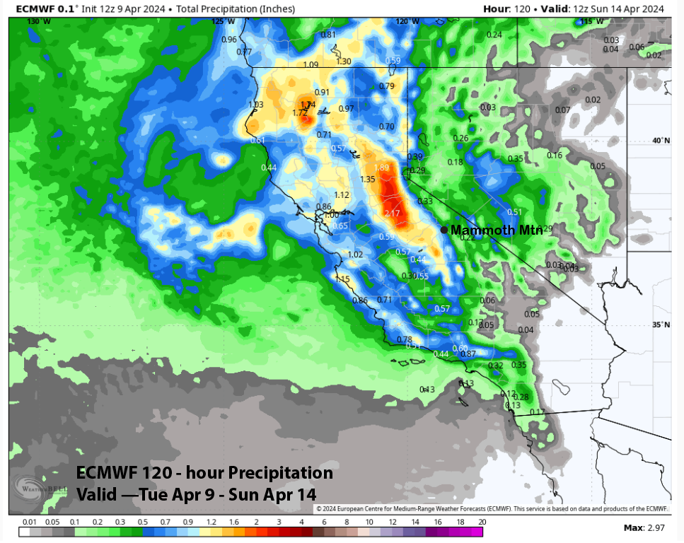
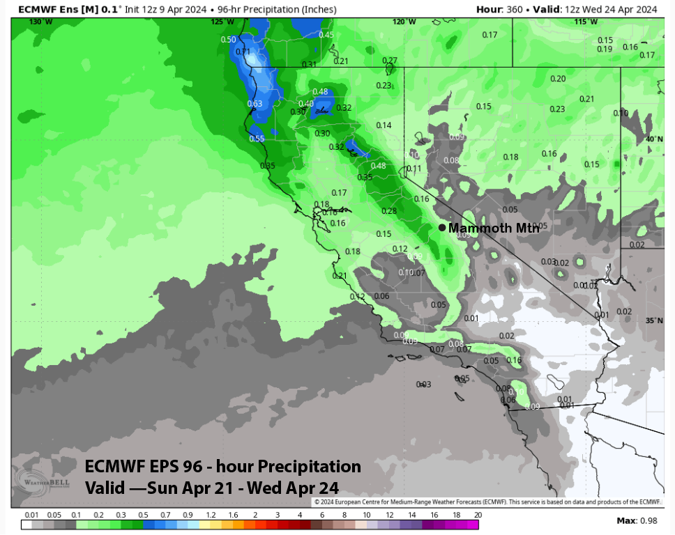
The models, except for the GFS, are mostly aligned with the liquid precipitation forecast. The GFS (image below) is not as wet as the other models as it keeps the trough farther off the coast initially and then moves it through SoCal instead of Central CA. The other models (images below) are all showing around 0.75” liquid with over an inch west of the crest.
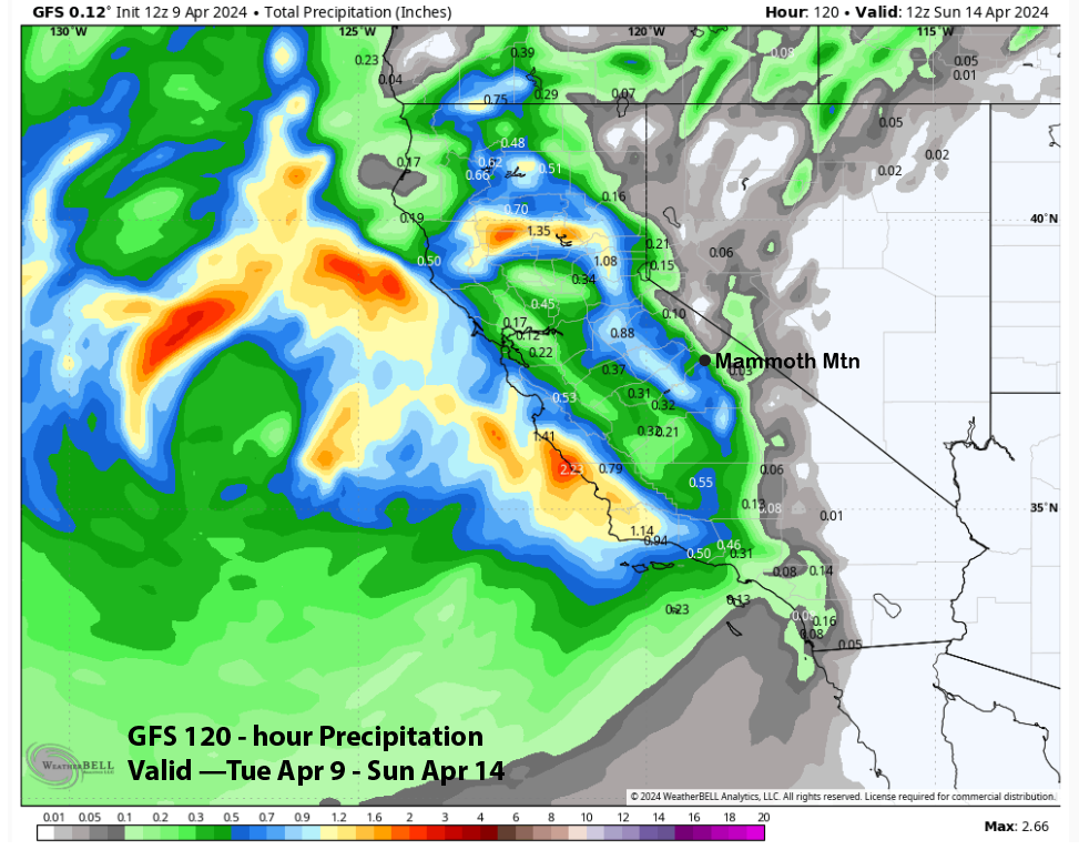
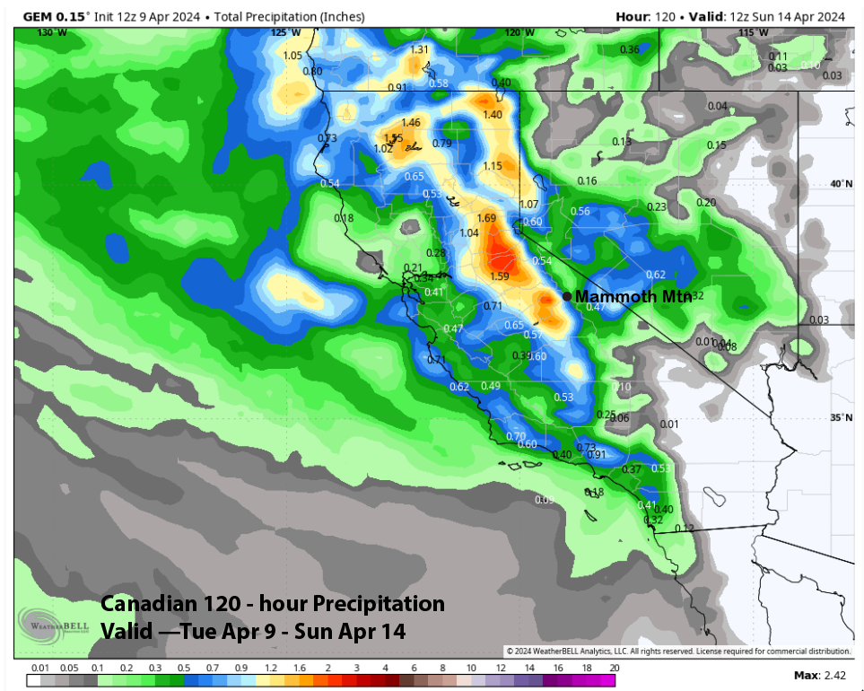
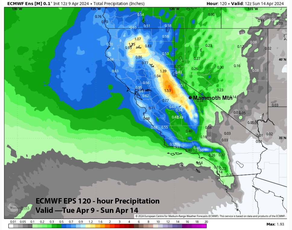
The forecast follows the ECM EPS that has enough for powder conditions and about 9” of snowfall at Main. Since it is a cut-off, the exact track of the system might not be known until a couple of days before the event. Thus, confidence is lower than usual. Even the drier GFS has enough snowfall for low-end powder conditions, so the chance for a powder day Sunday is decent to high.
Long Range (Days 5+):
The longer-range guidance still suggests a chance for spring storms the rest of the month and also through most of May as well. However, the exact dates of when that may occur are not known after this weekend.
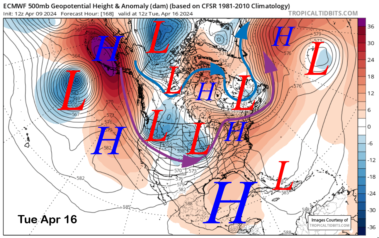
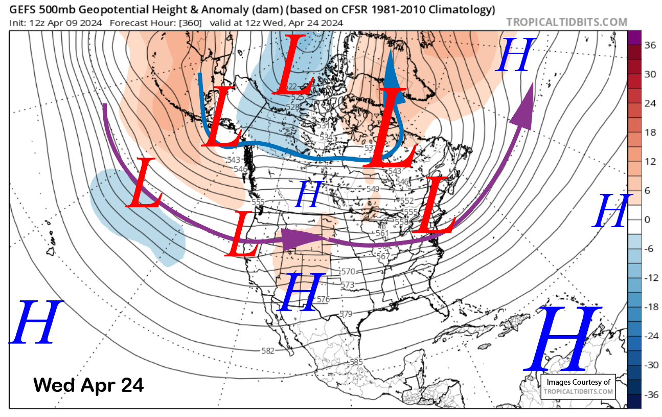
The 12z run of the ECM model moves an inside slider-type short-wave into CA around the middle of next week (image below). That trajectory could result in some very light snowfall with just a better chance of cooler-than-normal temperatures for mid-April. There is a chance that the system could move southward farther westward which would give it a better chance to produce some meaningful snowfall.
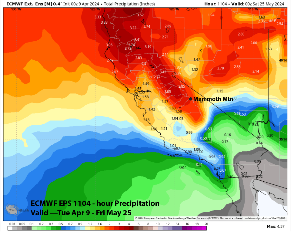
The GFS ensemble (image below) suggests there could be a chance for a spring storm over the middle part of the following week with a weak longwave trough along the coast. The ECM EPS also has a weak trough and is only forecasting very light liquid amounts (two images below) and possibly not enough for powder conditions.
It is now that time of year when the models don’t perform as well in the longer time frames with the storm now expected for this weekend a great example as it was not in the cards in the last post. That said, the ECM EPS super long-range forecast has about 2.5” liquid for Mammoth through mid-May. When that next surprise storm may occur is up in the air. WG