Powder Forecast –Friday April 29th, 2022
Ted Schlaepfer CCM —- Mammoth Mountain WeatherGuy
Snowfall forecasts are valid at the Sesame snow course (Main Lodge) for the prior 24 hours as reported in the 6-7 AM morning snow report.
**Snowfall forecast confidence ranges from very low (1) to very high (5)
Sat 4/30 = 0”
Sun 5/1 = 0”
Mon 5/2 = 0”
Tue 5/3 = 0”
Wed 5/4 = 0”
Thu 5/5 = 0”
Fri 5/6 = 0 – 2”
Sat – Mon 5/7 – 5/9 = 0 – 2”
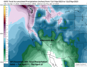
April Snowfall = 34.5”
April Forecast = 34.5”
Detailed 4-day Snowfall Forecast:
Sat 4/30 through Tue 5/3 – No snowfall expected all days.
Forecast Summary:
Short Term (Days 1 – 4):
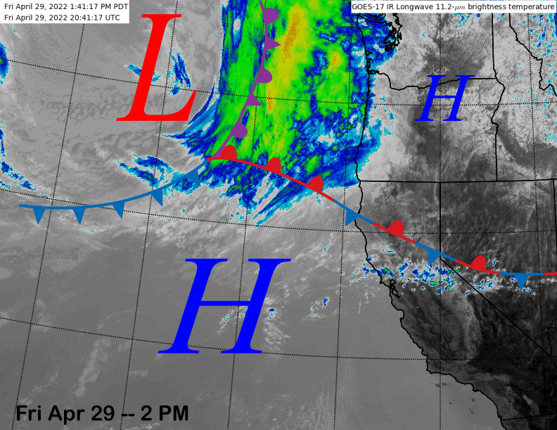
The infrared satellite image (below) this afternoon shows a stationary front connected to an upstream weather system about to move into the PacNW tonight/tomorrow.
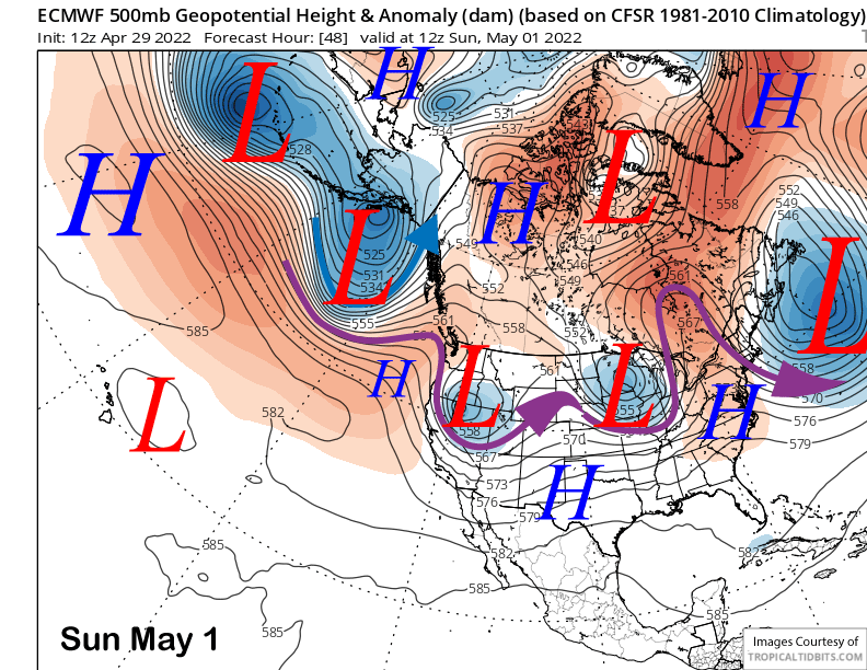
That weather system will take an inside slider track through Nevada on early Sunday (image below) with the main effect just slightly cooler temperatures and northerly breezy winds.
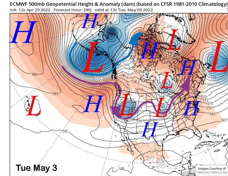
Another weather system will take a similar track on Monday and into Tuesday (image below) for a similar verdict. Any weather model that was showing light snowfall in the previous post is now dry and the dry weather should continue into the middle part of next week or longer.
Long Range (Days 5+):
The longer-range guidance is showing a fairly typical spring pattern for the foreseeable future with weak weather systems moving through the area every few days resulting in just cooler temperatures at times and breezy winds, although there is still a chance for light snow toward the end of next week.
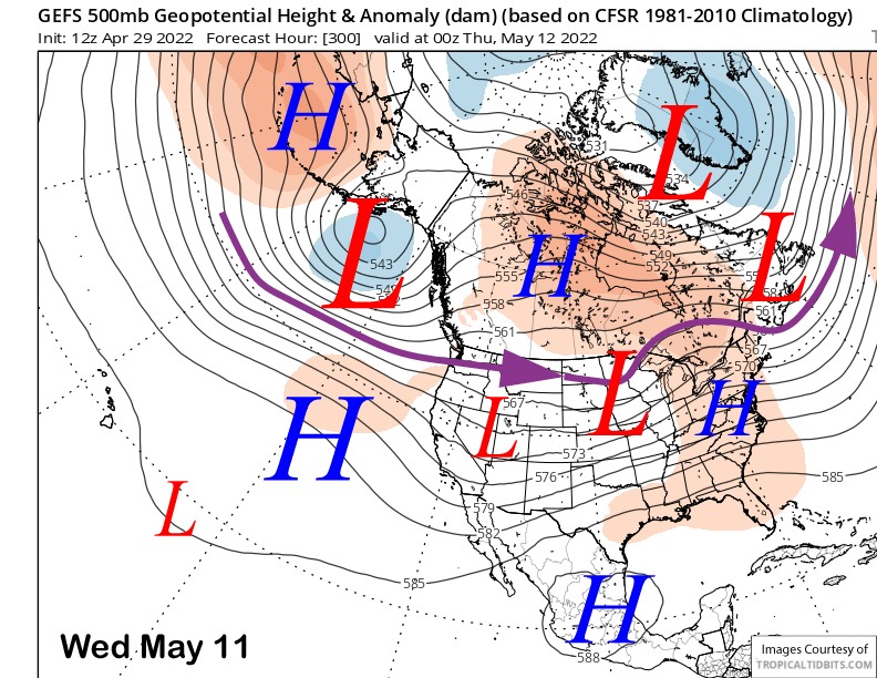
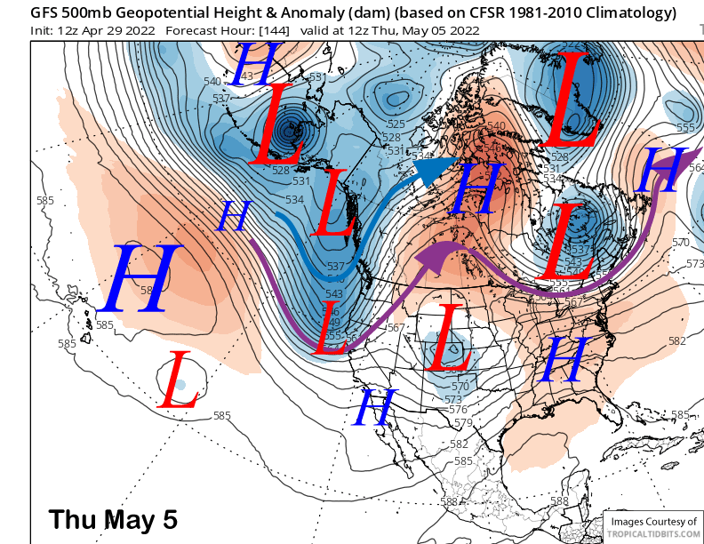
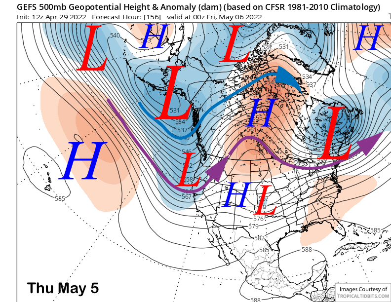
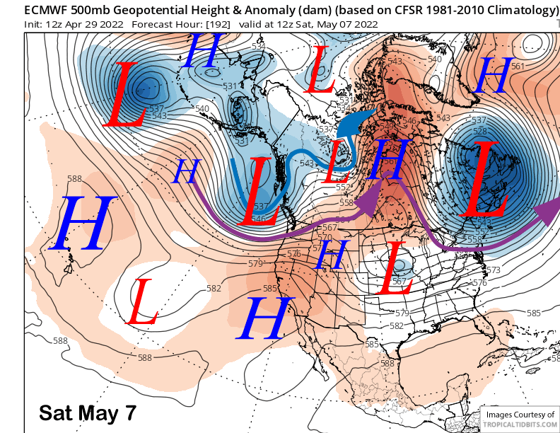
The latest guidance has high pressure holding through Wednesday next week before the models diverge on potential solutions for the rest of the week and following weekend. The GFS model continues to be the most aggressive with a short-wave moving through CA around Thursday next week (image below). The latest ECM model is much weaker and farther north with the system (two images below) and the Canadian is similar. And it doesn’t have much support from the GFS ensemble either (three images below) that is also rather weak and a bit farther northward.
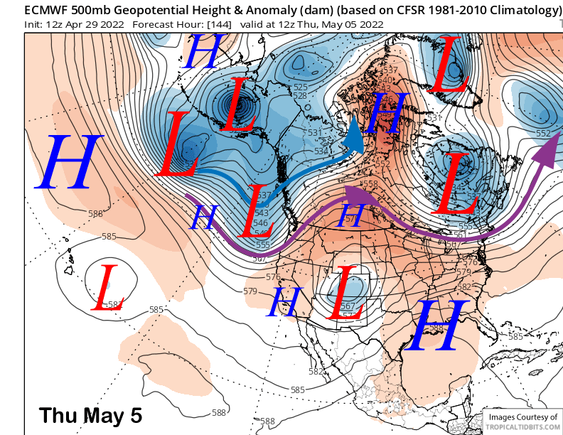
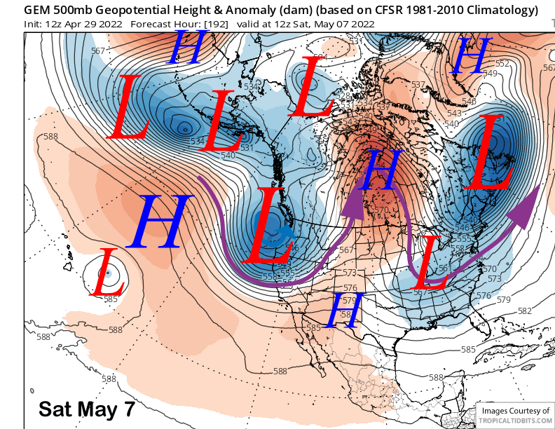
Interestingly, the Canadian model moves a strong upper-low into CA around the following Saturday (image below) and it would be deep enough to produce enough snowfall for low-end powder conditions. Unfortunately, the other models, ECM in particular (two images below), have it moving into the PacNW, so confidence in that solution is very low.
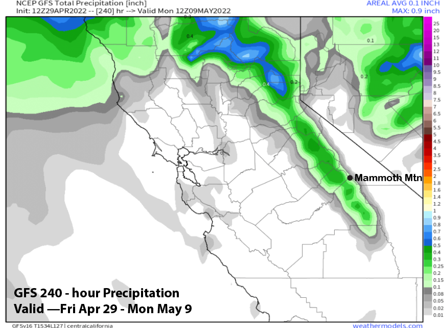
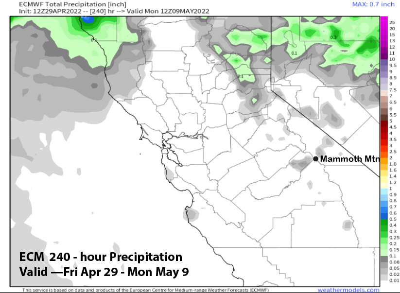
Overall, the GFS is showing very light amounts (image below) with the system next Thursday while the ECM model is dry for the 10-day period (two images below). Thus, there is a slight chance for light snowfall per the GFS, but it probably won’t be enough for powder. Only about 4 of the 52 ECM ensembles are showing anything, so a very slight chance.
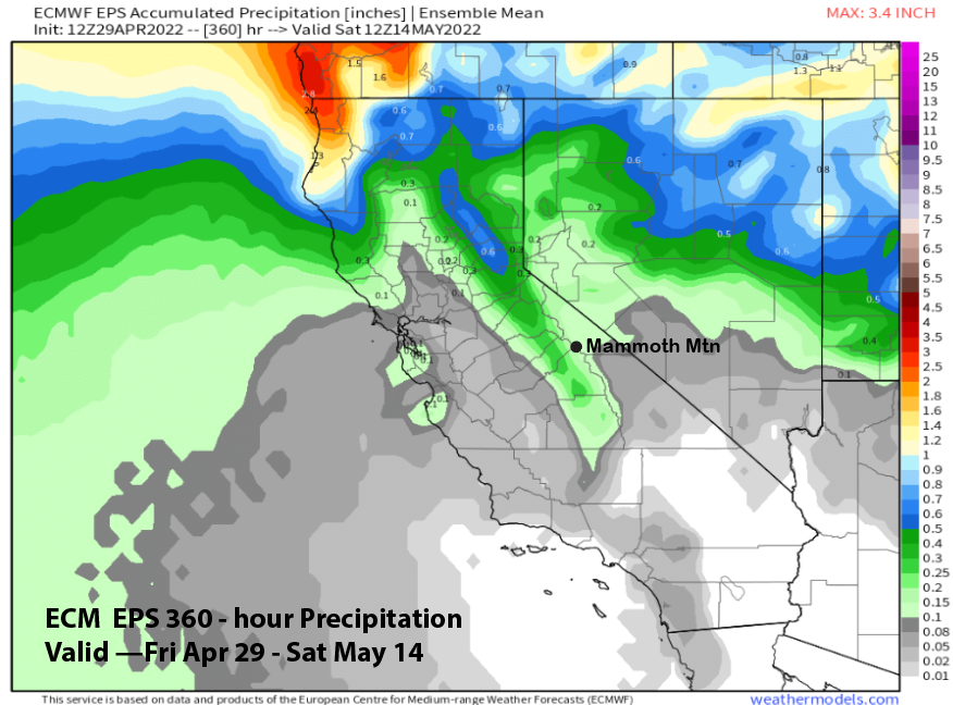
Beyond that, the GFS ensemble mean (image below) is showing a typical May pattern with a weak jet stream into the PacNW and weak ridging over CA. This pattern would mean typical spring conditions. Overall, the ECM EPS model is only showing very light amounts for the 15-day period (two images below) into mid-May. Powder days may be over the for the season. WG