Powder Forecast – Friday November 18th, 2022
Ted Schlaepfer CCM —- Mammoth Mountain WeatherGuy
Snowfall forecasts are valid at the Sesame snow course (Main Lodge) for the prior 24 hours as reported in the 6-7 AM morning snow report.
**Snowfall forecast confidence ranges from very low (1) to very high (5)
Sat 11/19 = 0”
Sun 11/20 = 0”
Mon 11/21 = 0”
Tue 11/22 = 0”
Wed 11/23 = 0”
Thu 11/24 = 0”
Fri 11/25 = 0”
Sat – Mon 11/26 – 29 = 3 – 12”
November Snowfall = 60”
November Forecast = 70 – 85”
Detailed 4-day Snowfall Forecast:
Sat 11/19 through Tue 11/22 – No snowfall expected all days.
Forecast Summary:
Short Term (Days 1 – 4):
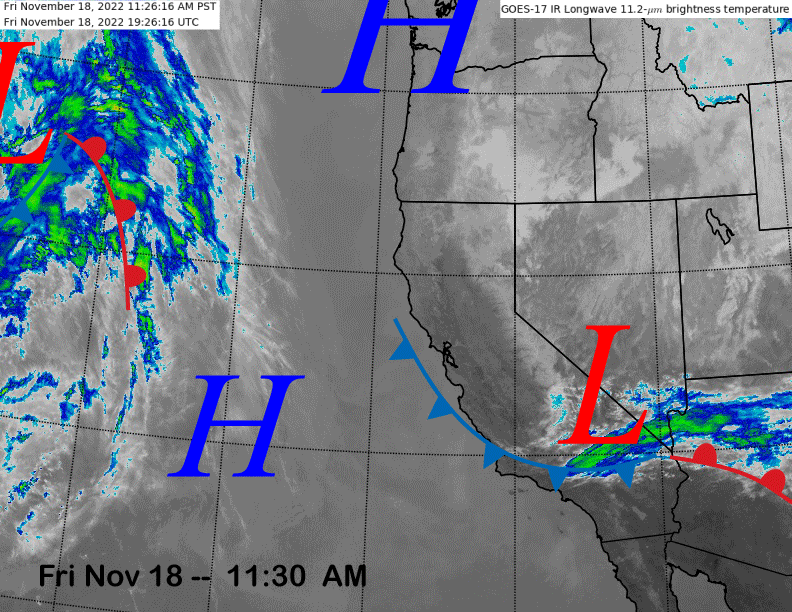
The current infrared satellite image (below) shows an inside slider type short-wave trough moving into SoCal and easterly winds are now starting to increase in the wake of its passage. Those winds should die off during the day tomorrow as high pressure builds back into the state.
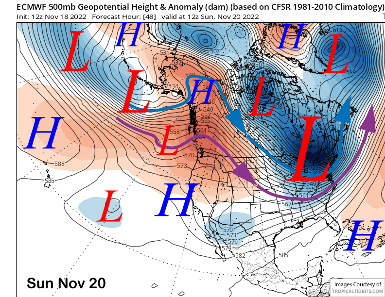
High pressure (image below) will continue to build on Sunday and should hold through early next week for continued fair and dry weather as the action this weekend will be focused across the eastern US where a deep trough will produce winter-like weather there.
Long Range (Days 5+):
The longer-range guidance is mostly unchanged from the previous update and favors dry weather through next week before a more substantial pattern change is possible over the last part of the month.
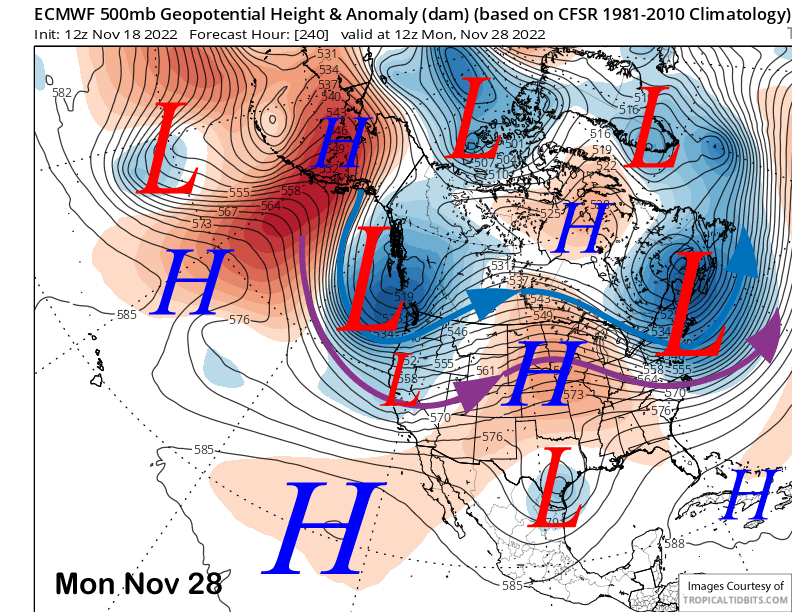
The models are favoring the ridge of high pressure to strengthen further on Thanksgiving (ECM below) and then hold in place through most of the holiday weekend.
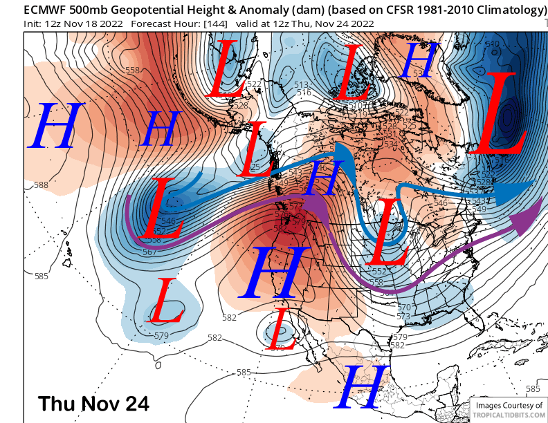
Under the strong ridge, temperatures could get unseasonably warm with the GFS model forecasting 700-mb or 10K elevation temps rising to near 8°C by Friday. Thus, temps could get up into the 40s up top and mid 50s at Main Thursday through Saturday.
The longer range guidance is then still forecasting the expected change in the weather pattern for the last part of the month, although the timing and strength of any storms is still quite uncertain.
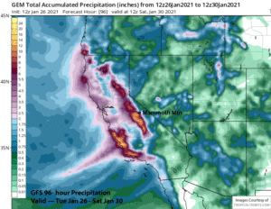
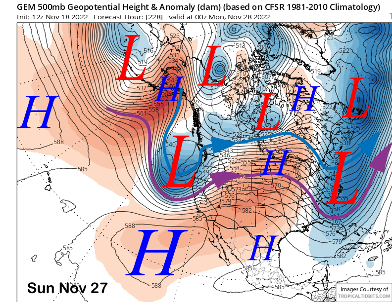
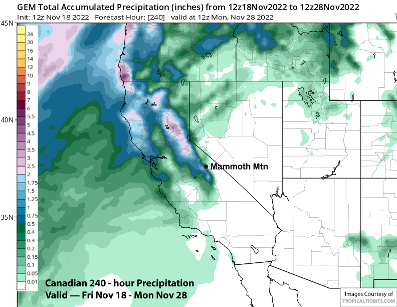
The Canadian model is the most aggressive (image below) and moves the first storm into the Sierra by Sunday of the holiday weekend. It has over an inch liquid (two images below) or a foot of snow by Monday morning.
The ECM model is not as deep and also a bit slower as it moves the trough into CA on Monday instead (image below) of Sunday. It holds off most of the snowfall until Monday during the day.
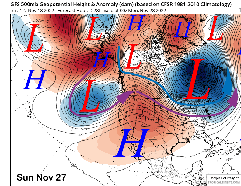
The 12Z operational run of the GFS is the slowest as it still has a ridge of high pressure over the state on Sunday (image below). It doesn’t move any snowfall into the Sierra until almost mid-week.
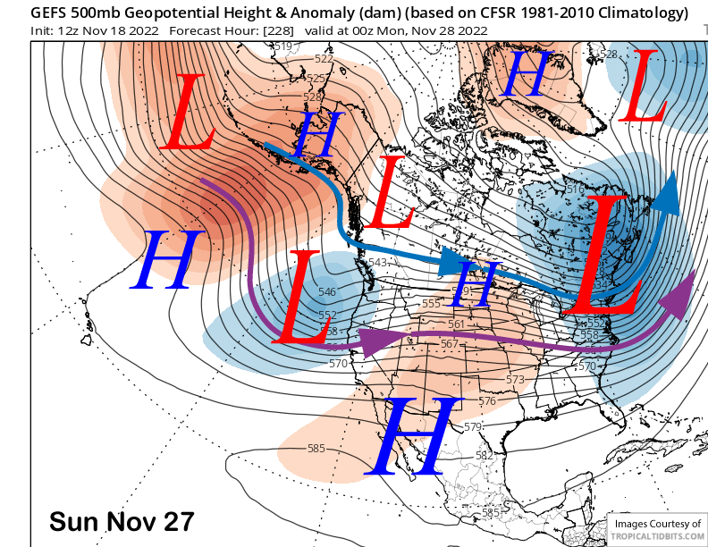
However, the GFS does not match up with the GFS ensemble mean (image below) that is closer to the Canadian model and moves the trough into CA on Sunday. The ECM EPS is slightly weaker and slightly slower. Thus, best forecast for the next snowfall chance in late over the holiday weekend and those who stay into Monday may get a powder or storm day.
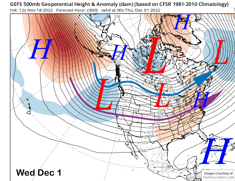
The longer-range GFS ensembles favor keeping the long-wave trough in place along the West Coast and southward into CA through the middle part of the following week (image below) and into early December. So, there will be a chance for continued storms through the 11-15 forecast period.
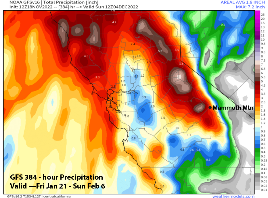
The GFS 12Z operational run has some big storms moving into CA and shows hefty amounts (image below) for the Sierra and Mammoth. However, the GFS mean is only showing about 1.5” as the models are not bullish yet about a major event. The ECM EPS is also not bullish on a big event yet. Let’s hope that changes. WG