
Powder Forecast – Tuesday May 9th, 2023
Ted Schlaepfer CCM —- Mammoth Mountain WeatherGuy
Snowfall forecasts are valid at the Sesame snow course (Main Lodge) for the prior 24 hours as reported in the 6-7 AM morning snow report.
**Snowfall forecast confidence ranges from very low (1) to very high (5)
Final update for the 2022-23 season
Wed 5/10 = 0 – 1”
Thu 5/11 = 0”
Fri 5/12 = 0”
Sat 5/13 = 0”
Sun 5/14 = 0”
Mon 5/15 = 0”
Tue 5/16 = 0”
Wed – Fri 5/17 – 5/19 = 0”
May Snowfall = 10”
May Forecast = 10 – 15”
Detailed 4-day Snowfall Forecast
Wed 5/10 through Sat 5/13 – No snowfall expected all days except for a slight chance of an afternoon flurry on Wednesday.
Forecast Summary:
Short Term (Days 1 – 4):
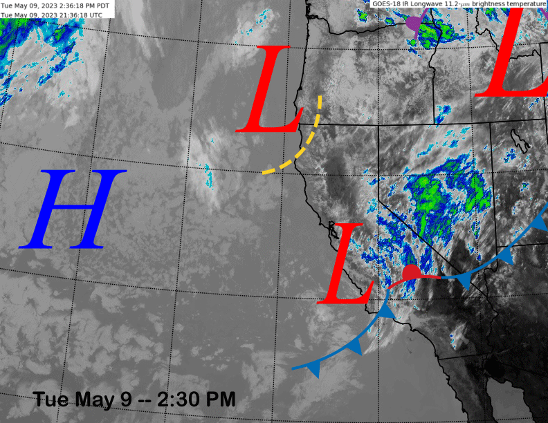
The current infrared satellite image (below) this afternoon shows a weak weather system off the Central Coast that will move through SoCal tonight and early tomorrow. That system will produce some light snow showers this afternoon and evening, but not expecting more than an inch accumulation, if not just a trace.
The low off the Oregon coast moves ashore across NorCal tomorrow and that system may produce a flurry during the afternoon tomorrow, otherwise high pressure will start to build into the state on Thursday (image below) for dry and warmer weather.
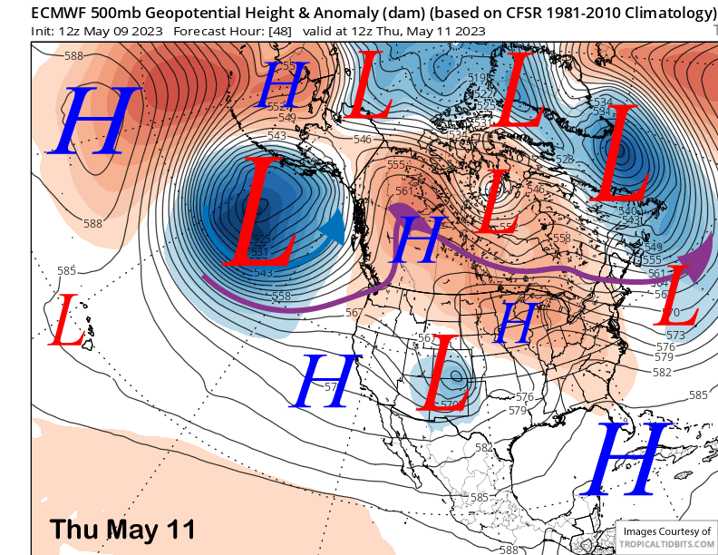
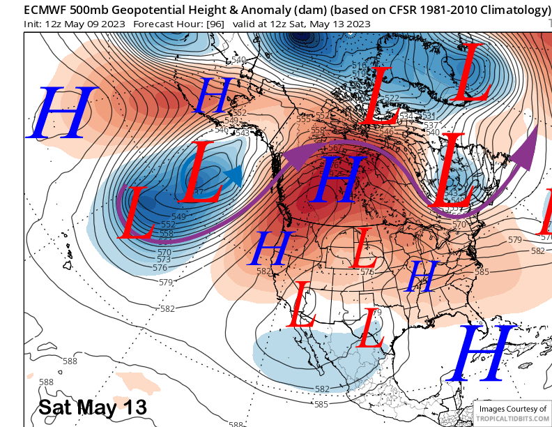
The high pressure ridge will strengthen through Saturday (image below) with a spring conditions returning to all parts of the mountain by Friday, if not most of the mountain by Thursday PM, as the “winter-like” pattern that produced the light snowfall over the past week comes to a close.
Long Range (Days 5+)
The longer-range guidance is favoring more typical spring weather for the remainder of the month, although afternoon rain showers and thunderstorms may be more abundant than usual for this time of year starting next week. Powder days have most likely ended for the season.
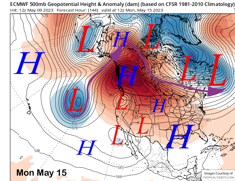
The ECM model (image below) and others retrograde a upper-level westward from the Great Basin on Sunday and into Monday and that should result in slightly cooler weather by early next week. It will also introduce a chance for afternoon showers and thunderstorms starting on Sunday with that chance continuing each day through next week as the weak low-pressure system may linger over/near the state.
The 11-15 day pattern (image below) favors a long-wave trough across eastern Canada southward into the Great Lakes region and a ridge across the interior West extending northward into British Columbia. It also shows a baggy trough extending southward through California.
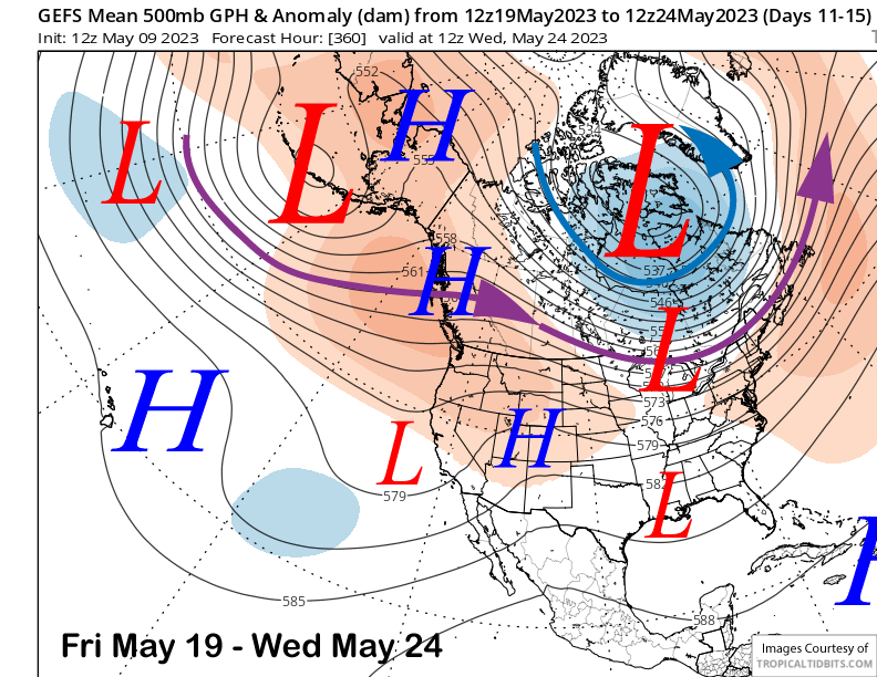
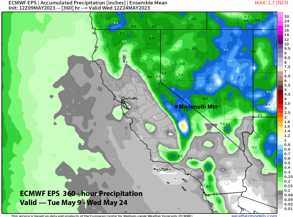
This is a typical late-spring pattern that would result in continued spring conditions on the mountain in addition to continued chances for afternoon/evening showers/thunderstorms. The ECM EPS (image below) is showing more than half an inch liquid for the period suggesting that the showers and thunderstorms could be widespread at times. However, freezing levels will be too high for any snowfall on the mountain.
Overall, no more snowstorms are favored for the rest of the season with spring conditions transitioning into summer conditions next month. This will be the last update for this record-breaking and epic season. Glad you were here for the ride. See you on the slopes this spring/summer. WG


