Powder Forecast – Tuesday January 24th, 2023
Ted Schlaepfer CCM —- Mammoth Mountain WeatherGuy
Snowfall forecasts are valid at the Sesame snow course (Main Lodge) for the prior 24 hours as reported in the 6-7 AM morning snow report.
**Snowfall forecast confidence ranges from very low (1) to very high (5)
Wed 1/25 = 0” Thu 1/26 = 0” Fri 1/27 = 0” Sat 1/28 = 0” Sun 1/29 = 0” Mon 1/30 = 2 – 3” Tue 1/31 = 4 – 6” Wed – Fri 2/1 – 2/3 = 0 – 6”January Snowfall = 186” January Forecast = 186” – 200”
Detailed 4-day Snowfall Forecast
Wed 1/25 through Sat 1/28 – No snowfall expected all days
Forecast Summary:
Short Term (Days 1 – 4):
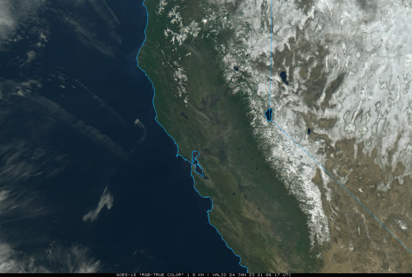
The current visible satellite image (below) shows clear skies across the state and a vast snowpack across eastern California.
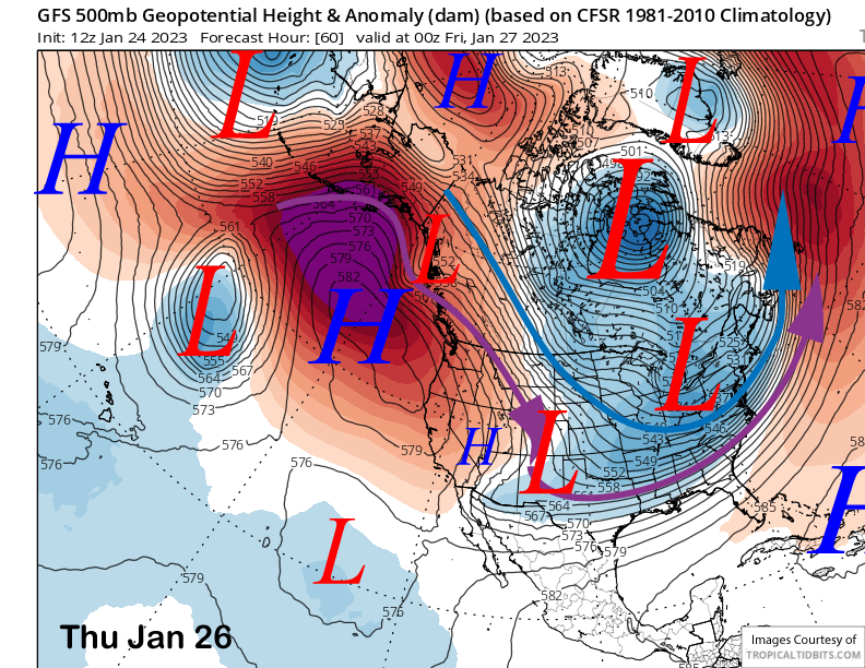
High pressure will continue to reside north and west of the state (image below) through the end of the week and into the weekend for continued fair skies and dry weather. Any storms should move southward well east of the Mammoth area with a deep trough positioned in the center of the country.
Long Range (Days 5+)
The longer-range guidance has shifted a little, with a storm chance for Sunday/Monday, followed by another period of dry weather before more storm chances occur during the first week of February. Right now, a major storm cycle is not expected.
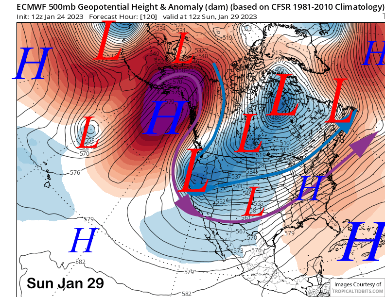
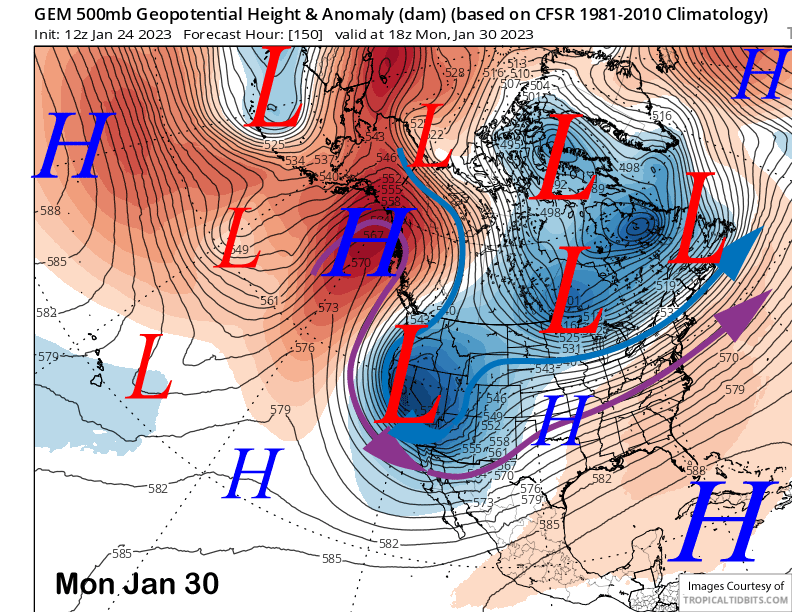
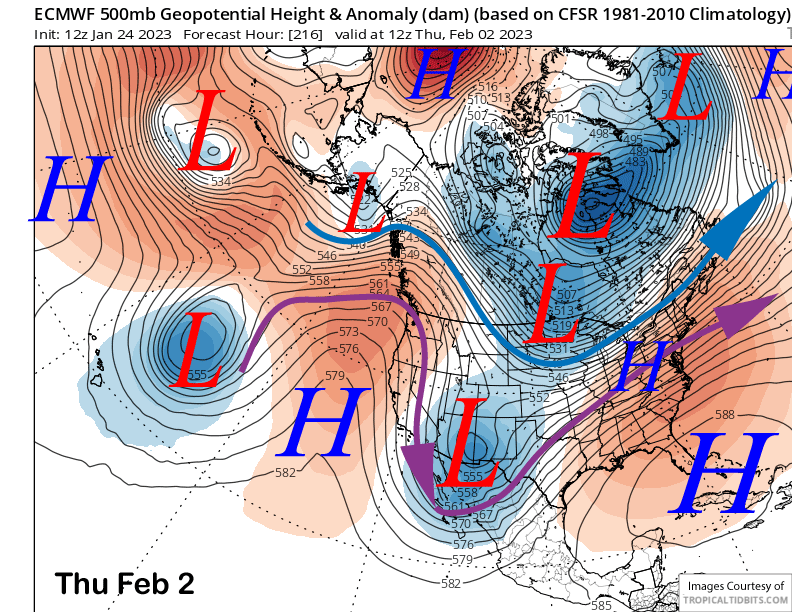
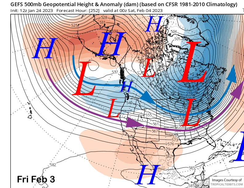
The ECM model moves a rather deep short-wave trough southward into CA from western Canada on Sunday (image below) and into Monday. The Canadian model (two images below) is similar to the GFS, just not quite as deep, and also slightly slower.
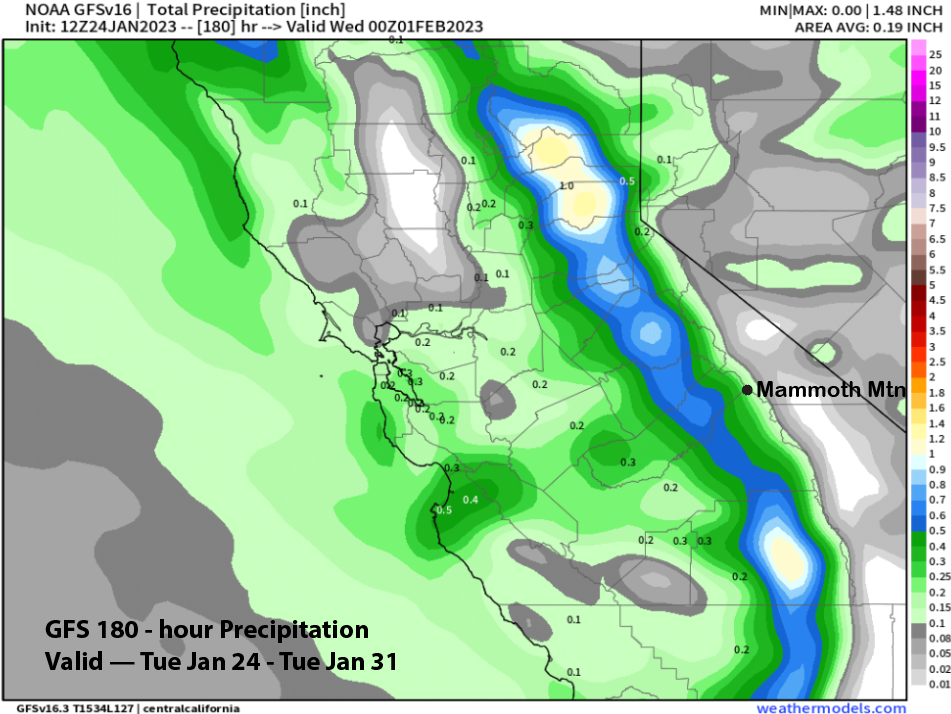
However, the GFS model is weaker and farther eastward with the low and projects its path with less over-water trajectory versus the other models. Thus, the QPF from the GFS (image below) at a couple tenths is much less than the ECM model at around 0.75” liquid (two images below). The Canadian model is showing around a half an inch.
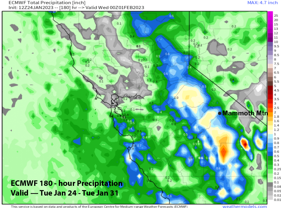
Forecast follows closer to the Canadian model which is a nice blend of the GFS and ECM. This would be a cold storm and snow ratios in the 15-20”:1” range, thus a half an inch liquid could be up to 10” of fluffy snowfall. Overall, it will probably be enough snowfall for at least low-end powder conditions. It is still 6 days out, so the forecast will probably change.
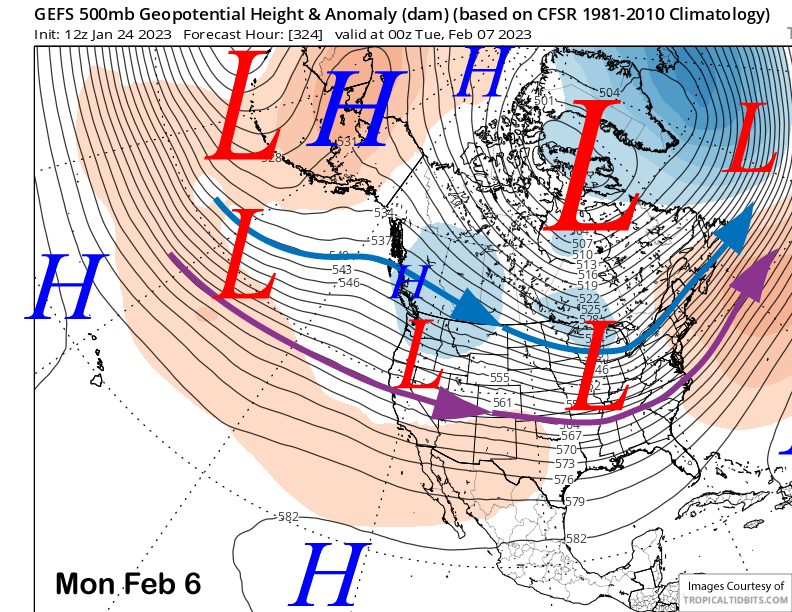
Models are then favoring ridging to return by the middle part of next week (image below) for a return of fair, dry, and warmer weather. The dry weather may last through Thursday, maybe Friday.
The GFS ensemble is forecasting as weak breakthrough of the westerlies under a high-pressure ridge centered over Alaska (image below). The main jet axis is currently forecast to be just north of Mammoth (purple arrow) with lots of uncertainty about the exact position of the jet/strength. Models are struggling with the placement of that ridge. A bit further southward and the jet stream would be a more favorable position.
The GFS ensemble generally keeps this pattern in place through the following weekend (image below) which would allow another storm/two to move into central and northern California. The latest ECM EPS (which was late today) is similar or slightly weaker versus the GFS ensemble and has generally shifted drier versus the past update.
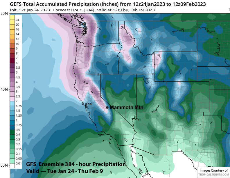
The GFS ensemble model is showing about 2” liquid (image below) for the period, so a big event is not favored at the moment. The amount of jet energy moving into the West Coast under the Alaska ridge is not forecast be super strong/persistent and may be a progressive pattern of quick moving storms. There is still a decent shot for more powder days, just maybe not deep ones.
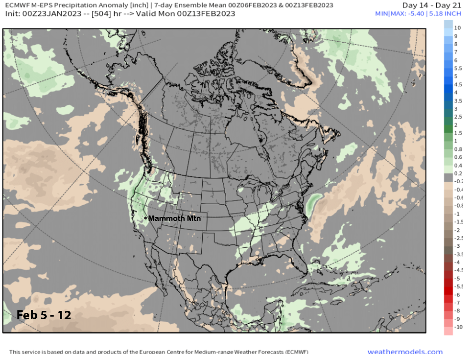
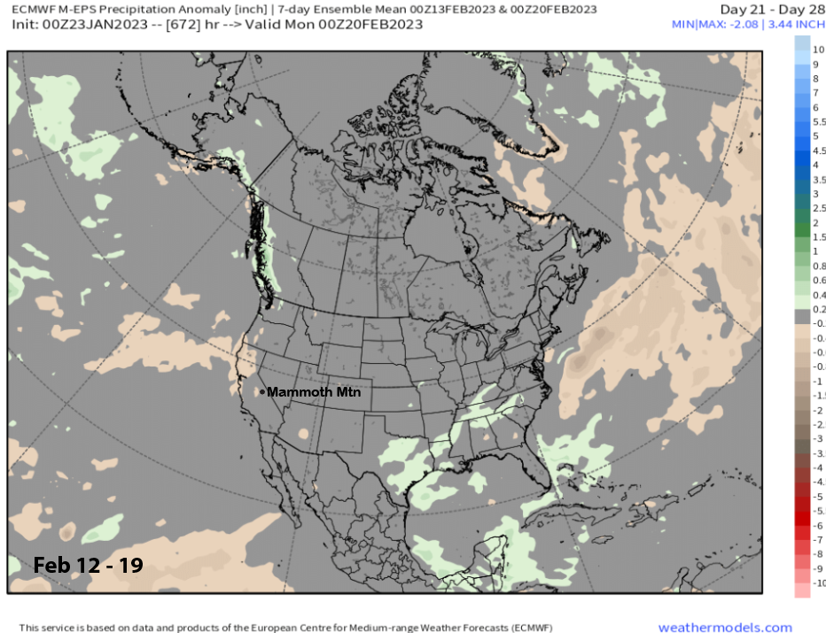
Super long range climate models say the wet pattern may continue into the second week of February with the ECM EPS (image below) showing above normal precipitation. That model favors dry weather to return mid-February (two images below) and doesn’t favor any more storm patterns for the rest of the month. I hope it is wrong or else powder days may be limited to just the first part of February. WG