Powder Forecast – Tuesday, March 12th, 2024
Ted Schlaepfer CCM —- Mammoth Mountain WeatherGuy
**Snowfall forecast confidence ranges from very low (1) to very high (5)
Wed 3/13 = 2”
Thu 3/14 = 0”
Fri 3/15 = 0”
Sat 3/16 = 0”
Sun 3/17 = 0”
Mon 3/18 = 0”
Tue 3/19 = 0”
Wed – Fri 3/20 – 3/22 = 0 – 3”
March Snowfall: 41”
March Forecast = 60 – 80”
Detailed 4-day Snowfall Forecast:
Wed 3/13 – No snowfall expected.
Thu 3/14 – Light snowfall is possible during the late afternoon and overnight. Accumulations around an inch are possible by Friday AM.
Fri 3/15 – Light snowfall is possible during the morning, then dry weather likely returns during the afternoon. No accumulation is expected.
Sat 3/16 – No snowfall expected.
Forecast Summary:
Short Term (Days 1 – 4):
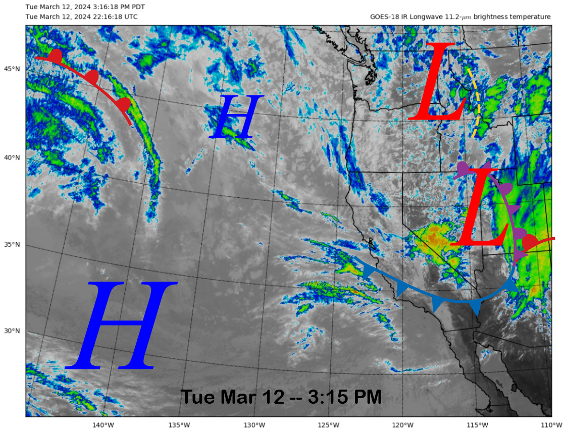
The current infrared satellite image (below) shows that the weather system that moved through this morning has already moved into Utah. One last wave is now entering the Sierra, producing clouds and breezy winds only for Mammoth.
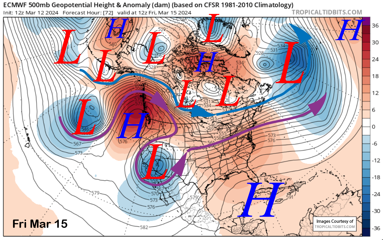
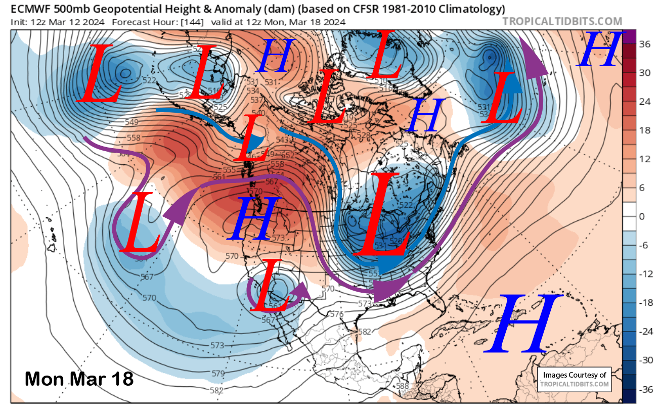
The upper-low associated with today’s storm will move southward into SoCal/Arizona by Friday (image below) and cut off from the jet stream. It will then remain mostly stationary through the weekend and into Monday (two images below) next week while generally decreasing in strength (filling).
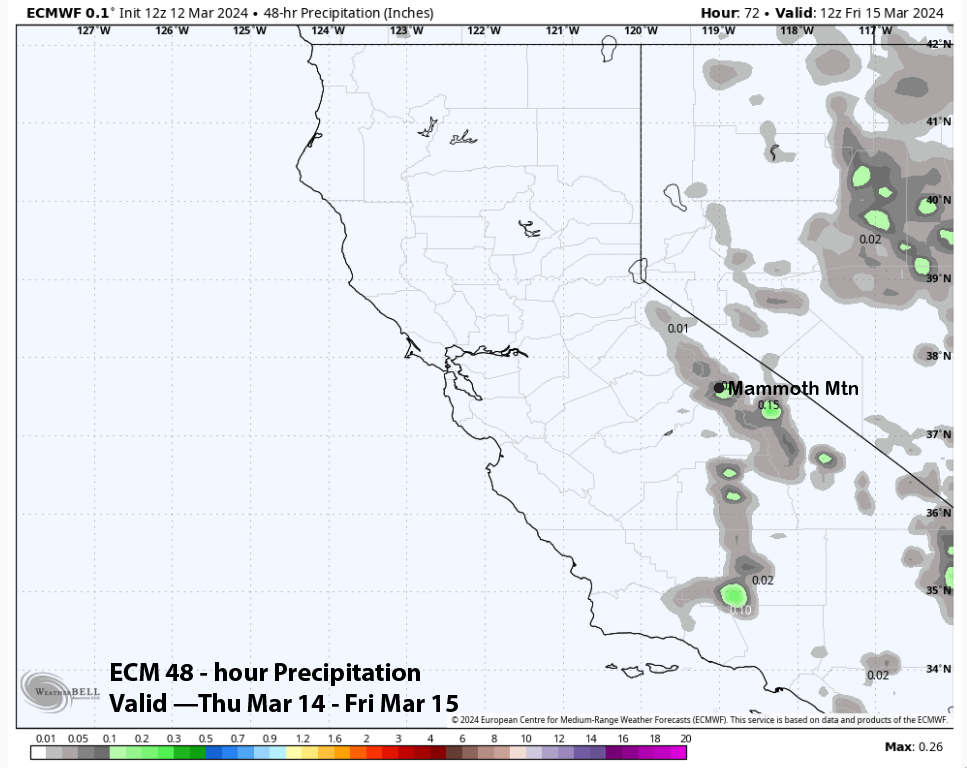
As it moves southward, there could be some wrap-around snowfall starting on Thursday afternoon and through Friday morning. It doesn’t look like much, with the ECM forecast only showing about a tenth liquid (image below) or about an inch of snowfall. Otherwise, it will be dry through Saturday, with the only issues being gusty northeast winds on Thursday and breezy winds on Friday.
Long Range (Days 5+):
The longer-range guidance is looking rather dry into the middle part of next week before the models start to hint that wet weather may return at some point next week or over the last part of the month. The models are not showing anything major but possibly strong enough storms for at least low-end powder conditions.
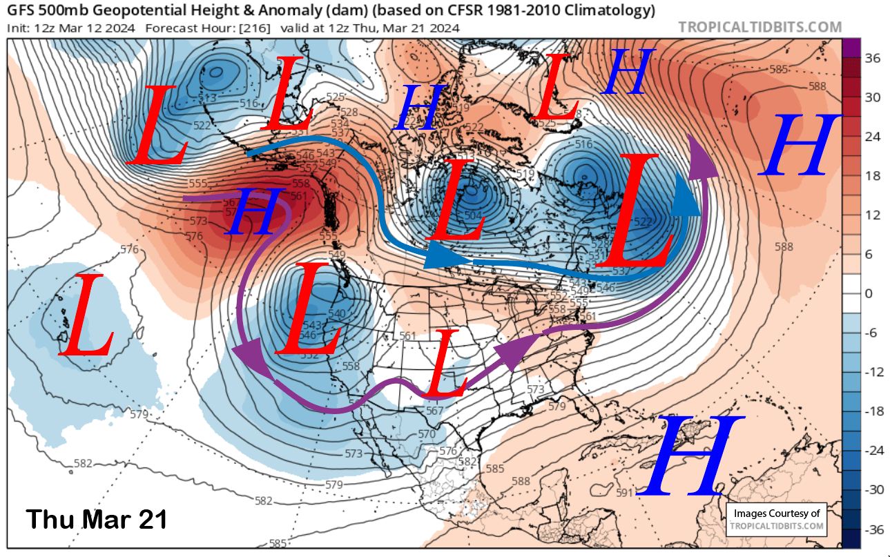
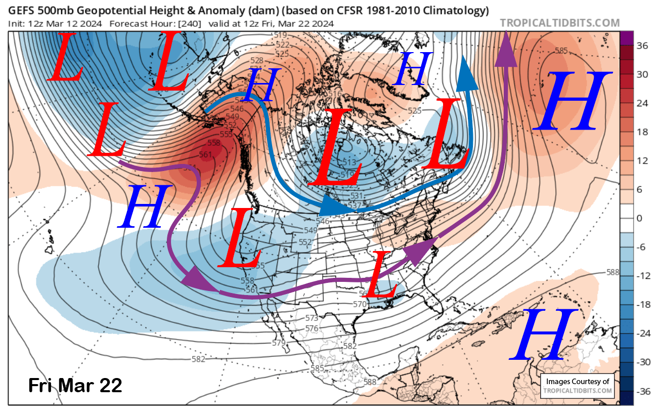
The GFS model is the most aggressive, producing some snowfall by Wednesday or Thursday next week (image below) with an upper-level low moving into the state. However, that solution is only weakly supported by the GFS ensemble (two images below) that has the position of the trough farther eastward and lacks over-water trajectory.
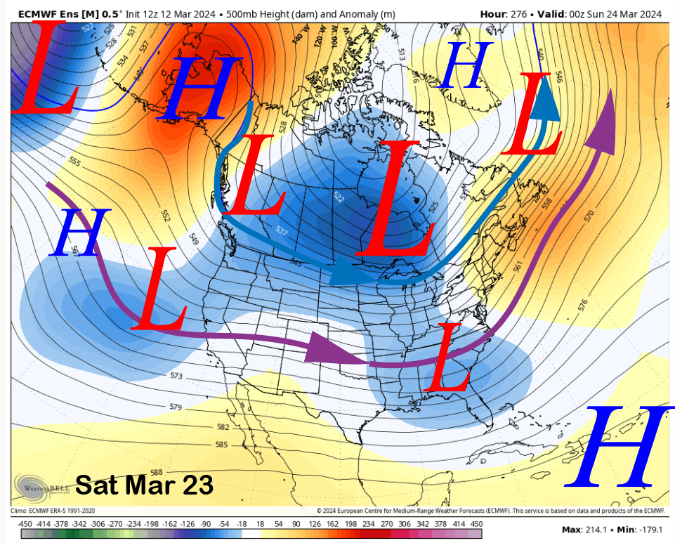
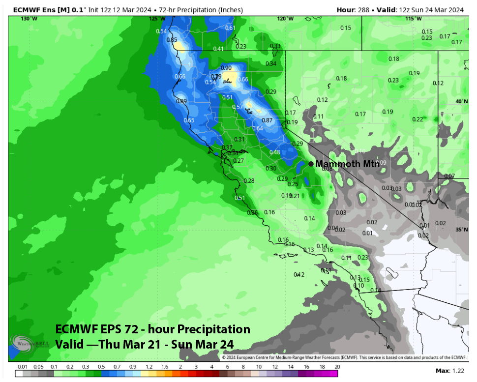
The ECM EPS also has a trough moving into the state, but a couple of days later on Saturday (image below) and into Sunday. That model is showing some precipitation, with the trough (two images below) at just under half an inch, which may be enough for low-end powder conditions. The forecast follows the ECM mean, with a chance for an accumulation of snowfall Wednesday into Friday.
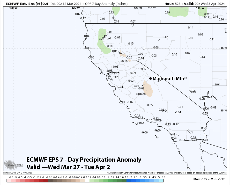
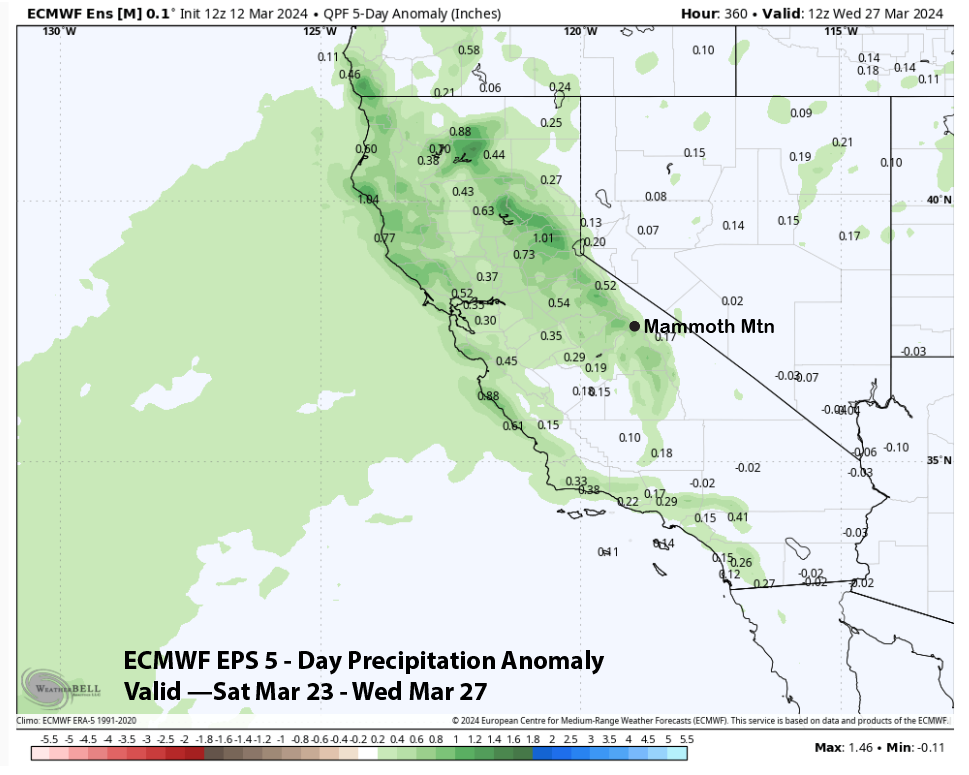
For the 11-15 day period, there is some suggestion that weak/moderate storms may move into the state. The GFS ensemble only favors average precipitation for that period, while the ECM EPS favors above-average precipitation (image below). So, there is hope that powder days may return by the end of the month.
The fantasy range guidance from the ECM EPS shows average precipitation to the end of March and the start of April (image below). It is only slightly drier for the next week. That suggests a weak or moderate storm at times through early April as the season slowly winds down for the year heading through spring. WG