Powder Forecast –Friday, February 9th, 2024
Ted Schlaepfer CCM —- Mammoth Mountain WeatherGuy
Snowfall forecasts are valid at the Sesame snow course (Main Lodge) for the prior 24 hours, as reported in the 6-7 AM morning snow report.
**Snowfall forecast confidence ranges from very low (1) to very high (5)
Sat 2/10 = 1 – 2”
Sun 2/11 = 0”
Mon 2/12 = 0”
Tue 2/13 = 0”
Wed 2/14 = 0”
Thu 2/15 = 0”
Fri 2/16 = 0 – 3”
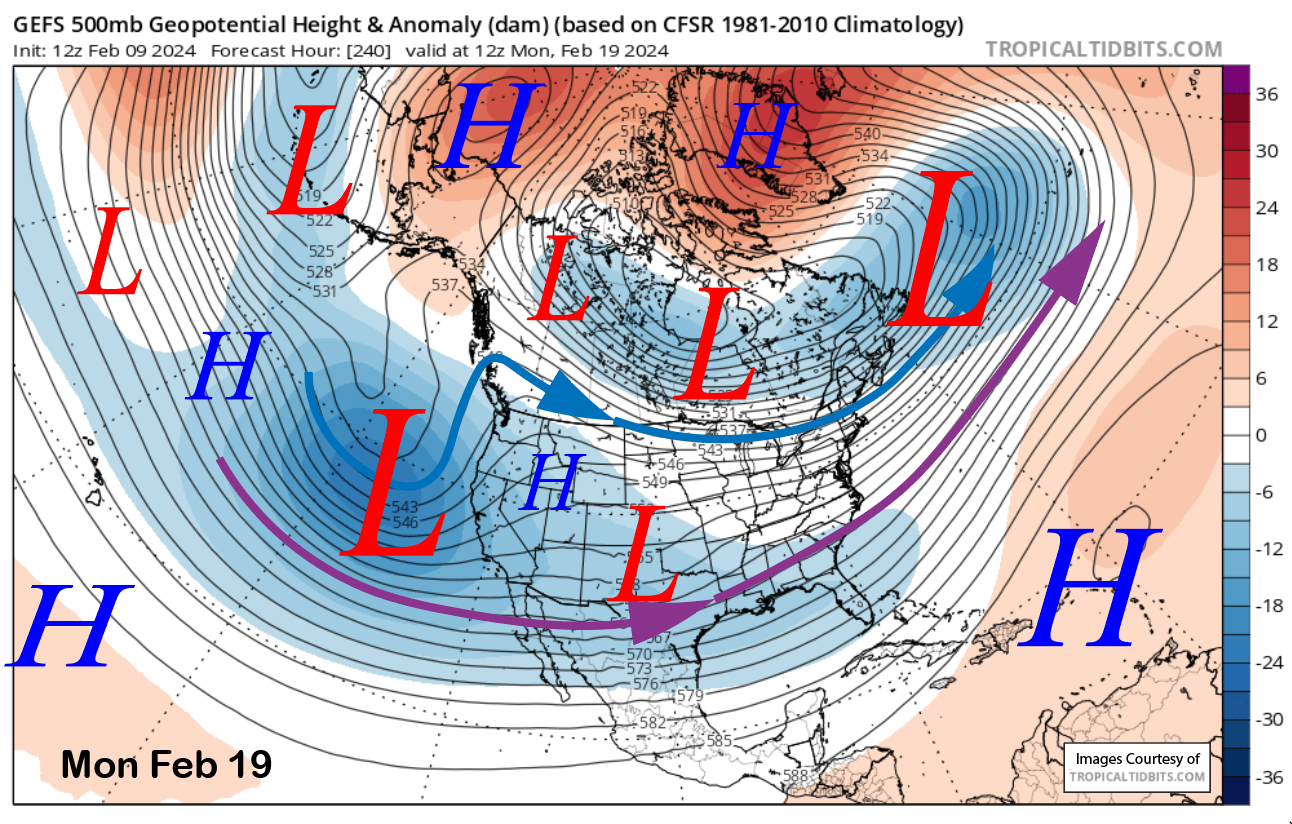
Sat – Mon 2/17 – 2/19 = 6 – 18”
February Snowfall = 88”
February Forecast = 120 – 150”
Detailed 4-day Snowfall Forecast:
Sat 2/9 – Chance for an early morning flurry or light snow shower, then dry weather returns.
Sun 2/10 through Tue 2/13 – No snowfall expected all days.
Forecast Summary:
Short Term (Days 1 – 4):
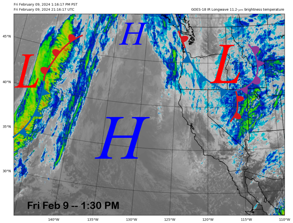
The current infrared satellite image (below) today shows a weather system moving southward through the interior PacNW and a ridge of high pressure off the coast stretching northward into British Columbia. The weather system will move southward into the eastern Sierra tonight and produce light snowfall.
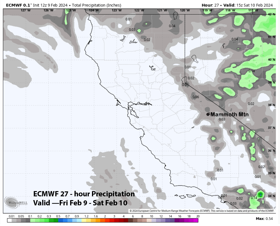
The ECM model QPF only shows very light liquid amounts around 0.05” (image below), and the GFS is similar. It is a cold system, and snow ratios will be around 20”:1”, and that small liquid amount may be enough for an inch or two of snowfall that should refresh the mountain.
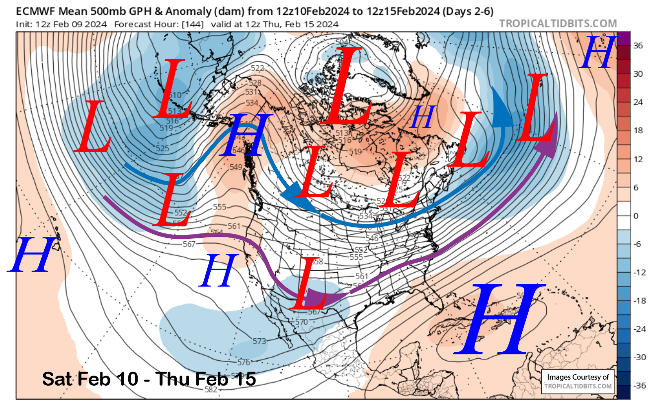
There could be a morning flurry early Saturday. Otherwise, the models say the ridge of high pressure off the coast will build into the state for the next five days (image below). Weak systems will pass through the ridge at times, resulting in some passing clouds, and temperatures over the period will stay seasonably cold and winter-like. Conditions should be excellent.
Long Range (Days 5+):
The longer-range guidance favors a wet weather pattern getting re-established by the end of next week and/or over the following weekend and continuing into the following week. This pattern will likely benefit Mammoth with periods of moderate to heavy snowfall at times that will help to continue to build a base for spring.
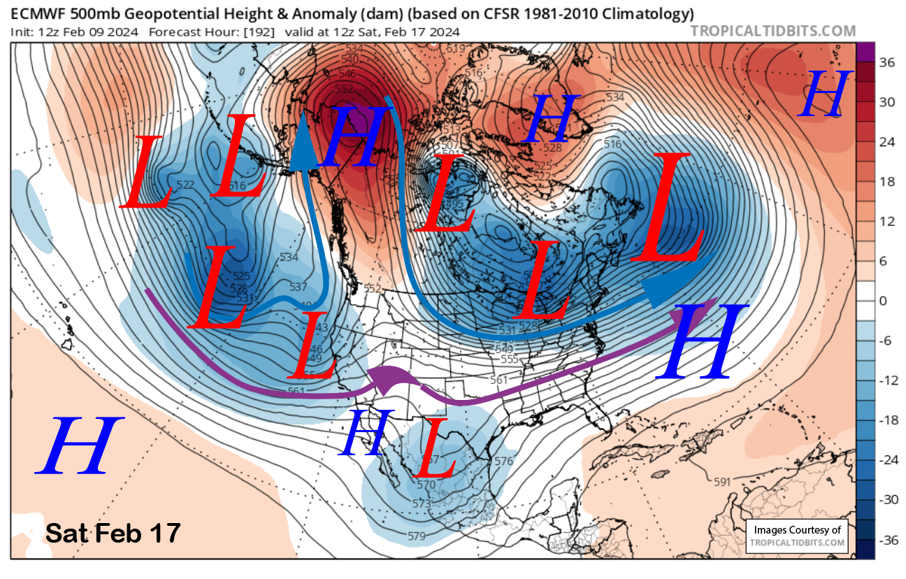
The latest 12z ECM run brings the first trough to the coast around late Friday or early Saturday next week (image below). It looks like it will split when it reaches the coast, and any snowfall amounts at Mammoth will likely remain light to moderate.
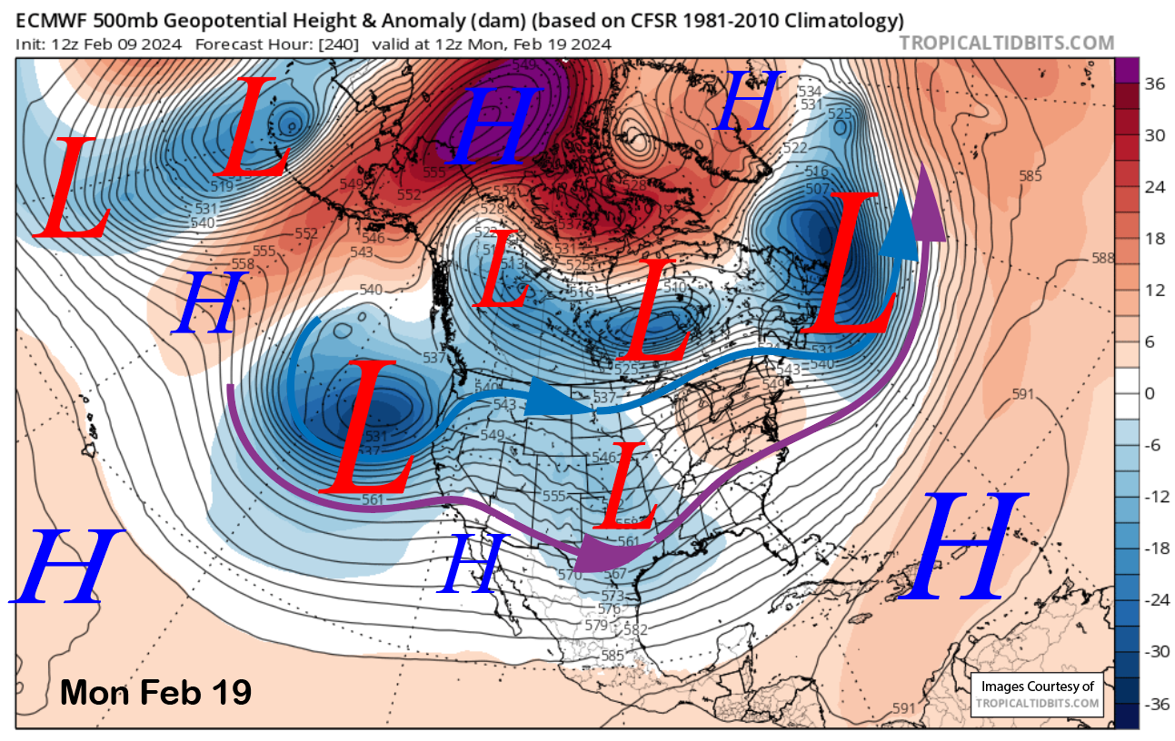
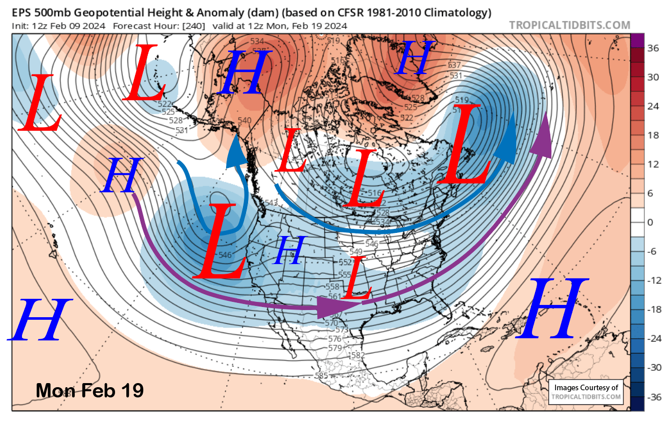
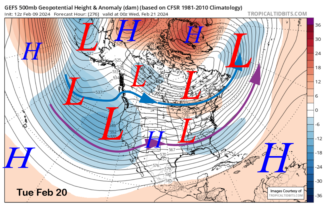
The ECM then moves a much deeper trough into CA, backed by a strong jet stream by early the following week (image below) that would produce a round of heavy snowfall. This solution is well supported by the ECM EPS (two photos below) and GFS ensemble (three images below) that also have a deep trough in place in about the same position. However, the ensembles are not quite as deep with the trough as the deterministic run.
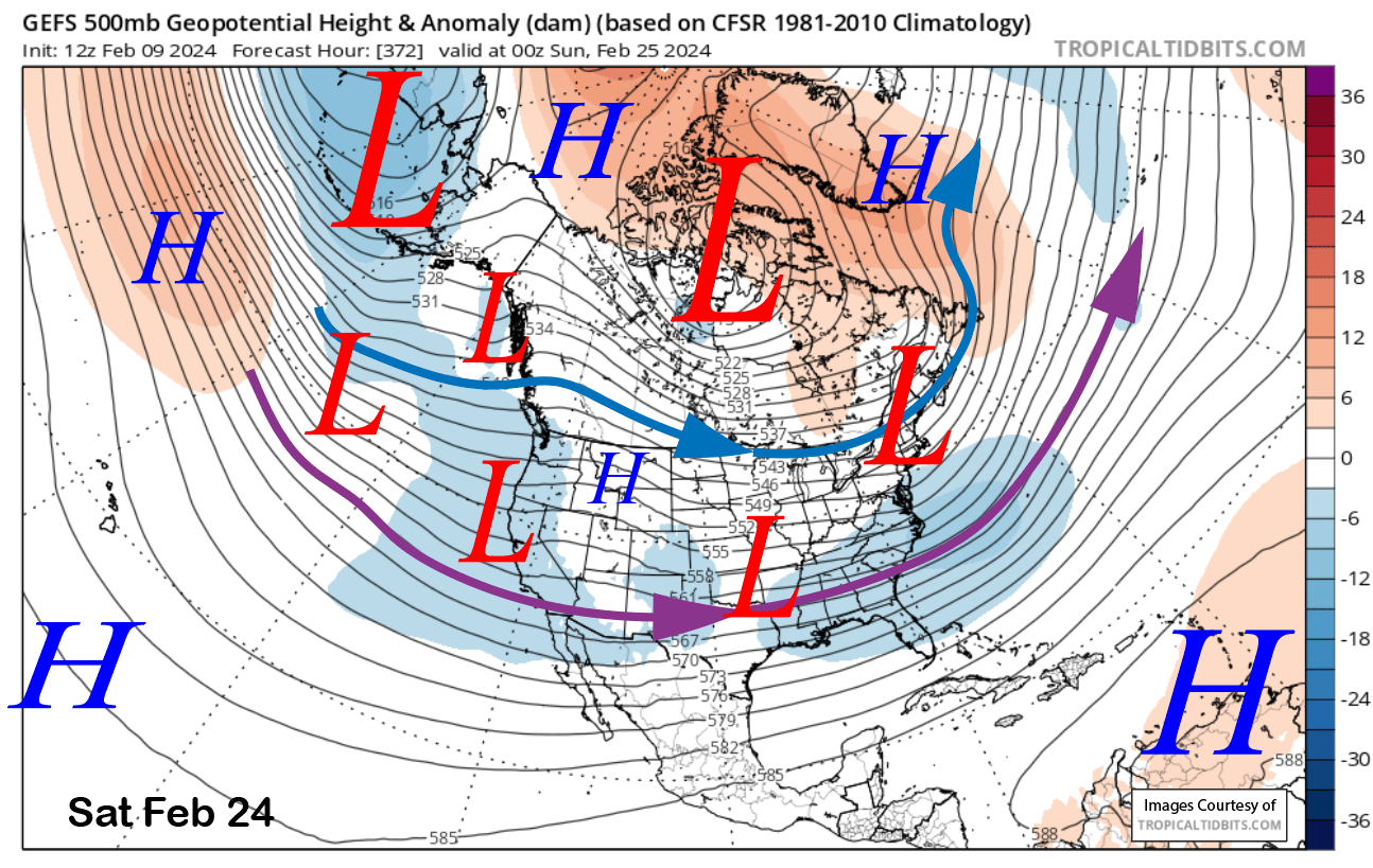
The GFS ensemble moves another trough into CA about 36 hours later (image below) and keeps the general stormy pattern for the rest of that week (two photos below) for a reasonably long storm cycle.
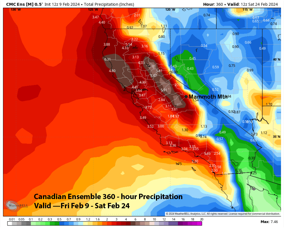
Model ensemble QPF for the 15 days only varies slightly, with the ECM EPS showing around 4” (image below), and the GFS ensemble (two photos below) is similar. The Canadian ensemble (three images below) is slightly drier, but does show 7” on the west side that is often a good indicator for Mammoth during these wet periods.
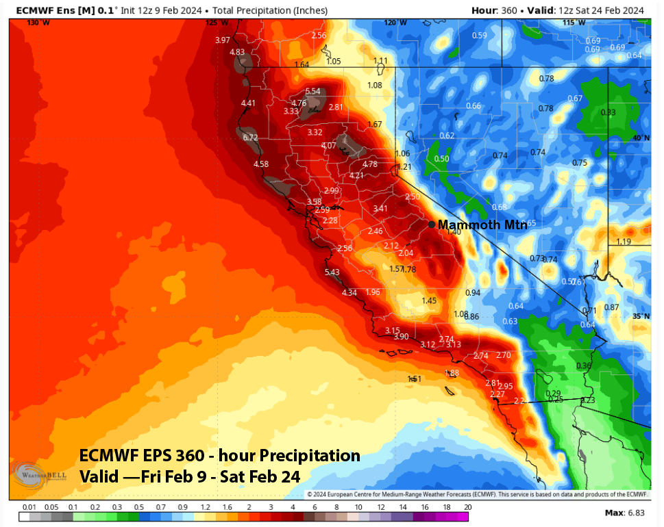
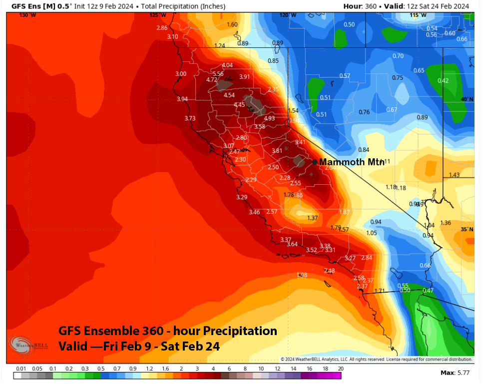
Overall, the guidance is fairly lined up for a snowy period to start in about a week and last for about a week. Confidence is fairly high for such an extended forecast due to great model consistency and similar solutions. Three to four feet of snowfall is probably a good guess right now with a great chance for more. The ECM EPS control run forecast (cover image) is probably the best-case scenario with 10-12” liquid at the Main or around a hundred inches of snowfall.
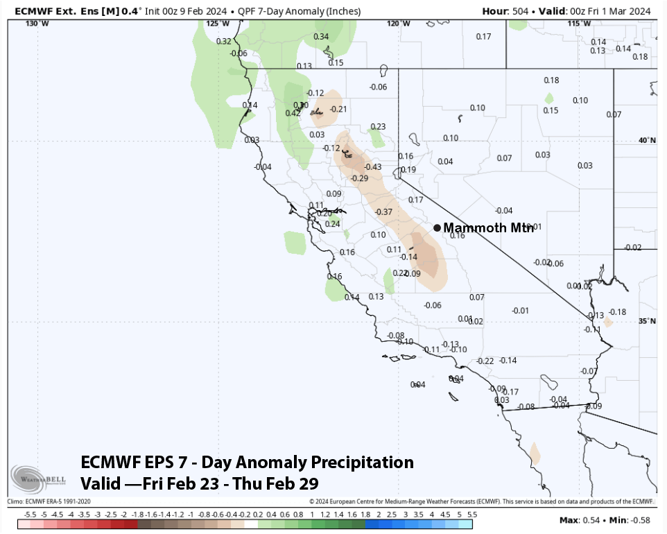
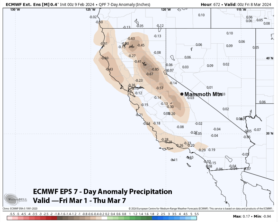
The longer-range fantasy guidance is now less dry for the last week of February and shows normal precipitation in the higher Sierra (image below), suggesting a storm or two. It then brings drier weather back for the first part of March (two images below). Hopefully, we will be buried in powder by then. WG