Powder Forecast – Tuesday February 28th, 2023
Ted Schlaepfer CCM —- Mammoth Mountain WeatherGuy
Snowfall forecasts are valid at the Sesame snow course (Main Lodge) for the prior 24 hours as reported in the 6-7 AM morning snow report.
**Snowfall forecast confidence ranges from very low (1) to very high (5)
Wed 3/1 = 20 – 26” (H20 = 1.75” – 2.00”)**4
Thu 3/2 = 1 – 3” (H20 = 0.10” – 0.20”)**3
Fri 3/3 = 0”
Sat 3/4 = 0”
Sun 3/5 = 5 – 7”
Mon 3/6 = 12 – 24”
Tue 3/7 = 2 – 4”
Wed – Fri 3/8 – 3/12 = 3 – 15”
February Snowfall = 101” (MammothMtn shows 113”, but they double counted on 2/24)
February Forecast = 101”
Detailed 4-day Snowfall Forecast
Wed 3/1 – Snowfall ends during the morning with continued snow showers into the afternoon. Accumulations 1 – 3” by Thursday AM and 3”+ up top
Thu 3/2 and Fri 3/3 – No snowfall expected both days
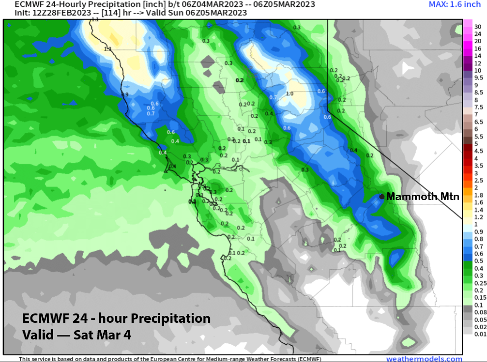
Sat 3/4 – Light snow showers are possible during the day before snowfall starts late PM and continues overnight. Snow Accumulations 5 – 7” by Sunday AM, ~10” up top
Forecast Summary:
Short Term (Days 1 – 4):
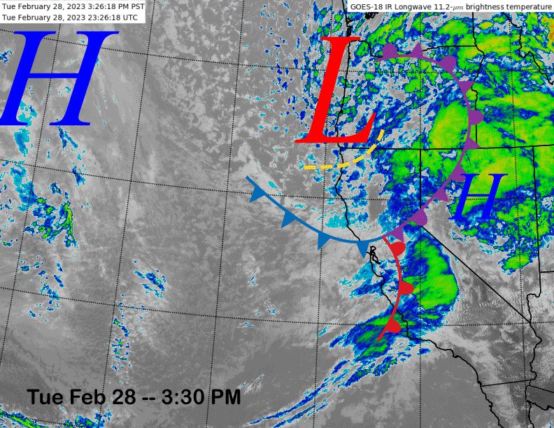
The current infrared satellite image (below) this afternoon shows a cold upper-level low pressure system centered off the Oregon coast and an associated frontal system stretching across central and northern CA. The front is currently producing heavy snowfall/blizzard conditions on the mountain with most of the hill closed today due to the extreme weather.
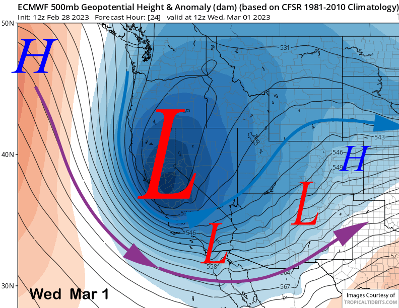
The models move the upper-low through Central California early tomorrow (image below) and the snowfall should decrease during the morning with only scattered snow showers during the day, ending during the afternoon. The cold upper-level jet (blue arrow) will produce bitterly cold temperatures tomorrow morning with continued cold temperatures during the day.
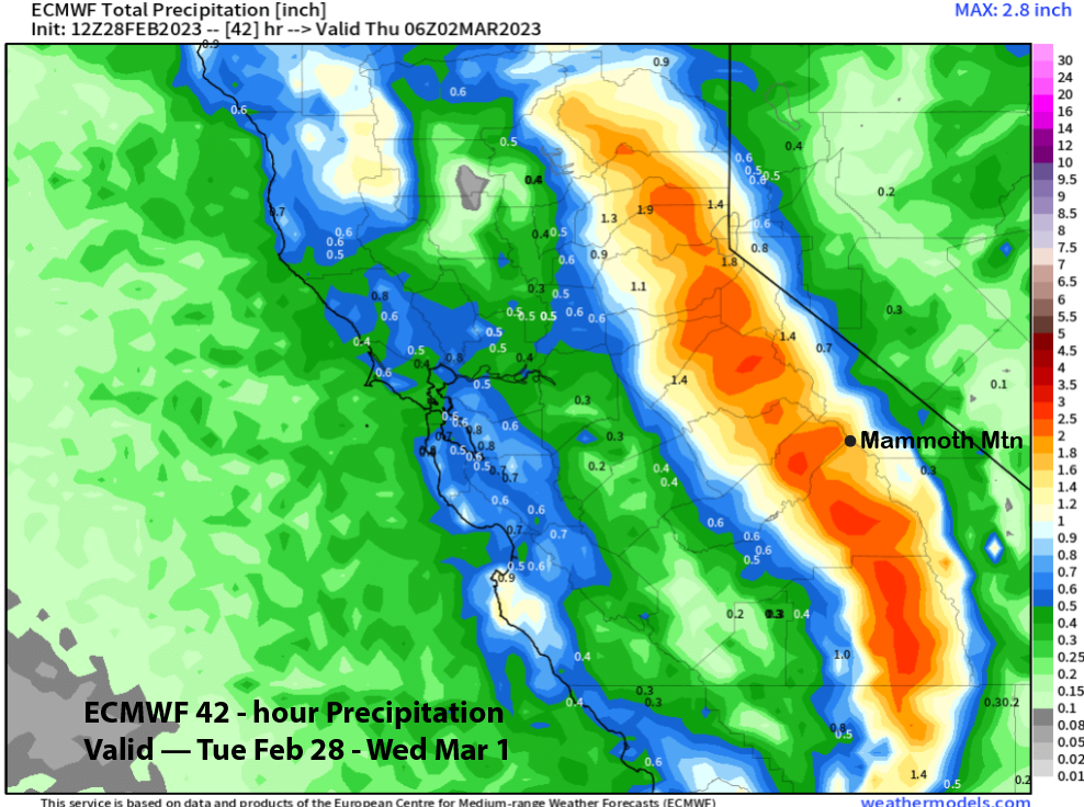
The 12z run of the ECM model is showing almost 2” liquid for the storm (image below) that will likely translate to around 2 feet of powder at Main and 2 ½ feet up top. And it will a colder type powder too. With the lingering snow during the morning, it will likely be a slow opener with so much avy work for ski patrol to get down across the mountain.
Dry weather returns Thursday and is expected to continue Friday that will likely be a sunny day. Conditions should continue to be epic with all the new snowfall. The next storm moves into Mammoth Saturday afternoon and night with possibly up to 6” of new snow at Main by the time lifts open
Long Range (Days 5+)
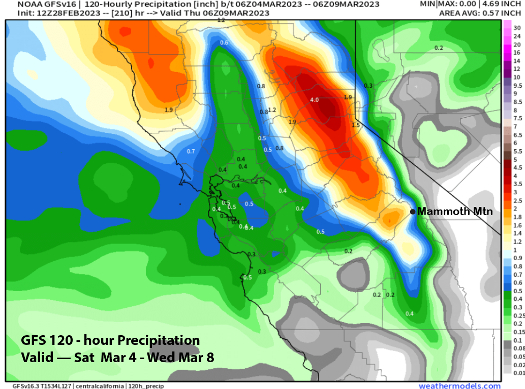
The longer-range guidance is showing continued powder day chances through the middle part of next week before the models start to diverge with the potential solutions in the fantasy range. If the GFS is right, all of this colder type snowfall could be followed by warmer type cement heading into mid-month.
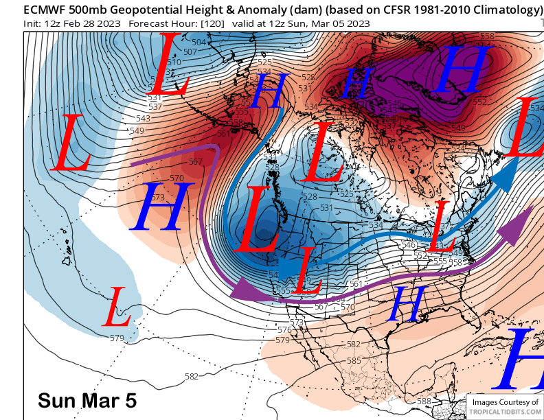
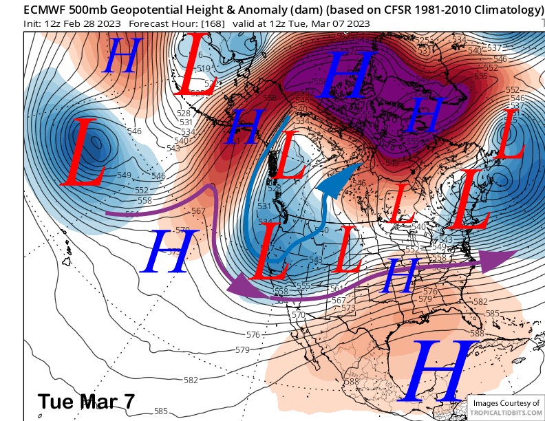
The ECM and other models move another deep, cold, upper-level low pressure system from the Gulf of Alaska into CA by early Sunday (image below). That will support a fairly good snowstorm again with generally low snow levels and likely enough wind for blizzard conditions.
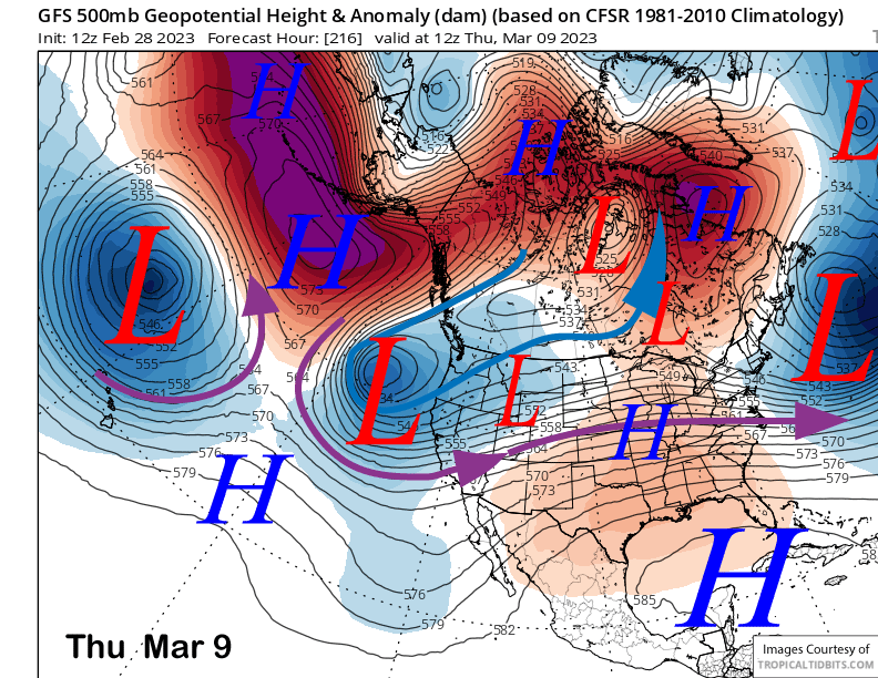
The models are not quite as wet with this storm as the current one with the ECM model showing about a half inch liquid Saturday PM/night (image below) followed by another 1.25” on Sunday (two images below). GFS is showing slightly less at around 1” for the period (three images below).
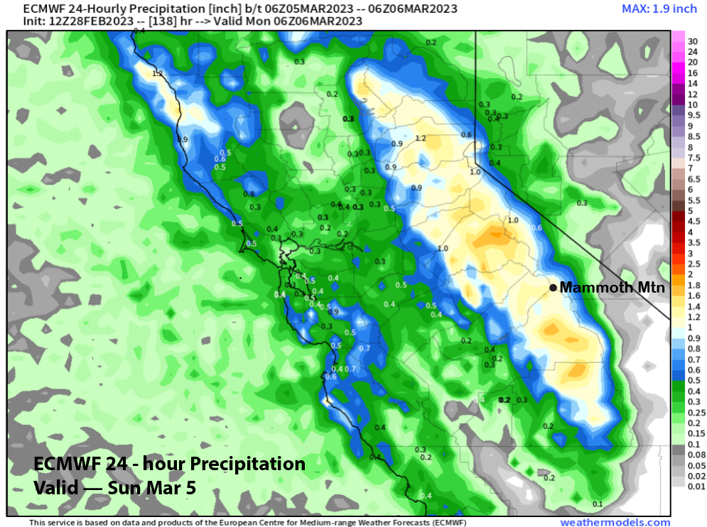
It looks like snow levels will be in the 2000-3000 foot range again, so this will be a colder type snowfall again with snow ratios probably in the 12-15”:1” range. That should translate to 1-2 feet of powder at Main by Monday morning and two plus feet up top. Epic conditions continue. This doesn’t happen every season.
The models keep the upper low mostly stationary through Tuesday (image below) and snowfall may continue at times into next Wednesday. Snow levels may rise a bit, but should still stay seasonably low and the powder a cold, dry type.
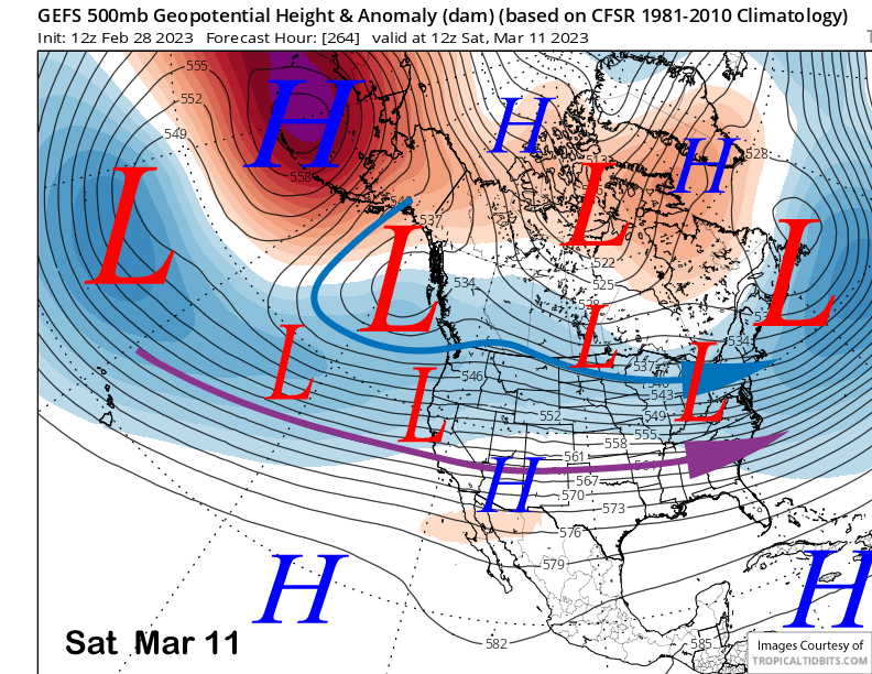
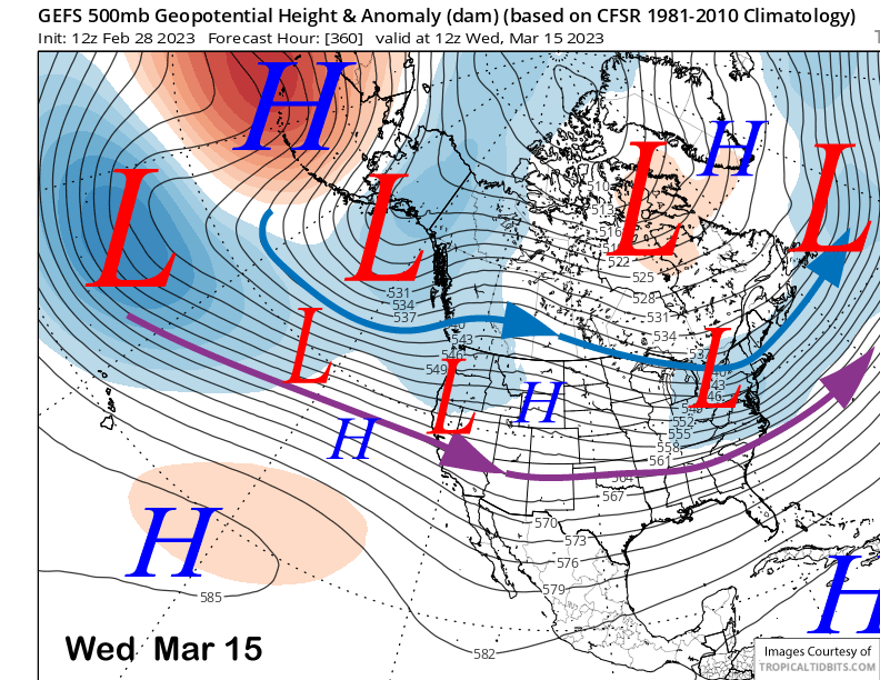
The models then diverge with the GFS model (image below) keeping a upper-low off the CA coast while the ECM and Canadian models move the low eastward out of CA and build a ridge over the state.
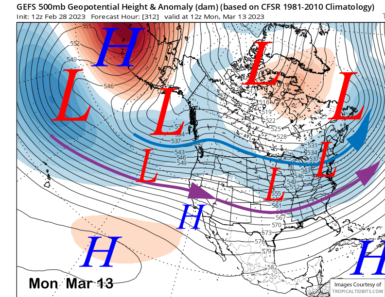
The GFS model is then favoring a breakthrough of the westerlies and a potential low-latitude (warmer) storm that could contain an atmospheric river for the end of next week or following weekend. This is well supported by the ensemble mean (image below) that shows a Bering Sea block setting up and a couple deep lows in the central and eastern Pacific. That pattern allows the southern branch of the jet stream to move into the state from the central Pacific near Hawaii.
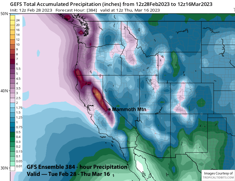
The GFS ensemble generally favors keeping this pattern in place through the fantasy period (images below) with the jet stream lifting a bit northward. That would just mean storms with higher snow levels and even heavier cement. The ECM EPS is not as bullish about this pattern, but many ensemble are showing it and the mean does have 4-5” liquid for the period.
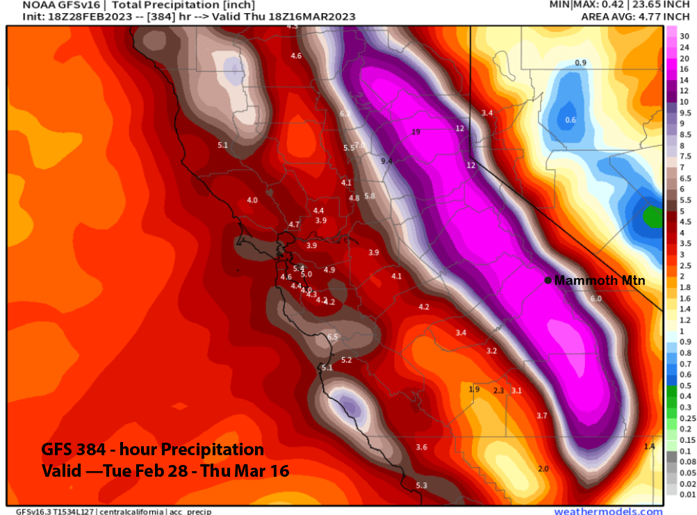
The GFS mean is showing more and about 6” liquid (image below) for the period while the latest 18z run of the GFS is showing an extreme example of the potential pattern with almost 20” liquid for the period (two images below).
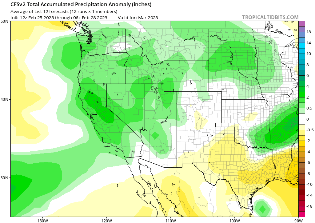
Overall, it looks like March will not be a dry month and the last run of the CFS model is now favoring above normal precipitation (image below). So far this season, every month December through February has seen 100”+ of snowfall. Snowfall records go back to 1969, and there has never been a season when all four months December through March saw 100” of snowfall, although 1982-83 was close by only a few inches. Could this be the season? WG