Powder Forecast – Friday February 17th, 2023
Ted Schlaepfer CCM —- Mammoth Mountain WeatherGuy
Snowfall forecasts are valid at the Sesame snow course (Main Lodge) for the prior 24 hours as reported in the 6-7 AM morning snow report.
**Snowfall forecast confidence ranges from very low (1) to very high (5)
Sat 2/18 = 0”
Sun 2/19 = 0”
Mon 2/20 = 0”
Tue 2/21 = 0”
Wed 2/22 = 4 – 8”
Thu 2/23 = 4 – 8”
Fri 2/24 = 5 – 10”
Sat – Mon 2/25 – 2/27 = 3 – 10”
February Snowfall = 18”
February Forecast = 40 – 55”
Detailed 4-day Snowfall Forecast
Sat 2/18 through Mon 2/20 – No snowfall expected all days.
Tue 2/21 – No snowfall expected through midday, then winds increase during the afternoon and snowfall likely starts by late PM or evening, continuing overnight. Accumulations 4 – 8” by Wednesday AM and 8”+ up top
Forecast Summary:
Short Term (Days 1 – 4):
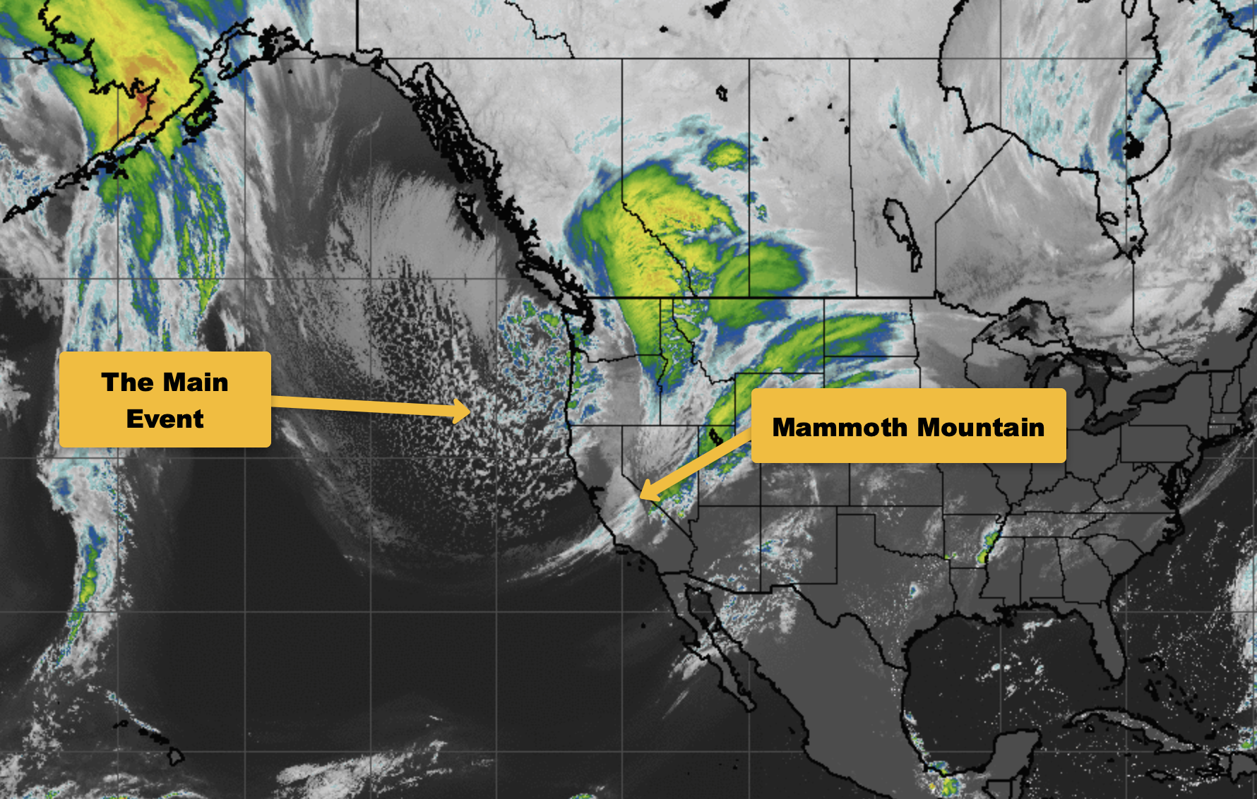
The current infrared satellite image (below) this afternoon shows an area of low pressure well off the SoCal coast and another weak low moving through SoCal with some cloudiness.
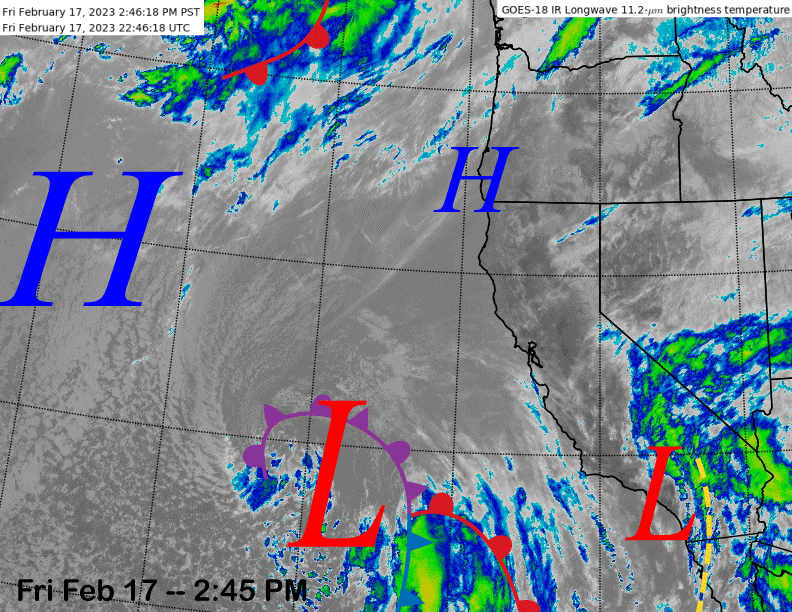
High pressure (image above) in the central Pacific will move into the eastern Pacific Ocean this weekend and the short-wave ridge over Oregon will move southward into CA. The end result will be fair weather and seasonable temperatures with Monday the warmest day when temps up top may get into the low 30s.
Long Range (Days 5+)
The longer-range guidance for the rest of the month is still looking good for the most part, although the guidance has backed off a bit over the last couple of days. Nonetheless, powder days are still planned for the middle/end of next week and more for the end of the month and early March.
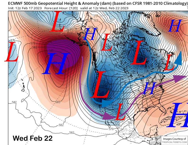
The models (ECM model images below) are in good agreement that a very deep high-latitude type upper-level trough will move southward into CA on Wednesday and linger through at least Thursday, if not likely Friday. That will bring into Mammoth a very cold arctic air mass in addition to snowfall.
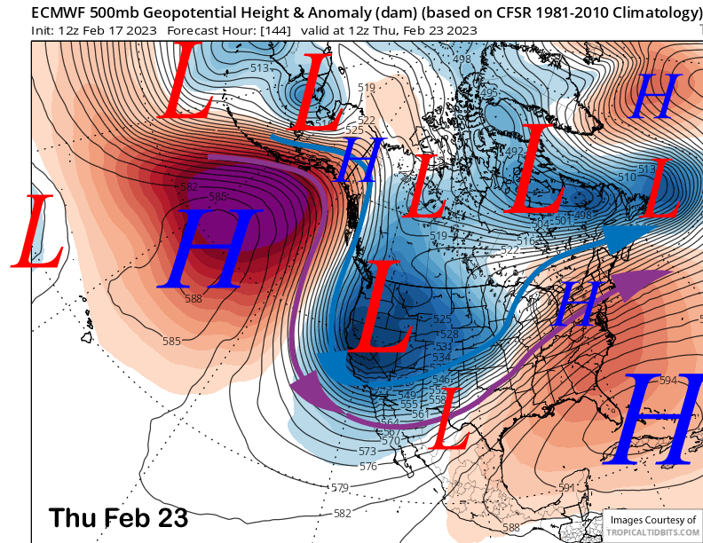
There is still some uncertainty with the scenario next week with the GFS model (image below) a bit farther westward with the initial upper-level trough while the Canadian model is closer to the ECM solution. The GFS solution would produce a bit more snowfall from the initial front due to more over-water trajectory before landfall.
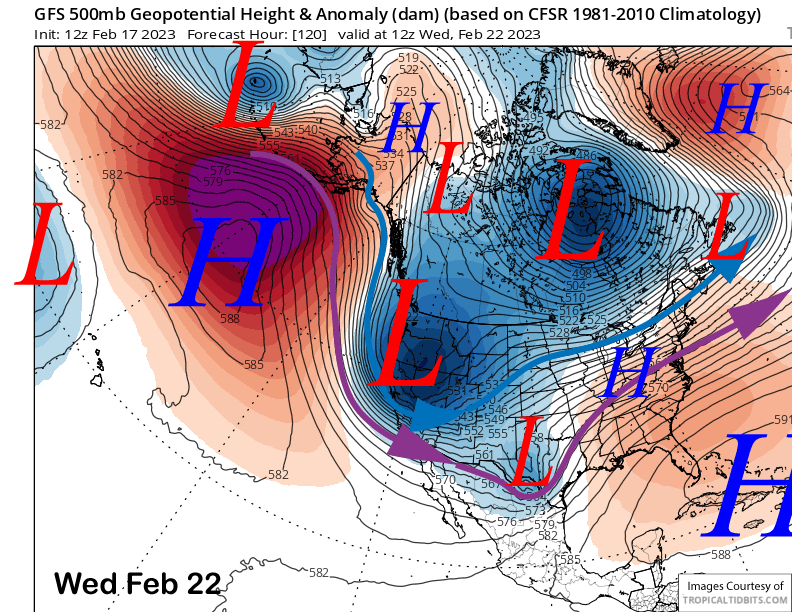
There are also difference with how long the trough lingers over CA with the ECM slower to move it out of the state on late Friday and the GFS faster with the eastward progression on Thursday. That means the GFS solution ends the snowfall earlier while the ECM keeps the light and dry snowfall ongoing into Friday.
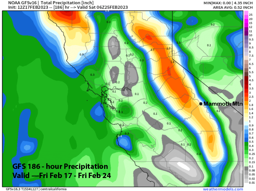
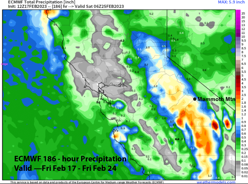
Overall, the GFS model is a bit wetter with the event (image below) at just under 1.5” liquid due to more snowfall with the initial front while the ECM (two images below) is showing a bit less liquid at just over an inch. However, the ECM has more liquid precipitation when the temps are really cold, so total snowfall amounts might actually be higher due to high liquid to snow ratios (20:1) after the cold air arrives on Wednesday.
And temperatures will be cold on Wednesday and Thursday with single digit temperatures expected at Main and around zero up top, if it would be open. There will also be gusty winds Tuesday afternoon and night ahead of the deep trough with winds on Wednesday and Thursday not too strong, so Chair 22 has a good chance of running.
Overall, it looks like around six inches should fall by Wednesday morning followed by an additional nine to eighteen inches into Friday with more up top. Due to the cold temps, it will be a cold and fluffy snow type, similar to Utah/Colorado snow.
The models are suggesting a brief dry period around the first part of the following weekend before the long-wave trough reloads across the West Coast per the GFS ensemble (image below) with the ECM model fairly similar. The 12z run of the GFS operational model was showing a deep closed low just off the coast on the last day of February (image below), so hopefully a stronger storm may materialize.
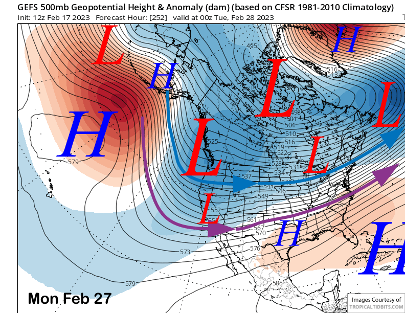
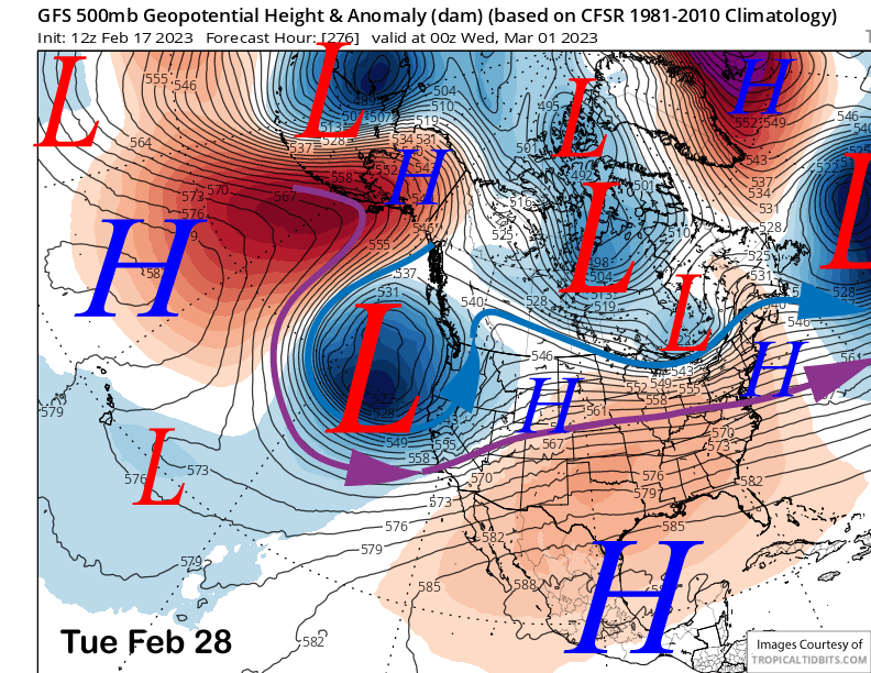
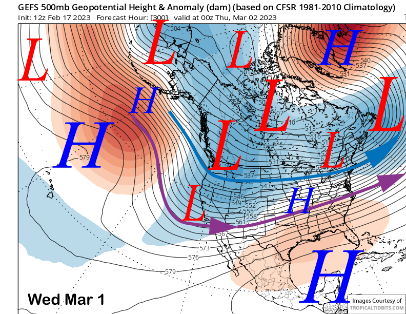
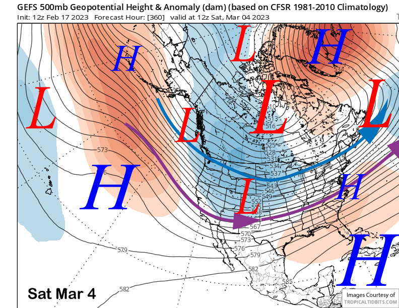
The models keep the trough in place through end of the month (image below) before shifting it eastward over the first weekend in March (two images below). Thus, dry weather could return during very back end of the forecast period after a chance for several storms to end February and start March.
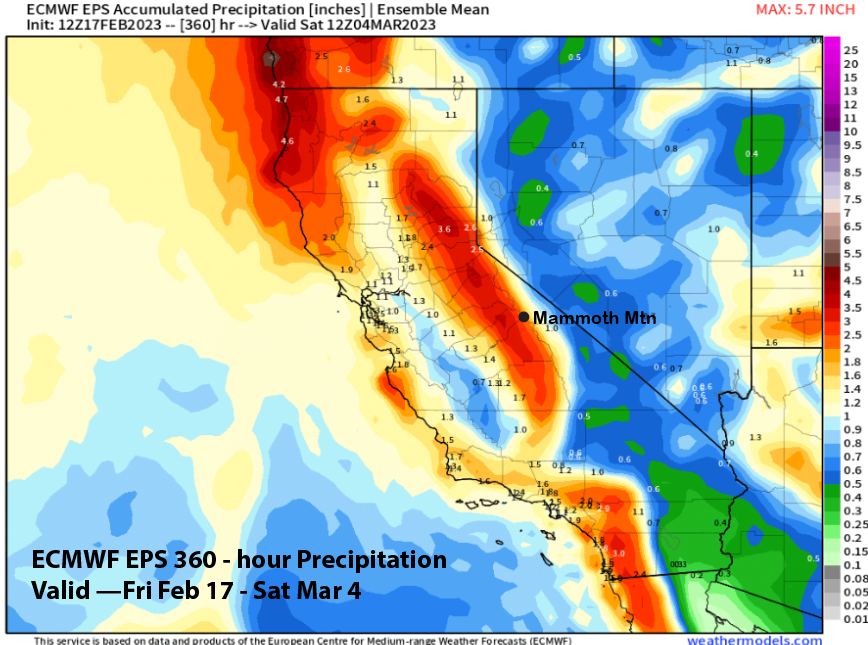
The ECM EPS (image below) is showing around 4” liquid west of the Sierra crest near Mammoth for the two week period. The GFS ensemble is generally similar. Hence, the guidance is not favoring a major storm cycle right now and more of a typical snowy winter pattern. That still means lots of powder days. WG