Powder Forecast – Tuesday, November 28th, 2023
Ted Schlaepfer CCM —- Mammoth Mountain WeatherGuy
Snowfall forecasts are valid at the Sesame snow course (Main Lodge) for the prior 24 hours as reported in the 6-7 AM morning snow report.
**Snowfall forecast confidence ranges from very low (1) to very high (5)
Wed 11/29 = 0”
Thu 11/30 = 0”
Fri 12/1 = 1 – 2”
Sat 12/2 = 0 – 1”
Sun 12/3 = 0 – 1”
Mon 12/4 = 0”
Tue 12/5 = 0”
Wed – Fri 12/6 – 12/8 = 0 – 3”
November Snowfall = 14”
November Forecast = 14”
Detailed 4-day Snowfall Forecast:
Wed 11/29 – No snowfall expected.
Thu 11/30 – Light snowfall or flurries develop during the late afternoon and continue through the evening before ending overnight. Accumulations 1 – 2”, up to 2”+ up top
Fri 12/1 – Dry during the day, then a chance for light overnight. Little or no accumulation expected
Sat 12/2 – Chance for light snowfall or flurries during the day, ending overnight. Little or no accumulation is expected.
Forecast Summary:
Short Term (Days 1 – 4):
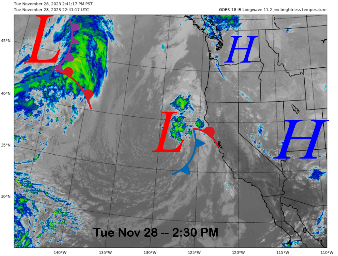
The current infrared satellite image (below) this afternoon shows a weather system positioned off the Northern California coast that is slowly moving eastward. It will move onto the coast overnight, and then abruptly turn southward during the day tomorrow along the Central Coast while washing out. Only some passing clouds are expected for Mammoth tomorrow.
Another weather system will move into CA on Thursday before exiting eastward Friday (image below), and it will not have a great over-water trajectory and will be mostly an inside-slider type storm. Nonetheless, light snowfall will probably develop during the late afternoon and/or evening before ending overnight.
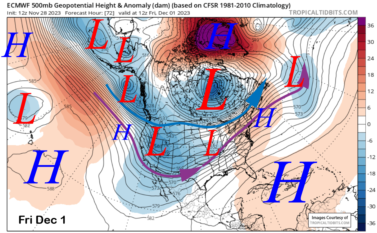
The GFS and Canadian models are basically dry for Mammoth with this weather system while the ECM is showing very light amounts. Probably only an inch or two at Main and maybe 3” up top if we are lucky.
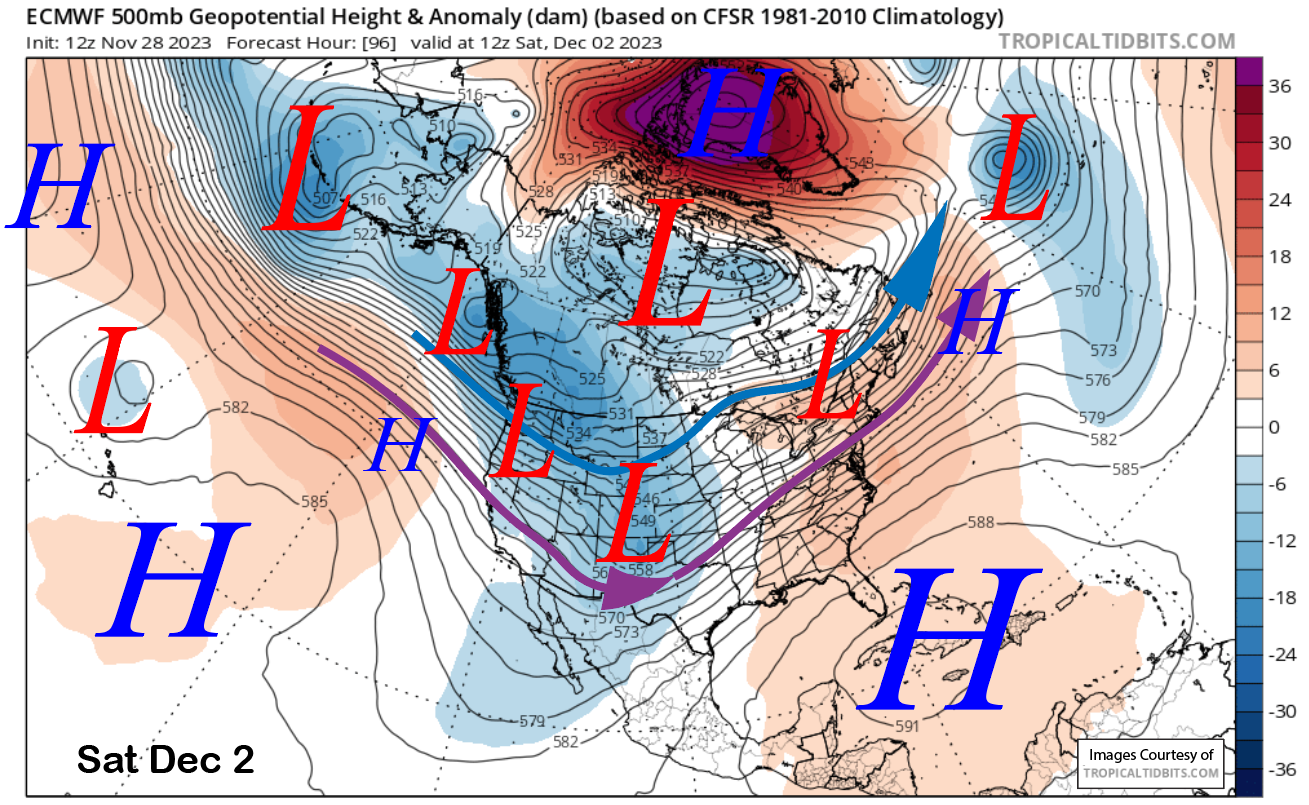
Another weather system will move north of Mammoth on Saturday (image below) for a chance for light snowfall or flurries during the day before that chance ends overnight into Sunday. Overall, no meaningful snowfall is expected through the upcoming weekend.
Long Range (Days 5+):
The longer-range guidance has not changed much since the last post and a base building storm we need is still not on the horizon. The Chair 16 opening may get rather interesting if we don’t see any good snowfall by mid-December.
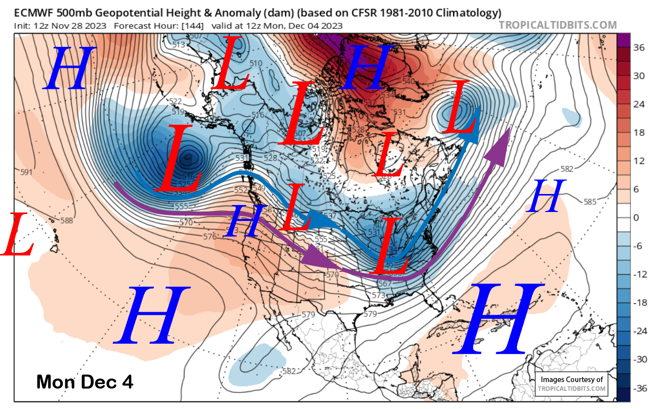
High pressure builds into the state early next week (image below) resulting in fair, dry, and warmer weather. That should last through mid-week.
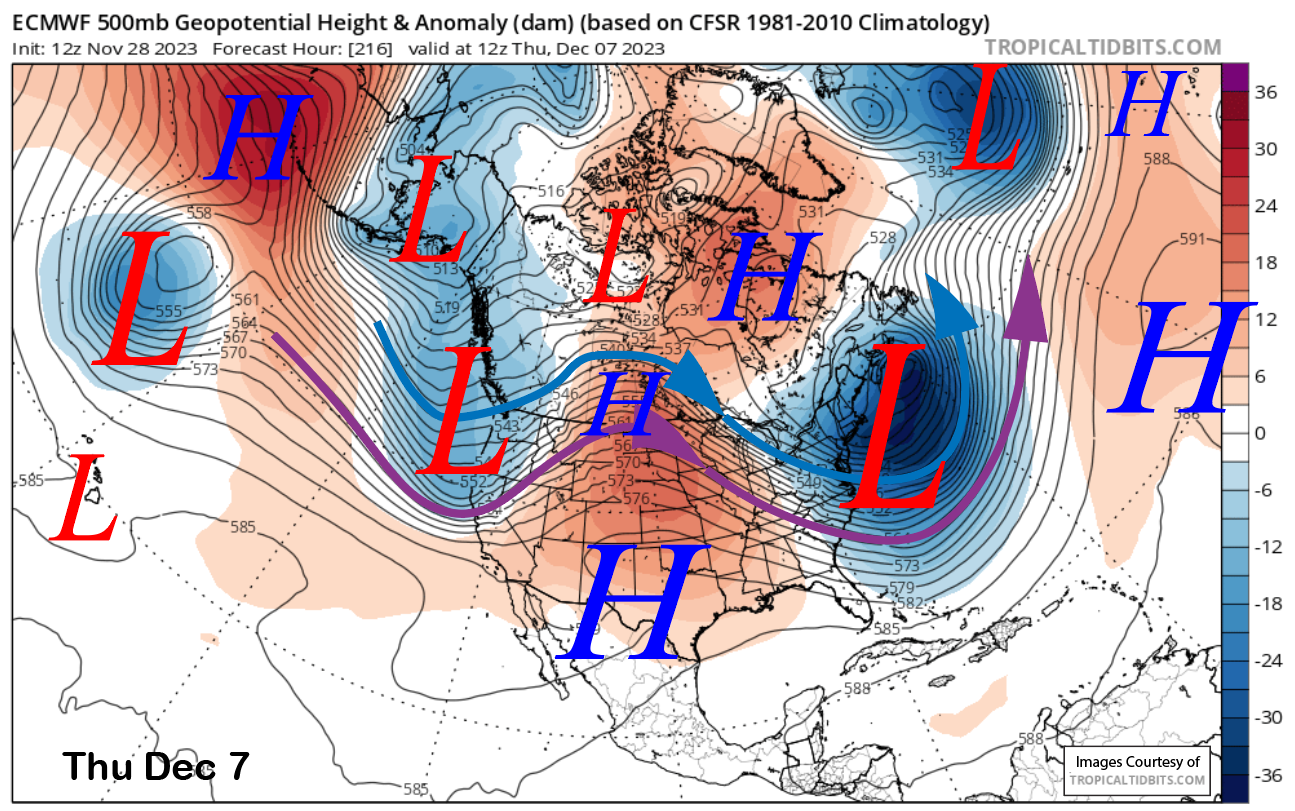
The ECM model then moves a fairly strong trough into the PacNW with the southern edge moving into CA (image below). The Canadian model is slightly farther north with the trough and the GFS is much farther northward. The ECM mean (two images below) also shows a decent trough, but a bit too far north for good snowfall for Mammoth.
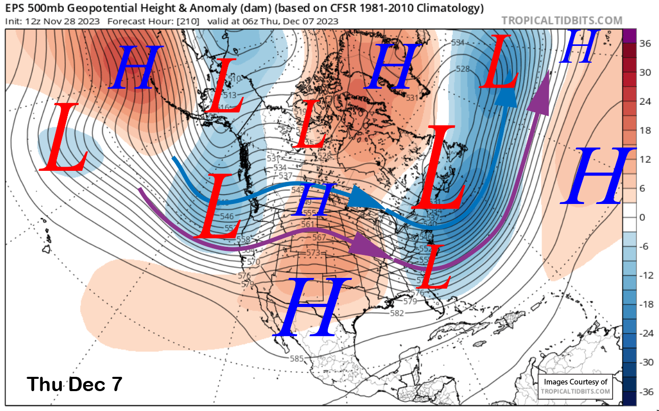
Right now, the ECM solution is only showing light snowfall of a few inches and the ECM ensemble mean is similar. Either way, not a big storm with most of the precipitation moving into the PacNW if the ECM is right and continued dry if the other models are correct.
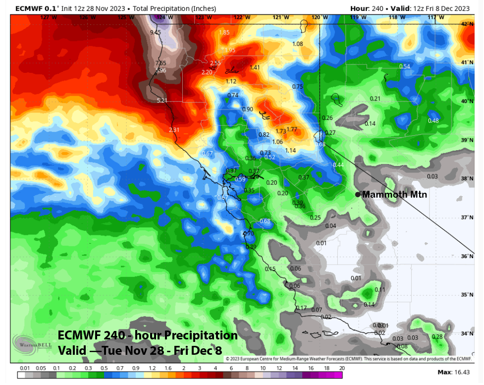
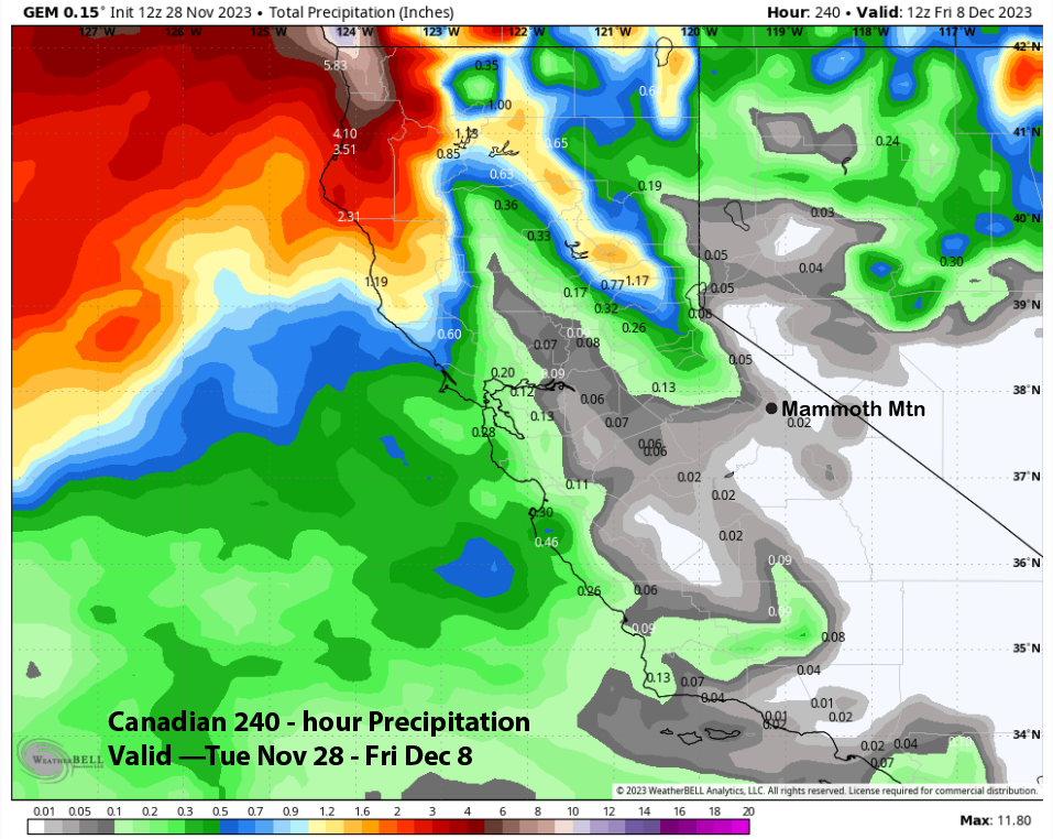
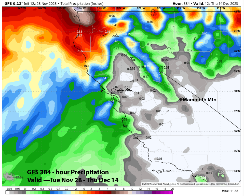
The 10-day precipitation forecast from the models is generally dry with the ECM model (image below) showing light amounts while the Canadian model (two images below) also shows only very light amounts. The GFS model has only a tenth of an inch for the 15-day period (three images below).
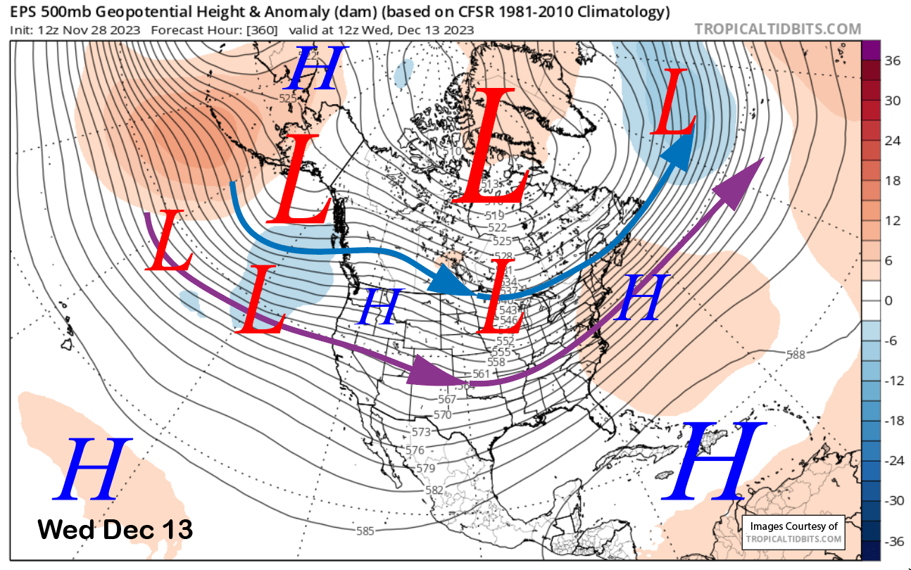
The longer-range ensembles do favor ridging to return by the following week for more dry weather. The ECM model is showing the jet stream flattening out in weak zonal flow by the end of the period (image below).
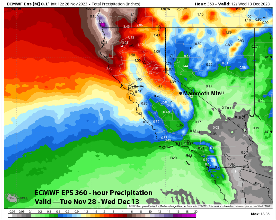
Right now, that jet stream (purple arrow) is still too far northward for any big storms for Mammoth. It does have about an inch of liquid for the period (two images below), but spread out over two weeks, not a base-building pattern.
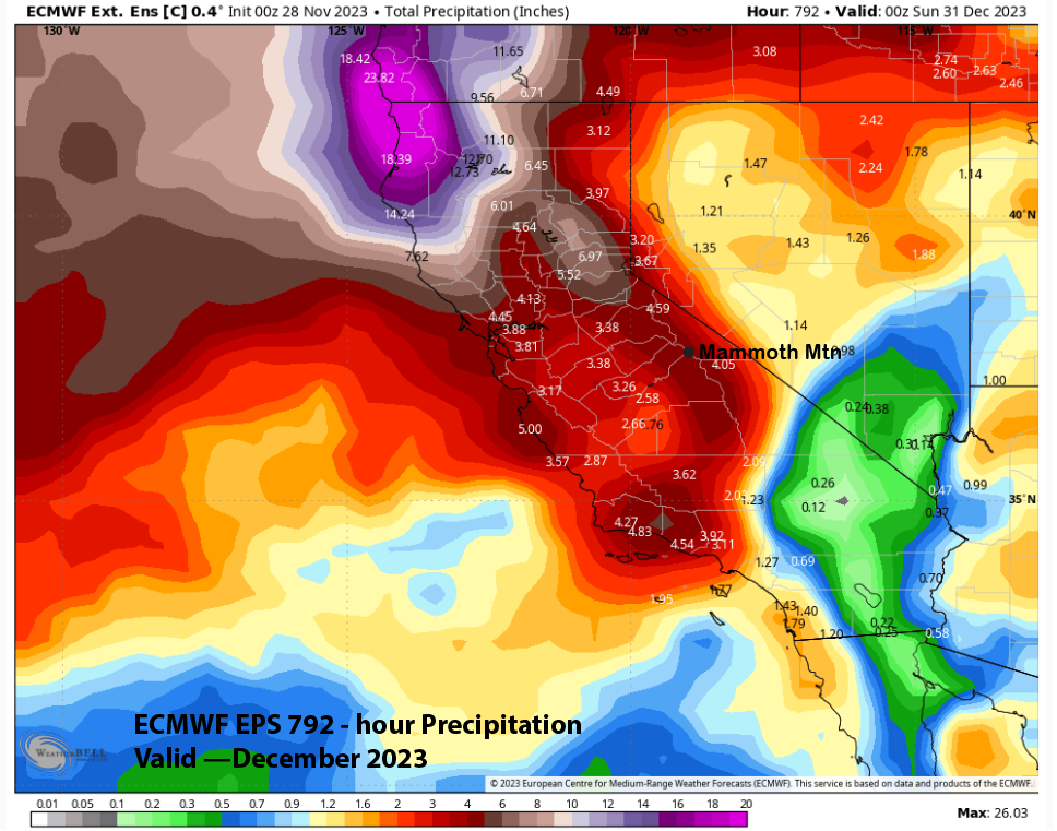
If you want to feel a little bit optimistic, the latest ECM EPS 45-day forecast is showing about 4-5” liquid for Mammoth during December (image below). That would be about 35-55” of snowfall. Average December snowfall is around 65”, 2022 saw 116”. This sure isn’t last season when we had lots of brown and purple colors over Mammoth. WG