Powder Forecast – Tuesday April 25th, 2023
Ted Schlaepfer CCM —- Mammoth Mountain WeatherGuy
Snowfall forecasts are valid at the Sesame snow course (Main Lodge) for the prior 24 hours as reported in the 6-7 AM morning snow report.
**Snowfall forecast confidence ranges from very low (1) to very high (5)
Forecast cadence now switching to once per week on Tuesdays
Wed 4/26 = 0”
Thu 4/27 = 0”
Fri 4/28 = 0”
Sat 4/29 = 0”
Sun 4/30 = 0”
Mon 5/1 = 0”
Tue 5/2= 0 – 2”
Wed – Fri 5/3 – 5/5 = 3 – 6”
April Snowfall = 3”
April Forecast = 3”
Detailed 4-day Snowfall Forecast
Wed 4/26 through Sat 4/29 – No snowfall expected all days.
Forecast Summary:
Short Term (Days 1 – 4):
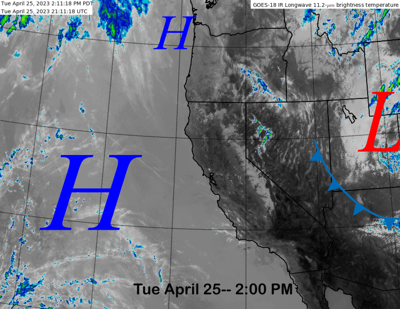
The current infrared satellite image (below) this afternoon shows high pressure is situated just off the CA coast and a low-pressure system well east of CA in Utah. The high-pressure ridge will move eastward into the state over the next few days resulting in fair and warmer weather with spring conditions on the mountain.
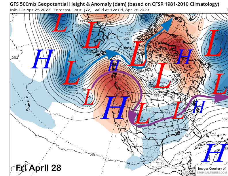
The ridge is forecast by the models to strengthen through Friday (image below) and into Saturday before breaking down late over the weekend. Thus, spring skiing and riding under light winds should be great this weekend.
Long Range (Days 5+)
The longer-range guidance is trending more favorable for a return to winter-like conditions next week including a chance for snowfall. This pattern may last through the first week of May or longer with spring skiing possibly on hold for a while.
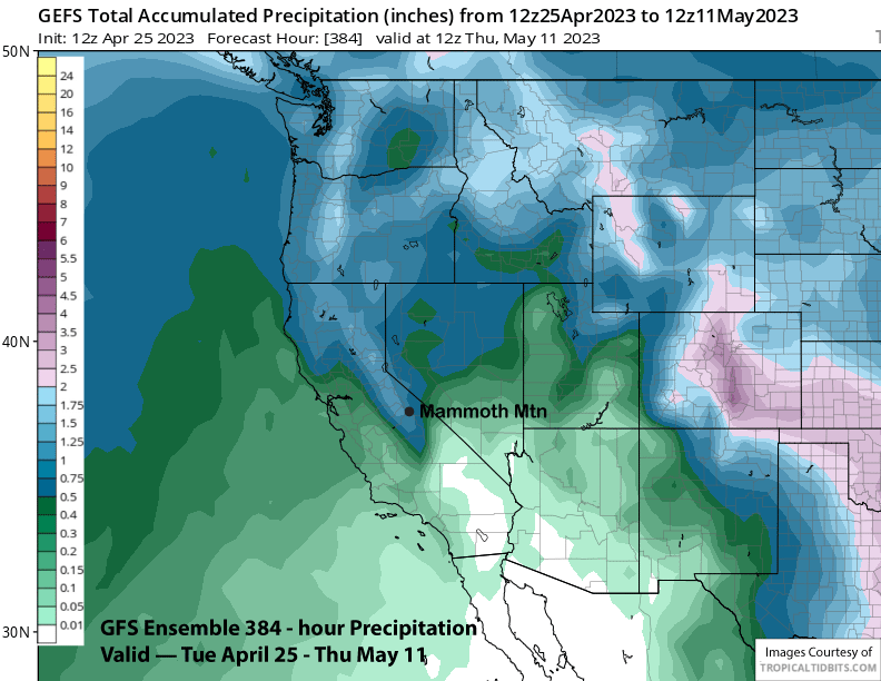
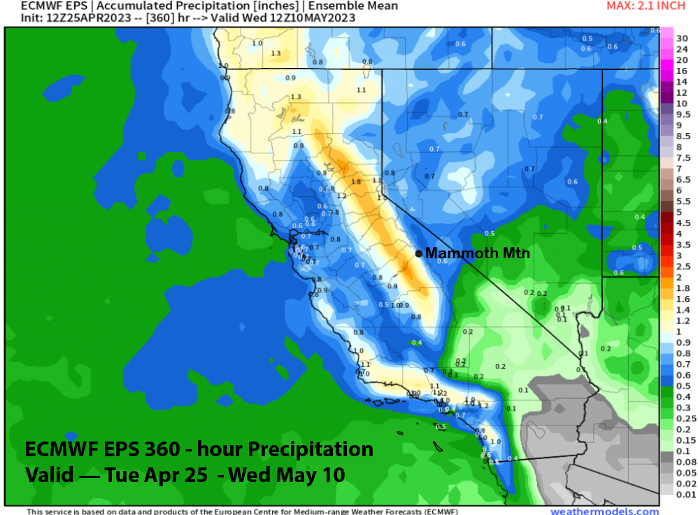
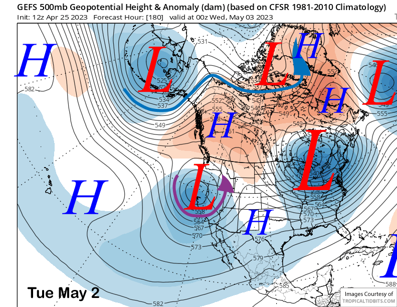
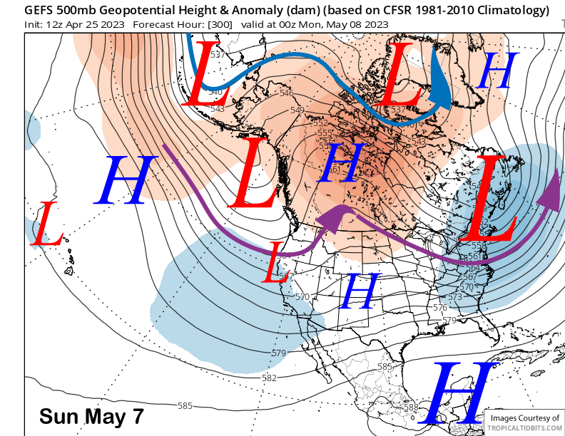
The GFS ensemble (image below) develops a closed upper low over CA by Tuesday next week and keeps is mostly stationary for the rest of next week. The latest ECM deterministic run (two images below) is similar to its ensemble mean with the closed low a bit deeper and farther to the southwest.
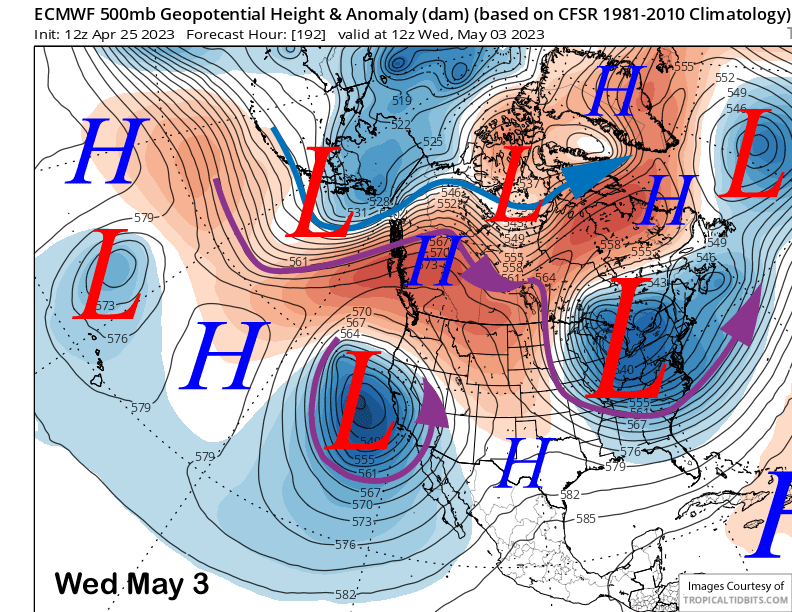
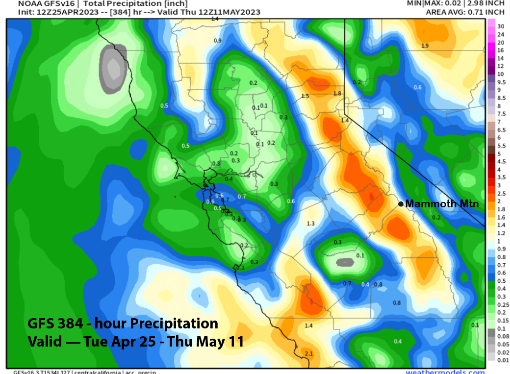
Exactly how deep the low ends up and how much moisture gets entrained into the system are still very questionable. The GFS model is currently wetter (image below) than the ECM (two images below) with the GFS showing enough potential snow water equivalent for powder conditions.
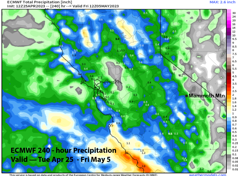
Current forecast follows the ECM mean that is showing mostly light amounts that could add up to low-end powder conditions by the end of the week. Only a few ECM ensembles right now are showing enough liquid for deep powder over six inches.
The longer range fantasy guidance says a weak long-wave trough (GFS ensemble below) will remain in place across the West and CA through the first weekend in May. The ECM EPS is similar, just a little deeper with the longwave trough, and also keeps it in place a little longer as well and into the middle part of the next week.
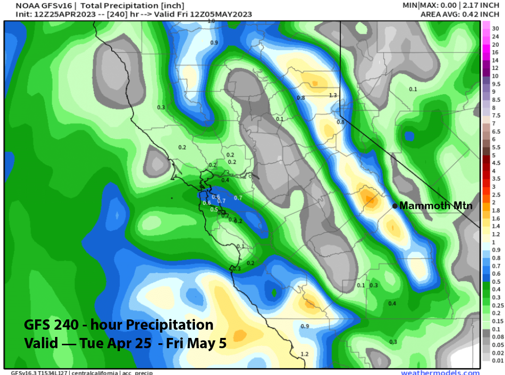
Best case scenario could be the 12z GFS that has about 1.5” for the period (image below) with a few small events. The GFS ensemble mean is showing much less (two images below), but the GFS run matches better with the ECM EPS (three images below). May powder does happen—seven Mays in the snowfall history have received two feet or more. Maybe this year will be number eight. WG