Powder Forecast – Friday, February 23rd, 2024
Ted Schlaepfer CCM —- Mammoth Mountain WeatherGuy
Snowfall forecasts are valid at the Sesame snow course (Main Lodge) for the prior 24 hours, as reported in the 6-7 AM morning snow report.
**Snowfall forecast confidence ranges from very low (1) to very high (5)
Sat 2/24 = 0”
Sun 2/25 = 0”
Mon 2/26 = 0”
Tue 2/27 = 2 – 5” (H20 = 0.25” – 0.50”)**1
Wed 2/28 = 0”
Thu 2/29 = 0”
Fri 3/1 = 2 – 6”
Sat – Mon 3/2 – 3/4 = 28 – 42” **1
February Snowfall: 132”
February Forecast = 132 – 137”
Detailed 4-day Snowfall Forecast:
Sat 2/24– No snowfall expected.
Sun 2/25– No snowfall expected during the day, then a chance for light snow showers overnight. No accumulation is expected.
Mon 2/26 – Light to moderate snowfall probably develops during the day and continues into Monday night before ending by dawn Tuesday. Accumulations 2 – 5” at Main by Tuesday AM, maybe up to 6” up top
Tue 2/27– Slight chance for a morning flurry, otherwise no snowfall expected.
Forecast Summary:
Short Term (Days 1 – 4):
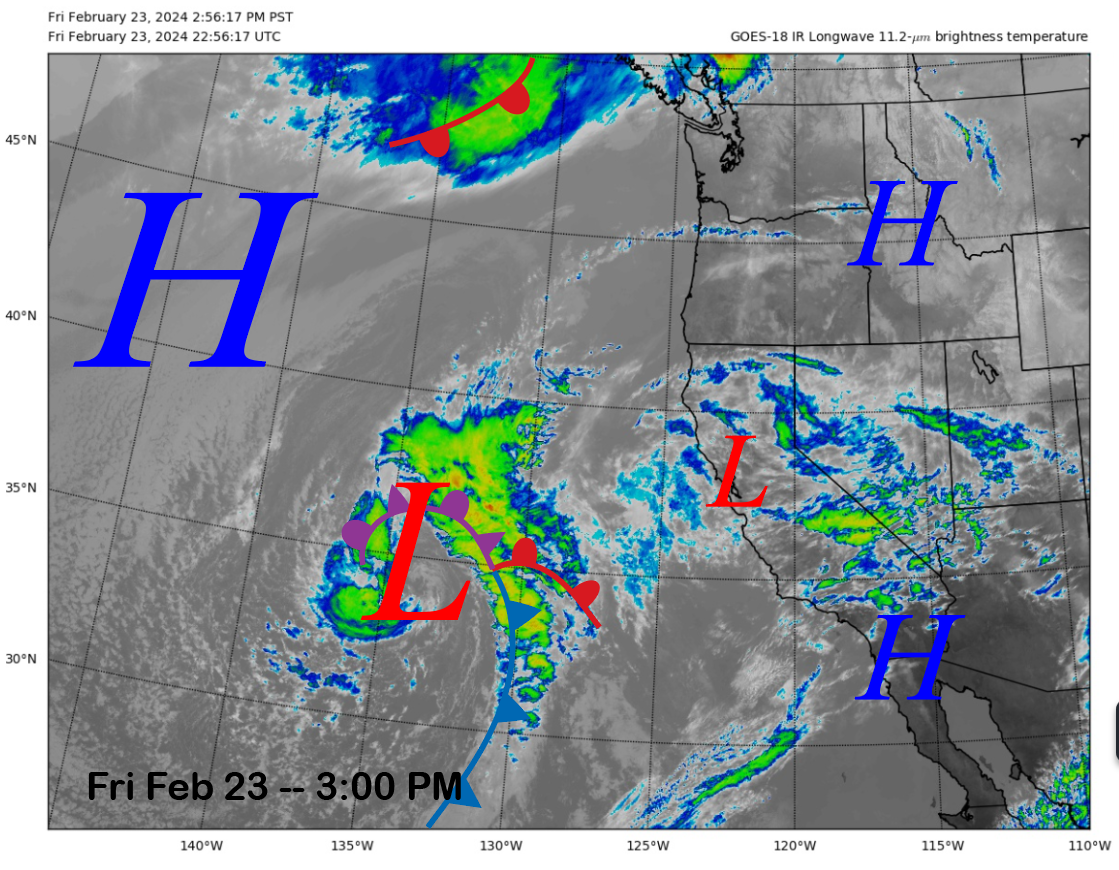
The current infrared satellite image (below) today shows high clouds moving through the state from a passing weak low and another nearly stationary low well off the California coast. The high clouds should move eastward overnight, and high pressure will build into the area tomorrow for fair and warmer temperatures.
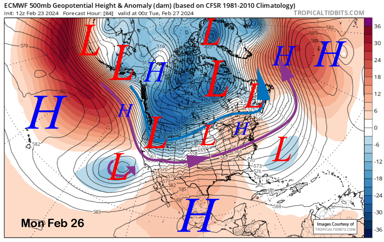
The low-pressure system off the coast will meander toward CA through Sunday before finally moving eastward Monday and then merging by Tuesday with an upper-level short-wave trough forecast to drop into the state on Monday (image below).
The short-wave trough will entrain some moisture from the low, and it should be enough for a round of light to moderate snowfall during the day on Monday and Monday night. The models are still struggling with how the moisture will phase with the short wave and have now backed off on the larger amounts forecast only a few runs ago.
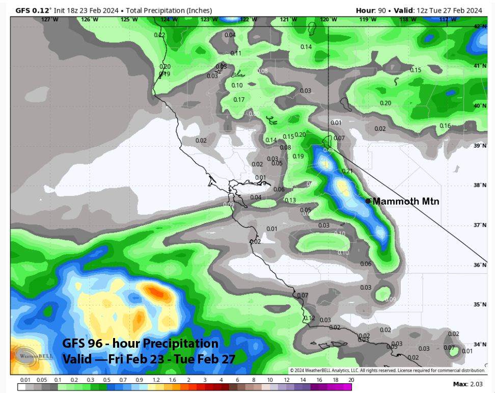
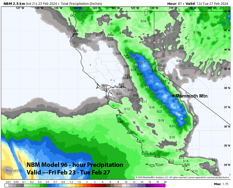
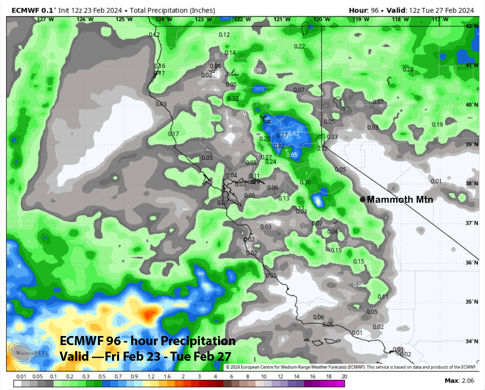
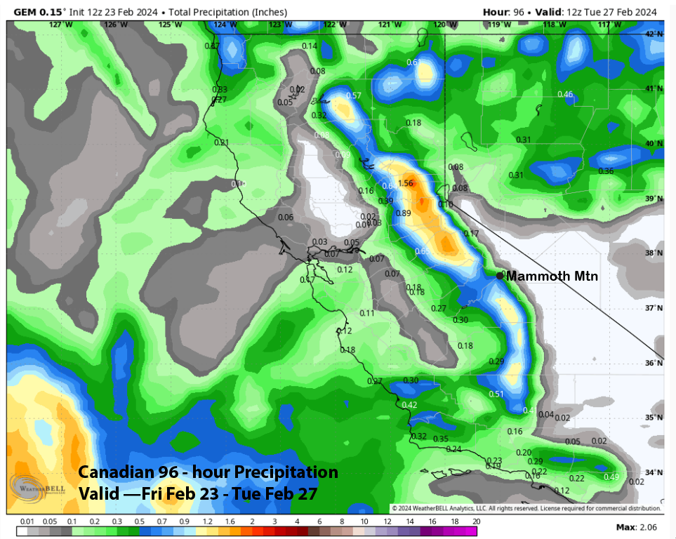
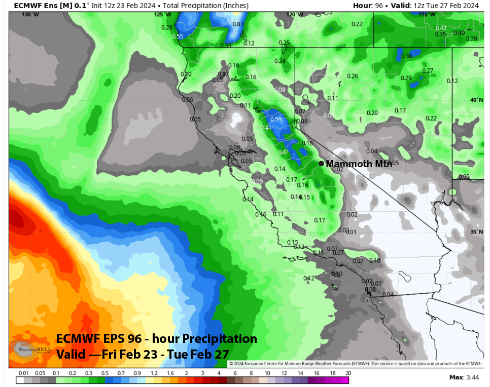
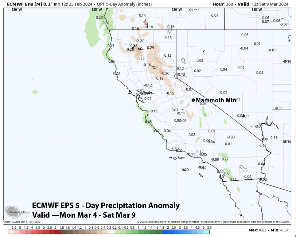
The GFS is still the wettest model (image below) at over half an inch, but that model was showing 3-4” yesterday. The NBM (two images below) is also on the wet side of the guidance with over half an inch while the ECM (three images below) is only showing very light amounts. The Canadian (4 below) model is closer to the GFS at just under half an inch.
The forecast follows the ECM EPS (image below) has about a third of an inch of liquid and a slight lean toward the NBM. Expecting only a few inches of snowfall with an outside chance for up to 5”. Overall, it is a low confidence forecast. Hopefully, enough will fall for some low-end powder turns on Tuesday it should be a cold, crisp, and breezy day.
Long Range (Days 5+):
The longer-range guidance is still fairly bullish about a favorable snowfall pattern by the end of next week and the following weekend. Right now, the models are suggesting a fairly classic Sierra snowstorm with heavy snowfall and, eventually, very low snow levels at the back end of the storm.
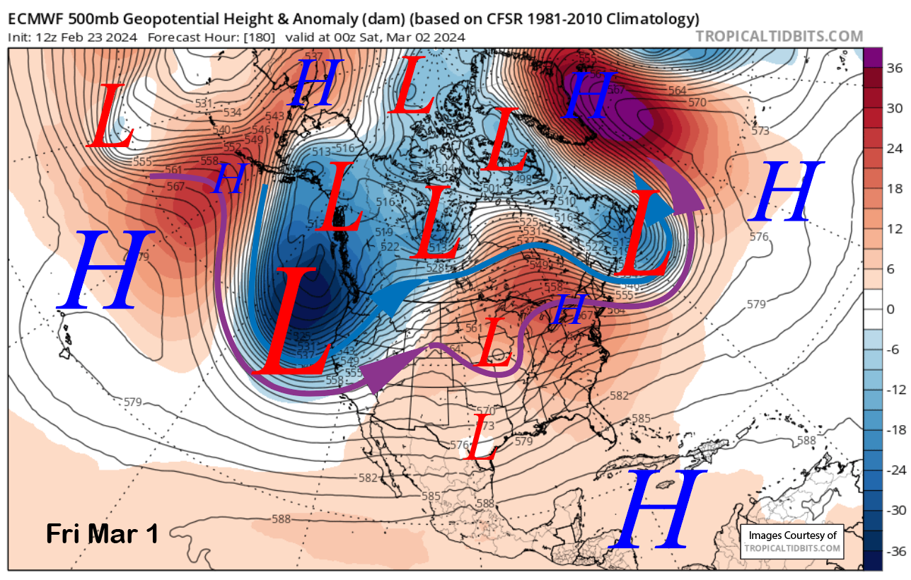
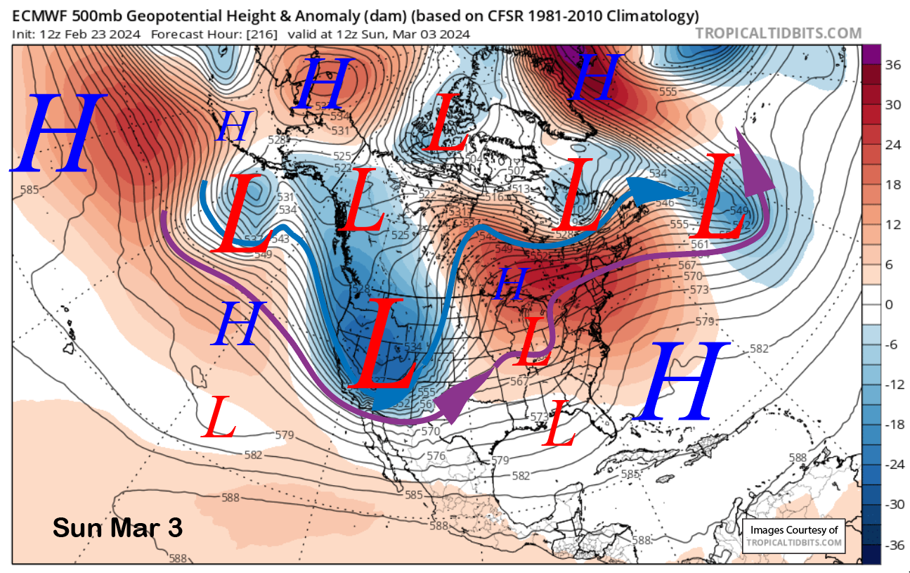
Dry weather should continue on Wednesday and may also continue through the first part of Thursday. The guidance is then in fairly good agreement about a deep upper-level trough moving southward into CA on Friday (image below) before exiting the state on Sunday (two images below).
That would produce a period of heavy snowfall on Friday and Saturday, with lingering snowfall into Sunday. Snow levels would start out around 5500 feet Friday and then may lower to around 4500 feet Saturday during the period of heaviest snowfall. Snow levels could then fall to near 2000 feet by early Sunday as the precipitation is winding down.
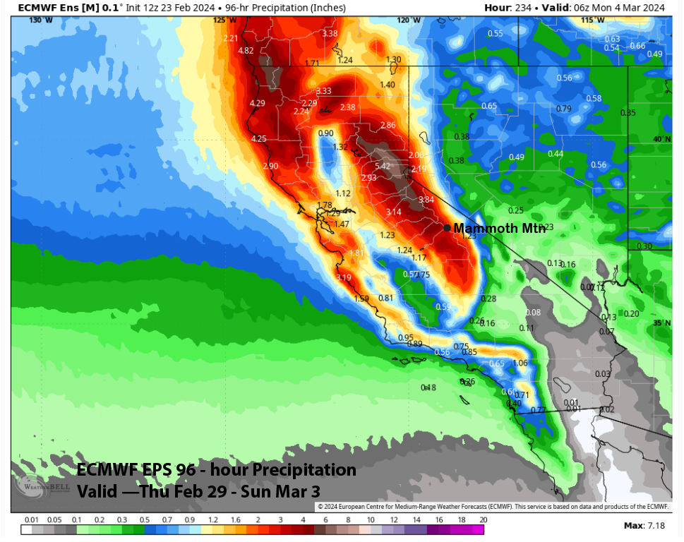
The latest ECMWF EPS (image below) forecast is showing about 3.5” liquid for the event, or 3-4 feet of snowfall at Main, and the 12z deterministic run is similar (cover image). That would be nice, but it is still about a week away, so the forecast will likely change, hopefully in a desirable direction.
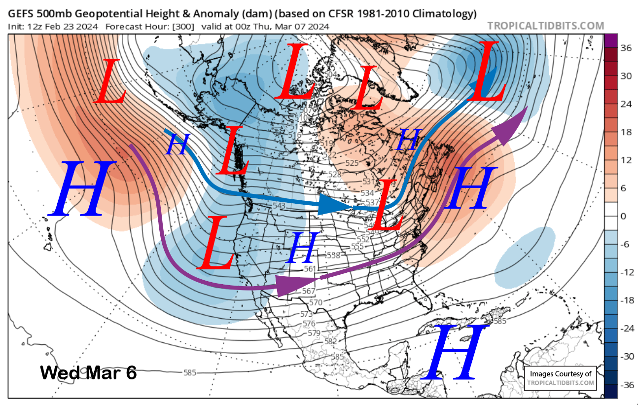
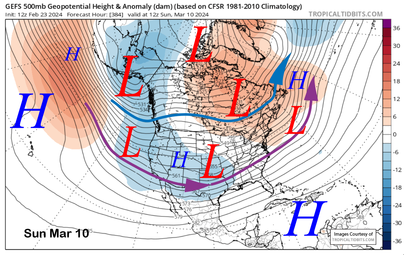
The longer-range fantasy guidance from the GFS ensemble keeps reforms of the longwave trough around the middle part of the next week (image below) and keeps it mostly in place through the next weekend (two images below). That would allow a couple/few storms to continue to move into CA and Mammoth as the jet stream will be positioned well far enough southward. The ECM EPS shows the average precipitation for the period (three images below).
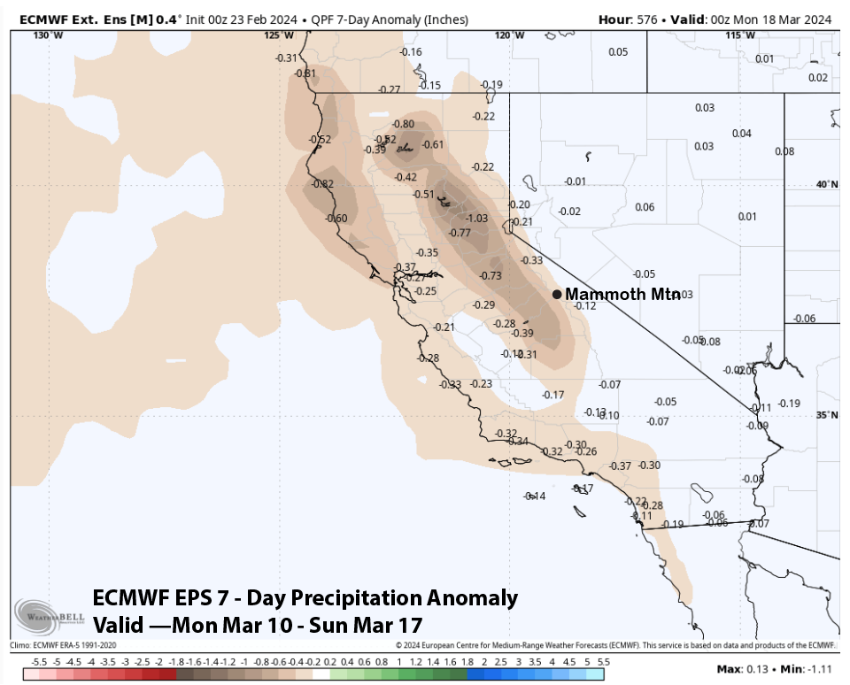
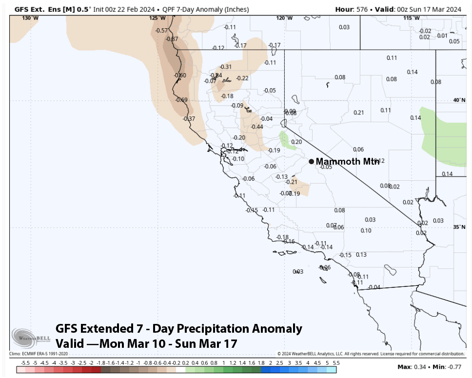
The super long-range guidance suggests that the pattern will turn drier through mid-month. The ECM EPS (image below) is more bullish than the GFS extended and still has average precipitation for the 7-day period (two images below). Regardless, the first part of March is looking fantastic for epic powder days. WG