Mammoth Mountain Powder Forecast – Friday, December 15th, 2023
Ted Schlaepfer CCM —- Mammoth Mountain WeatherGuy
Snowfall forecasts are valid at the Sesame snow course (Main Lodge) for the prior 24 hours, as reported in the 6-7 AM morning snow report.
**Snowfall forecast confidence ranges from very low (1) to very high (5)
Sat 12/16 = 0”
Sun 12/17 = 0”
Mon 12/18 = 0 – 1”
Tue 12/19 = 3 – 5” (H20 = 0.65” – 0.90”)**2
Wed 12/20 = 2 – 4” (H20 = 0.40” – 0.65”)**2
Thu 12/21 = 2 – 6”
Fri 12/22 = 0 – 2”
Sat – Mon 12/23 – 12/25 = 0”
December Snowfall = 3”
December Forecast = 30 – 45”
Detailed 4-day Snowfall Forecast:
Sat 12/17 and Sun 12/18– No snowfall expected on both days.
Mon 12/19– Snowfall likely develops during the day or afternoon (chance for rain during the morning) and continues overnight. Accumulations 3 – 5” by Tuesday AM, 6”+ up top
Tue 12/20– Light to moderate snowfall likely continues at times through Tuesday night. Accumulations 2 – 4” by Wednesday AM, up to 6” up top.
Forecast Summary:
Short Term (Days 1 – 4):
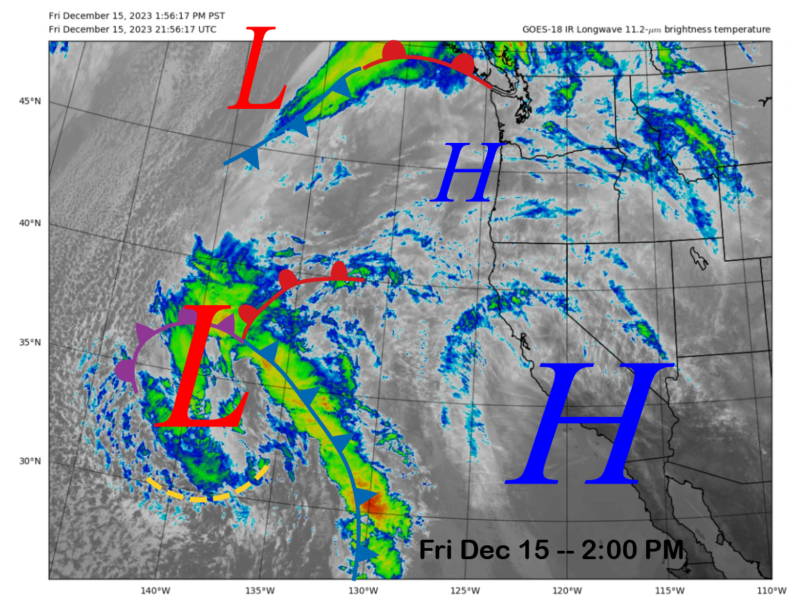
The current infrared satellite image (below) this afternoon shows a dirty high-pressure ridge building into the state as there are lots of high clouds streaming overhead today. A deep low-pressure system is setting up in the eastern Pacific and will slowly move toward the coast over the next few days while weakening.
The ridge should continue to build into the state into early Sunday (image below) before shifting eastward early next week. Temps should get a little warmer and freezing levels will be around 10,000-11,000 feet. Not the greatest set-up for overnight and early morning snow making conditions.

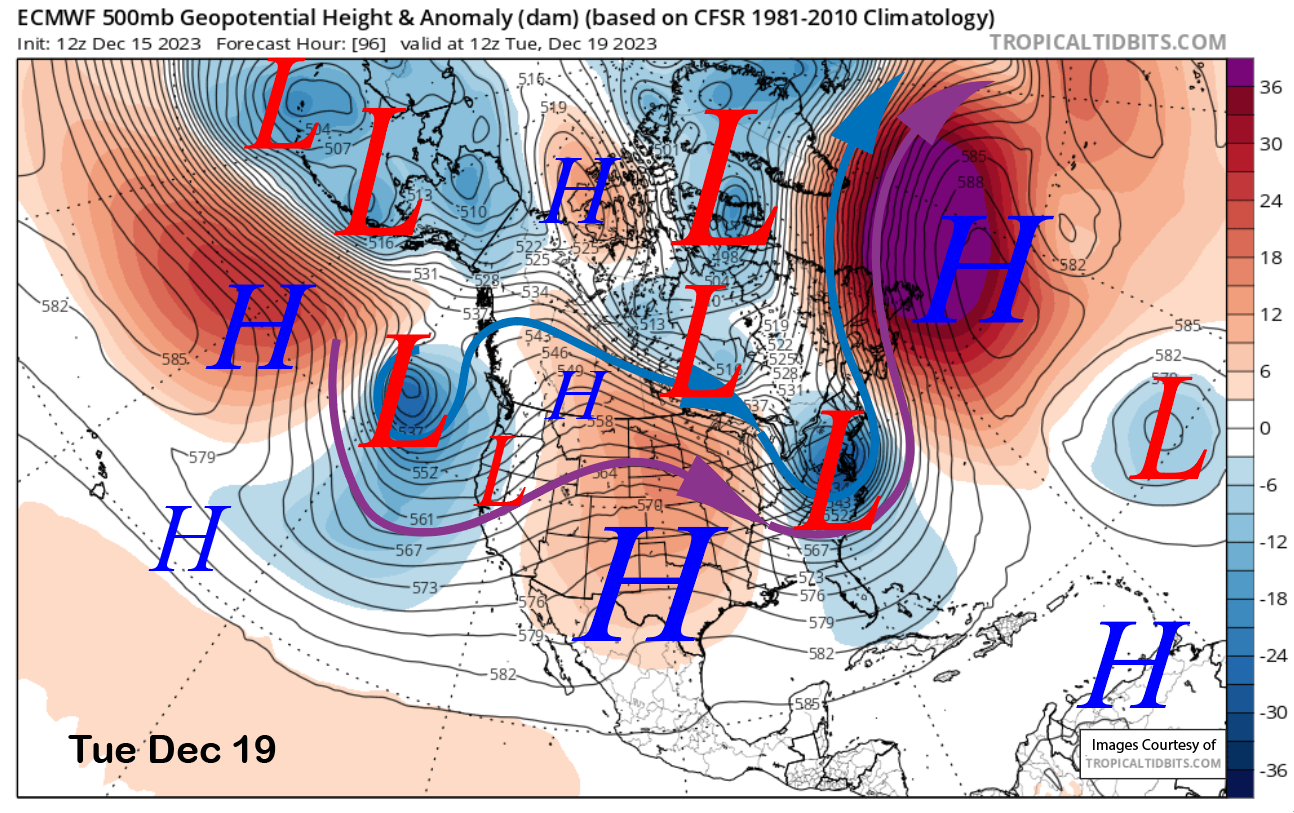
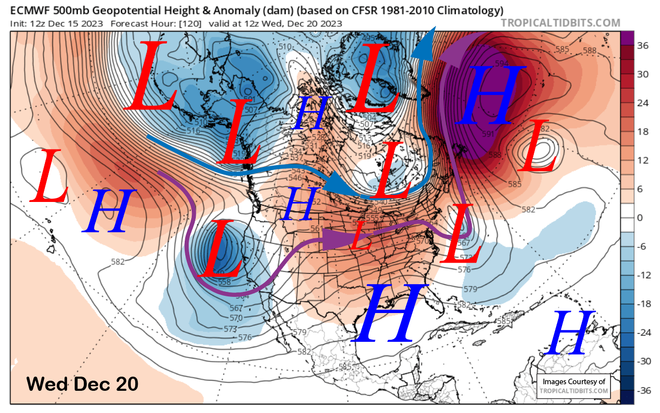
Changes in the pattern are still forecast for early next week, with snowfall likely increasing during the day on Monday and continuing at times through Tuesday when the ECM (image below) and other models move the low-pressure system ashore.
Even in its weakened state, the low will have a good moisture tap (> 1” precipitable water) and will move through the state slowly on both days. It looks like the jet will be just far enough southward for decent precipitation at Mammoth, although most of it will move into NorCal.
It will also be a warm storm with snow levels Monday around 8500-9000 feet before lowering to around 7800-8000 feet on Tuesday. So that means rain at Canyon and Eagle on Monday, with a better chance for snow on Tuesday.
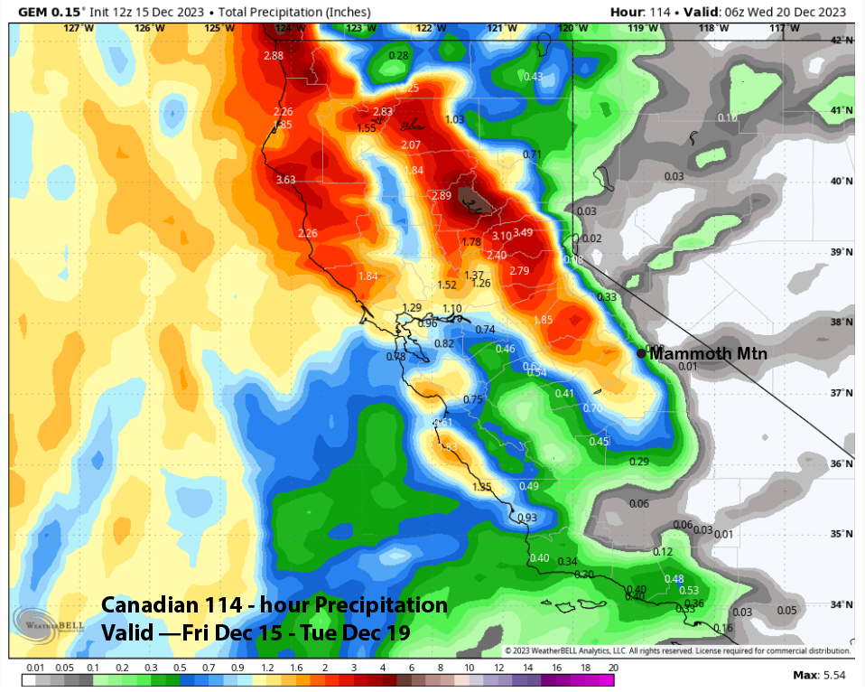
The model QPF does vary a bit with the GFS, the wettest model (image below) at well over an inch, with the ECM (two images below) showing about half that amount and the Canadian (three images below) even less.
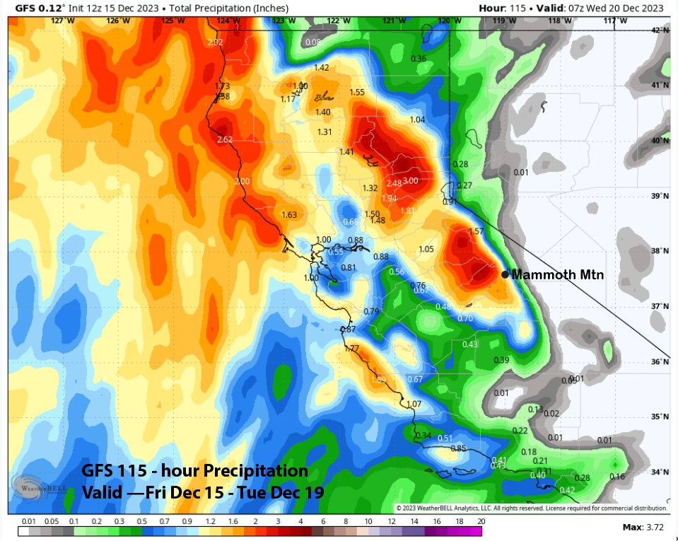
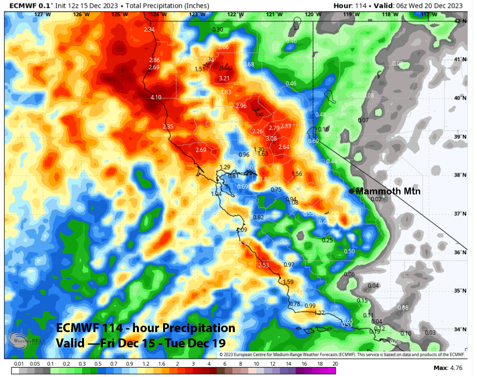
The forecast leans toward the wetter GFS, but with the high snow levels, snow ratios will be low overall, and that will probably keep accumulation from getting too large. Hopefully, Main will see about 6” of wet snow.
Long Range (Days 5+):
The longer-range guidance has not changed too much, with that needed base storm still possible sometime around or just after the Christmas holiday. Looks like the storm next week will not move far enough inland as it moves southward into SoCal for good snowfall at Mammoth.
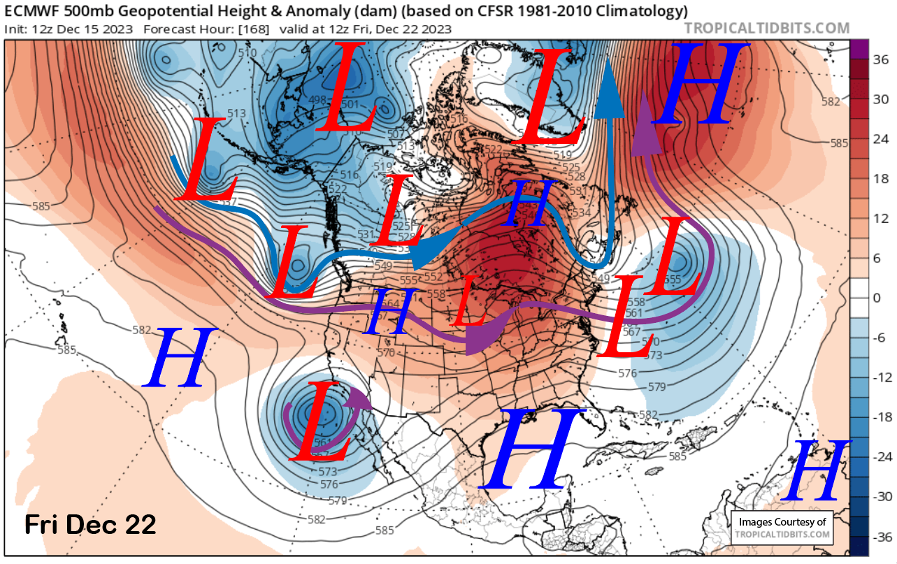
The model moves another upper-low southward toward CA around Wednesday next week. The solutions about the placement and strength of the low vary between the models, with the ECM (images below) taking the low southward along the coast Wednesday through Friday farther offshore versus the GFS. The GFS is right along the coast, while the Canadian is more progressive eastward before moving the low southwestward back into CA.
This costal hugger type storm is a tough call as the GFS ensemble mean (image below) is pretty much in line with the deterministic run, and the ECM ensemble also lined up with its 12z deterministic run. Fifty to 100 miles, either way, will make a big difference in QPF, with the front either getting over the crest into Mammoth with the closer jet placement or remaining west-side with the low farther offshore.
The forecast follows a blend of the ensemble means and only a few inches to maybe six if the GFS is right. Either way, unless the solutions change and the low moves eastward into the Sierra, this will not be the savior storm we need right now to build a base.
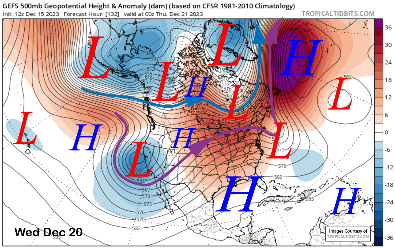
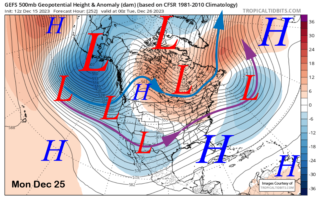
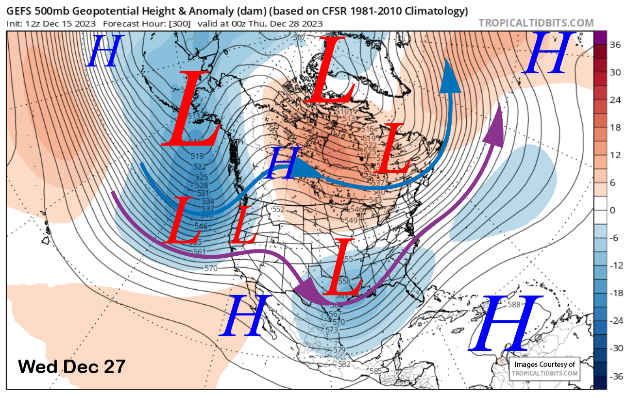
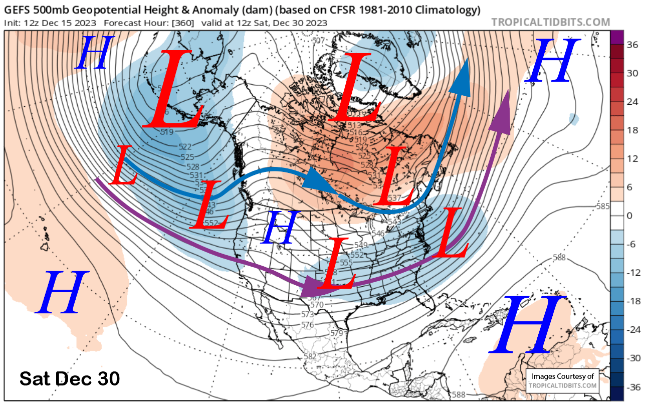
Dry weather may return ahead of the Christmas Holiday, with the longer-range GFS ensemble still favoring a trough to move onto the West Coast late Christmas (image below), followed by a stronger one on the 27th (two images below). It then keeps a weak zonal flow in place for the rest of the week (three images below) for continued chances of a weak storm.
The ECM ensemble is different and less bullish about big storms than the GEFS. It keeps weak ridging in place through Christmas and then never really moves the extension of the zonal jet stream into CA but keeps it offshore for the period. That would suggest any storms moving into CA would weaken upon arrival.
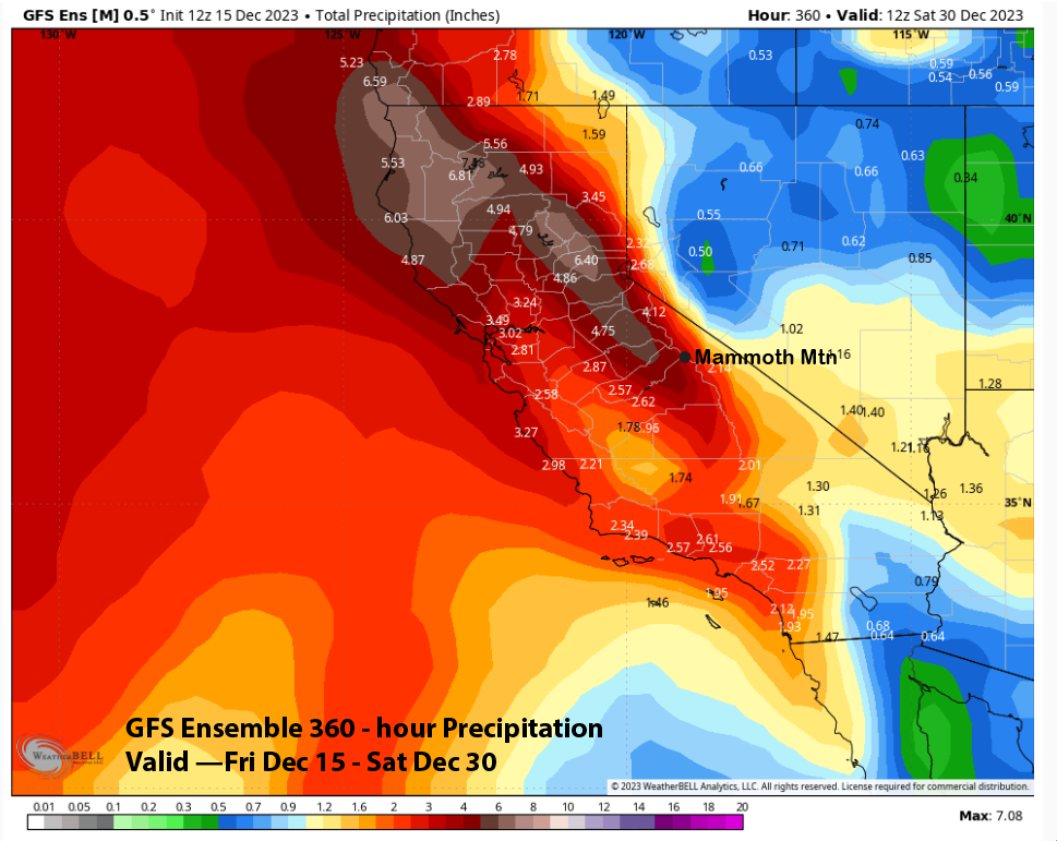
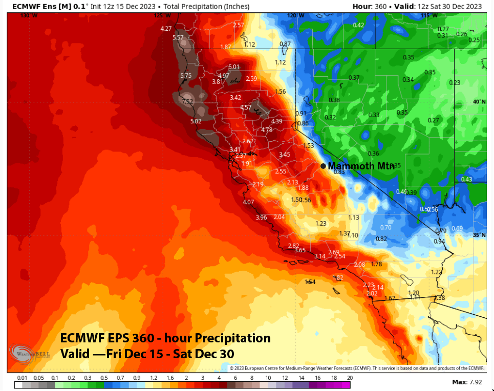
Those differences are exemplified in the QPF output with the GFS ensemble (image below) much wetter at nearly 4” liquid for the 15-day period versus the ECM (two images below) at just over an inch liquid. At this point, we can only hope the GFS is correct, and the storm on the 27th comes through, as it appears to be the best chance for a base storm for the rest of 2023.
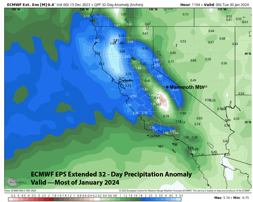
Looking really far out, the latest ECM 45-day forecast favors above-normal precipitation (image below) for Mammoth in January. One thing to note is that the eastern part of CA is also above normal, and that suggests storms with a strong jet stream and spill-over potential, similar to what occurred all last season. At this point, we can only hope. WG