Powder Forecast – Friday, March 15th, 2024
Ted Schlaepfer CCM —- Mammoth Mountain WeatherGuy
No updates next week; the next update is on 3/26
Snowfall forecasts for the prior 24 hours are valid at the Sesame snow course (Main Lodge), as reported in the 6-7 AM morning snow report.
**Snowfall forecast confidence ranges from very low (1) to very high (5)
Sat 3/16 = 0”
Sun 3/17 = 0”
Mon 3/18 = 0”
Tue 3/19 = 0”
Wed 3/20 = 0”
Thu 3/21 = 0 – 1”
Fri 3/22 = 0 – 2”
Sat – Mon 3/23 – 3/25 = 3 – 10”
March Snowfall: 41”
Marc Forecast = 60 – 80”
Detailed 4-day Snowfall Forecast:
Sat 3/16 through Tue 3/19—No snowfall is expected all days except for a slight chance of snow showers Tuesday PM/night. No accumulation is expected.
Forecast Summary:
Short Term (Days 1 – 4):
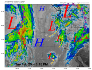
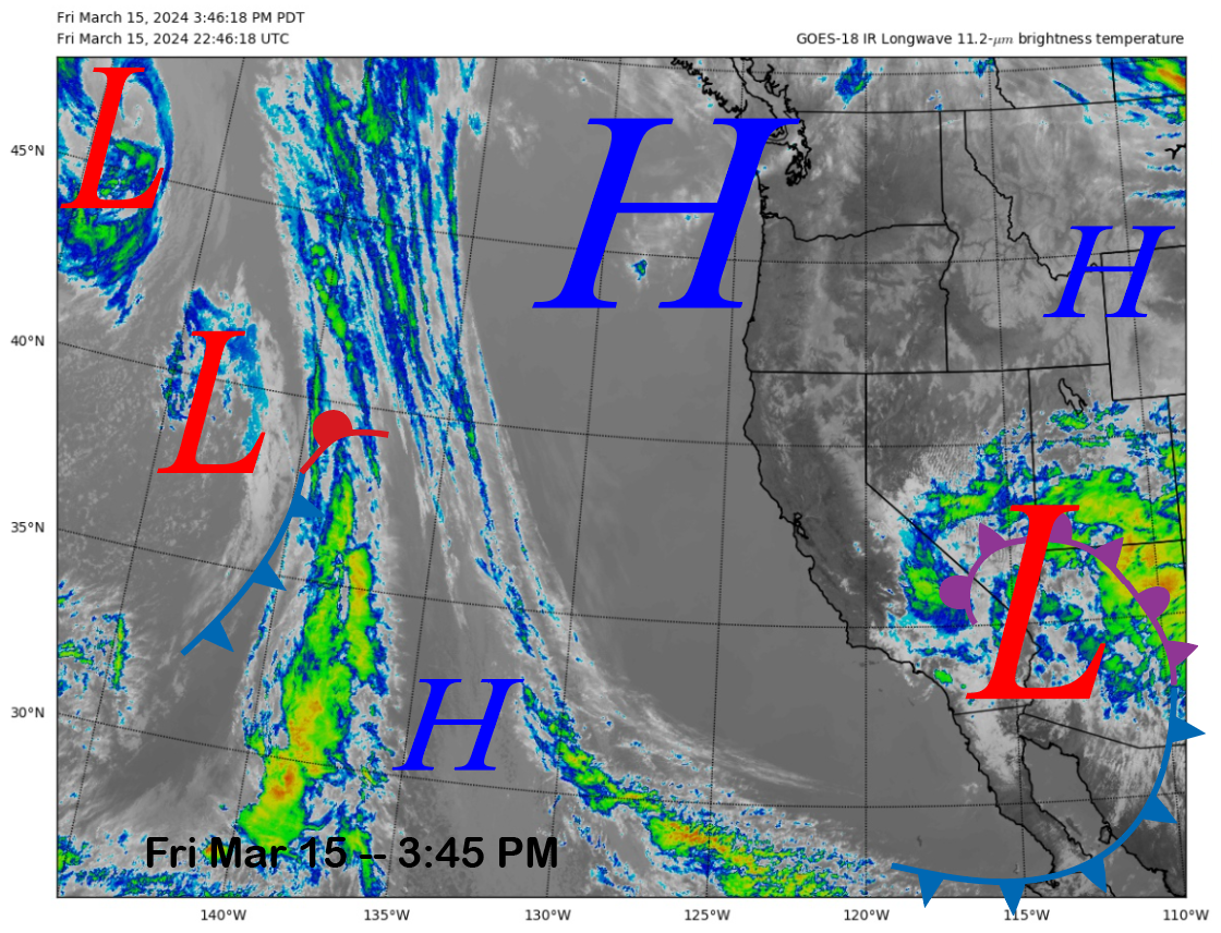
The current infrared satellite image (below) shows a nearly stationary weather system over the CA/Zona border and wrap-around clouds moving into the eastern Sierra. Those clouds produced an inch of snowfall yesterday. High pressure is positioned over the PacNW.
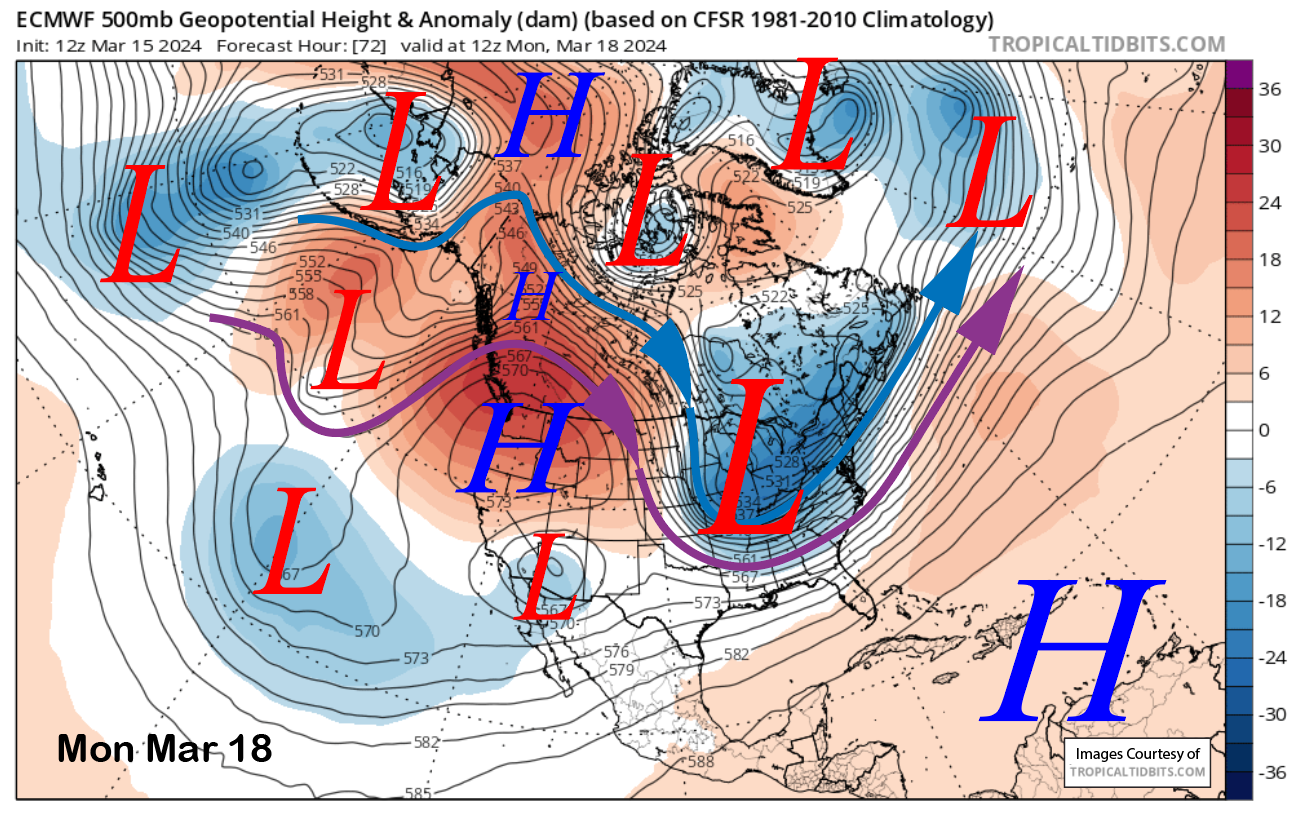
The low-pressure system will basically remain stationary through Monday (image below) while weakening, with the high-pressure ridge over the PacNW moving southward by early next week. That means the gusty winds will subside tonight and tomorrow, followed by lighter winds and warmer temperatures through early next week. Some moisture may sneak into the Sierra around Tuesday afternoon or night with any showers on the east side of the Sierra remaining scattered and light.
Long Range (Days 5+):
The longer-range guidance is now more bullish about snowy weather possibly returning by the end of next week and/or the following weekend. It is also favoring potential stormy weather at times through the end of the month and into early April for more chances of powder days.
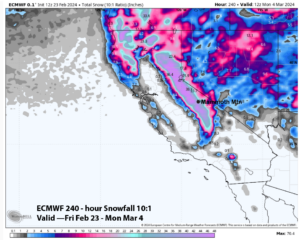
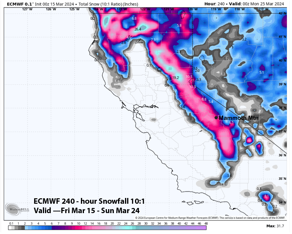
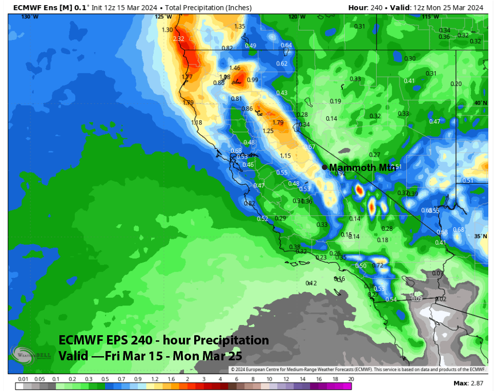
The latest ECM model is still showing a trough passage for the Friday into Saturday (image below) time frame resulting in moderate snowfall amounts. The 12z run was drier versus the 0z run from last night, which showed about a foot of snowfall (two images below).

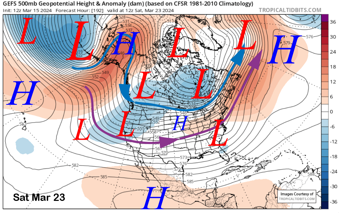
This pattern is well supported by the GFS ensemble mean (image below) and the ECM EPS, which is quite similar. The ECM EPS QPF (two images below) is not that impressive, with around 0.75” liquid for the potential storm, but that would be enough for powder turns. Current timing has Friday as a storm riding day and then snow showers Saturday and Saturday night. That will probably change as it is a week out.
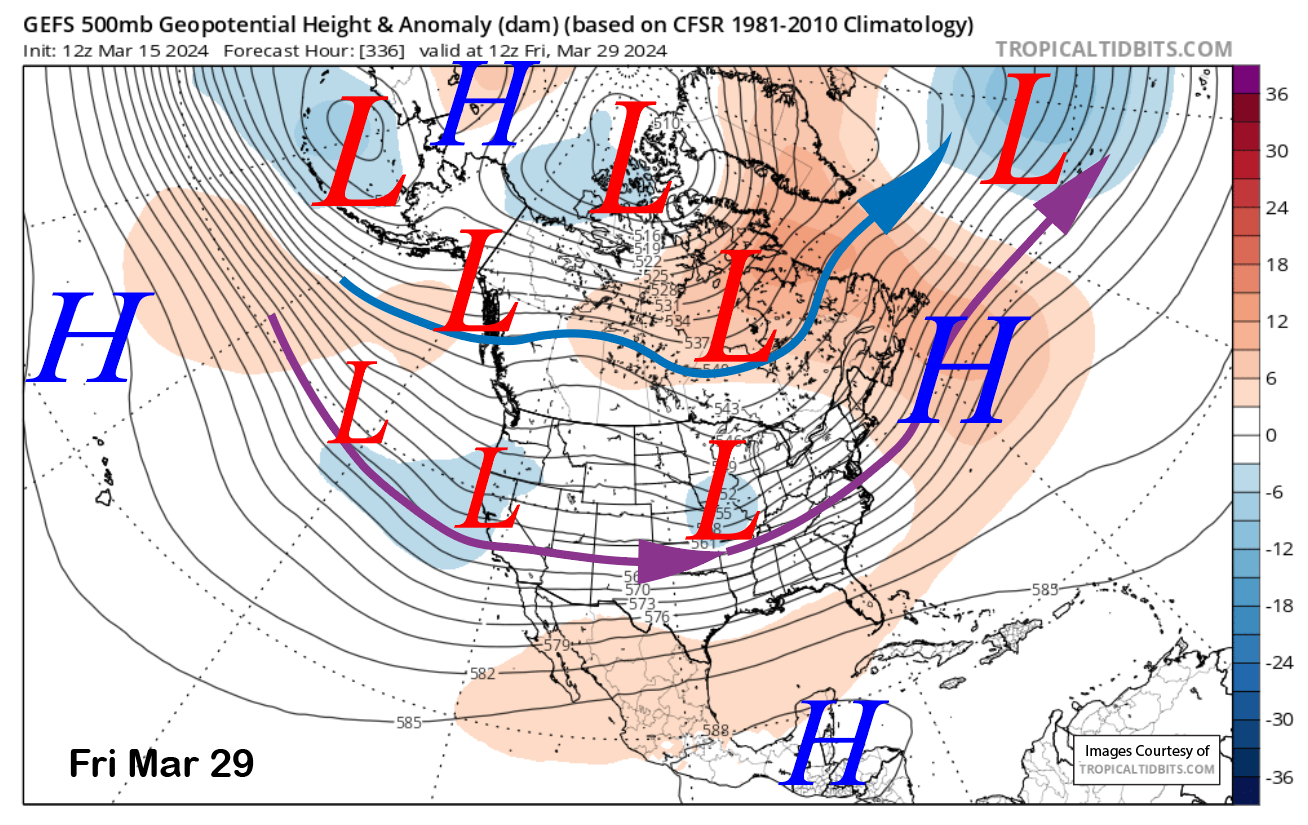
The longer-range guidance is showing a westerly jet stream extension into the West Coast and CA for the following week (images below). That would allow a series of weak to moderate storms to move into CA and Mammoth for rounds of snowfall.

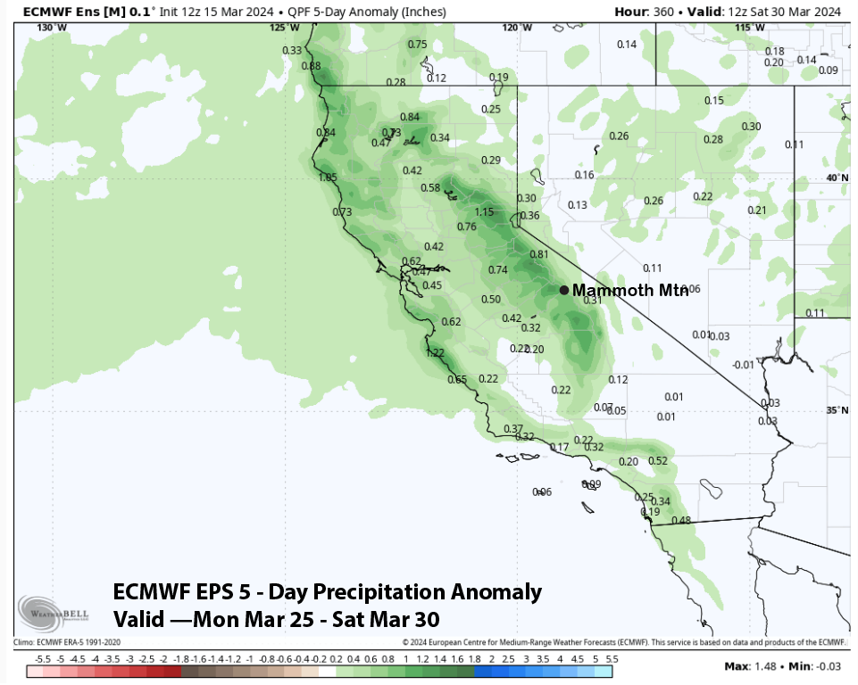
It doesn’t look like major storms right now with the ECM EPS showing above normal precipitation that week (image below), but not any significant anomalies. But it would be enough for storm and powder days in addition to keeping conditions great.
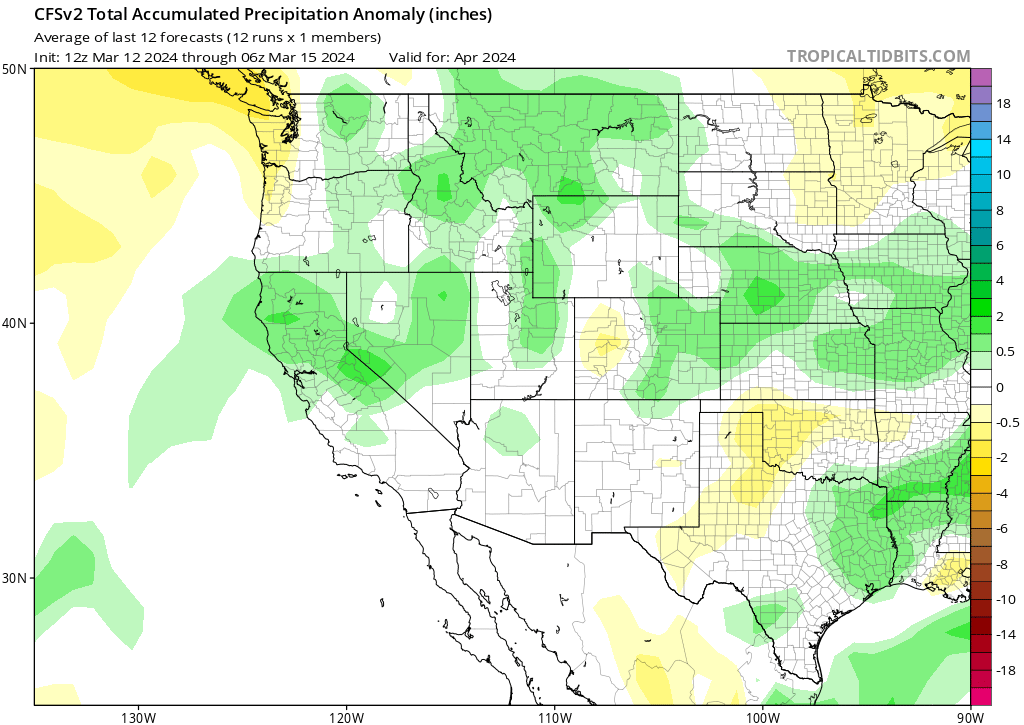
The latest CFS forecast for April is now showing above-normal precipitation for the month. So, hopefully, powder days will continue through when Canyon/Chair 22 closes on April 14th. WG