Powder Forecast –Tuesday, March 26th, 2024
Ted Schlaepfer CCM —- Mammoth Mountain WeatherGuy
Snowfall forecasts are valid at the Sesame snow course (Main Lodge) for the prior 24 hours, as reported in the 6-7 AM morning snow report.
**Snowfall forecast confidence ranges from very low (1) to very high (5)
Wed 3/27 = 0”
Thu 3/28 = 5 – 7” (H20 = 0.50” – 0.65”)**3
Fri 3/29 = 3 – 4” (H20 = 0.30” – 0.40”)**3
Sat 3/30 = 8 – 12” (H20 = 0.75” – 1.25”)**2
Sun 3/31 = 2 – 4” (H20 = 0.25” – 0.40”)**2
Mon 4/1 = 0 – 2”
Tue 4/2 = 0”
Wed – Fri 4/3 – 4/5 = 0 – 3”
March Snowfall: 59”
Marc Forecast = 75 – 90”
Detailed 4-day Snowfall Forecast:
Wed 3/27 – Dry through the mid-afternoon, then snowfall develops late PM or evening and continues overnight. Accumulations 5 – 7” by Thursday AM at Main Lodge, up to 9” up top.
Thu 3/28 – Moderate snowfall during the morning tapers off during the afternoon/evening and end overnight. Accumulations 3 – 4” by Friday AM at Main Lodge, up to 6” up top.
Fri 3/29 – Snowfall develops during the day and continues overnight, when it may be heavy at times. Accumulations 8 – 12” by Saturday AM at Main Lodge, 14”+ up top.
Sat 3/30 – Snowfall during the morning changes to snow showers during the day, with snow showers continuing overnight. Accumulations 2 – 4” by Sunday AM at Main Lodge, 6”+ up top.
Forecast Summary:
Short Term (Days 1 – 4):
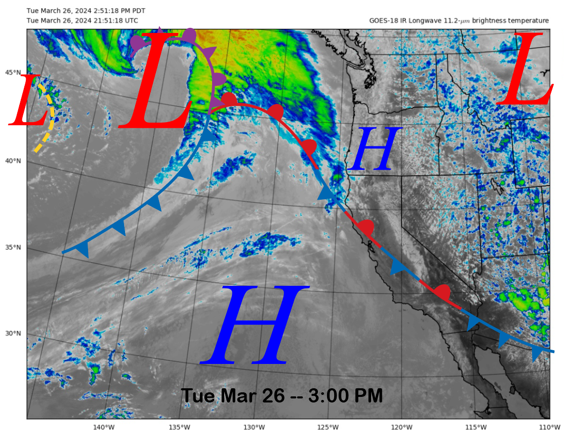
Today’s current infrared satellite image (below) shows a stationary front over CA connected to the next upstream weather system now entering the eastern Pacific. High pressure will briefly build over Mammoth tonight and into early tomorrow before the cold front associated with the storm moves into Mammoth tomorrow night.
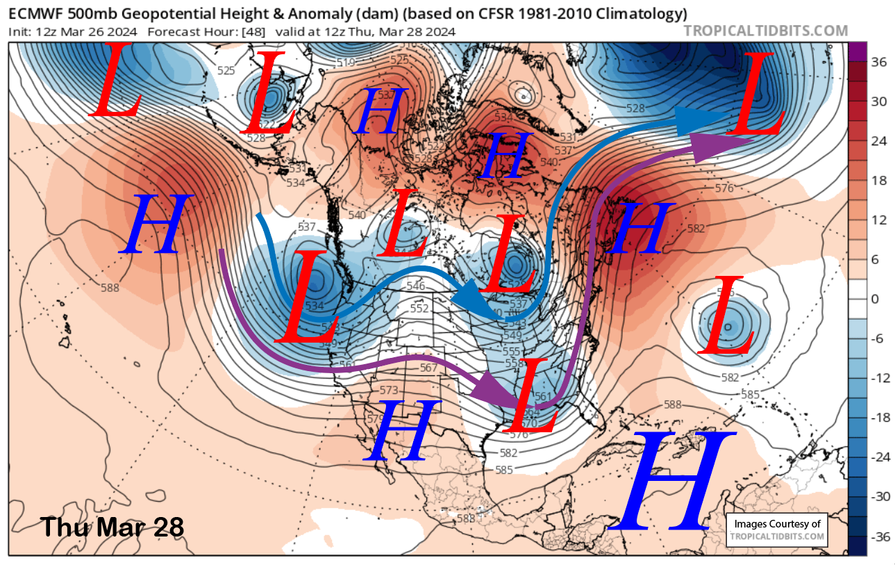
The ECM model moves the trough axis through the Sierra Thursday late morning (image below) and the snowfall should taper off by the afternoon before briefly ending overnight into Friday. The heaviest period of snowfall should be just before the lifts open for the day with storm riding all morning.
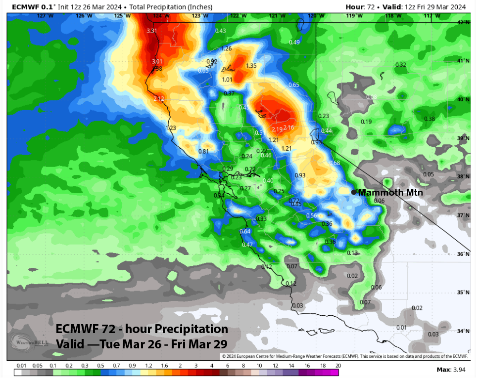
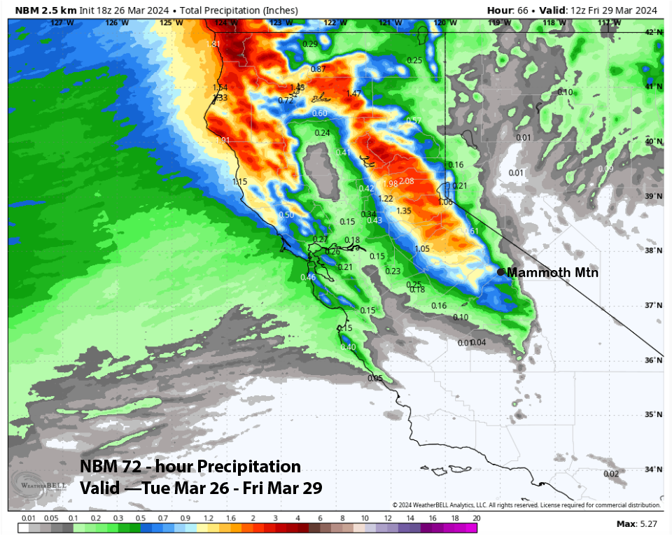
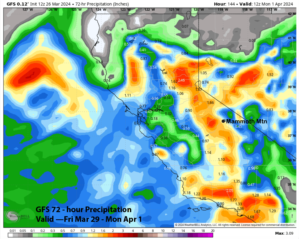
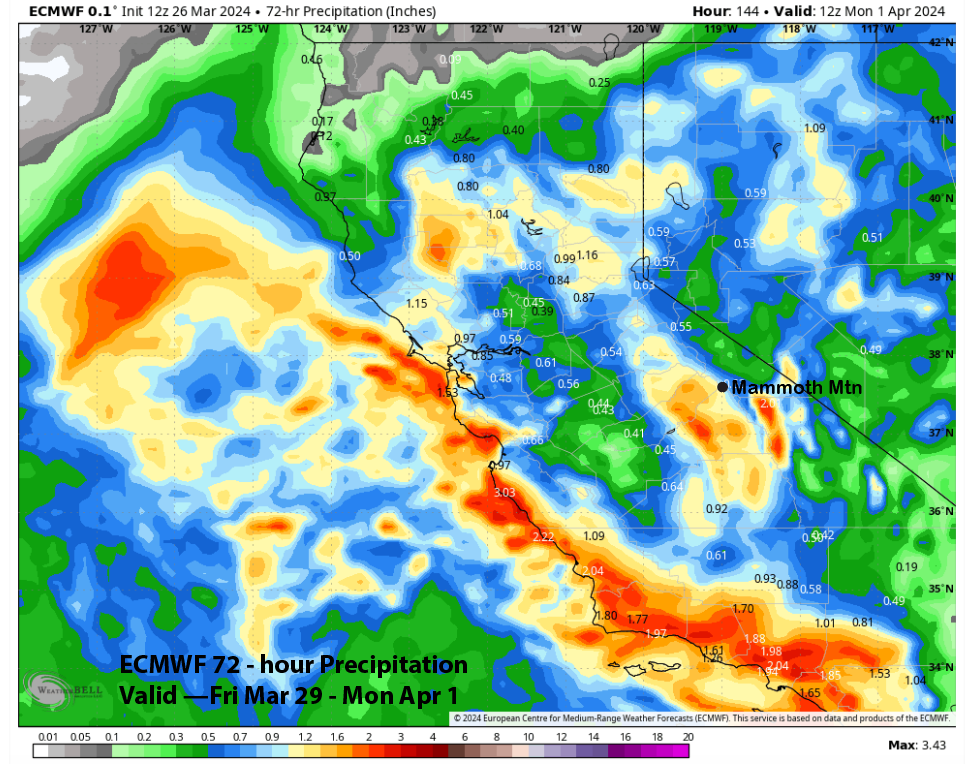
QPF from the models is mostly aligned with the GFS model, which is the wettest at just under an inch (image below), with the ECM showing only slightly less (two images below). The National Blend of Models (three images below) is also quite close, with about 0.80” for Mammoth.
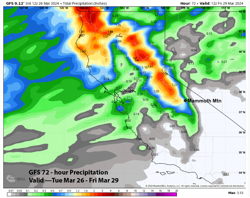
The forecast is calling for at least six inches of snowfall at Main and probably closer to 10” by the time the storm is finished Thursday night. The top should see at least a foot and likely a bit more, especially in the powder fields.
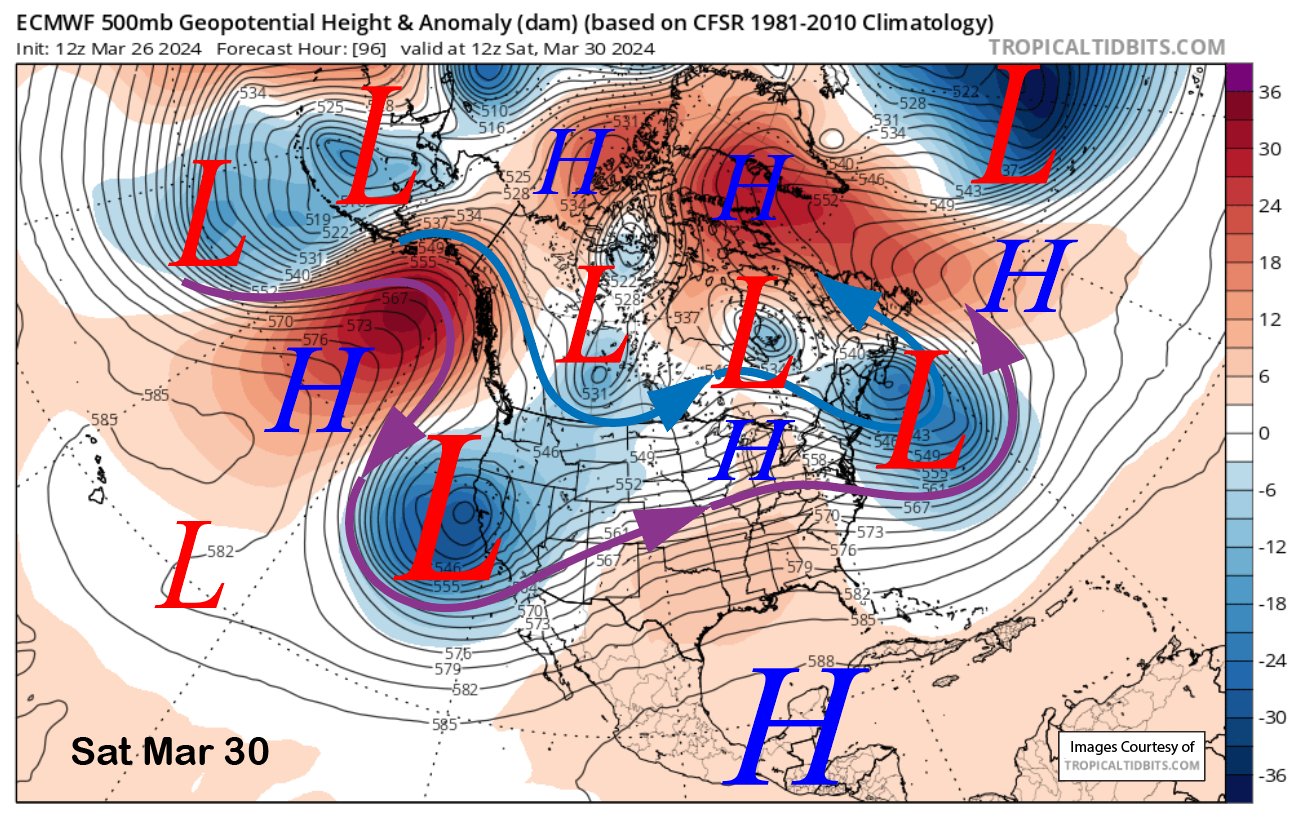
The break from snowfall will be brief, with the next storm moving into the area on Friday and into the weekend (image below). The cold front will move into Mammoth during the day Friday when snowfall is expected to develop and peak overnight into Saturday. Snow showers will then continue through Sunday with a slight chance into Monday.
Model QPF is slightly larger than the previous storm, with most guidance showing over an inch of liquid. Once again, the GFS model is the wettest (image below), with almost an inch and a half, and the ECM model shows about an inch (two images below). Unfortunately, the models all backed off from large amounts forecast from previous runs.
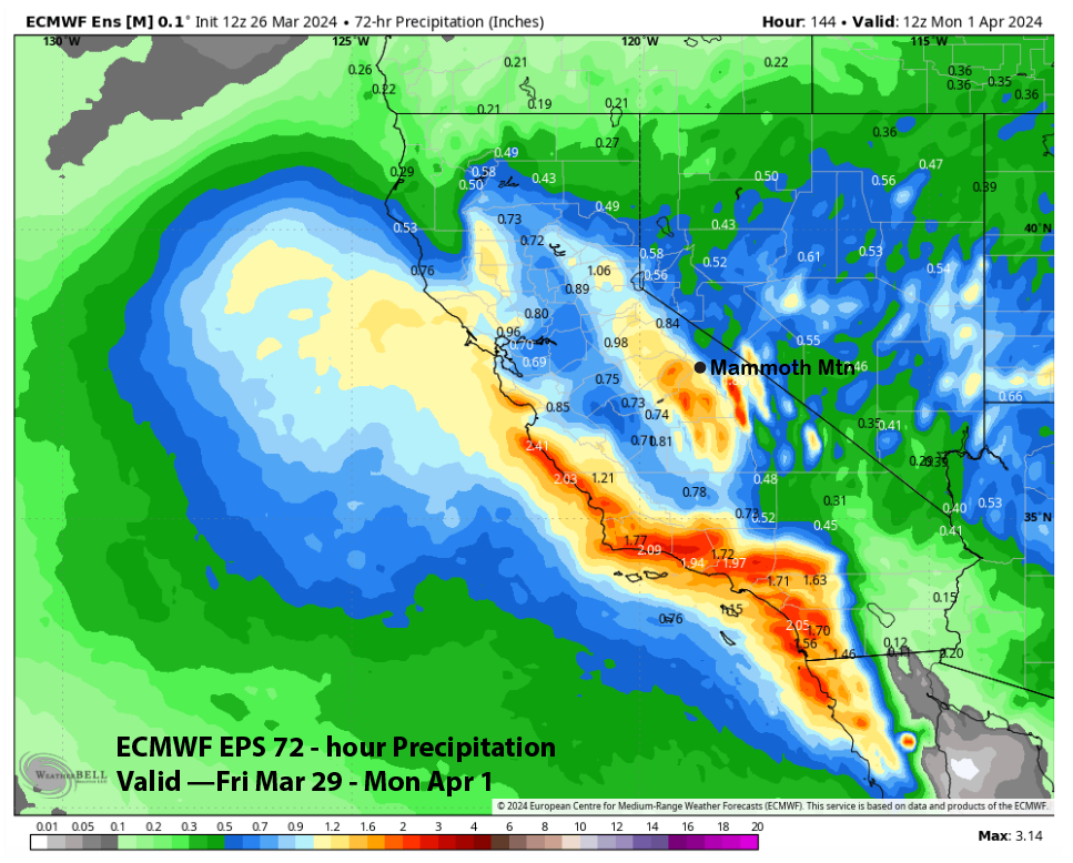
The forecast leans closer to the GFS run, with the ECM EPS favoring liquid amounts over an inch (image below). We’re expecting about a foot at Main for the event with 18”+ up top. Snow levels will be about 5000 feet, so the snowfall should be on the drier side but not super dry. Most of the snow will fall by Saturday morning, just like last weekend.
Long Range (Days 5+):
The longer-range guidance favors the chance for storms to return by the end of next week and the following weekend after a dry period Monday through Wednesday next week. More typical spring weather may then be in the cards heading through mid-month, with only occasional chances for weak storms.
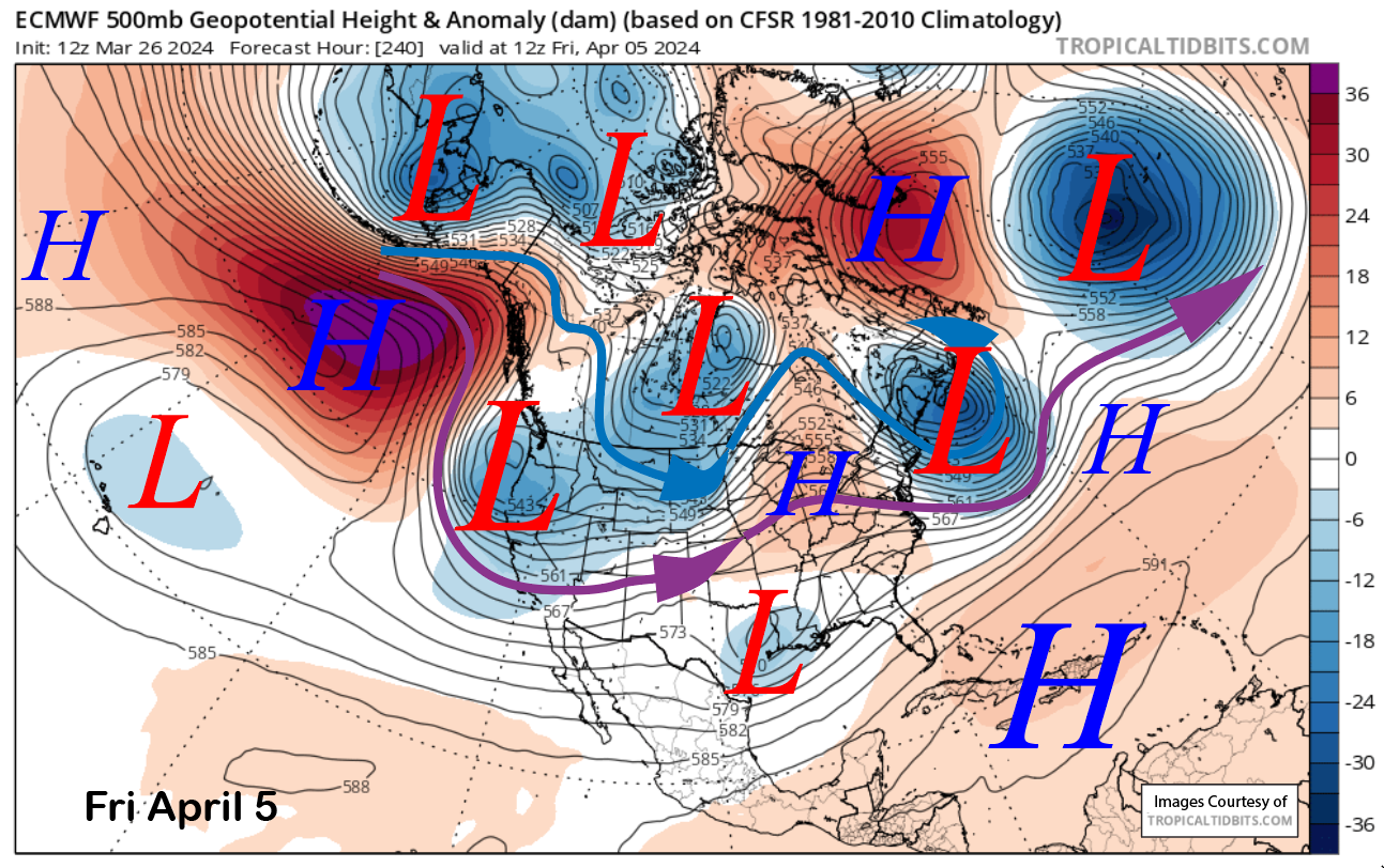
The latest ECM model (image below) moves a trough southward into CA by the end of next week. This solution is fairly well supported by the GFS ensemble mean (two images below), which has a longwave trough established into CA by that weekend, when a couple of shortwaves may move through Mammoth.
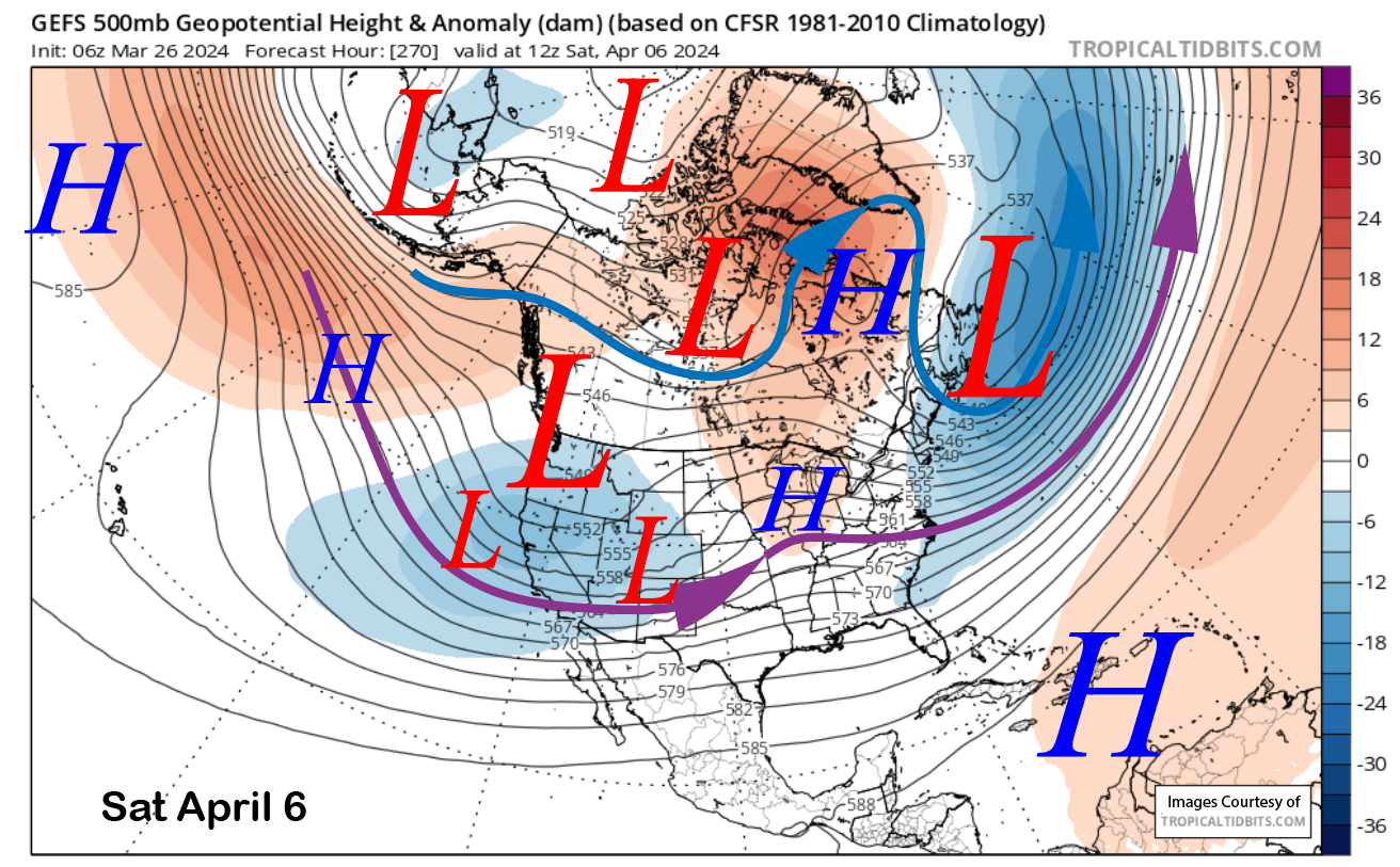
It does not look like a big storm system cycle right now, with the ECM EPS showing only light amounts of liquid (image below) and only enough for low-end powder conditions at times. It is a ways out, so the forecast could certainly change to become more favorable. It is also April, and that is when precipitation starts to taper off for the season.
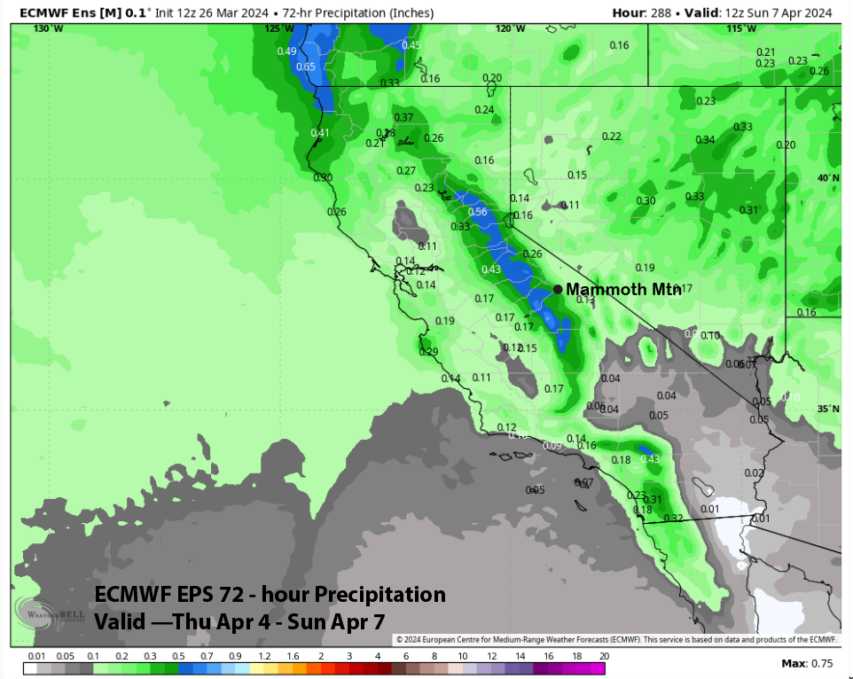
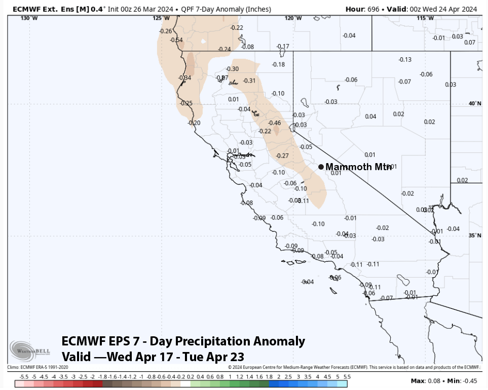
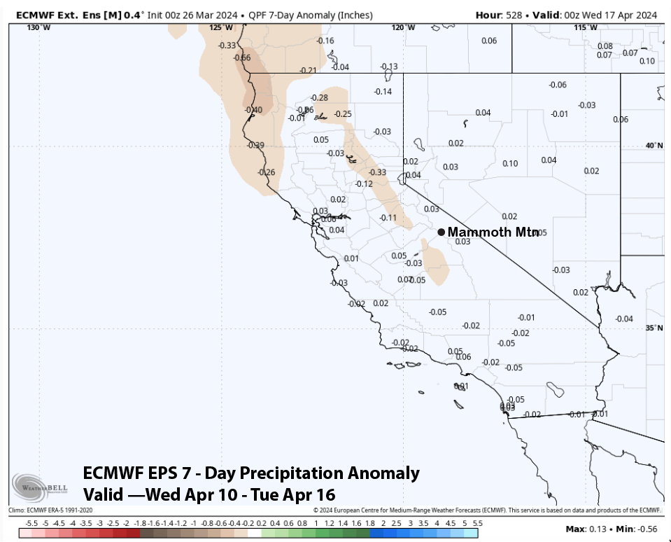
The super long range fantasy guidance keeps a zonal flow into NorCal/West Coast heading into mid-month (image below), but has the jet stream too far northward for any big storms to hit Mammoth. ECM EPS 7-day precipitation anomaly forecast (two images below) has average precipitation for Mammoth mid-month. That isn’t much, though, as mid-April weekly averages are only a handful of inches of snowfall.
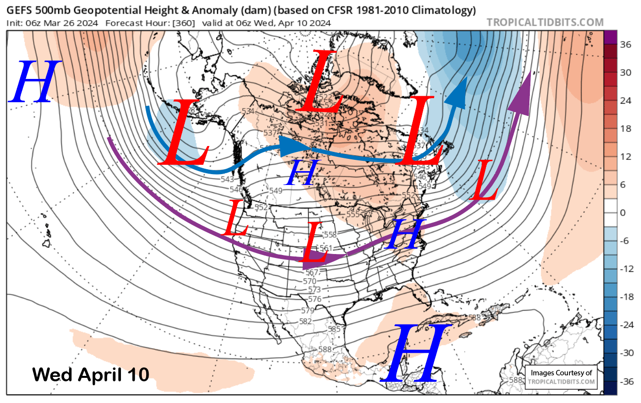
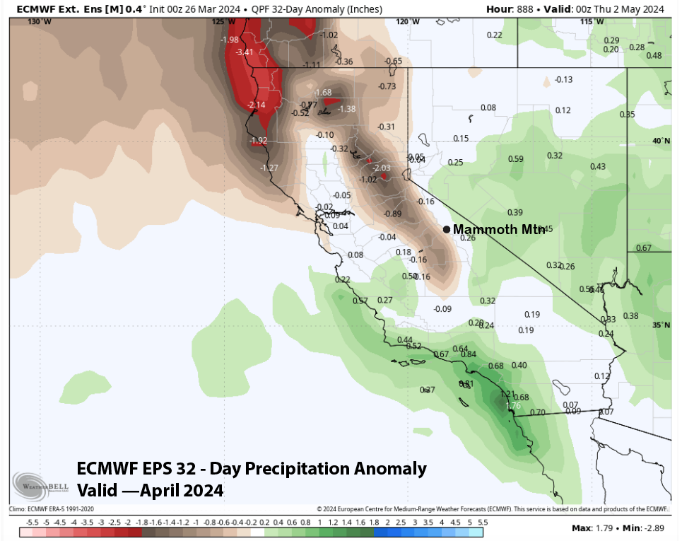
The same trend is forecast for the next week (image below), and the forecast for the entire month is slightly drier (two images below). I always consider April powder days as a bonus, so I would advise you to get them while you can before spring kicks into full gear. WG