Powder Forecast – Tuesday, February 13th, 2024
Ted Schlaepfer CCM —- Mammoth Mountain WeatherGuy
Snowfall forecasts are valid at the Sesame snow course (Main Lodge) for the prior 24 hours as reported in the 6-7 AM morning snow report.
**Snowfall forecast confidence ranges from very low (1) to very high (5)
Wed 2/14 = 0”
Thu 2/15 = 6 – 8” (H20 = 0.60” – 0.75”)**3
Fri 2/16 = 0”
Sat 2/17 = 0”
Sun 2/18 = 8 – 10” (H20 = 0.75” – 1.00”)**2
Mon 2/19 = 3 – 6”
Tue 2/20 = 12 – 20”
Wed – Fri 2/21 – 2/23 = 6 – 12”
February Snowfall = 88”
February Forecast = 120 – 150”
Detailed 4-day Snowfall Forecast:
Wed 2/14 – Dry through midday then snowfall develops late PM or evening and continues overnight before ending around dawn. Accumulations 6 – 8” at Main, 8”+ up top by Thursday AM.
Thu 2/15 and Fri 2/16– Other than a chance for a morning flurry Thursday, no snowfall is expected on both days.
Sat 2/17 – Dry through midday then snowfall develops late PM or evening and continues overnight. Accumulations 8 – 10” at Main, 12”+ up top by Sunday AM
Forecast Summary:
Short Term (Days 1 – 4):
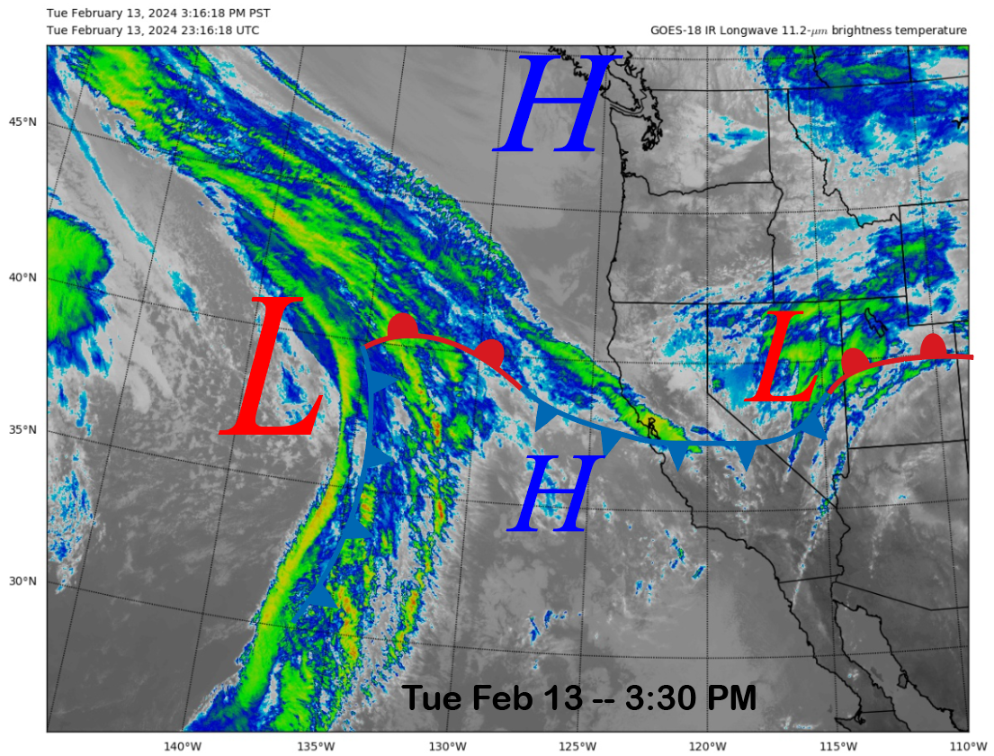
The current infrared satellite image (below) today shows a weather system east of CA in Nevada and an approaching storm system in the eastern Pacific. The storm off the coast will be the one that produces the next round of snowfall tomorrow night.
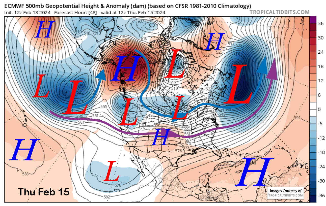
The models move the trough through the state by early Thursday (image below) and that is when the snowfall is expected to stop after peaking overnight. Light snow should start Wednesday late PM and then become moderate to heavy at times overnight.
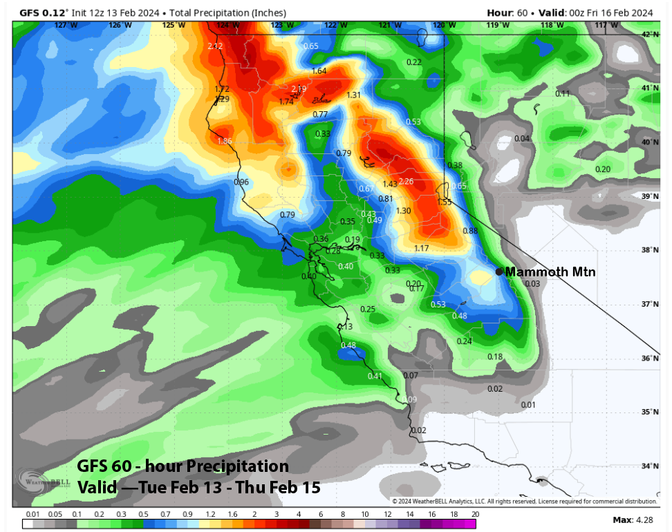
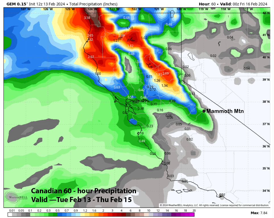
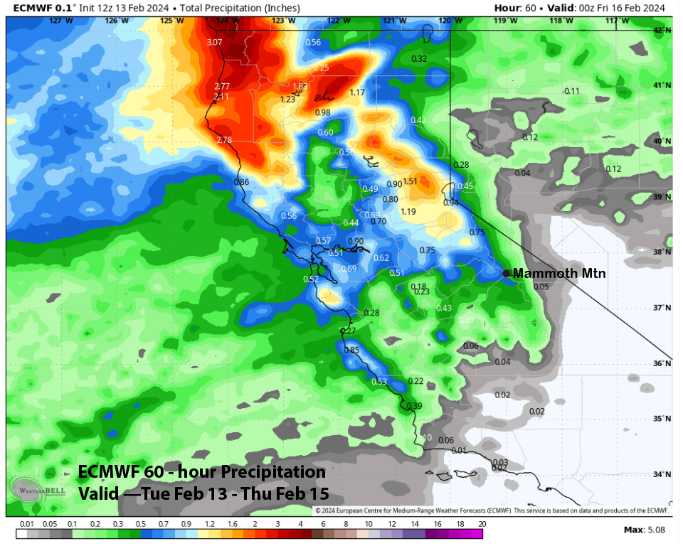
The model QPF still shows notable differences with the GFS model the wettest (image below) at over 0.75” while the Canadian is the driest at about a third of an inch (two images below). The ECM model (three images below) is in between the two at about half an inch.
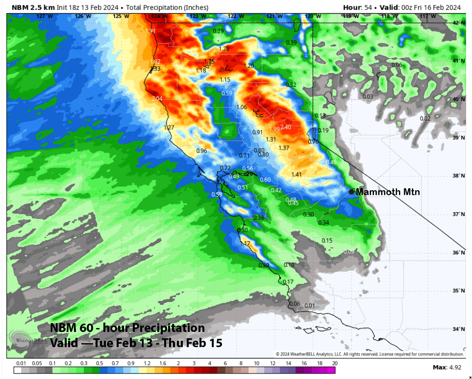
The ECM EPS is similar to the latest 12Z ECM run above while the National Blend of Models (NBM) is slightly higher at about 0.60” (image below). Forecast follows a blend of the NBM and GFS models with about 6-8” of snowfall at Main and up to 9” up top. Snow levels will be around 6000 feet, so it won’t be a super dry type of powder, but certainly enough for powder turns.
The rest of Thursday and Friday will be dry days with clouds increasing again Saturday out ahead of the next storm. Models move the storm into Mammoth on Saturday late PM/evening again with most of the snowfall occurring overnight ahead of the trough passage early Sunday (image below).
The precipitation forecast from the models suggests most of the rain/snow will fall across NorCal with the storm. The 12z run of the ECM has a QPF around 0.85” (image below) which is slightly higher versus the ECM EPS or ensemble (two images below). The system has a decent moisture tap and the forecast leans a bit wetter versus the ECM with a good shot at 8-10” at Main and about a foot up top. Another powder day on Sunday that will dry out after some morning snow showers.
Long Range (Days 5+):
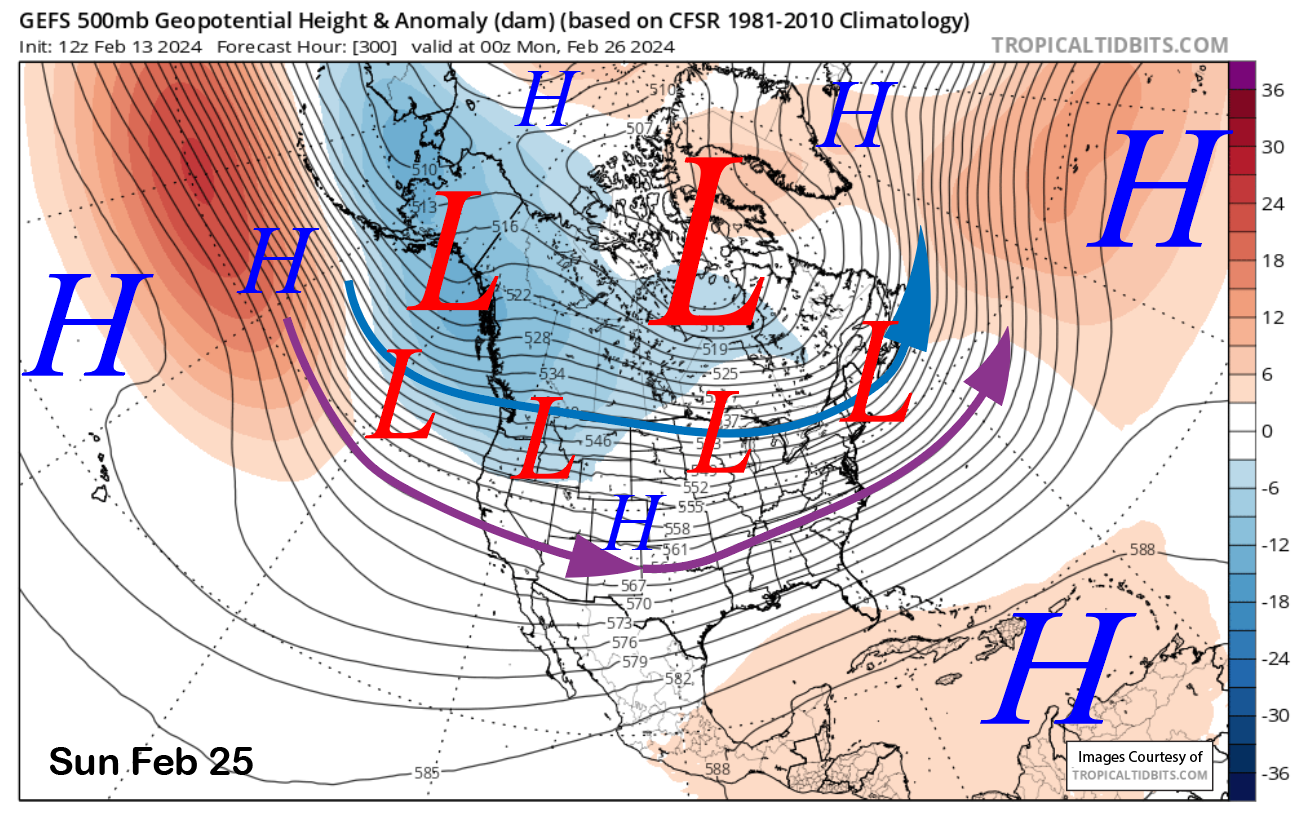
The longer-range guidance is still showing the long-advertised storm cycle continuing into next week before there may be a break. It now favors storms to return over the last part of the month for hopefully another round of powder days.
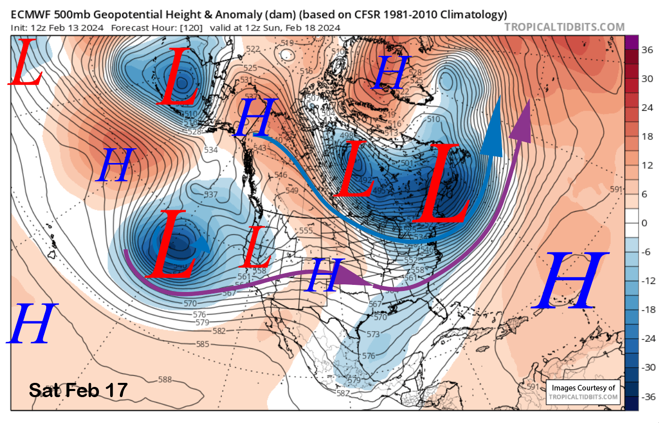
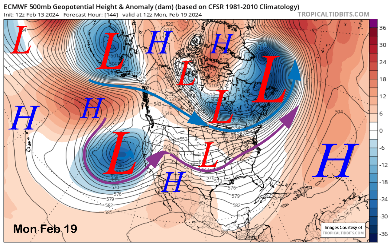
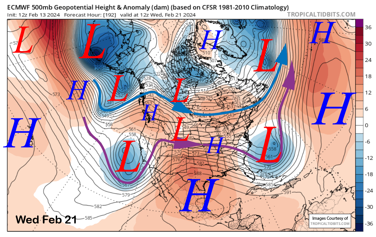
The ECM (image below) and other models agree that a deep upper-level low will approach the coast next Monday and slowly meander off the coast through mid-week (two images below). That would produce waves of snowfall for Mammoth with the biggest dump happening on Monday and into Tuesday (riders of the storm days).
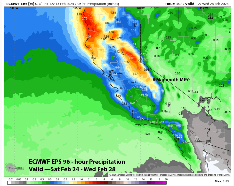
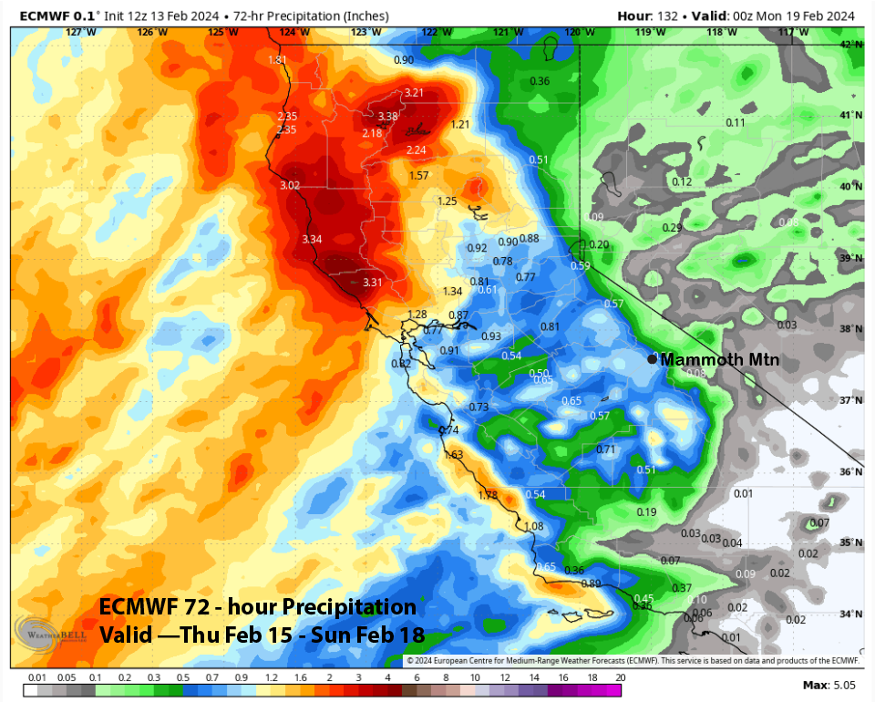
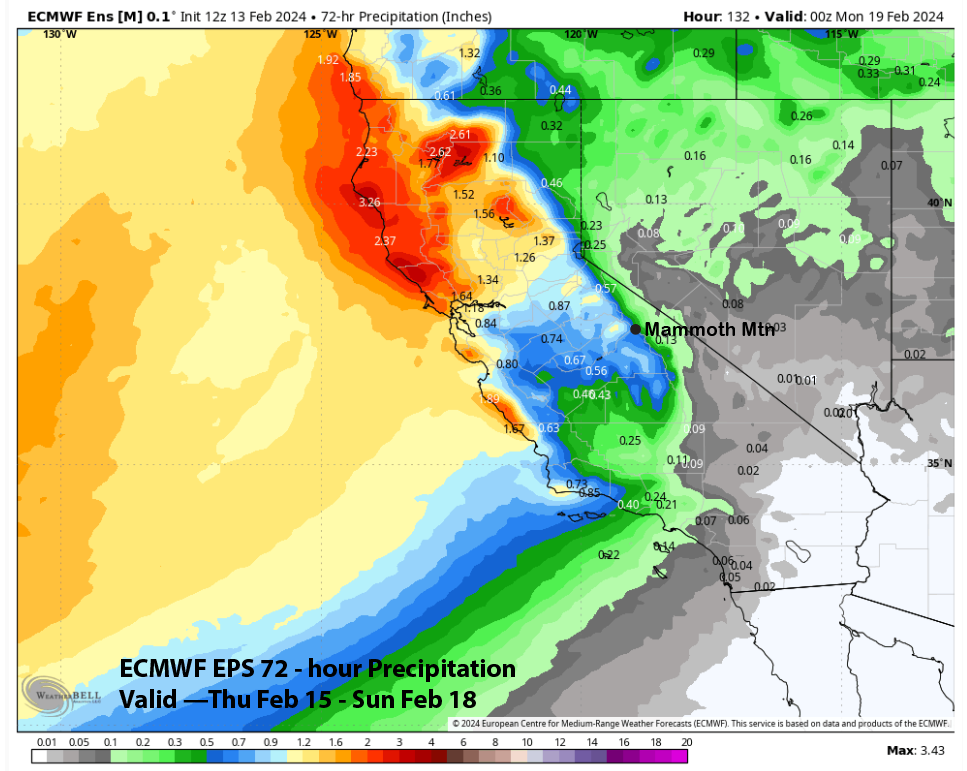
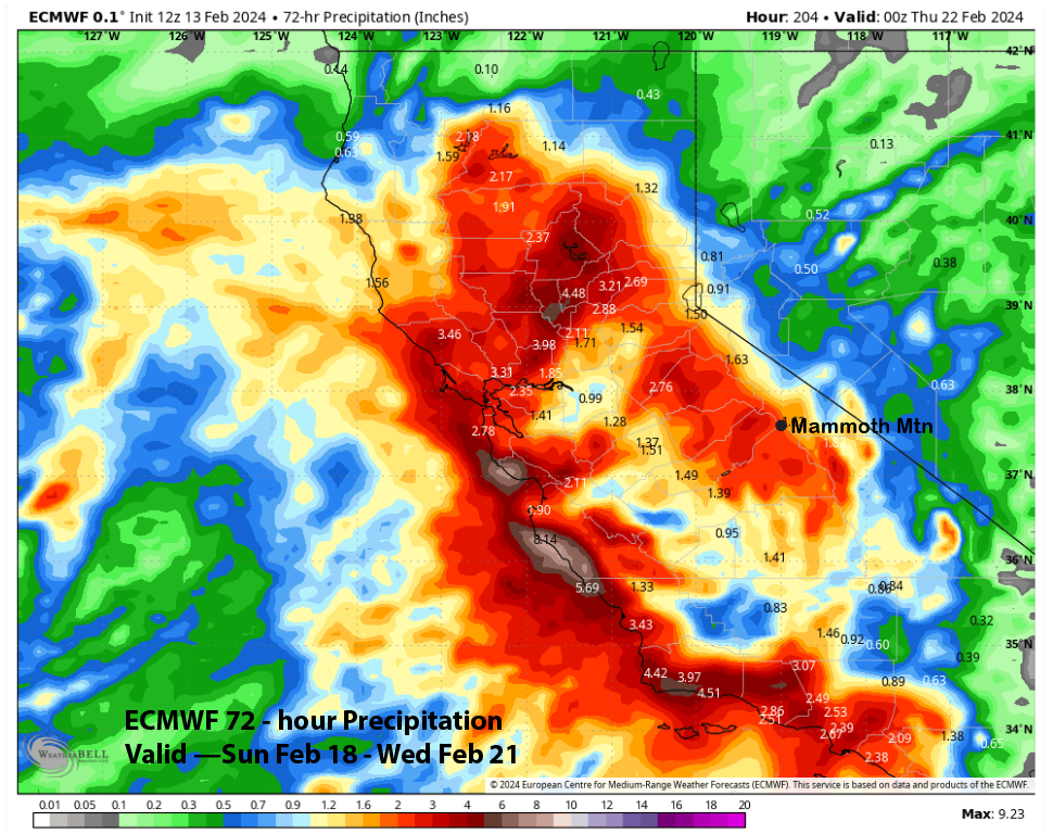
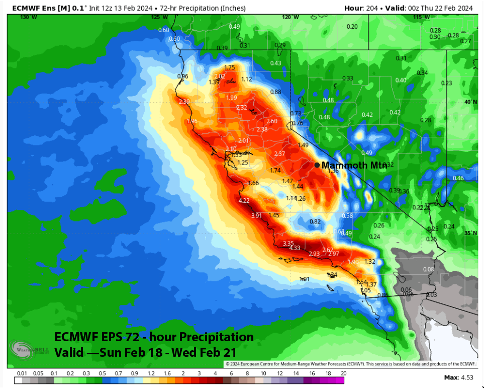
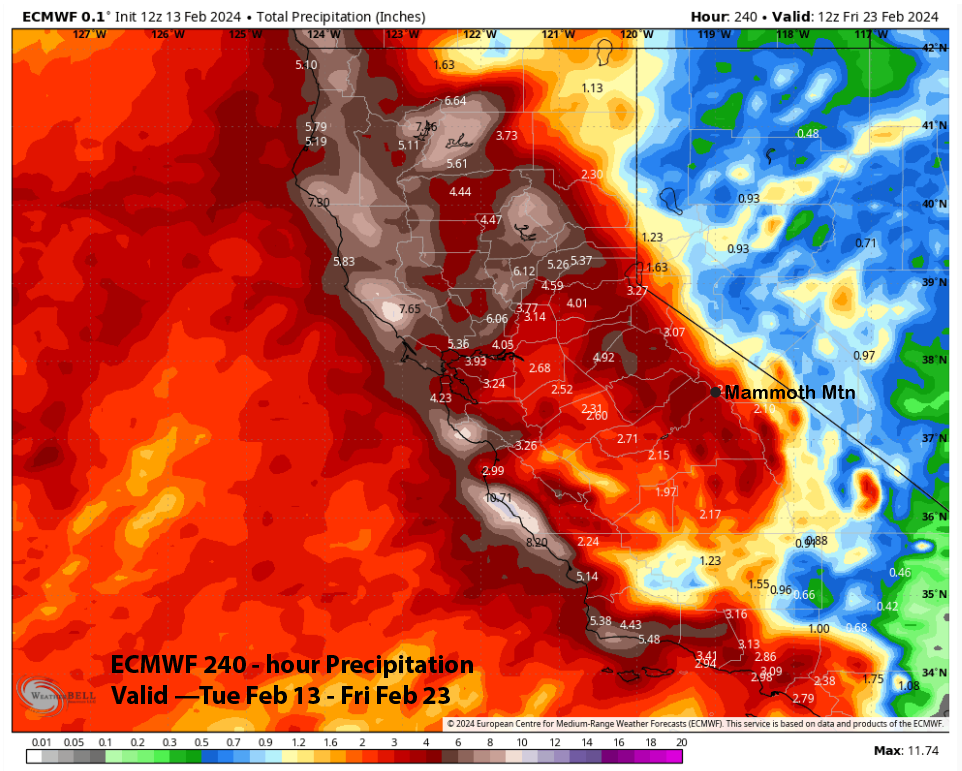
QPF from the latest ECM run (image below) shows about 2.5” for the event and the ECM EPS is similar (two images below). The GFS is similar to the ECM with just slower timing while the Canadian model is wetter by about an inch. It is still six-plus days out, so the forecast will almost certainly change, however, it looks like a good bet for at least a foot at Main and possibly two feet or more. And overall, the storm cycle looks pretty decent with the ECM showing almost 4″ liquid for the next ten days (three images below).
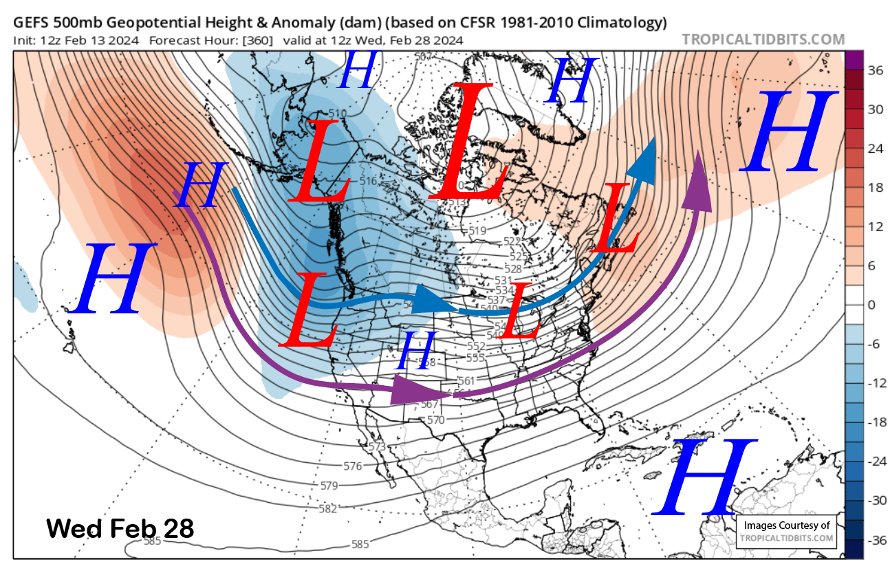
The fantasy range guidance is suggesting there could a break from the storms before GFS ensemble says the longwave trough reforms over the following weekend (image below) and into the middle part of the next week (two images below).
The ECM EPS is similar and is showing over an inch of liquid (image below) over the back end of the forecast period. These storms would likely be coming from the Gulf of Alaska and would be colder-type systems with fluffier-type snow. Thus, even better powder days may lie ahead. WG