Powder Forecast – Friday, April 5th, 2024
Ted Schlaepfer CCM —- Mammoth Mountain WeatherGuy
Snowfall forecasts are valid at the Sesame snow course (Main Lodge) for the prior 24 hours as reported in the 6-7 AM morning snow report.
**Snowfall forecast confidence ranges from very low (1) to very high (5)
Sat 4/6 = ~4” (~H20 = 0.40”)**5
Sun 4/7 = 0”
Mon 4/8 = 0 – 1”
Tue 4/9 = 0”
Wed 4/10 = 0”
Thu 4/11 = 0”
Fri 4/12 = 0”
Sat – Mon 4/13 – 4/15 = 0 – 1”
April Snowfall: 19”
April Forecast = 25 – 35”
Detailed 4-day Snowfall Forecast
Sat 4/6 – No snowfall expected.
Sun 4/7 – Dry during the morning and into the afternoon, then a chance for light snowfall late PM and overnight. Little or no accumulation is expected.
Mon 4/8 – Slight chance for an AM flurry, otherwise no snowfall is expected.
Tue 4/9 – No snowfall expected.
Forecast Summary:
Short Term (Days 1 – 4):
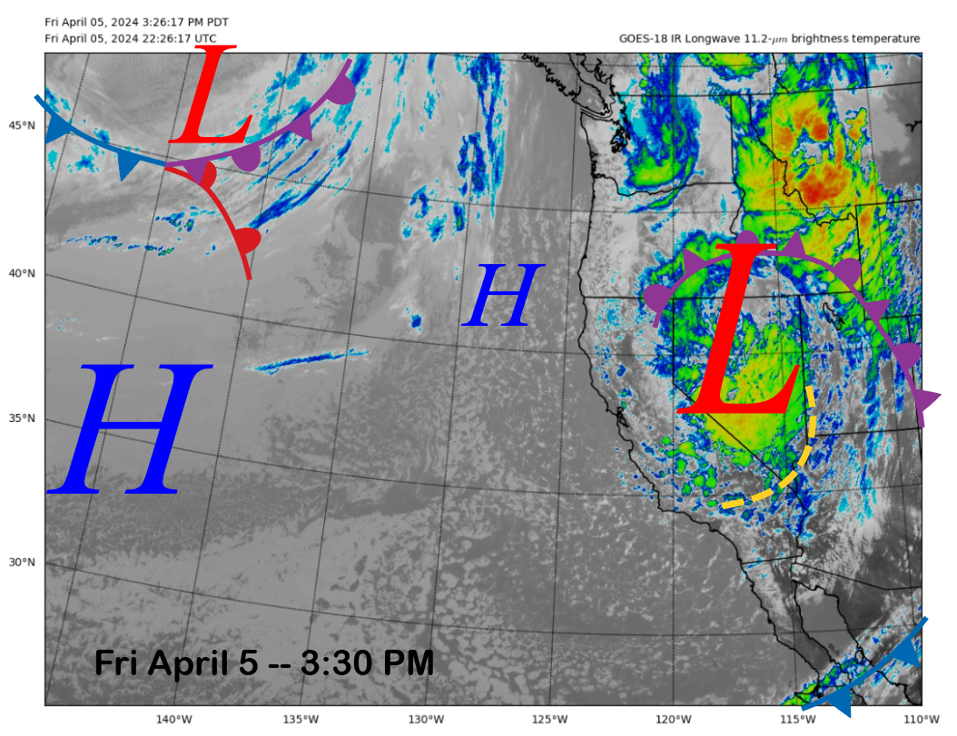
The current infrared satellite image (below) today shows the storm system that delivered the goods yesterday and today moving eastward into Nevada and Utah. High pressure off the coast will build into the area tomorrow for a dry day.
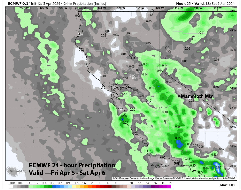
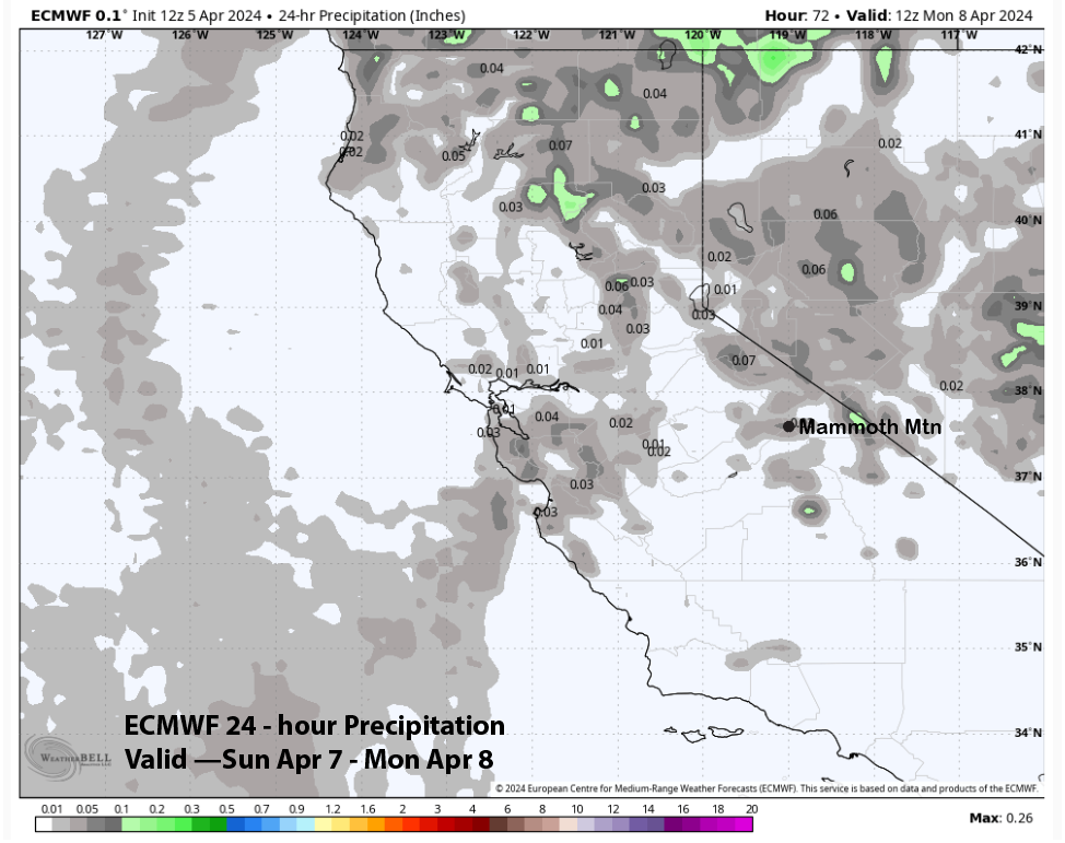
The snowfall should stop this evening with the storm total at Main around two feet. ECM model is only showing very light amounts for the rest of today (image below). Tomorrow will be a powder day and the top should open under the partly cloudy skies and dry weather.
A weak system will move through the area on Sunday PM and night (image below) and that will keep temperatures seasonally cold through the weekend. There is also a chance for light snowfall late afternoon or overnight on Sunday. ECM model is only showing very light amounts (two images below) of liquid and little or no accumulation is expected, maybe an inch in spots.
That system exits Monday and dry weather will return early next week. Temperatures will also warm up with spring conditions on the lower and middle part of the mountain by Tuesday.
Long Range (Days 5+):
The longer-range guidance has spring written all over it with dry weather expected through the pond skim weekend and then just a slight chance for spring storms the rest of the month.
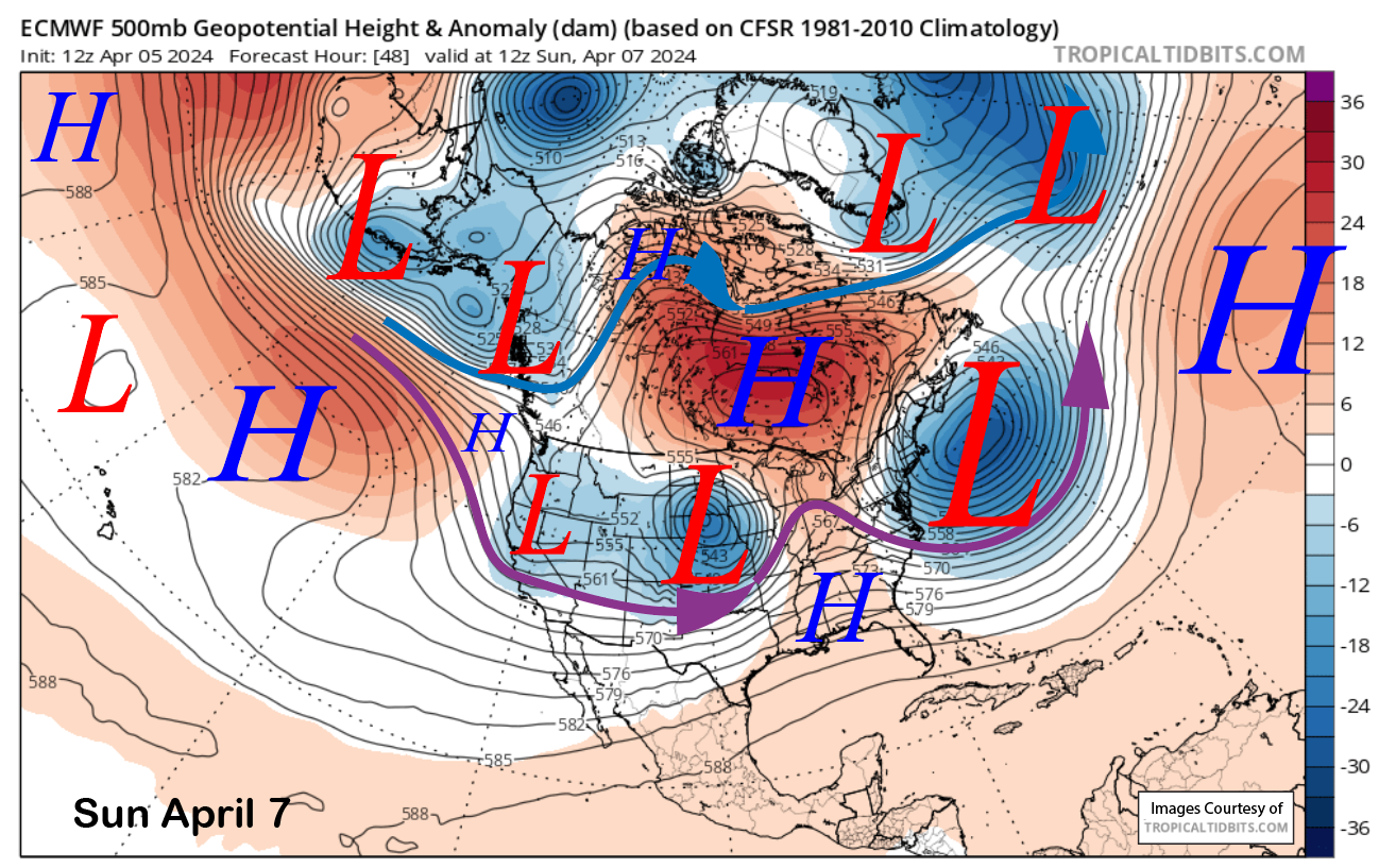
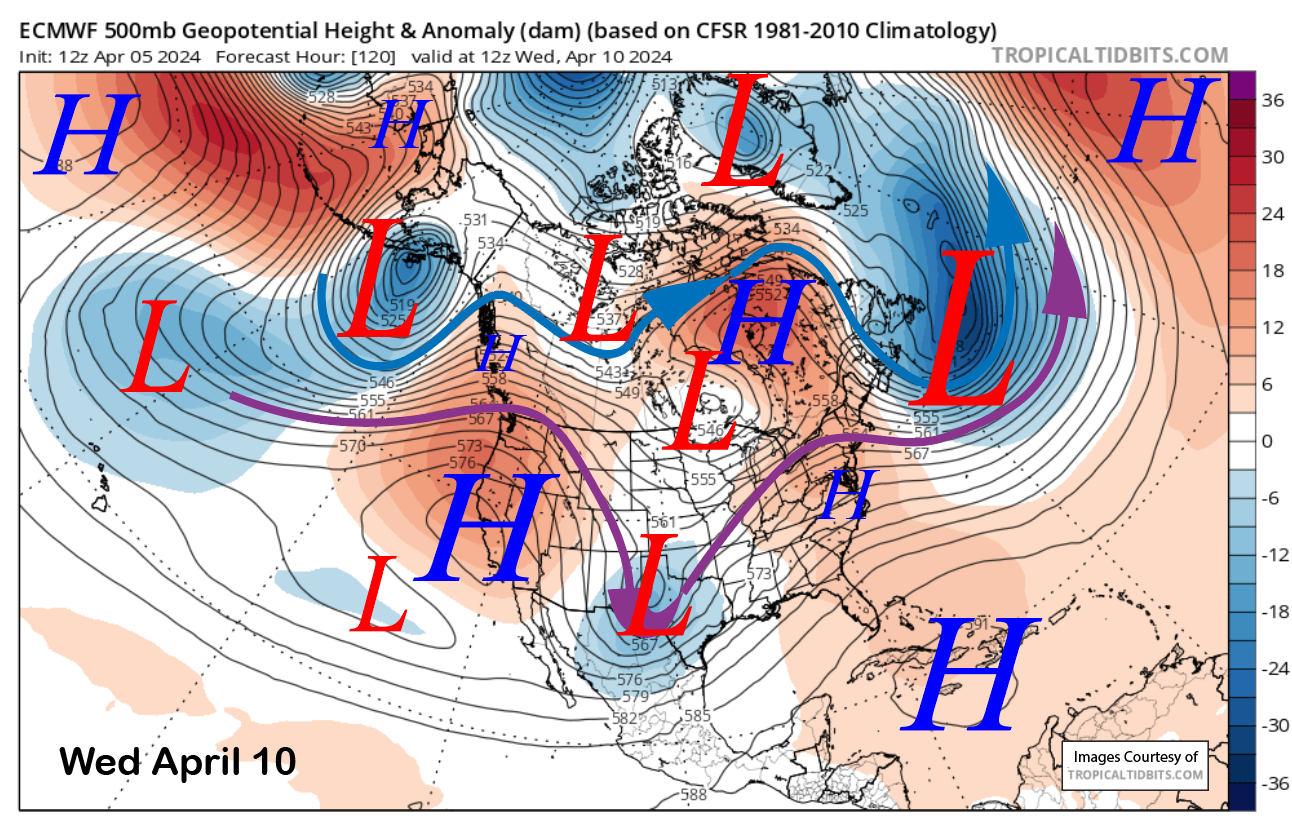
High pressure will continue to build through mid-week (image below) and spring conditions will likely develop across the entire mountain by Wednesday. The fair, dry, and spring weather should last through the weekend.
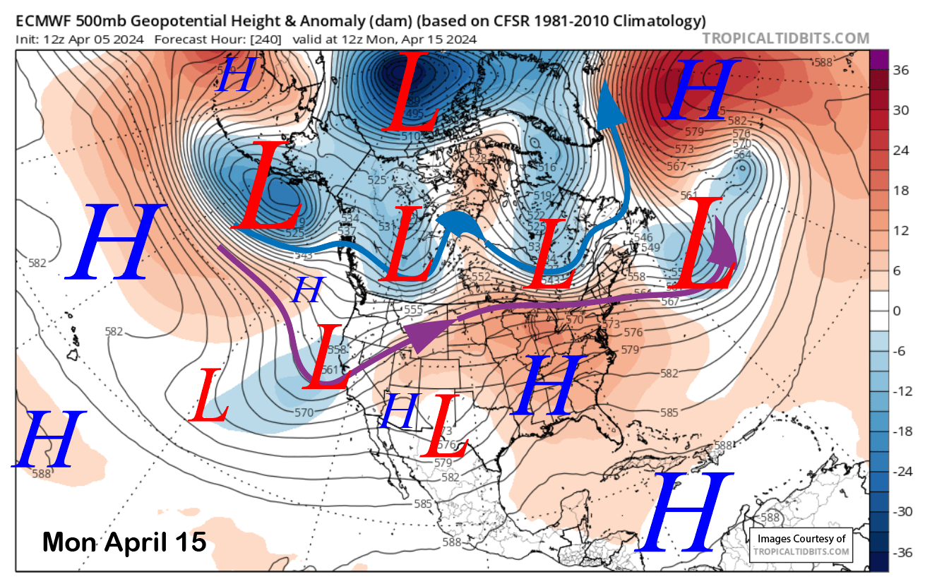
The ECM model moves a weak short wave into CA around Monday (image below) over the following week and the Canadian has it too. The GFS keeps the ridge in place for continued spring weather. The ECM solution would mean cooler weather and a chance for flurries or light snow showers.
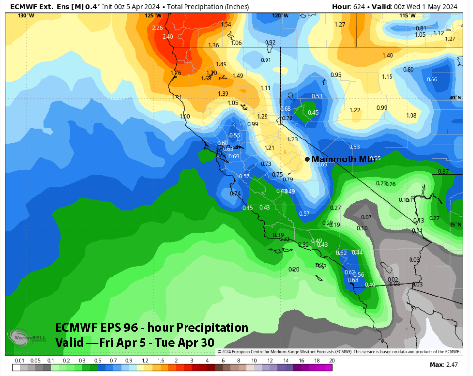
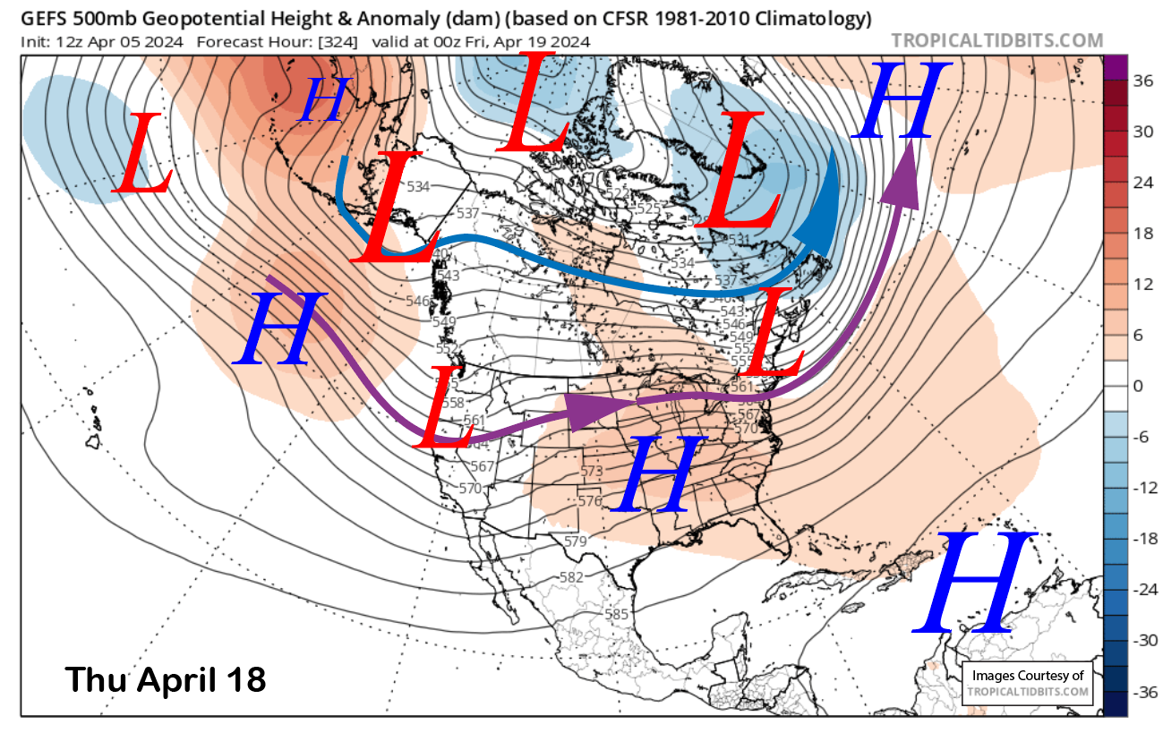
The long-range GFS ensemble suggests the next chance for a spring storm and snowfall would be later that week (image below) and into the following weekend when Canyon and Ch. 22 close. The ECM EPS is not as bullish and the QPF (two images below) is only showing light amounts and not enough for powder conditions. Hopefully, models will trend wetter.
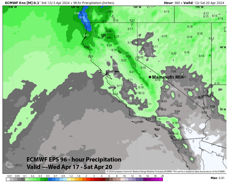
The fantasy range ECM EPS is suggesting that could be a weak storm or two over the rest of April and has almost an inch of liquid for the rest of the month (image below). A spring surprise is always on the table. WG