Powder Forecast –Friday, December 22nd, 2023
Ted Schlaepfer CCM —- Mammoth Mountain WeatherGuy
Snowfall forecasts are valid at the Sesame snow course (Main Lodge) for the prior 24 hours, as reported in the 6-7 AM morning snow report.
**Snowfall forecast confidence ranges from very low (1) to very high (5)
Sat 12/23 = 0”
Sun 12/24 = 0”
Mon 12/25 = 0”
Tue 12/26 = 0”
Wed 12/27 = 0”
Thu 12/28 = 2 – 6”
Fri 12/29 = 0”
Sat – Mon 12/30 – 1/1 = 9 – 15”
December Snowfall = 12”
December Forecast = 20 – 30”
Detailed 4-day Snowfall Forecast:
Sat 12/23 through Tue 12/26 – No snowfall expected all days.
Forecast Summary:
Short Term (Days 1 – 4):
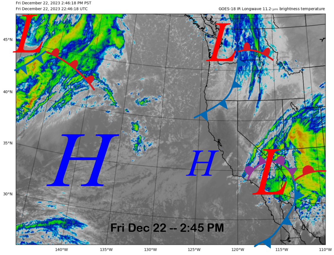
The current infrared satellite image (below) today shows a low-pressure system just off the SoCal coast that will move inland today and a weak front moving into the PacNW and far NorCal. High pressure positioned well off the coast will come into the state tomorrow and Sunday.
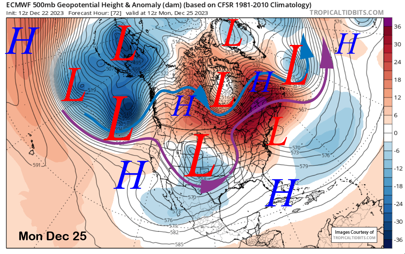
High pressure (image below) will generally remain in place through Christmas and into the middle part of next week. That will mean continued dry weather for the holiday under seasonal or slightly above normal temperatures in the 20s up top to low 40s at Canyon.
Long Range (Days 5+):
The longer-range guidance has not changed too much since the last post, with the storm around the 27th still expected to move too far northward for significant snowfall. However, there is a better agreement for a storm around the end of the year that could help a little with the base building.
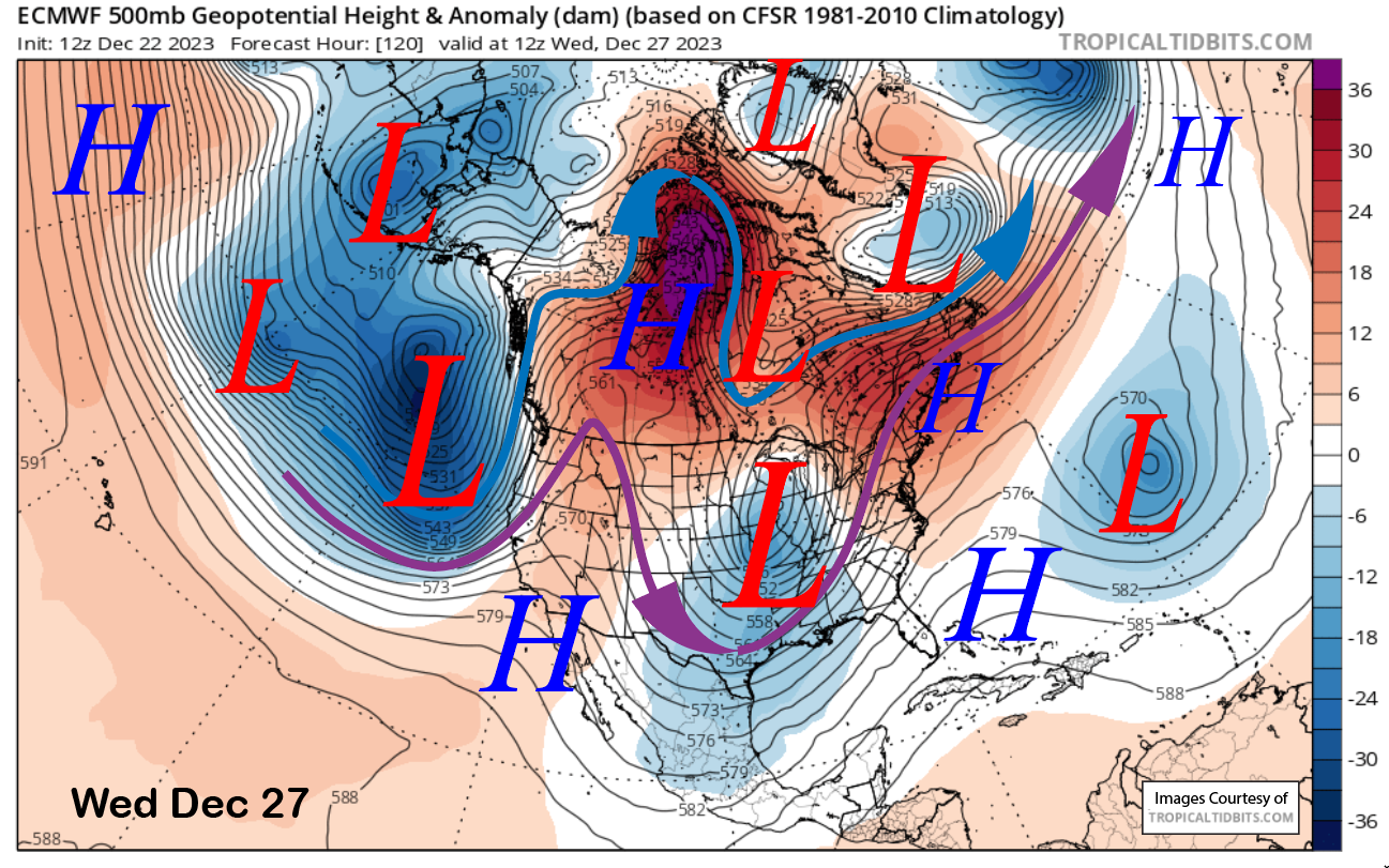
The latest ECM brings the next trough to the CA coast on Wednesday next week (image below) before weakening the trough as it moves inland into Thursday. It looks like the jet stream (purple arrow) will stay too far north for the front to hold together by the time it reaches Mammoth.
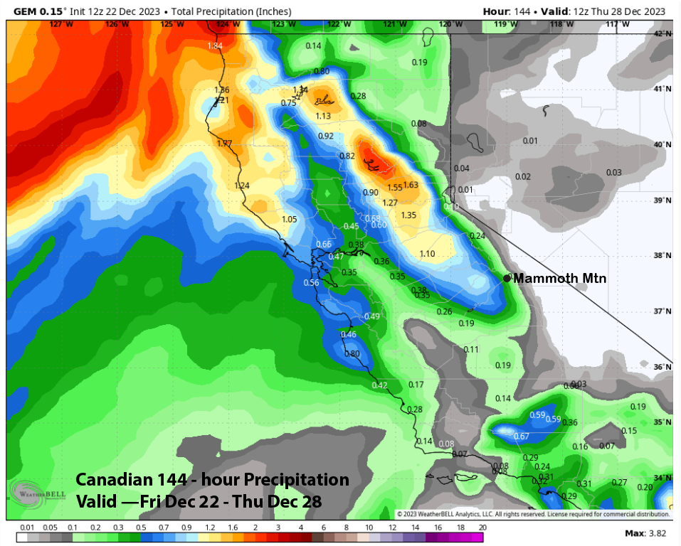
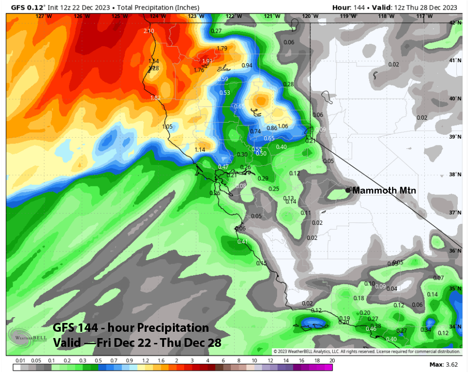
Model QPF reflects this idea with generally very light amounts under quarter of an inch (images below) for the storm. The Canadian is the wettest, but shows only enough for a few inches of snowfall.
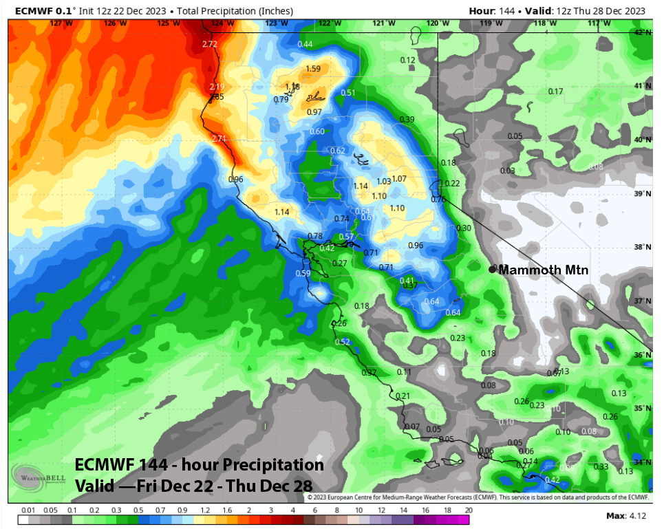
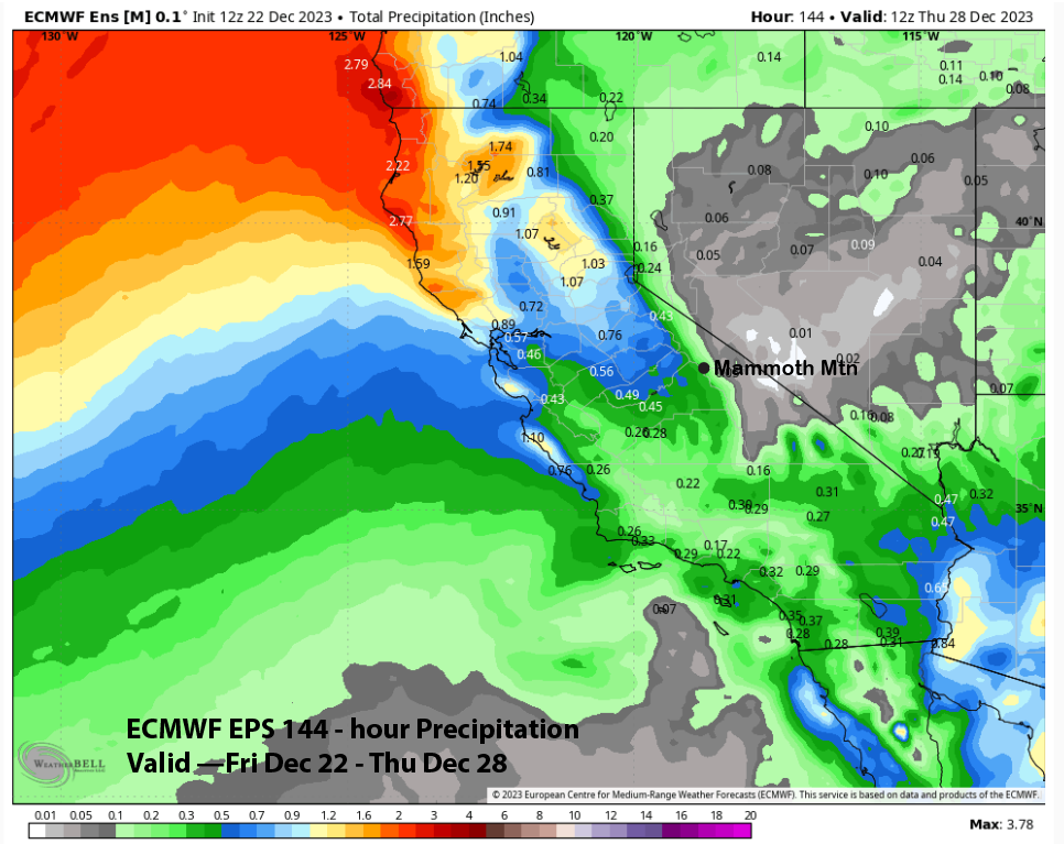
The forecast follows the ECM mean (image below) and has about a third of an inch of liquid that would be good for a couple or a few inches of snowfall. It is still five days out, so amounts will change. However, they are unlikely to go up a lot. The best case scenario would be six inches of snowfall, but unlikely at this point.
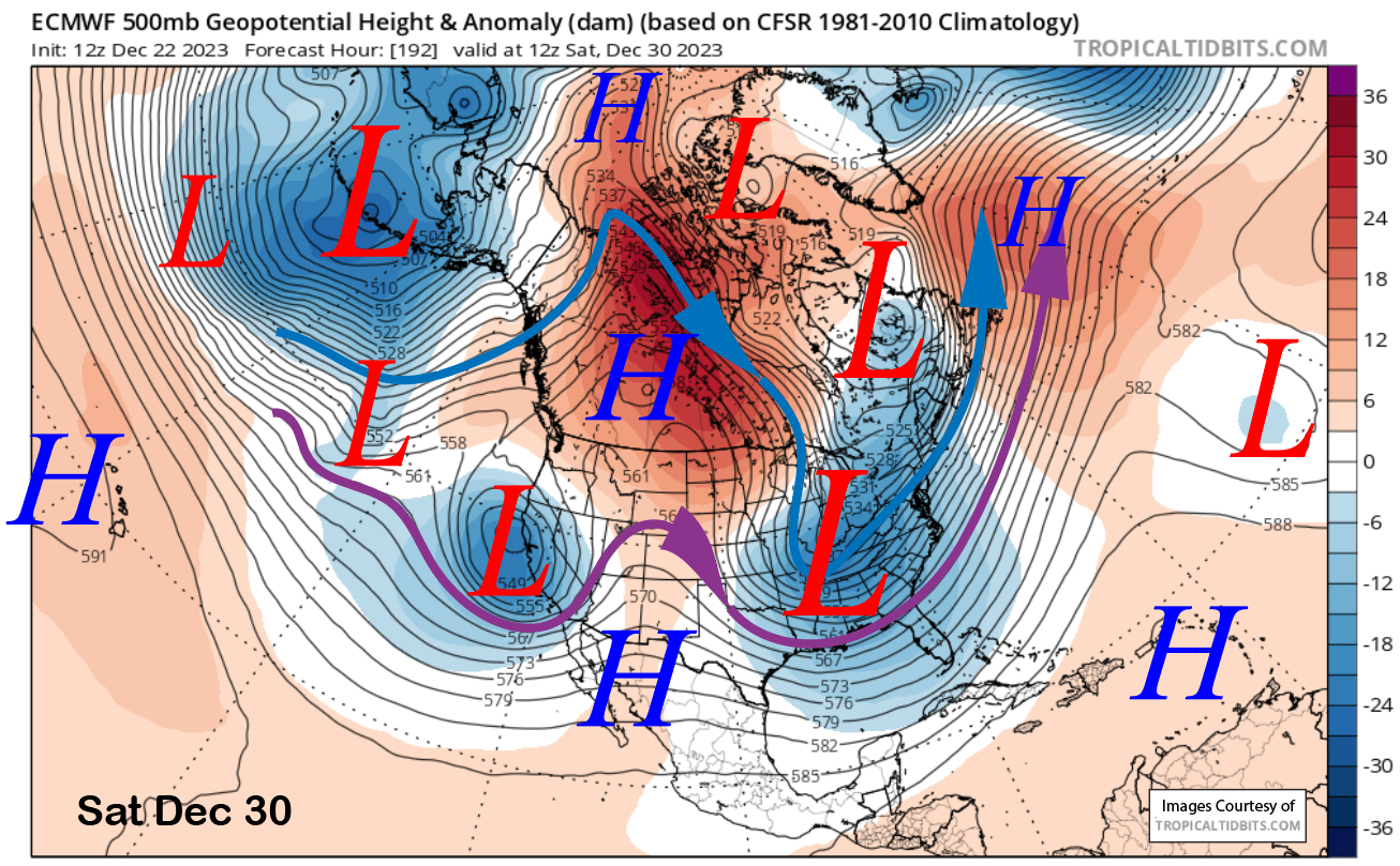
The ECM (image below) then moves another trough farther southward just before the end of the month/year. The jet stream (purple arrow) is far enough southward for snowfall in Mammoth, with the main question being how strong the storm will be upon arrival.
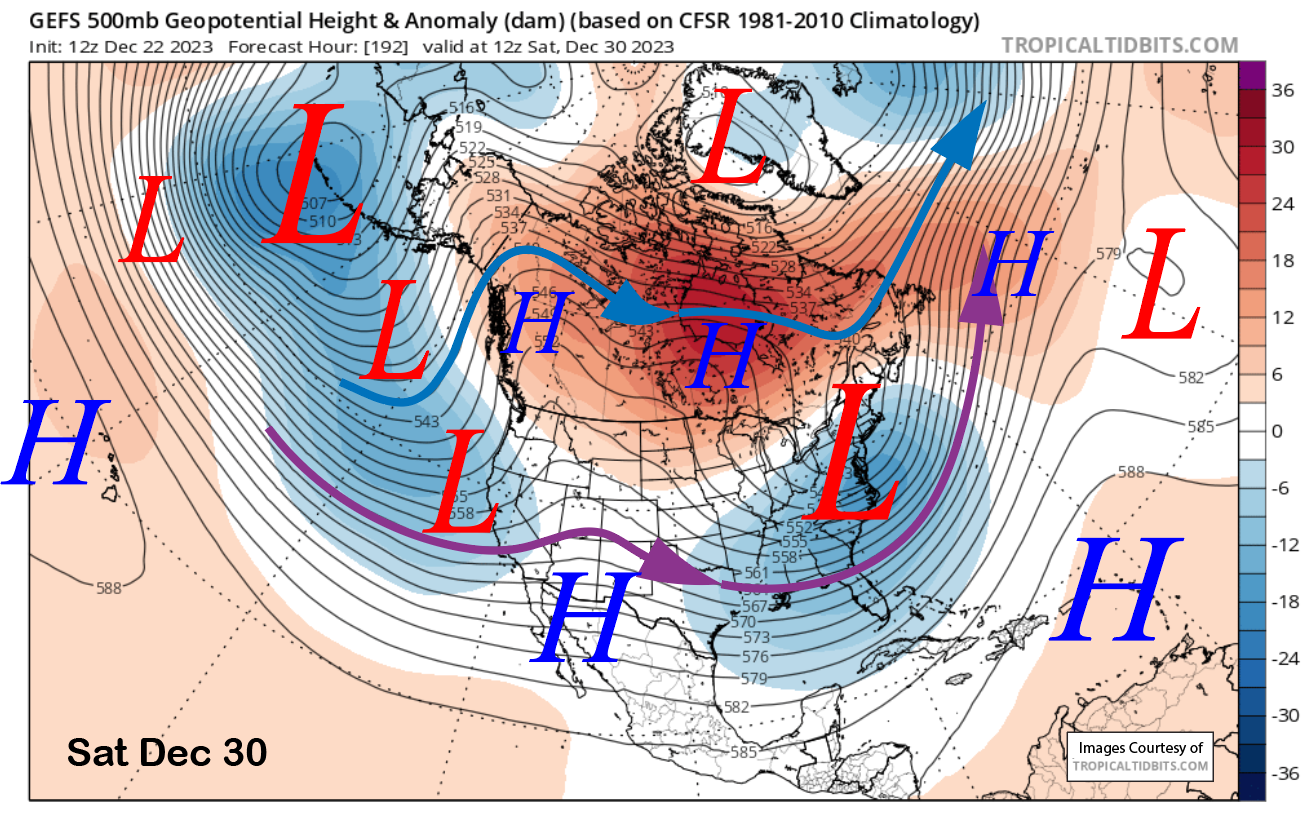
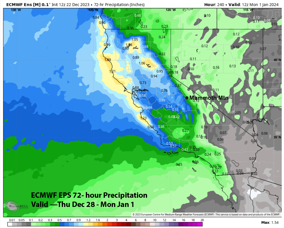
The GFS ensemble (image below) has a trough along the coast into CA at that time frame too, but is rather weak with the jet stream. Thus, the current forecast favors only a weak or moderate-strength storm. The ECM EPS also only favors a weak storm right now with under half an inch of liquid (two images below). Overall, no big storms are expected for the rest of 2023.
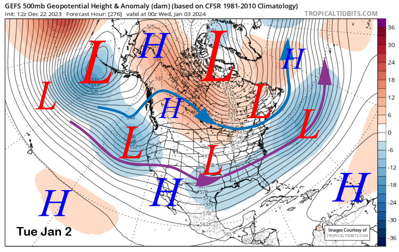
The longer-range fantasy guidance is showing a weak trough (image below) along the CA coast and a jet stream into Central CA to start 2024. That would allow storms to move into Mammoth. The models keep this pattern through the first week or so before dry weather may return toward mid-month.
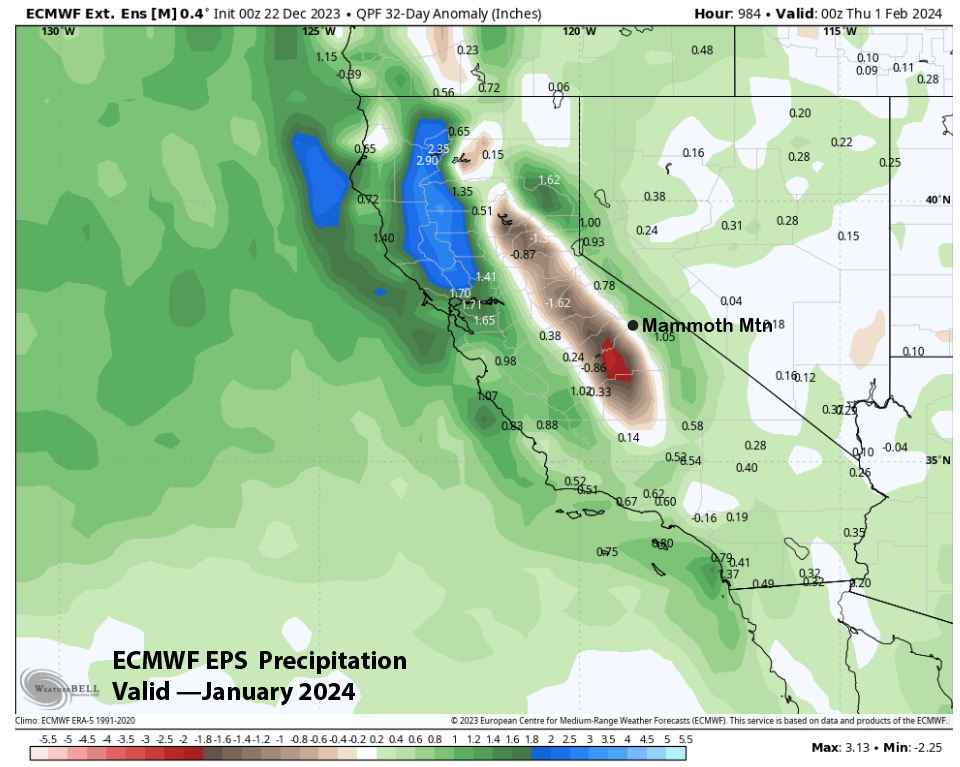
The precipitation forecast for January from the ECM EPS has backed off a bit with any above normal snowfall for Mammoth and now shows near average, but below normal on the west side of the crest (image below). Normal is about 6” liquid or 60” of snowfall. Merry Christmas and Happy New Year. WG