Powder Forecast – Friday December 30th, 2022
Ted Schlaepfer CCM —- Mammoth Mountain WeatherGuy
Snowfall forecasts are valid at the Sesame snow course (Main Lodge) for the prior 24 hours as reported in the 6-7 AM morning snow report.
**Snowfall forecast confidence ranges from very low (1) to very high (5)
Sat 12/31 = 8 – 12” (H20 = 2.25” – 2.75”) **3
Sun 1/1 = 23– 30” (H20 = 3.25” – 3.75”) **3
Mon 1/2 = 0”
Tue 1/3 = 3 – 6”
Wed 1/4 = 0 – 3”
Thu 1/5 = 9 – 15”
Fri 1/6 = 15 – 24”
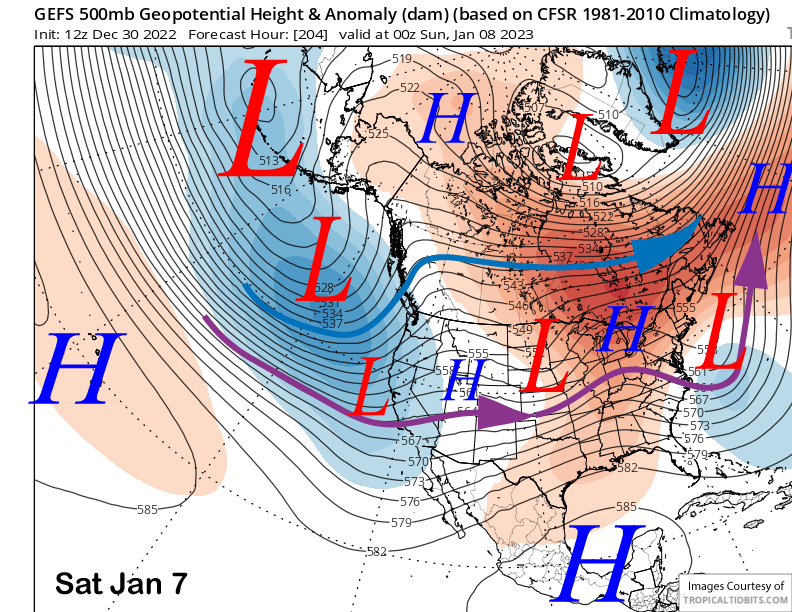
Sat – Mon 1/7 – 1/9 = 12 – 24”
December Snowfall = 90”
December Forecast = 95 – 105”
Detailed 4-day Snowfall Forecast
Sat 12/31 – Heavy snow during the day and into the evening hours, then snowfall mostly ends overnight. Strong winds during the day, especially AM. Accumulations 23– 30” by Sunday AM, up to 40” up top
Sun 1/1 – Lingering snow showers or flurries into the afternoon, dry at night. No accumulation expected
Mon 1/2 –Dry during the morning hours, then light to moderate snowfall develops during the afternoon and continues overnight before ending by dawn. Accumulations 3– 6” by Tuesday AM, 6”+ up top
Tue 1/3 – Dry during the day, then a chance for snowfall overnight. Accumulations 0– 3” by Wednesday AM
Forecast Summary:
Short Term (Days 1 – 4):
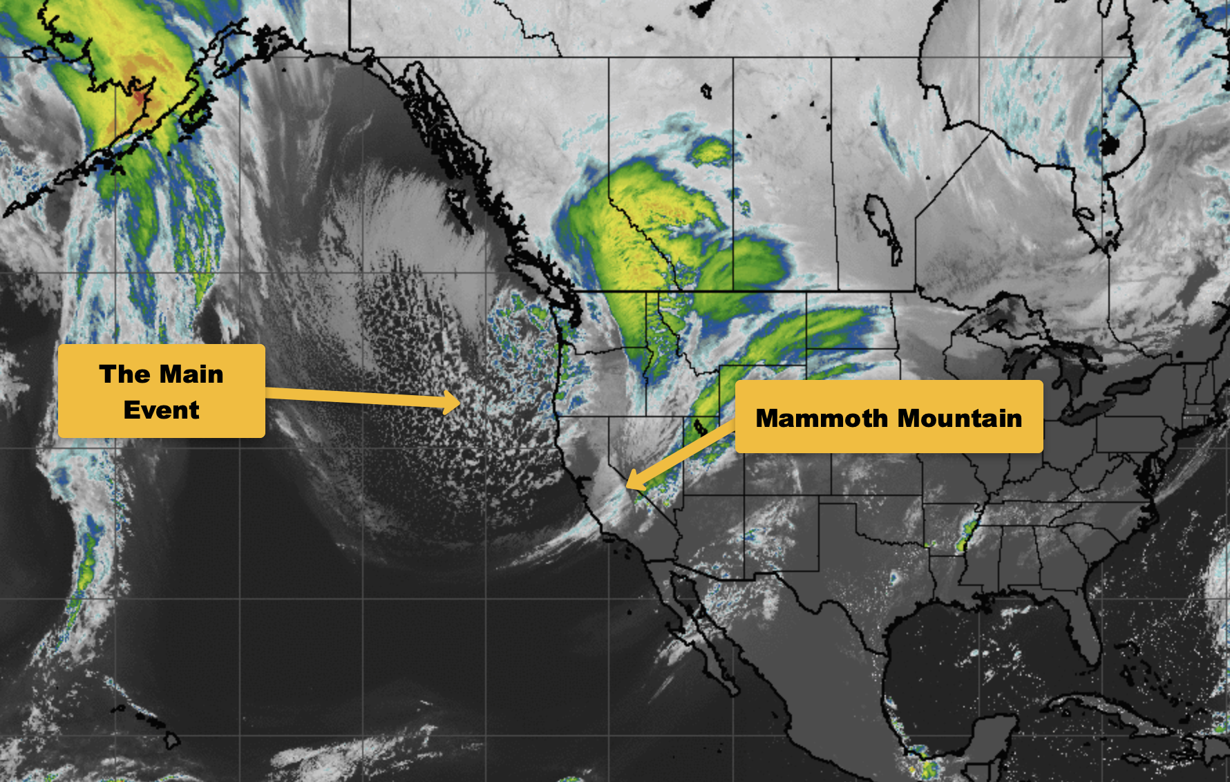
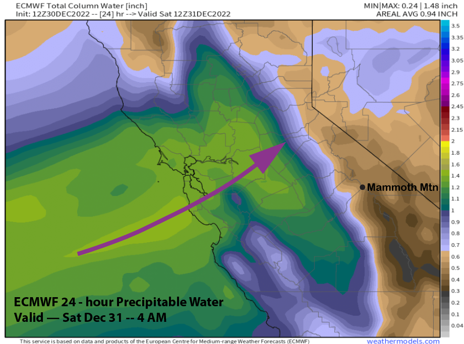
The current infrared satellite image (below) shows a low-pressure area moving into Oregon and a stationary warm front extending southward through Central CA. A plume of clouds associated with an Atmospheric River (AR) stretches westward into the Pacific with a low-pressure system just moving into the eastern Pacific. That low will eventually push the whole storm system southward over the next 36 hours.
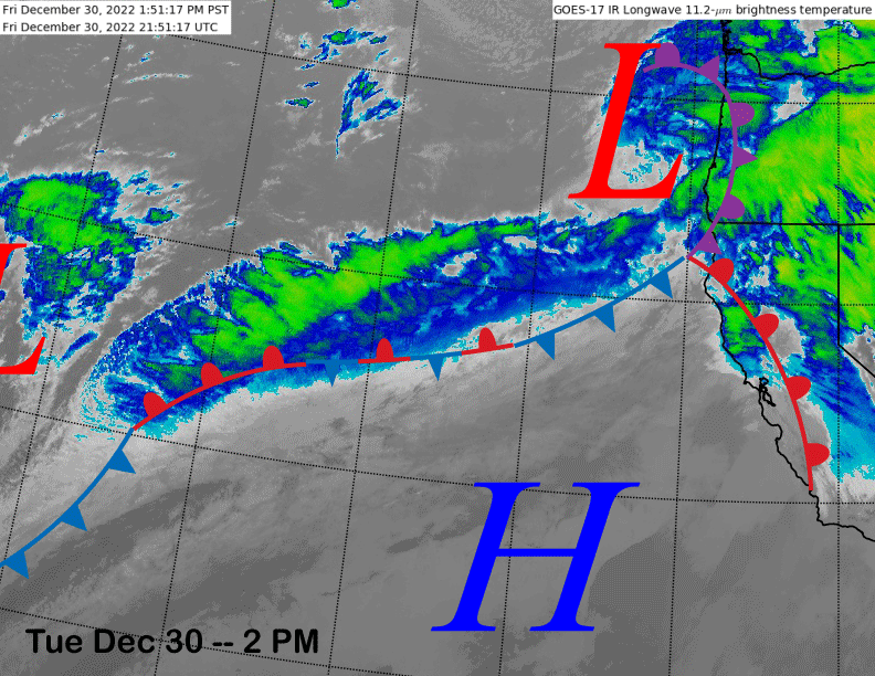
The GFS moves the upper low through Central CA tomorrow afternoon (image below), and as it does so, it will push the AR southward through Central CA (two images below) during the day with the AR moving through Mammoth late afternoon and tomorrow evening.
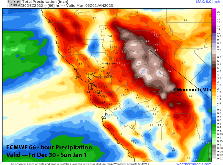
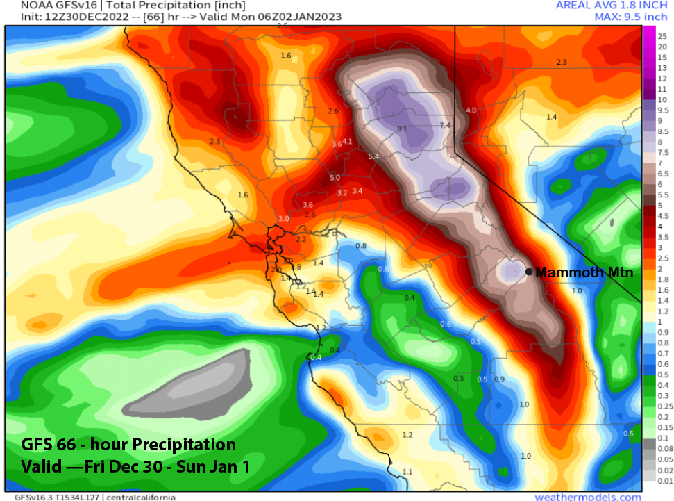
Forecast precipitation amounts with the passage of the storm are impressive with the ECM showing around 5.50” liquid (image below) and the GFS slightly more at 7 inches liquid. If this was a colder storm, then the mountain would be completely buried.
But the stationary warm front over the state today is pushing snow levels up rather high with rain at Canyon and a rain/snow mix at Main this afternoon. It does appear to be snowing at McCoy according to the cams with the snowline at the top of Broadway.
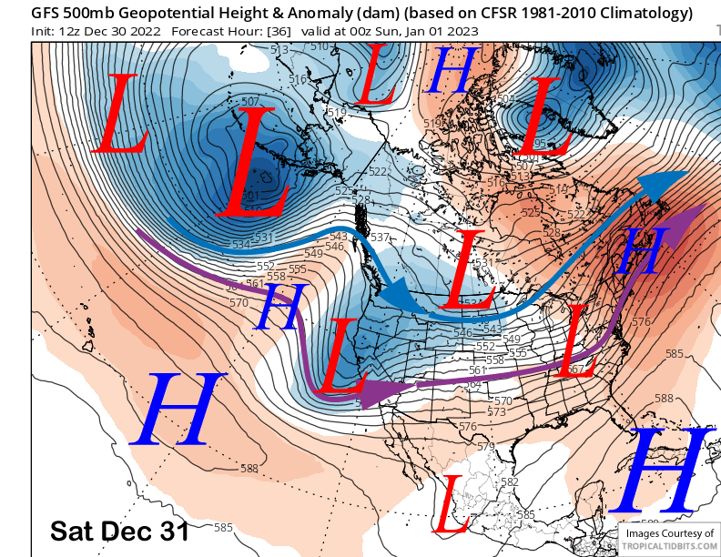
ECM 700-mb temp forecast peaks the warm advection this evening at around 1-2°C (image below) before cooling occurs and snow levels lower overnight to town levels. Models suggest a brief rise tomorrow morning and into the afternoon to Canyon elevations before lowering for the rest of the afternoon and night.
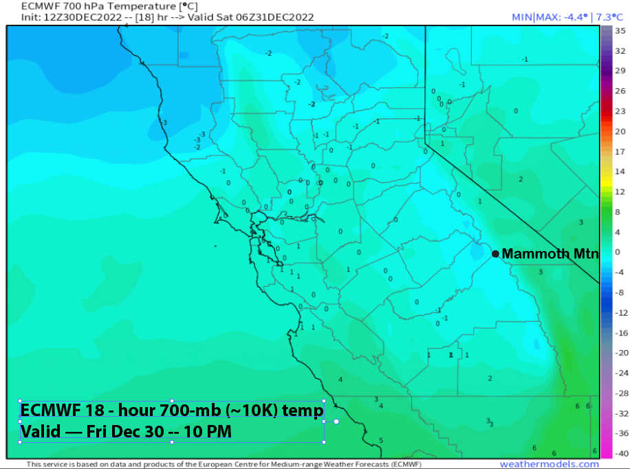
Thus, it is a complicated forecast for the storm, with some rain mixed with very low snow ratio snowfall in the 4-5”:1” range. It does look like possibly up to a foot of cement could fall at Main overnight, depending upon how fast snow levels fall. It should stay all snow at Main tomorrow and a couple feet is likely with the main band tomorrow afternoon and evening and possibly up to 30” when all is said and done by Sunday morning.
Flurries or light snow showers may continue at times into the afternoon on New Year’s Day before dry conditions return Sunday night. Dry weather will likely continue Monday morning before the next storm moves into the area Monday afternoon/night as the ECM model quickly moves another short-wave onto the coast (image below). This quick mover will probably produce 3-6” of snowfall by Tuesday morning when dry weather returns during the day.
Long Range (Days 5+)
The longer-range guidance is showing the storm cycle continuing next week and possibly through the following weekend, although there is some uncertainty about the extent of the wet pattern.
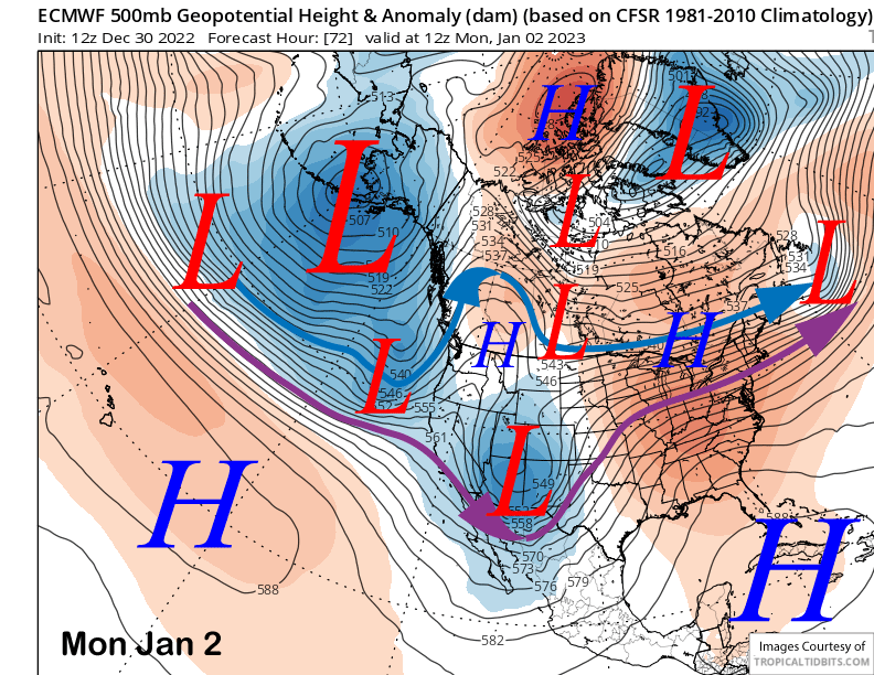
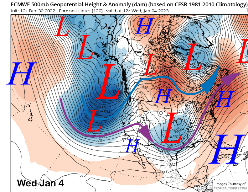
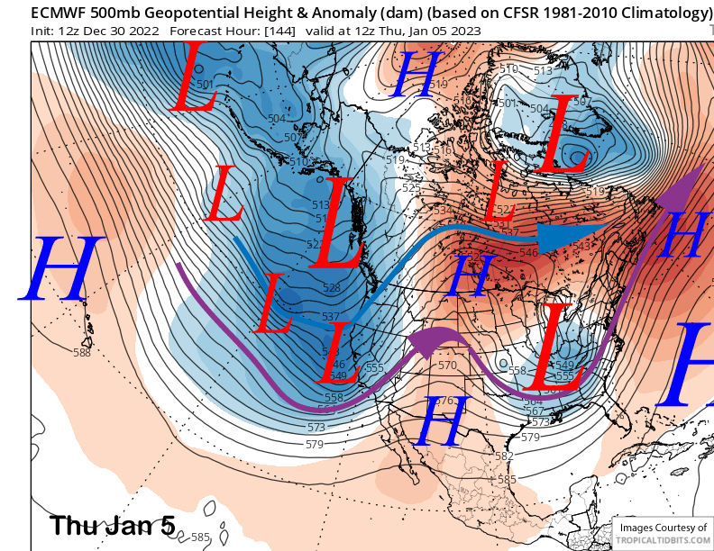
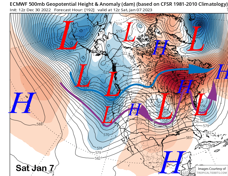
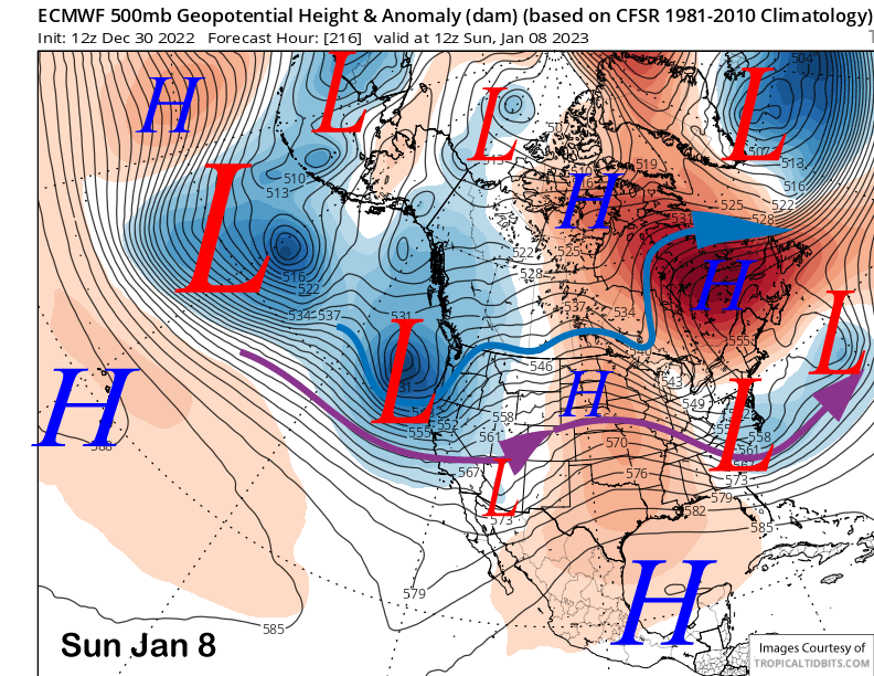
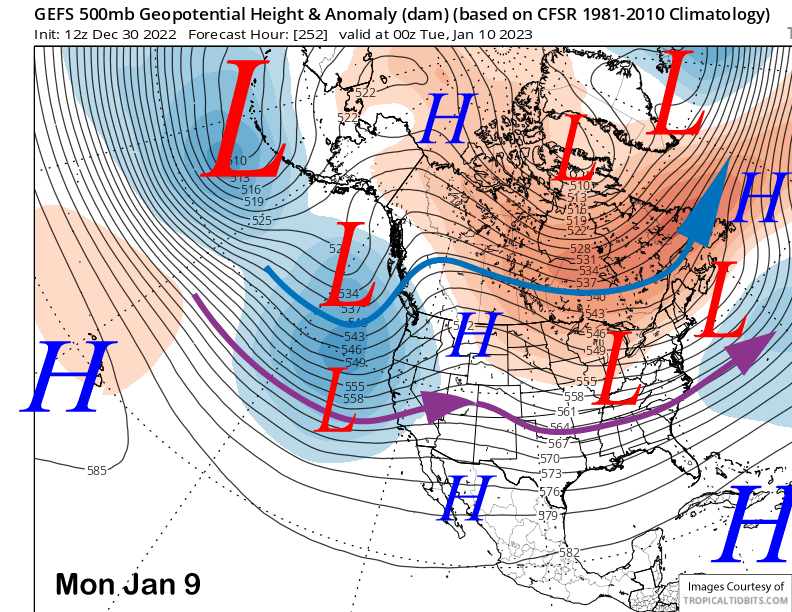
The ECM and other models move a deep upper-low toward the coast around the middle part of next week (image below) before swinging the trough ashore around Thursday next week (two images below). This is slightly different from the last update with the jet stream more southwest oriented and pointing into NorCal versus the west-southwest jet projection from the last update that pointed the AR into the southern Sierra.
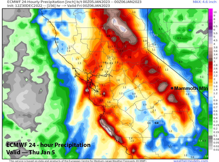
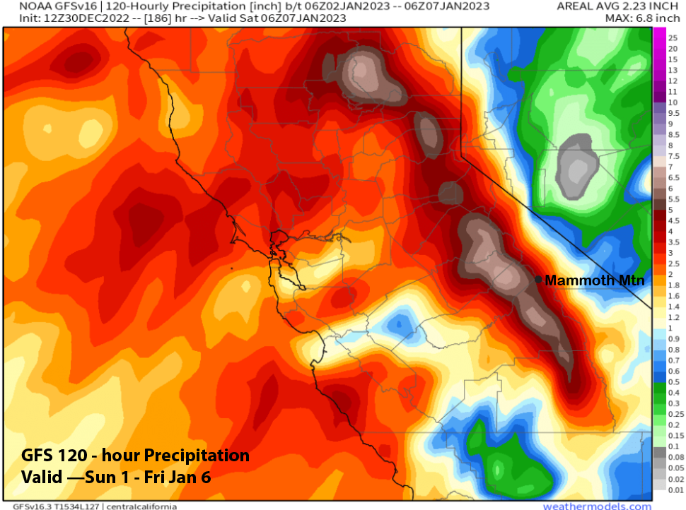
So, the forecast amounts from the models have decreased versus the previous update, but are still healthy with the ECM showing over 2” liquid (image below) during the peak 24-hour period and the GFS forecast around 4.5” liquid (two images below) for the event. And with snow levels expected to be well below town levels (5-6000 feet), snowfall amounts could be substantial for the end of next week. Current forecast is favoring two to three feet at Main and maybe 4 feet up top.
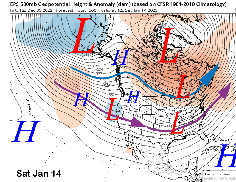
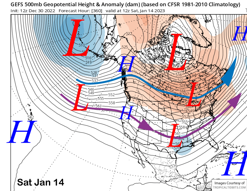
The forecast for the end of next week and following weekend is more challenging with the Canadian model now showing the next storm system to move north of CA (image below) and a ridge to build into the state for the extended period.

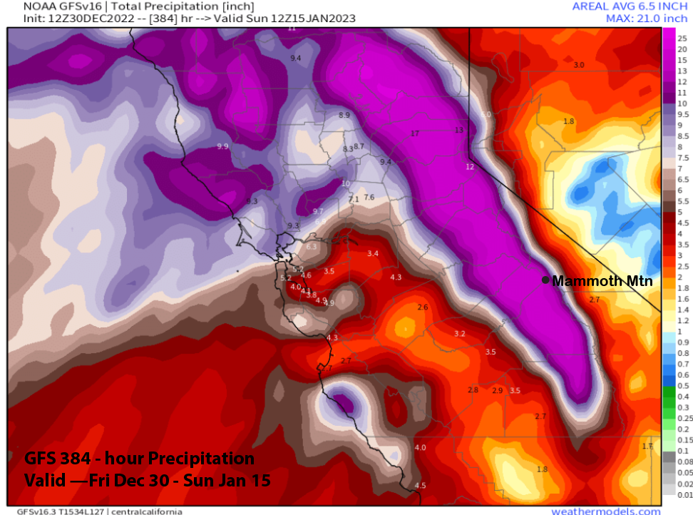
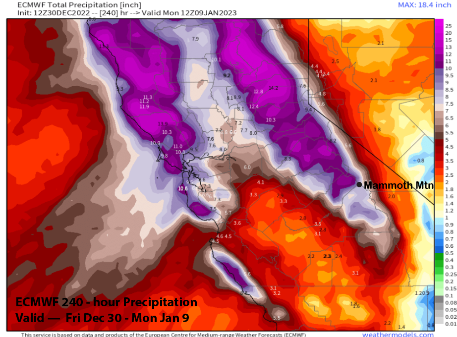
The ECM model is different and splits that trough (image below), but still moves a weak system through the Sierra Saturday It then moves another trough into the state on Sunday (two images below). This adds on to the 10-day QPF total that is impressive at about 9” liquid total (three images below).
The GFS ensemble is showing a weak negatively tilted trough (three images below), so a splitting scenario is certainly possible.
The ECM EPS is more bullish, and is suggesting another decent storm over the weekend and into Monday the next week. The GFS ensemble (image below) also supports the idea of another storm by the latter part of the weekend and that Monday too, just maybe not on Saturday. Thus, there is more uncertainty in the extended forecast.
That uncertainty continues in the fantasy range with both ensemble systems suggesting a period of dry weather just before mid-month. But the ECM starts to suggest a zonal break through (image below) while the GFS ensemble still favors ridging (two images below).
Even if dry weather does return around mid-month, it will have been a great storm cycle, especially if the 12z GFS run verifies and Mammoth gets over 15” more to add to the storm from two days ago. Certainly way better than what occurred last January 2022. WG