Powder Forecast – Friday March 31st, 2023
Ted Schlaepfer CCM —- Mammoth Mountain WeatherGuy
Snowfall forecasts are valid at the Sesame snow course (Main Lodge) for the prior 24 hours as reported in the 6-7 AM morning snow report.
**Snowfall forecast confidence ranges from very low (1) to very high (5)
Sat 4/1 = 0”
Sun 4/2 = 0”
Mon 4/3 = 3 – 5” (H20 = 0.25” – 0.45”)**3
Tue 4/4 = 1– 2” (H20 = 0.10” – 0.15”)**3
Wed 4/5 = 0”
Thu 4/6 = 0”
Fri 4/7 = 0”
Sat – Mon 4/8 – 4/11 = 0”
March Snowfall = 192”
March Forecast = 192”
Detailed 4-day Snowfall Forecast
Sat 4/1 – No snowfall expected, but breezy to windy.
Sun 4/2 – Dry during the day with strong winds, then snowfall develops Sunday late evening or overnight. Accumulations 3 – 5” by Monday AM, 6”+ up top
Mon 4/3 –Light snowfall during the day, ending Monday evening. Accumulations 1 – 2” by Tuesday AM, 3”+ up top
Tue 4/4 – No snowfall expected.
Forecast Summary:
Short Term (Days 1 – 4):
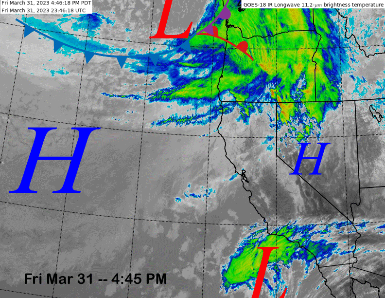
The current infrared satellite image (below) this afternoon shows California is in between weather systems with a weak low moving into SoCal and a storm moving into the PacNW.
The weather system in the PacNW will shift southward over the next couple of days with the main effect being an increase in westerly winds across the mountain. A couple wind holds occurred today and more holds will probably happen again tomorrow, and especially Sunday when the mid and upper mountain might be on wind hold.
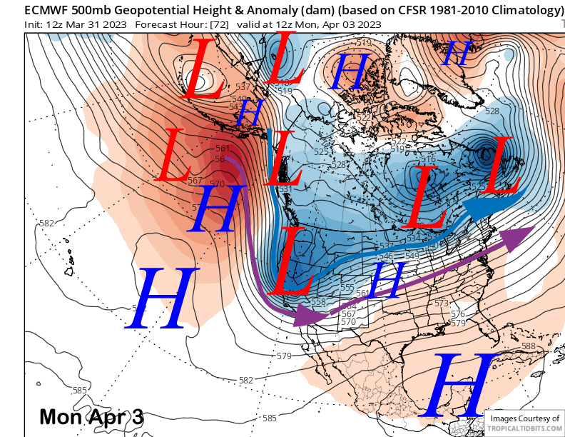
The upper trough moves southward by Sunday night and early Monday (image below) and that is when snowfall is expected to occur. It will be another colder type of system, but this time with limited moisture.
Snowfall likely starts Sunday night and continues during the day Monday before ending Monday PM or early evening. The ECM model is forecasting just under half an inch liquid (image below) while the GFS model is showing slightly less.
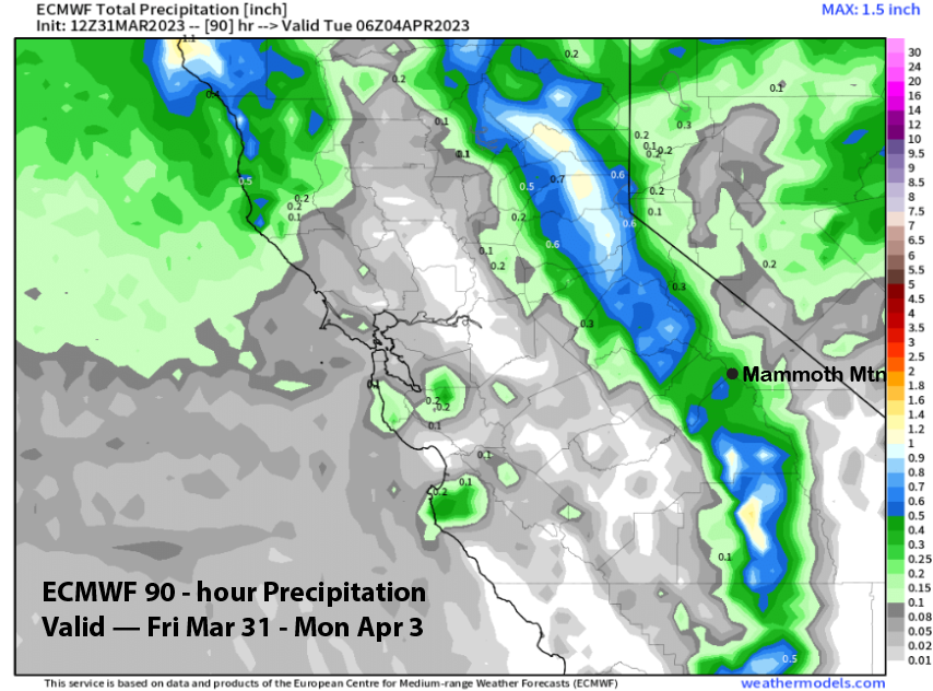
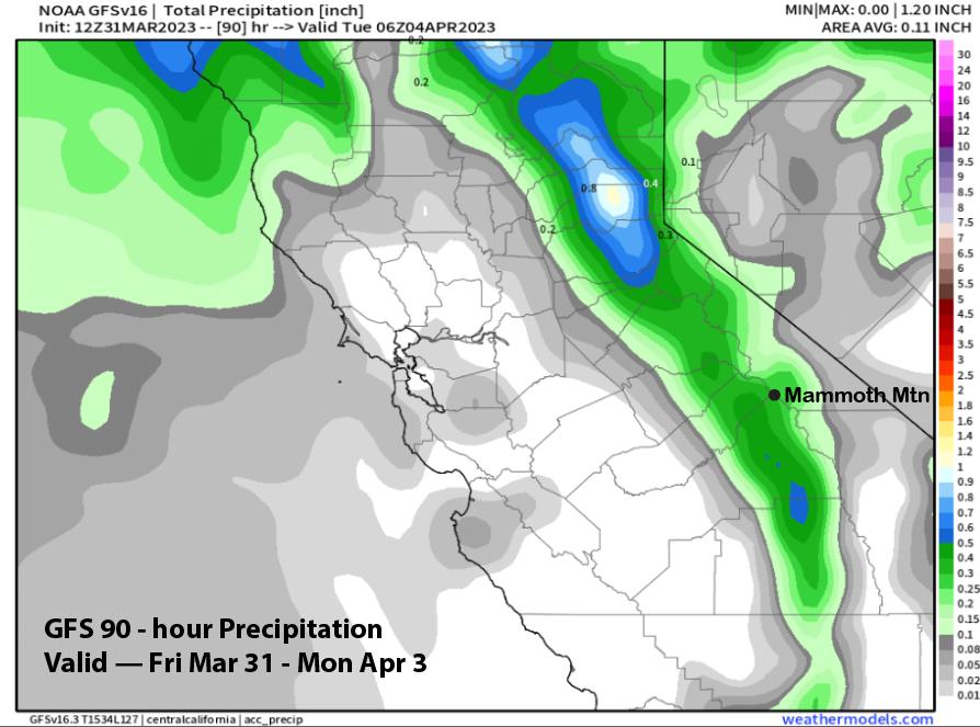
Amounts will probably be up to 6” at Main and a bit more up top. It will be a dry type of snowfall and there should be enough for at least low-end powder turns on Monday and up top on Tuesday when dry weather returns.
Long Range (Days 5+)
The longer-range guidance is still suggesting a shift toward spring over the 6-10 day period with potential spring storm chances returning around mid-month.
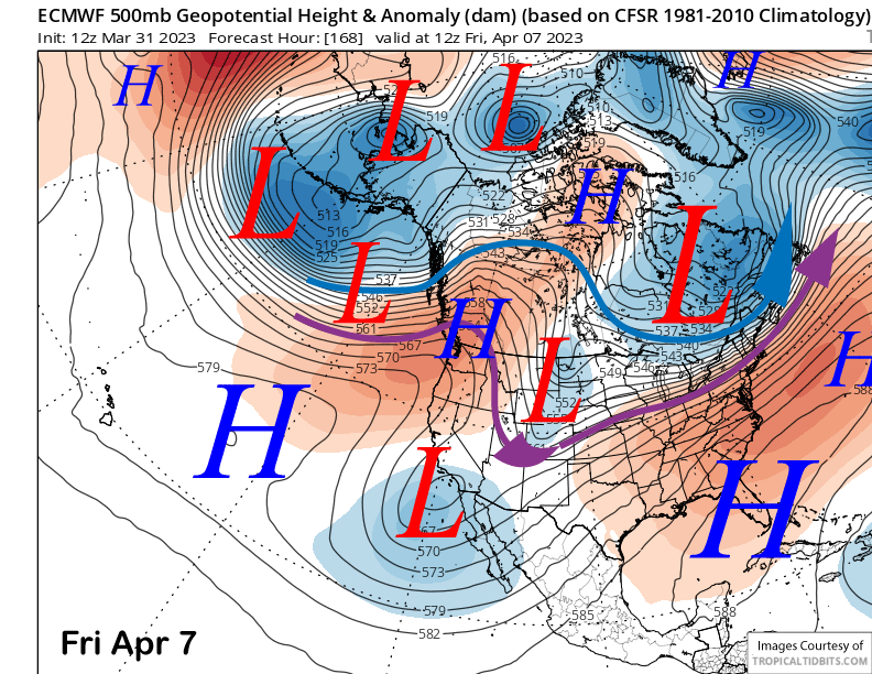
The ECM model builds a ridge over northern CA toward the end of next week (image below) with a cut-off over SoCal. The ensembles then favor the ridge to continue to build through the following weekend. Temps will probably stay seasonably cool next week before warming up over the weekend.
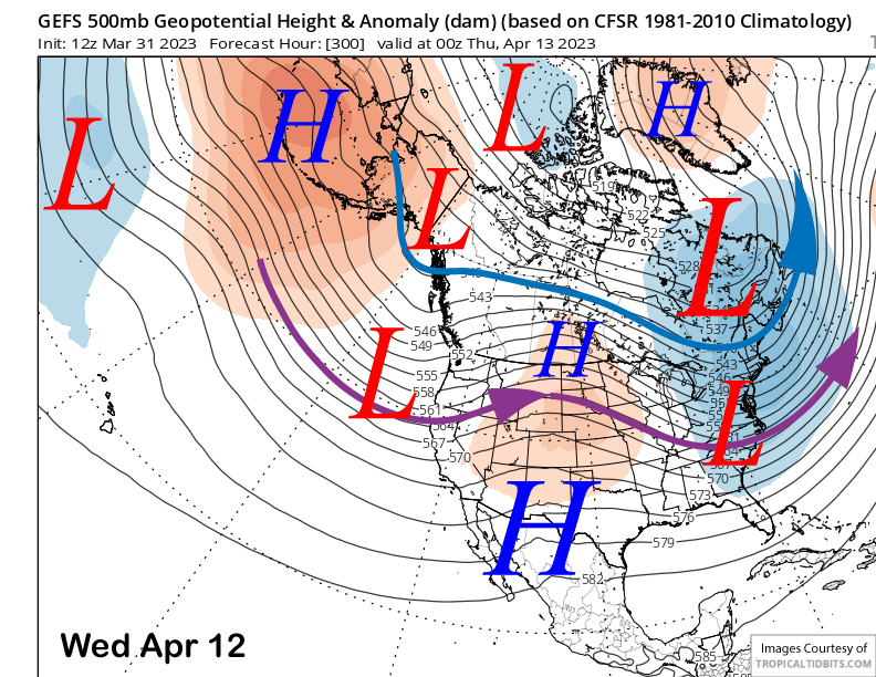
The longer range ensembles (GFS ensemble mean below) favor a trough to reform across the West Coast around mid-month. The ECM EPS is similar, but just a little slower with the formation of the long-wave trough.
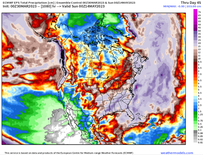
Thus, spring storm and powder chances may return over the second half of the month. The latest control run of the ECM 45-day forecast (image below) is showing about 4” liquid for the rest of April and into May. It might not add much to the record base at this point, but a powder day or three is not out of the question for the rest of this season. WG