Powder Forecast –Tuesday January 11th, 2022
Ted Schlaepfer CCM —- Mammoth Mountain WeatherGuy
Snowfall forecasts are valid at the Sesame snow course (Main Lodge) for the prior 24 hours as reported in the 6-7 AM morning snow report.
**Snowfall forecast confidence ranges from very low (1) to very high (5)
Wed 1/12 = 0”
Thu 1/13 = 0”
Fri 1/14 = 0”
Sat 1/15 = 0”
Sun 1/16 = 0”
Mon 1/17 = 0”
Tue 1/18 = 0”
Wed – Fri 1/19 – 1/21 = 0”
January Snowfall = 0”
January Forecast = 10 – 30”
Detailed 4-day Snowfall Forecast:
Wed 1/12 through Sat 1/15 – No snowfall expected all days.
Forecast Summary:
Short Term (Days 1 – 4):
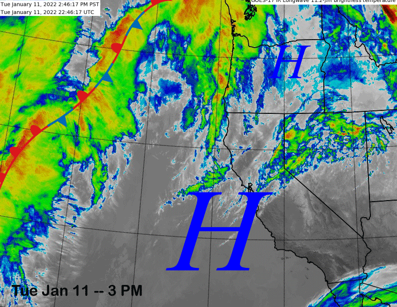
The infrared satellite image (below) this afternoon shows some high clouds moving over the top of a West Coast high-pressure ridge, otherwise, dry weather continues, with the ridge forecast to strengthen a bit over Ca tomorrow.
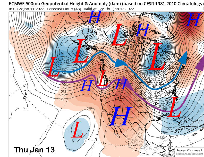
The ECM (image below) and other models move a weak short-wave trough through the ridge into the PacNW and far NorCal on Thursday with little effect for the weather in Mammoth. The ridge of high pressure is then forecast to rebuild over the state through the end of the week and into the MLK Holiday weekend resulting in continued dry weather.
Long Range (Days 5+):
The longer-range guidance is still looking abysmal for significant snowfall anytime soon with dry weather still favored to continue to at least the middle part of the last week of the month or probably longer.
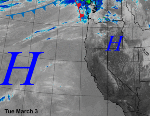
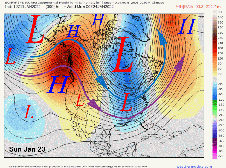
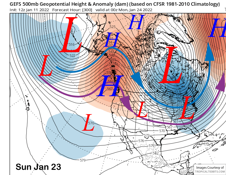
The ECM model moves a very weak cut-off low slowly toward the SoCal coast over the weekend and Monday next week (image below) before it slides eastward by Tuesday. The other models are similar.
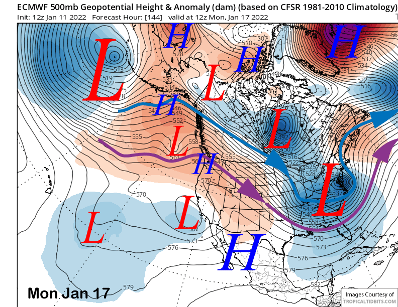
Its passage early next week will likely result in slightly colder temperatures and maybe some flurries over the latter half of the weekend. Winds will increase a bit over the weekend too, but will be northeasterly, which is not a great wind buff direction for most of the mountain and often strips the very top.
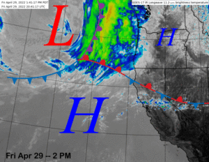
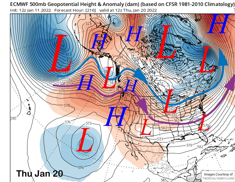
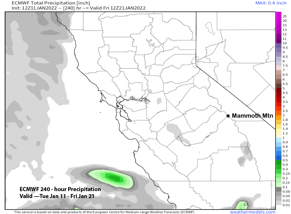
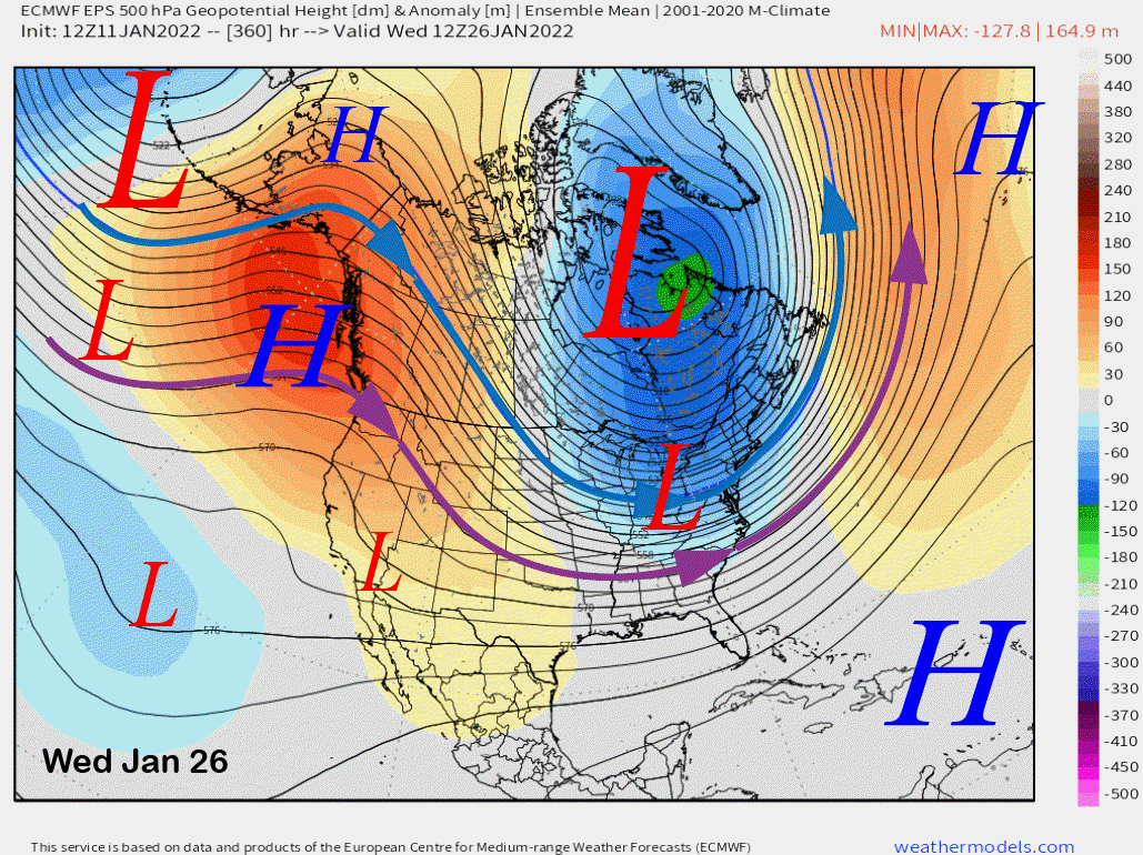
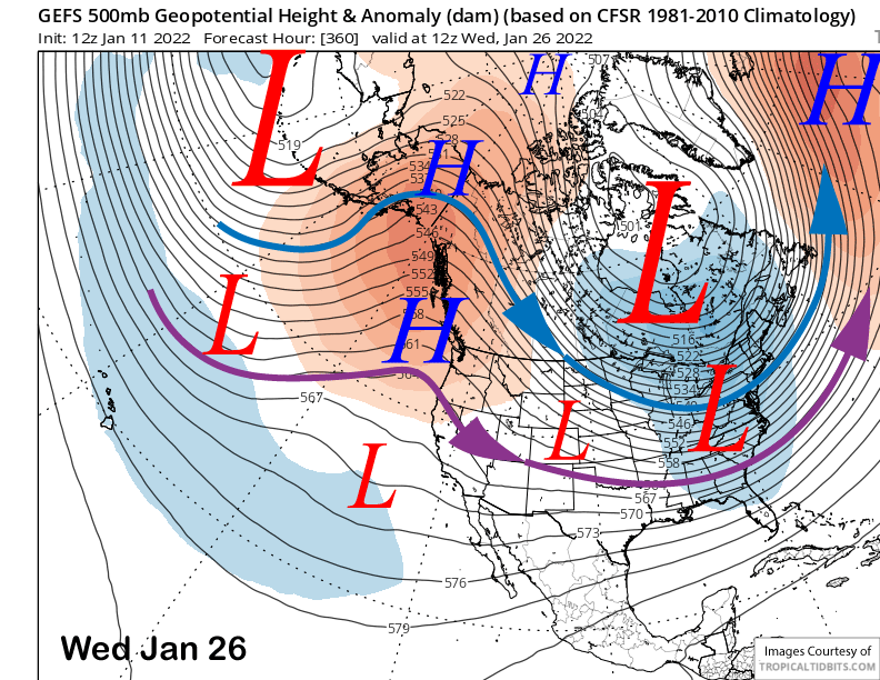
The ECM model then rebuilds the high-pressure ridge toward the middle part of next week (image below) for sustained dry weather. Temperatures may actually get seasonably mild and may approach the 50s again at Main. The precipitation forecast for the 10-day period is completely dry (two images below)
The longer-range fantasy guidance is probably close to reality with the high-pressure ridge forecast to remain along the West Coast and a trough in the East, although the ridge is centered north of CA and over the PacNW. Both the ECM ensemble (image below) and GFS ensemble (two images below) are quite similar in their projections for continued dry weather for CA and Mammoth.
The generally dry pattern is forecast to continue through the end of the 15-day forecast period with both models (images below) holding the ridge in place for the most part, although it does begin to edge north and slightly west toward the Gulf of Alaska. If it does retreat northward, then there is a chance for breakthrough of the westerlies under the ridge. A couple of the GFS runs of late showed this scenario for that last week of January. Right now, that is not favored to happen at that time.
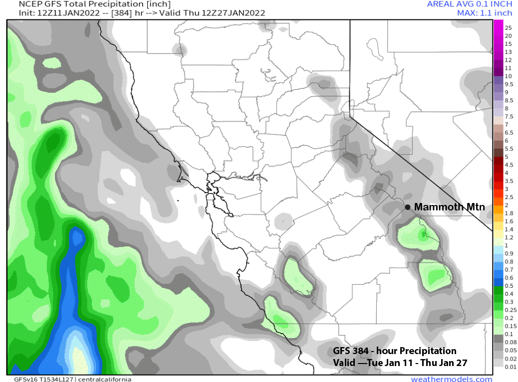
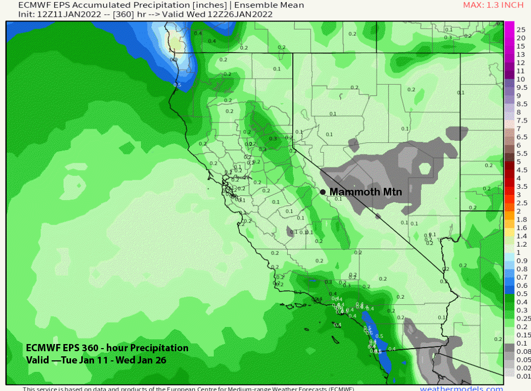
And that is what the latest GFS run is suggesting as it is mostly dry for the 16-day period (image below). That is well supported by the ECM EPS 15-day forecast that is only showing very light amounts for Mammoth into January 26th (two images below).
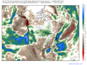
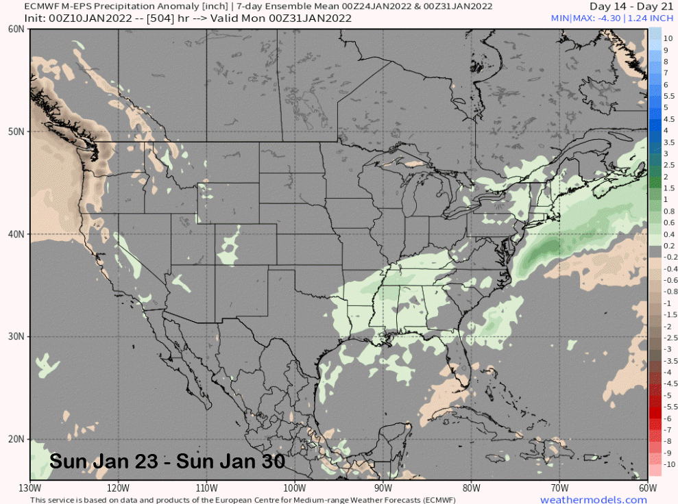
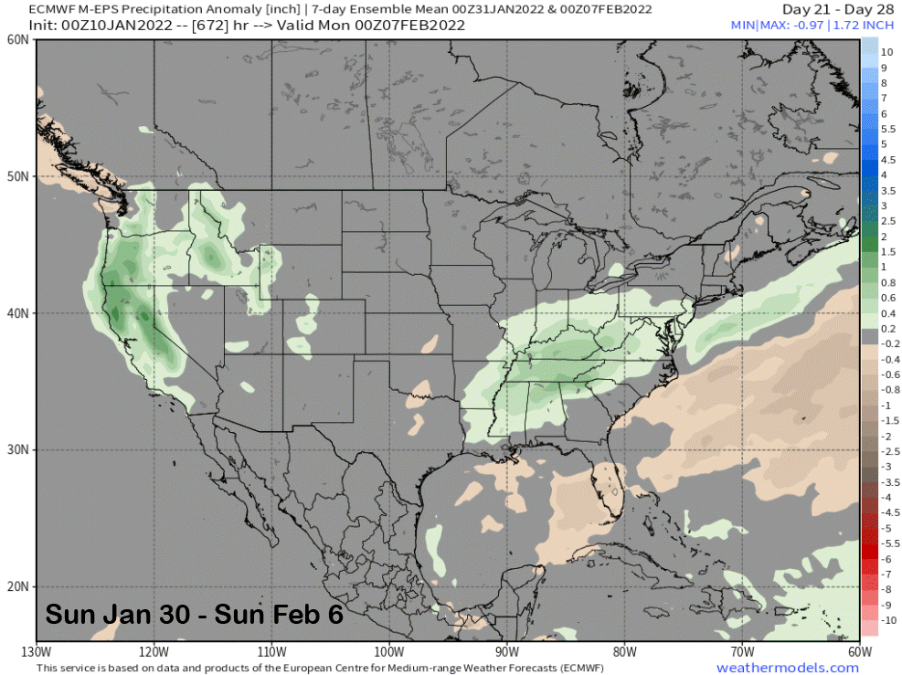
The only real good news about today’s powder forecast is that the ECM 45-day climate model forecast is still mostly unchanged from the previous few runs, showing storminess increasing toward the end of the month and early February. It shows precipitation increasing week 3 (image below) and mostly during week 4 (two images below) that is early February.
Based on the latest EPS output, if anything, I think a slower transition back to wet is more realistic and probably might not happen until the last weekend of the month or later. A lot of it has to do with the MJO evolution and whether it will play a role in the teleconnection forcing across the mid-latitudes. Unfortunately, the CPC web site has not been updating regularly lately, but the latest peek suggested the suite of models are in major disagreement with the MJO forecast, with the ECM moving it back westward into phase 6 and other models moving it eastward toward phase 1 and 2. It is a wait and see game again. WG