Powder Forecast –Friday April 15th, 2022
Ted Schlaepfer CCM —- Mammoth Mountain WeatherGuy
Snowfall forecasts are valid at the Sesame snow course (Main Lodge) for the prior 24 hours as reported in the 6-7 AM morning snow report.
**Snowfall forecast confidence ranges from very low (1) to very high (5)
Sat 4/16 = 1 – 2” (H20 = 0.15” – 0.25”) **4
Sun 4/17 = 5 – 7” (H20 = 0.60” – 0.85”) **4
Mon 4/18 = 0”
Tue 4/19 = 0”
Wed 4/20 = 0 – 1”
Thu 4/21 = 0 – 2”
Fri 4/22 = 4 – 8”
Sat – Mon 4/23 – 4/25 = 2 – 4”
April Snowfall = 7”
April Forecast = 20 – 30”
Detailed 4-day Snowfall Forecast:
Sat 4/16 – Snow, heavy during the morning, tapers off during the afternoon and end tomorrow evening. Windy through the early afternoon. Accumulations 5 – 7” by Sunday morning, up to 10” up top.
Sun and Mon 4/17 and 4/18 – No snowfall expected both days.
Tue 4/19 – Chance for light snow during the afternoon/evening. Accumulations 0 – 1 by Wednesday morning.
Forecast Summary:
Short Term (Days 1 – 4):
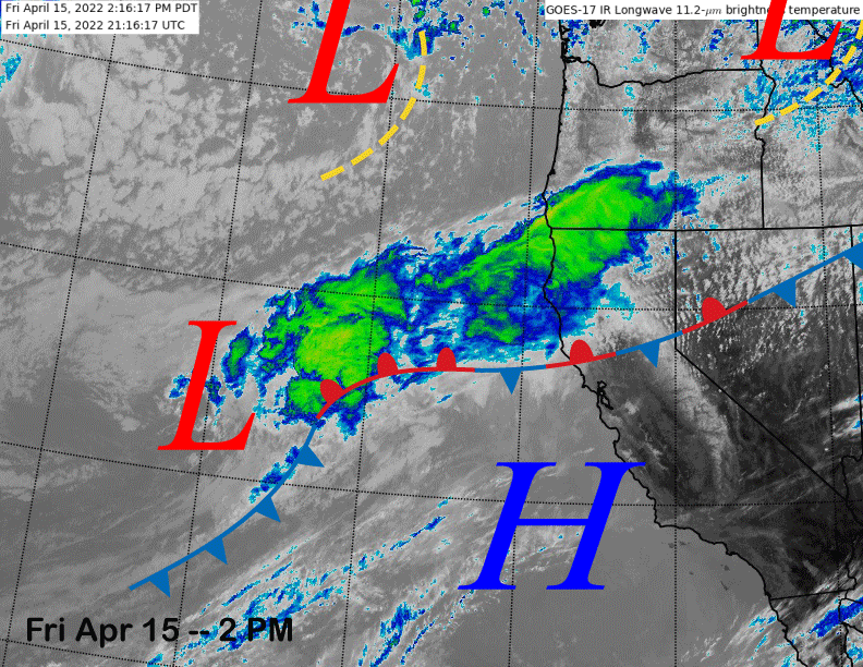
The infrared satellite image (below) today shows a stationary front aligned across NorCal attached to a developing weather system offshore that will move through the Sierra tomorrow during the day. Snowfall is expected to start very early tomorrow morning and become heavy during the morning hours before tapering off during the late afternoon.
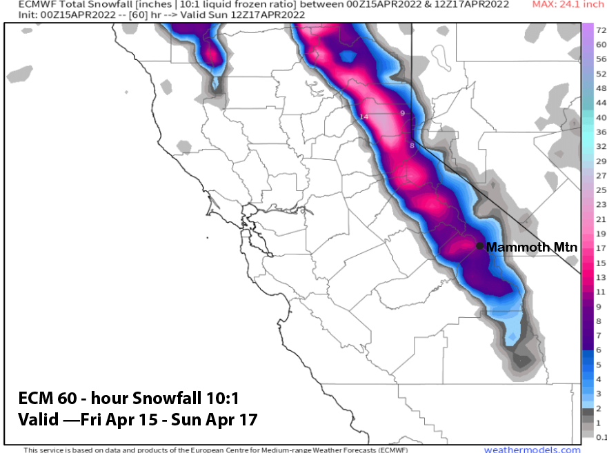
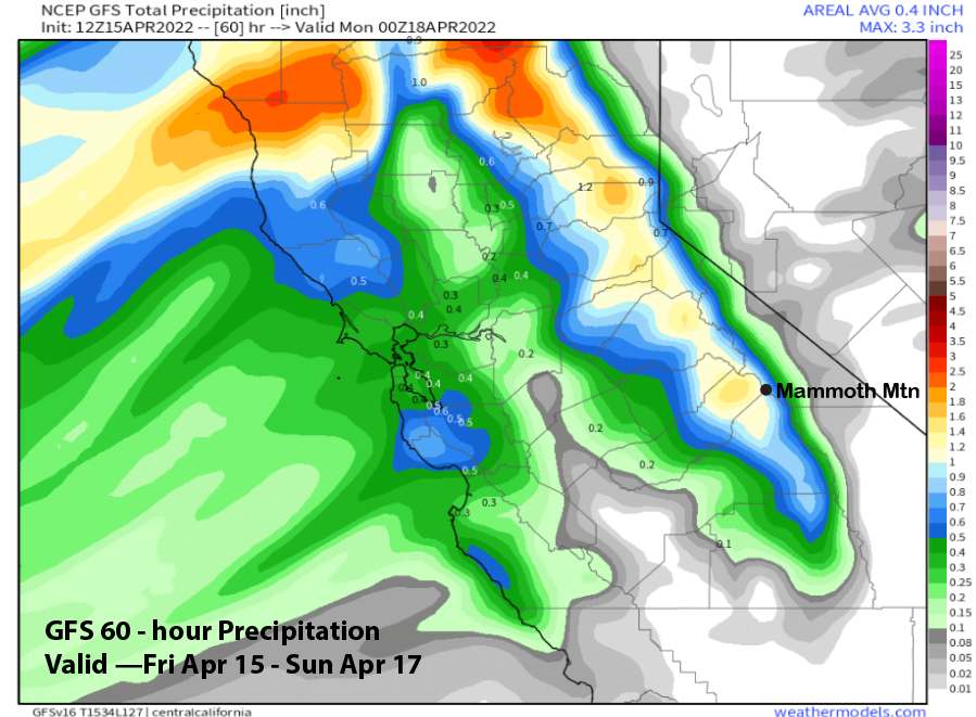
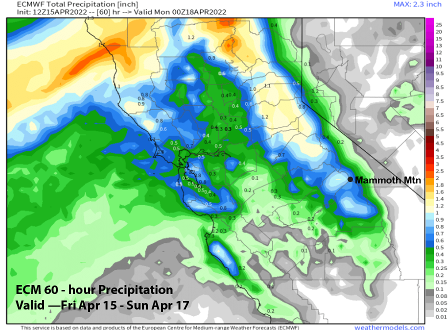
The model Quantitative Precipitation Forecasts (QPF) have increased a bit from the last update with the GFS model now showing the most at around 1” liquid (image below) with the 12Z run of the ECM showing about 0.85” (two images below). This is not a cold storm with snow levels around 6000-6500 feet and the snow should be a bit cement-like. Nonetheless, it looks like a good bet for at least 6” of snow at Main and more up top with a decent chance for liquid totals over 1” for the first time in 2022.
With the heaviest snow falling just after lifts open, and most, if not all, of the snow falling by the end of operations, tomorrow should be a decent/good storm riding day. The winds will increase through midday likely leading to lift holds by late AM/noon, but Ch 22 could open briefly during the morning hours. Since it is a southwest wind, Ch 2 may stay open when normally Ch 1 closes. If Ch. 7 stays open, laps on the backside of Ch. 1 should be wide-open and fun (e.g. St Aton’s, Andy’s Double Gold).
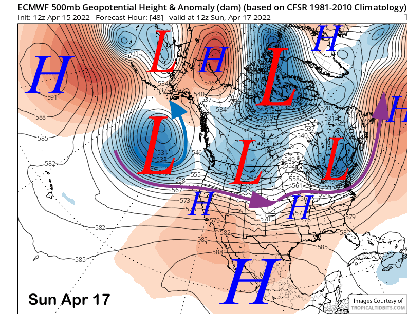
High pressure will build into the state on Sunday (image below) and the last day of operations for the Canyon side of the mountain. Temps should warm up nicely with spring conditions possible by the afternoon for the lower part of the mountain and pond skim.
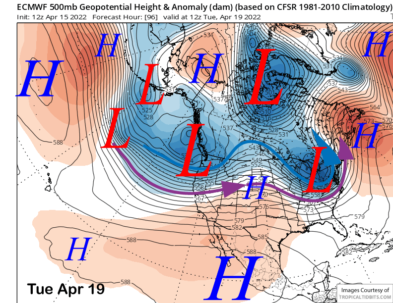
Continued dry weather is forecast for Monday before a weather system moves north of the Mammoth area on Tuesday (image below). Similar to yesterday, there is a chance that the front may brush Mammoth during the afternoon/evening for a chance for light snowfall, but likely not enough for powder conditions.
Long Range (Days 5+):
The longer-range guidance says the winter-like storm period we never got during January through March will continue next week with a chance for a larger storm toward end of the week. If it doesn’t happen tomorrow, that storm will be another, and maybe last chance, for a storm in 2022 that produces more than 1” of snow water equivalent.
Dry weather is expected on Wednesday and into Thursday next week before the aforementioned storm system moves into the state Thursday and into Friday. It is a very interesting set up and I would not be surprised if the model guidance trends stronger as we get closer to the potential event.
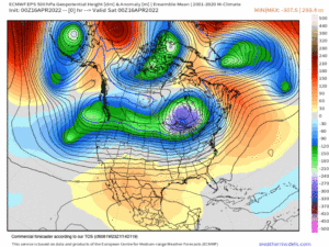
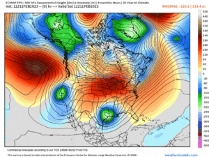
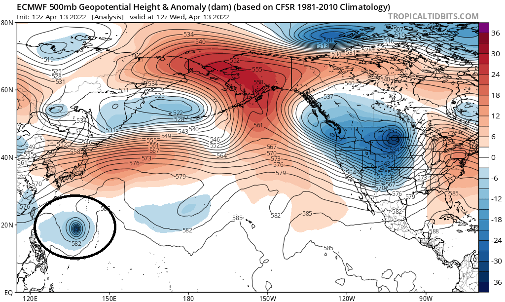
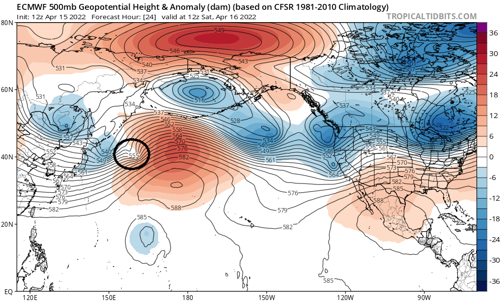
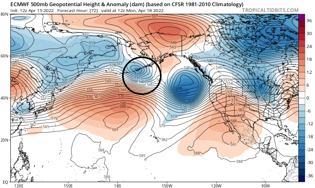
The reason is due to the fact that this potential weather system is associated with a recurving typhoon in the western Pacific. Category 4 Typhoon Malakas (image below, black circle) has been swept up by the East Asian jet stream (two images below, black circle) and is expected to curve around the upper-level ridge south of the Aleutians (three images below, black circle) before diving southward and energizing a long-wave trough in the eastern Pacific (four images below) around Thursday next week. That could add water vapor and increased dynamics (e.g. upper-level divergence) to the potential storm.
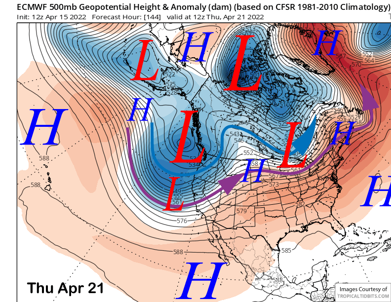
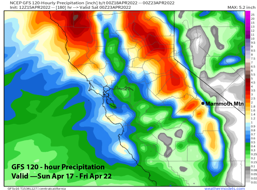
That rather deep trough for this time of year is forecast to move into the Sierra Thursday and into Friday and it could be a good snow event if everything lines up. Unfortunately, the latest ECM does not phase the moisture and dynamics properly and it is only showing light to moderate amounts. Fortunately, that run is an outlier versus most of the ensembles. The Canadian and GFS (image below) models are wetter with the 12Z GFS showing about 1.25” liquid or around a foot of snowfall.
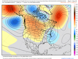
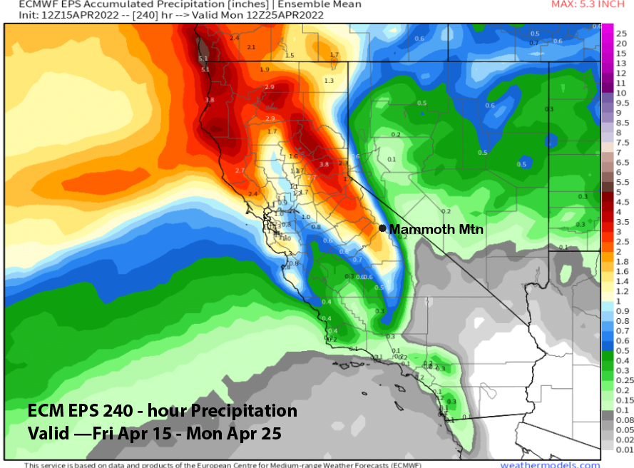
It is still about a week out and historically the models don’t handle these recurving typhoons well in the extended time frame. If anything, they underdo the QPF and are too low with the snow levels. I guess it is a good thing that nothing below 8500 feet will be open anymore anyway if that happens. But there is pretty good confidence that it could be a good storm as the ECM EPS total precipitation is showing well over an inch for the period (image below).
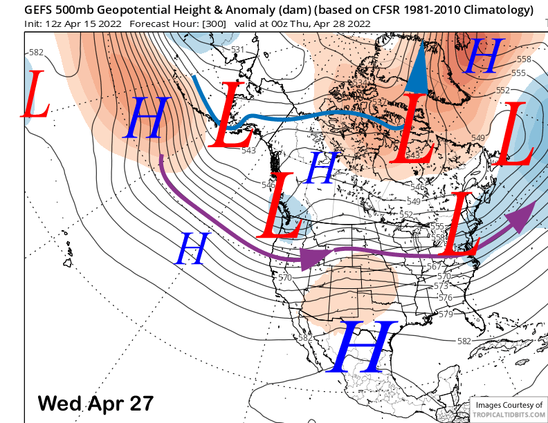
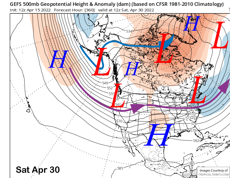
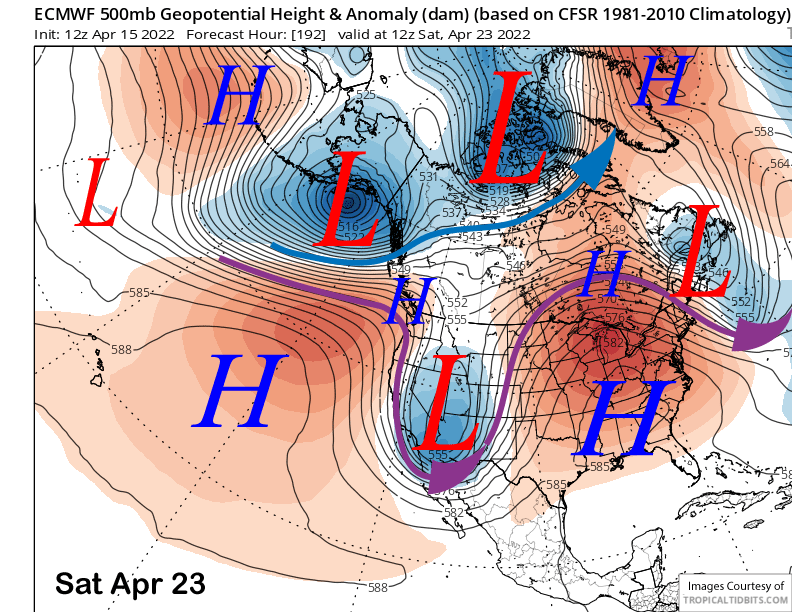
Fair and dry weather will likely return over the following weekend as models say the weather system will cut-off from the jet stream and move into Arizona (image below). The weather may stay winter-like for a day or two, but this time of year, reverts back to spring quickly. Thus, the best powder conditions will probably be next Friday only with Thursday a possibly storm riding day.
The longer-range fantasy guidance does keep a weak trough along the West Coast over the last week of April (images below). However, the jet stream is too far north and too weak for any significant storms to move into Central CA. It looks has all the look of spring with a weak jet stream that is father northward like normal. Powder days in May do happen rarely, but I would not count on it, and if you want one more day, plan on tomorrow/Sunday AM or the end of next week. WG