Powder Forecast – Tuesday, April 2nd, 2024
Ted Schlaepfer CCM—- Mammoth Mountain WeatherGuy
Snowfall forecasts are valid at the Sesame snow course (Main Lodge) for the prior 24 hours, as reported in the 6-7 AM morning snow report.
**Snowfall forecast confidence ranges from very low (1) to very high (5)
Wed 4/3 = 0”
Thu 4/4 = 0 – 2”
Fri 4/5 = 16 – 21” (H20 =1.25” – 1.50”)**3
Sat 4/6 = 2 – 3” (H20 =0.10” – 0.15”)**3
Sun 4/7 = 0”
Mon 4/8 = 1 – 3”
Tue 4/9 = 0 – 2”
Wed – Fri 4/10 – 4/12 = 0”
April Snowfall: 0”
April Forecast = 30 – 40”
Detailed 4-day Snowfall Forecast:
Wed 4/3 – No snowfall expected.
Thu 4/4 – Snowfall develops early Thursday and increases in intensity during the day, becoming heavy at times during the late afternoon and evening, tapering in intensity overnight. Accumulations 16 – 21” by Friday AM at Main Lodge, 24”+ up top.
Fri 4/5 – Snowfall ends during the morning, then snow showers during the afternoon, ending in the evening. Accumulations 2 – 3” by Saturday AM at Main Lodge, 3”+ up top.
Sat 4/6 – No snowfall expected.
Forecast Summary:
Short Term (Days 1 – 4):
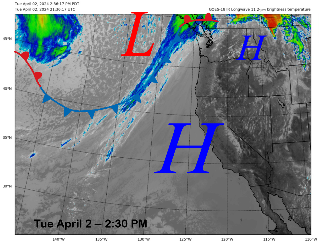
The current infrared satellite image (below) shows high pressure building over the state, resulting in fair/warmer weather. High pressure will continue to hold tomorrow until the weather system just entering the eastern Pacific moves into the state by early Thursday.
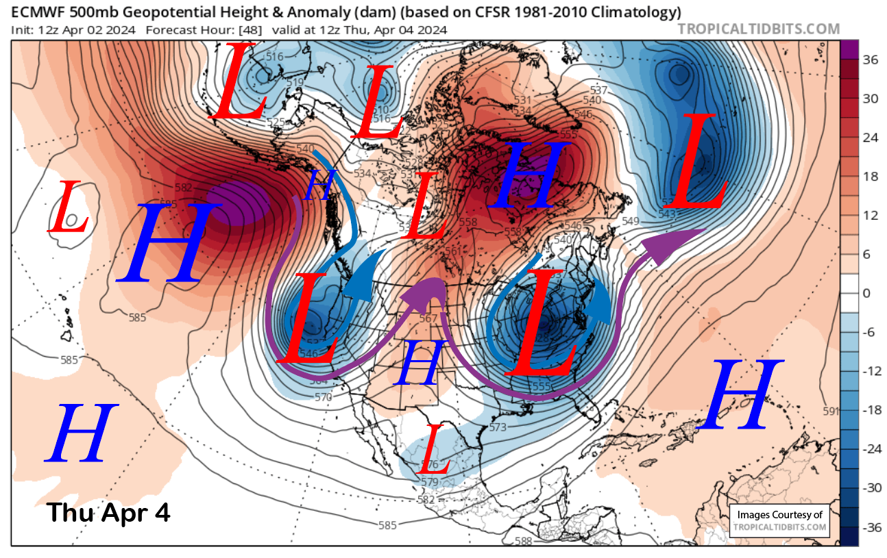
The deep upper-level trough will move through the state on Thursday (image below) and Friday (two images below) and will usher into the area, a very cold air mass for this time of year. Temperatures should drop into the single digits up by Friday and teens to low 20s elsewhere on the mountain.
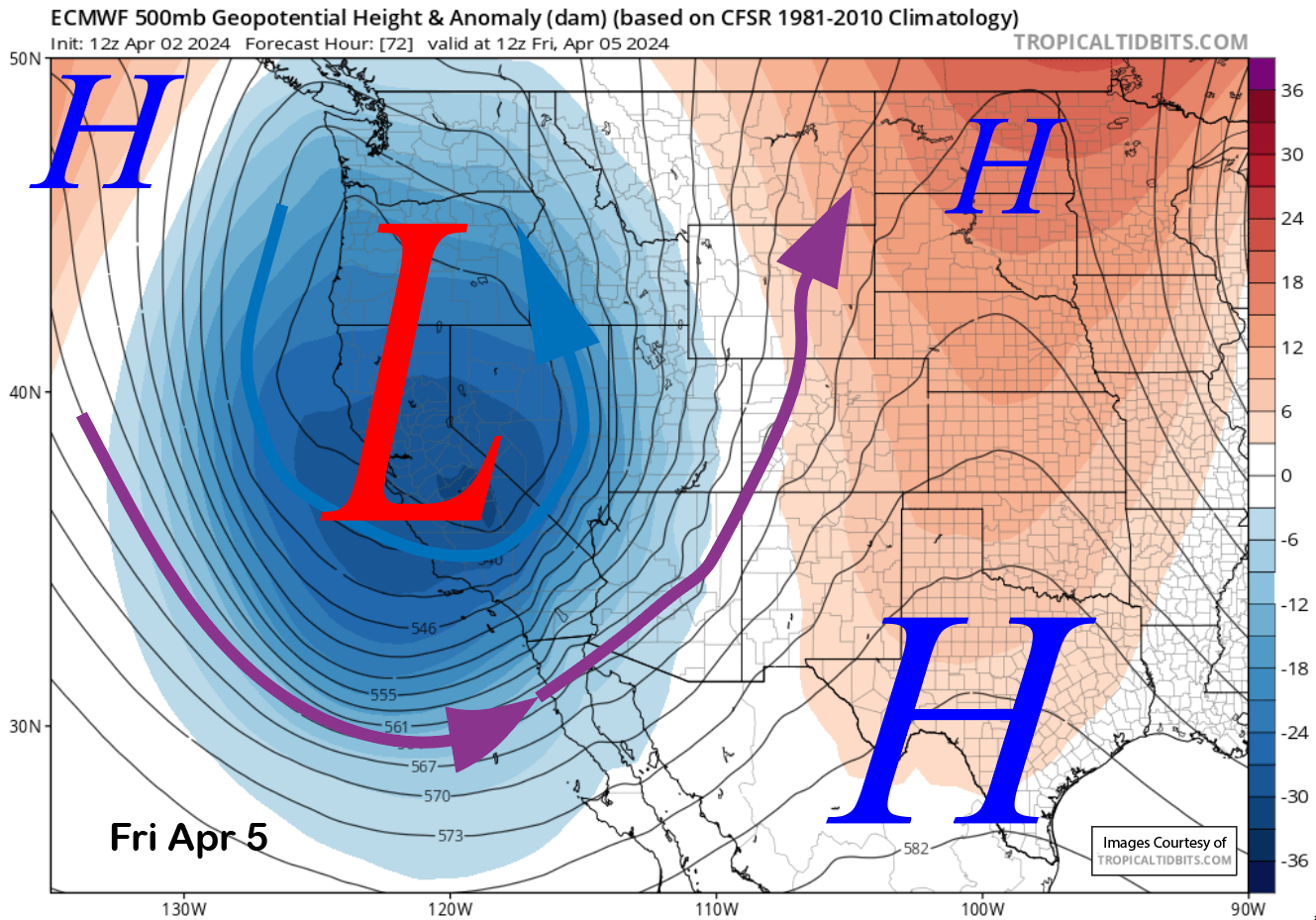
The low pressure system will also produce a round of moderate to heavy snowfall Thursday and Thursday evening. It will be a cold, dry type of snowfall as snow levels will be around 5K Thursday during the day before lowering to near 3K by early Friday. Snow ratios will probably be in the 15”:1” range which is rather rare for early April.
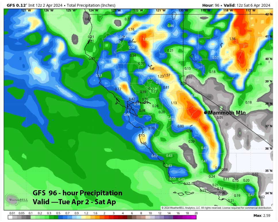
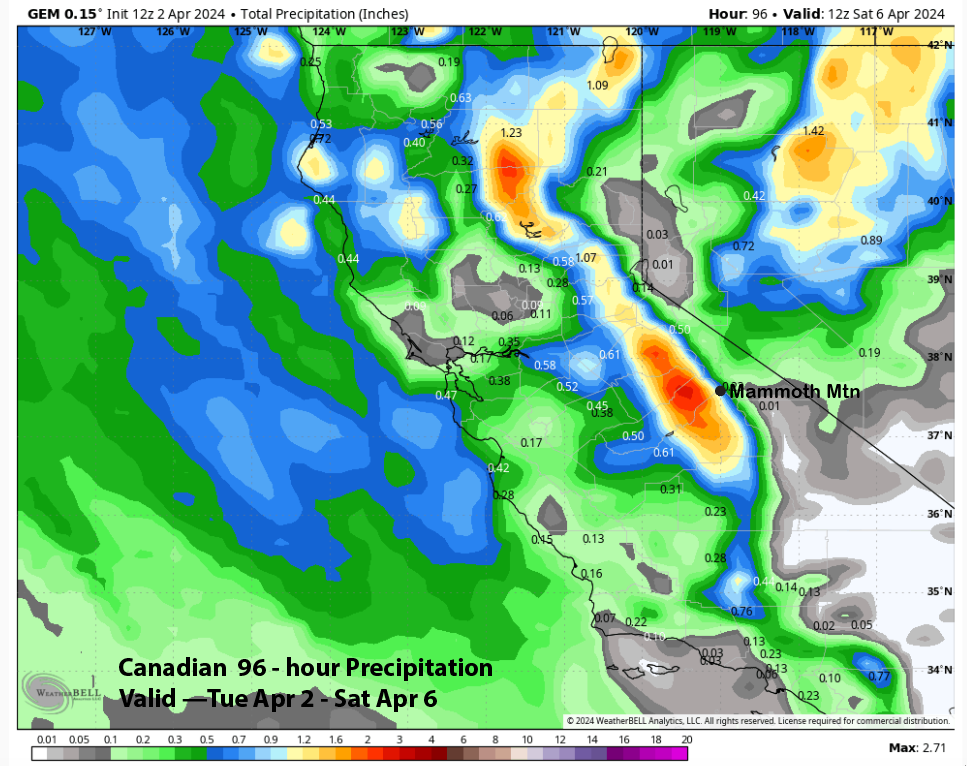
Model QPF is mostly aligned with the GFS (image below), ECM (two images below), and Canadian models (three images below), showing about 1” liquid for the main pulse but having about 1.5” liquid west of the crest.
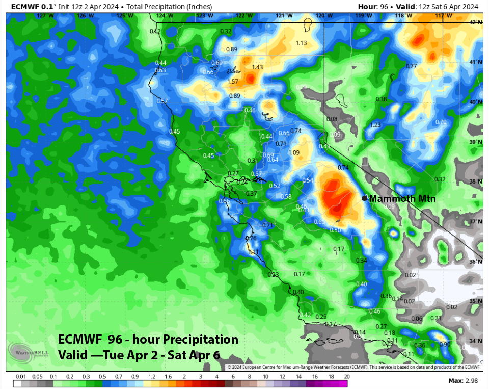
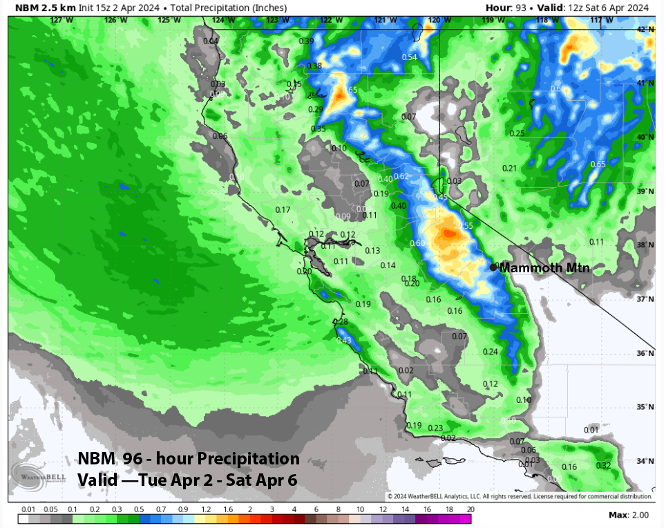
The National Blend of Models (image below) is showing slightly less, while the ECM EPS is favoring about 1.25” (two images below). The forecast leans toward the wetter ECM EPS due to the anomalous deep upper-low and southern position of the trough, which will result in a period of strong upslope flow on Thursday PM.
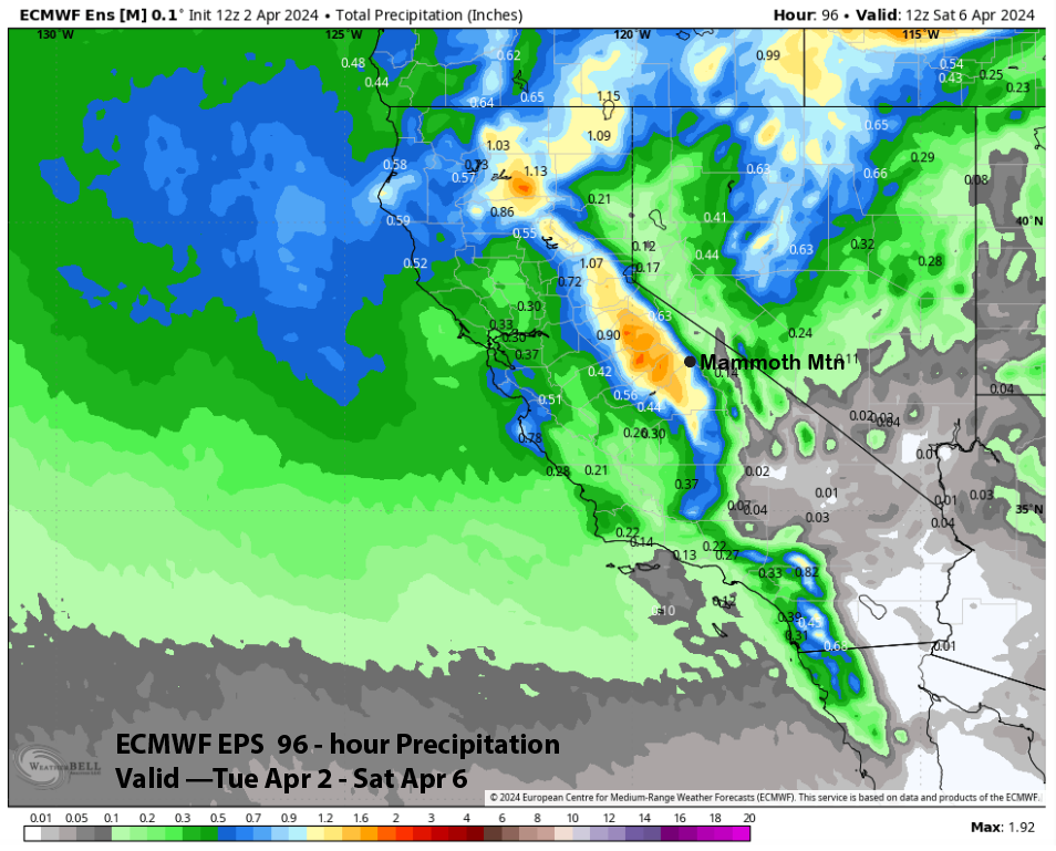
With snow ratios at 15”:1”, snowfall totals should be around 20” at Main Friday morning and around two feet up top. The Kuchera snowfall method is showing around 2 feet at the Main (cover image). The snowfall will end Friday morning with only snow showers expected during the day under the cold temps. That is a set-up for an epic powder day Friday, with Saturday likely being a good day as well when the top opens under partly cloudy and dry weather.
Long Range (Days 5+):
The longer-range guidance is still favoring typical spring weather next week, which may transition back to winter around mid-month. Typical spring weather may then return for the second half of the month, with only chances for storms.
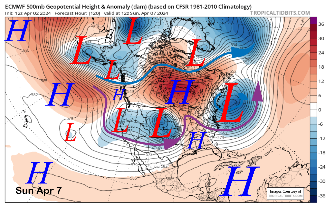
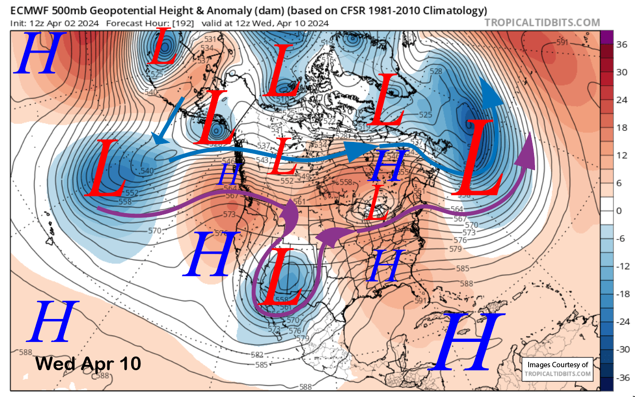
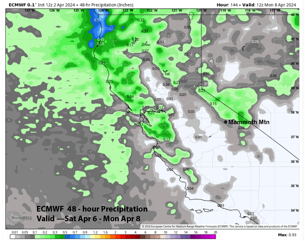
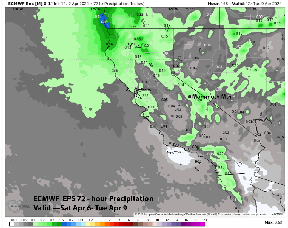
A weather system is expected to move through the state on Sunday (image below) and into Monday. It is currently forecast to be weak, and any snowfall will likely be light. It may cut off over the southern part of the state early next week, with high pressure favored to build into the region by mid-week (two images below) for a stretch of fair/spring weather.
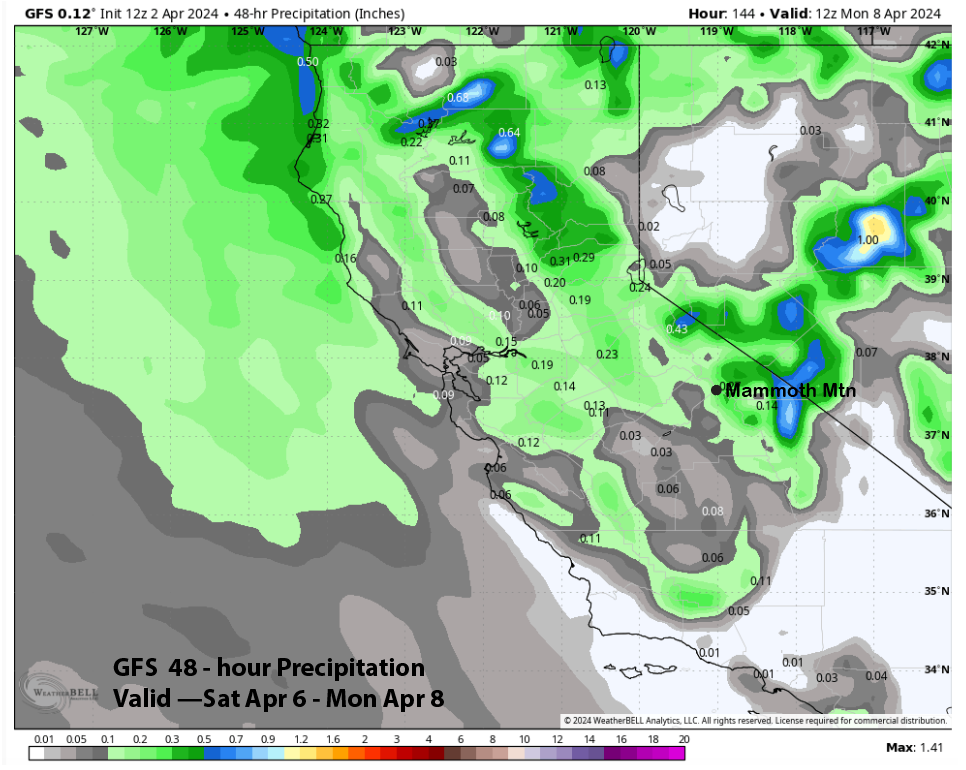
QPF from the models for the Sunday/Monday system is light and mostly under a quarter inch. GFS has about two-tenths (image below), and the ECM is the driest at less than a tenth (two images below). The ECM EPS has almost a quarter inch (three images below); thus, only a couple of inches of snowfall is favored.
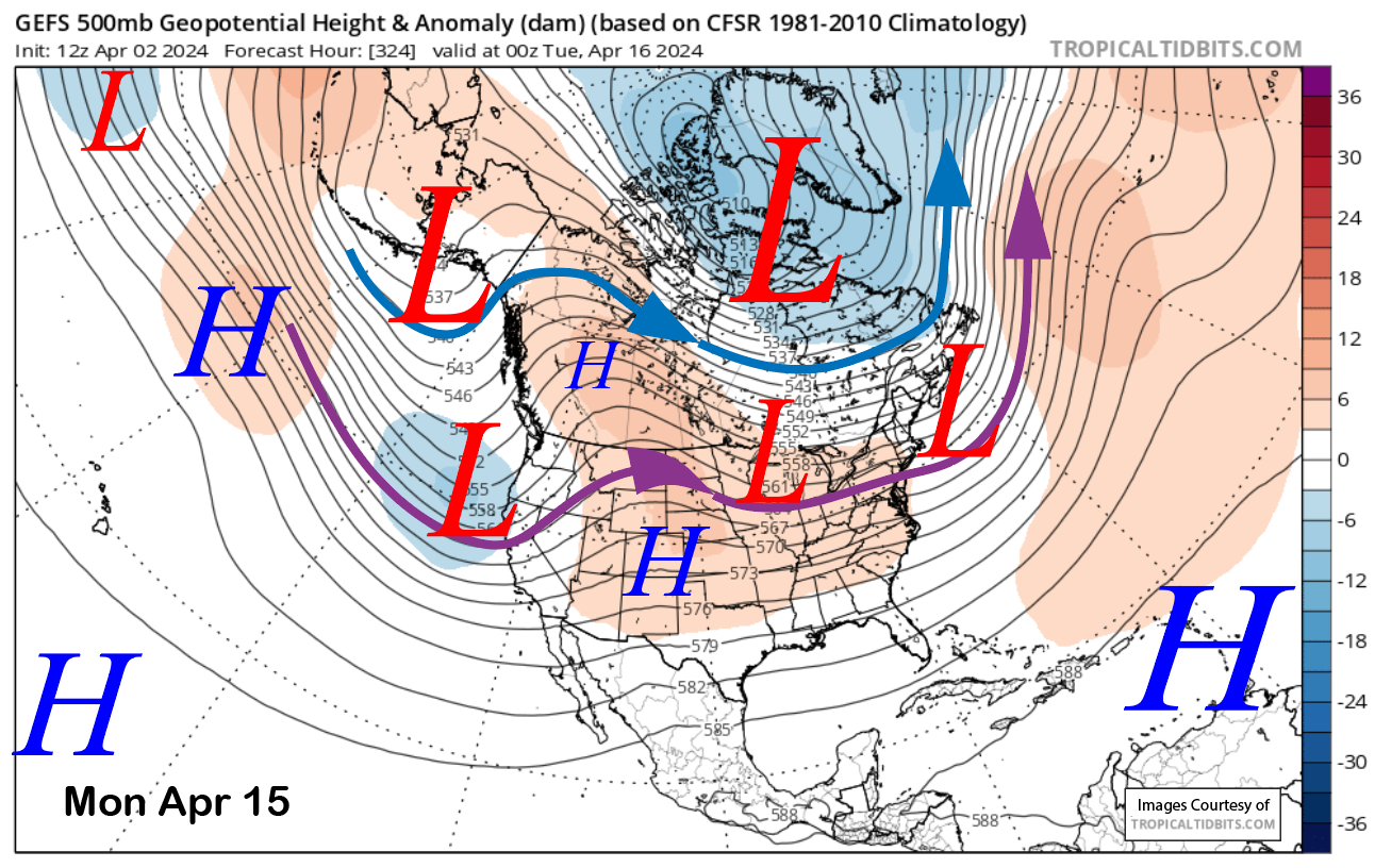
Dry weather is then expected until about mid-month when the models favor a longwave trough to redevelop along the West Coast and southward into CA (image below). Since the last post, the models have moved the jet stream (purple arrow) a bit farther southward for a better chance for snowfall at Mammoth.
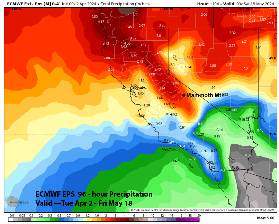
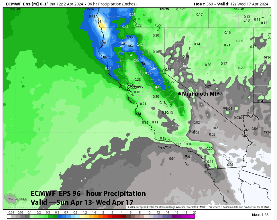
The liquid forecast from the ECM EPS is showing only light amounts right now, at around a third of an inch (image below), which would make it a rather typical spring storm. It is still very far out in time, so hopefully, this potential storm will trend wetter and be the last powder day for Chair 22 of the season.
There certainly could be more powder days over the second half of the month or later. The ECM EPS is forecasting almost 3” liquid through early May (image below). With about an inch this Thursday and Friday, that leaves about 2” liquid for the rest of the period. That sure could translate into a powder day or two this month or even early May. WG