Powder Forecast – Friday December 8th, 2023
Ted Schlaepfer CCM —- Mammoth Mountain WeatherGuy
Snowfall forecasts are valid at the Sesame snow course (Main Lodge) for the prior 24 hours as reported in the 6-7 AM morning snow report.
**Snowfall forecast confidence ranges from very low (1) to very high (5)
Sat 12/9 = 0”
Sun 12/10 = 0”
Mon 12/11 = 0”
Tue 12/12 = 0”
Wed 12/13 = 0”
Thu 12/14 = 0”
Fri 12/15 = 0”
Sat – Mon 12/16 – 12/18 = 3 – 12”
December Snowfall = 3”
December Forecast = 25 – 40”
Detailed 4-day Snowfall Forecast:
Sat 12/9 through Tue 12/12– No snowfall expected all days.
Forecast Summary:
Short Term (Days 1 – 4):
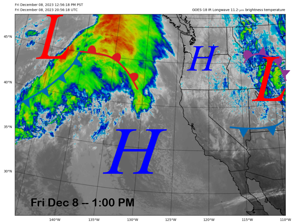
The current infrared satellite image (below) this afternoon shows high pressure moving eastward into the state as the weather system that produce some precipitation yesterday for NorCal moves into the Rocky mountain region.
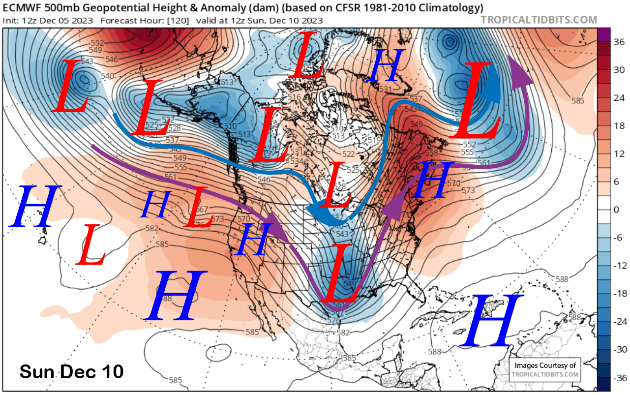
High pressure will hold through the weekend for fair and dry weather under mostly sunny skies. Temperatures will remain seasonably cold into Saturday for good snow making before it warms up a bit Sunday night into early next week. A weak short-wave crashes through the ridge (image below) early next week with some passing clouds, otherwise dry weather continues through early next week.
Long Range (Days 5+):
The longer-range guidance has not changed much with the next expected chance for snowfall just after mid-month. Dry weather may still return before Christmas with the last week of the month having the next decent chance for significant snowfall.
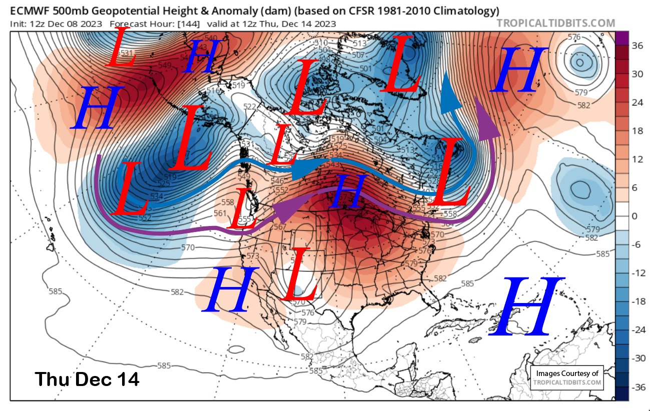
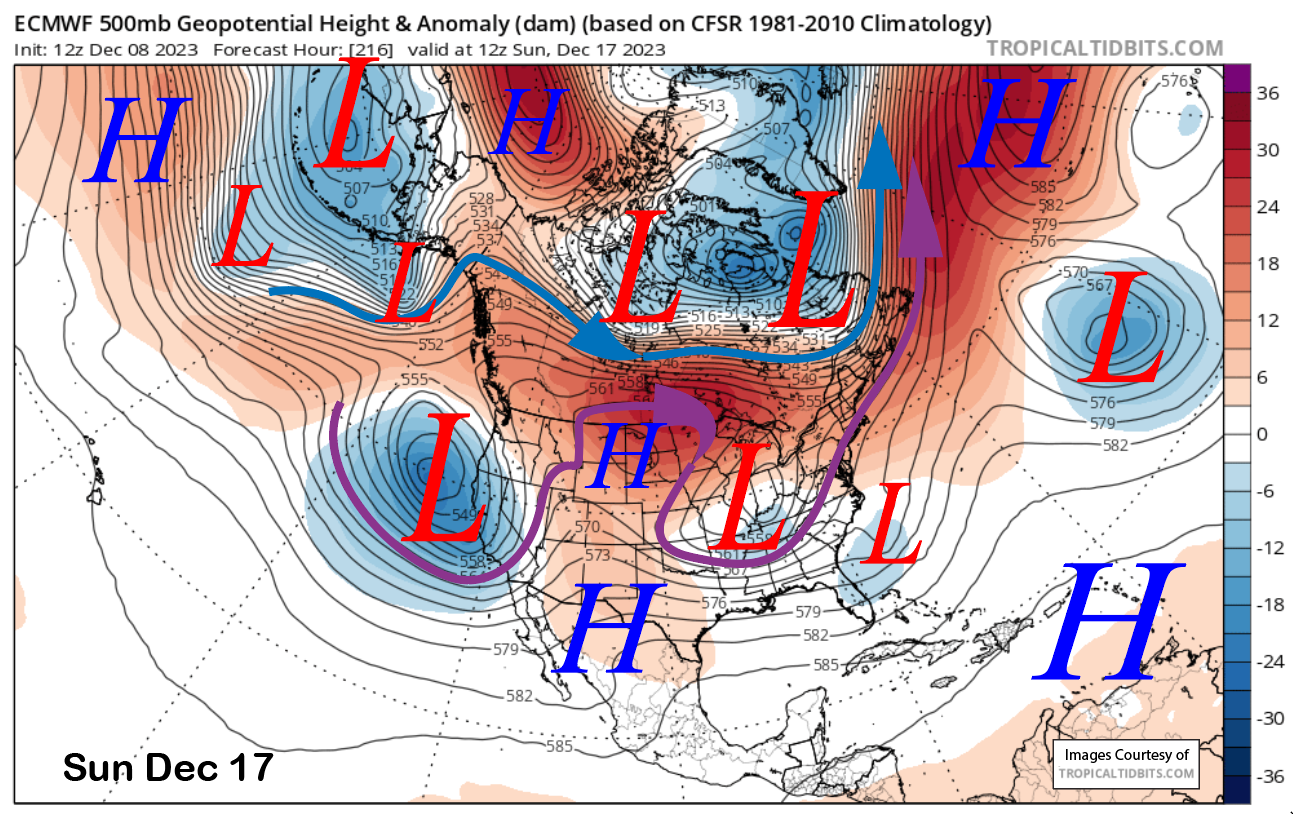
High pressure will hold through the middle part of next week with just a weak wave (image below) moving through NorCal around Thursday next week (image below). Before that, a cut-off low may set up over the SouthWest on Tuesday and that would result in slightly colder temperatures for better snow making conditions through mid-week.
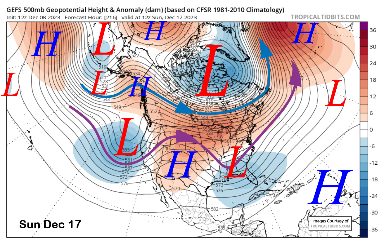
The dry weather should last through the end of next week (and scheduled Canyon/Eagle openings) before changes in the pattern are possible over the following weekend. All the models now move a low pressure trough into CA over the weekend (ECM below) for a chance of snowfall and the GFS mean also still has a trough (two images below).
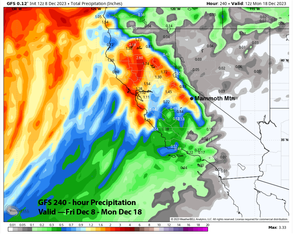
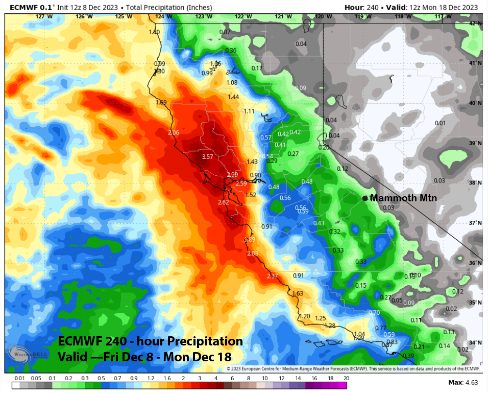
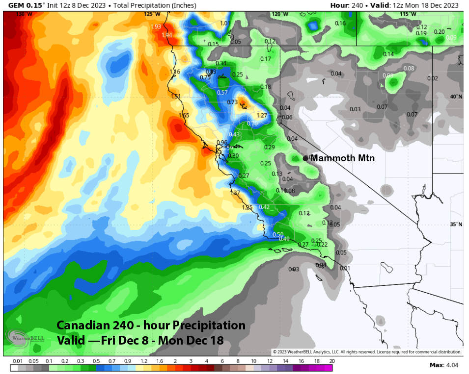
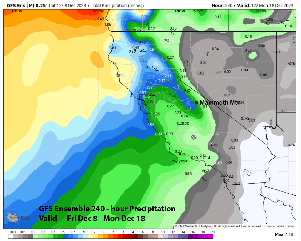
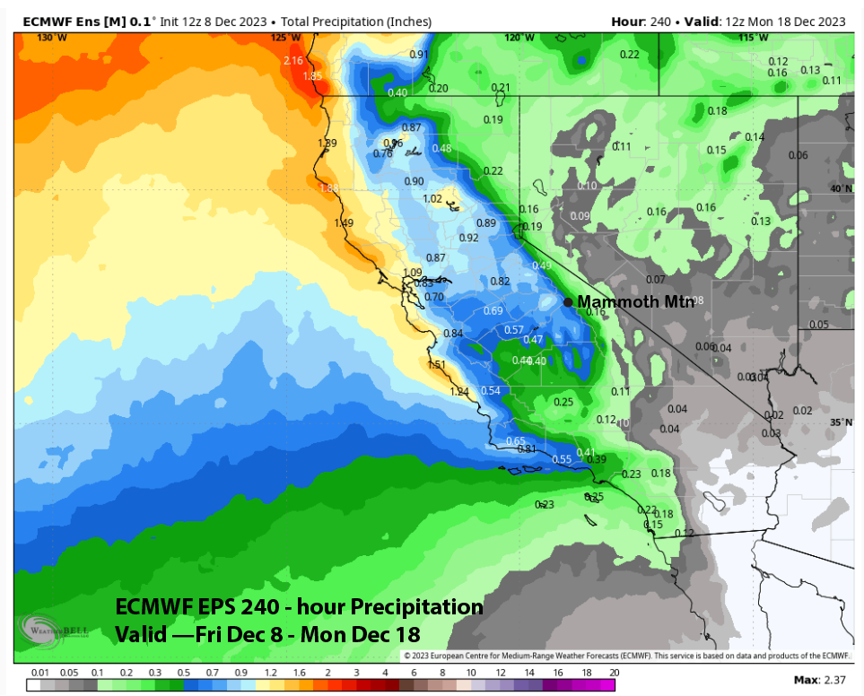
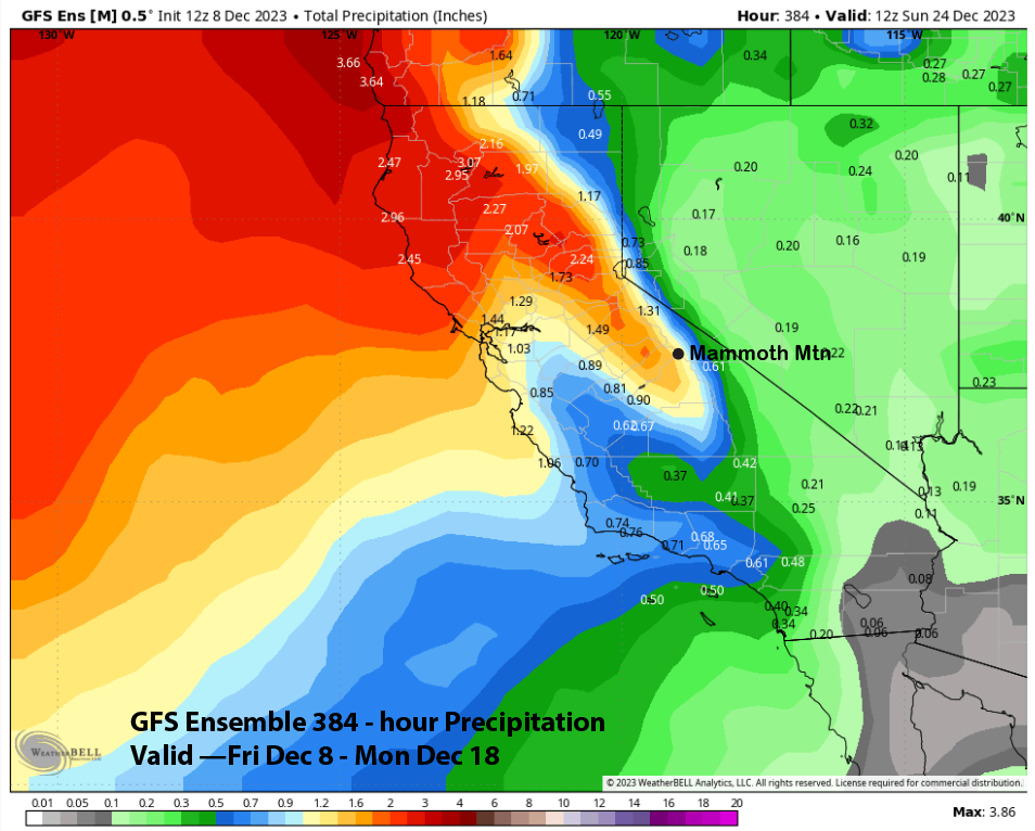
If is still far out for an accurate forecast from the deterministic guidance, and as expected, they are not in much agreement with the expected precipitation. The GFS is the wettest at over an inch (image below) with the ECM (two images below) showing much lighter amounts at about a third, and the Canadian (three images below) not showing much at all and only a tenth or so.
The GFS ensemble (image below) does not line up well with the deterministic run and shows amounts similar to the ECM run. The Canadian ensemble is similar. However, the ECM EPS is the wettest and is closer to the GFS run at about 0.75” liquid (three images below).
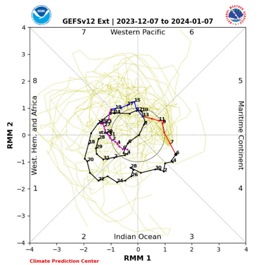
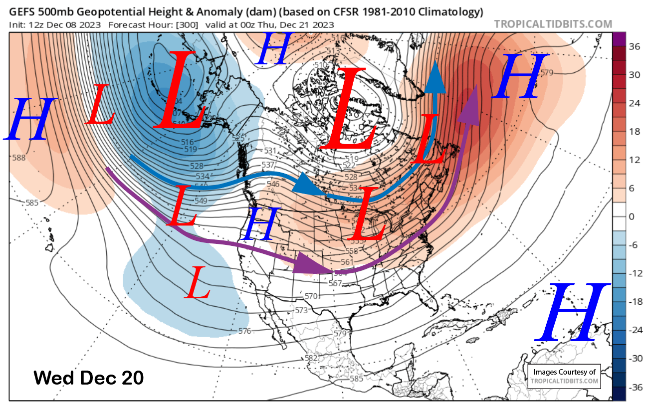
The current forecast follows a blend of the ensemble means of the various models and favors at least a few inches of snowfall and up to a foot. The key is the MJO (image below) and whether it will regain amplitude when it moves into phase 7 just after mid-month or stay inside the unit circle and not strengthen the mid-latitude troughing pattern for the West Coast.
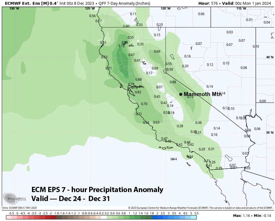
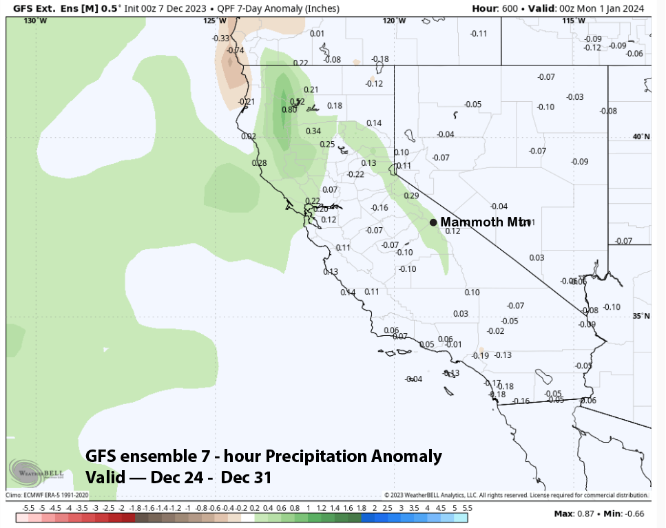
The trough may hang around for a couple days per the ensemble mean before weak ridging is favored to return during the latter part of the week before Christmas (image below). That would mean more dry weather if it verifies, however, I would say the pattern is more low-confidence that usual for even an extended forecast. The QPF from both the ECM and GFS ensembles show more precipitation moving into CA in the 11-15 pattern (GFS two images below).
The super long range guidance is getting a bit more bullish about snow chances increasing over the last week of December. The ECM long range ensemble (image below) is showing above normal precipitation that week while the GFS (two images below) is only showing average precipitation. Neither is showing below normal. Hopefully the ECM is onto something.
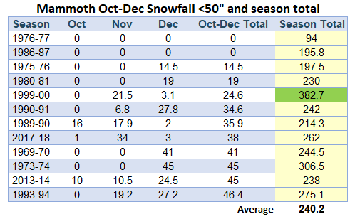
We really do need a big storm or two by the end of the month as history says it will likely be a low-tide year and earlier closing when October through December snowfall is much below average (image below). For all years back to 1972 ski season, when Mammoth snowfall was less than 50 inches for the 3-month period, only one season (1999-2000), ended up having above normal snowfall (average is 350”). Most seasons were below 300” and the average for all the seasons was 240”. But even low-tide years have great powder days. One of my best pow days ever was March 3, 2018. That was the day Climax had a big slide. WG