Powder Forecast –Friday, February 16th, 2024
Ted Schlaepfer CCM —- Mammoth Mountain WeatherGuy
Snowfall forecasts are valid at the Sesame snow course (Main Lodge) for the prior 24 hours.
**Snowfall forecast confidence ranges from very low (1) to very high (5)
Sat 2/17 = 0”
Sun 2/18 = 7– 9” (H20 = 0.75” – 1.00”)**2
Mon 2/19 = 20 – 25” (H20 = 2.00” – 2.50”)**2
Tue 2/20 = 22 – 27” (H20 = 2.50” – 3.00”)**2
Wed 2/21 = 9 – 15”
Thu 2/22 = 2 – 6”
Fri 2/23 = 0”
Sat – Mon 2/24 – 2/26 = 3 – 9”
February Snowfall = 99”
February Forecast = 140 – 170”
Detailed 4-day Snowfall Forecast:
Sat 2/17 – Dry through midday, then snowfall develops during the afternoon and continues overnight. Accumulations 7 – 9” at Main by Sunday AM, 9”+ up top
Sun 2/18 – A few morning flurries are possible; otherwise dry until Sunday evening when snowfall develops that becomes heavy overnight. Accumulations 20 – 25” at Main by Monday AM, 26”+ up top
Mon 2/19 – Heavy snowfall through midday/early PM with continued snowfall overnight. Accumulations 22 – 27” at Main by Tuesday AM, 30”+ up top
Tue 2/20 – Snowfall intensity likely increases during the day and becomes heavy at times overnight. Accumulations 9 – 15” at Main by Wednesday AM, 18”+ up top
Forecast Summary:
Short Term (Days 1 – 4):
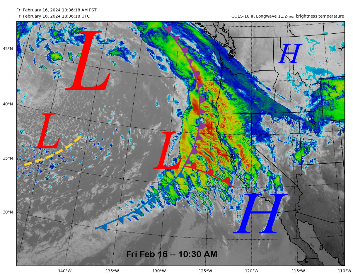
The current infrared satellite image (below) today shows a storm system approaching the coast and a large upper-level low-pressure system still well offshore in the central Pacific. Clouds will continue to stream into Mammoth through tonight, but snowfall won’t start until Saturday afternoon or early evening.
The GFS model moves the short-wave into the state Saturday evening (image below) and the heaviest snowfall will occur overnight and into early Sunday. Sunday during the day should be mostly dry other than some morning flurries.
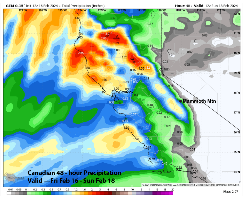
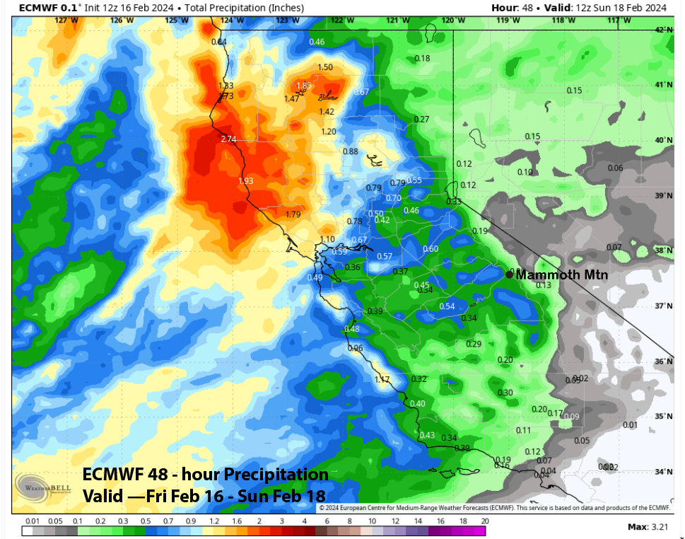
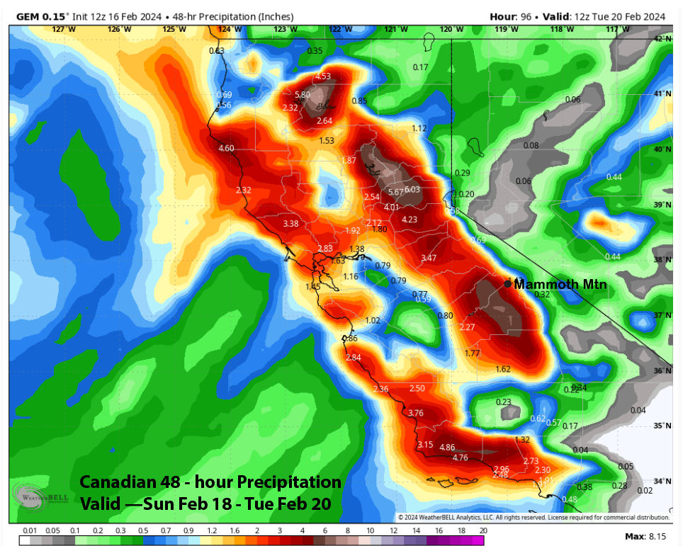
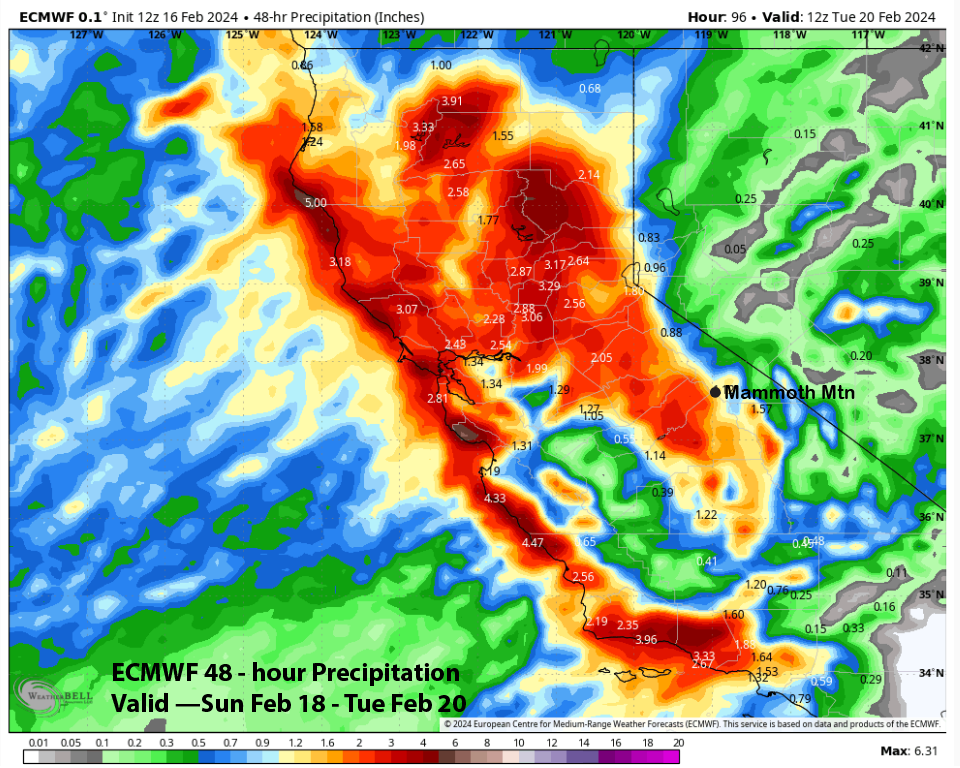
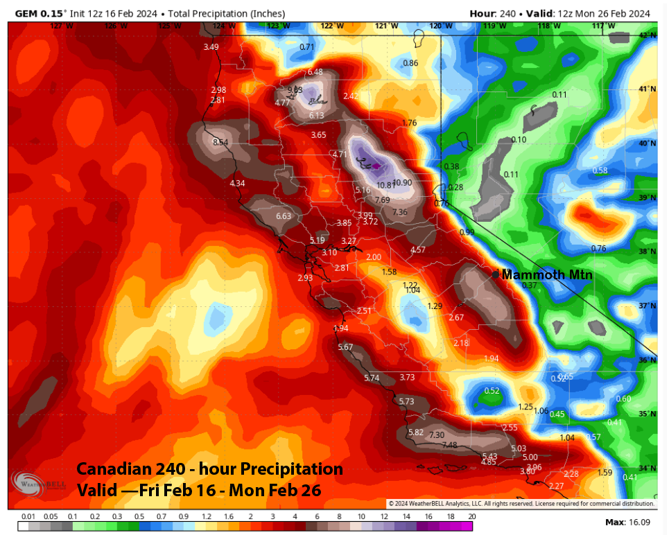
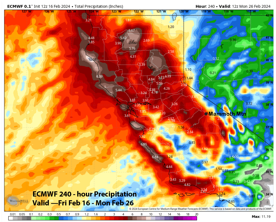
Model QPF for the first storm does vary a bit with the GFS (image below) the wettest at about an inch and the ECM (two images below) showing less than half that amount. The Canadian (three images below) is slightly wetter than the ECM and the NBM (four images below) is similar to the ECM.
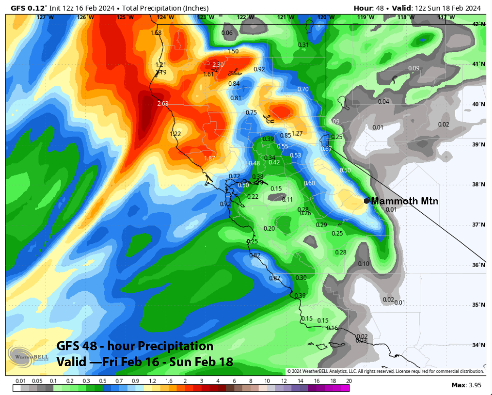

The forecast follows closer to the wetter GFS model as the jet stream will move far enough southward for the front to hold together in addition to some orographic enhancement. At least 6” should fall at Main and about 9” or more up top. Snow levels will be around 5000-6000 feet.
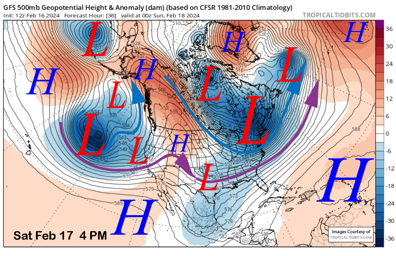
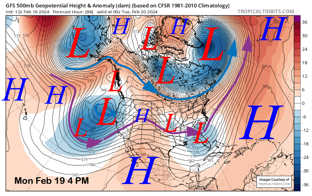
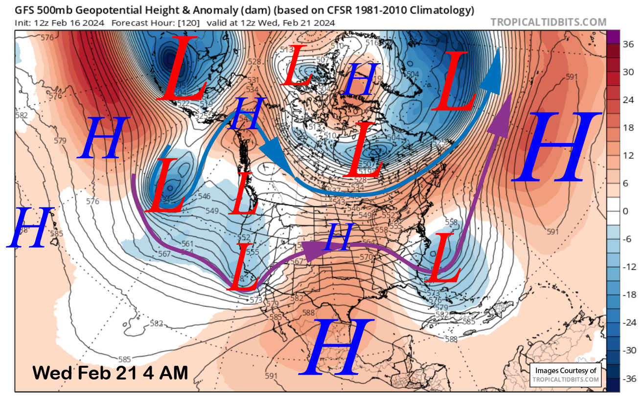
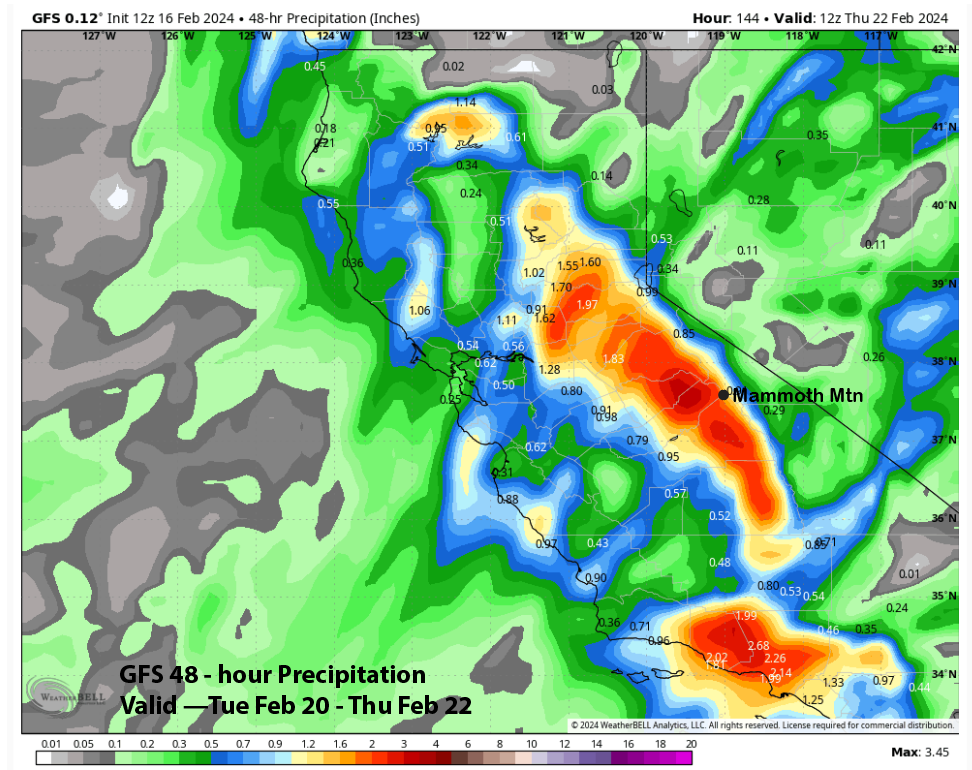
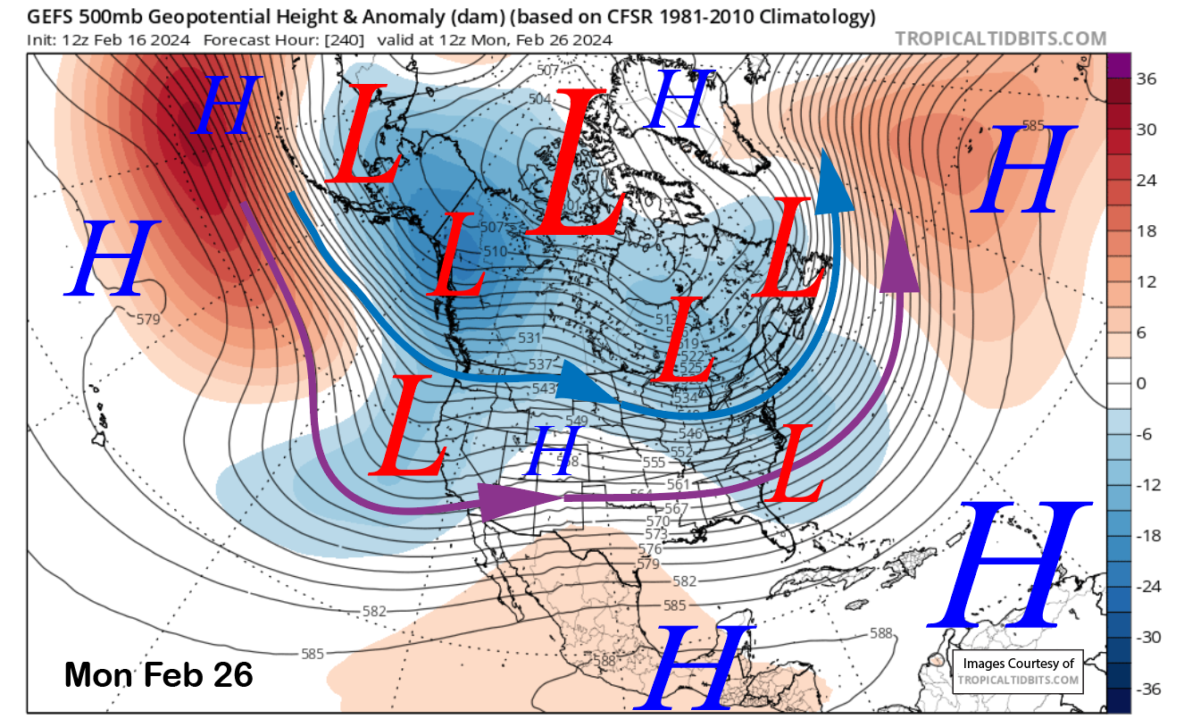
The next stronger storm moves into the Mammoth area Sunday evening and overnight and it appears Mammoth will be a favorable position for an enhanced moisture feed to produce significant snowfall. The GFS model (image below) has the southern branch of the jet stream (purple arrow) aligned into the Mammoth area for the bulk of the event.
Heavy snowfall with snow levels around 7-7500 feet is forecast to develop overnight Sunday and through Monday midday before decreasing in intensity by the evening and overnight. Snow levels may come down to nearly 6000 feet by Tuesday, but this will start out as a Sierra cement event.
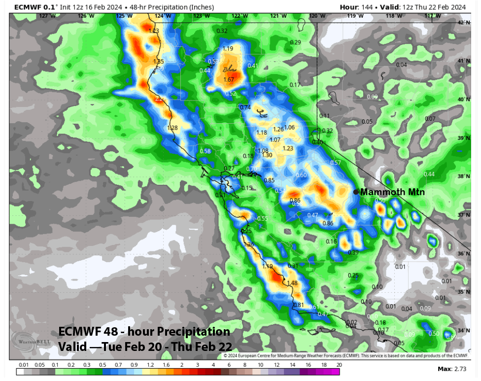
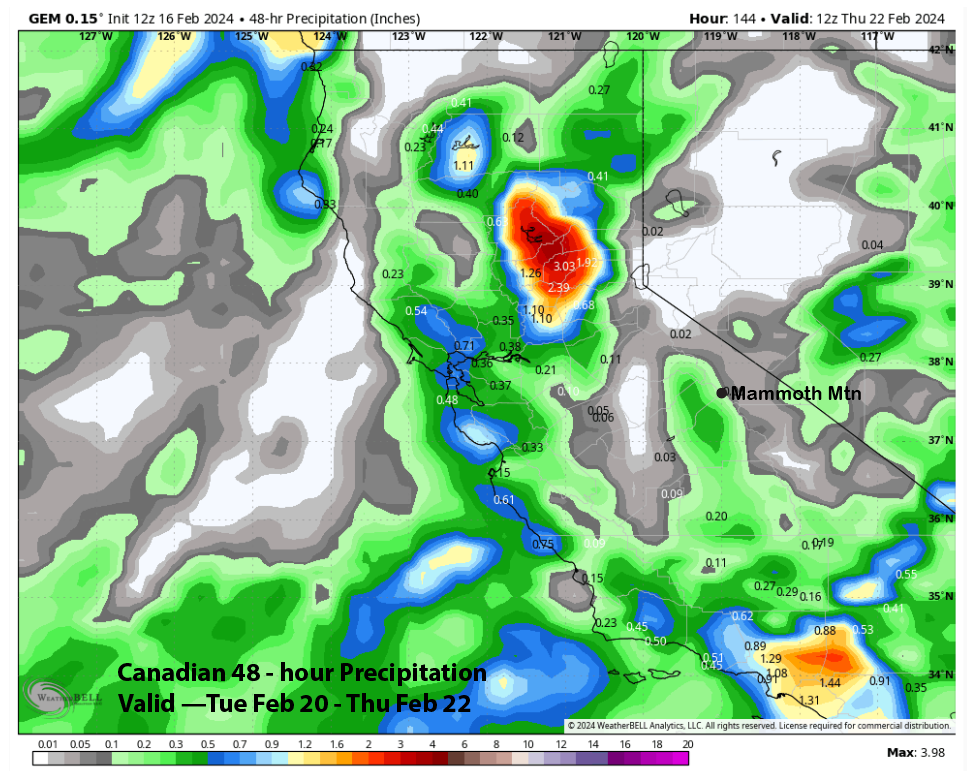
The guidance is showing good liquid amounts, although there is a lot of variances. The GFS model is the wettest again (image below) and has about 4-5” liquid. The Canadian is also quite wet and has about 3” liquid and 5” west of the crest (two images below). The ECM is the driest and has less than 2” for the period (three images below). The ECM run this morning was a dry outlier versus the ensemble suite.
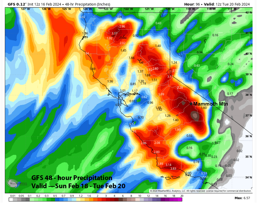
The forecast leans closer to the wetter GFS model with about 4-5” liquid for the period. This is a good set-up for Mammoth with the strong southwest flow up the San Joaquin River canyon. Expecting three-plus feet at Main over the two-day period and 4-5 feet up top.
The models (GFS below) finally move the longwave trough ashore around next Wednesday. That will produce one more round of moderate to heavy snowfall Tuesday during the day and overnight into Wednesday.
Model QPF for this last round varies with the GFS the wettest again at around 2” and the ECM showing about 0.75” (two images below), while the Canadian (three images below) has almost nothing. ECM EPS has about an inch, and the forecast follows a blend of that and the GFS model. Another foot of snowfall will be possible at Main.
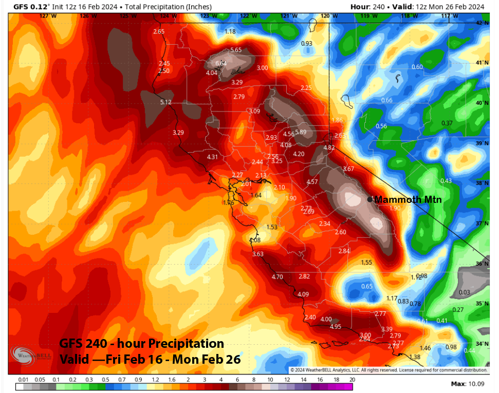
Overall, it looks like it will be a very productive pattern that will really help out with the longevity of the season. The total QPF by some of the models like the GFS (image below) at around 8” is impressive while the Canadian (two images below) and ECM (three images below) still show good amounts at around 4” liquid.
Long Range (Days 5+):
The longer-range guidance is a bit mixed about the end of next week, but there is more agreement that storms may return for the last part of the month and into early March.
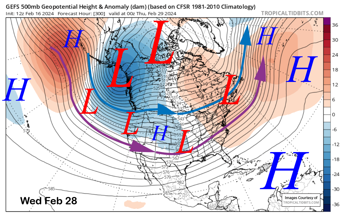
The GFS ensemble mean has a weak trough along the coast next weekend and deepens it a bit by next Monday (image below). It then further deepens the trough by mid-week in addition to extending it back westward (two images below). This would allow for colder-type storms to move into the state from the Gulf of Alaska.
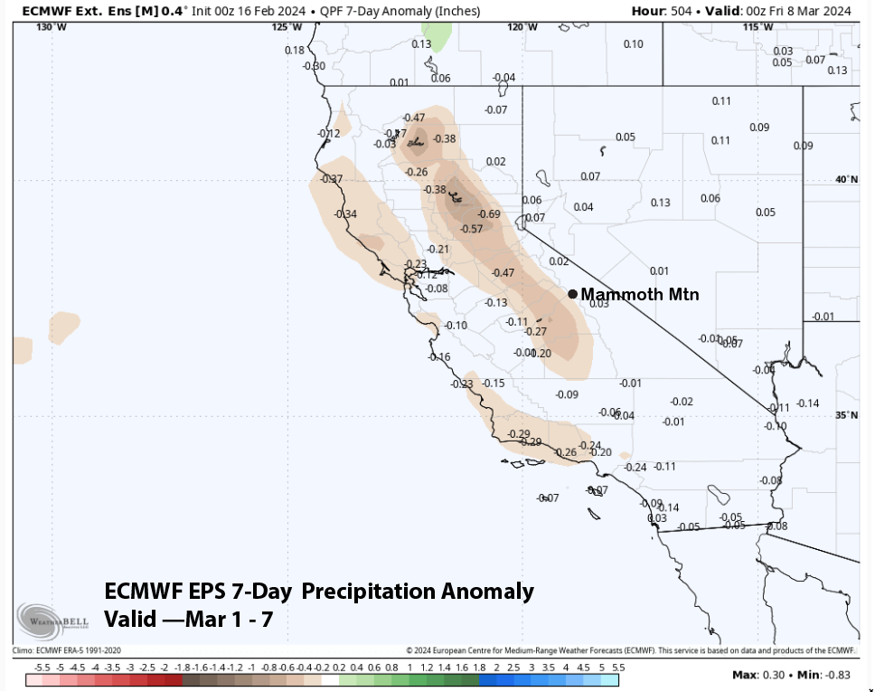
The ECM EPS is similar or slightly weaker with the trough and has the jet a bit farther northward. The precipitation forecast for the end of the period shows about an inch of liquid (image below) that would be easily enough for powder conditions.
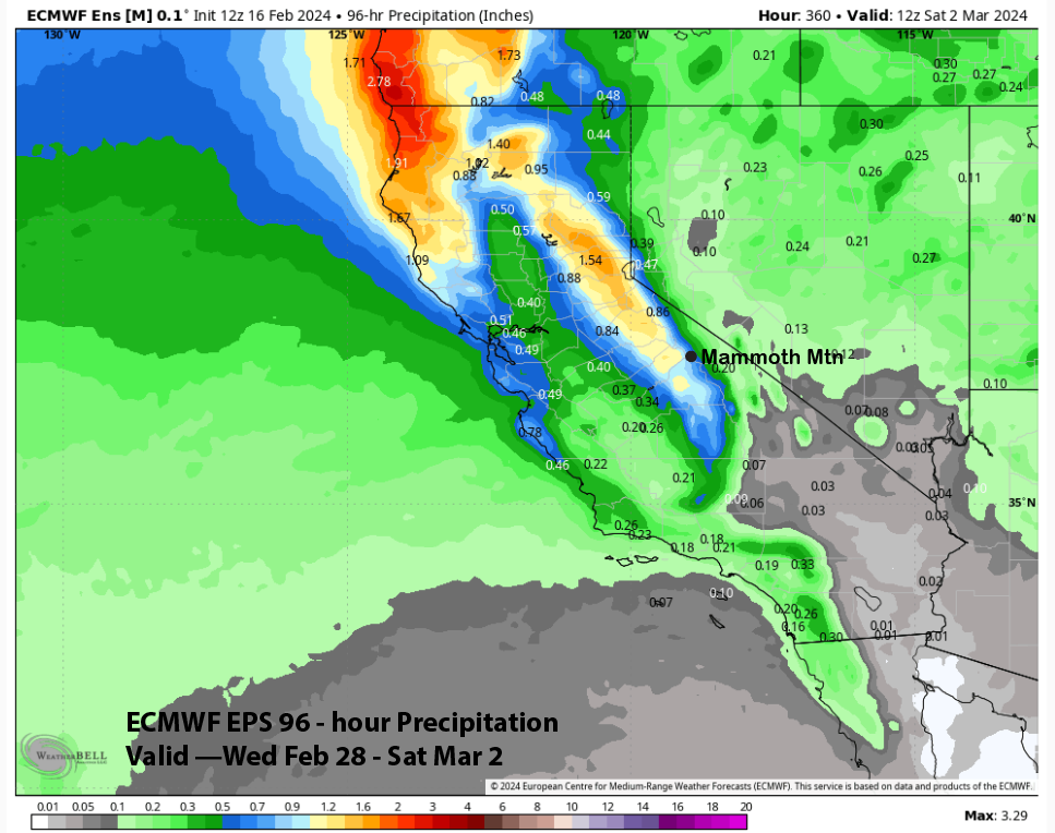
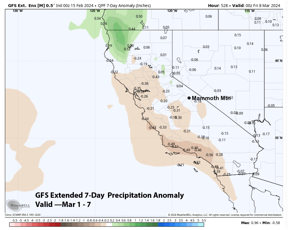
There is a suggestion this pattern could continue into the first part of March. Both the GFS extended (image below), and ECM EPS (two images below) show near-normal precipitation for the period. Normal precipitation for the first week of March is about a foot or two of snowfall. I don’t think anyone would complain about that. WG