Powder Forecast –Friday, January 5th, 2024
Ted Schlaepfer CCM —- Mammoth Mountain WeatherGuy
Snowfall forecasts are valid at the Sesame snow course (Main Lodge) for the prior 24 hours, as reported in the 6-7 AM morning snow report.
**Snowfall forecast confidence ranges from very low (1) to very high (5)
Sat 1/6 = 0”
Sun 1/7 = 8 – 11” (H20 = 0.60” – 0.75”)*4
Mon 1/8 = 0”
Tue 1/9 = 0”
Wed 1/10 = 0 – 2”
Thu 1/11 = 6 – 12”
Fri 1/12 = 0 – 3”
Sat – Mon 1/13 – 1/15 = 6 – 24”
January Snowfall = 16”
January Forecast = 60 – 90”
Detailed 4-day Snowfall Forecast:
Sat 1/6 – Snowfall likely develops around mid-day and becomes moderate to heavy during the late afternoon and early evening before ending overnight. Accumulations 8 – 11”, 12”+ up top
Sun 1/7 and Mon 1/8 – No snowfall expected on both days.
Tue 1/9 – Chance for light snowfall to develop during the day and into the night, little accumulation expected.
Forecast Summary:
Short Term (Days 1 – 4):
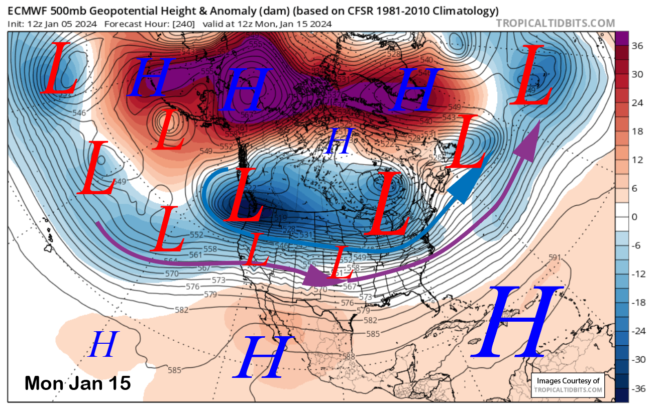
The current infrared satellite image (below) this afternoon shows a weather system moving southward from the Gulf of Alaska and into the Pacific Northwest. A transitory short-wave ridge over CA today will shift eastward tonight and early tomorrow as the storm moves into CA.
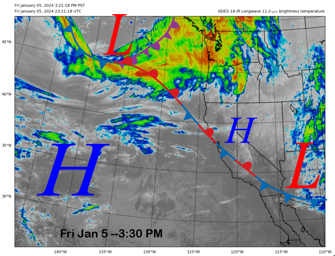
The models move the trough quickly through the state with the trough axis into southeastern CA by early Sunday morning (image below). The result will be about 15 hours of snowfall starting Saturday early PM and ending very early Sunday.
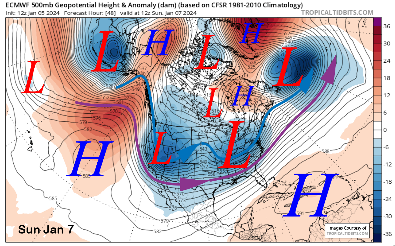
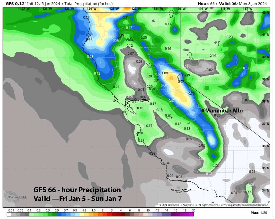
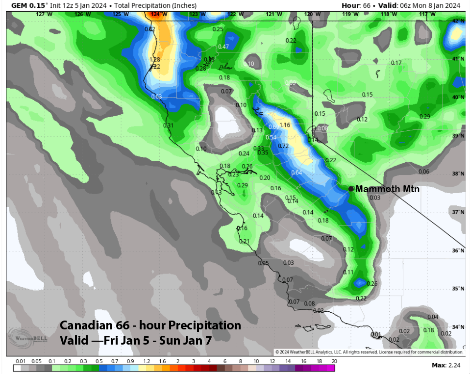
Coming from the Gulf of Alaska, it will be a colder type of storm with snow levels around 4000 feet and snow ratios around 12-14”:1” The models do differ slightly on the forecast amounts, with the ECM (image below) showing the most at around 0.65” and the GFS (two images below) and Canadian (three images below) showing just under half an inch.
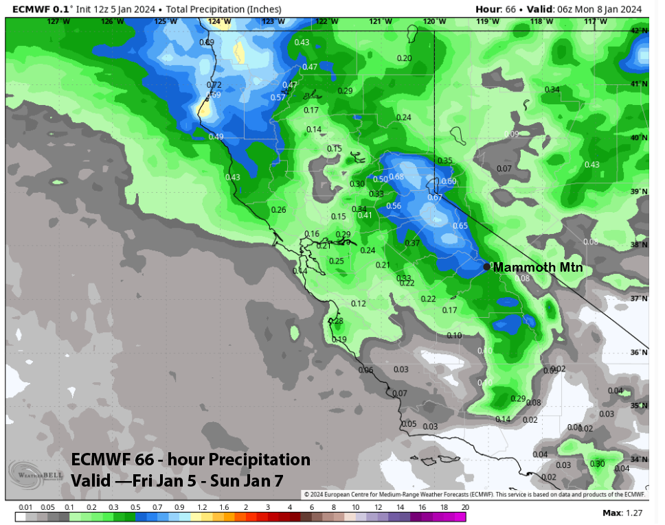
The Forecast follows the ECM model as there is good jet dynamics with the system as it digs southward; even though it is moisture-starved and coming from the North, that is typically not a good direction for snowfall. Nonetheless, Main could see up to 10” and over a foot is likely up top.
High pressure will then build into the region Sunday and into Monday with cold temperatures forecast for Sunday. With the fluffy powder, conditions should be excellent, even though it is still low-tide out there. A weak weather system will move north of Mammoth Tuesday and Tuesday night, with the main effect passing clouds, breezy winds, and a chance for light snowfall or flurries.
Long Range (Days 5+):
The longer-range guidance is still showing an active pattern through mid-month, and now, is suggesting there is a chance for significant storms. All of the guidance is not bullish on big storms just yet, but it seems to be trending that way, and there is some support for these wet solutions from tropical forcing due to the MJO.
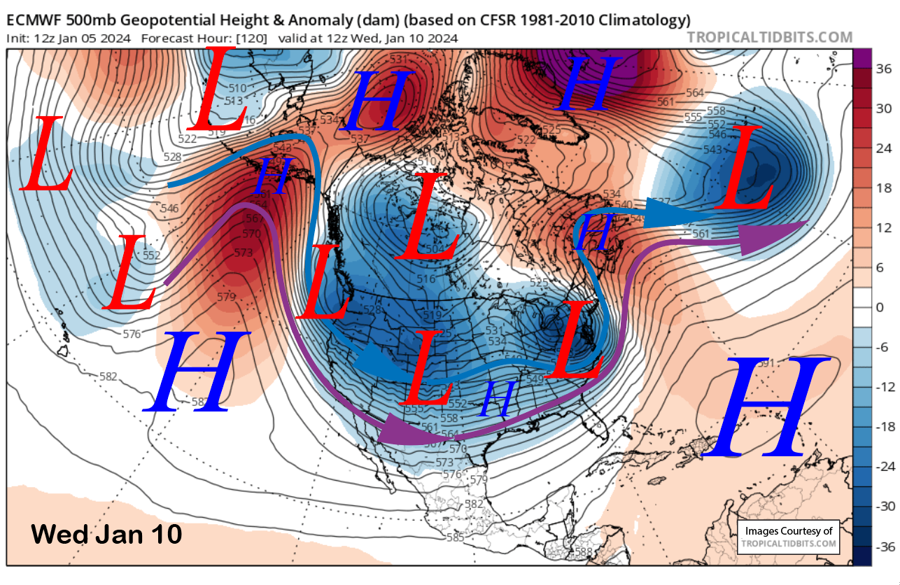
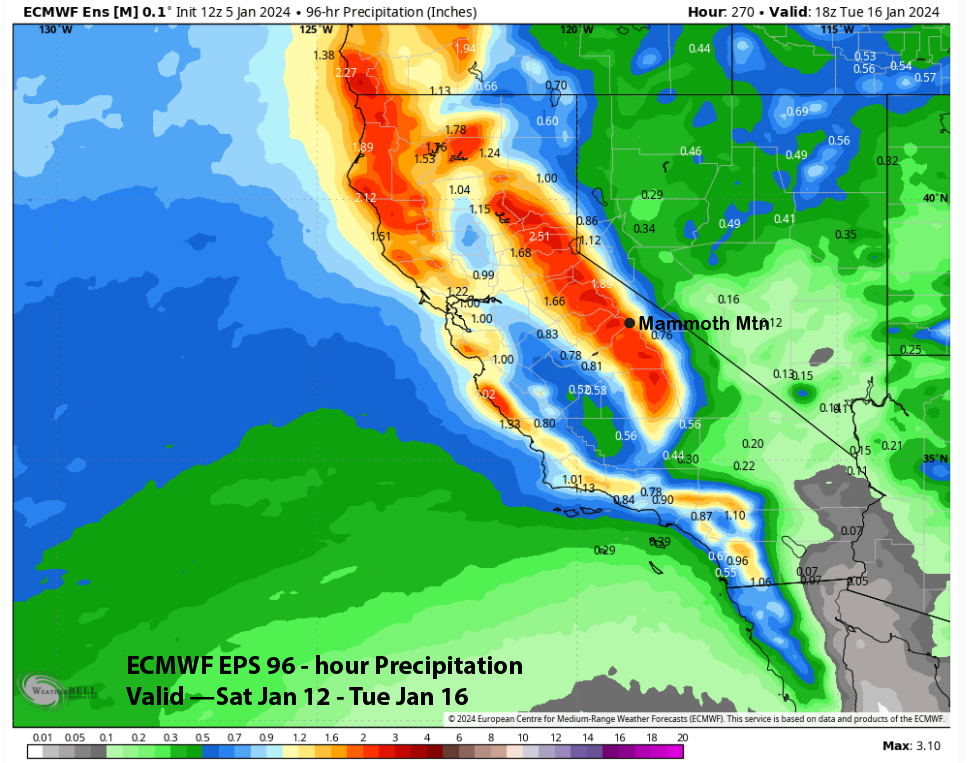
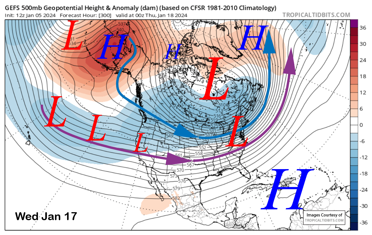
The pattern will likely have another cold-type storm around the middle part of next week, first with the ECM model (image below) moving another trough southward from the Gulf of Alaska/western Canada on Wednesday and into Thursday. This one could be potentially colder than the weekend storm, with even higher snow ratios.
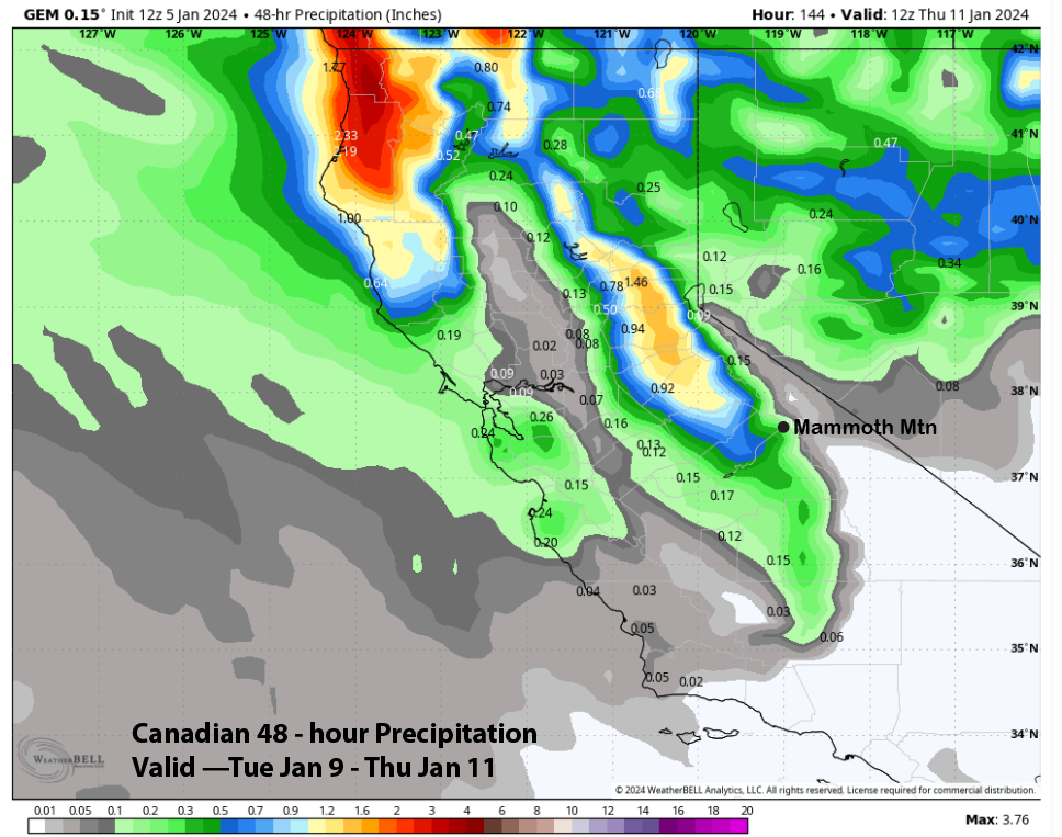
Since it is six days out, the guidance is not in agreement with the exact details of the trough, with the ECM model slightly wetter (image below) at just under an inch as it is slightly deeper with it. The GFS (two images below) is showing about half that amount, while the Canadian (three images below) is the driest at around a quarter inch of liquid.
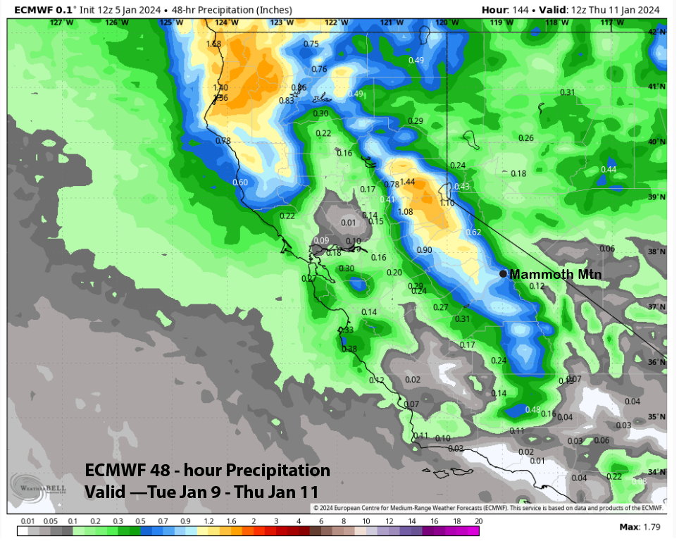
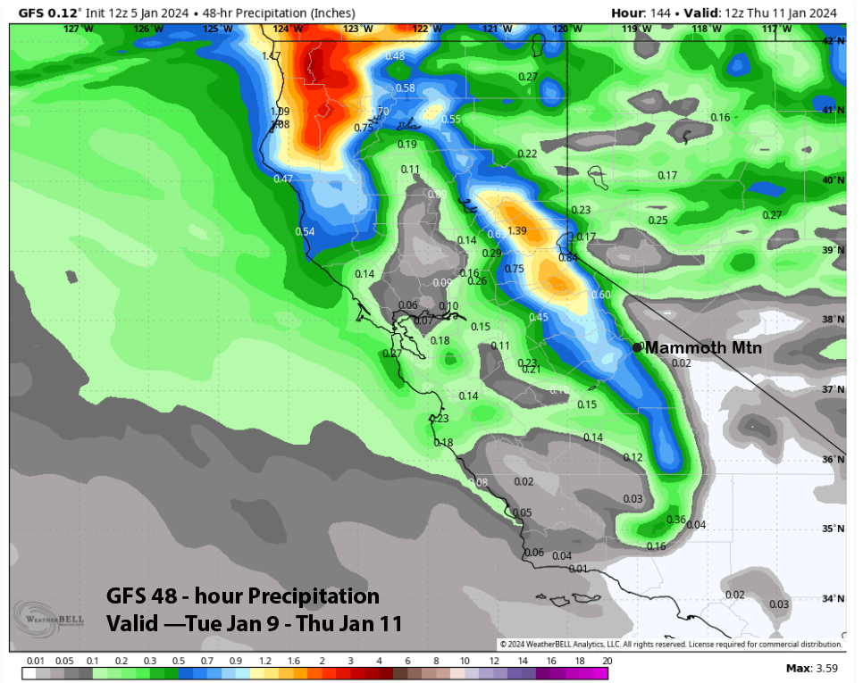
The forecast follows the ECM ensemble mean that has about half an inch of liquid and is similar to the GFS model. With ratios as high as 15”:1”, amounts should be over six inches at Main and possibly up to a foot if the wetter ECM solutions verify. Conditions should continue to be great.
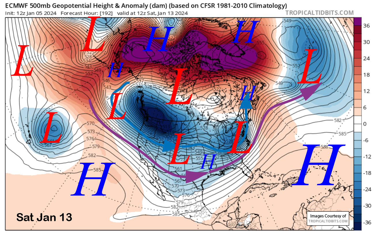
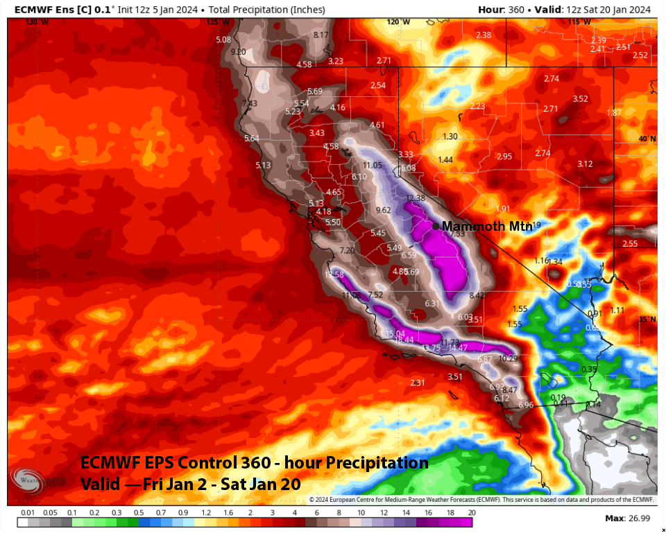
The back end of today’s 12z ECM run (images below) flipped from bringing another very deep cold trough southward into the state to backing the longwave trough westward to allow for a breakthrough in the southern branch of the jet stream. That model run is showing huge amounts of snowfall for Mammoth and is not exactly believable yet as the GFS was showing the cold trough scenario still (that would produce more fluffy snow).
The ECM EPS is a bit slower/weaker with the development of the breakthrough, but is showing about 2.5” liquid (image below) for the first event. Even though the GFS deterministic run is not showing it, the GFS ensemble is more bullish, although it is a bit slower with the main breakthrough (two images below) by a couple of days. The EPS control run shown is probably the best-case scenario with almost 20” liquid.
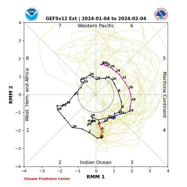
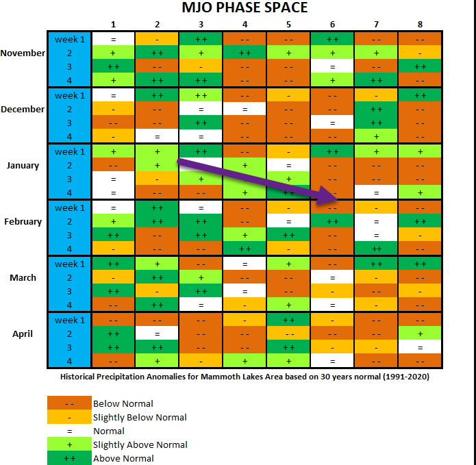
A lot of the changes in the guidance since the last post could be linked to jet stream teleconnection forcing from the tropics. The active MJO (image below) is now forecast to move slower from its current phase 3 into phase 6 by the end of the month.
Plotting its forecast path for the rest of January on my handy MJO precipitation anomaly chart (two images below), there is good support for a period of storms just before mid-month and through the third week (~Jan 23rd). Better late than never. WG