Powder Forecast – Tuesday April 4th, 2023
Ted Schlaepfer CCM —- Mammoth Mountain WeatherGuy
Snowfall forecasts are valid at the Sesame snow course (Main Lodge) for the prior 24 hours as reported in the 6-7 AM morning snow report.
**Snowfall forecast confidence ranges from very low (1) to very high (5)
Wed 4/5 = 0”
Thu 4/6 = 0”
Fri 4/7 = ~1” (H20 = 0.05” – 0.10”)
Sat 4/8 = 1 – 2” (H20 = 0.10” – 0.15”)
Sun 4/9 = <1”
Mon 4/10 = 0”
Tue 4/11 = 0 – 2”
Wed – Fri 4/12 – 4/14 = 2 – 6”
April Snowfall = 2”
April Forecast = 25 – 40”
Detailed 4-day Snowfall Forecast
Wed 4/5 – No snowfall expected.
Thu 4/6 – Dry during the morning and midday hours, then a chance for flurries/light snow late afternoon and then again late at night. Accumulations around an inch.
Fri 4/7 – A chance for light snowfall during the morning and into the night. Accumulations 1 – 2” by Saturday AM, 3”+ up top.
Sat 4/8 – A chance for light snow during the morning, then dry by the afternoon. No accumulation expected.
Forecast Summary:
Short Term (Days 1 – 4):
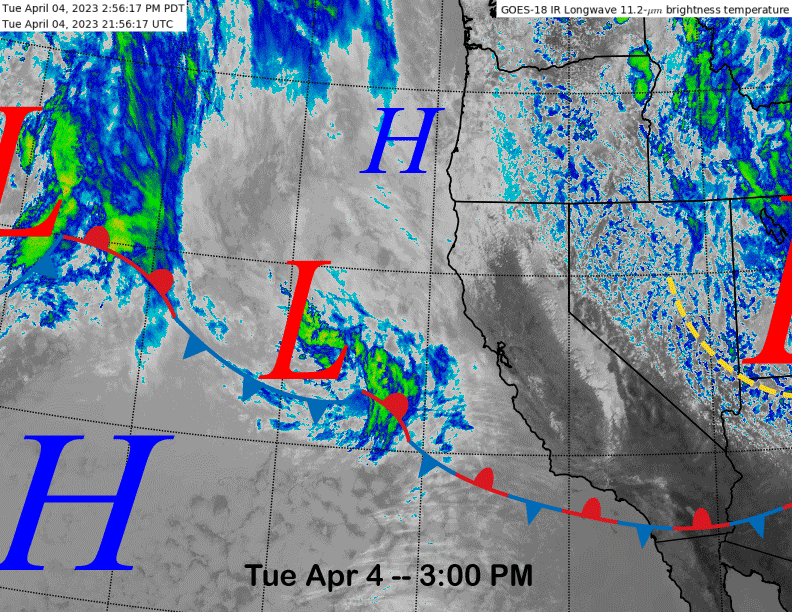
The current infrared satellite image (below) this afternoon shows the system that produced the light snow/wind over the weekend and yesterday has moved eastward with a weak low pressure system now approaching the coast.
That weak system will move through the state tomorrow with just passing clouds and no precipitation. High pressure will then briefly build back into the state Wednesday night and into Thursday before the next storm approaches.
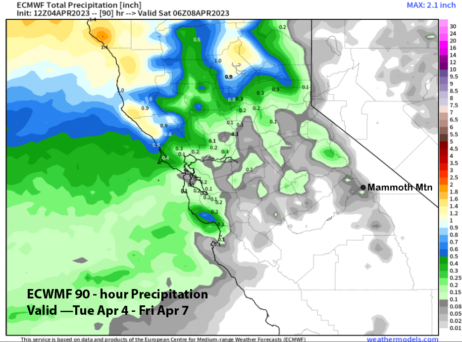
The ECM (image below) and the other models then move a stronger short-wave trough into NorCal on Friday. The storm is generally expected to remain too far north of Mammoth for any significant snowfall with the fronts just brushing the area with light snowfall.
Light snowfall or flurries could start with the passage of the warm front Thursday PM and night followed by light snowfall on Friday and possibly into early Saturday from the cold front. QPF from the models is quite light with the 12z run of the ECM model (image below) showing only a tenth of an inch liquid and the GFS (two images below) about a quarter inch.
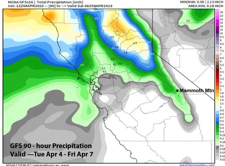
The forecast is calling for only a couple inches and mostly dust on crust conditions, although there could be spots near up top where it hits low-end powder thresholds. Dry weather returns Saturday during the day and continues Sunday in addition to warmer temperatures with spring conditions possible on the lower part of the mountain.
Long Range (Days 5+)
The longer-range guidance has not changed too much with the models still favoring a slow transition to spring with no sustained periods of above normal temperatures, nor any big storms. However, the record snowpack is very cold (not ripe) for early April due to a cold winter and early spring and the continued unseasonably cool temps will continue to mitigate any serious melt for a while.
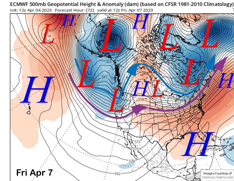
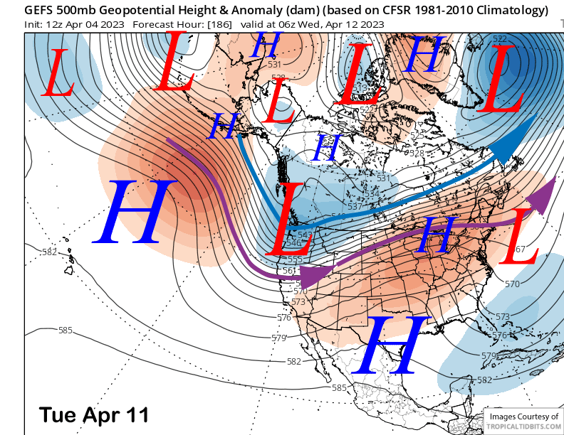
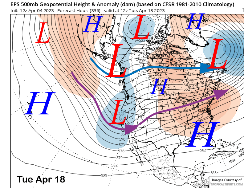
The numerical guidance moves another short-wave trough into CA around Tuesday next week (ECM below). It generally has the trough and jet stream (purple arrow) a bit too far northward for significant snowfall for Mammoth. The GFS ensemble (two images below) is fairly similar to the ECM model.
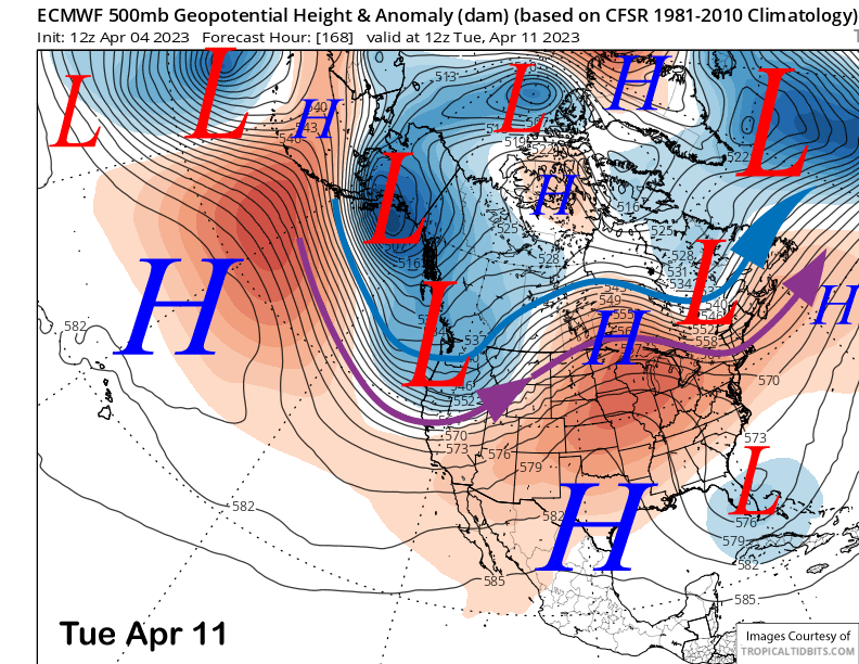
The forecast is only calling for a couple inches right now and likely another dust on crust or low-end powder storm that is typical of spring. Probably more wind than snowfall with the best chance for snow during the day Tuesday. The trough will probably move southward around Wednesday or Thursday resulting in colder temperatures and continued light snow showers.
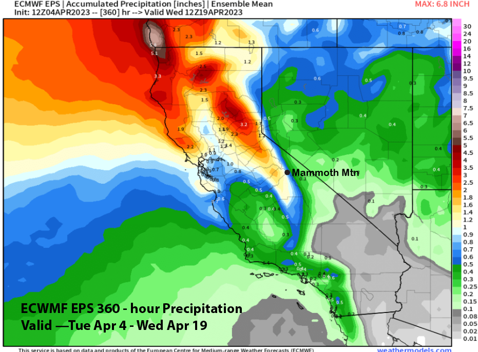
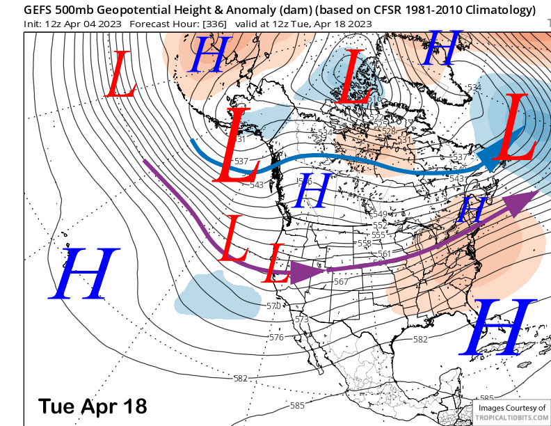
The fantasy range forecast from the ensembles shows dry and seasonably cool weather over the following weekend before a longwave trough may reform over the West Coast. The GFS ensemble (image below) is not as deep as the ECM EPS (two images below) with the latter deep enough to support a storm that could produce enough snowfall for powder conditions.
The ECM EPS (image below) is showing around an inch liquid for the two-week period with most of it falling with the aforementioned storm chance around the 18th. Otherwise, it looks like typical small spring storms at times and continued below normal temperatures. WG