Powder Forecast –Tuesday January 14th, 2020
Ted Schlaepfer CCM —- Mammoth Mountain WeatherGuy
Snowfall forecasts are valid at the Sesame snow course (Main Lodge) for the prior 24 hours as reported in the 6-7 AM morning snow report.
**Snowfall forecast confidence ranges from very low (1) to very high (5)
Wed 1/15 = 0”
Thu 1/16 = 0”
Fri 1/17 = 9– 13” (H20 = 0.75” – 1.00”)**3
Sat 1/18 = 0”
Sun 1/19 = 0”
Mon 1/20 = 0”
Tue 1/21 = 0 – 1”
Wed – Fri 1/22– 1/24 = 3– 9”
January Snowfall = trace
January Forecast = 25 – 35″
Detailed 4-day Snowfall Forecast:
Wed 1/15—No snowfall expected.
Thu 1/16— Dry during the morning hours with gusty winds, then heavy snow develops during the afternoon and into the evening before tapering off overnight. Accumulations 9 – 13” by Friday AM, up to 18” up top.
Fri 1/17 and Sat 1/18—Slight chance for a lingering snow shower Friday AM, otherwise no snowfall expected both days.
Forecast Summary:
Short Term (Days 1 – 4)
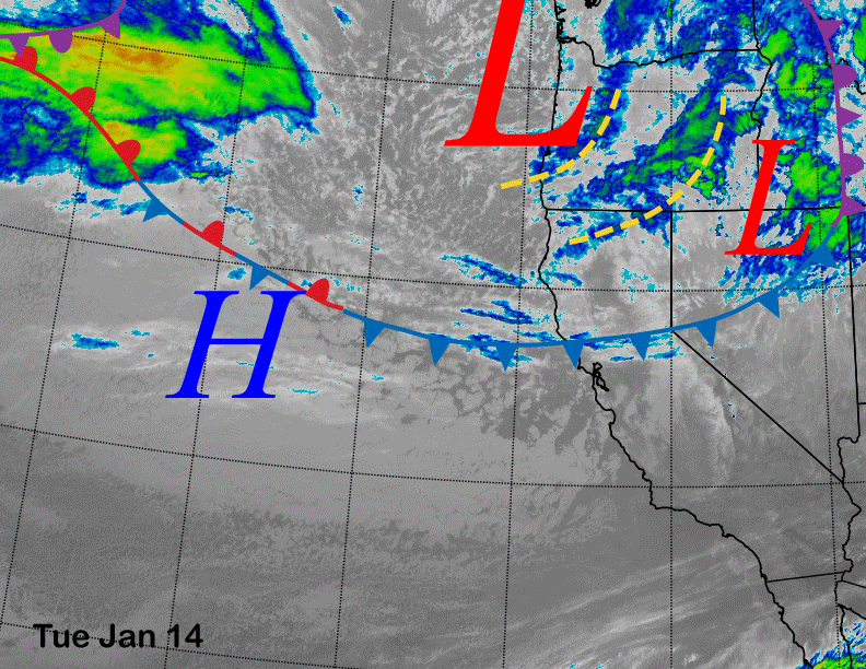
Satellite imagery today (below) shows a cold front stretching across central CA associated with a deep long-wave trough along the West Coast. That front is not producing any snowfall in Mammoth, but instead strong winds up to 100 mph on the mountain this morning. Those winds will weaken this afternoon, but remain gusty.
High pressure off the coast will build into CA tomorrow for a day of lighter winds before the system now entering in the upper left hand part of the satellite image moves into CA on later Wednesday and then Thursday for Mammoth.
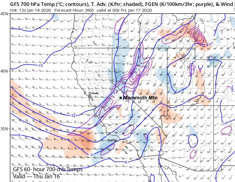
The latest GFS (image below) moves a strong short wave into CA on Thursday within the deep long-wave trough along the West Coast. That wave will produce a period of heavy snowfall under seasonably low snow levels before snowfall ends rather quickly Thursday overnight.
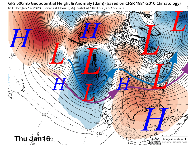
Overall, the numerical guidance has trended drier since the last update, slower with onset of the snowfall, and faster with the movement of the front. It looks like snowfall now won’t start until midday or early afternoon Thursday with heaviest snowfall occurring between 3-7 PM. There may be enough accumulation for powder turns over the last hour or two of the day Thursday.
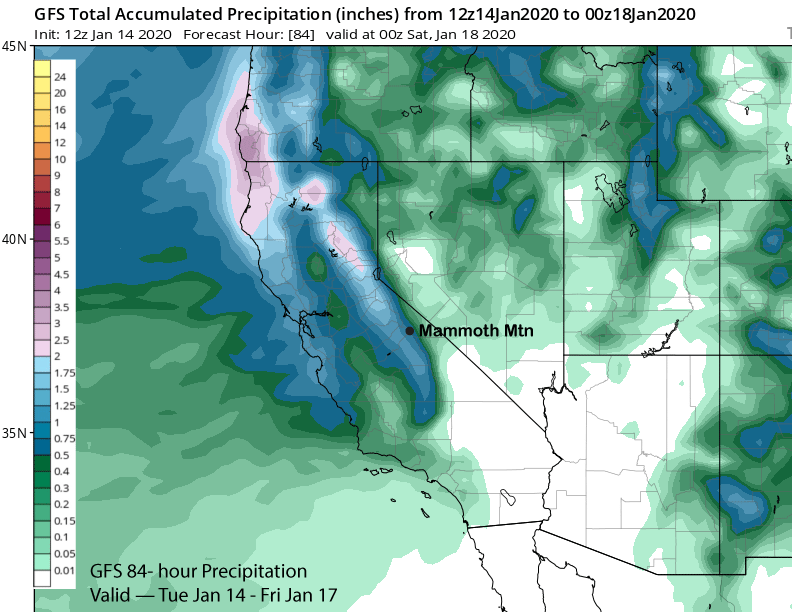
The latest GFS (image below) is showing a little over 0.75” liquid now (down from 1.5” since last post) while the ECM is showing about an inch. It is a cold storm with snow levels about 4000” with the frontal passage and 700-mb temps around -10-12°C. Snow ratios should be around 12-15” snow to 1” liquid. So probably around 10” at Main and maybe a foot. Up top should see 12-18” of powder with drifting likely due to the light and dry nature of the snowfall and scouring in spots too.
It will be a quick storm with a bluebird morning possible on Friday by opening with cold temps during the morning hours. Saturday will be a fair and warmer day and generally seasonable.
Long Range (Days 5+):
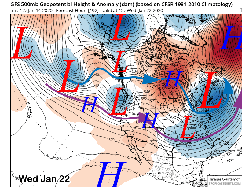
Longer range guidance is favoring continued nice weather Sunday and slightly warmer temperatures before colder weather and some clouds/flurries/wind is possible on MLK Holiday as the GFS is moving a weak system through CA (image below).
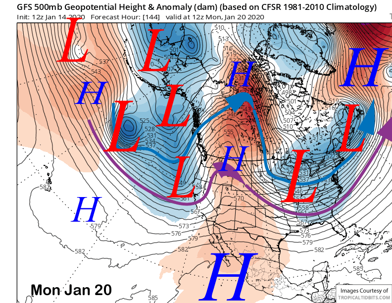
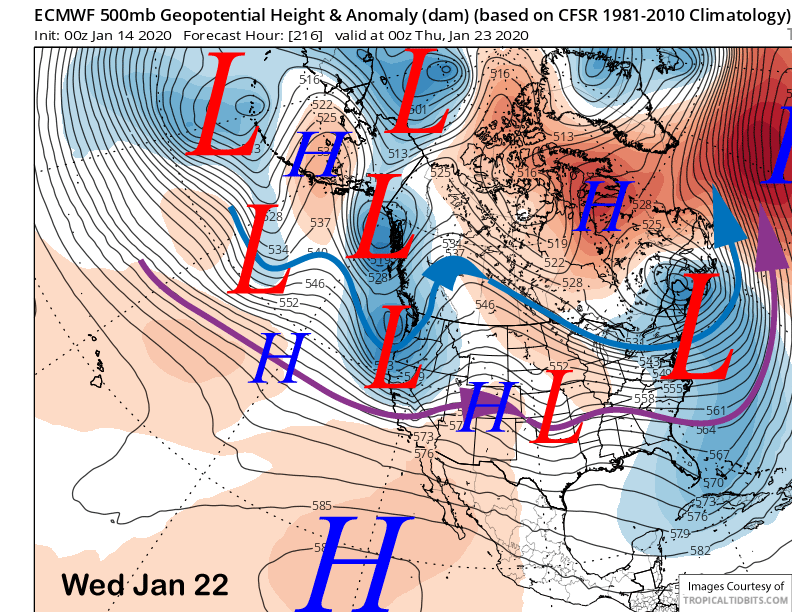
That model moves another system in CA around Wednesday next week (image below) while the ECM model is stronger and farther southward with that potential storm (two images below). While it does represent a chance for some snowfall, most of the ensembles are dry for Mammoth and keep the jet stream too far North. Let’s hope it happens, next chance might not be unit the 27th. Next update on Saturday. WG