Mammoth Mountain & Eastern Sierra Recreational Weather Forecast
Monday, October 11th, 2021 @ 1:24 PM
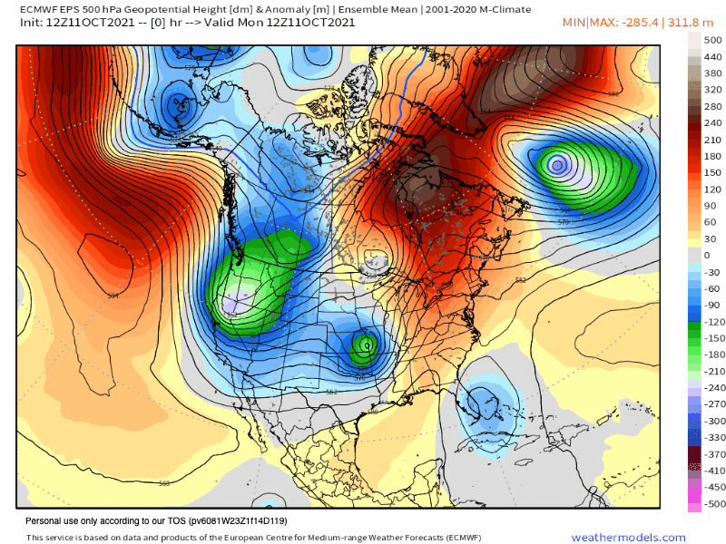
Weather Summary: Over the next several days the weather will be dominated by a strong cut-off low dropping into the great basin. Inside sliders are typical for this time of year, this one is on the strong side and will be extra cold and offer up a ton of wind and a bit of snow.
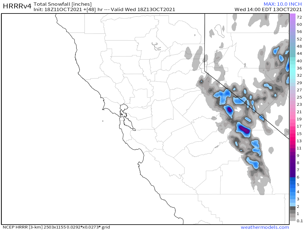
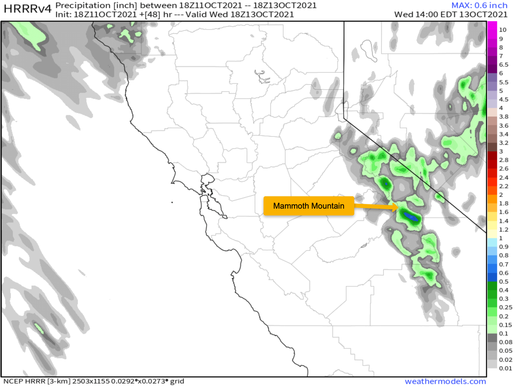
This pattern will drop temperatures in the Eastern Sierra that will be more winter than early Fall-like. Along with the cold, there could be 1-6 inches of fresh powdery snow that falls above the 7500-foot level. Areas below that could see a dusting to an inch of what white stuff.
The low will take its time moving east and will put us in a cold winter temperature pattern for several days this week.
If the Mountain wants to make snow it looks like there is a couple of day window to do it. Might be too early for snowmaking, but maybe not.
Checking the window cast there is moderate snowfall at 1 PM on Mammoth Mountain with 1-2 inches of new snowfall so far today.
Taking a look at local conditions the last couple of days. Yesterday at the top of Mammoth Mountain there was a high of 39, the low this morning was 23 and at 1:30 PM the temperature is 12. The peak wind gust over the last 24 hours was 87 MPH @ 6:45 AM out of the WSW.
The snow study site @9000 feet is showing 3.3 inches of snow on the ground with a temperature of 21 with .12 precipitation today and 1.6 inches of fresh snowfall
In Mammoth Lakes, the temperature peaked at 60 degrees on Sunday with a low of 27 degrees this morning. Winds in town have been out of the W with peak gusts of 27 MPH today.
Precipitation & Snowfall Forecast: Look for 1-5 inches of snowfall above 8000 feet today with a slight chance of rain showers in the lower elevations. *6.5 inches new at the snow study site on Friday.*
Temperatures: Highs will be in the low 30s at the Main Lodge and in the Mammoth Lakes Basin on Monday and Tuesday. Highs warm into the mid to upper 40s by Wednesday and Thursday. With late week into the weekend in the mid-50s.
Mammoth Lakes will be in the upper 30s to low 40s on Monday and Tuesday. With low to mid-50s Wednesday and Thursday and 60s over the weekend.
Bishop will be in the 50s to start the week and then by Wednesday and Thursday high will be in the upper 60s, by the weekend it will be 70s in downtown Bishop.
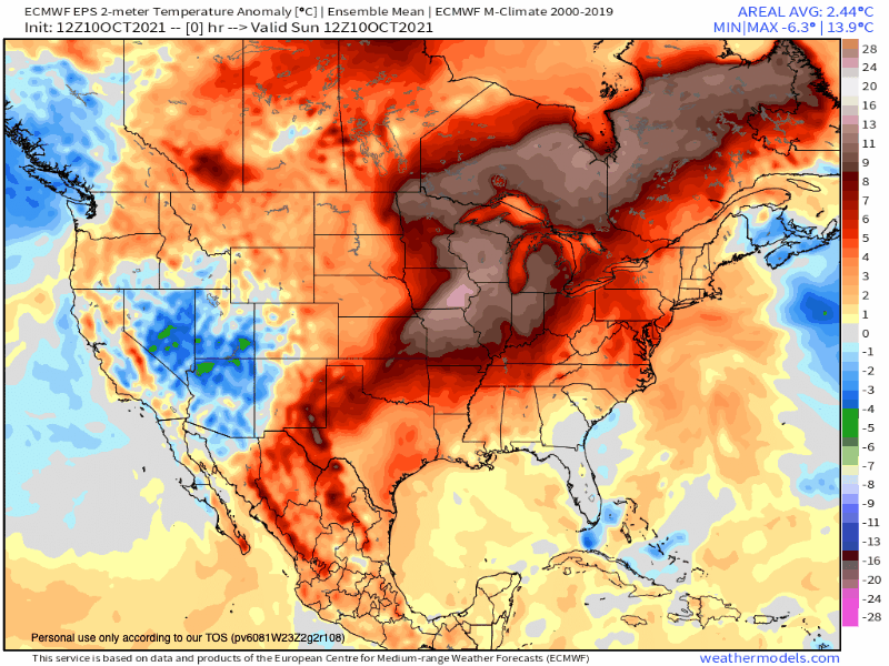
*You have to love this temperature Anomaly GIF below. After months of it showing heat and above normal it’s finally gone cool. What a blessing, yahoo
Winds: On Monday expect North to North West winds 35-55 MPH in areas of the Eastern Sierra. That includes areas of 395, so travelers beware.
Here are the links to the local NWS Forecasts for Main Lodge & the Mammoth Lakes Basin, Mammoth Lakes, June Lake, Crowley Lake, and Bishop.
Fire and Smoke Forecast: Skies are expected to be clear of smoke and haze until further notice. Today the chart below is now showing dust creating bad air quality.


