
Powder Forecast – Friday January 20th, 2023
Ted Schlaepfer CCM —- Mammoth Mountain WeatherGuy
Snowfall forecasts are valid at the Sesame snow course (Main Lodge) for the prior 24 hours as reported in the 6-7 AM morning snow report.
**Snowfall forecast confidence ranges from very low (1) to very high (5)
Sat 1/21 = 0”
Sun 1/22 = 0”
Mon 1/23 = 0”
Tue 1/24 = 0”
Wed 1/25 = 0”
Thu 1/26 = 0”
Fri 1/27 = 0”
Sat – Mon 1/28 – 1/30 = 0 – 3”
January Snowfall = 186”
January Forecast = 186” – 200”
Detailed 4-day Snowfall Forecast
Sat 1/21 through Tue 1/24 – No snowfall expected all days
Forecast Summary:
Short Term (Days 1 – 4):
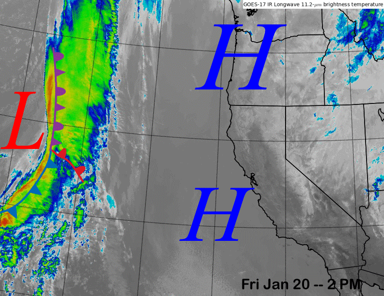
The current infrared satellite image (below) shows high pressure has built into the West Coast and the storm track has shifted northward.
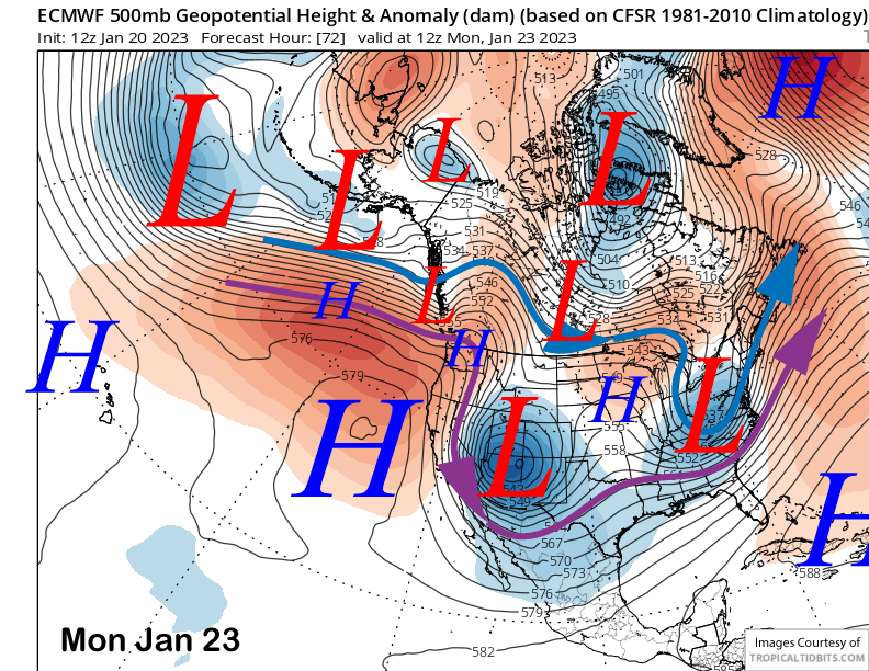
The models hold the high pressure in place through tomorrow before an inside slider type short-wave trough moves southward through the Great Basin east of the Sierra on Sunday and into Monday (image below).
That will result in colder temperatures Sunday and Monday along with some breezy to gusty easterly winds on Monday that could result in lift holds. Otherwise, dry weather continues through early next week.
Long Range (Days 5+)
The longer-range guidance hasn’t changed much, favoring dry weather until possibly the last part of the month or early February. I like the consistency in the models as that has been in the forecast for the last three updates.
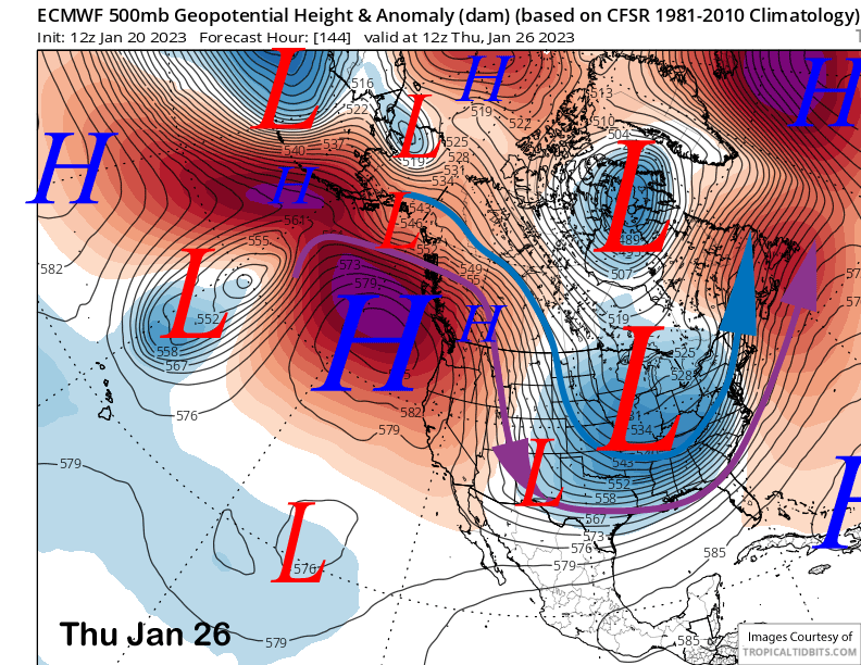
The ECM model holds the high pressure ridge in place through the middle part of next week (image below) for fair and dry weather. With the ridge centered to the north and west of Mammoth, temperatures should remain wintery and seasonable.
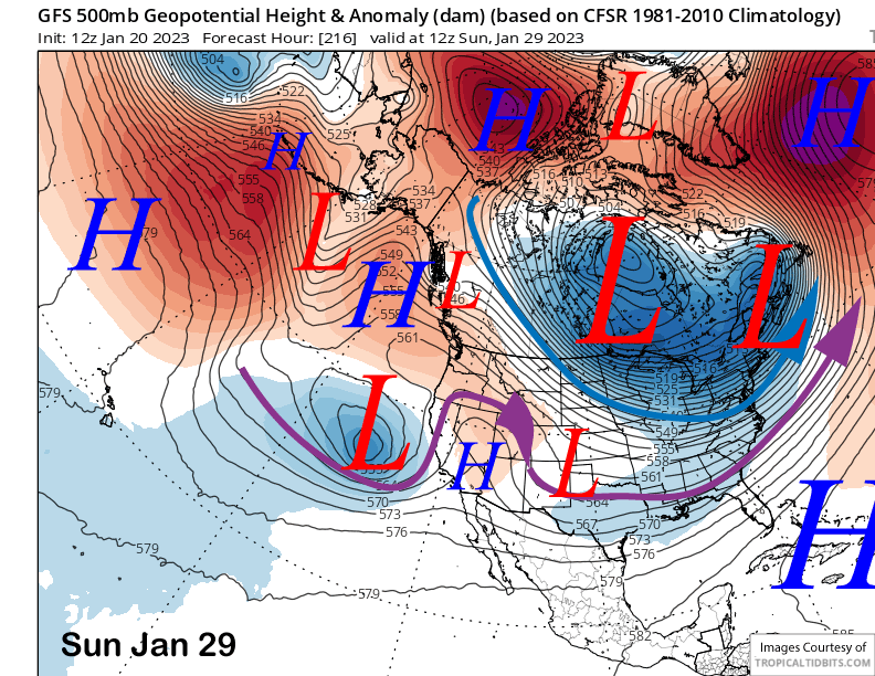
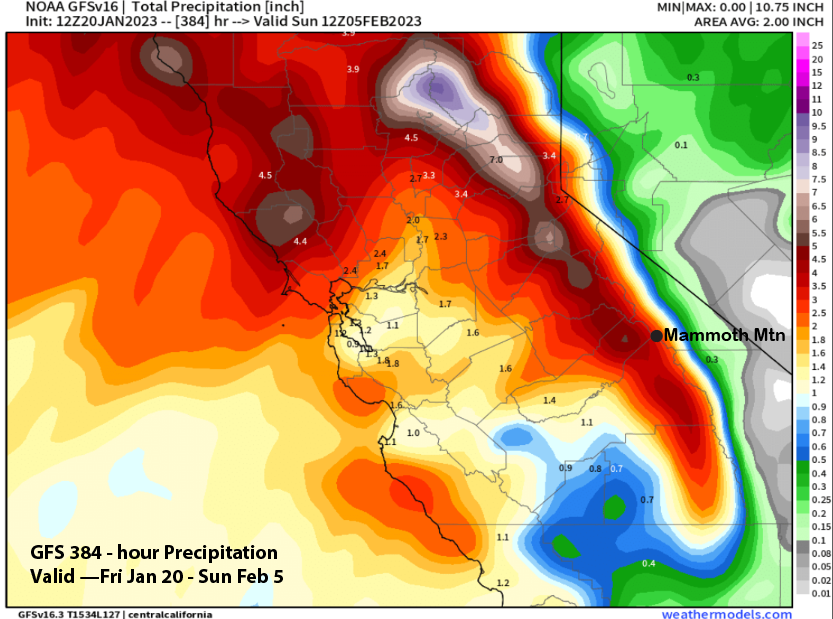
Difference in the guidance emerge on the back-end of the 10-day forecast period with the GFS model moving a low into CA from off the Pacific (image below). That model has that weather system as the start of a storm cycle that continues through early February. QPF from the 12z model run is almost 4” liquid through the end of the period (two images below).
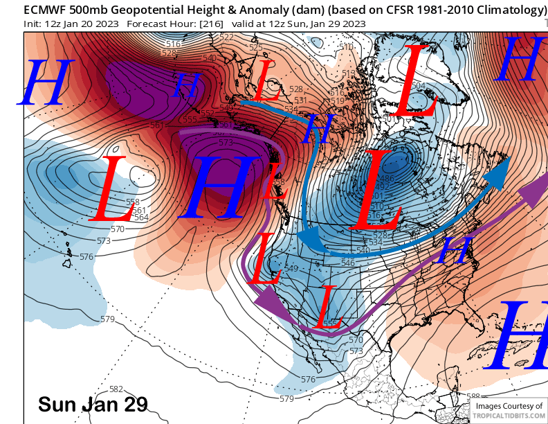
The ECM (image below) and Canadian models though, have a different solution and favor a short-wave trough moving southward from interior Canada, not off the Pacific. These solutions are mostly dry with only light snowfall projected.
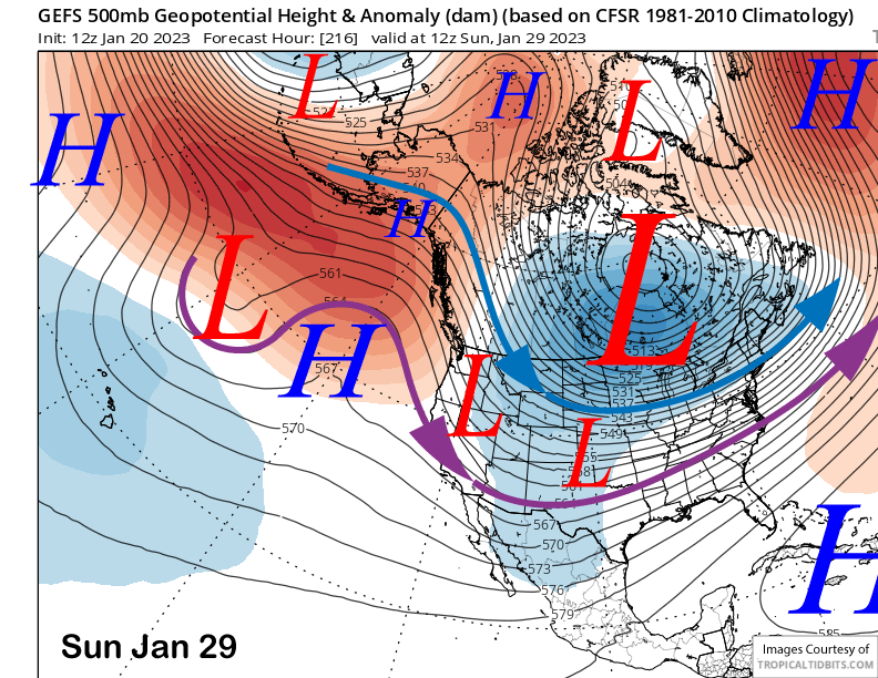
And these solutions are closer to the GFS ensemble (image below) that also favors a trough moving southward from Canada. Thus, current forecast favors mostly dry weather through the last weekend of January with just a chance for light snowfall.
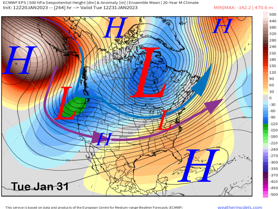
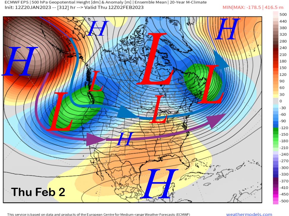
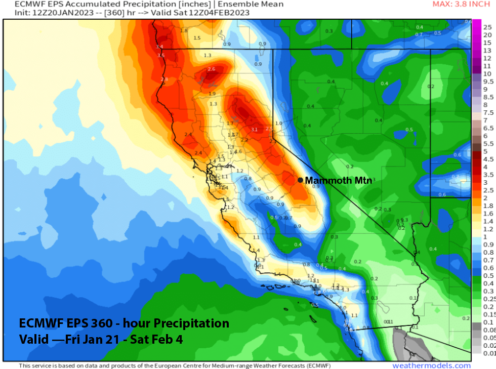
The fantasy range model guidance is still showing a transition back to a stormy pattern and potentially more powder days again at the end of the month and early February, per the ECM EPS model (image below). That model digs the longwave trough southwestward in early February (two images below) and that would allow storms with more over-water trajectory. QPF from the model right now is showing around 2” liquid (three images below).
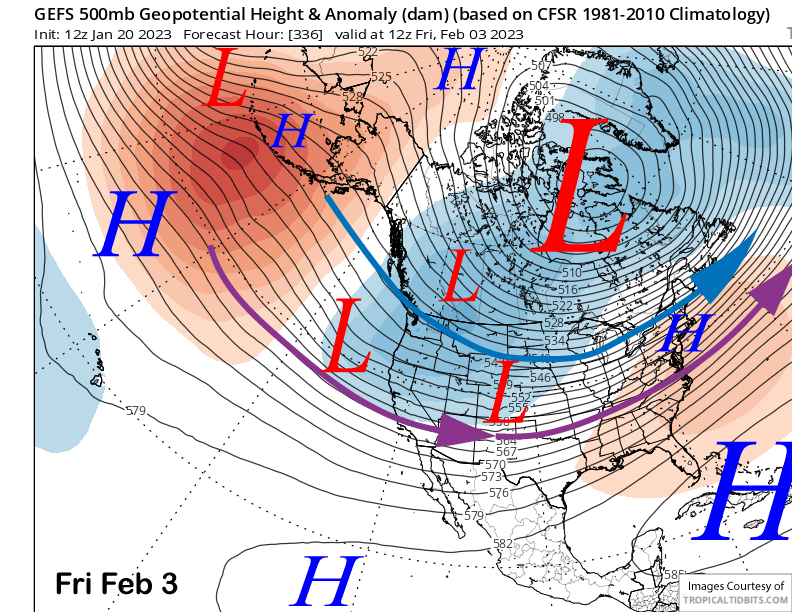
And the GFS ensemble is also showing a trough developing along the West Coast during early February (image below) and that only lends more confidence that the dry period will end in about ten days or so. Looks like more powder days soon. WG
WG


