Powder Forecast – Tuesday January 12th, 2021
Ted Schlaepfer CCM —- Mammoth Mountain WeatherGuy
Snowfall forecasts are valid at the Sesame snow course (Main Lodge) for the prior 24 hours as reported in the 6-7 AM morning snow report.
**Snowfall forecast confidence ranges from very low (1) to very high (5)
Wed 11/13 = 0”
Thu 11/14 = 0”
Fri 11/15 = 0”
Sat 11/16 = 0″
Sun 11/17 = 0″
Mon 11/18 = 0″
Tue 11/19 = 0″
Wed – Fri 1/20 – 1/22 = 0 – 3”
January Snowfall = 3”
January Forecast = 20 – 35”
Detailed 4-day Snowfall Forecast:
Wed 1/13 through Sat 1/16 – No snowfall expected all days.
Forecast Summary:
Short Term (Days 1 – 4):
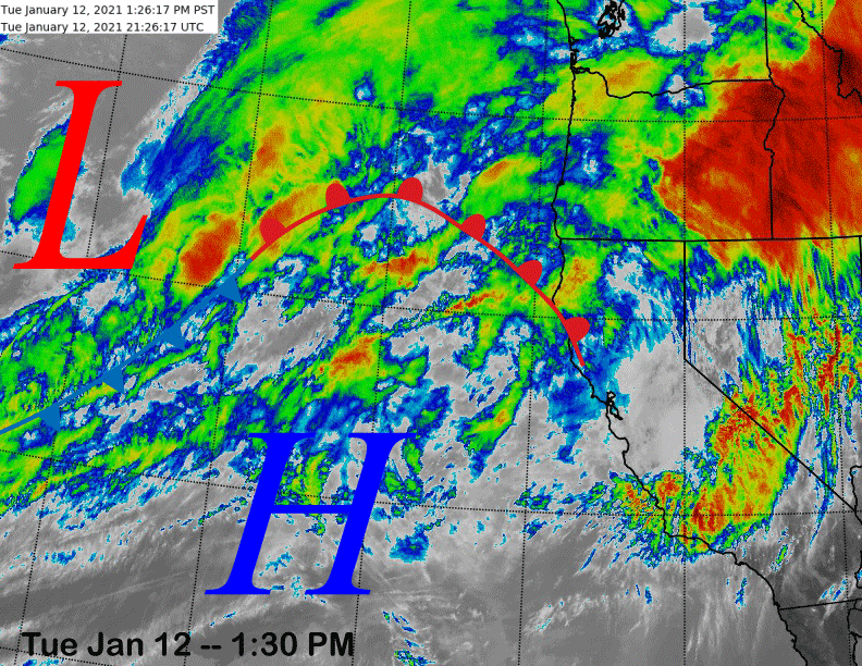
The infrared satellite image (below) this afternoon shows a storm system and associated atmospheric river moving into the PacNW southward into northern California with rain, but only clouds southward in the rest of California.
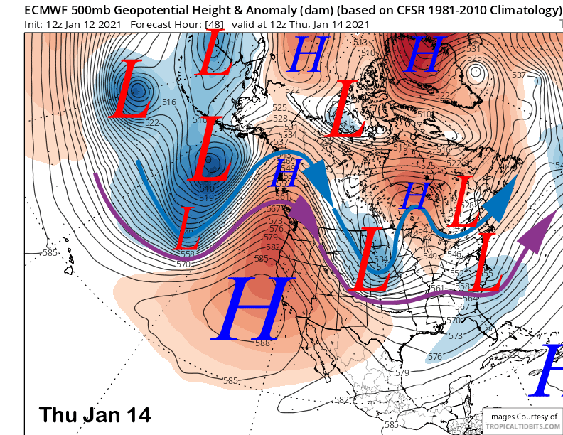
That system will continue to move through those areas into tomorrow before the high-pressure ridge that is currently positioned south of the front moves into CA and the West Coast on Thursday (image below) for fair and warmer weather. It will produce unseasonably mild weather for the end of the week. Temps will probably get into the mid-50s at Main, mid-40s at McCoy, and possibly mid/upper 30s up top that will probably result in a January thaw.
Long Range (Days 5+):
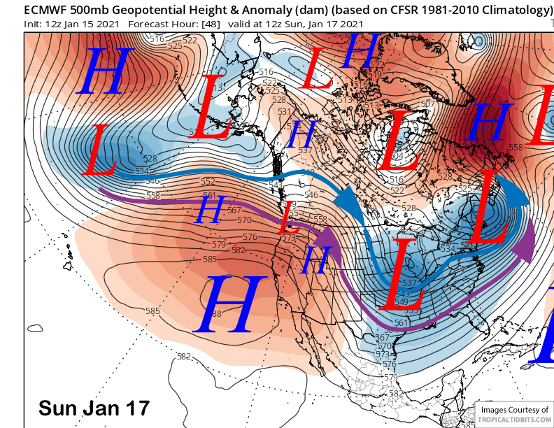
The longer-range guidance has not changed much since the last update with dry weather still expected until about the last week of the month. The latest ECM model (image below) keeps the ridge in place through the upcoming weekend and the other models agree with that solution for continued dry weather.
There could be a system move through mid-week next week that partially breaks down the ridge, otherwise meaningful changes in the weather pattern are not anticipated until the end of next week when discontinuous retrogression of the long-wave ridge/trough westward likely occurs.
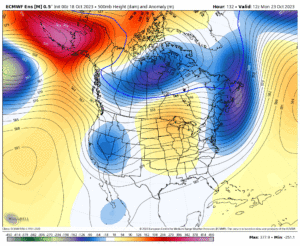
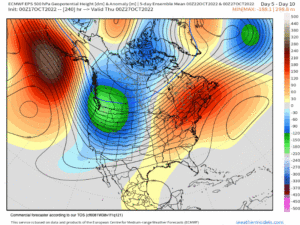
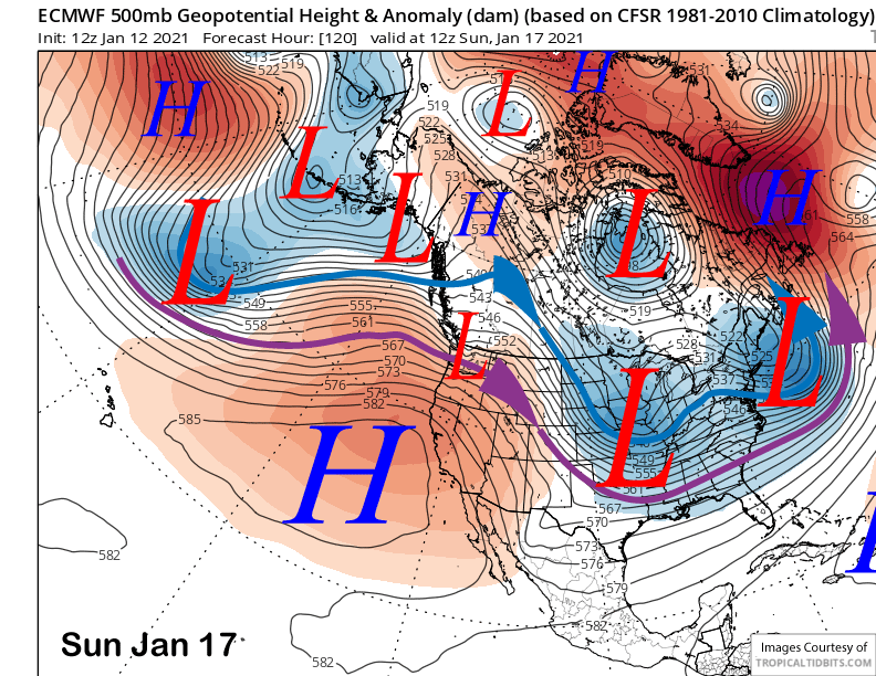
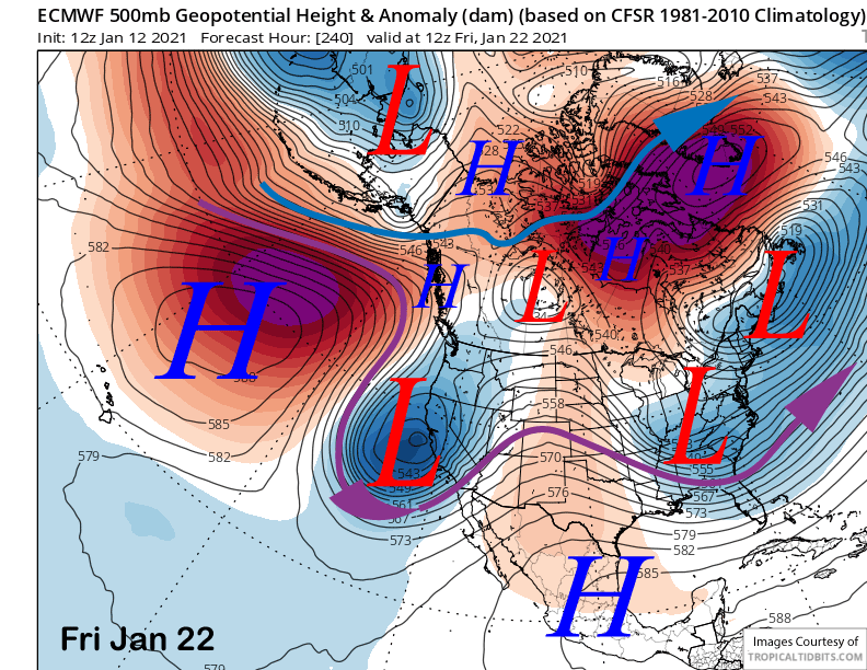
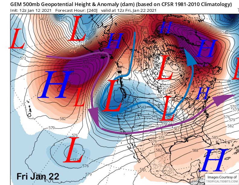
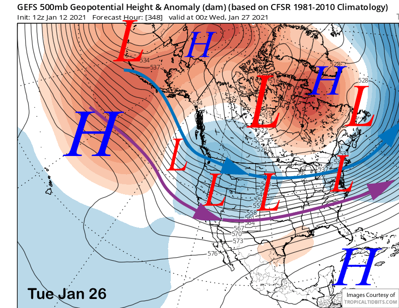
The main question concerning this scenario is not just how deep the eventual trough may be over the West Coast, but also particularly how fast it unfolds. The latest ECM run does move an upper-level trough southward and deepen it just of the CA coast next Friday (image below). The Canadian also has a trough developing along the West Coast (two images below), but is slower and farther northward.
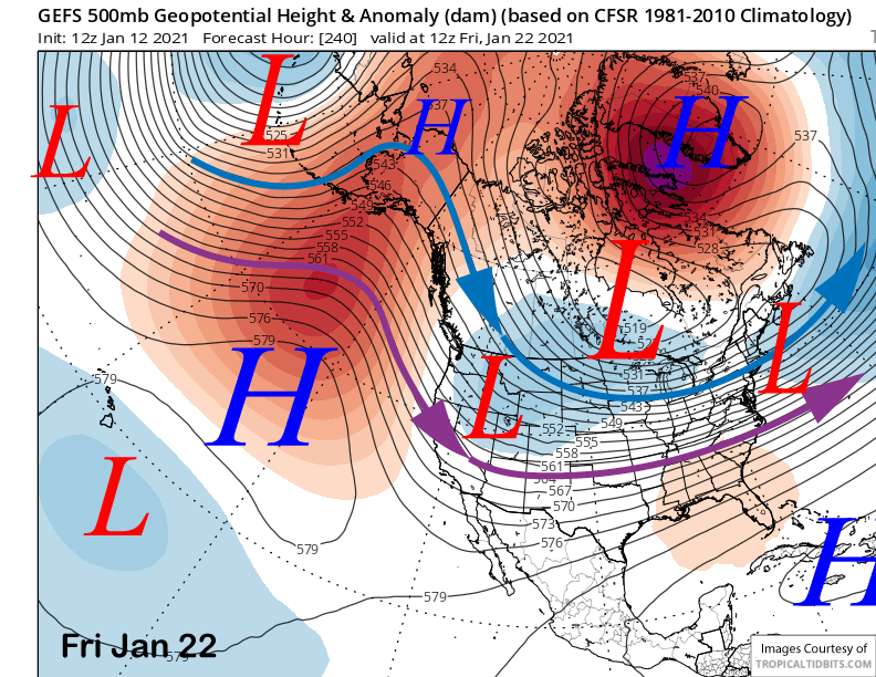
The operational GFS is the slowest with the retrogression and the GFS ensemble mean (image below) also favors a slower evolution of the pattern. It suggests the first system to drop southward into CA will be a dry/cold inside slider storm or hopefully a high-latitude type that generally has cold temperatures and more snowfall than the sliders, although the stronger ones have resulted in big dumps of fluffy powder.
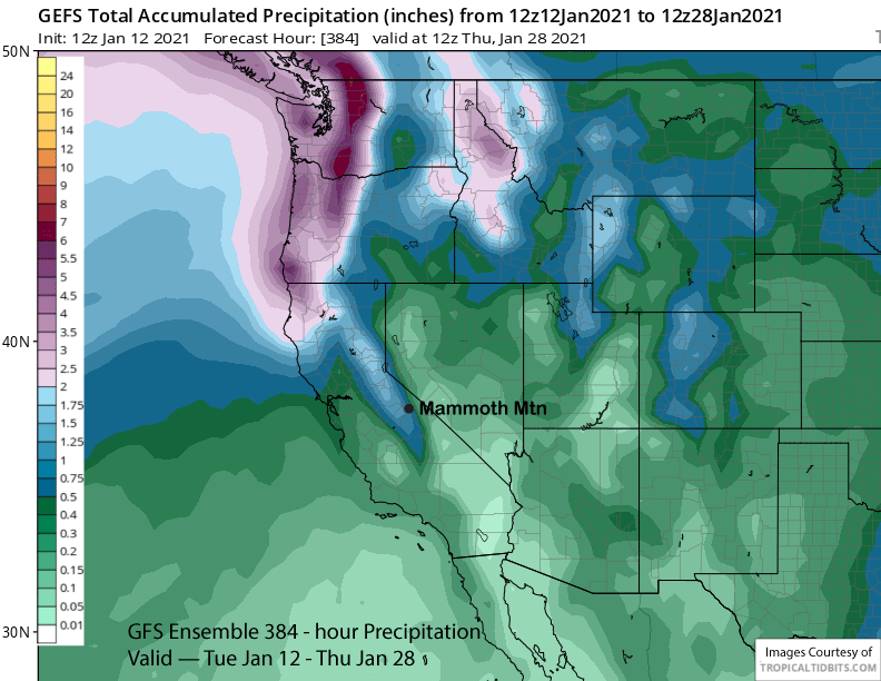
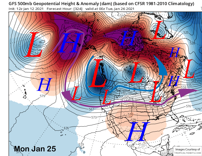
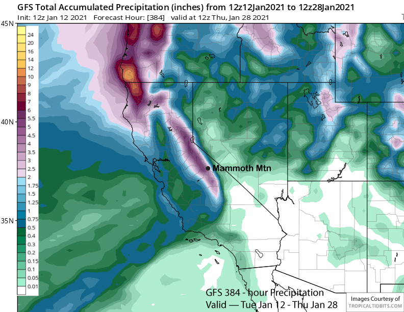
The GFS model (image below) does eventually move the long-wave trough westward into the West Coast over the following week (image below) and generally keeps it there for the remainder of the period. It does generate good precipitation with about 3-4” liquid over the crest (image below).
That solution is better supported by the GFS ensemble mean (image below) that does move the trough westward as well by that time and also flattens it out, thus allowing weather systems move over-water trajectory before moving inland and potentially larger snowfalls. But it is not as bullish as the operational run above.
Overall, it does look like snowfall and next chance for a powder day will return over the last week of the month as has been suggested in the last few updates. Right now, there is no guarantee that amounts will be huge as the GFS mean is still only showing about 1” liquid over the forecast period (image below) that would only be about a foot of snowfall. Further, right now, after the lasted busted pattern, I am just hoping that we actually get something and are not let down again by the guidance. WG