Powder Forecast –Friday March 12th, 2021
Ted Schlaepfer CCM —- Mammoth Mountain WeatherGuy
Snowfall forecasts are valid at the Sesame snow course (Main Lodge) for the prior 24 hours as reported in the 6-7 AM morning snow report.
**Snowfall forecast confidence ranges from very low (1) to very high (5)
Sat 3/13 = ~2” (H20 = ~0.15”)**4
Sun 3/14 = 0”
Mon 3/15 = 5 – 7” (H20 = 0.45” – 0.65”)**3
Tue 3/16 = 2 – 3” (H20 = 0.15” – 0.25”)**3
Wed 3/17 = 0”
Thu 3/18 = 0”
Fri 3/19 = 0 – 2”
Sat – Mon 3/20 – 3/22 = 3 – 12”
March Snowfall = 19”
March Forecast = 40 – 50”
Detailed 4-day Snowfall Forecast:
Sat 3/13 – No snowfall expected.
Sun 3/14 – Dry during the day with increasing winds, then snowfall develops overnight and becomes heavy for a bit near dawn Monday. Accumulations 4 – 6” by Monday AM, 6”+ up top
Mon 3/15 –Snow during the early morning changes to snow showers during the day, ending at night. Accumulations 2 – 3” by Tuesday AM, 3”+ up top
Tue 3/16 – No snowfall expected.
Forecast Summary:
Short Term (Days 1 – 4):
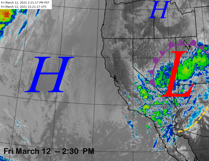
The infrared satellite image (below) this afternoon shows the upper0level low-pressure system that has produced the snowfall over the last couple of days positioned over the Utah, Nevada, and Arizona border areas. Wrap-around easterly flow in the counter-clockwise circulation of the low has continued to produce light snowfall in Mammoth today that will end this evening.
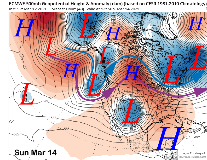
High pressure off the coast will then build into Mammoth tomorrow and into Sunday resulting in dry weather. A weather system will then split from the jet stream and move into NorCal Sunday afternoon and night (image below). Southwest winds will likely increase during the afternoon and there could be some good wind buff stashes in the usual locations (e.g. lower Drop Out 2, Face of 5, etc).
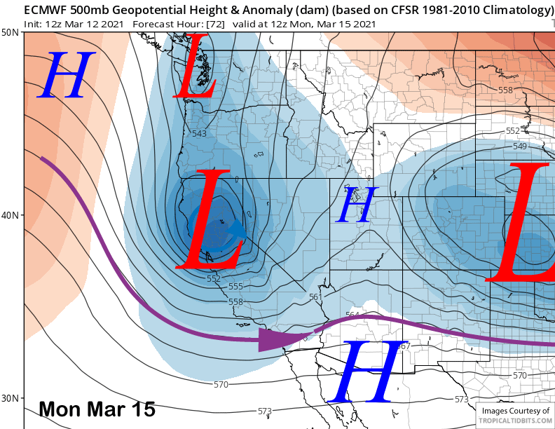
The upper-low is then forecast by the models to swiftly move southward overnight Sunday and early Monday (image below) through the Sierra for a period of moderate/heavy snowfall. It will be a cold system again with snow levels starting out around 4500’ feet before lowering to 3000 feet early Monday. So it will be the cold, dry, powder again and not Sierra cement.
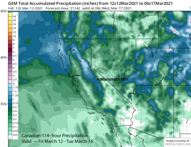
The ECM and GFS (image below) models are similar with amounts in the 0.75” range (image below) while the Canadian model (two images below) is showing slightly less and around a half an inch. The latest 18Z GFS hasn’t changed much.
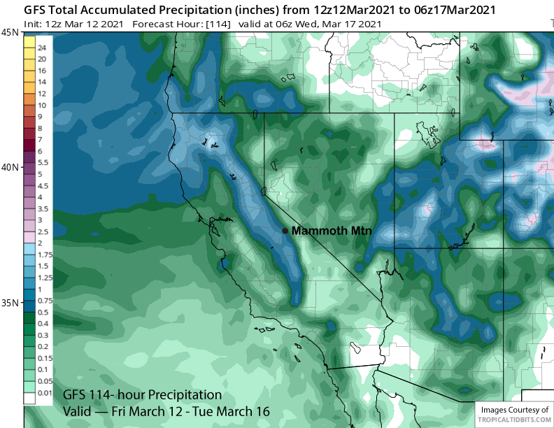
With the upper-low taking a southerly course through the Central Sierra, the forecast follows the wetter guidance with about 7-10” of snow for the event. Most of the snow will fall by mid-morning Monday with only light accumulation in the afternoon/evening before snowfall ends at night.
High pressure will then build into the Mammoth area Tuesday for fair weather and seasonably cold winter-like temperatures. Conditions early next week should continue to be epic with the dry powder and cold temperatures.
Long Range (Days 5+):
The longer-range guidance is favoring mostly dry weather through mid-week next week before there is a chance for snowfall end of next week and/or following weekend, although model agreement is generally lacking.
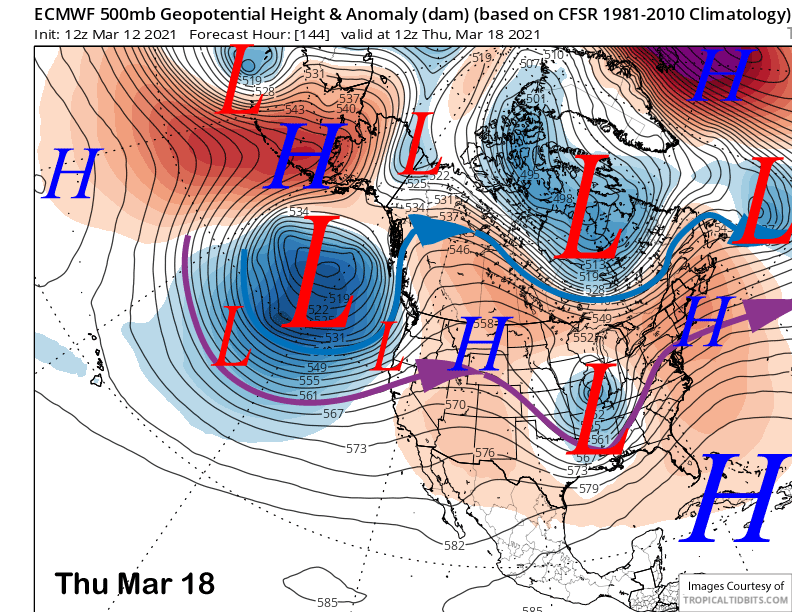
The ECM model moves a weak weather system in southwest flow well north of Mammoth around Thursday (image below) and into Friday. That would be mean passing clouds and continued dry weather.
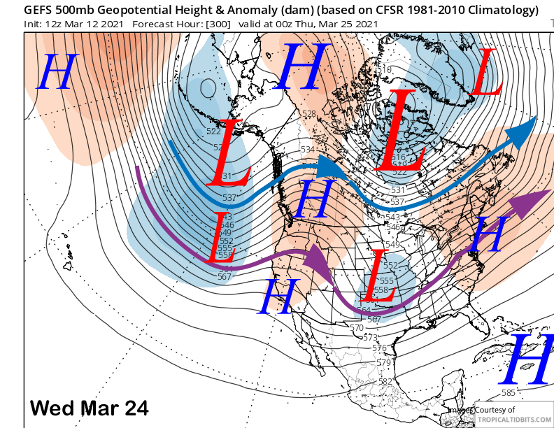
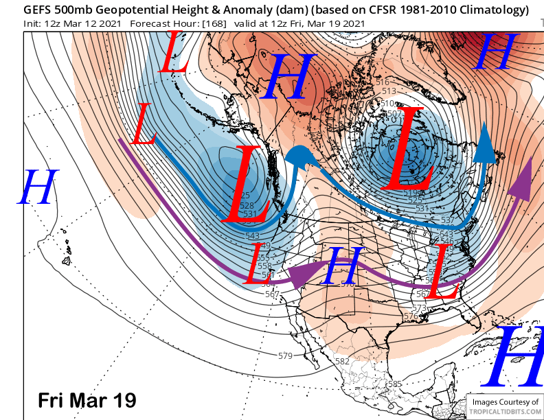
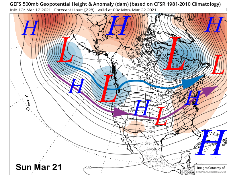
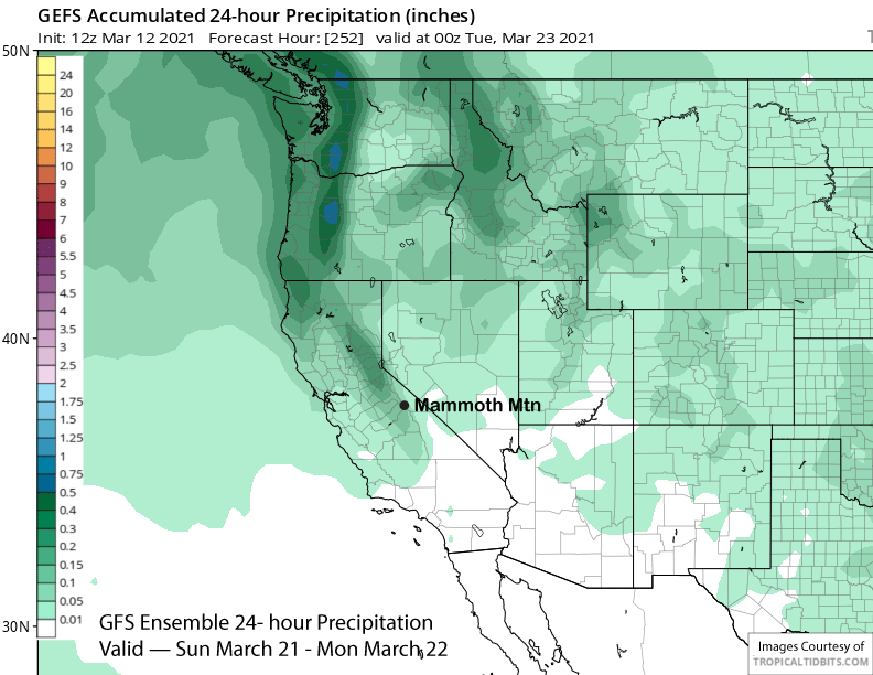
The GFS ensemble (image below), though, is showing a trough farther southward by Friday next week that may be far enough southward for light snowfall in Mammoth. It is only showing very light amounts (image below) that would only result in a few inches of snowfall at best.
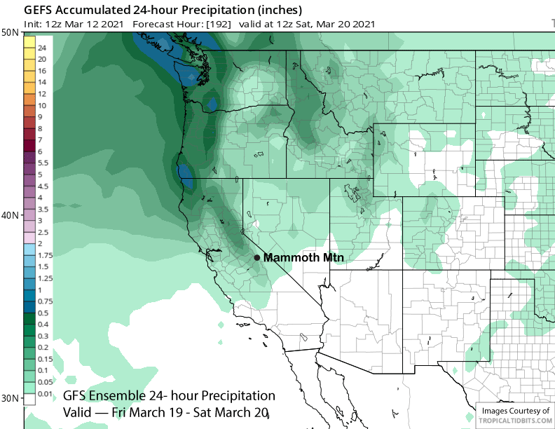
That model then moves another trough into the coast around Sunday the 22nd (image below). Again, the model is only favoring light amounts (two images below) as there are many dry ensembles countering the wetter ones that could be hiding a bigger storm.
That is what the latest 12Z run of the ECM model (image below) is suggesting with a very deep trough moving into the state over the weekend. If that verified, there would be two feet of new snow at Main and 20” at Canyon. Right now though, I consider that run an outlier and likely not to verify that strong, even though the 18Z GFS has trended that way.

Overall, the current thinking for the extended time frame is dry weather Tuesday through Thursday next week with good wind buff up top before there is a chance for snowfall late next week/following weekend. About half to two thirds of the ECM ensembles are showing snowfall for the end of next week/following weekend of highly variable amounts.
Beyond that potential event, the guidance has fair weather returning by mid-week over the following week (image below) with no clear sign of the next powder day chance. However, the longer-range climate models keep the pattern active into April with a long-wave trough along the West Coast to start spring. WG