October 10th, 2023 @ 8:42 AM – Good morning, currently you will find clear skies across Mammoth Mountain and all the way down to the Bishop area.
Up at the top of Mammoth Mountain here is a temperature of 31 with the wind flow out of the S @ 44 gusting to 55 MPH at times. Down in Mammoth Lakes, there is a temperature of 51, and down in Bishop there is a temperature of 57.
Over the next week here is what to expect weather-wise out on Mammoth Mountain and around the Eastern Sierra.
A weak low-pressure system will move through California and the Eastern Sierra over the next 48 hours. The result will be gusty winds in the high country along with cooling high temperatures region-wide. There is no snowfall expected with this low-pressure system.
Friday into the Weekend looks to be clear with temperatures in the area coming up about 5-7 degrees with lighter southwest winds expected. Should be the perfect weekend to check out all the peaking Fall Colors in the high elevations.
Basic Weather Forecast through Thursday: Temperatures out on Mammoth Mountain will be in the lower 50s with Mammoth Lakes in the upper 50s to lower 60s with Bishop in the mid to upper 70s.
Night-time lows will be in the mid 30s to upper 30s for the higher elevations with early morning lows down in Bishop in the upper 30s to lower 40s.
All high country locations above 6,000 feet should see a freeze by early Wednesday morning. The freeze is not expected to be deep enough or long enough to damage the Fall Color show
The wind forecast for the high country, the wind direction will be SW to West into Wednesday and then the wind direction will change over to flowing out of the NE into early Friday.
Wind speeds at the 9500-foot mark and above will be in the 25-40 MPH range with gusts to 45-55 MPH possible into Wednesday evening.
The SW flow returns by later in the day Friday with wind speeds in the 5-10 MPH range with gusts to 15-20 MPH over the higher elevations into Sunday.
PS: Fall Colors are peaking above the 9000-foot mark in most locations at this time. The lower elevations are all in the process of changing now with some good color starting to show in Bishop.
Snowman out...

7-Day Temperature Forecast

7-Day Snowfall Forecast

7-Day Wind Forecast


Days 1-7 Forecast Discussion
October 10th, 2023 @ 12:15 PM – The next seven days are looking primarily clear, with no snow expected. Very typical weather for this time of the year, with some cooling from a weak inside slider followed by more ridging moving in on day 7.
Over the upcoming week, the weather looks great for an adventure; make sure to layer up if you’re out early, especially on Wednesday morning when a freeze is expected in the high county.
Let’s look at some weather data so you can get a visual of what is going on now.
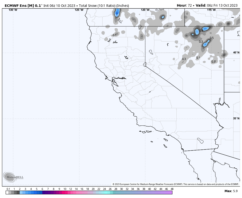
In this first image, you can see the low-pressure system off the Pacific Northwest coast. This low will be an inside slider heading well to the east of the Sierra Crest.
The direction and position of the low will result in just a change in temperatures and winds. When an inside slider is this far to the East of Mammoth Mountain, you can expect it to be dry with no snowfall.

In the two images below, you can see the system sliding to our east down into Utah and then through southern Colorado. This one is a quick mover, unlike the last hybrid slider we had a week ago that hung in the area longer. 

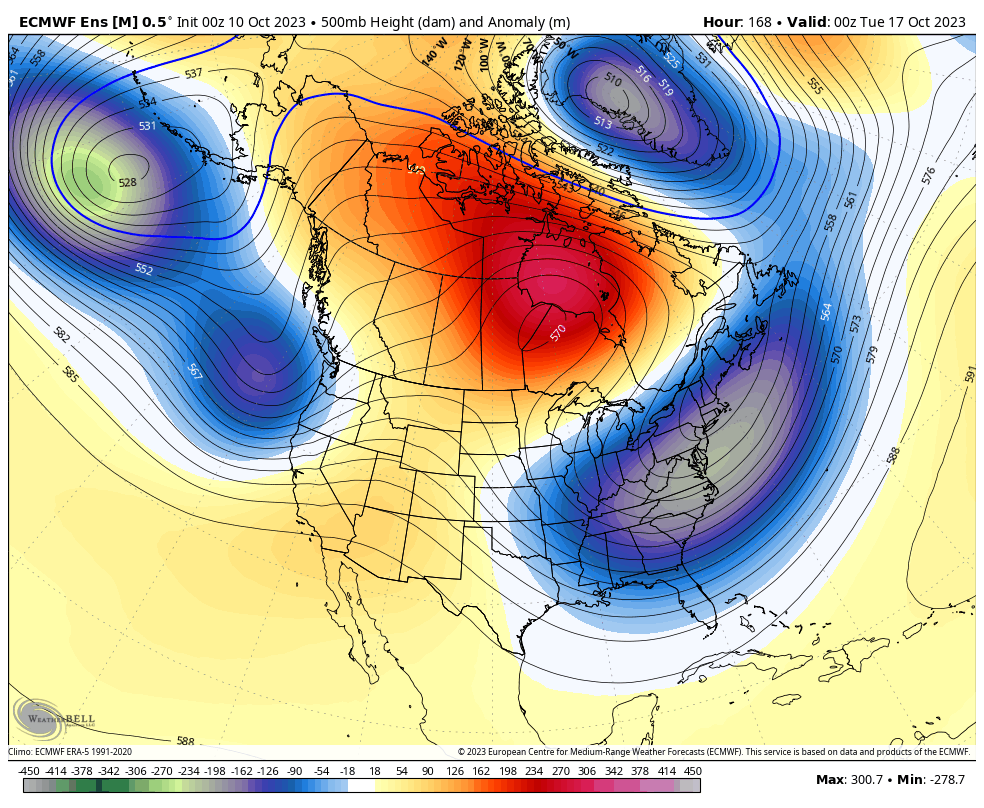
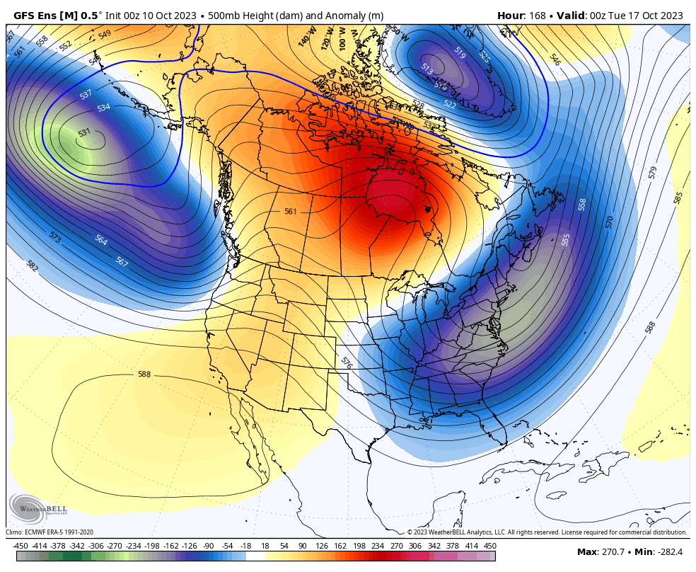
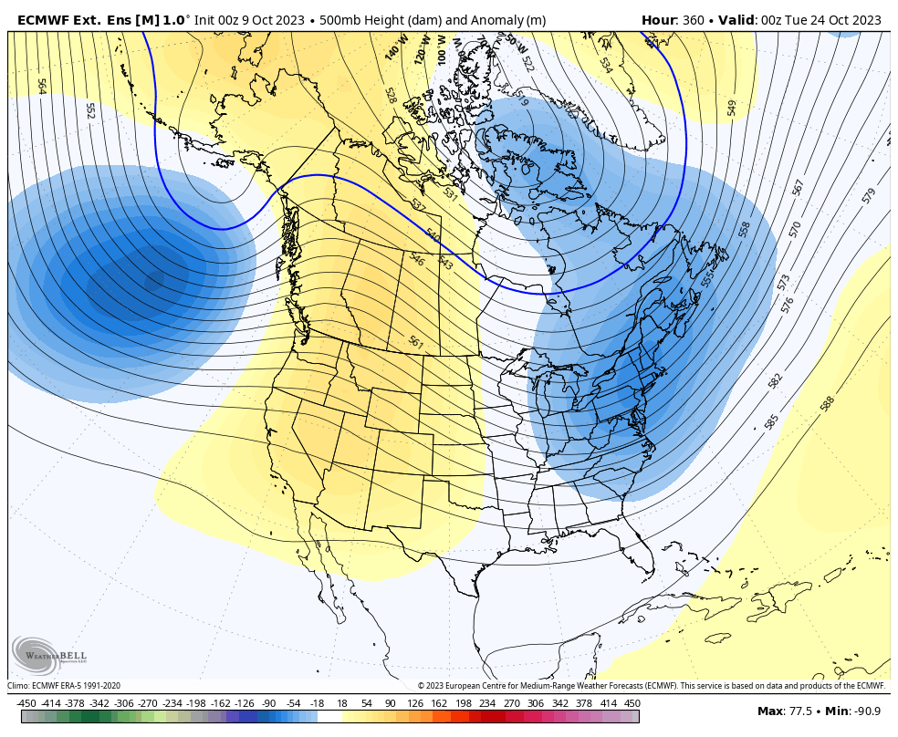
By the weekend, the ECMWF has the next low-pressure system set up off the Pacific Northwest coast; this system looks to hang out in that position for a time and will slowly bring in higher heights over the Eastern Sierra. This type of pattern means dry with season-average temperatures over the weekend.  The GFS has cooler weather with lower heights exteneding inland from the main trough in the pacific northwest. This would results in a cooler windier weekend then the model above as.
 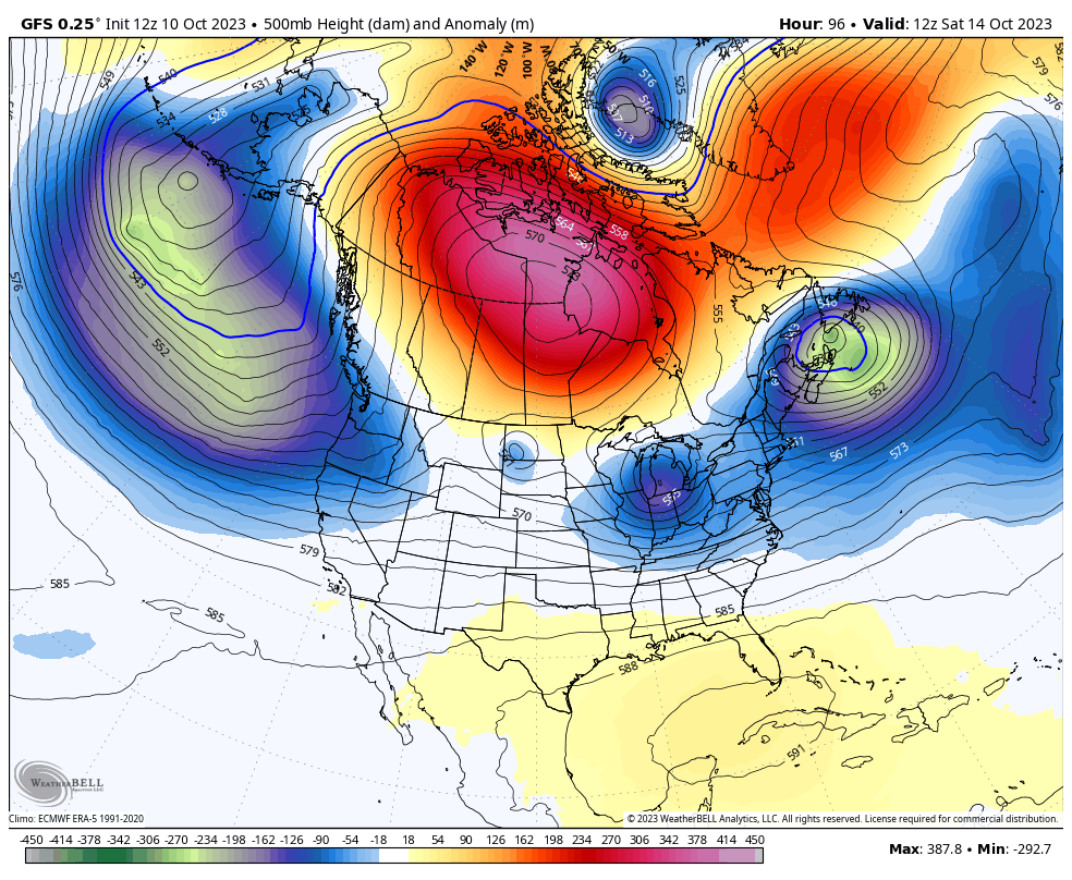 By next Monday, a strong ridge of high pressure will be just to the east of Mammoth Mountain. As the ridge nudges closer to the area, temperatures will increase, and winds will remain light.
____________________________________


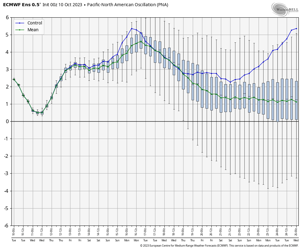
PNA Forecast Chart
Day 16 – 45 ECMWF Extended Ensemble Mean
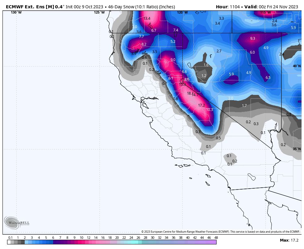
45 Snowfall from the ECMWF Ext. Ensemble Mean
Temperature Anomaly – ECMWF Ext. Ensemble Mean
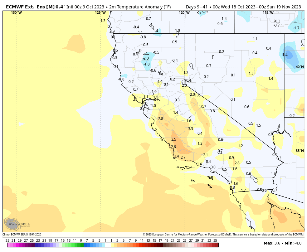
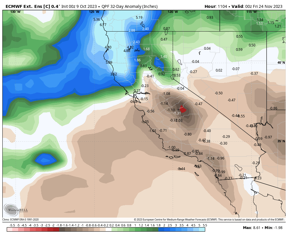
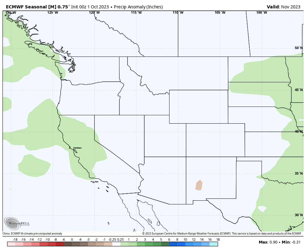
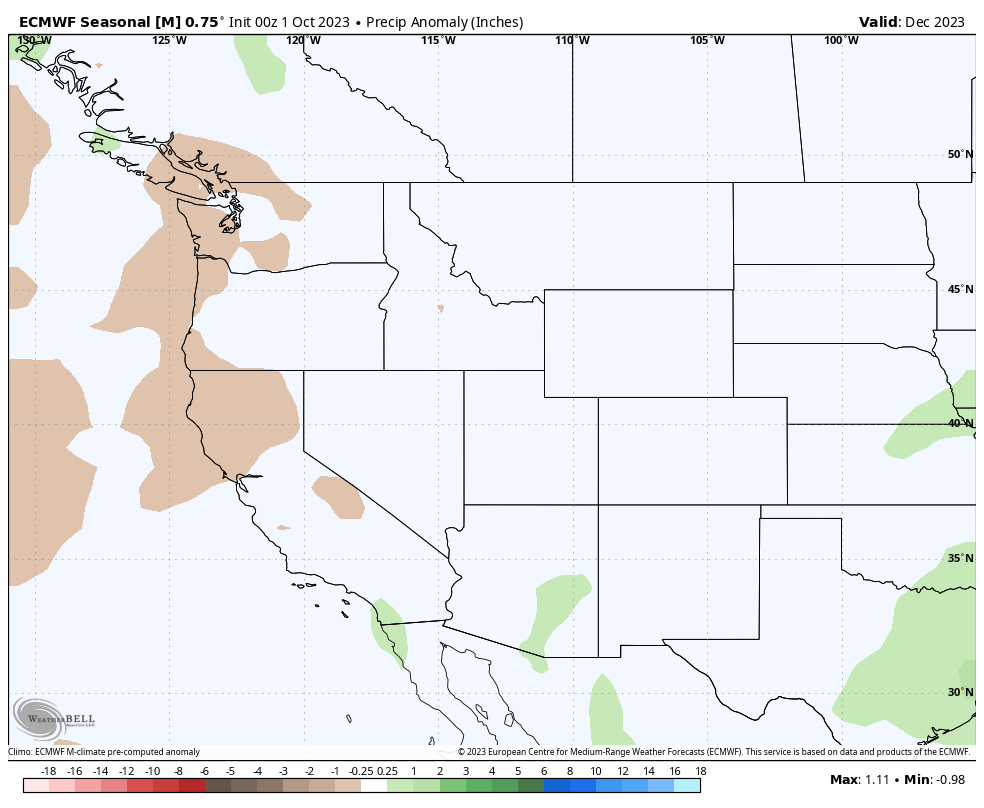
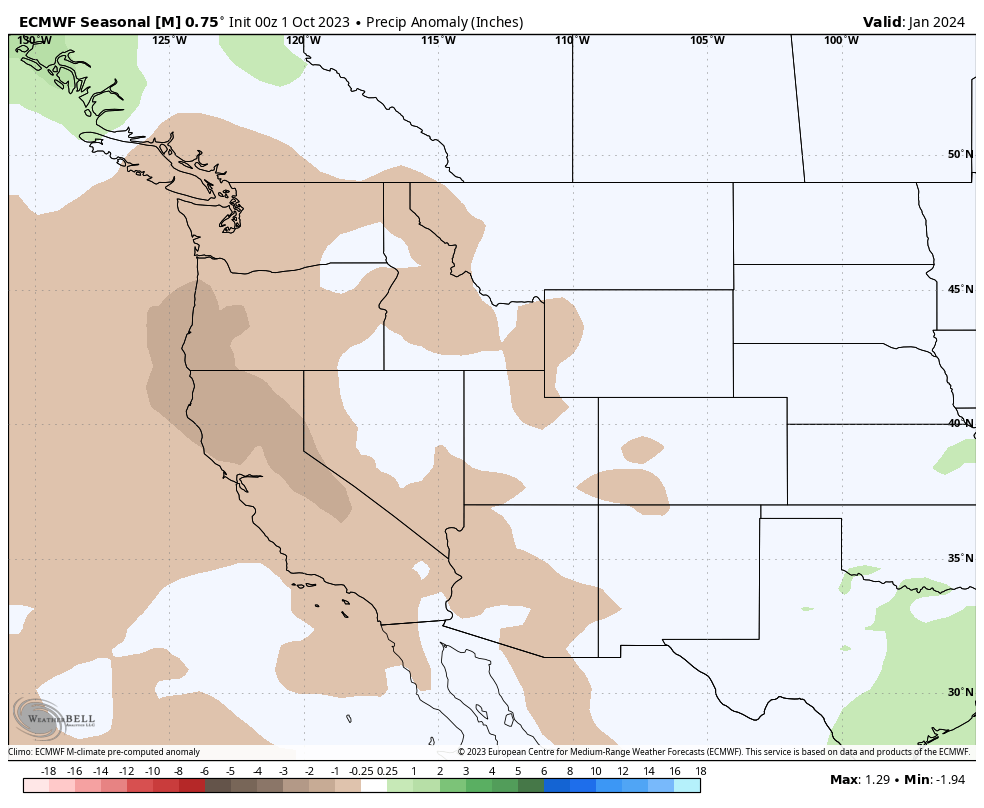
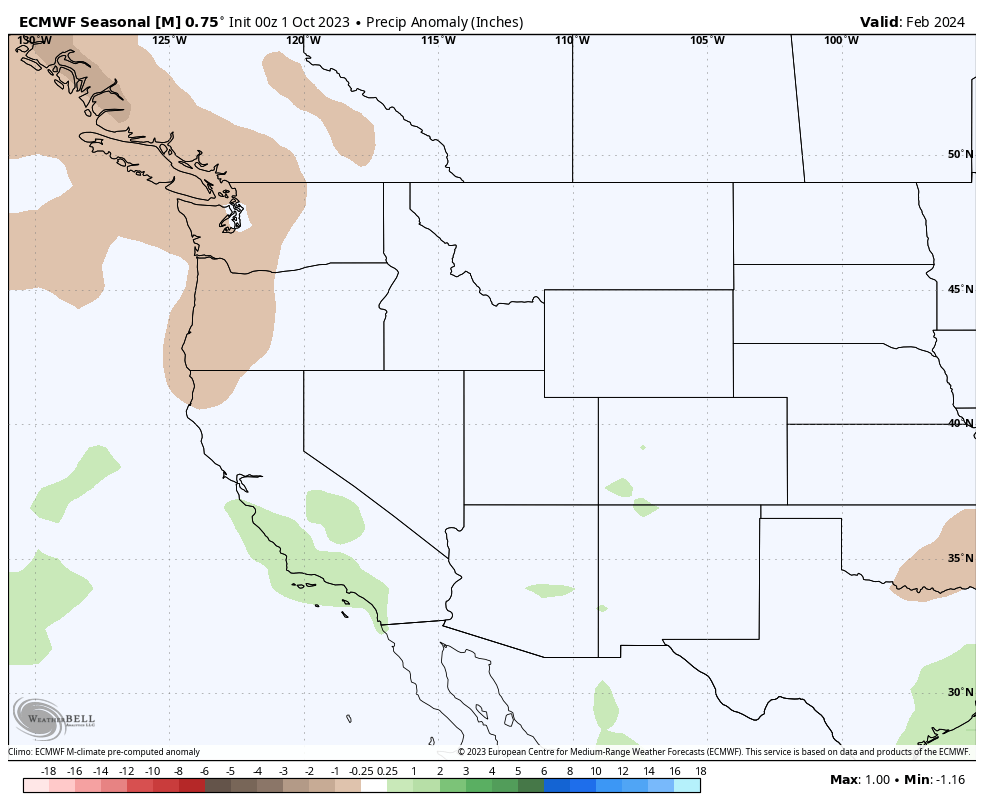
Precipitation Anomaly November 2023- ECMWF Extended Ensemble Mean
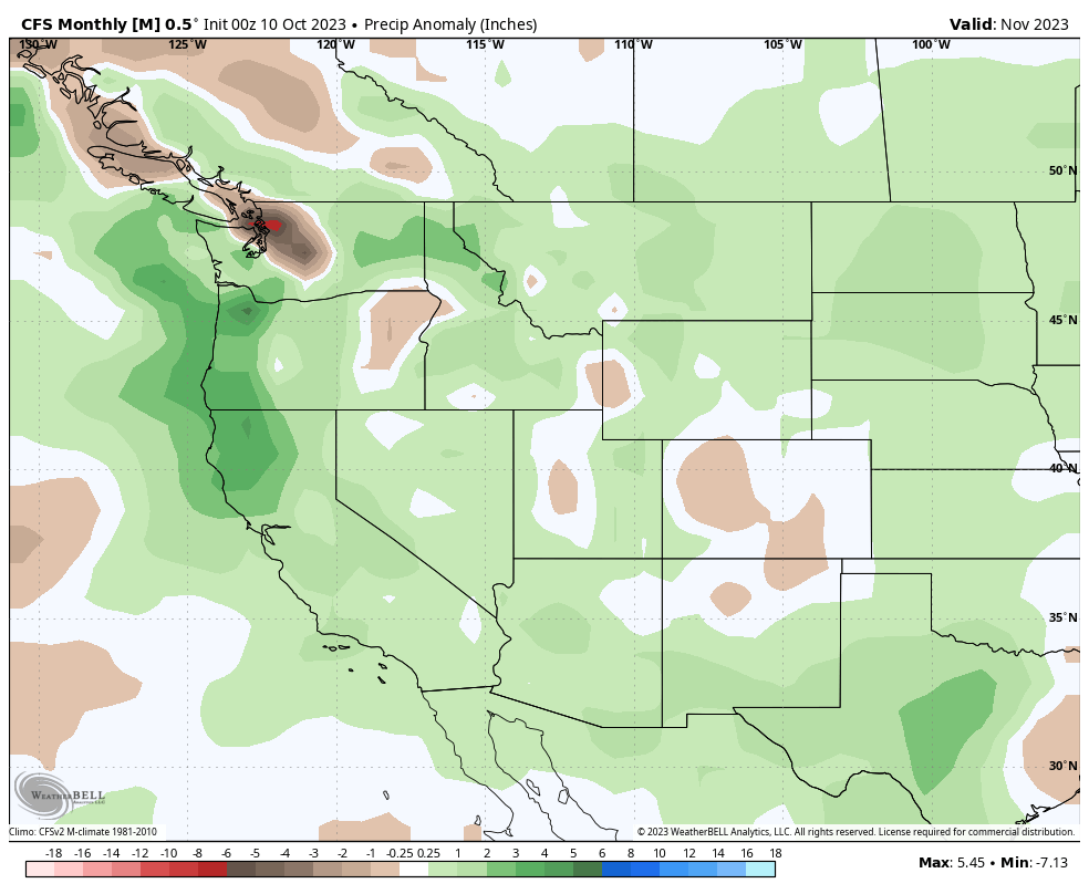
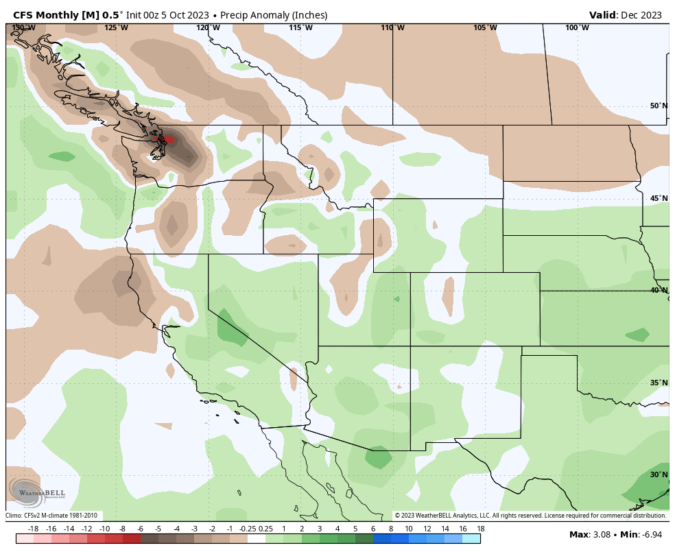
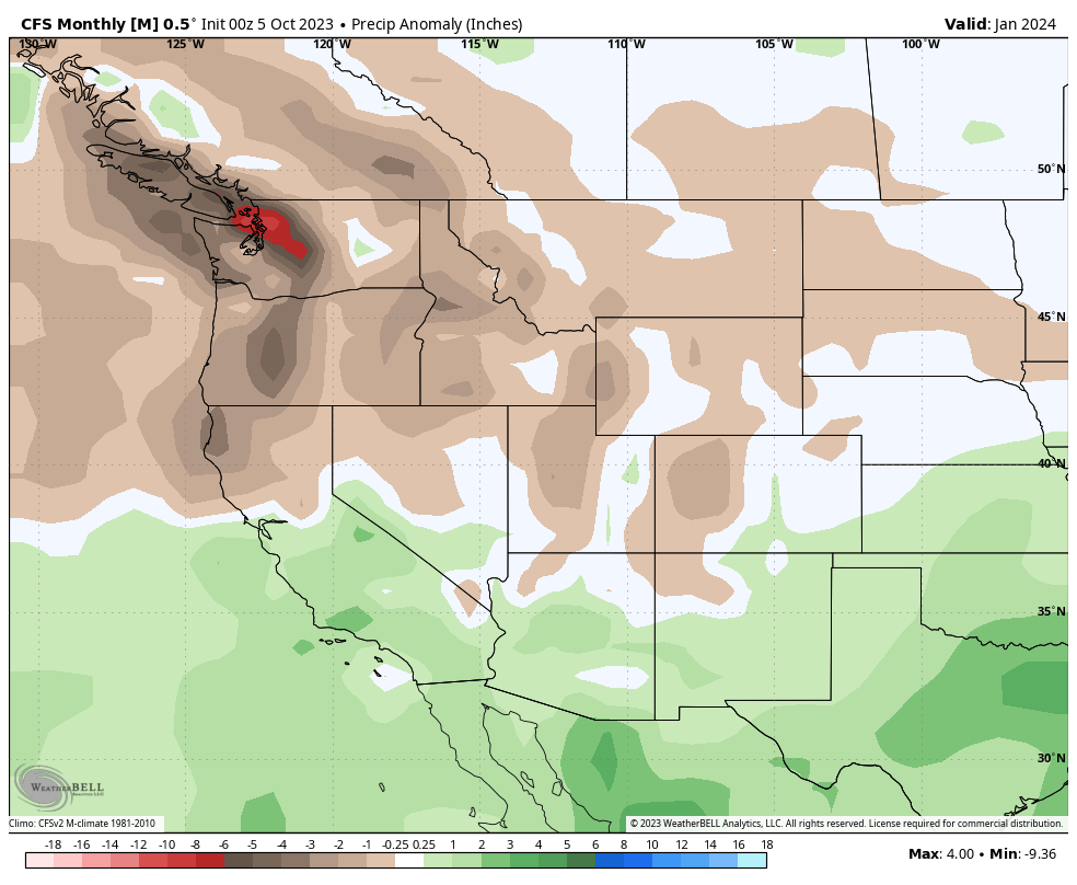
 Precipitation Anomaly November 2023 – CFS Monthly
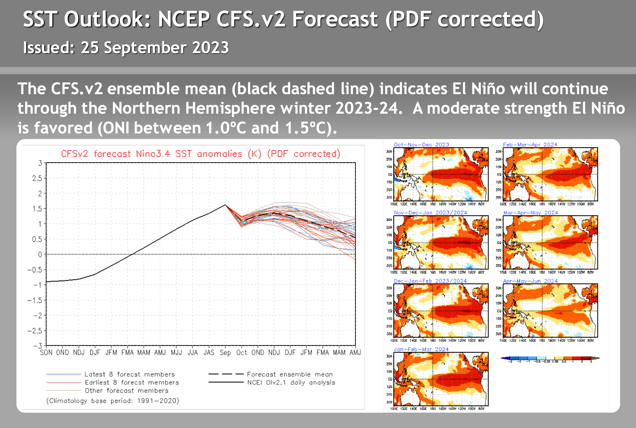
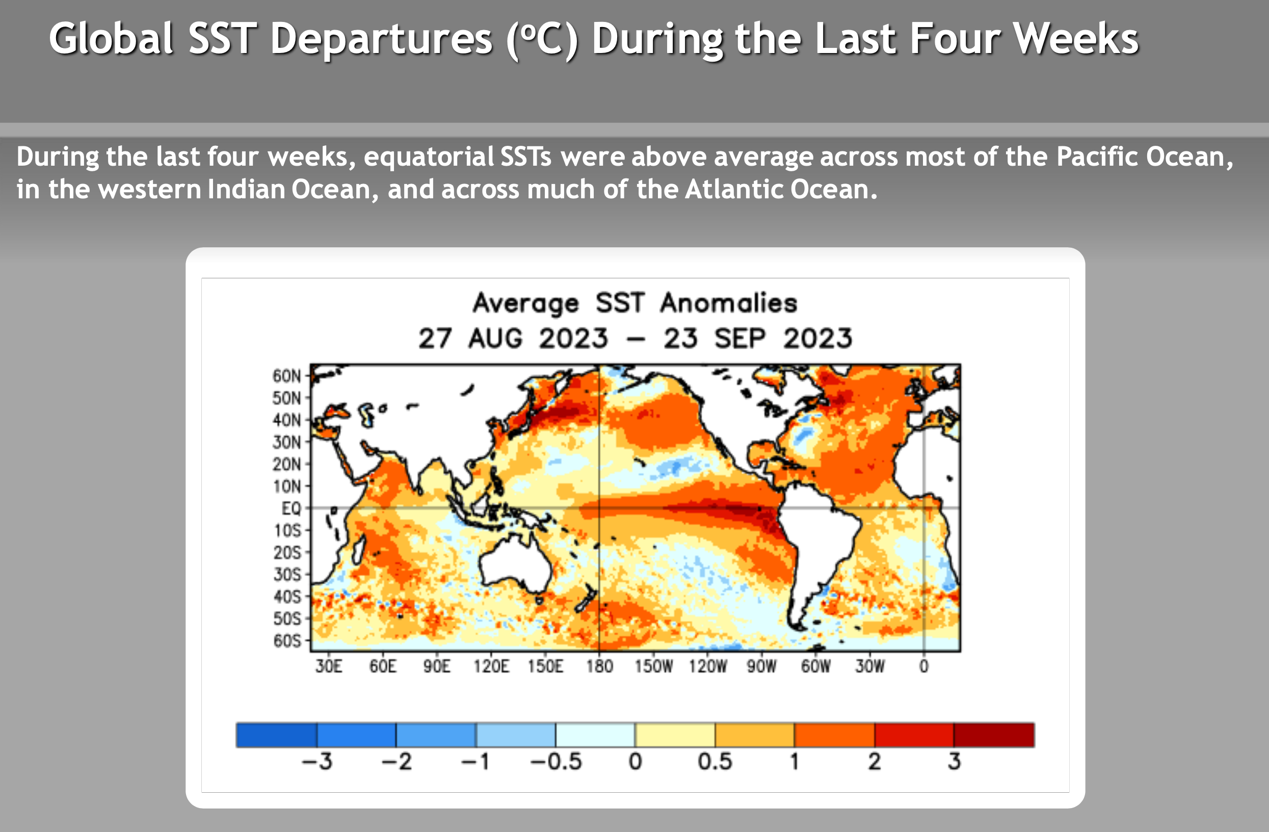
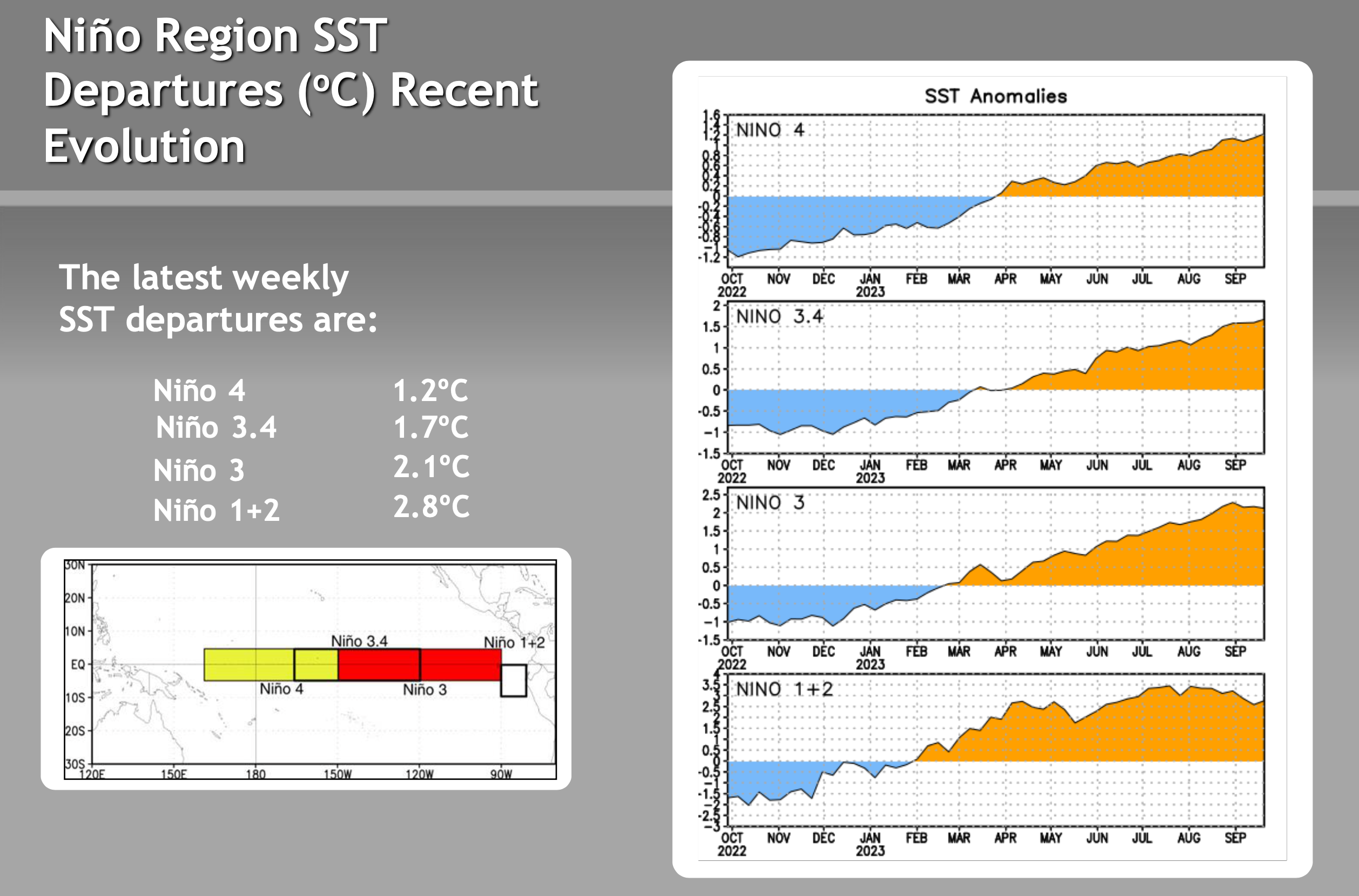
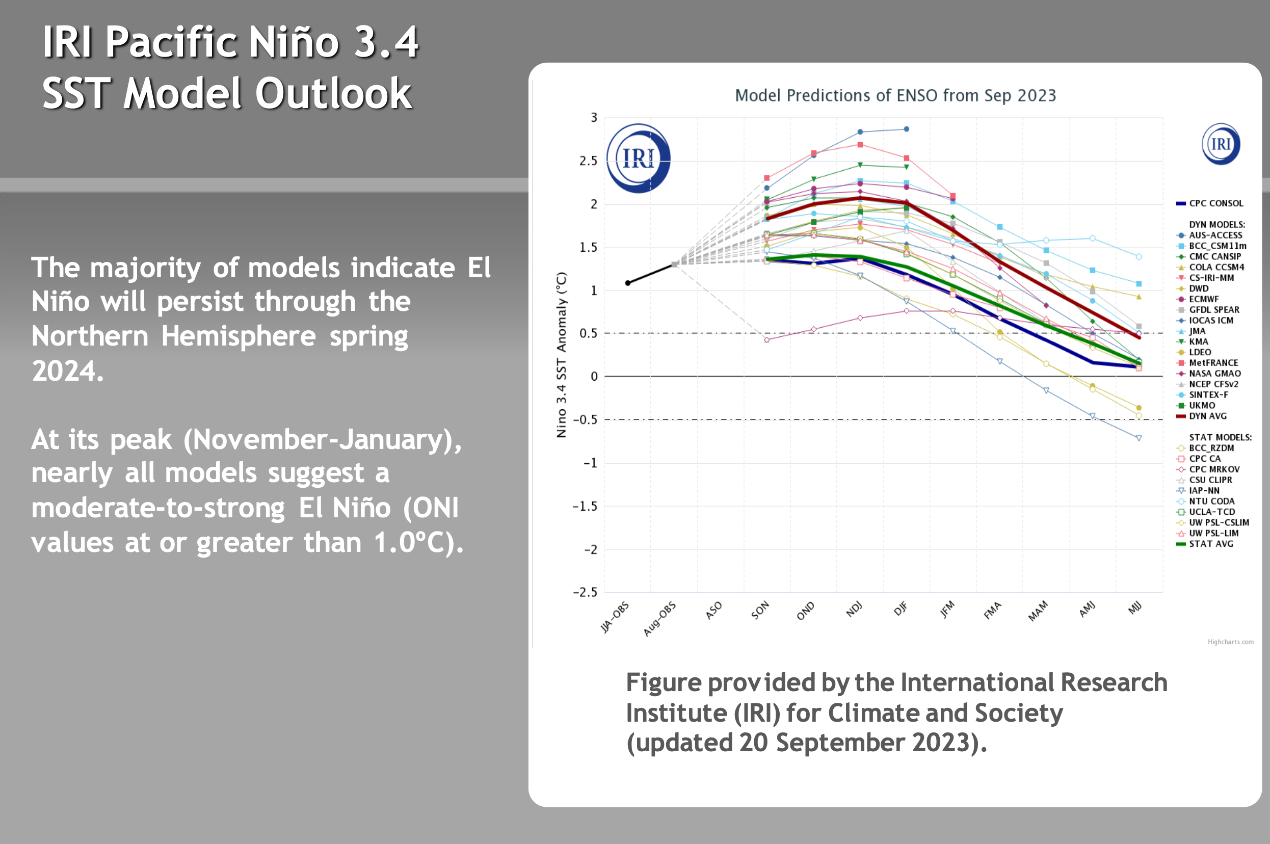
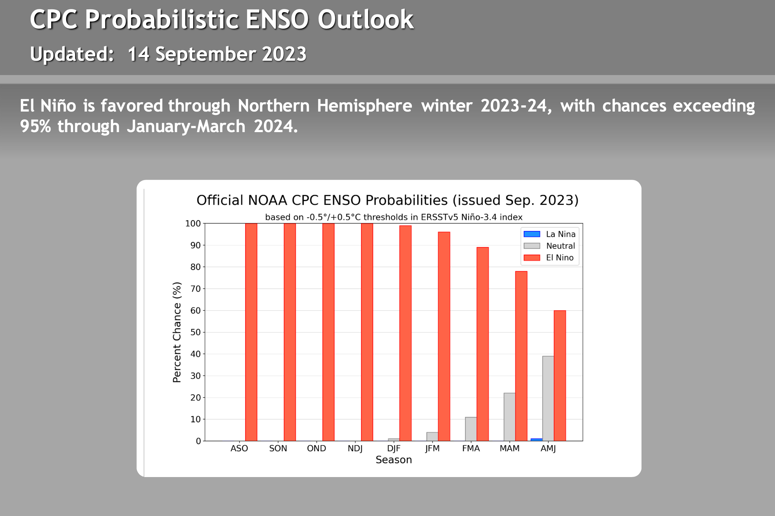
ENSO – El Nino / La Nine Outlook – September 26th, 2023
El Niño Update: The current El Nino is in the strong category. How the event affects Mammoth Mountain and the Eastern Sierra this winter is uncertain. There are a lot of variables with this particular El Nino event that have not been seen during other strong events. Take a look at the video below for more information.
There are not a lot of strong El Ninos to look back at, so it’s hard to trust any of the long-range data right now. Past El Niño winters have been slow to start, so don’t be surprised if the Eastern Sierra sees below-average rain and snowfall this Fall.
The video below is new from Mike Discussing the most current El Nino Data. All the images in this section have been updated, with what’s the most recent on there as of 9-26-23.
> To note, El Niño winters can be slow to start, so don’t be surprised if the Eastern Sierra sees below-average rain and snowfall this Fall.