October 13th, 2023 @ 8:42 AM Good morning, currently, we have high clouds over Mammoth Mountain and across the Eastern Sierra.
Up at the top of Mammoth at the 11,000-foot level, there is a temperature of 28 degrees with the wind flow out of the SSW @ 19 gusting to 21 MPH at times. At the Main Lodge, the temperature is 36 degrees, with a wet-bulb temperature of 33.
Down in Mammoth Lakes, there is a temperature of 32, with a 33 at the Mammoth Airport. In the town of Crowley Lake, it’s a chilly 26, and down in Bishop, there is a temperature of 36. Winds are light to non-existent in the lower elevations this morning.
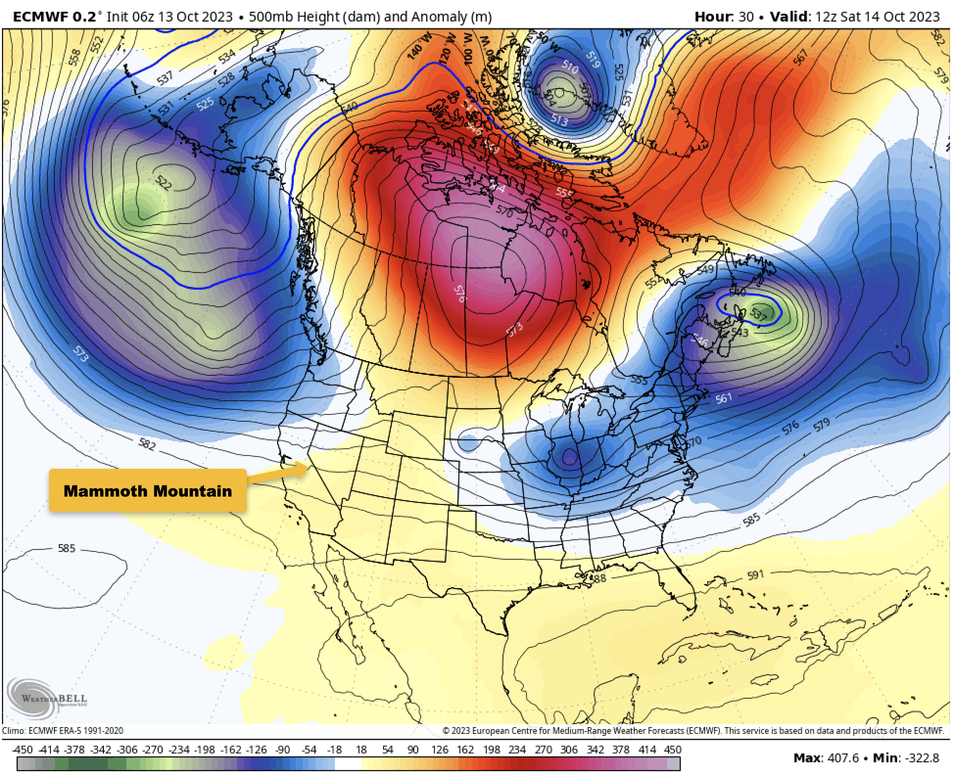
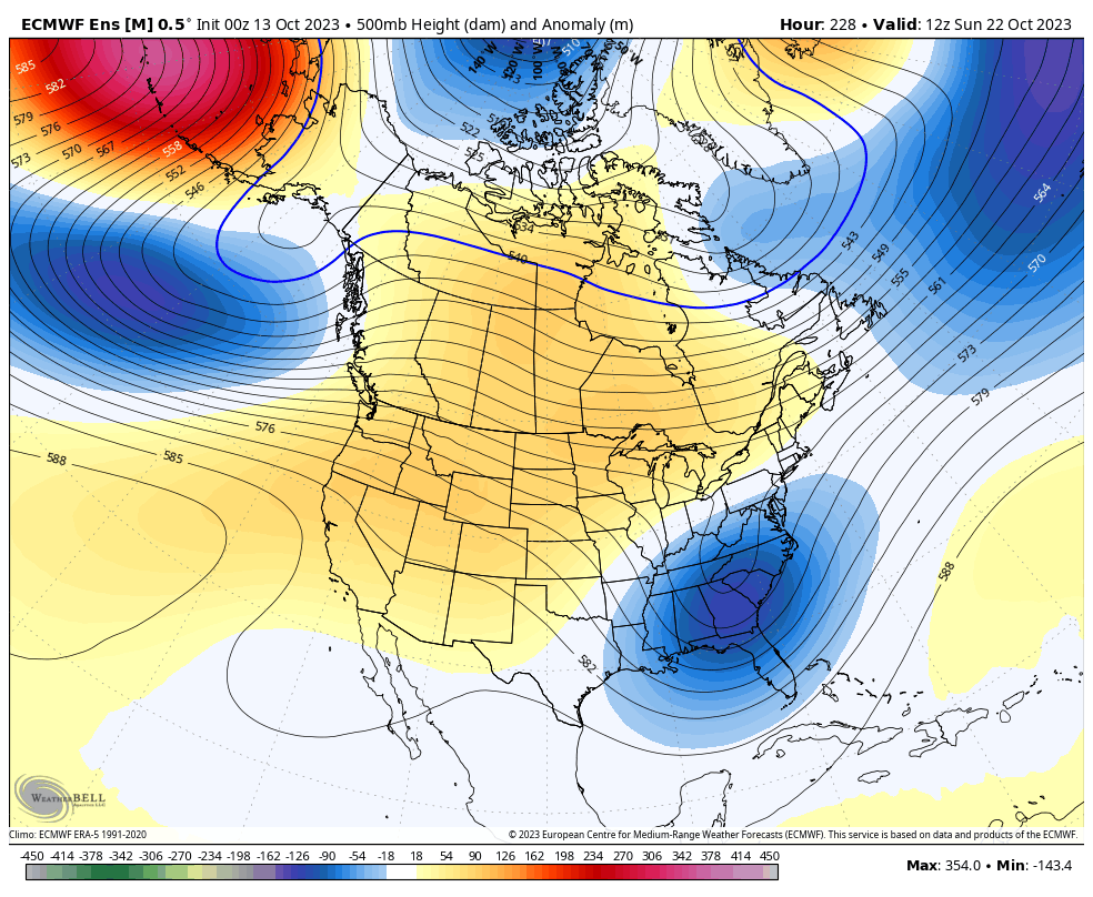
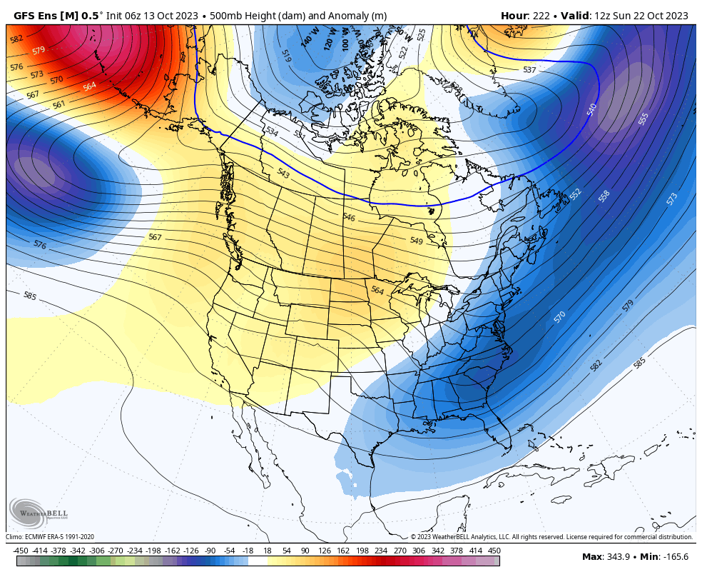
Over the next week, here is what to expect weather-wise out on Mammoth Mountain and around the Eastern Sierra. A strong low is off the Pacific Northwest Coast and is bringing some nice cool weather and high clouds to the Eastern Sierra today.
As that low intensifies a bit, it will help to kick up a ridge of high pressure that will affect the Eastern Sierra with some warming temperatures and lighter winds right through the weekend.
The ridging peaks on Sunday with some weak troughing into the area on Tuesday before the next stronger ridge rapidly builds into the area by the middle of next week.
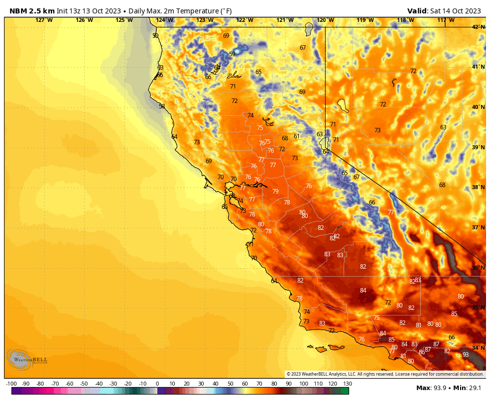
Basic Weather Forecast: Skies will be pt cloudy at times from the Mountain down into the Bishop area right through the weekend.
Mid-Day Temperatures out on Mammoth Mountain @ the 9000-foot level will be in the mid-50s today and Saturday, with temperatures coming up 7-10 degrees by Sunday into early next week.
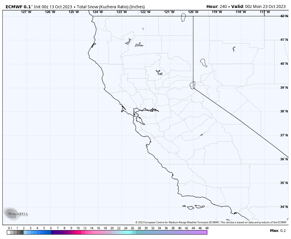
Night time lows will be in the mid-30s to upper 30s with lower 40s by Sunday night into next week. The wet blub looks to be too warm to make snow over the next week.
The Wind Forecast has the upper elevations seeing SW winds @ 5-15 MPH with gusts in the 25-35 MPH range today and then decreasing a bit over the weekend.
For Mammoth Lakes, mid-day temperatures will be in the upper 50s to lower 60s and then into the lower 70s by Sunday and Monday. Night-time lows will be in the mid to upper 30s and then the lower 40s by Monday night.
Down at the 4100-foot level in Bishop, mid-day temperatures will be in the low to mid-70s today and Saturday and then low to mid-80s Sunday onward.
Night-time lows will be in the lower 40s on Saturday, with upper 40s by Sunday and Monday, with afternoon winds of 10-20 MPH possible at times.
Snowmaking Outlook: Over the years, crews have started to make snow after about the 21st of October each year. I have seen them test the system and run it at full before then, but that is rare. From here on out, I will be checking the wet blub outlooks and posting a snowmaking forecast until there is enough base.
Also, to Note that the Fall Colors have taken a bit of a hit in the higher elevations with lots of wind and a decent freeze the last couple of nights. Colors a just past peaking above 9000 feet with a mix of near to peaking now from 8000 to 9000 feet. Below that, there is a mix of yellow and green leaves with some peaking trees thrown in above the 6000-foot level.
Snowman out...


7-Day Temperature Forecast
7-Day Snowfall Forecast
7-Day Wind Forecast

7-Day Wetblub for Snowmaking Forecast

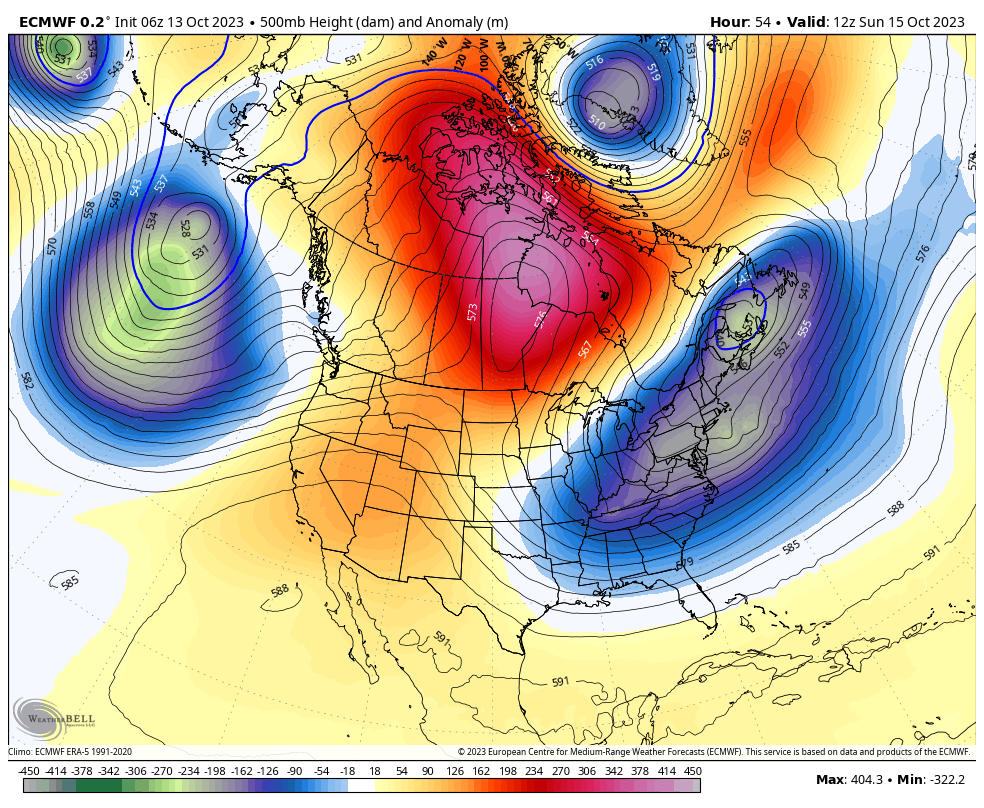
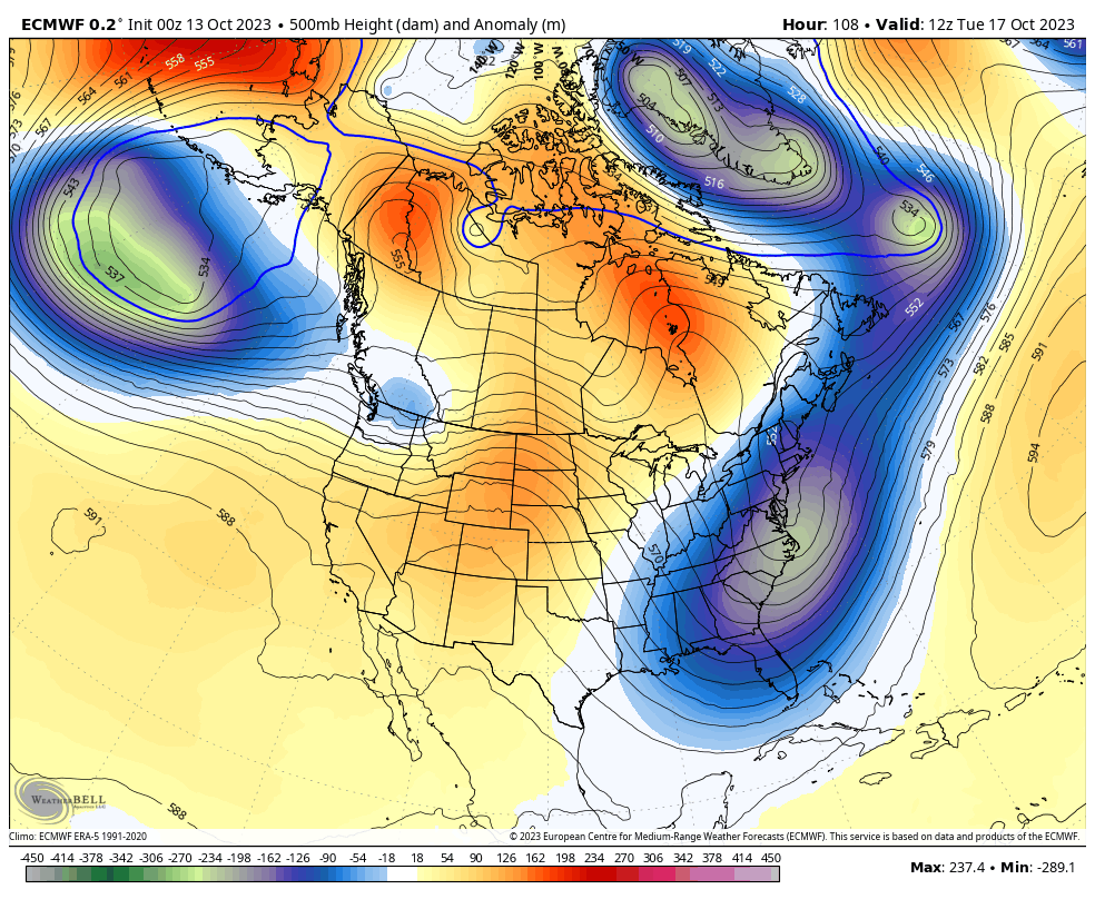
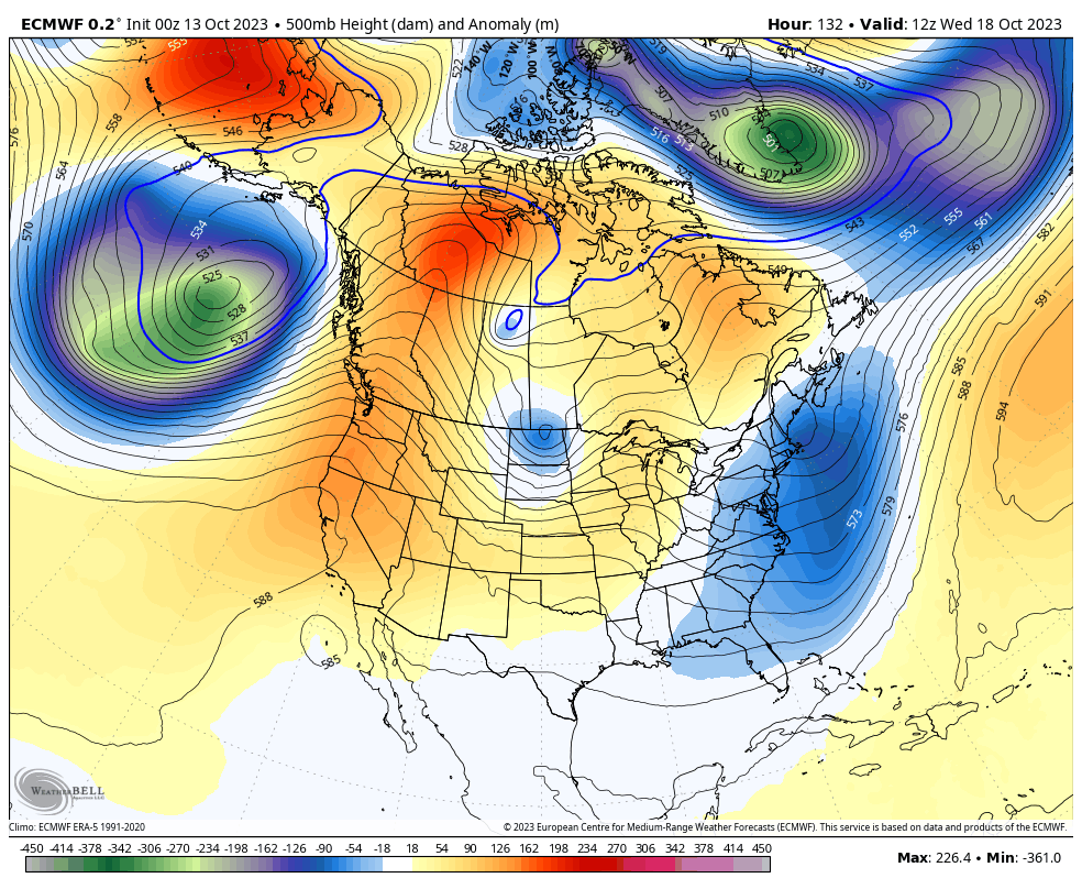
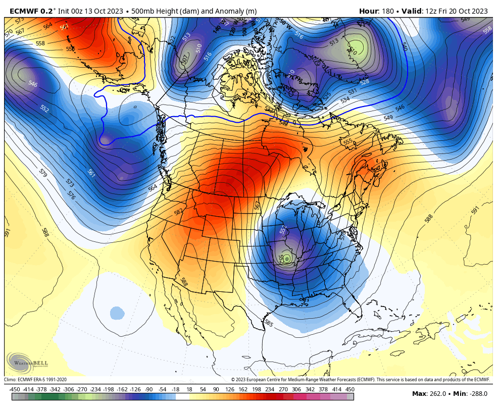
Days 1-7 Mammoth Weather Discussion & Images
October 13th, 2023 @ 10 AM – As mentioned above, today, there is a strong low-pressure system off the Pacific Northwest coast. That system will kick up a moderate ridge in the area by later in the weekend. The ridge looks dirty, with some high clouds moving through the area at times.
The ridging peaks late Sunday into Monday with some cooling Tuesday, and then the next stronger ridge rapidly builds into the area by the middle of next week.
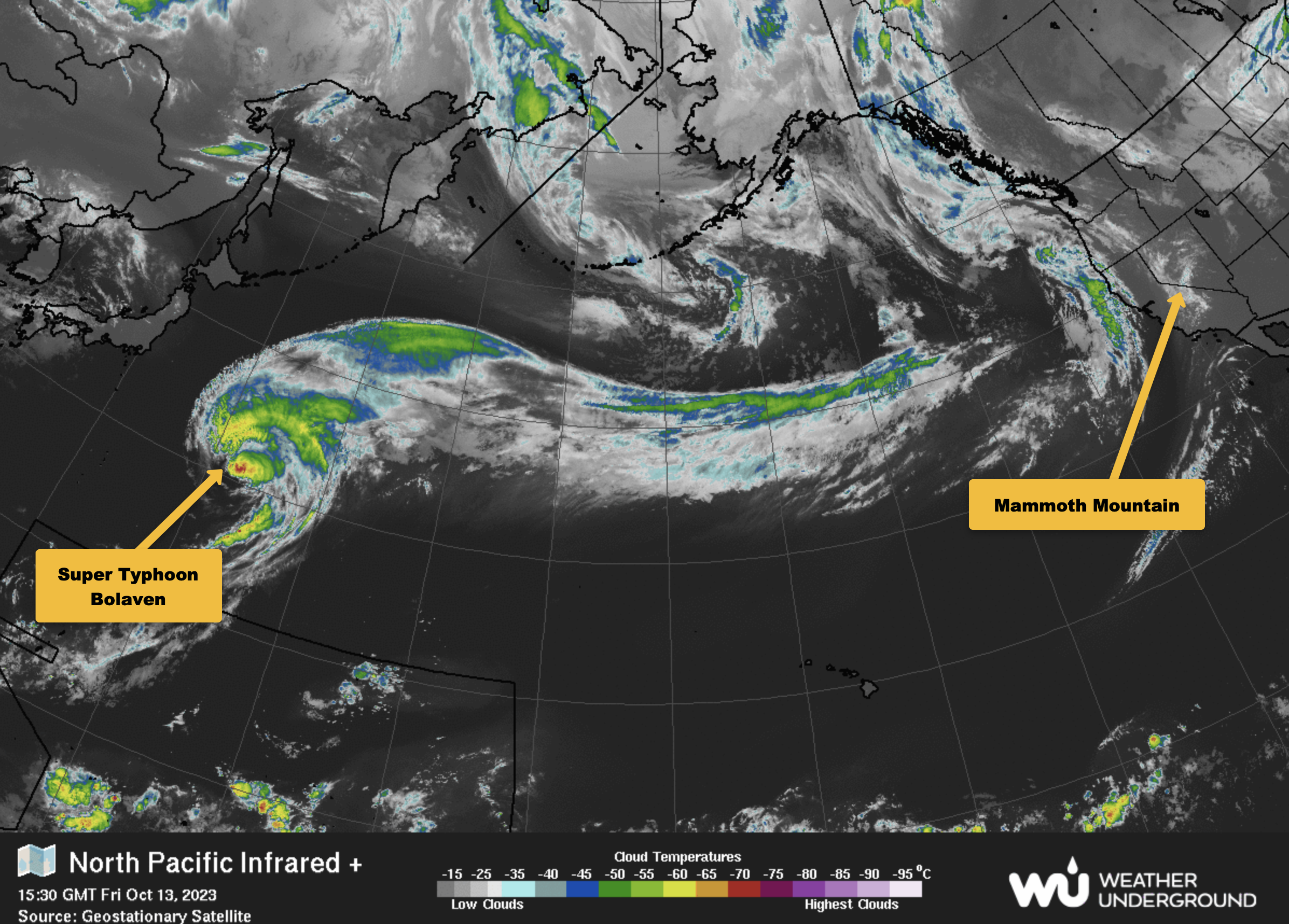
Next weeks mid week ridge will be pumped up by the remnants of old Super Typhoon Bolaven. Sometimes these Super Typhoons can enhance the jet and bring an early-season storm to Mammoth Mountain.
This time around, that does not look to happen, but hopefully, the pattern repeats itself in 2-to 3 weeks, and another Super Typhoon merges into the westerlies.
Mid-fall typhoon patterns can help bring an early opener to the Mammoth Mountain Ski Area Main Lodge lifts. The patterns are something we watch for every year around this time.
That’s all for now, folks; enjoy the weather over the next week. It looks like a great time to get out for an October Adventure.
____________________________________


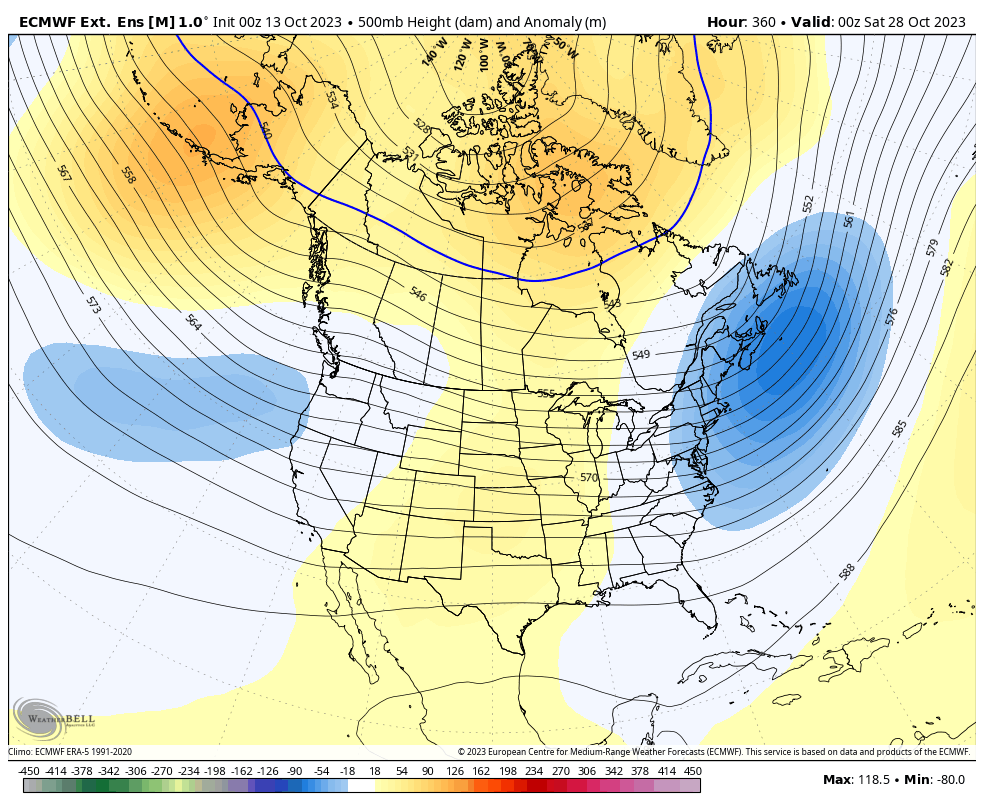
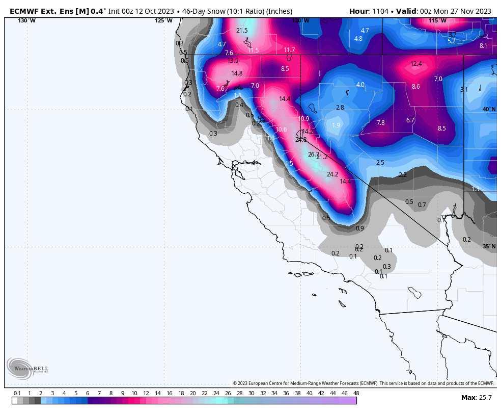
Day 16 – 45 – ECMWF Extended Ensemble Mean
The pattern shown below would be a great start for the new upcoming winter sports season on Mammoth Mountain. Does not look like a massive snow producer but there could be a couple feet of base snow before the big Thanksgiving Holiday starting on November 23rd. Along with the Mammoth Mountain Snowmaking Upgrade the Ski area will be off to a decent start to the season if the date below is close to being right.
45 Snowfall from the ECMWF Ext. Ensemble Mean
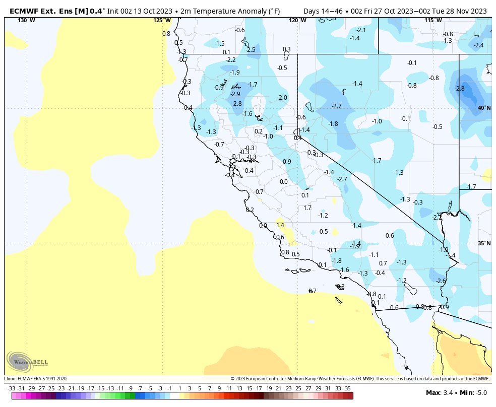
Temperature Anomaly – ECMWF Ext. Ensemble Mean
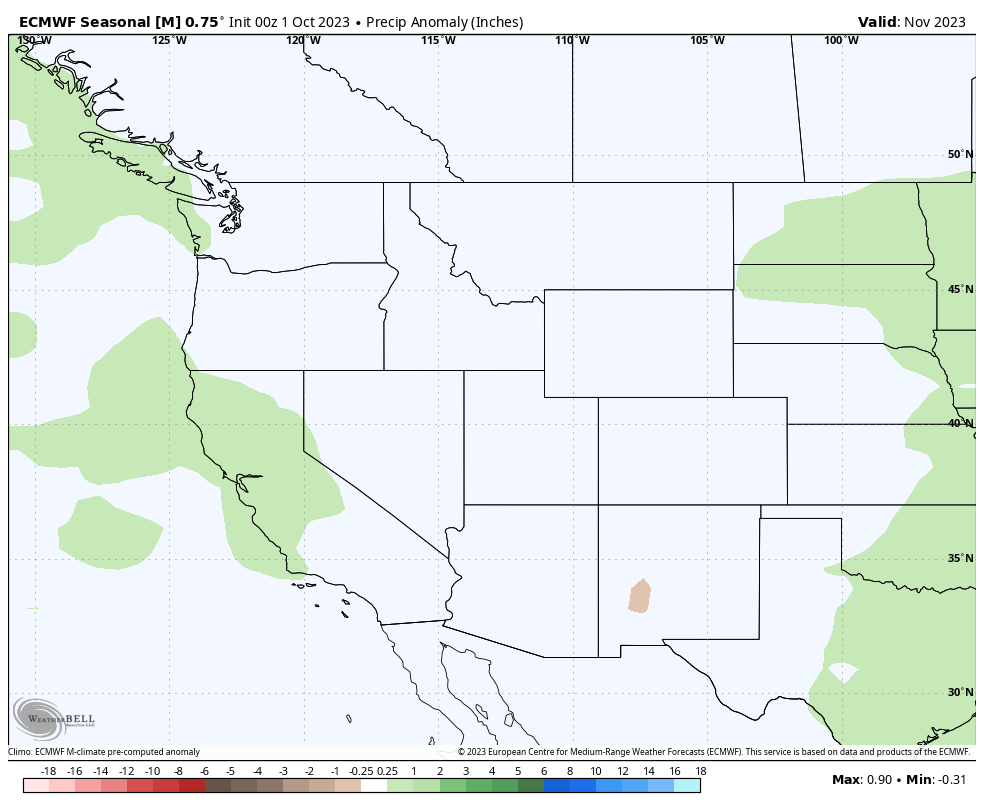
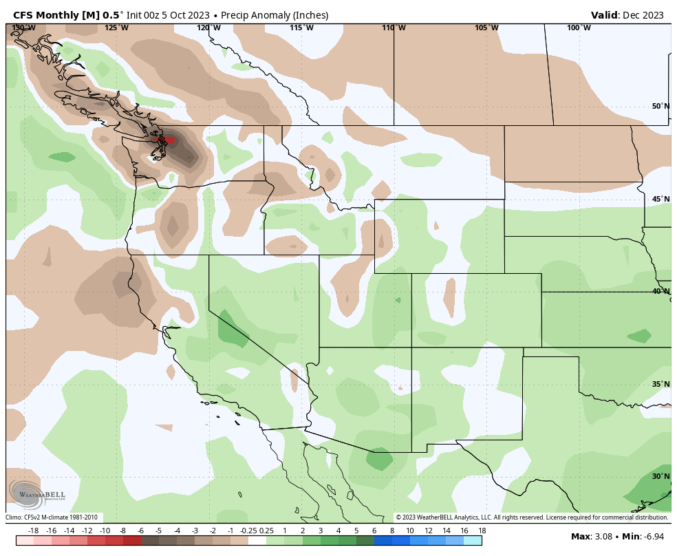
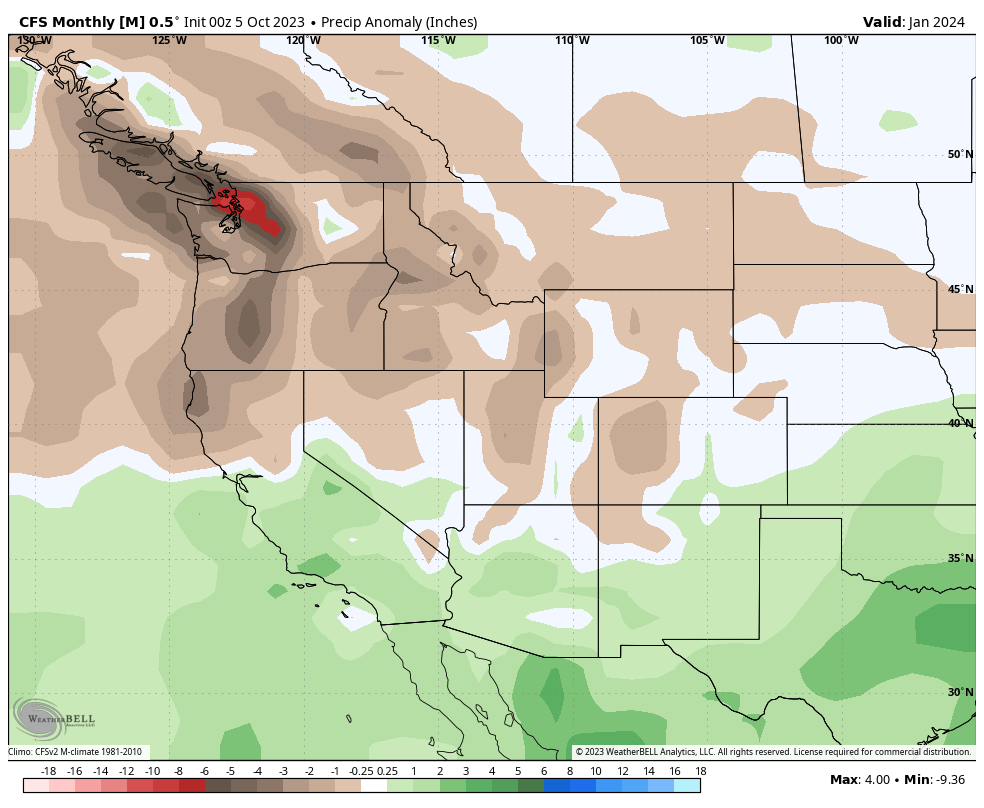
Precipitation Anomaly November 2023- ECMWF Extended Ensemble Mean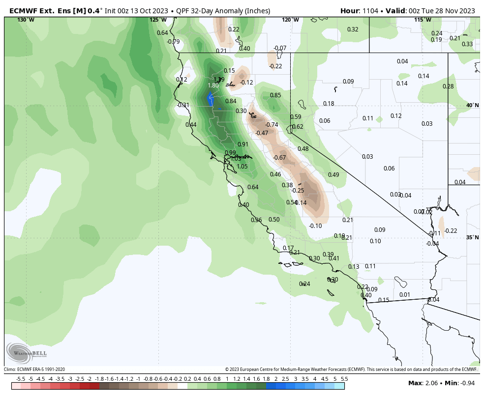
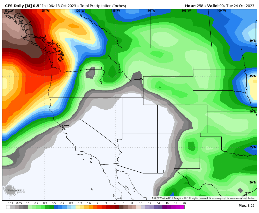
Total Precipitation November 2023 – CFS Daily Model
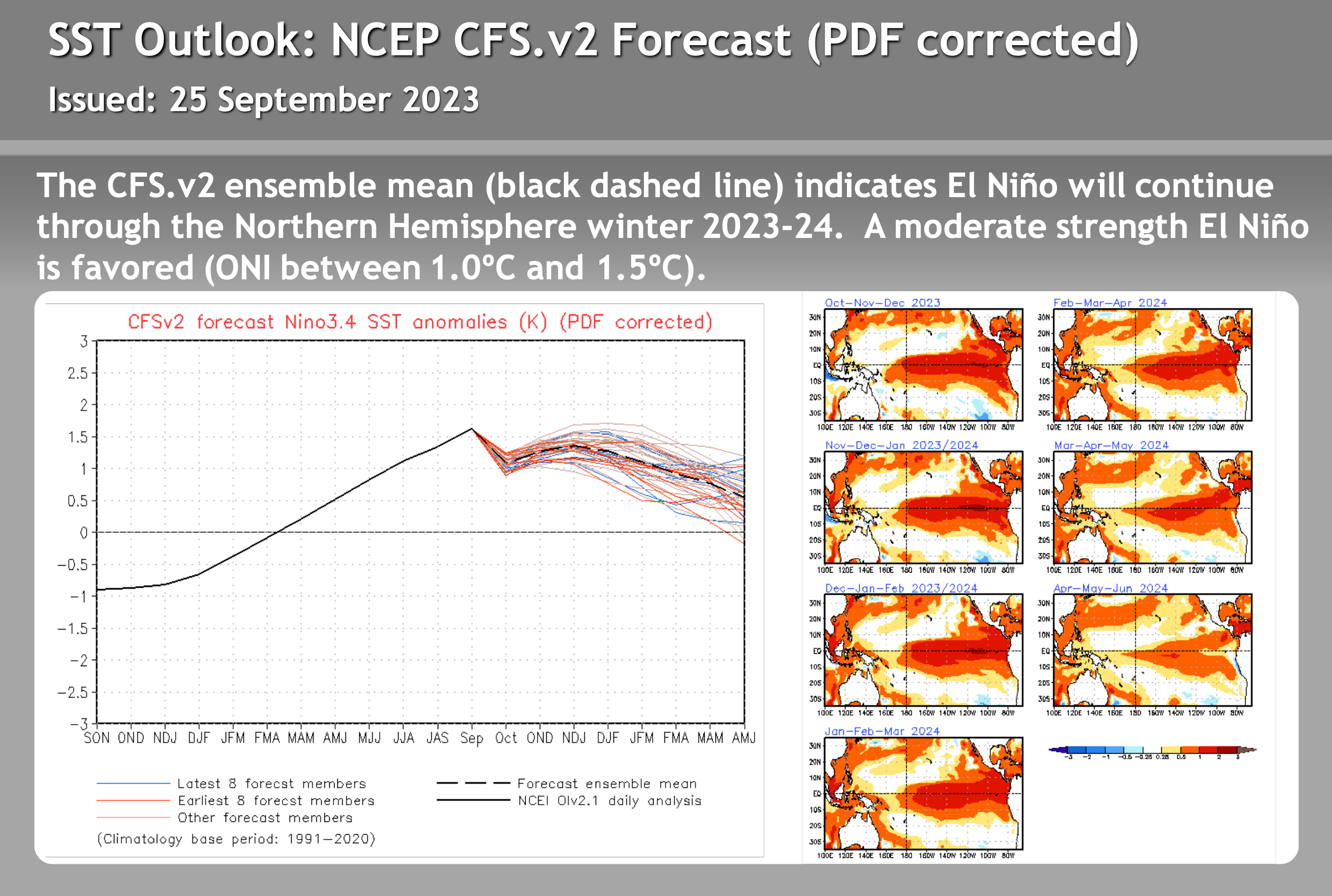
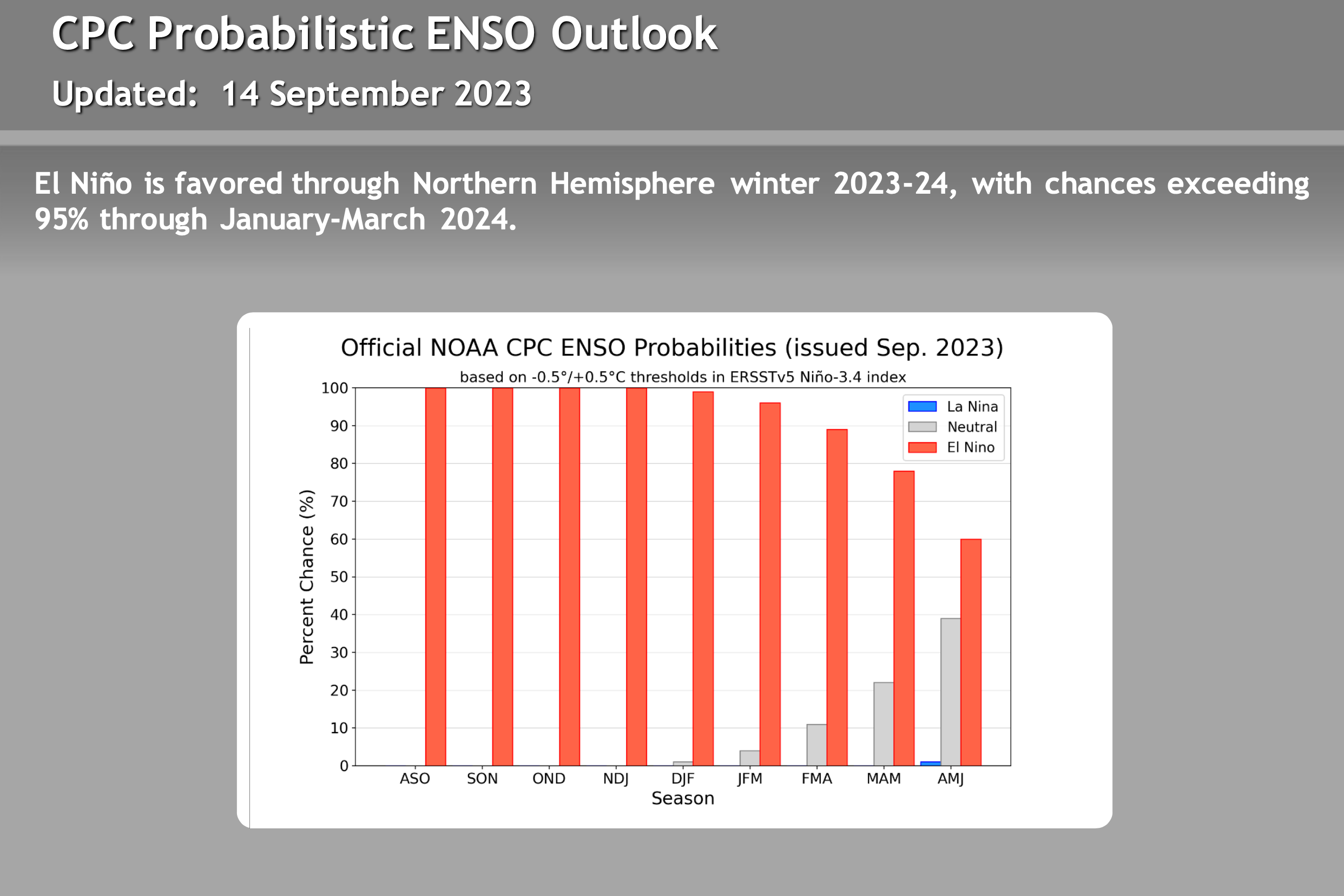
ENSO – El Nino / La Nine Outlook – September 26th, 2023
El Niño Update: The current El Nino is in the strong category. How the event affects Mammoth Mountain and the Eastern Sierra this winter is uncertain. There are a lot of variables with this particular El Nino event that have not been seen during other strong events. Take a look at the video below for more information.
There are not a lot of strong El Ninos to look back at, so it’s hard to trust any of the long-range data right now. Past El Niño winters have been slow to start, so don’t be surprised if the Eastern Sierra sees below-average rain and snowfall this Fall.
The video below is new from Mike Discussing the most current El Nino Data. All the images in this section have been updated, with what’s the most recent on there as of 9-26-23.
> To note, El Niño winters can be slow to start, so don’t be surprised if the Eastern Sierra sees below-average rain and snowfall this Fall.