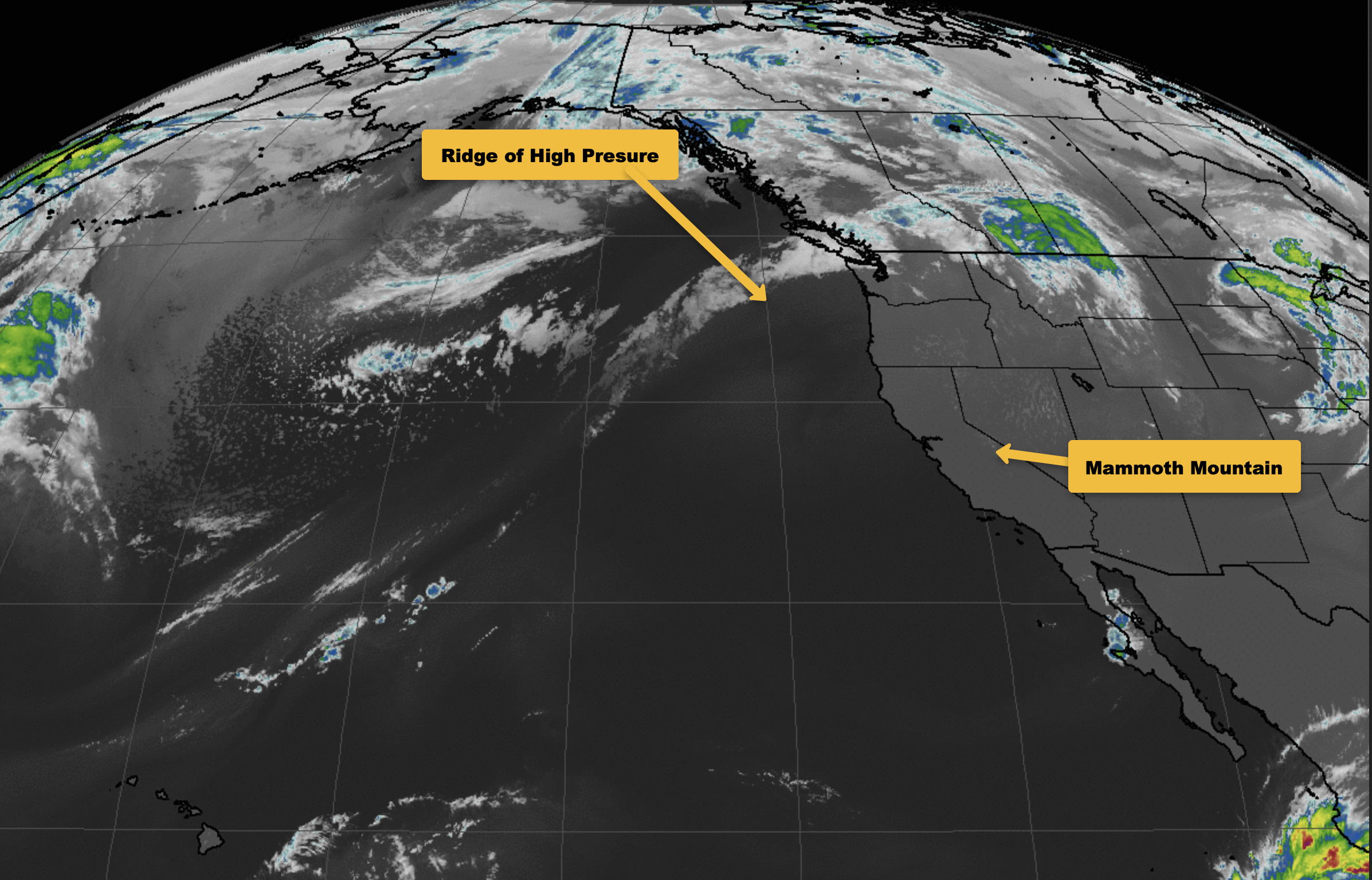
October 18th @ 7 AM – Good morning; you will find mostly clear skies in the area today with a bit of haze at times.
Currently, out on Mammoth Mountain at the 9000-foot level / Main Lodge, the temperature is 40 with a wet blub of 35 degrees. Winds are out of the SE at 5 to 10 MPH. Up at the Summit, the temperature is 42, with winds out of the NW at 7 to 10 MPH.
Down in Mammoth Lakes, there is a temperature of 38, with a 36 at the Mammoth Airport. In the town of Crowley Lake, the temperature is 34, and down in Bishop, there is a temperature of 39. No winds to report in the lower elevations at this time.
Into next Sunday, here is what to expect weather-wise out on Mammoth Mountain and around the Eastern Sierra.
Look for clear skies and just above average temperatures the next couple of days, with light winds in all areas under a strong ridge of high pressure.
Temperatures start to back off on Friday as the pattern starts to change. A weak low-pressure system is expected to drop into the area by Sunday.
In the process, temperatures will be down 10 degrees on Saturday, with 10 more degrees in drop by Sunday. Winds will also come up later Friday and Saturday, especially over the high elevations.
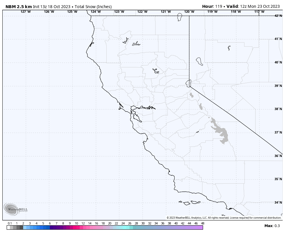
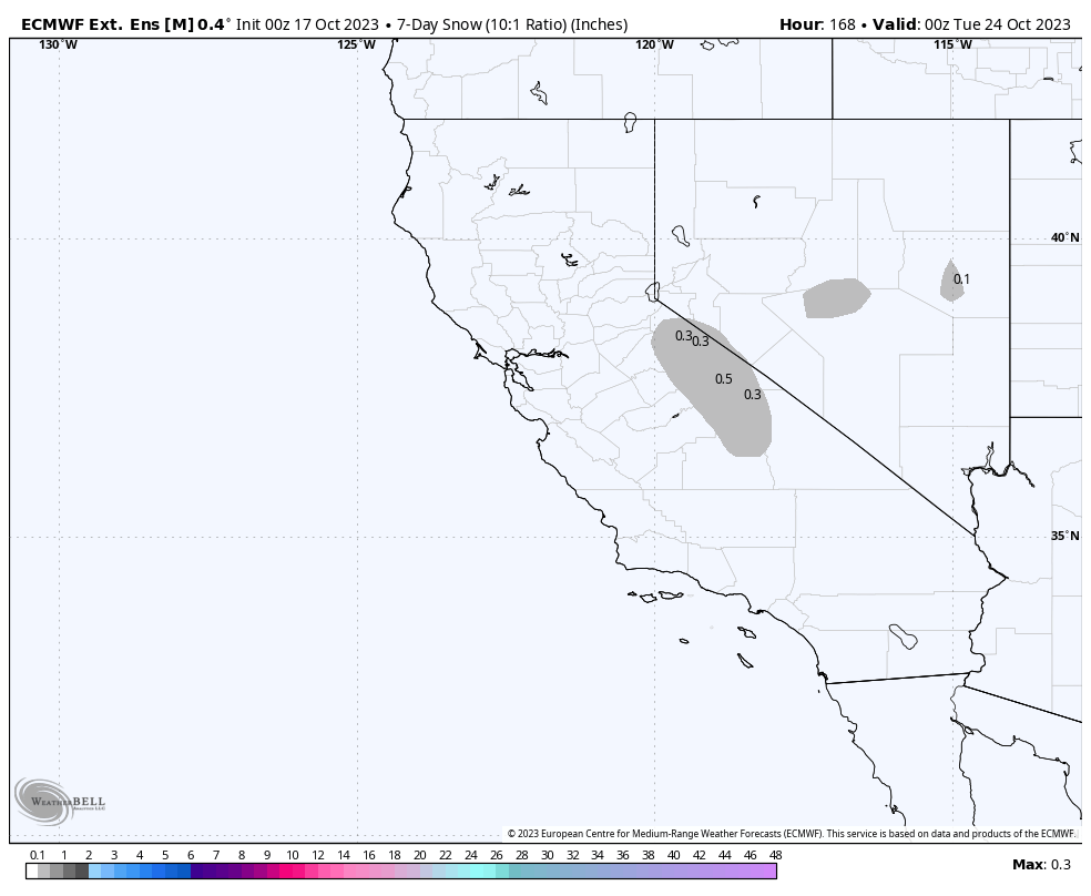
As for snowfall, this first system will be a bit warm and have limited water to work with, so it looks like there could be a dusting of snow above the 9500 feet level with some brief very light rain expected below that elevation.
Basic Weather Forecast: Skies are expected to remain mostly clear with just a few high clouds at times from the Mountain down into the Bishop area right through Saturday. Then expect increasing clouds Saturday night and Sunday, leading to a 30% chance of showers with the snow level around 9000 feet.
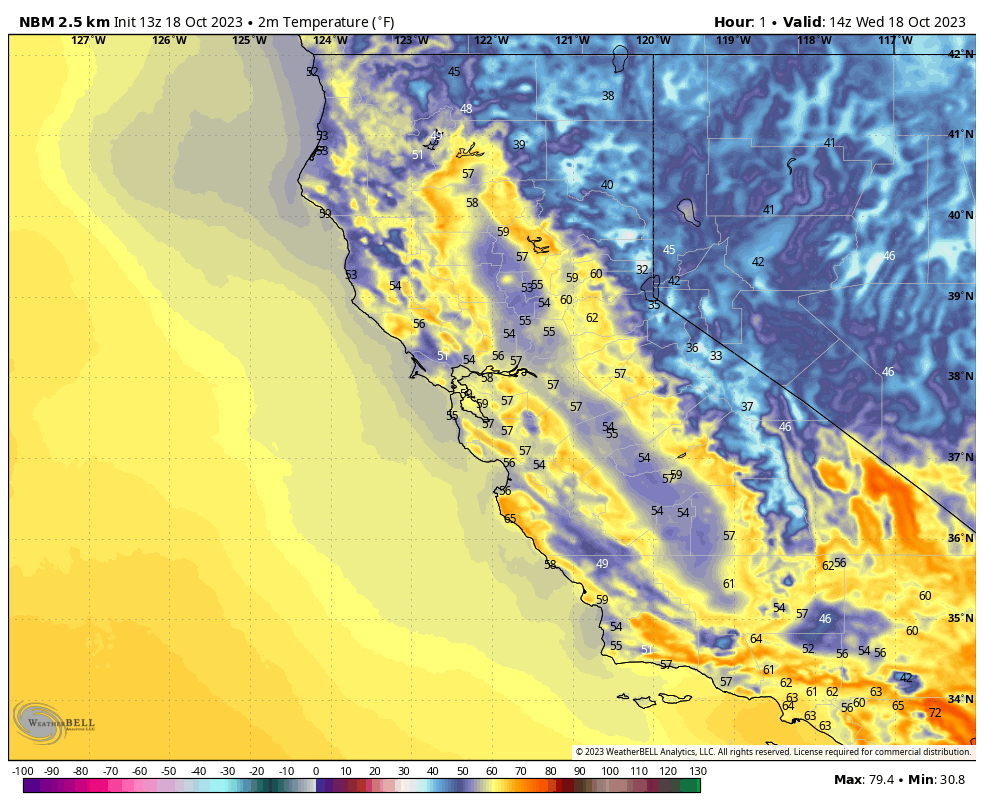
Mid-day temperatures out on Mammoth Mountain @ the 9000-foot level will be in the mid to upper 60s Today and Thursday, with temperatures coming down 3-5 degrees by Friday with an overall 20-degree drop by Sunday.
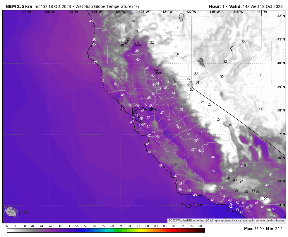
Night-time lows will be in the low to mid-40s into next Saturday morning. The wet blub looks to be too warm to make snow over the 5 days.
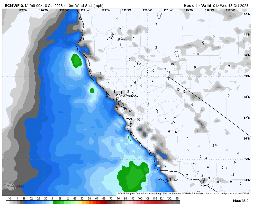
The Wind Forecast has the upper elevations and will have SW winds @ 10 -15 Mph with gusts in the 20-25 MPH range over the highest elevations and ridge tops into Saturday. Winds will pick up on Sunday as the low makes its way into the area.
For Mammoth Lakes, midday temperatures will be in the low to mid-70s and then into the low to mid-60s over the weekend. Night-time lows will be in the mid-40s into Saturday morning.
Down at the 4100-foot level in Bishop, mid-day temperatures will be in the low to mid-80s today into Friday, with highs this weekend in the mid to upper 70s.
Night-time lows will be in the upper 40s through the weekend.
Snowmaking Outlook: Over the years, crews have started to make snow after about the 21st of October each year. I have seen them test the system and run it at full before then, but that is rare. From here on out, I will be checking the wet blub outlooks and posting a snowmaking forecast until there is enough base.
Snowman out...
For my Full Weather Discussions and Longer Range Outlook Data, scroll down to the next section. Make sure to sign up for my Newsletter first…


Days 1-5 Mammoth Weather Discussion & Images
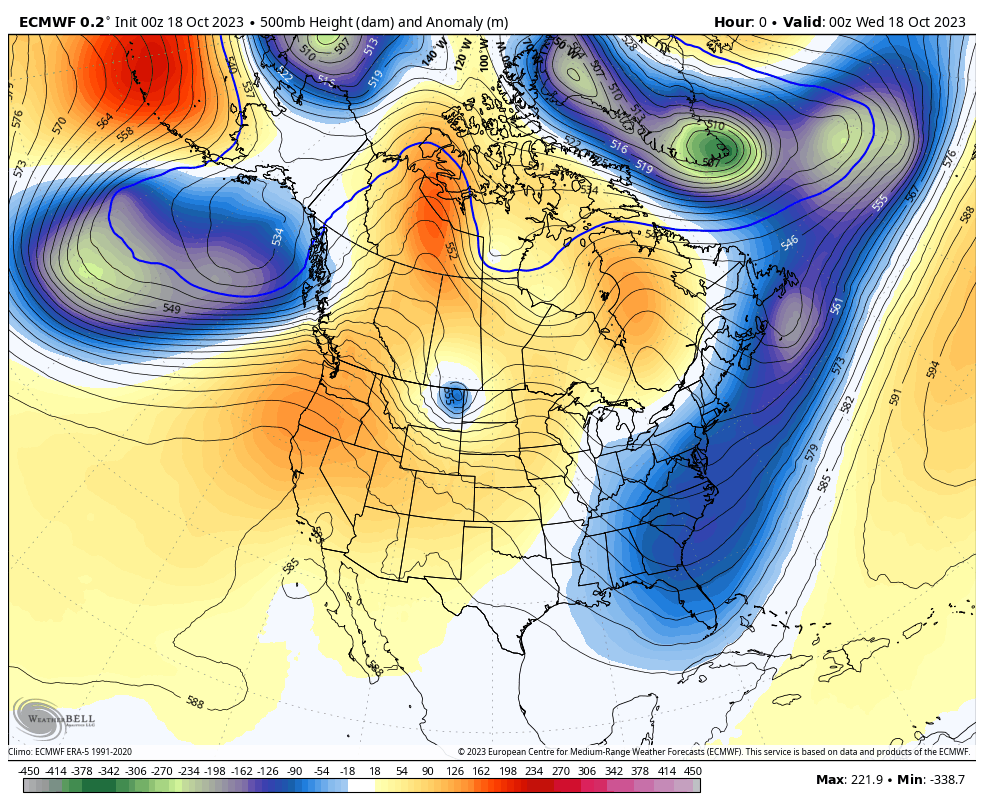
October 18th @ 8 AM – A very strong ridge for mid October will move through the area of the next 48 hours. Temperatures will be well above average into Friday and then fall 15 to 20 degrees by Sunday as the weak inside slider drops just to the east of the Sierra Crest. The path of the low is a dry one, QPF for this system is weak at under .10. There could be a bit of a dusting of snow but that may be out of the cards this one is looking drier each run.
5-Day Temperature Forecast
5-Day Snowfall Forecast
5-Day Wind Forecast
5-Day Wetblub for Snowmaking Forecast
____________________________________


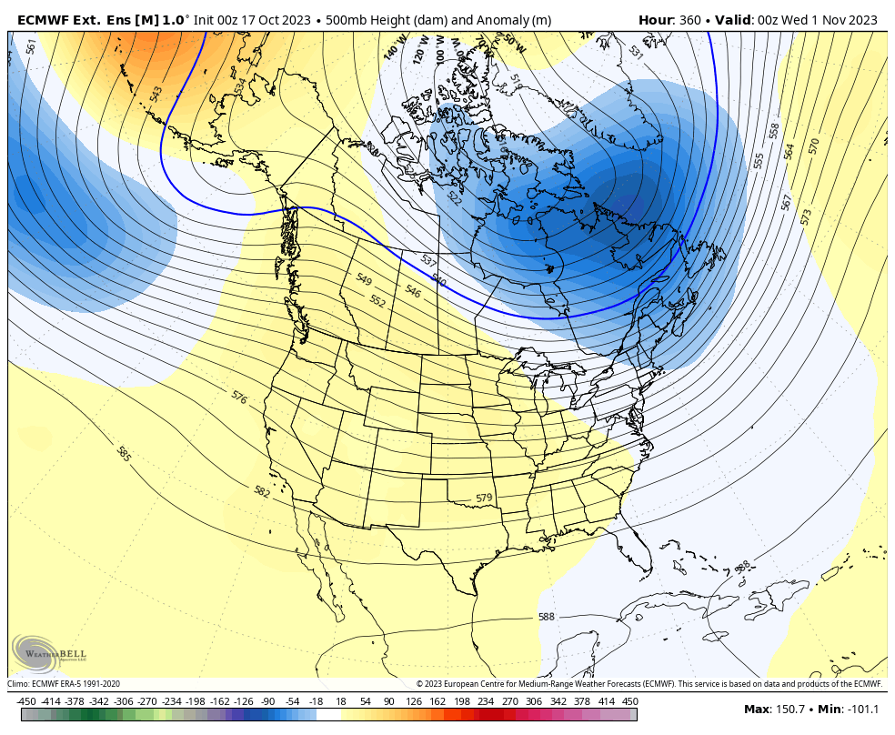
Day 16 – 45 – ECMWF Extended Ensemble Mean
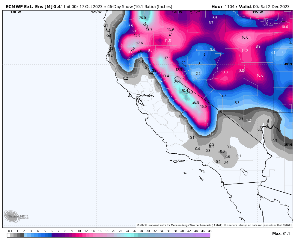
45 Snowfall from the ECMWF Ext. Ensemble Mean
Temperature Anomaly – ECMWF Ext. Ensemble Mean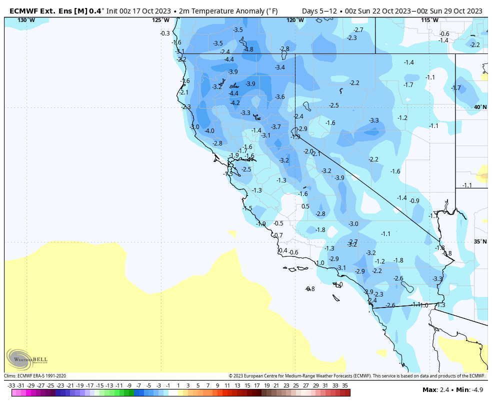
Precipitation Anomaly November 2023- ECMWF Extended Ensemble Mean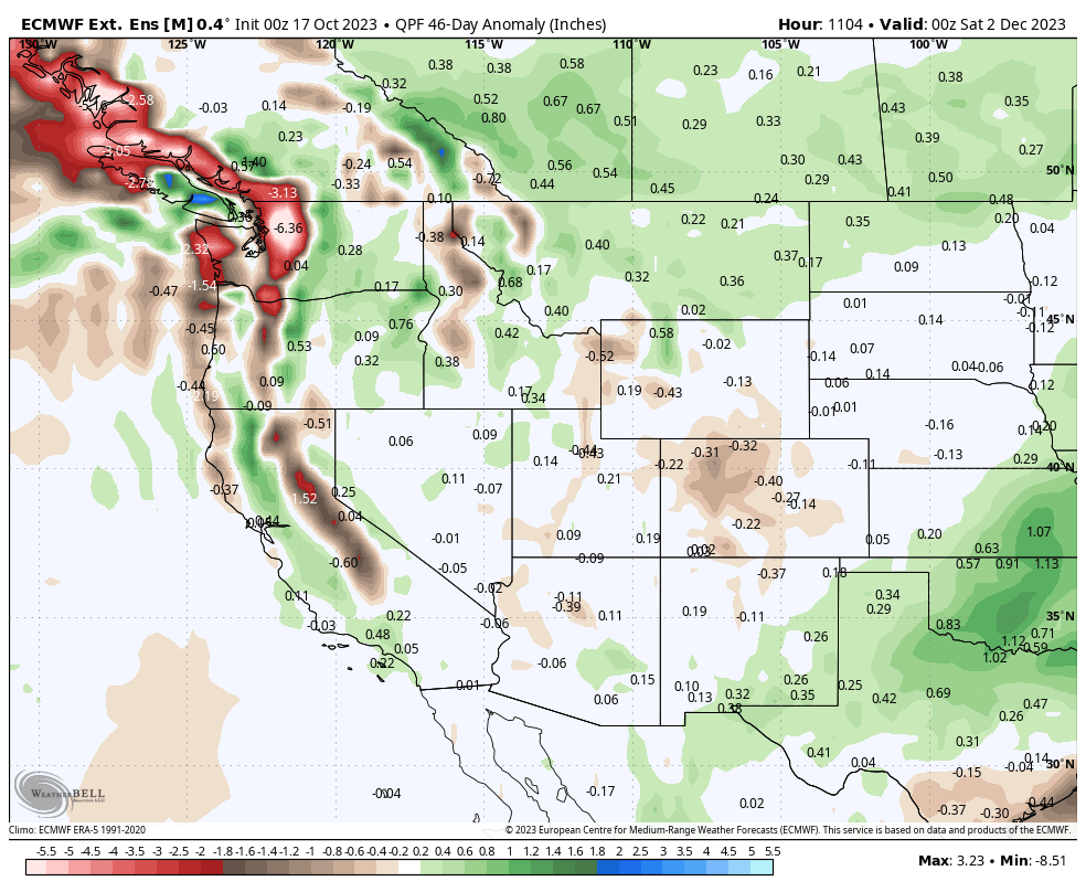
Total Precipitation November 2023 – CFS Daily Model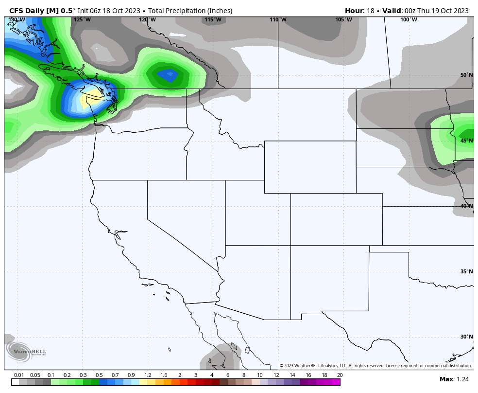
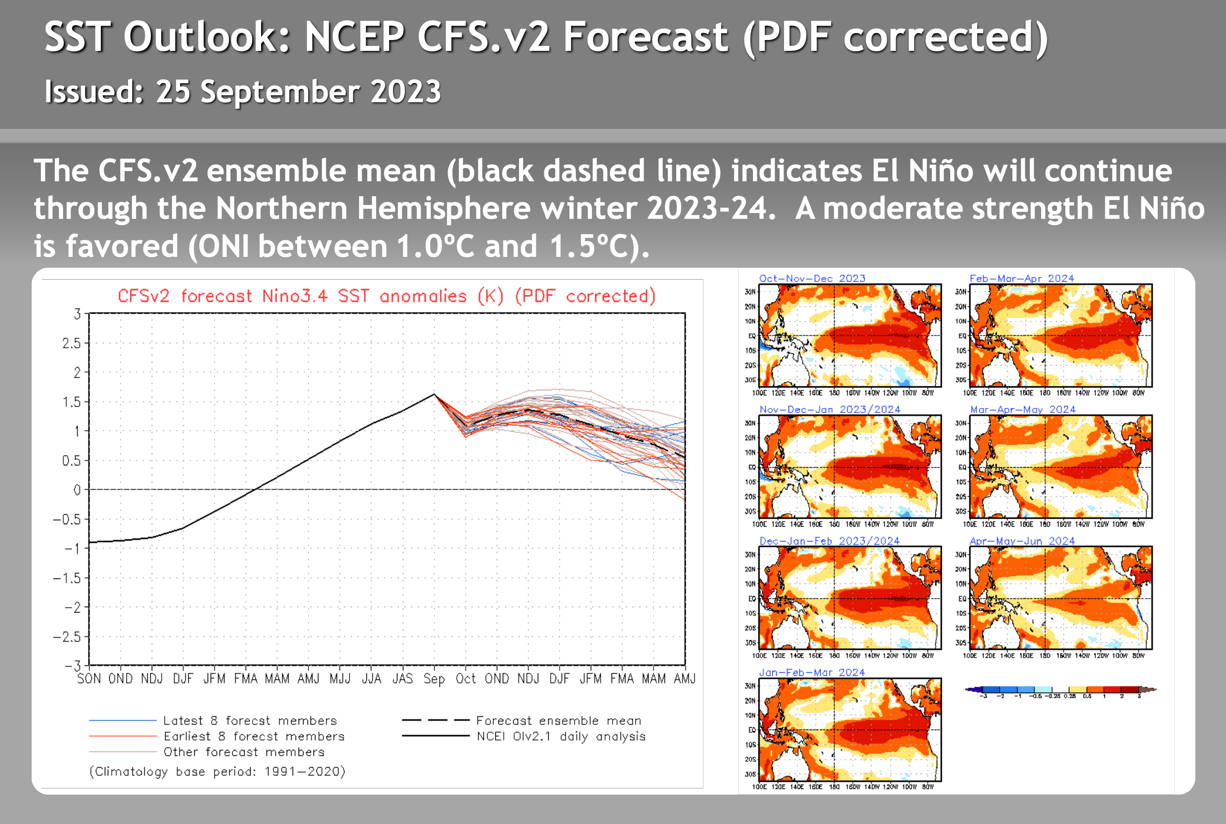
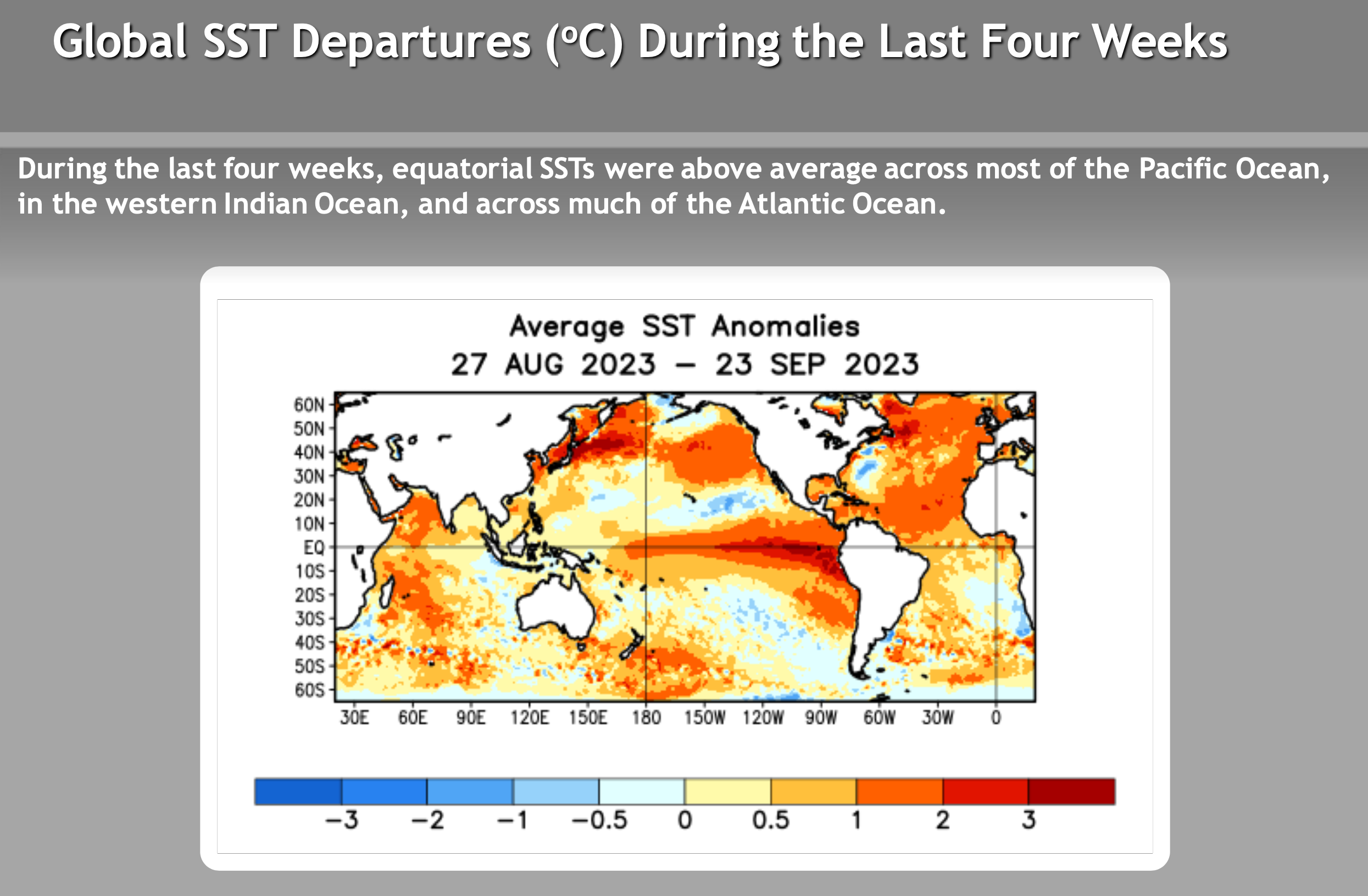
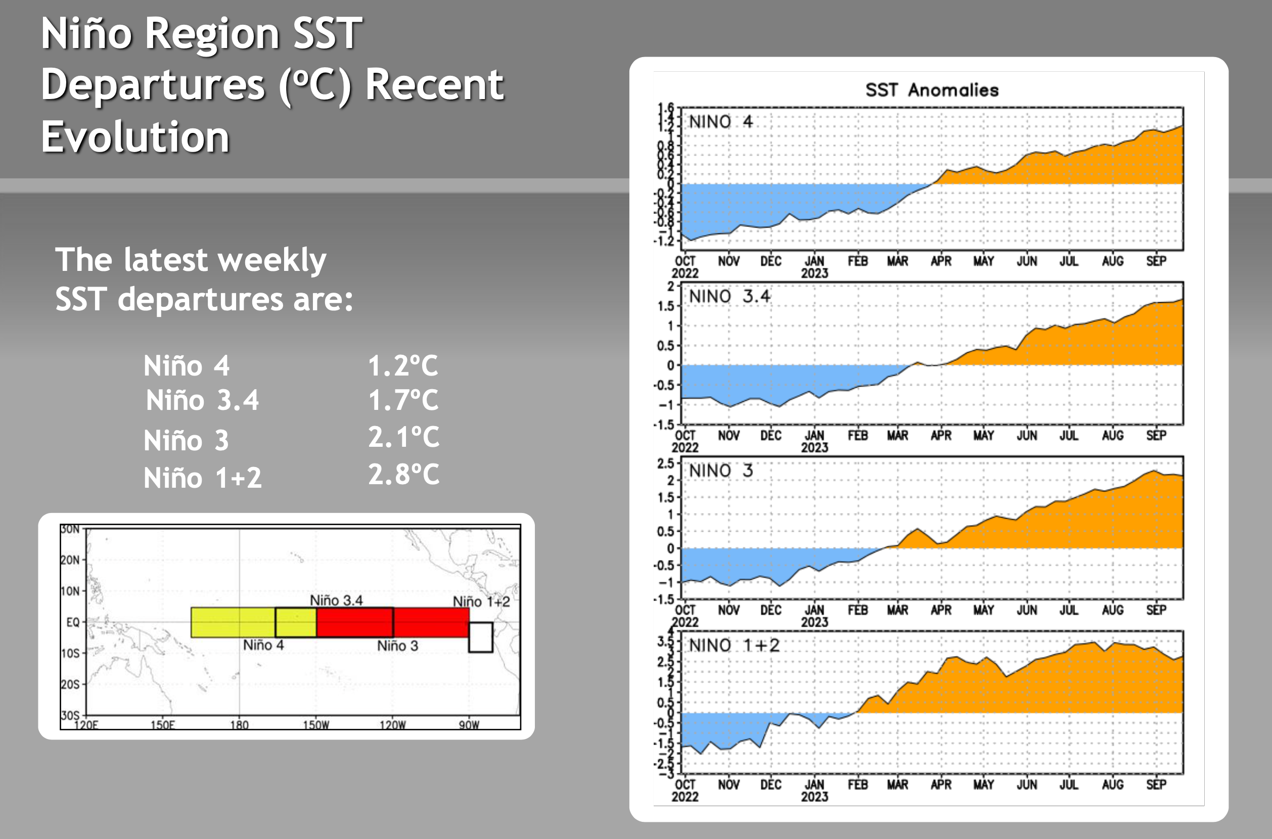
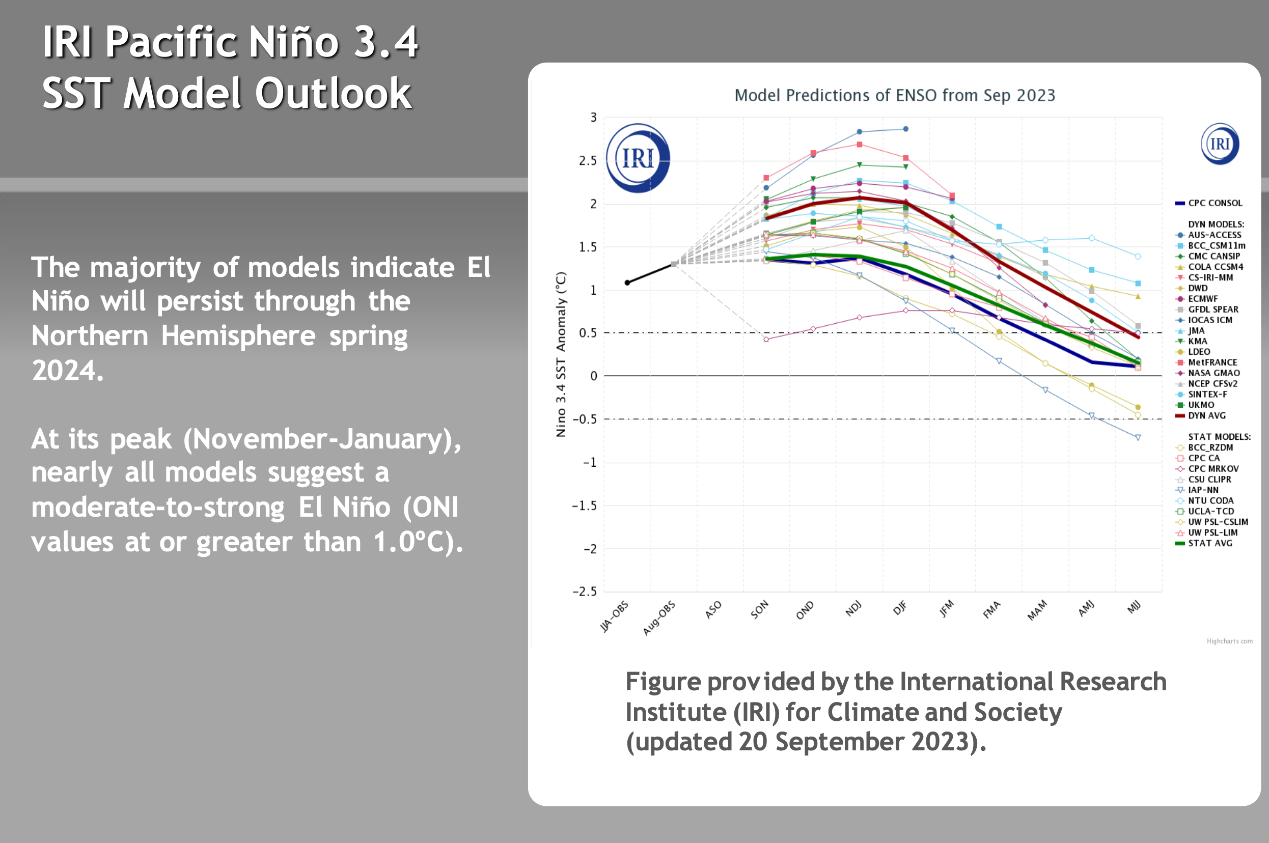
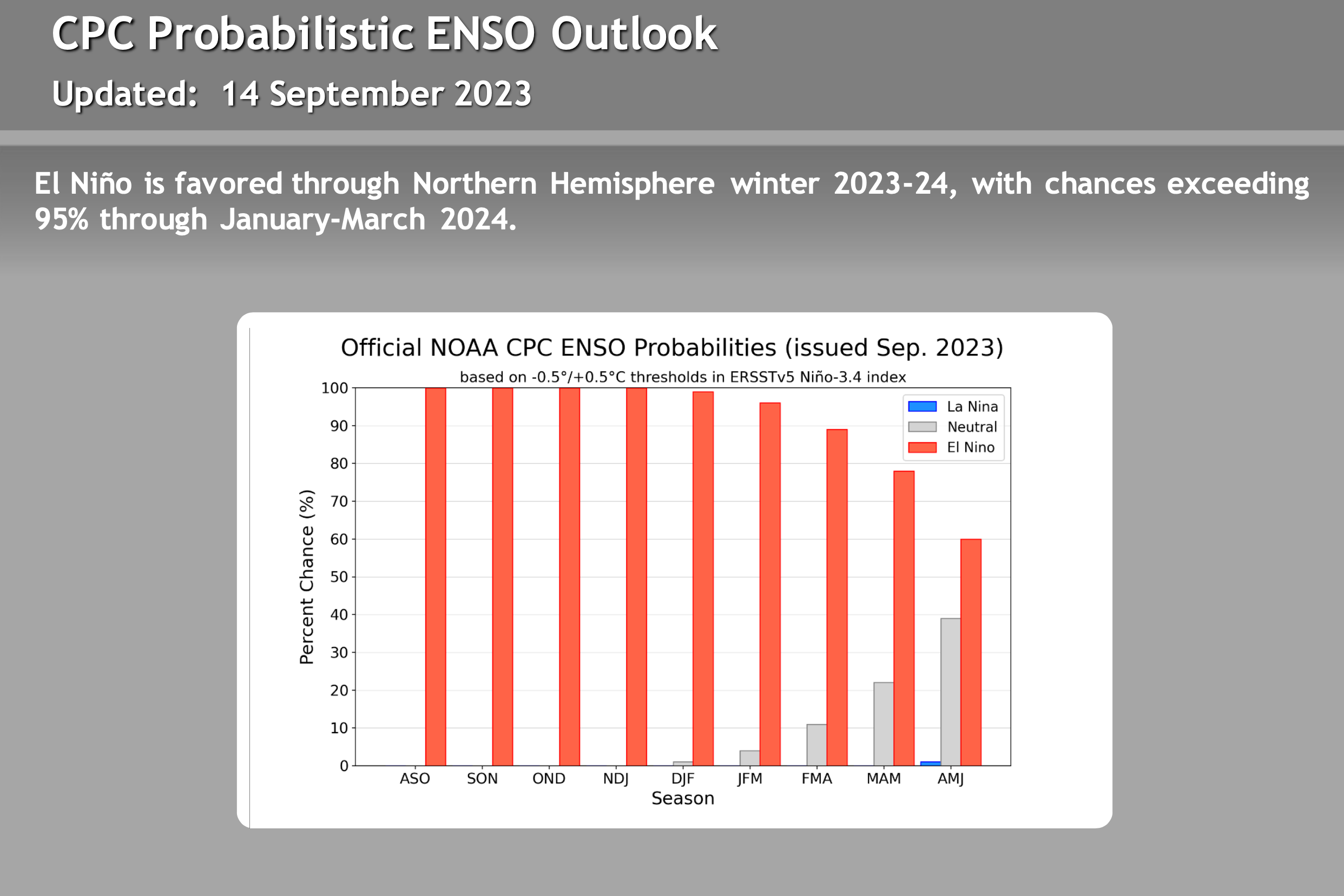
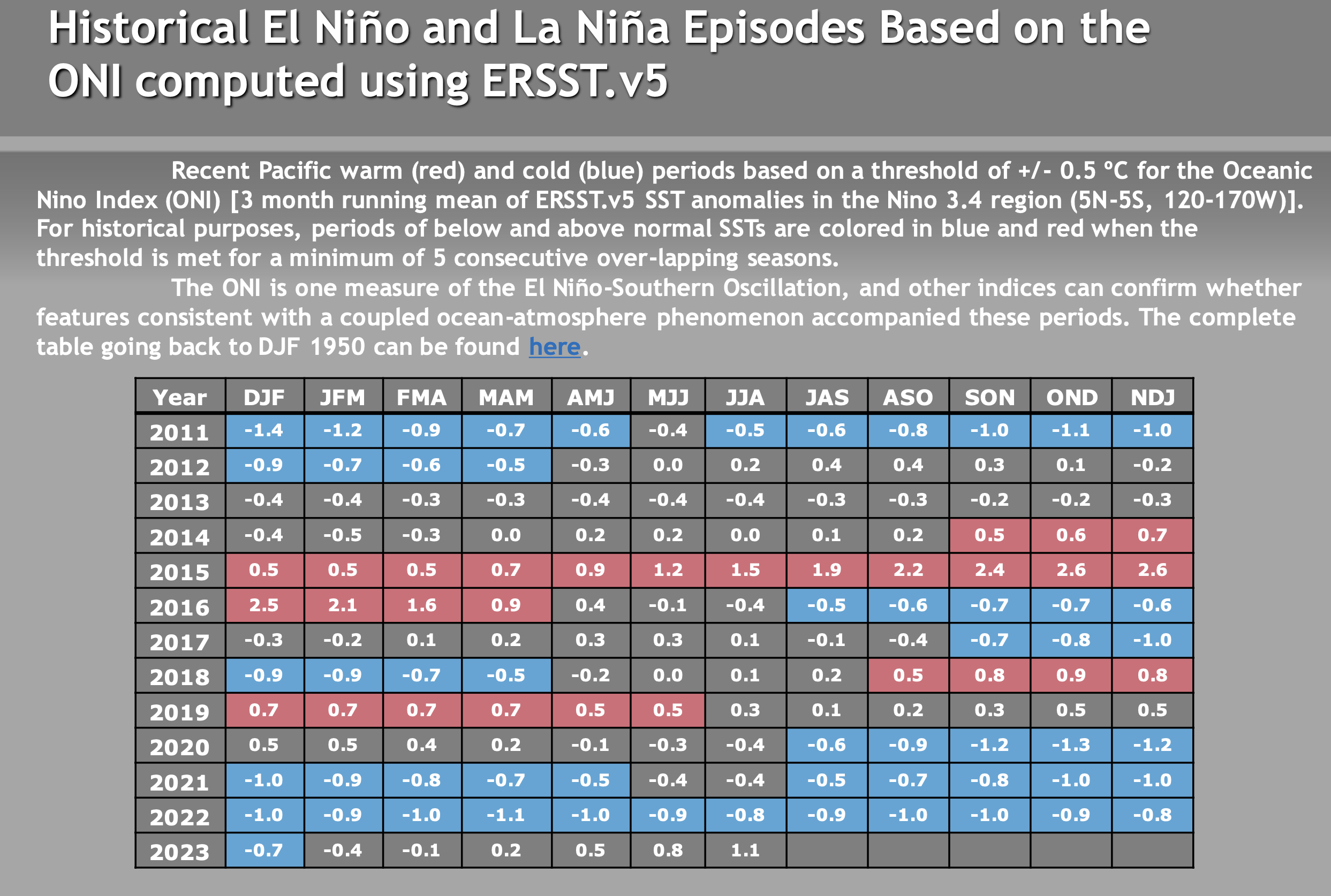
ENSO – El Nino / La Nine Outlook – September 26th, 2023
El Niño Update: The current El Nino is in the strong category. How the event affects Mammoth Mountain and the Eastern Sierra this winter is uncertain. There are a lot of variables with this particular El Nino event that have not been seen during other strong events. Take a look at the video below for more information.
There are not a lot of strong El Ninos to look back at, so it’s hard to trust any of the long-range data right now. Past El Niño winters have been slow to start, so don’t be surprised if the Eastern Sierra sees below-average rain and snowfall this Fall.
The video below is new from Mike Discussing the most current El Nino Data. All the images in this section have been updated, with what’s the most recent on there as of 9-26-23.
> To note, El Niño winters can be slow to start, so don’t be surprised if the Eastern Sierra sees below-average rain and snowfall this Fall.