

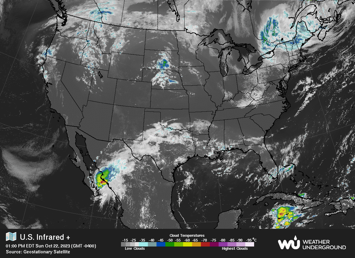
October 22nd, 2023 @ 8 AM – Good Morning; much cooler breezy Fall weather has arrived and is expected to be in the area through the 5-day forecast period.
The cooler weather is from a series of weak systems. The current low is now dropping right down the state, the next 2 lows for later this week should be real inside slider systems that will drop down into the Great Basin.
For Mammoth Mountain, Mammoth Lakes, and the Eastern Sierra, expect cloudy skies over the high country on Sunday with clear skies and breezy conditions most of the week with just a slight chance of snow showers and a few clouds around Thursday.
As far as Snowmaking goes, Nights will get much colder with a marginal wet blub by midweek, so Mammoth Mountain might be able to fire the Fan Guns on Broadway if they choose to do so. Confidence is low this morning on how cold it gets this week.
 5-Day Weather Forecast Details: Today, mid-day temperatures out on Mammoth Mountain @ the 9000-foot level will be in the mid to upper 40s with mid-40s on Monday and then upper 40s to lower 50s Tuesday with 3-5 degrees of temperature drop on Wednesday and Thursday.
Night-time lows this week will be in the lower 30s for the most part; it looks like there could be a freeze by early Friday.
The Wind Forecast for the upper elevations is to expect SW winds @ 15 -25 mph with gusts in the 30-40+ mph range over the highest elevations and ridge tops into early Monday. For the rest of the week, there should be a southwest wind of 15 to 30 mph with gusts as high as 45 mph over the higher elevations.
For Mammoth Lakes, mid-day temperatures will be in the mid-50s today and Monday and then upper 50s to low 60s the rest of the week. Night-time lows will be in the low to mid-30s this week. Colder locations will see a frost on Monday and again on Friday.
Down at the 4100-foot level in Bishop, mid-day temperatures will be in the mid to upper 70s today and then low to mid-70s the rest of the week. Night-time lows will be in the upper 30s to lower 40s through the week.
Snowman out... PS: Yes, I am about done modifying this weather page format. Moving forward, the plan is to update the short-term and 6-10-day forecasts every other day and the longer-range stuff each weekend. Ted will also be posting his powder forecasts again in November, so we have got you covered with lots of Mammoth Weather.


Snowmaking Forecast
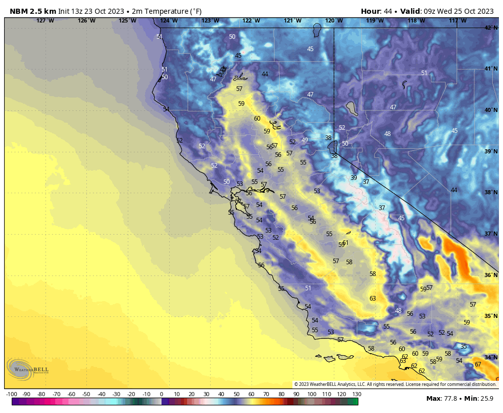
The seven day forecast is looking decent as there will be a transition to colder air into the area by early Thursday. From there on out the Snowmaking Crews will be able to make snow nightly all the way out to next Monday Morning.
The Snowmaking conditions will be low end on Thursday and Friday and then will be about perfect by early Sunday and into Monday Morning.
If the temperatures we are seeing on the models pan out the snowmaking team should be able to blow a ton of snow on Broadway. Remember those fans guns blow 3-5Xs more snow over night than the old snowmaking guns they used to use.
Longer Range Days 8-10 – Some of the models keep the colder air around into to early Tuesday with more decent snowmaking. Then way out at Day 9 and 10 higher heights looks to move into the area with warmer temperatures.
 Mammoth Mountain 10 Day Weather Discussion
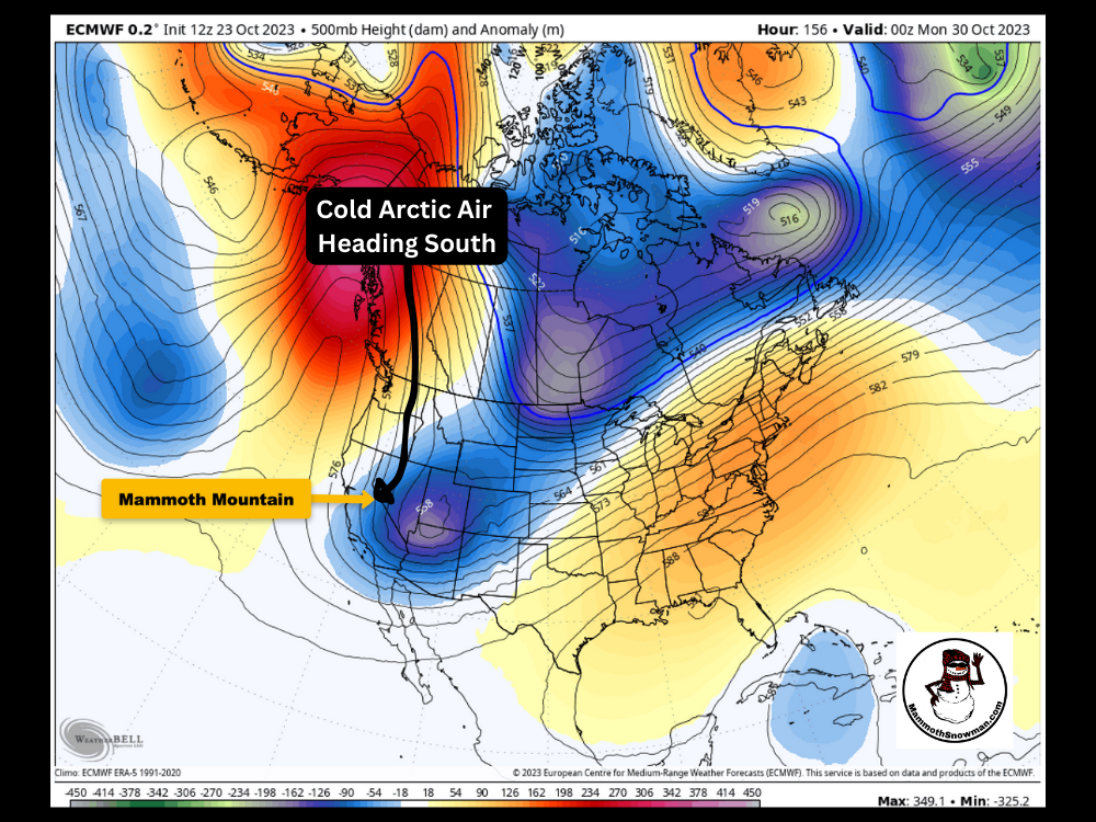
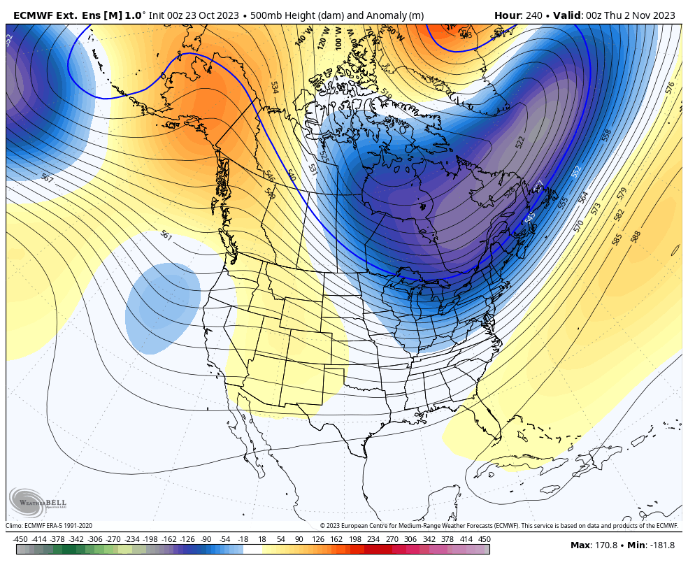
October 22nd @ Noon – The strong ridge that we had in the area has left and is being replaced today with a weak low-pressure system. By the middle of next week, there will be a second system that will reinforce the cooler air, and then there could possibly be a third low by late Friday, as shown on the ECMWF below.
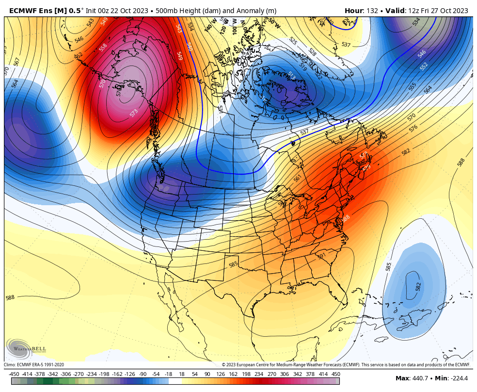
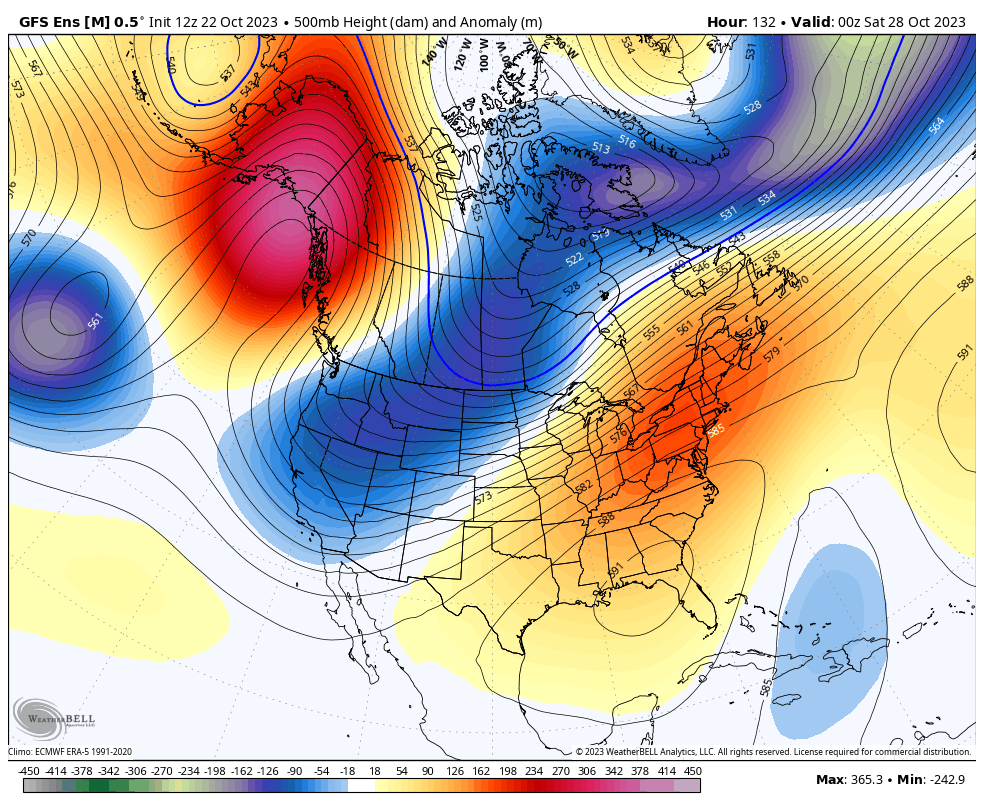
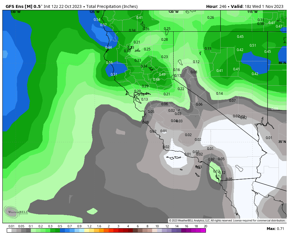
Overall these are dry systems and will not offer much, if any, snowfall at all. The good news is there looks to be a possible window to blow some snow starting early Thursday. 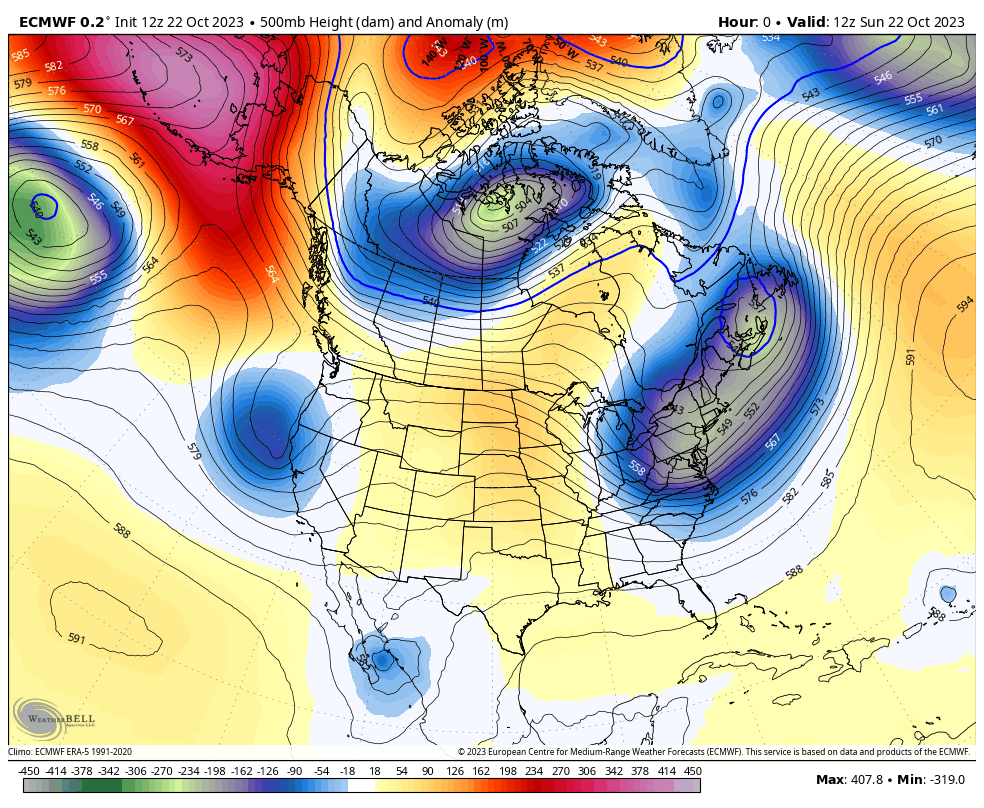 The 6-10 Day Ensemble Runs have progressive ridging moving through the area on days 7 into 9, and then all the way out at day 10; you can see the next weak low approaching the coast of California. QPF amounts over the next 10 days are light, so at best, at some point, one of these systems could produce a dusting of snow.
840 Hours Out – ECMWF Extended Ensemble Mean
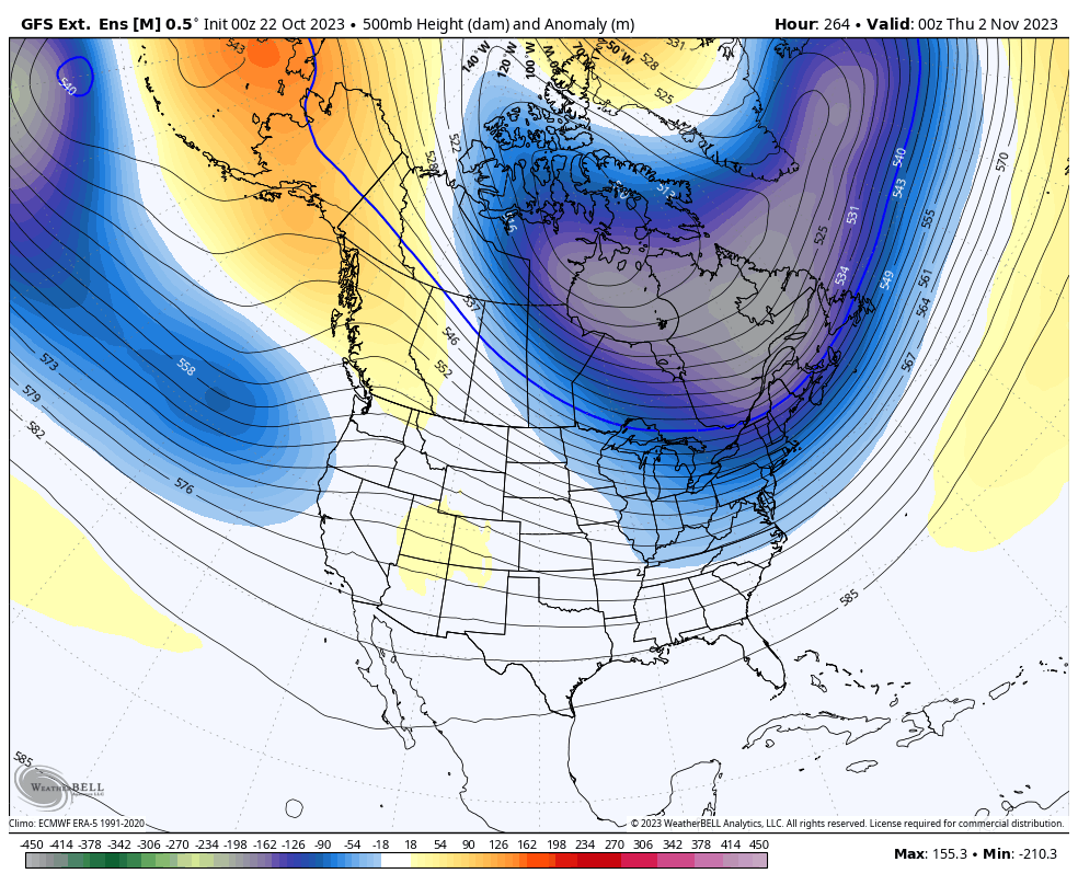
840 Hours Out – GEFS Ext Ensemble Mean
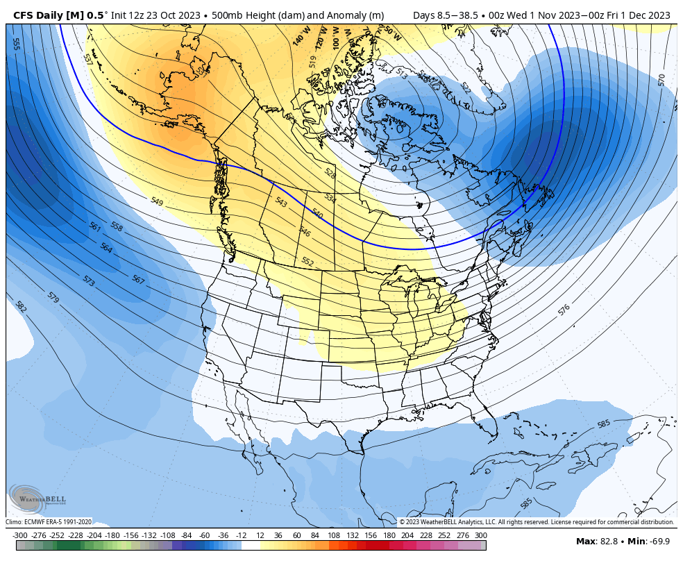
 November Height Anomaly – CFS Daily
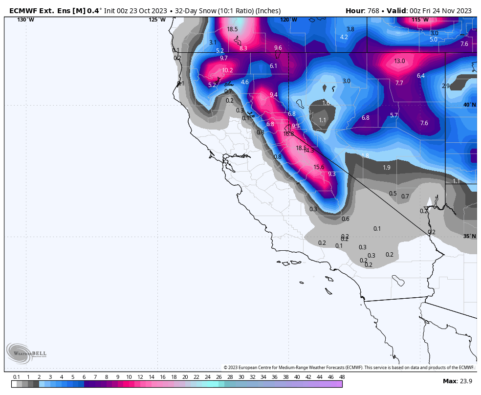
840 Hour Snowfall from the ECMWF Ext. Ensemble Mean
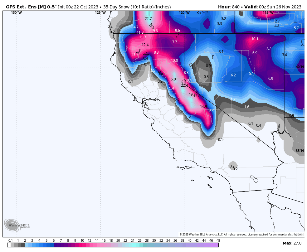
840 Hour Snowfall from the GEFS Ensemble Mean
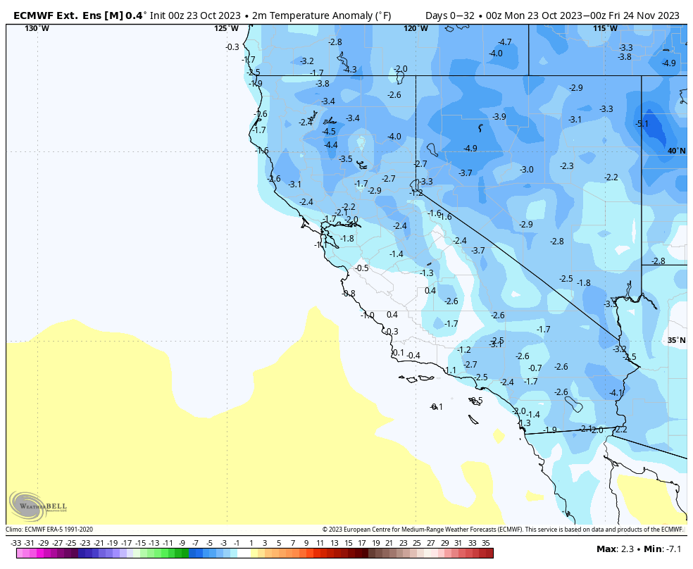
Temperature Anomaly – ECMWF Ext. Ensemble Mean
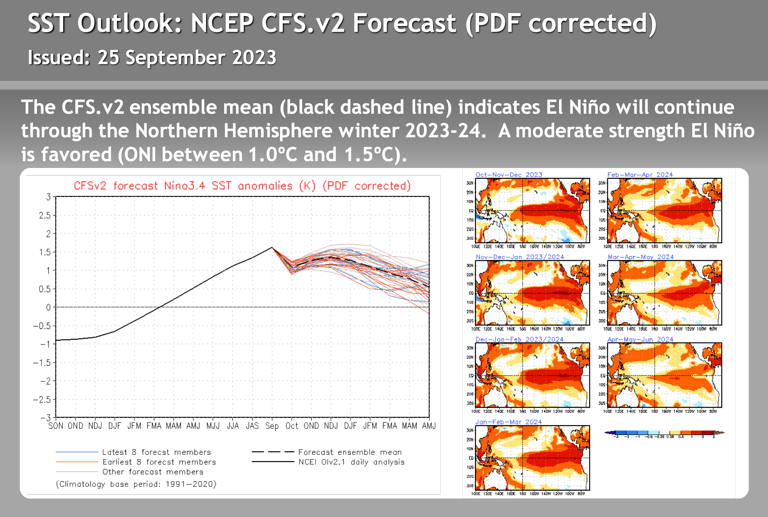
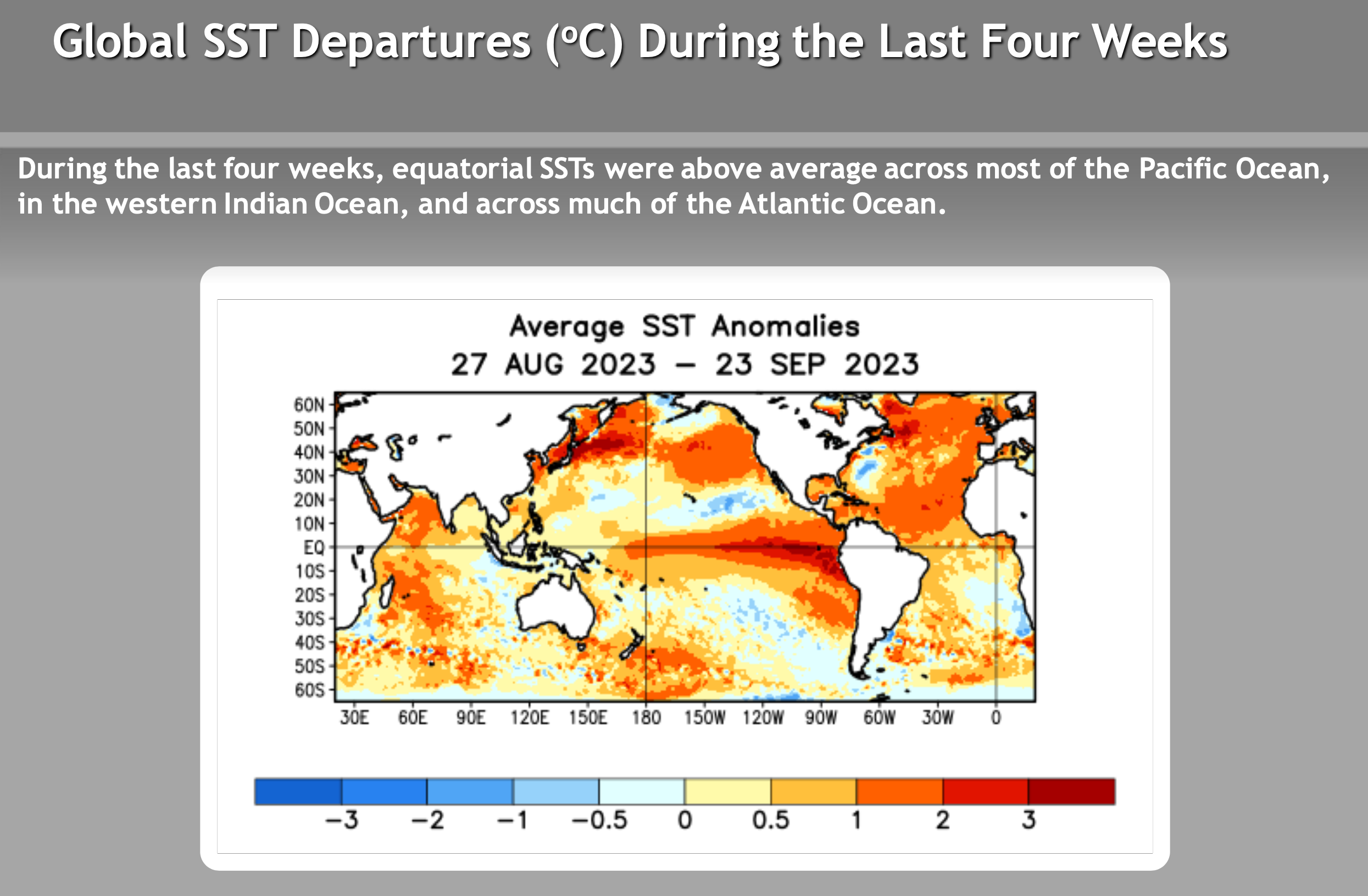
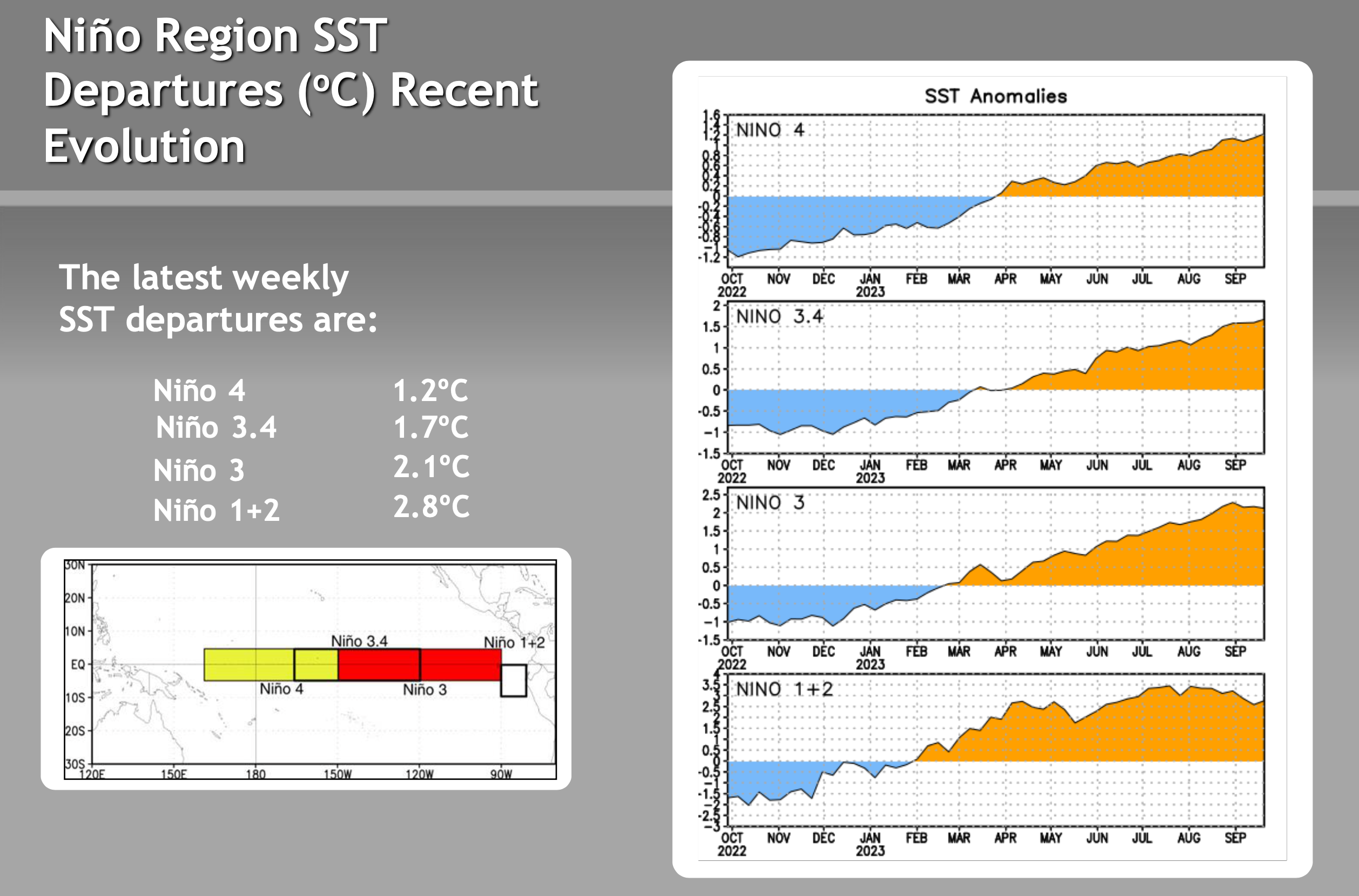
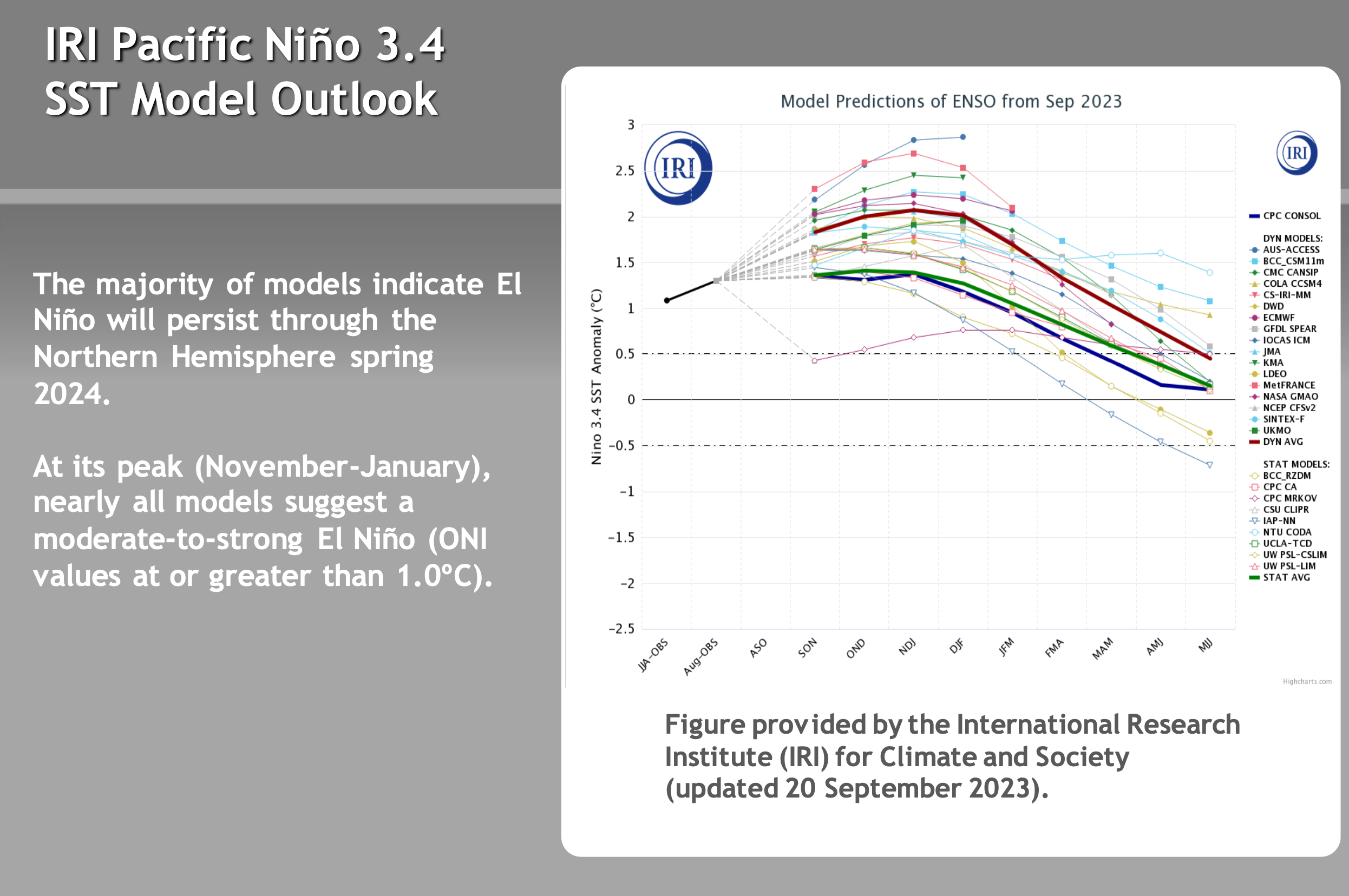
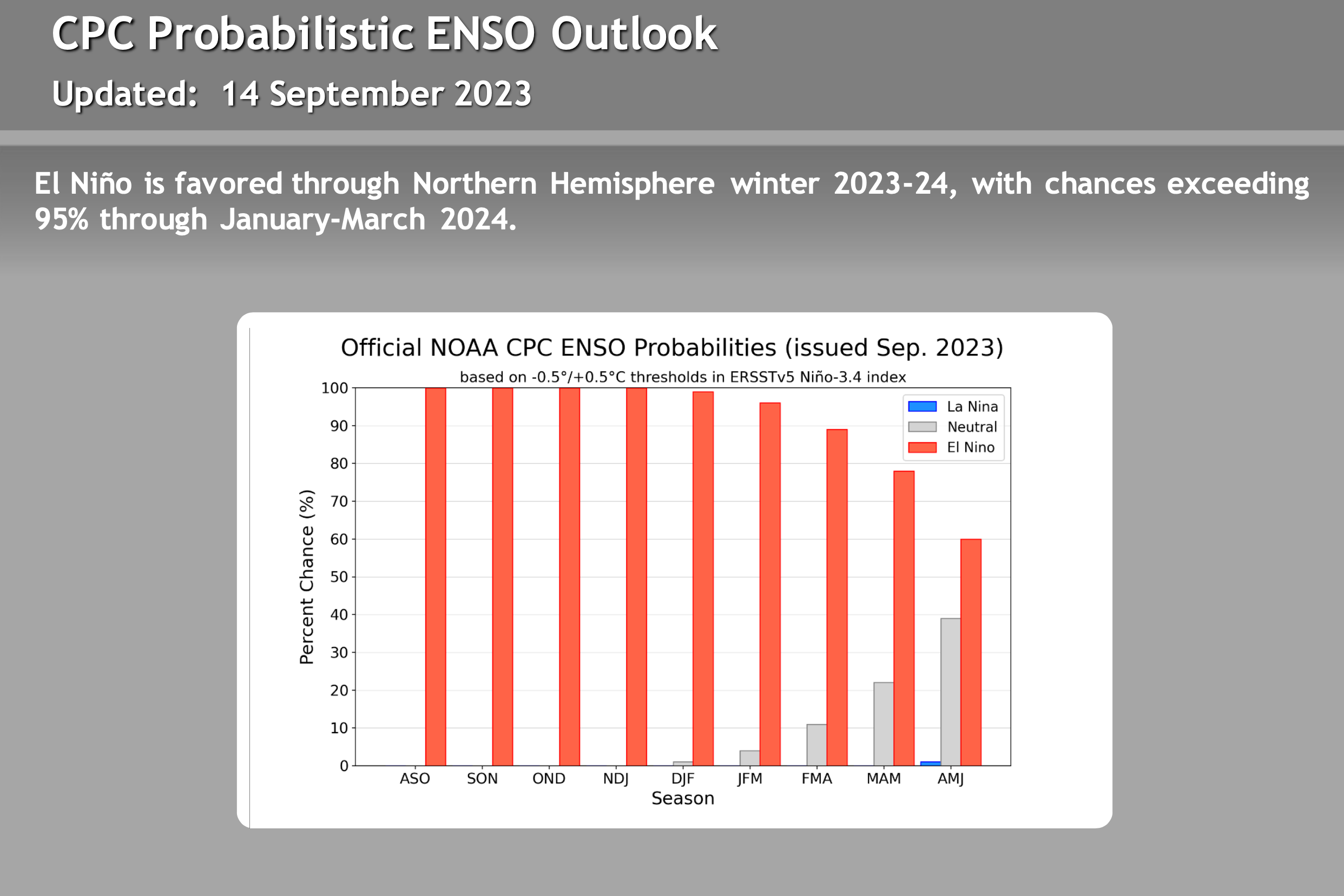
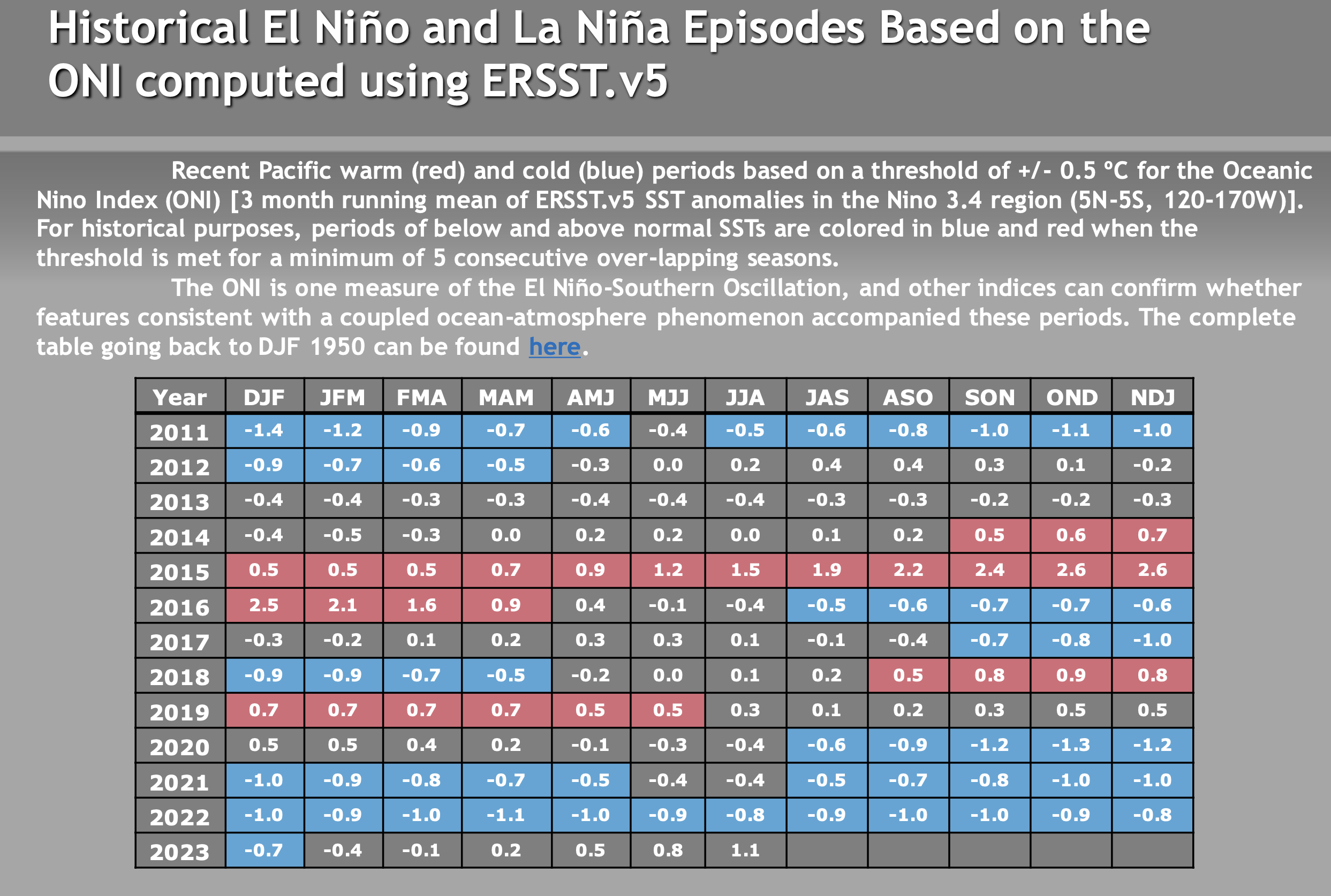
ENSO – El Nino / La Nine Outlook – September 26th, 2023
El Niño Update: The current El Nino is in the strong category. How the event affects Mammoth Mountain and the Eastern Sierra this winter is uncertain. There are a lot of variables with this particular El Nino event that have not been seen during other strong events. Take a look at the video below for more information.
There are not a lot of strong El Ninos to look back at, so it’s hard to trust any of the long-range data right now. Past El Niño winters have been slow to start, so don’t be surprised if the Eastern Sierra sees below-average rain and snowfall this Fall.
The video below is new from Mike Discussing the most current El Nino Data. All the images in this section have been updated, with what’s the most recent on there as of 9-26-23.
> To note, El Niño winters can be slow to start, so don’t be surprised if the Eastern Sierra sees below-average rain and snowfall this Fall.


Author – Steve Taylor – The Mammoth Snowman – Over the last 30+ years, Snowman has spent countless hours studying and learning about Mammoth Mountain Weather and Snow Conditions first hand. He has been skiing around the hill with marked ski poles since March of 1991 so he can measure the fresh snowfall amounts out on the hill.
Snowman started blogging this information back in 1990 on the old Mammoth BBS system, then the RSN Forums and then on to MammothSnowman.com in 2004 with Video & Photo Blog reports. (No YouTube back then). Facebook got added to the fold back in 2008 and then the Facebook Group in 2016.
Reports, videos, and photos from the website have been featured on both local TV Stations here in Mammoth and Bishop, along with KTLA, AP, Fox, ABC, CBS, and NBC News.
Click Here to Learn More About the People Who Make MammothSnowman.com a Reality


