

November 10th, 2023 @ 11 AM – Good morning; we have mostly clear skies with just a bit of haze. A couple of controlled burns are going, one in the Mammoth Lakes Basin and a big one near the June Lake Loop and 395.
The weather story for today: expect a short wave ridge of high pressure to move through the area over the next few days.
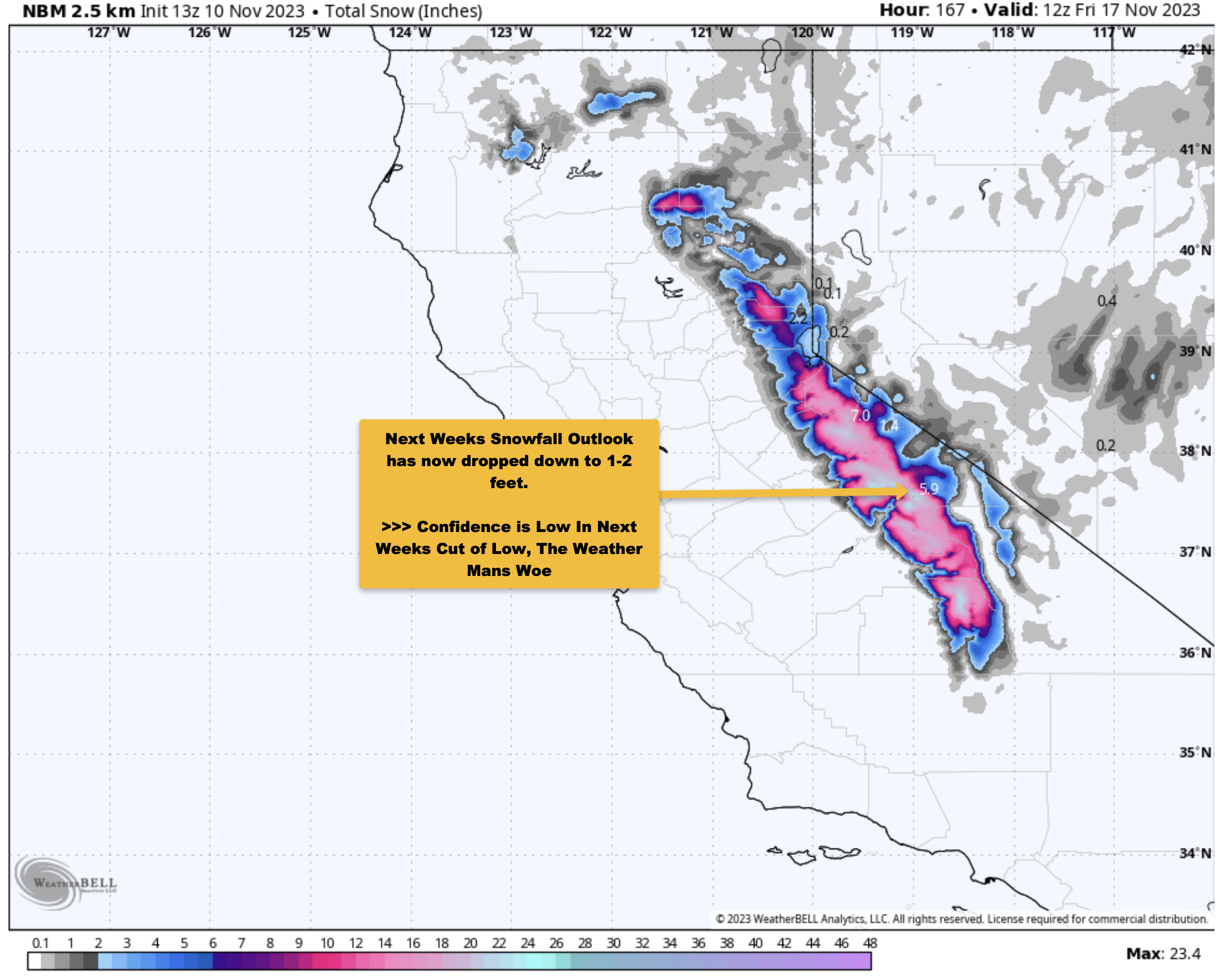
By Sunday, the ridge starts to move off to the east as a deep cut-off will set up off the coast of California. These cut-off lows are impossible to forecast, and where they go, nobody knows for sure.
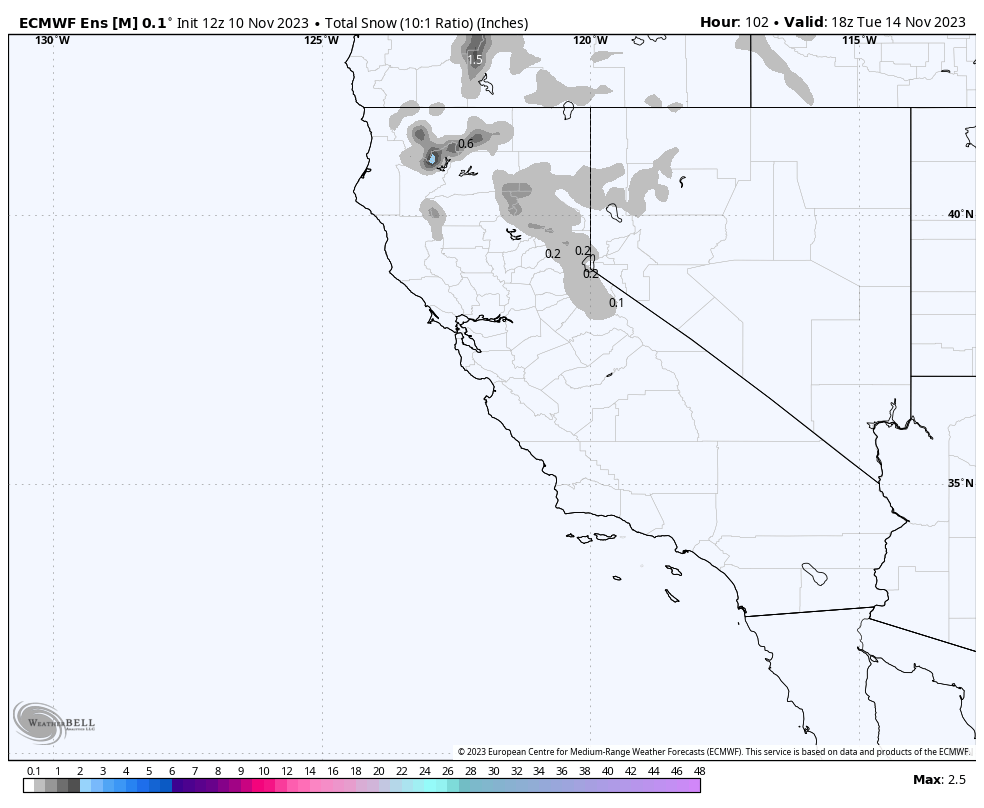
So what looked like a massive amount of snow coming in a few days ago now looks like snowfall in much lower amounts. The problem is the cut-off low is now forecasted too far off the coast for meaningful snowfall.
It does look like by Tuesday, there could be some snow showers out on Mammoth Mountain as the low moves closer to the coast. But even that forecast is suspect at this time.
We can take a look at this cut-off low again on Sunday. If you’re coming up to ski or snowboard on Monday and Tuesday, expect windy conditions with increasing clouds and a chance of snow showers on Tuesday.

Friday into Monday Weather Forecast Details: At the Main Lodge, expect mostly clear skies with some high clouds at times. Mid-day temperatures will be in the mid-40s, with early morning lows in the upper 20s to lower 30s.
SW winds will be 5-15 MPH into Saturday, and then gusts will be in the 25 to 35 MPH range by Sunday.
Mammoth Lakes temperatures will be in the mid to upper 40s on Wednesday and then lower to mid-50s on Thursday and into the weekend, with nighttime lows in the twenties.
Down in Bishop, it will be in the low to mid-60s into next Monday with nighttime lows into the 30s each night. Snowman out...


Mammoth Mountain 6-10-Day Weather Discussion
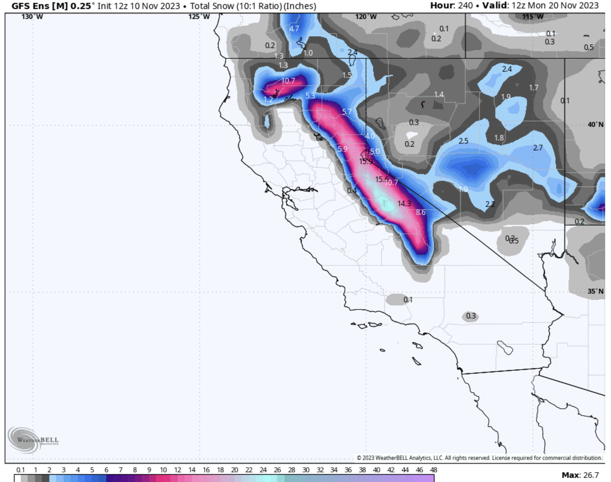
10-10-2023 – In the 6-10 day time frame there will be a Cut Off Low in play. As mentioned above the track of these lows can be a weathermans woe. Models really struggle with these systems.
At this point in the game the low is not going to be in a position that will result in big or even moderate snowfalls for the Sierra.
It’s to far off the coast to benefit us and when it does come in at the end of the period it does so well to our south. So we wait and see what happens, let’s hope we see a whole new track when we look again on Sunday.
Snowman
Content on this Mammoth Weather Page from: Steve Taylor (Snowman), Ted S (CCM), NWS Reno / Hanford / Vegas. Model Images from Weather Bell with on Hill WX data from the Mammoth Mountain Ski Patrol.
 …
…
…
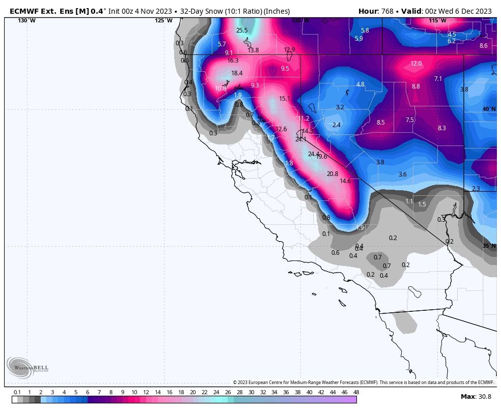
840 Hours Out – ECMWF Extended Ensemble Mean
840 Hour Snowfall from the ECMWF Ext. Ensemble Mean
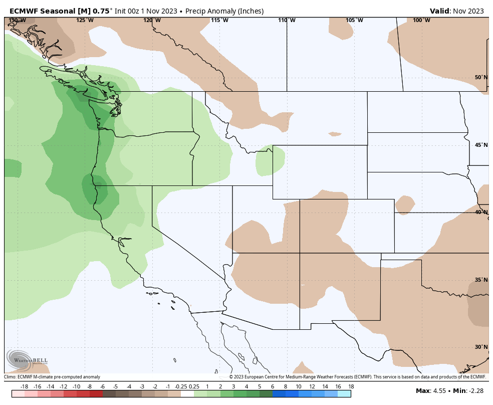
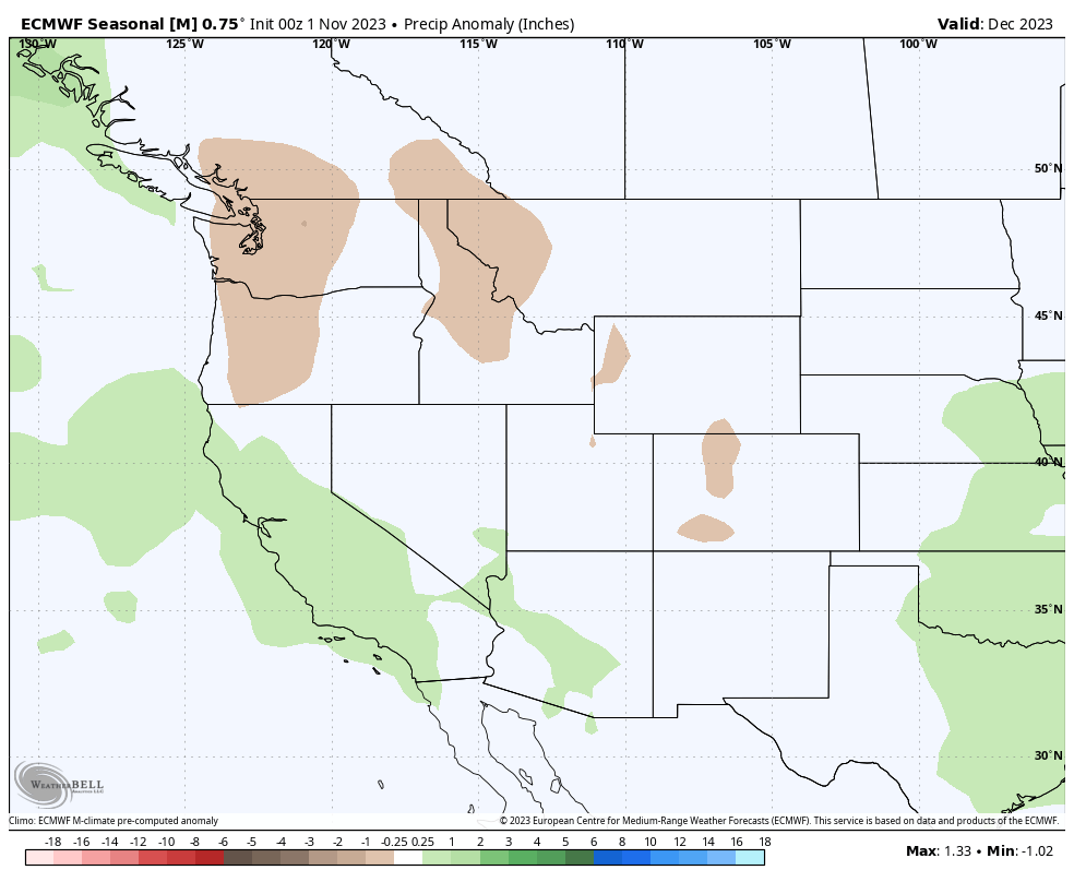
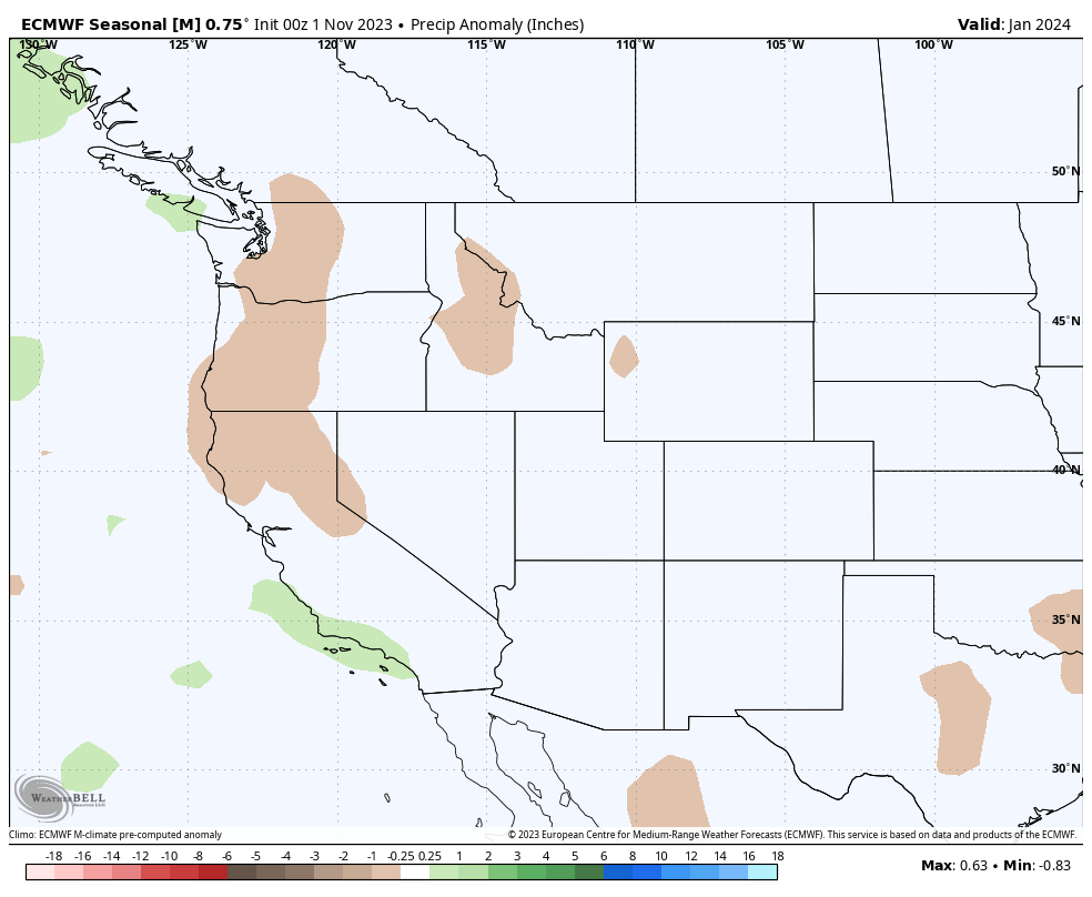
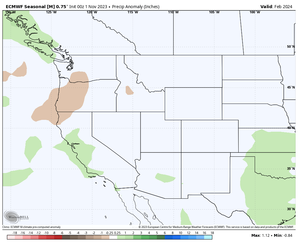
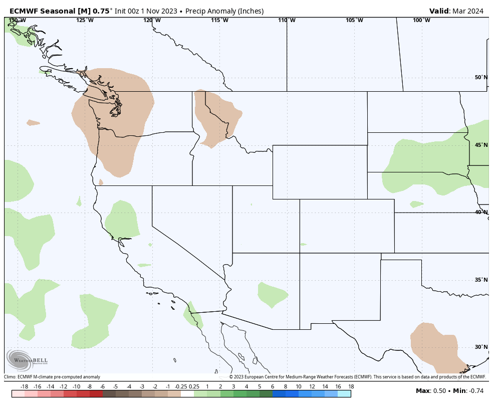
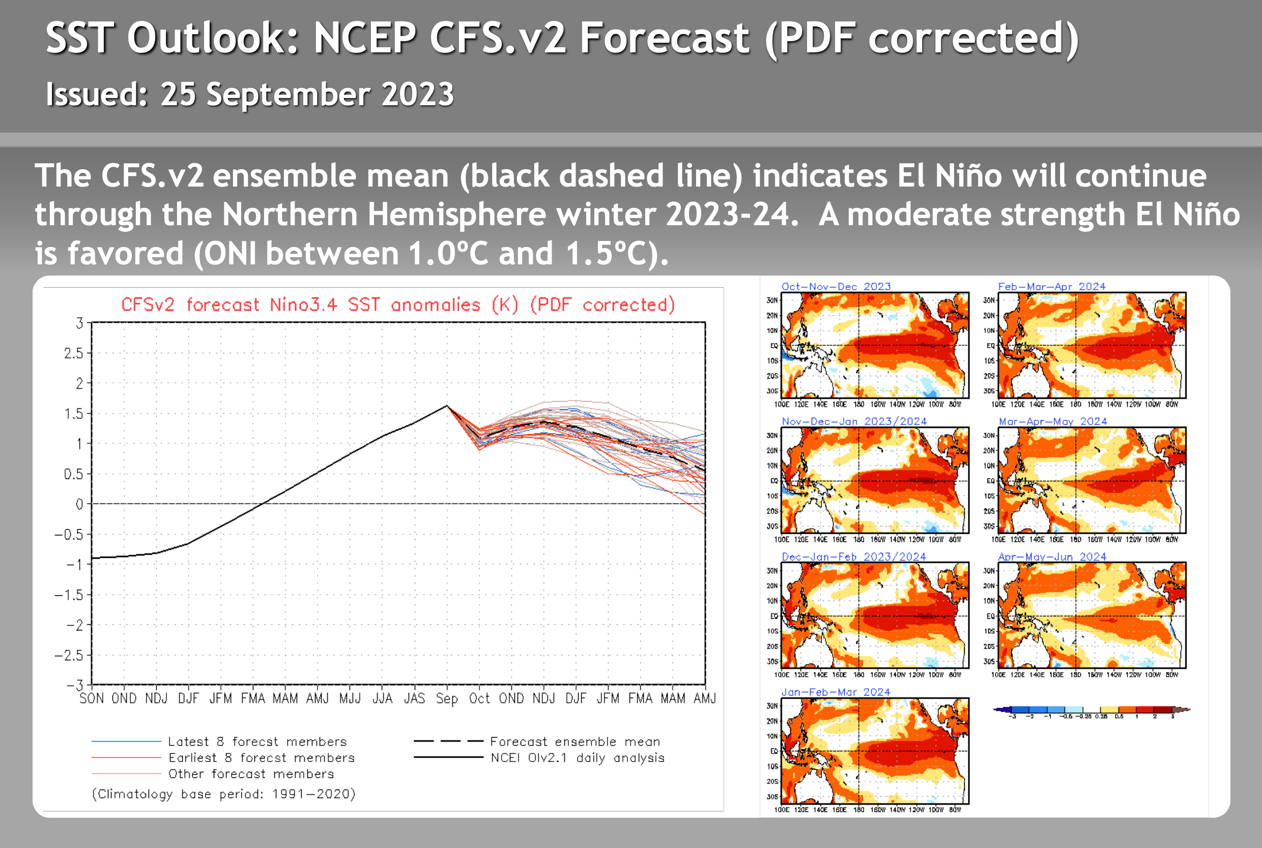
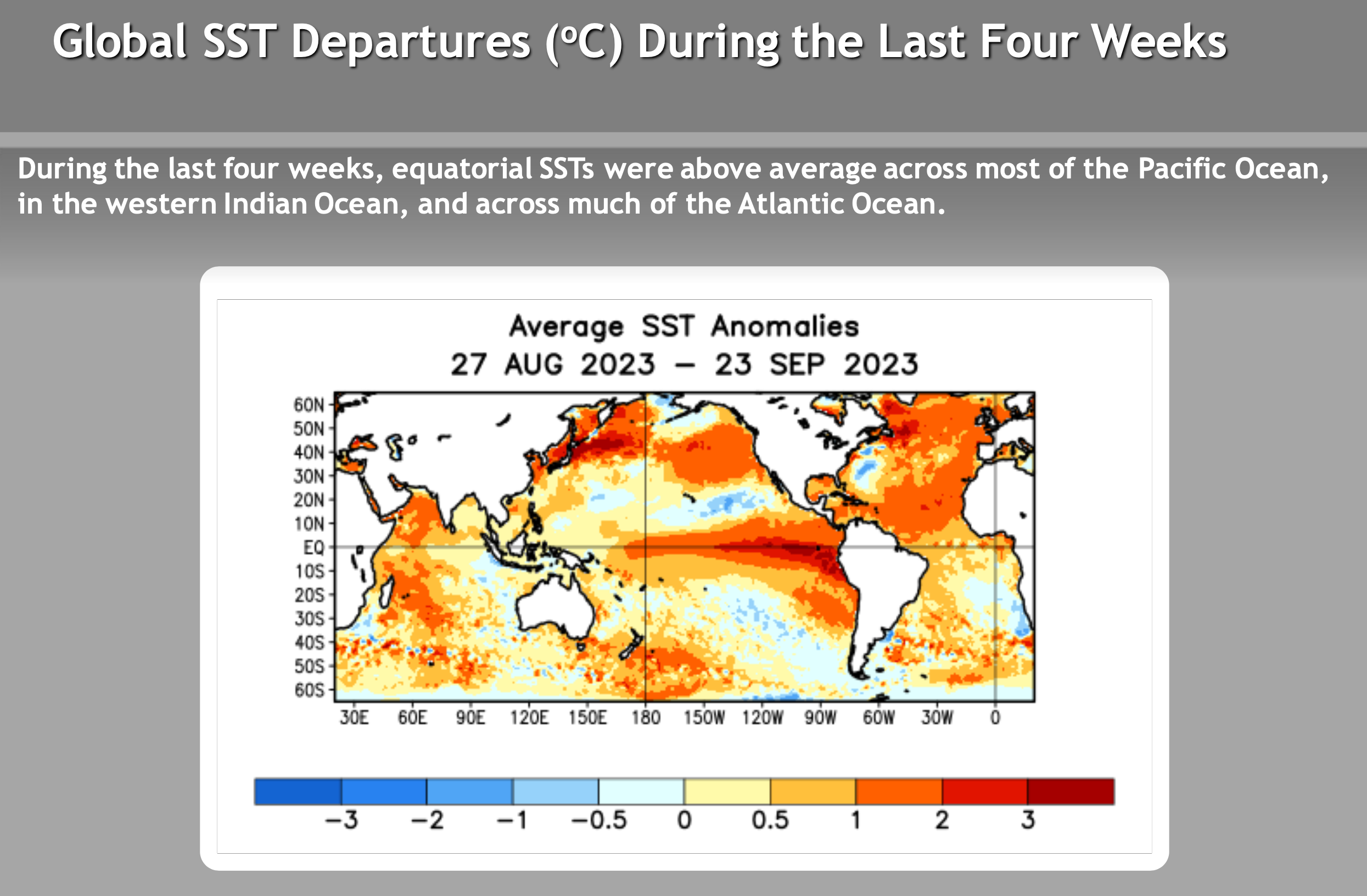
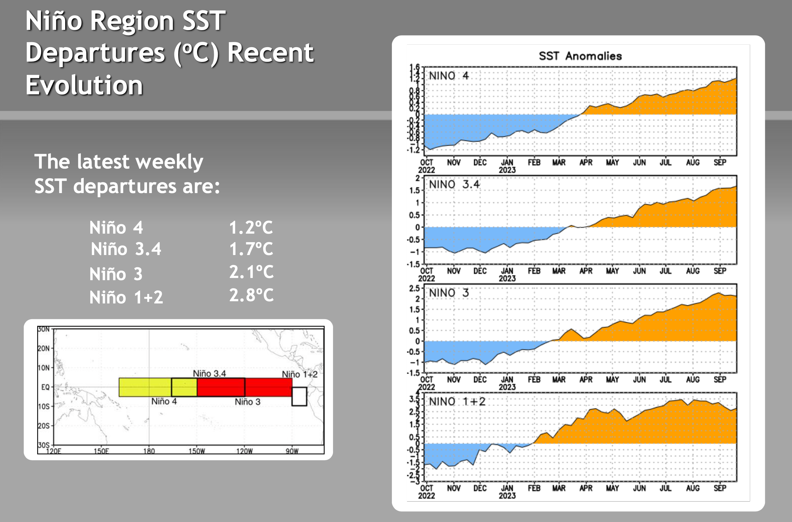
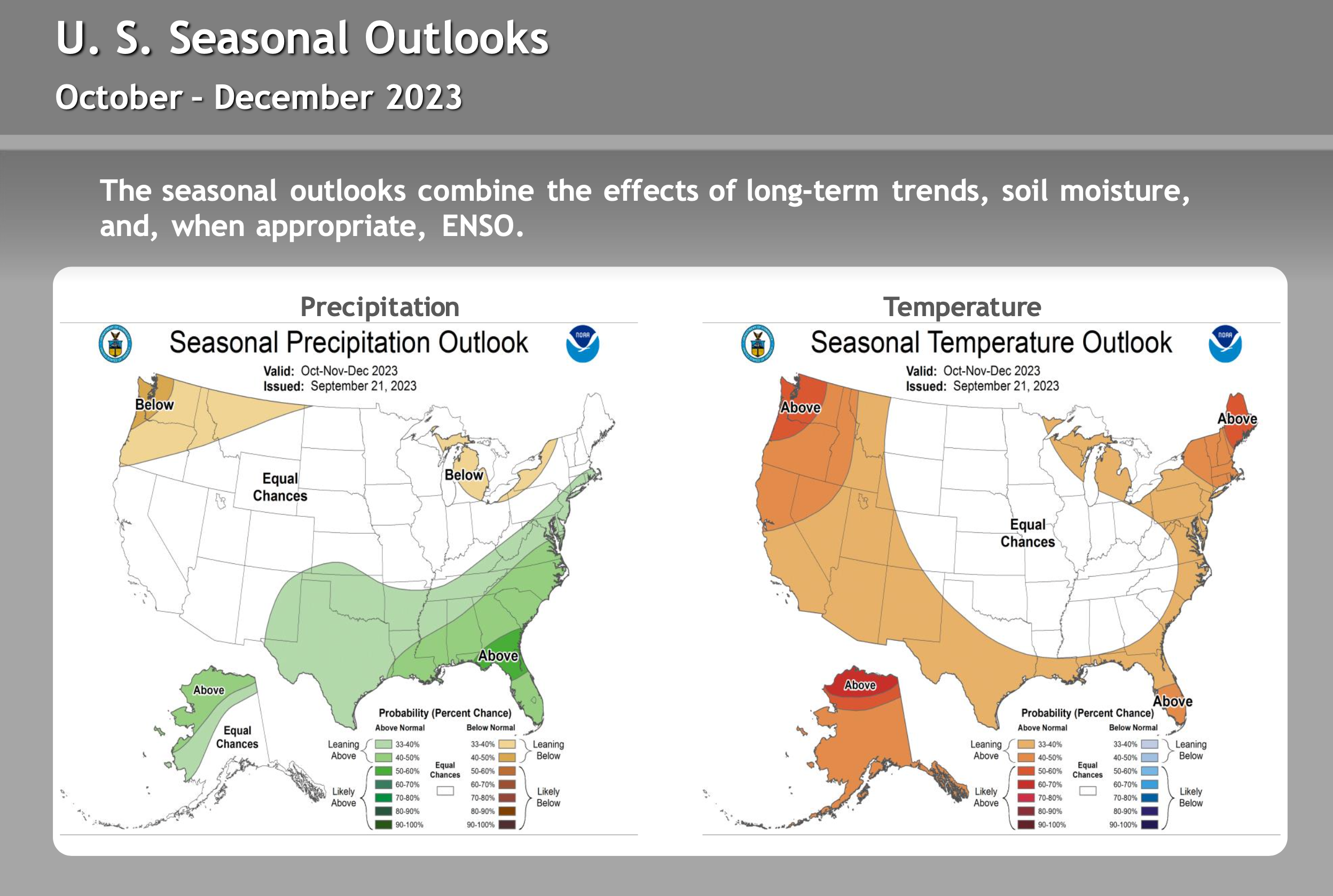
ENSO – El Nino / La Nine Outlook – September 26th, 2023
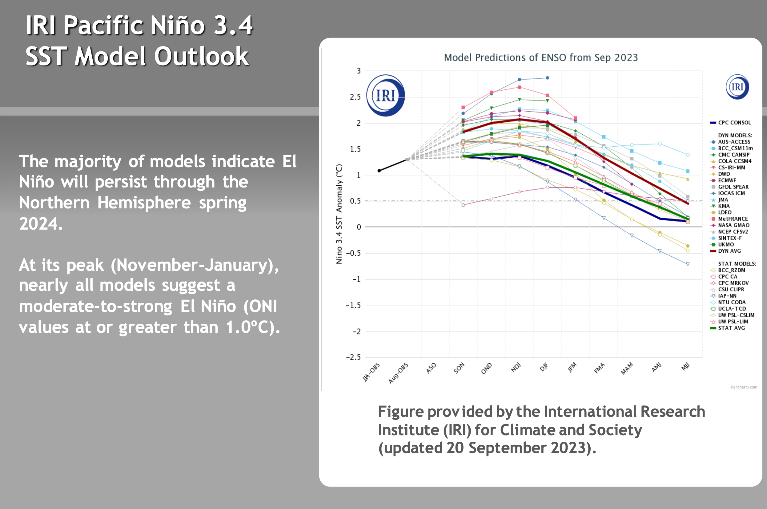
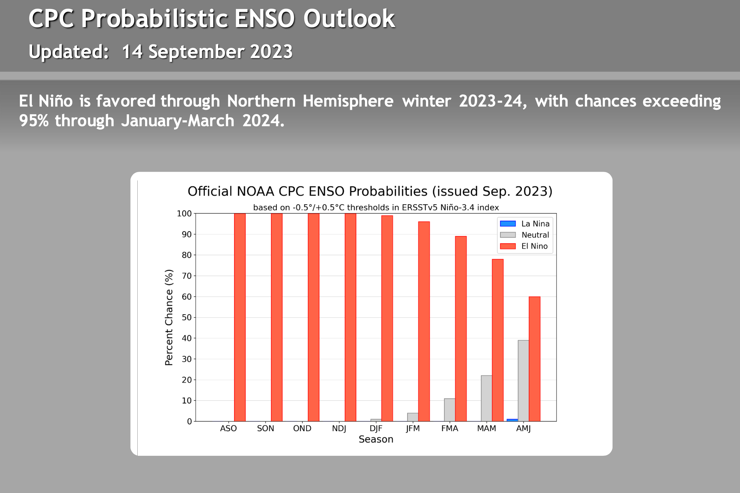
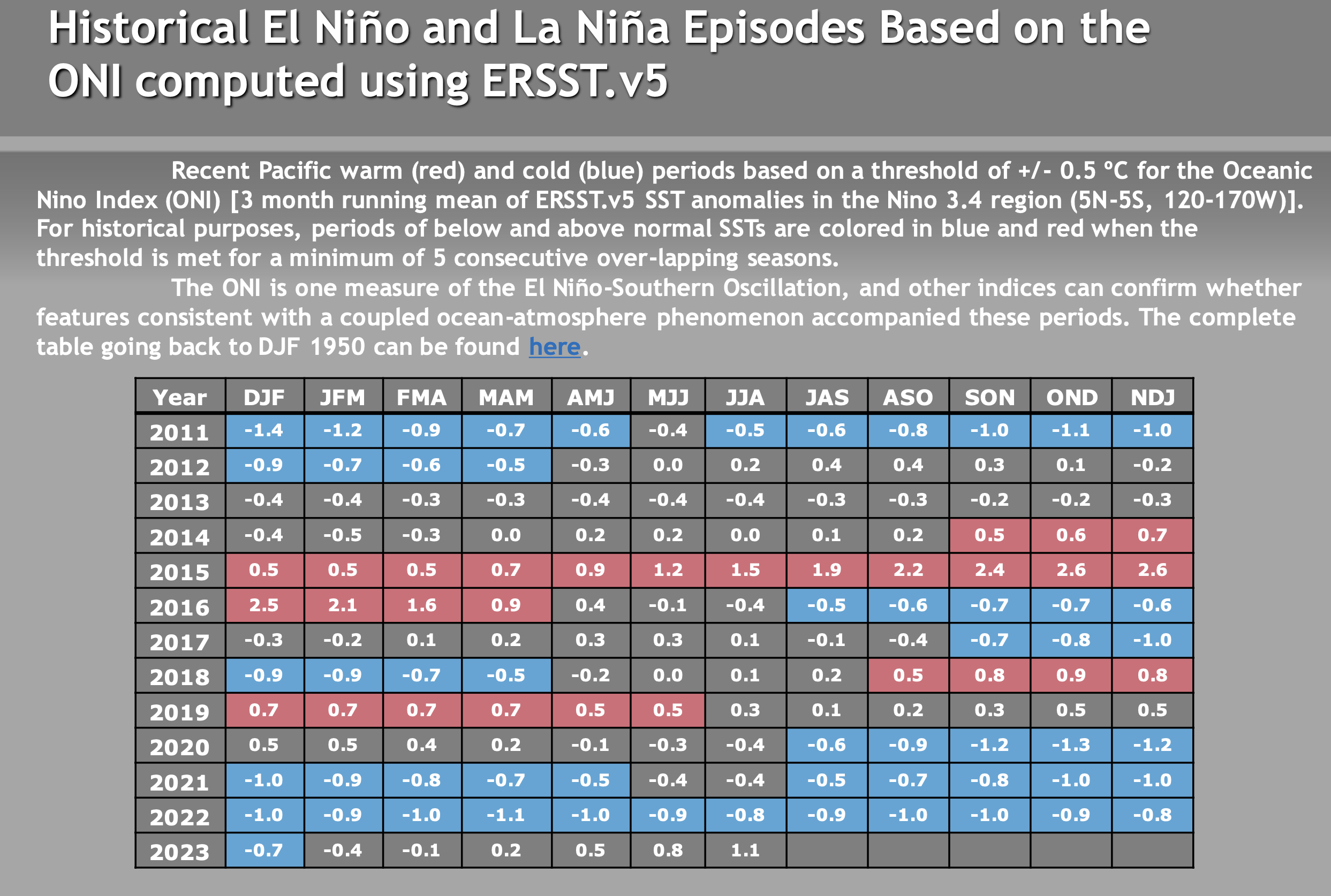
El Niño Update: The current El Nino is in the strong category. How the event affects Mammoth Mountain and the Eastern Sierra this winter is uncertain. There are a lot of variables with this particular El Nino event that have not been seen during other strong events. Take a look at the video below for more information.
There are not a lot of strong El Ninos to look back at, so it’s hard to trust any of the long-range data right now. Past El Niño winters have been slow to start, so don’t be surprised if the Eastern Sierra sees below-average rain and snowfall this Fall.
The video below is new from Mike Discussing the most current El Nino Data. All the images in this section have been updated, with what’s the most recent on there as of 9-26-23.
> To note, El Niño winters can be slow to start, so don’t be surprised if the Eastern Sierra sees below-average rain and snowfall this Fall.


Author – Steve Taylor – The Mammoth Snowman – Over the last 30+ years, Snowman has spent countless hours studying and learning about Mammoth Mountain Weather and Snow Conditions first hand. He has been skiing around the hill with marked ski poles since March of 1991 so he can measure the fresh snowfall amounts out on the hill.
Snowman started blogging this information back in 1990 on the old Mammoth BBS system, then the RSN Forums and then on to MammothSnowman.com in 2004 with Video & Photo Blog reports. (No YouTube back then). Facebook got added to the fold back in 2008 and then the Facebook Group in 2016.
Reports, videos, and photos from the website have been featured on both local TV Stations here in Mammoth and Bishop, along with KTLA, AP, Fox, ABC, CBS, and NBC News.
Click Here to Learn More About the People Who Make MammothSnowman.com a Reality


