Powder Forecast – Saturday November 28th, 2020
Ted Schlaepfer CCM —- Mammoth Mountain WeatherGuy
Snowfall forecasts are valid at the Sesame snow course (Main Lodge) for the prior 24 hours as reported in the 6-7 AM morning snow report.
**Snowfall forecast confidence ranges from very low (1) to very high (5)
Sun 11/29 = 0”
Mon 11/30 = 0”
Tue 12/1 = 0”
Wed 12/2 = 0”
Thu 12/3 = 0”
Fri 12/4 = 0”
Sat 12/5 = 0”
Sun – Tue 12/6 – 8 = 0”
November Snowfall = 21”
November Forecast = 21”
Detailed 4-day Snowfall Forecast:
Sun 11/29 through Wed 12/2 – No snowfall expected all days.
Forecast Summary:
Short Term (Days 1 – 4):
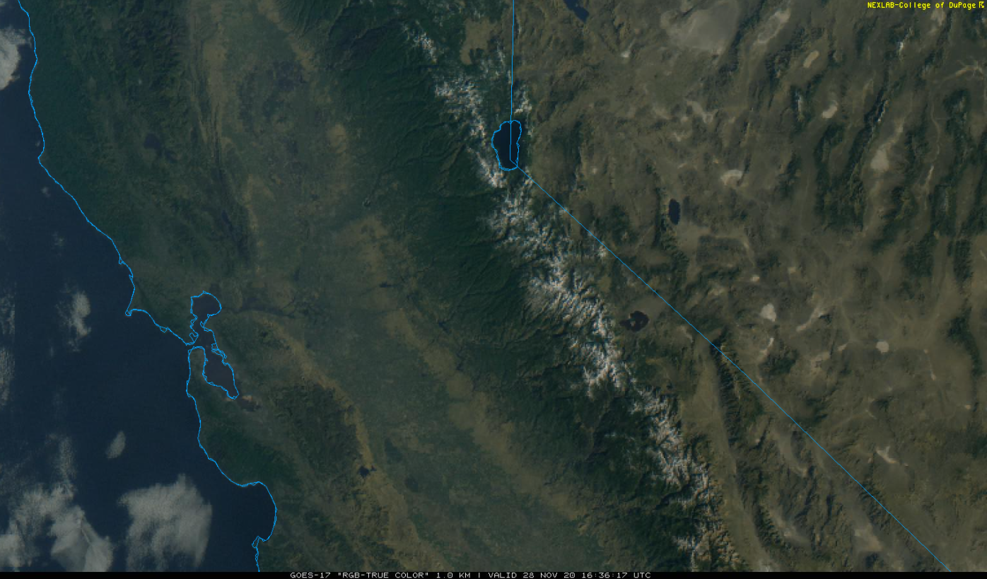
The morning visible satellite image (below) shows clear skies over the state under a weak ridge of high pressure. Clear skies and generally seasonable temperatures will continue through Monday with good snowmaking weather tonight and early tomorrow.
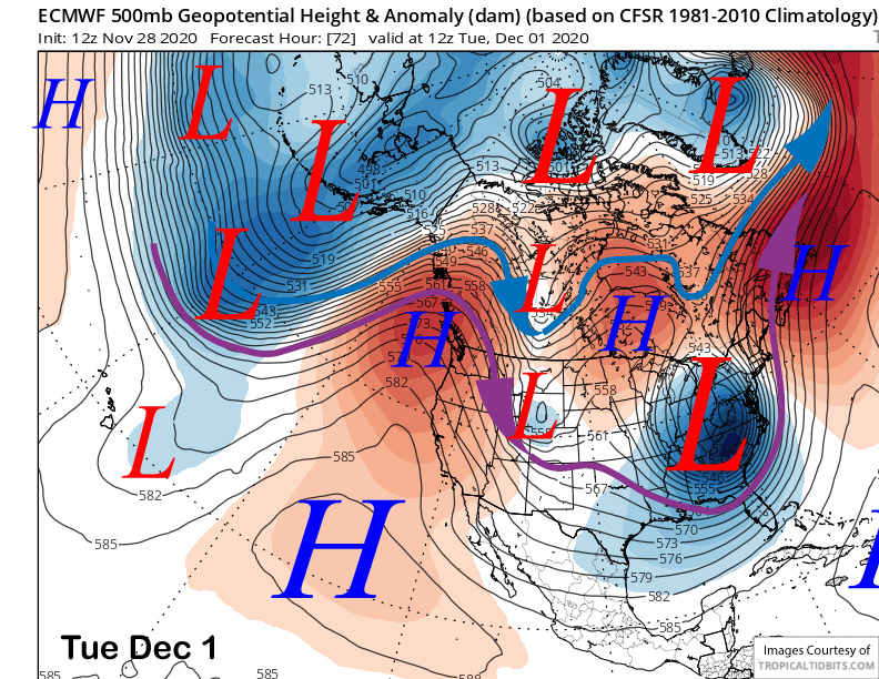
The models move an upper level trough through the Great Basin Monday and Tuesday (image below) resulting in some breezy northeast winds Tuesday, otherwise dry weather will continue through the middle part of next week or longer.
Long Range (Days 5+):
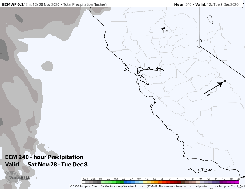
The longer-range guidance has not changed much and is still quite dry for the most part. The latest run of the deterministic ECM model keeps the upper level ridge in place through next week and the following weekend and has no precipitation over the next 10 days (images below). That model is also suggesting temps could get warmer by the following weekend that would limit snowmaking opportunities.
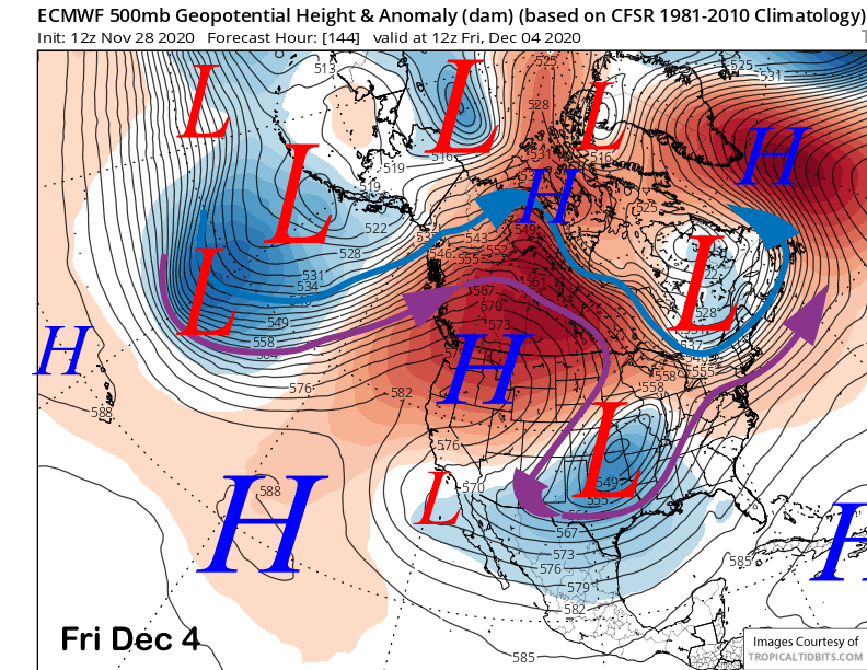
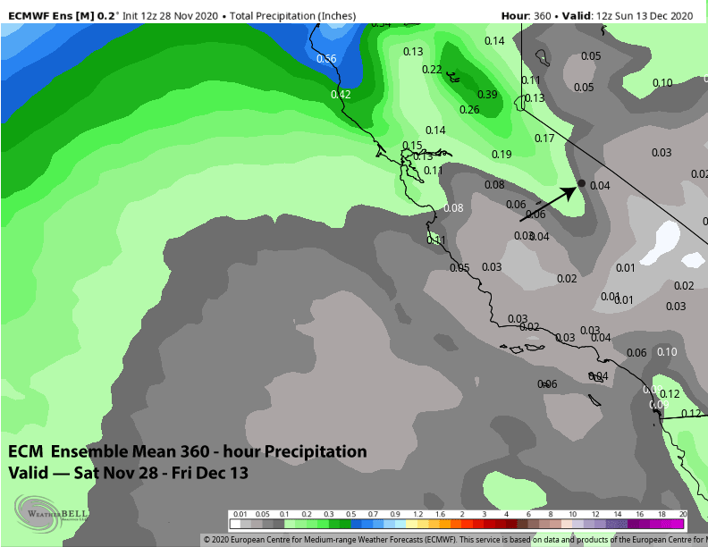
The generally dry weather is still expected to continue into mid-December. The ECM (image below), Canadian, and GFS ensembles all favor the West Coast ridge to remain in place through the 15-day forecast period. The ECM mean is basically dry for the period (two images below).
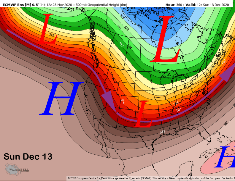
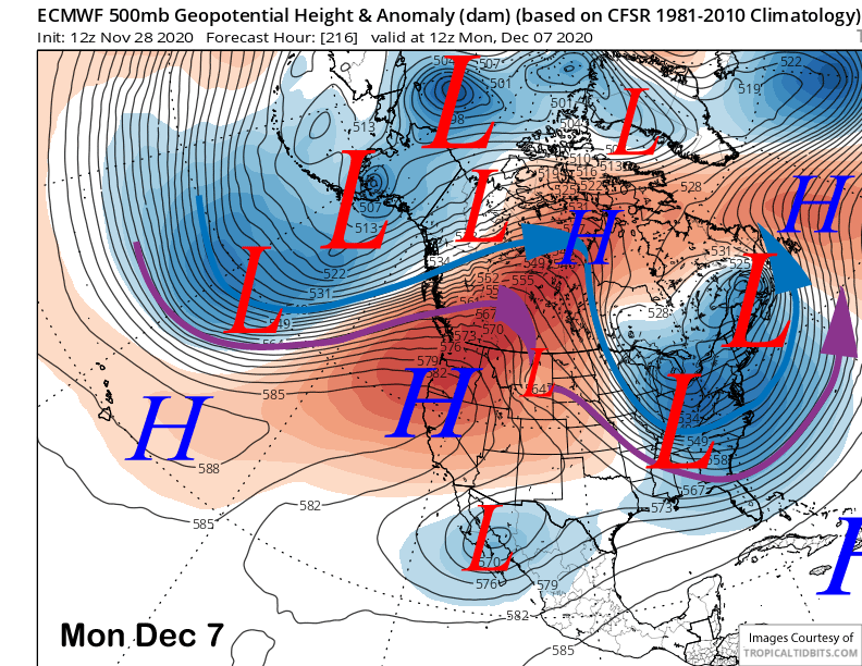
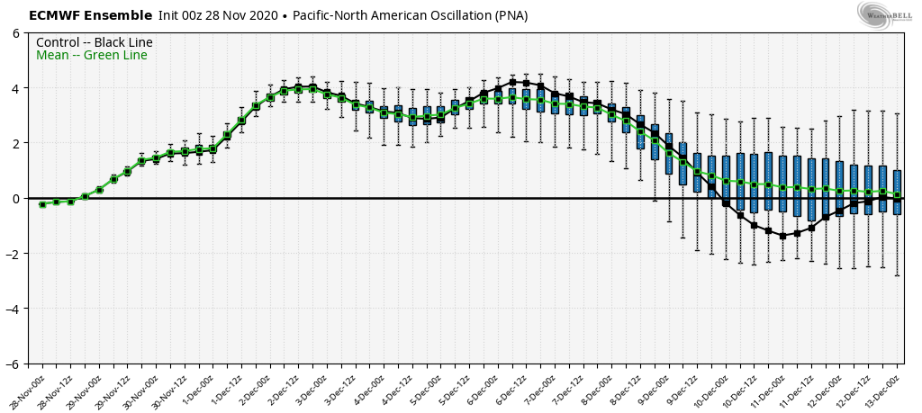
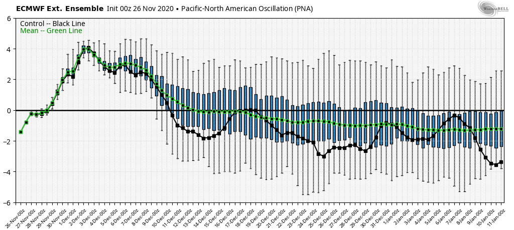
The numerical guidance says that this positive Pacific North America (PNA) pattern will last into the second week of December (image below) before the index may trend toward neutral mid-month. The only good news, if believable, is that the ECM weekly model (two images below) keeps that index negative starting mid/late December and through early January for potential storm chances.
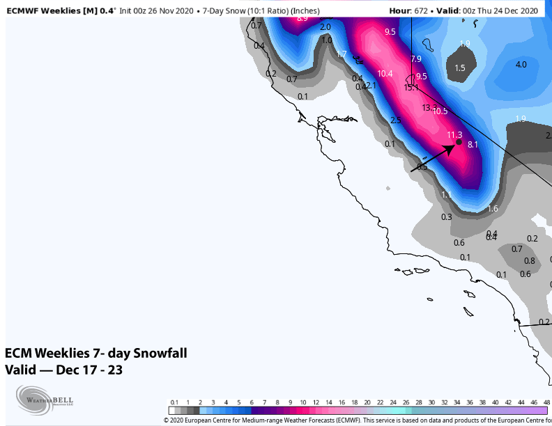
Otherwise, it looks like the next chance for decent snowfall won’t be until the 3rd week of December when the ECM model is predicting a period of storminess (image below). That is a very long ways out to get excited about. Looks like the snowmaking crew will be busy this early season. WG