Powder Forecast –Tuesday March 2nd, 2021
Ted Schlaepfer CCM —- Mammoth Mountain WeatherGuy
Snowfall forecasts are valid at the Sesame snow course (Main Lodge) for the prior 24 hours as reported in the 6-7 AM morning snow report.
**Snowfall forecast confidence ranges from very low (1) to very high (5)
Wed 3/3 = 0”
Thu 3/4 = 1 – 2”” (H20 = 0.10” – 0.15”)**3
Fri 3/5 = 0”
Sat 3/6 = 2 – 3” (H20 = 0.20” – 0.30”)**2
Sun 3/7 = 0 – 1”
Mon 3/8 = 0 – 2”
Tue 3/9 = 6 – 12”
Wed – Fri 3/10 – 3/12 = 15 – 30”
March Snowfall = 0”
March Forecast = 45 – 60”
Detailed 4-day Snowfall Forecast:
Wed 3/3 –Snow showers are expected during the afternoon and evening before ending overnight. Accumulations 1– 2” by Thursday AM
Thu 3/4 – No snowfall expected.
Fri 3/5 – No snowfall expected through the late evening hours with a period of snowfall expected late at night and early Saturday. Accumulations 2 – 3” by Saturday AM, ~4” up top
Sat 3/6 – Snow showers end during the morning. No accumulation expected or maybe an inch.
Forecast Summary:
Short Term (Days 1 – 4):
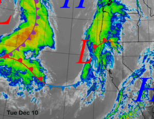
The infrared satellite image (below) this afternoon shows an upper level low pressure system positioned well off the SoCal coast drifting slowly southeastward. It is expected to move toward SoCal/northern Baja tomorrow that will produce rain/mtn snow for those areas.
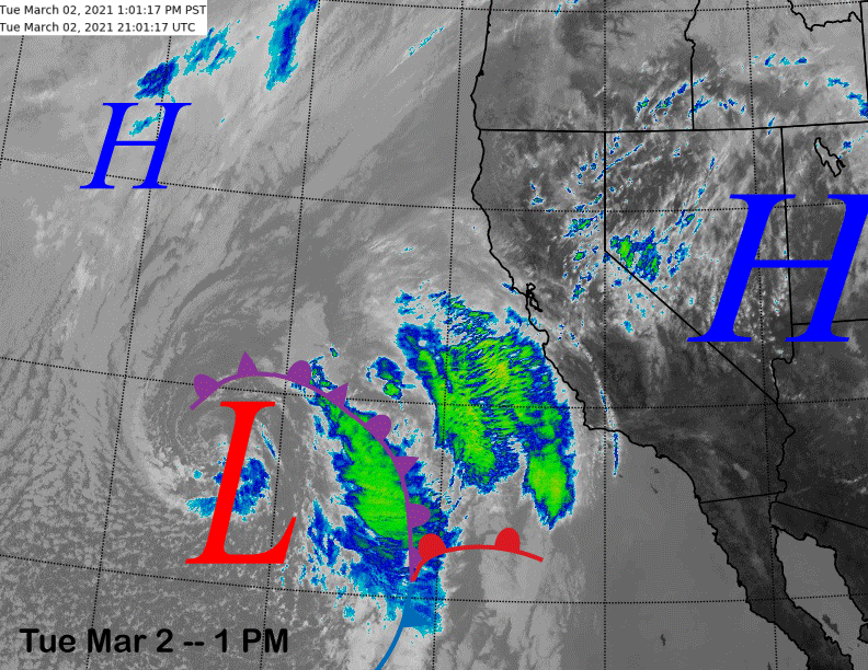
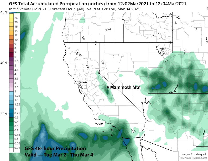
The models are also saying that it will be far enough northward (image below) for some light snowfall in Mammoth tomorrow afternoon and evening before ending overnight. Amounts look very light (two images below) and only an inch or two is expected resulting in dust on crust conditions.
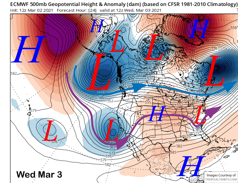
Dry weather is then expected until overnight Friday and Saturday morning when a dissipating cold front will move through Mammoth (image below). Amounts are expected to be slightly more than the previous system and possibly a quarter inch (two images below) liquid, but only a couple to a few inches of snowfall are forecast from the fast moving and dying front. Maybe enough for low-end powder conditions in the favored bowls, but likely fun turns nonetheless.

Long Range (Days 5+):
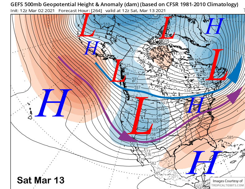
The longer-range guidance is still showing a transition to a pattern more favorable for significant snowfall in the extended range. However, there is still a lot of uncertainty regarding timing and intensity of snowfall as the models are generally all over the place, but are mostly showing a snowy pattern.
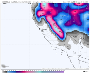
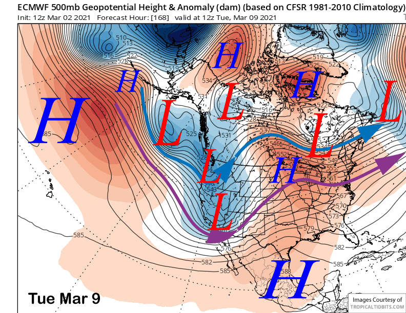
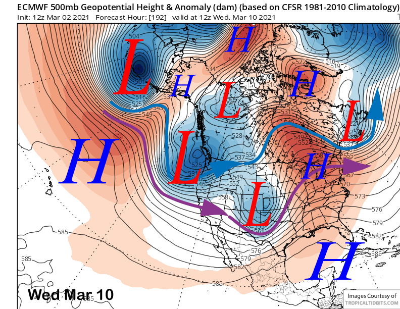
The ECM model moves a couple troughs through the Sierra on Monday into Tuesday (image below) and then again Wednesday into Thursday (two images below). The model splits the first trough and moves it through with only light snowfall while the second one is forecast to be much stronger and include a period of heavy snowfall across the Sierra under low snow levels.
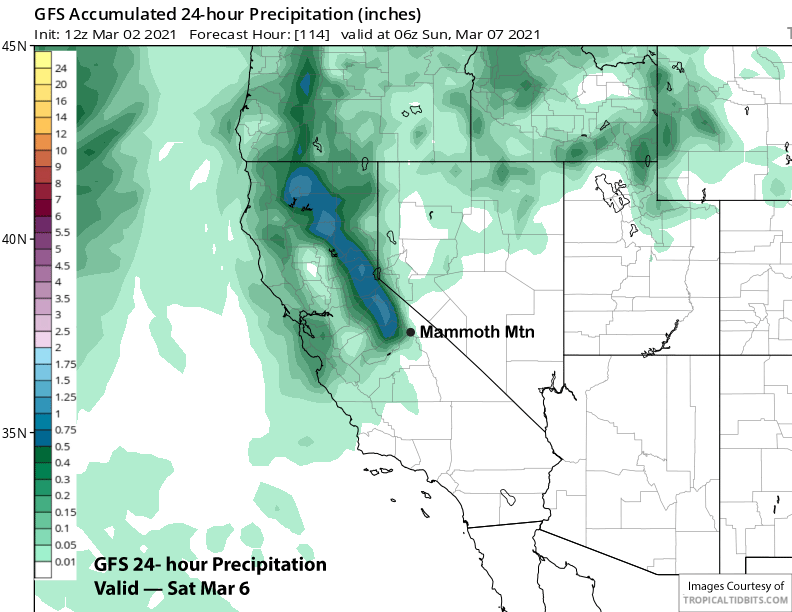
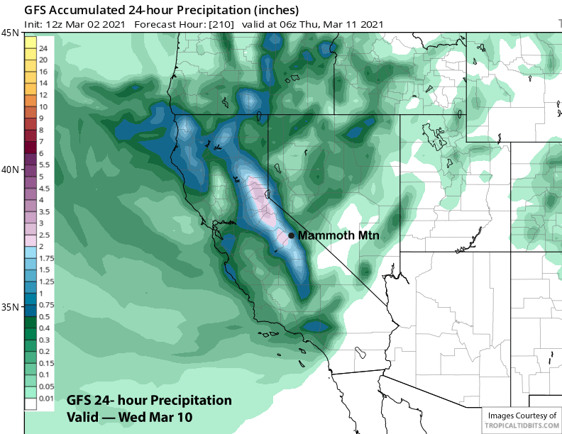
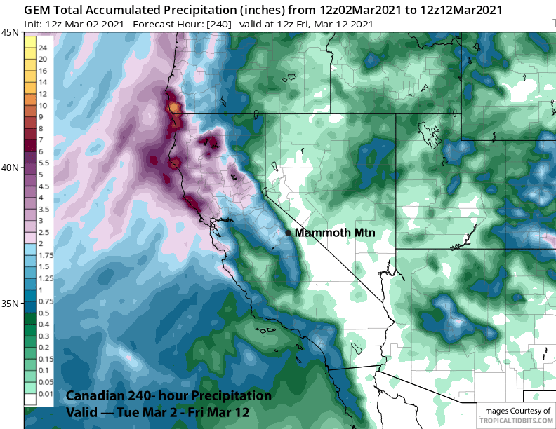
The Canadian model is closer with the ECM model through next Thursday with the GFS model much strong with the trough early in the week. It has moderate to heavy snowfall developing Monday and into Tuesday in addition to the potential stronger storm for Wednesday when it is showing about 2” liquid (image below) or about 2 feet of snowfall.
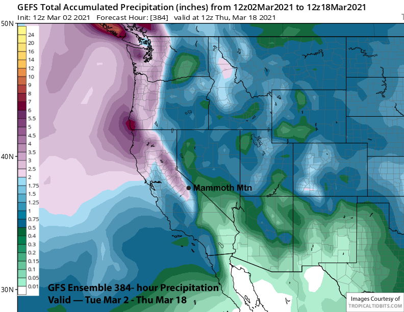
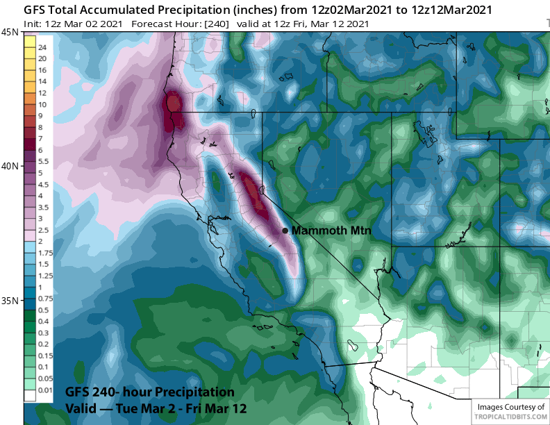
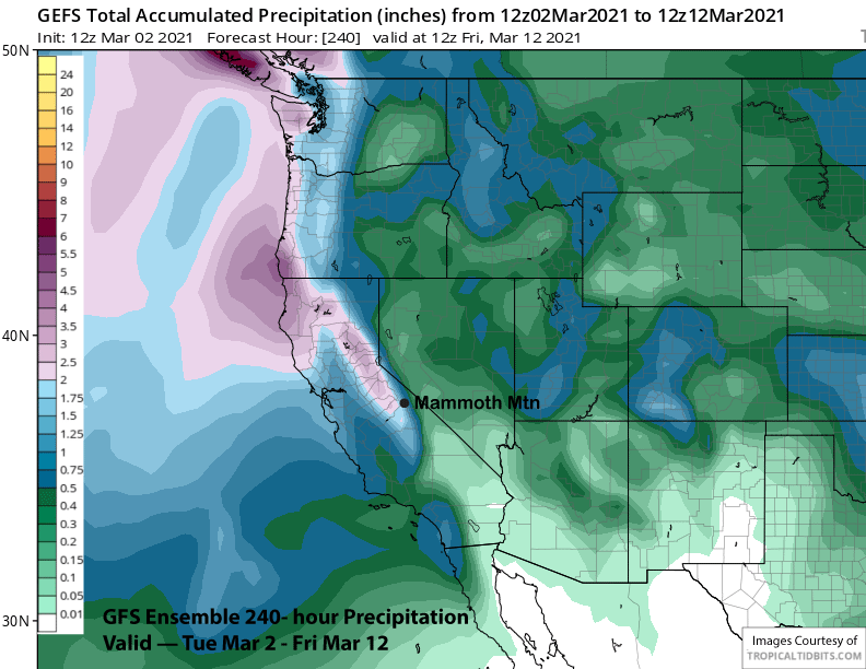
Overall, the GFS has about 4-5” liquid (image below) for the 10-day period while the Canadian is closer to the ECM with about 1.5-2.0” liquid (two images below). That actually matches up better with the GFS ensemble mean that has around 2” liquid (three images below). The ECM mean also has around 2″ liquid.
Overall, hopefully the GFS deterministic model is onto something, but right now, the ensembles are not supporting major snowfall, although certainly enough for powder conditions next week. And it will be the cold dry type of powder, not Sierra cement.
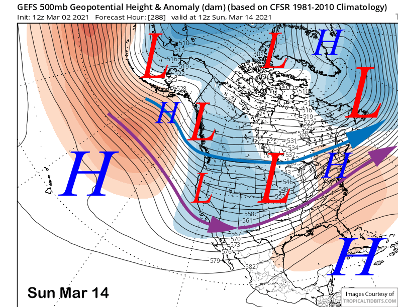
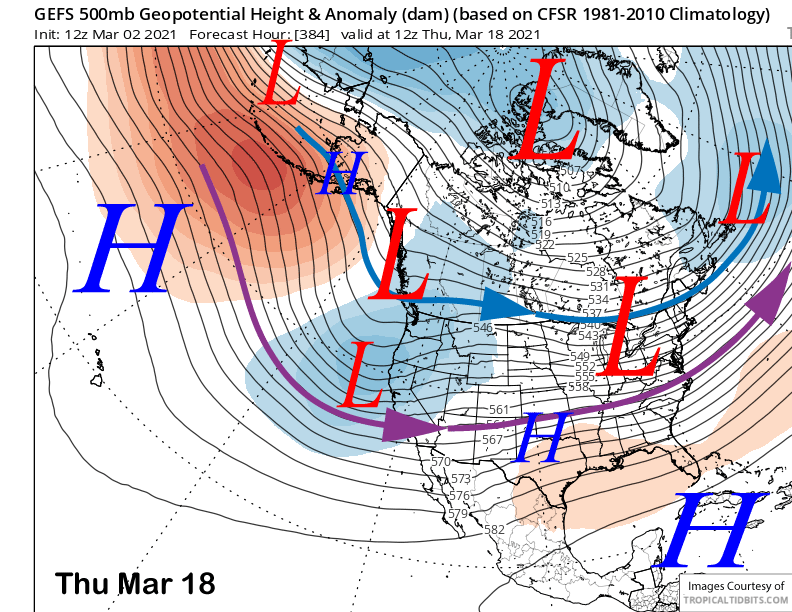
The fantasy range guidance moves the long-wave trough slightly eastward early over the following weekend (image below) before suggesting a weak system may move through over the latter part (two images below). That means there could be a period of fair/dry weather late next week or early over the weekend before snowy conditions may return Sunday.
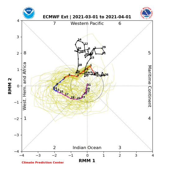
The GFS ensemble is then suggesting that the trough may re-develop along the West Coast sometime over the latter part of the following week (image below) or weekend for additional storm chances. The MJO signal (two images below) is expected to finally become active again heading into mid-March and that may help boost the pattern as well. Phase 1 in mid-March is wet for the southern two-thirds of California.
Overall, the GFS ensemble is showing good snowfall starting next week and through mid-month with about 3” liquid (image below) or about 3 feet. That will lead to multiple powder and storm riding days starting next week. WG