Saturday, September 17th, 2022 @ 11:00 AM – Here
is a quick update, first all the haze and smoke is gone today. Second,
just taking a late morning look at all the new data coming in.
The
QPF forecast late Sunday into Wednesday is still on the low end, with
.20 – .40 possible around Main Lodge up to the Top of Mammoth Mountain
and .10 – .25. in Mammoth Lakes. The EU operational model was the outliner with zero precipitation for Mammoth at this time.
Snow levels will be in the 9000-10,000 foot range and may briefly drop below that level at some point for a short time.
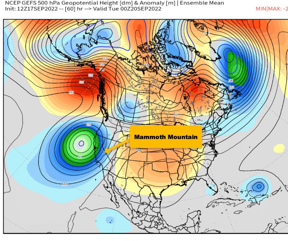
The
problem with this system is that as comes south it will stay just
offshore and never traverse over the central Sierra, about midweek it
weakens and then lifts to the NE.
As
this low cuts off who knows maybe it will change its mind and come over
and bring a decent dusting. “A cut-off low is the weatherman’s woe.”
Below is a gif image that shows the path of the low over the next 96 hours.