September 7th, 2023 @ 2:29 PM – Recreational Weather Forecast – Sunny skies are forecast on Mammoth Mountain and through out the Eastern Sierra into Friday.
Over the weekend, there will be some build-ups with the possibility of some showers 20% – 30% from Bishop Creek Canyon up towards Bridgeport. There could even be a slight dusting of snow above the 13,000-foot level. Lower elevations should be pt cloudy with just a very slight chance of any raindrops.
By Monday, ensembles models now have the Eastern Sierra under pt cloudy skies with a few very light showers possible in the higher elevations into the end of next week.
Mammoth Mountain and the Lakes Basin Forecast: Mid-day highs in the higher elevations (8900 feet) to be in the low to mid-60s with early morning lows into the lower to mid-40s. Winds will sometimes be out the West to SW at 5-15 MPH.
For Mammoth Lakes: Mid-day highs will be into the upper 60s to lower 70s, with nighttime lows in the mid to upper 40s.
For Bishop: Morning lows will be in the mid-50s, with mid-day highs in the upper 80s to 90 degrees.
Snowman
>> Scroll down the page for the full September forecast and updated Winter Outlook data.

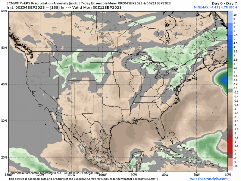
45 Day EPS Precipitation Outlook – 9-7-2023
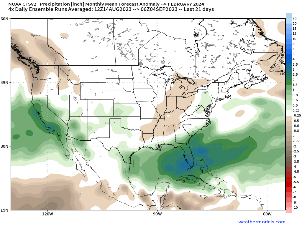
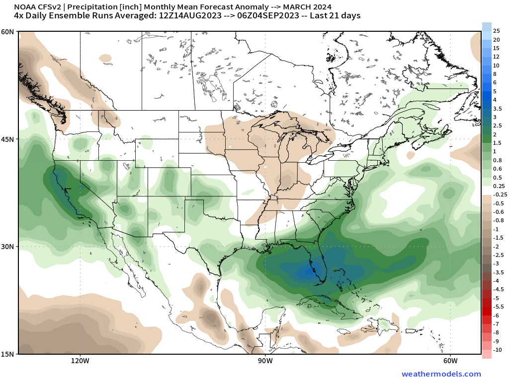
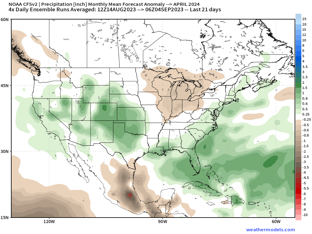
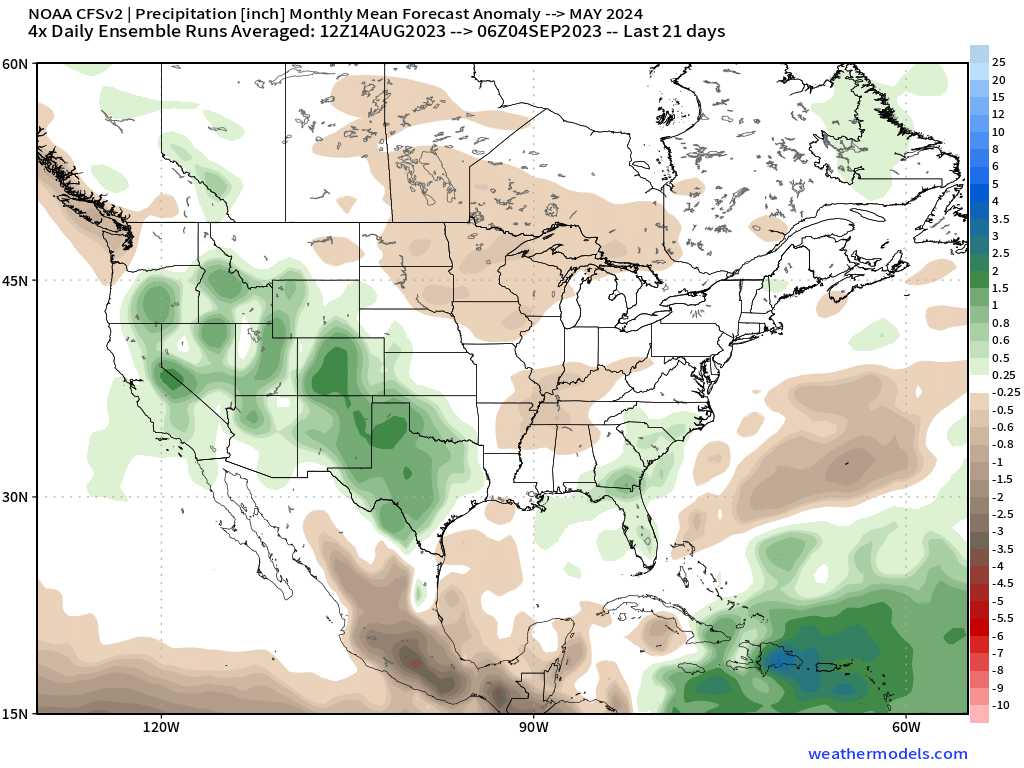
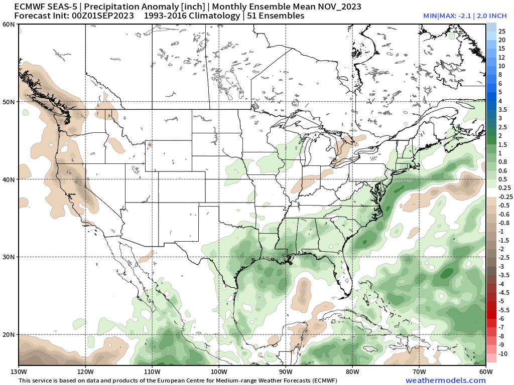
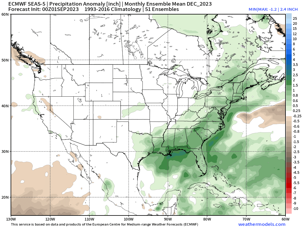
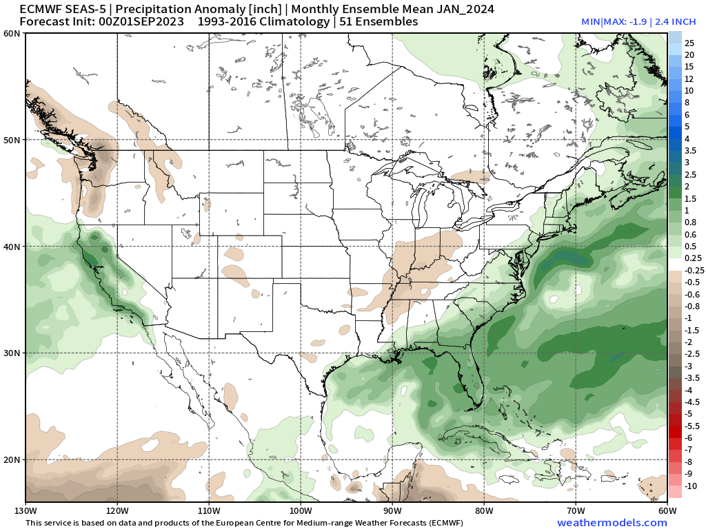
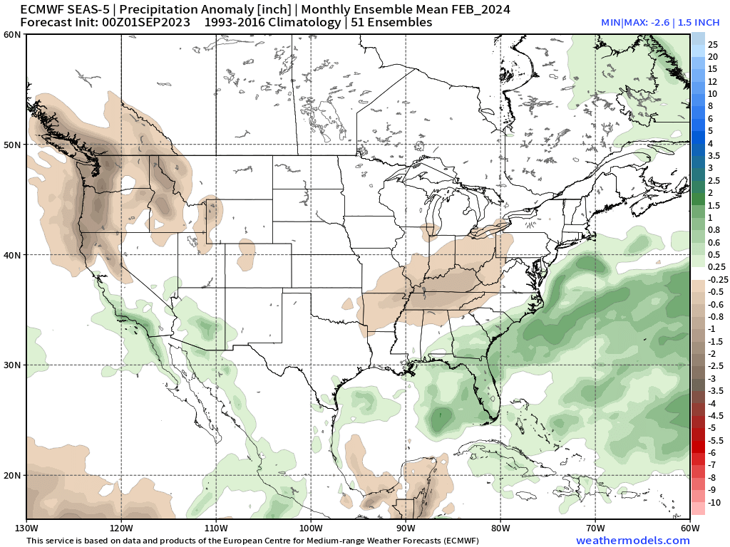
Long Range Seasonal Outlooks
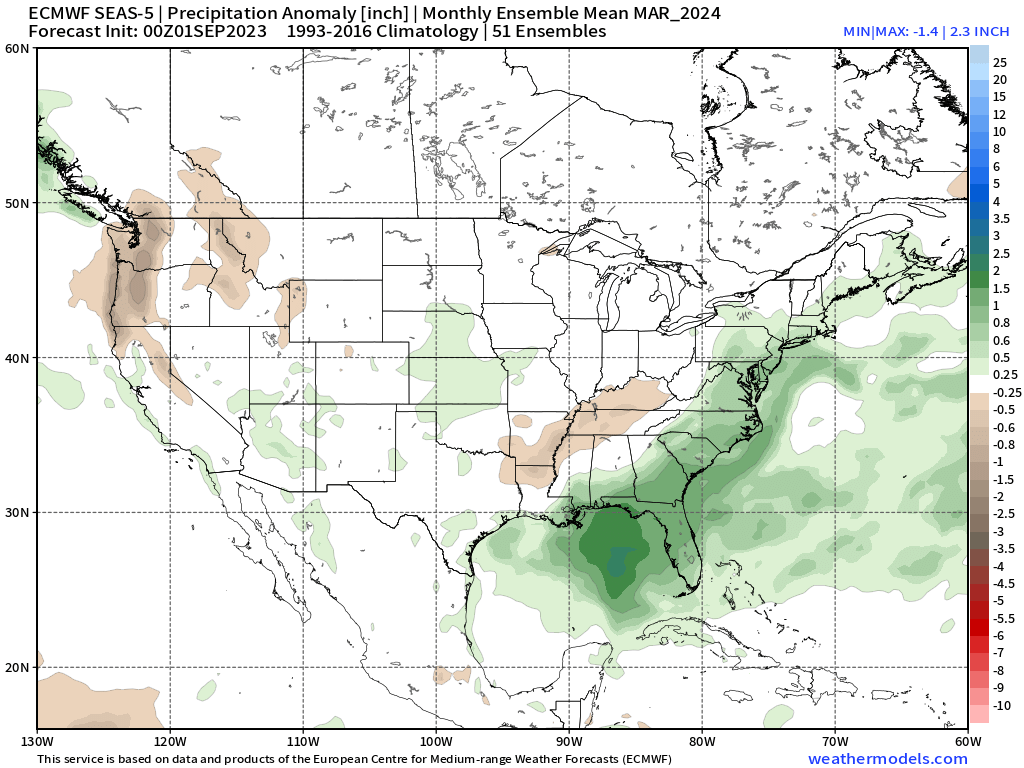
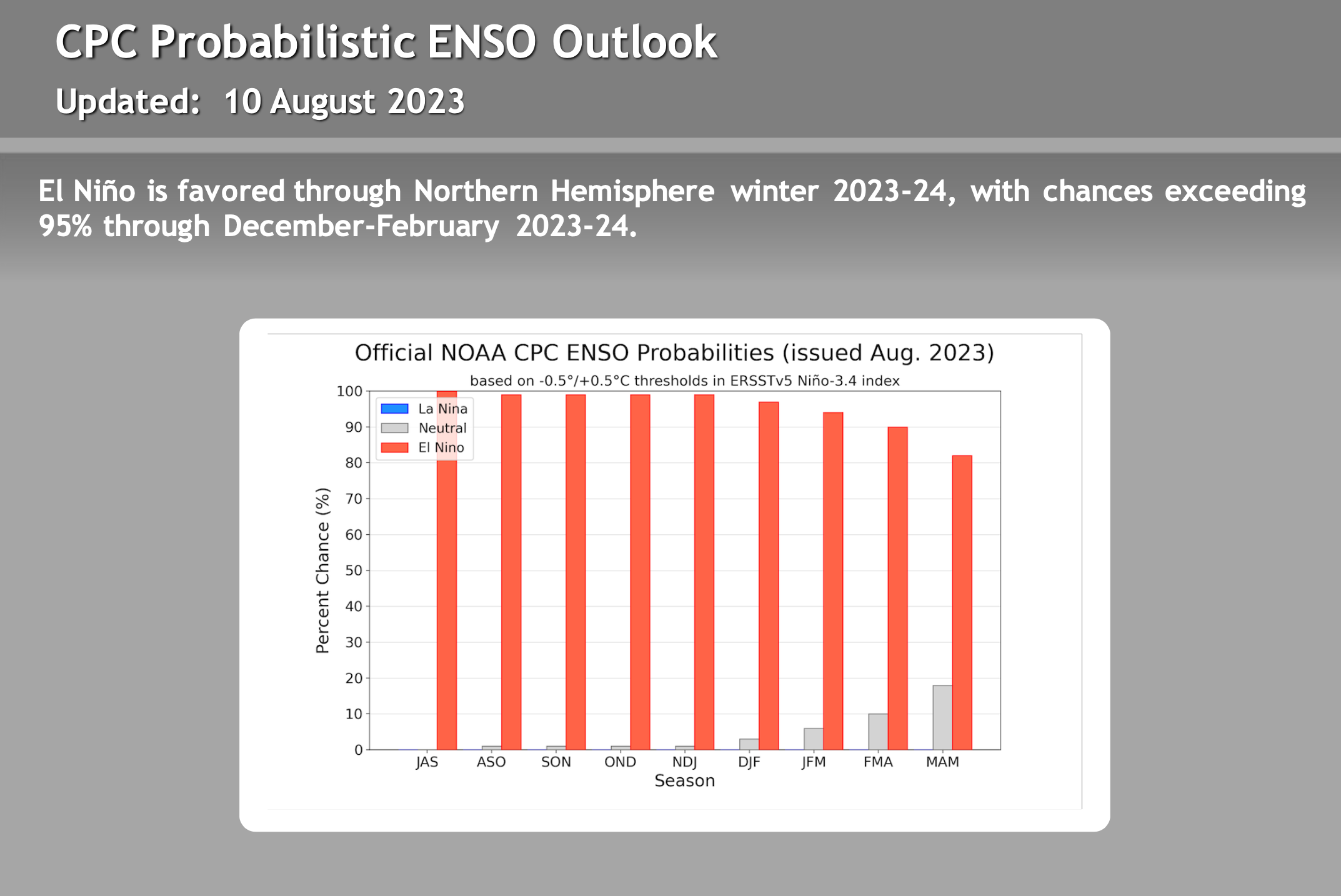
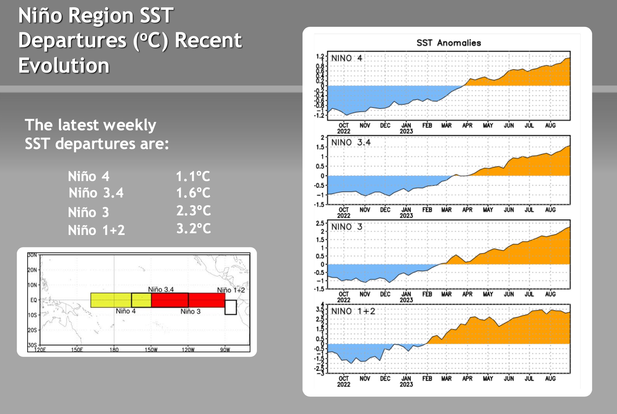
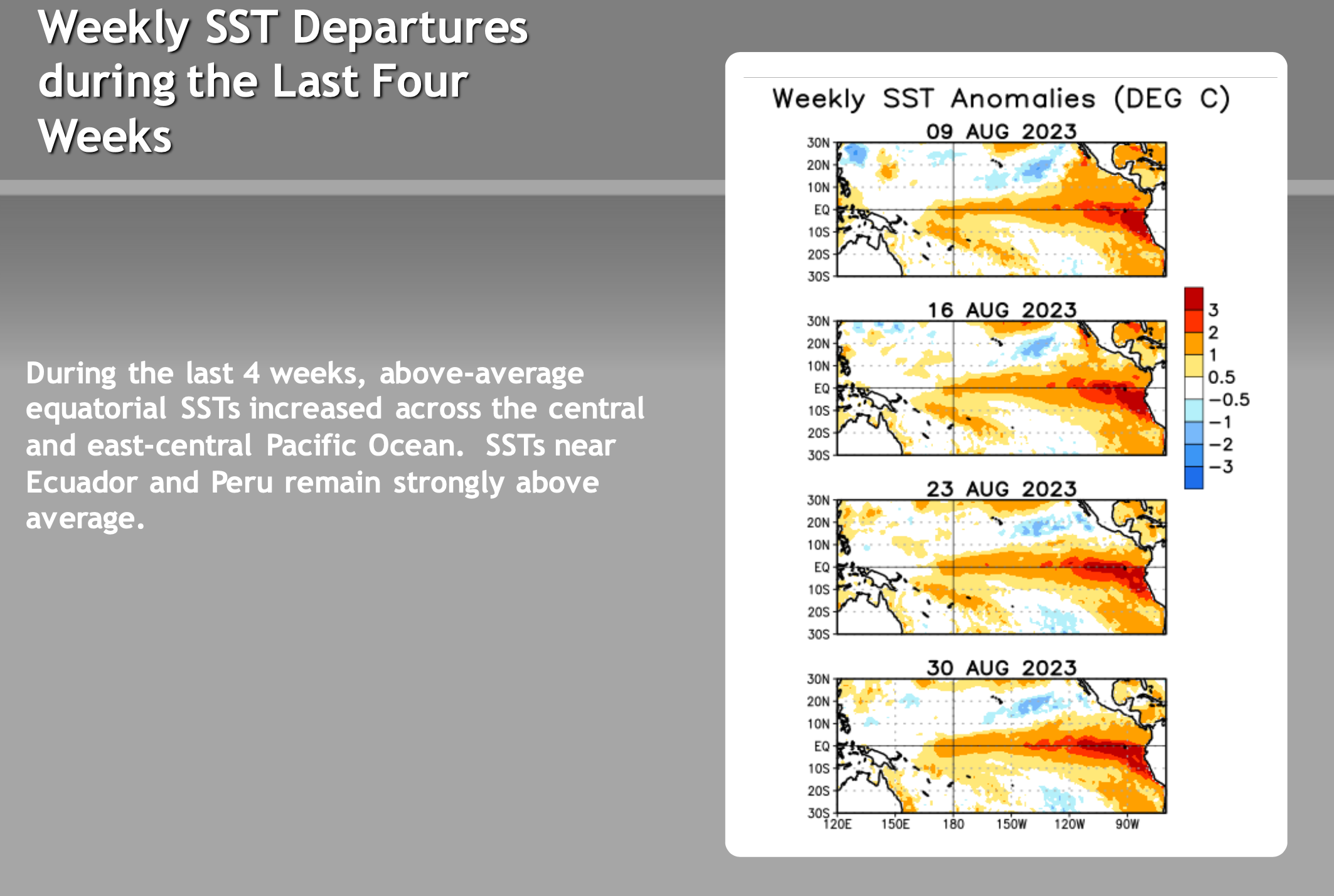
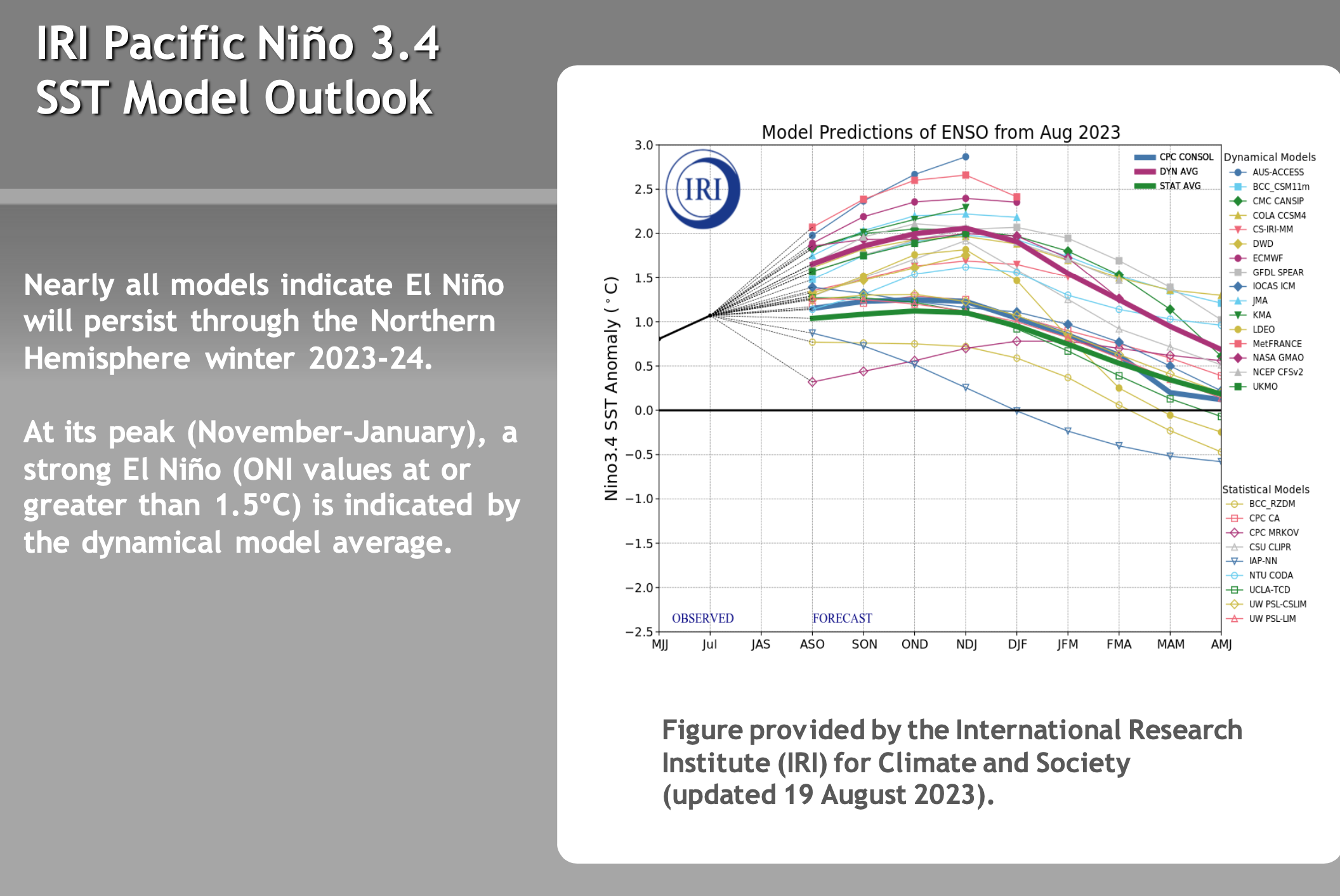
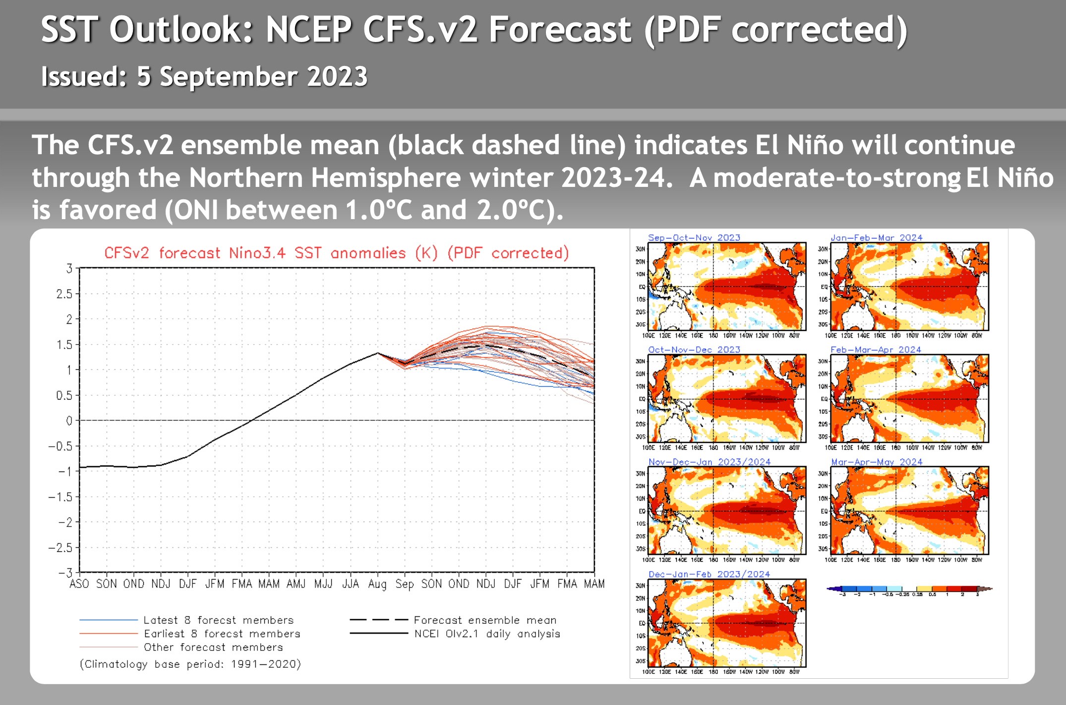
9-4-2023 – Now that Labor Day is here and Meteorological Fall has arrived it’s time to start looking at the upcoming Fall and Winter forecasts. As of now it appears there will be a moderate to strong El Nino that will be more easterly based then the last big El Nino that was western based.
More times then note when you have a strong El Nino that is easterly based Mammoth Mountain ends up with a normal to well above normal winter. 1983 was a strong easterly based El Nino and it snowed well into the May that season with mostly higher elevation base snow.
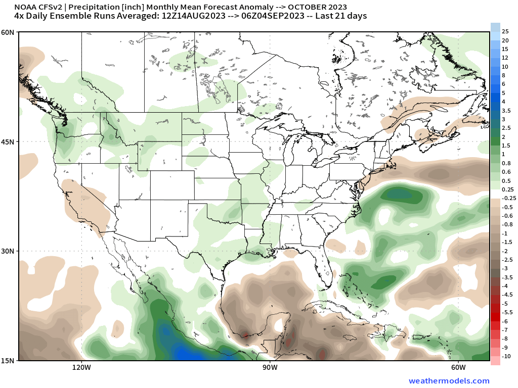
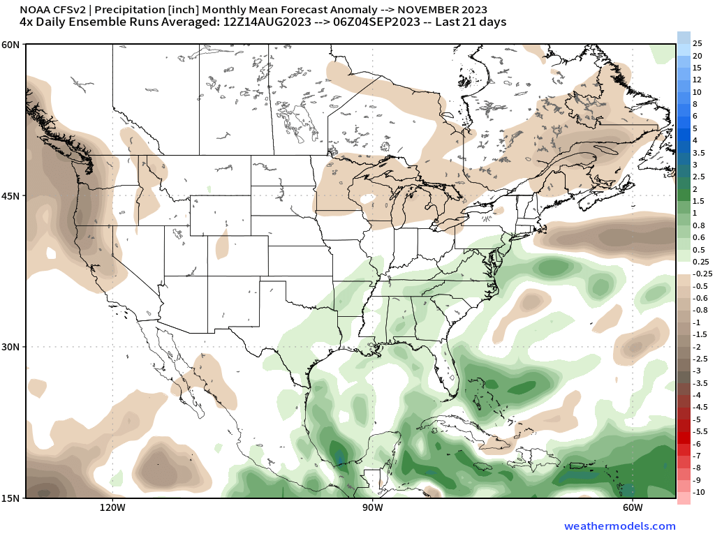
One thing to note, El Nino seasons seem to take some time to ramp up, so don’t expect a wet October and November. However a decent November could still be in the offering for the Eastern Sierra.
Still way to early in the game to know for sure but the odds of having at least an average season or better are in our favor for now. Snowman