

Mammoth Mountain Recreational Weather and Travel Forecast
February 26th, 2024 @ 2:30 PM – If you’re heading to the hill on Tuesday, expect clearing skies early with bluebird conditions by mid-day with temperatures in the mid to upper 30s. Winds will be out of the SW at 10-15 MPH with gusts to 20+ over the higher elevations.
On Wednesday, expect clear skies with mid-day temperatures in the mid to upper 30s. Winds will be out of the SW will be increasing to 10-20 MPH with gusts to 30 MPH.
By Thursday the next strong low-pressure system will be moving our way and will start sending in pt cloudy skies and moderate winds.
Mid-day temperatures will be in the low to mid-30s with SW winds at 20-30 MPH with gusts to 45-55 MPH at times. Looks like a decent wind buff day could be in the making.
Travel Forecast: Expect R1 conditions to be possible later today above the 7500-foot level. All Winter Roadways should be open and clear by mid-day Tuesday into Thursday evening.
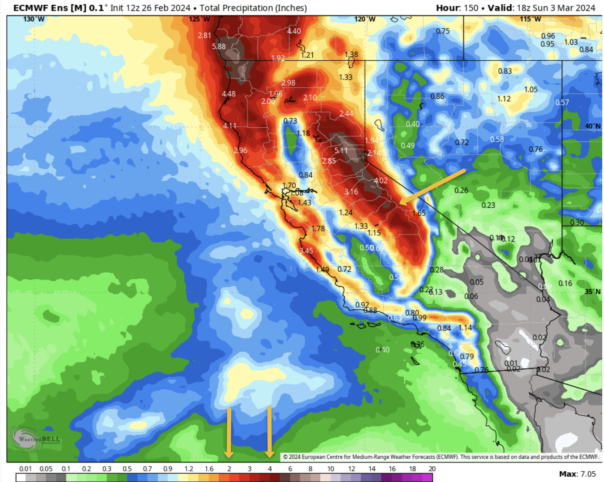
Extended Travel Forecast – Friday in Sunday: If you plan to travel to Mammoth Lakes next Friday or Saturday as of now moderate to possibly heavy snowfall at times.
Snow Level will be down to Toms Place on Friday and then down to the bottom of the grade sometime on Saturday. Cross winds are expected to gust to 20-30 MPH along 395.
As the snow levels drop expect blowing snow with possible white conditions at times Friday into mid-day on Saturday. If you don’t like driving in a storm and are not prepared wait till Sunday to come up to Mammoth.


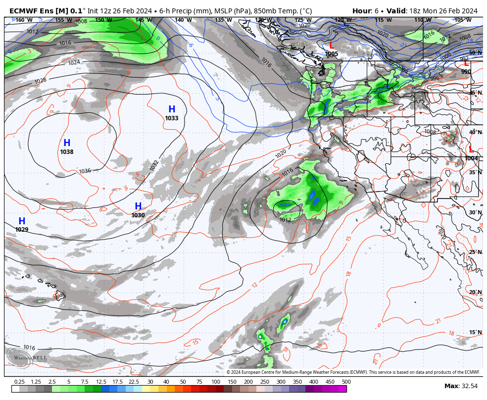
Detailed Weather Summary: A weak cut-off low and an inside slider are influencing the weather this afternoon. Winds are howling up on Mammoth Mountain out of the S to 90 MPH.
This evening a weak front will move through with chance for several inches of snow over the Mountain. Skies clear out for a break in the weather Tuesday into Thursday.
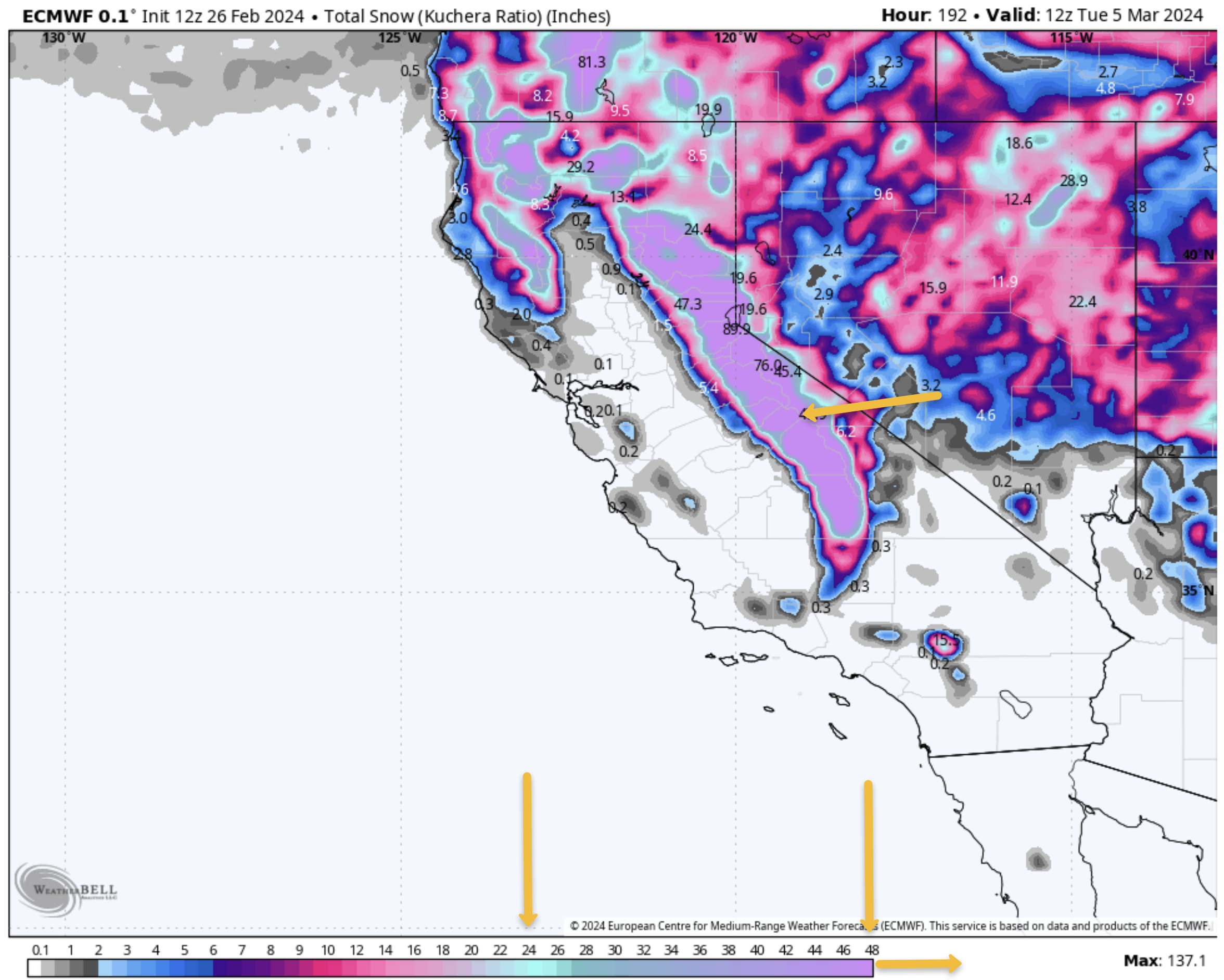
The next system coming in looks to be one of the strongest of the season, with strong winds and heavy snow possible Friday into mid-morning on Saturday.
Snowfall amounts look to be in the 2-3 foot range on the lower Mountain with 3-4+ Feet for the powder fields of Mammoth. With the strong winds, accumulations could be hindered a bit for a time on Friday.
In the last part of this system, winds are expected to back off a bit, with snow levels dropping possibly to Bishop or lower. Expect limited operations on Mammoth Mountain on Friday into early Saturday. Looks like a powder fest for those blessed to be out on the hill this weekend.
Snowman
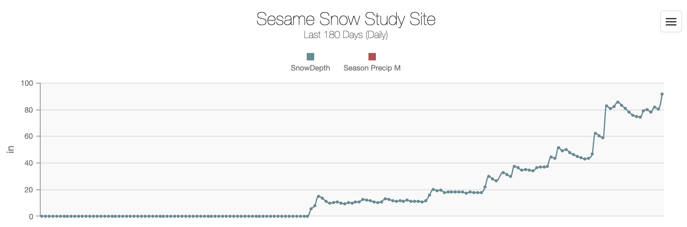
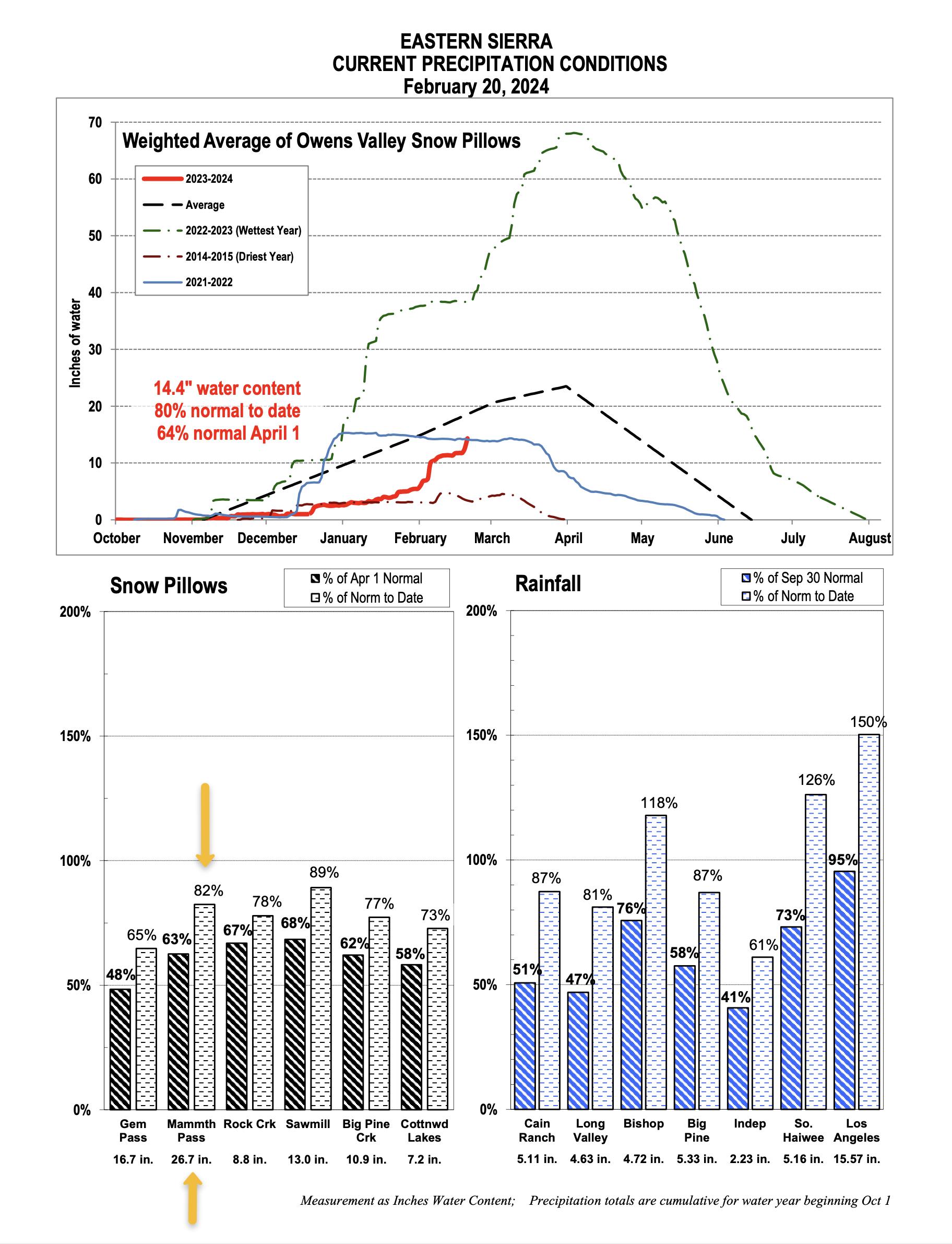
Snow Study Site & Eastern Sierra Snow Pillow
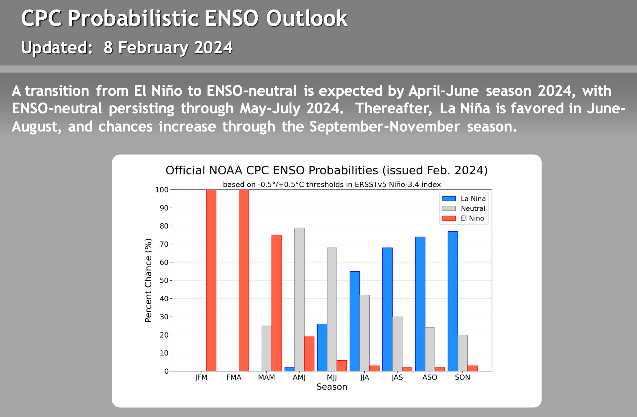
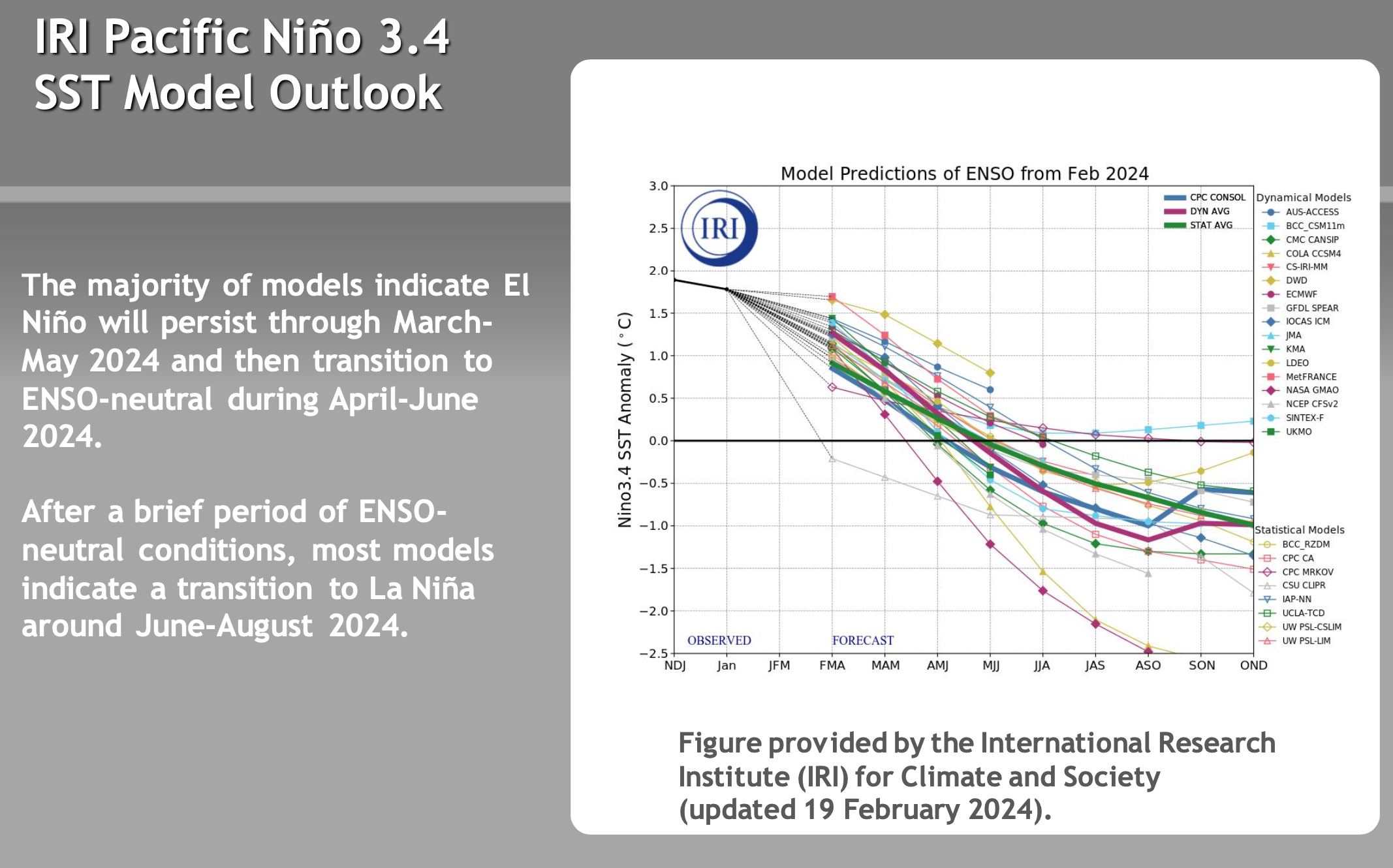
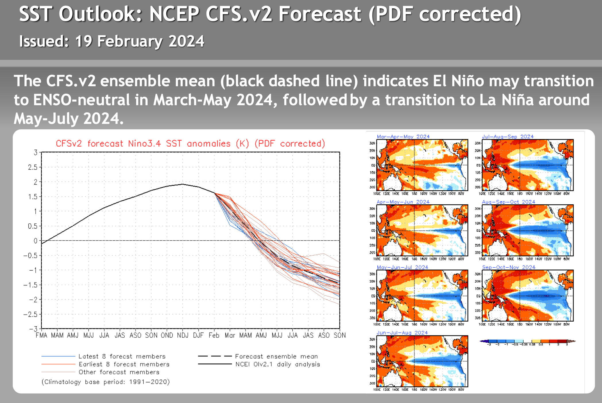
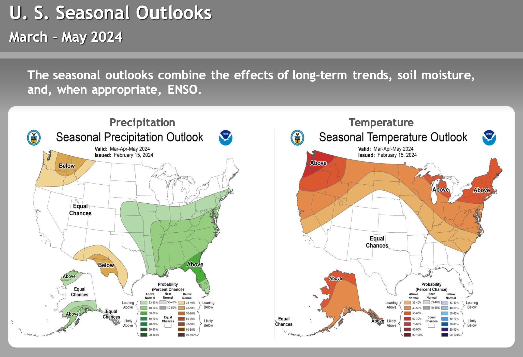
El Nino – La Nina – Neutral Watch


Author – Steve Taylor – The Mammoth Snowman – Over the last 30+ years, Snowman has spent countless hours studying and learning about Mammoth Mountain Weather and Snow Conditions first hand. He has been skiing around the hill with marked ski poles since March of 1991 so he can measure the fresh snowfall amounts out on the hill.
Snowman started blogging this information back in 1990 on the old Mammoth BBS system, then the RSN Forums and then on to MammothSnowman.com in 2004 with Video & Photo Blog reports. (No YouTube back then). Facebook got added to the fold back in 2008 and then the Facebook Group in 2016.
Reports, videos, and photos from the website have been featured on both local TV Stations here in Mammoth and Bishop, along with KTLA, AP, Fox, ABC, CBS, and NBC News.
Click Here to Learn More About the People Who Make MammothSnowman.com a Reality


